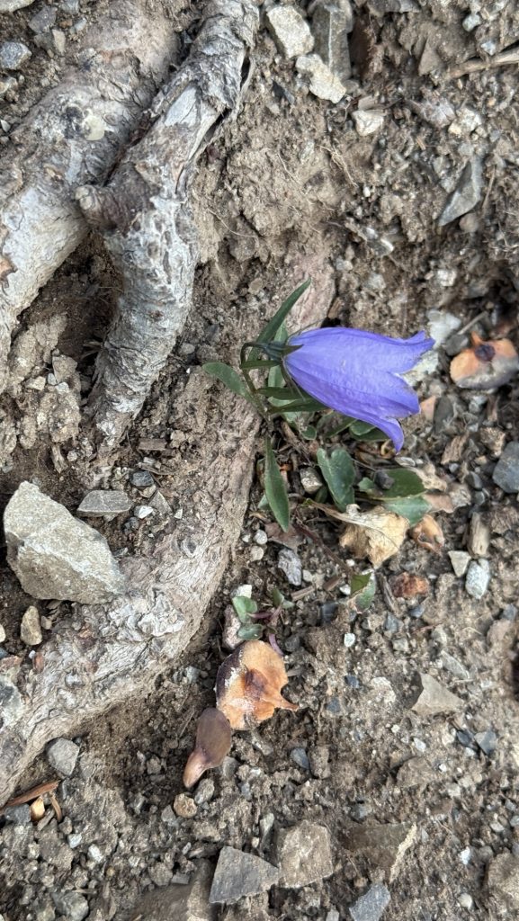
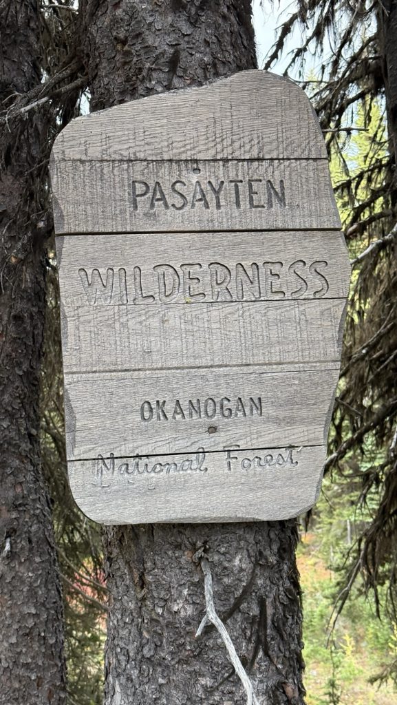
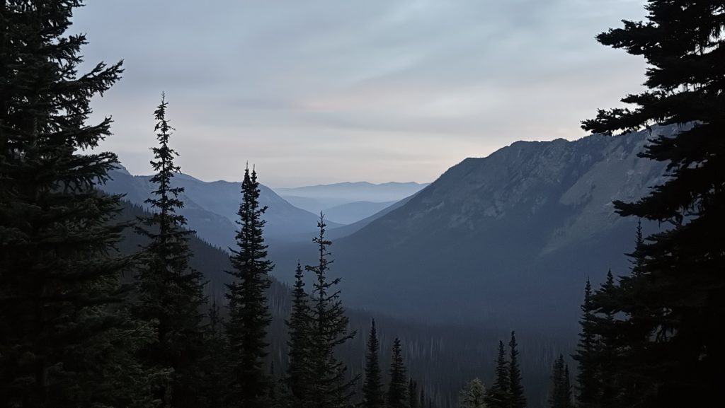
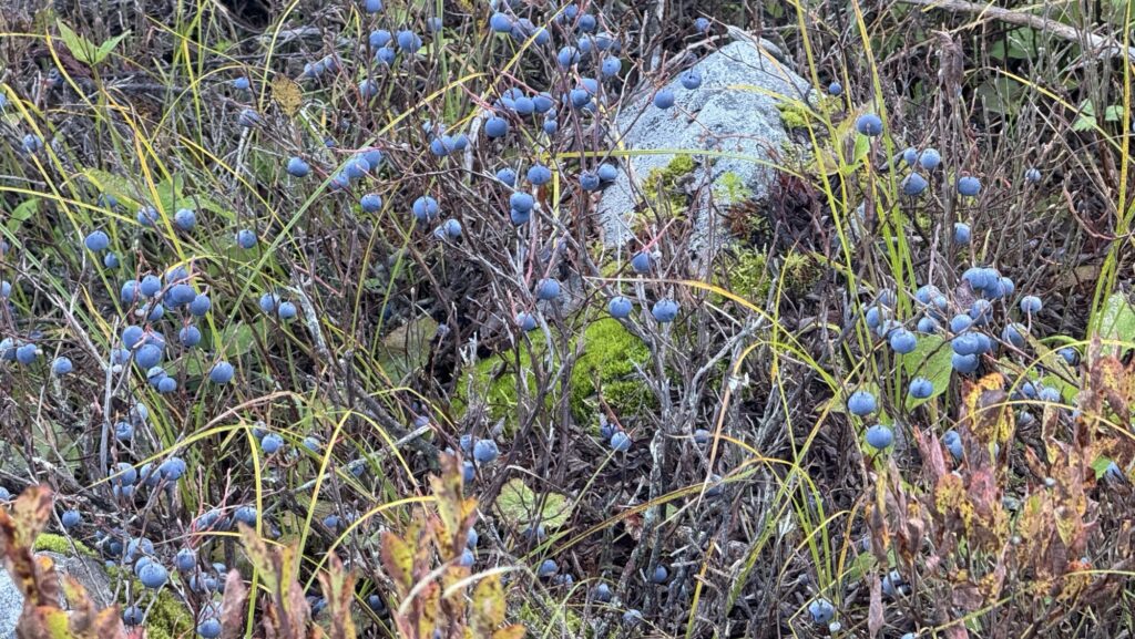
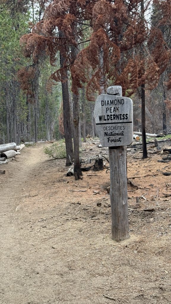
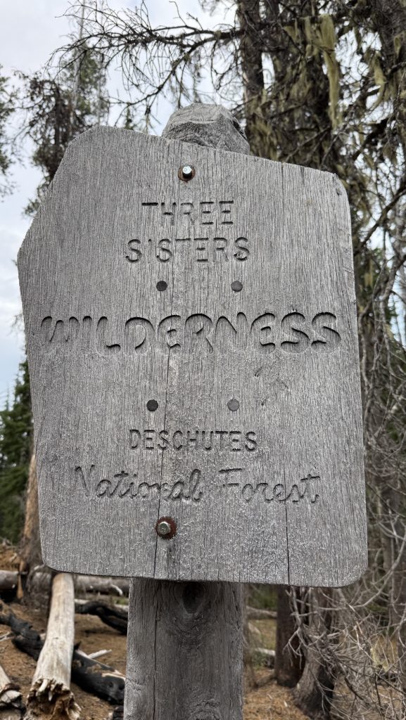
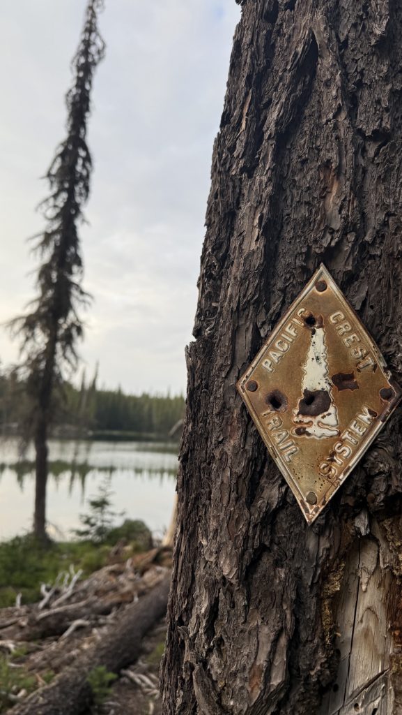
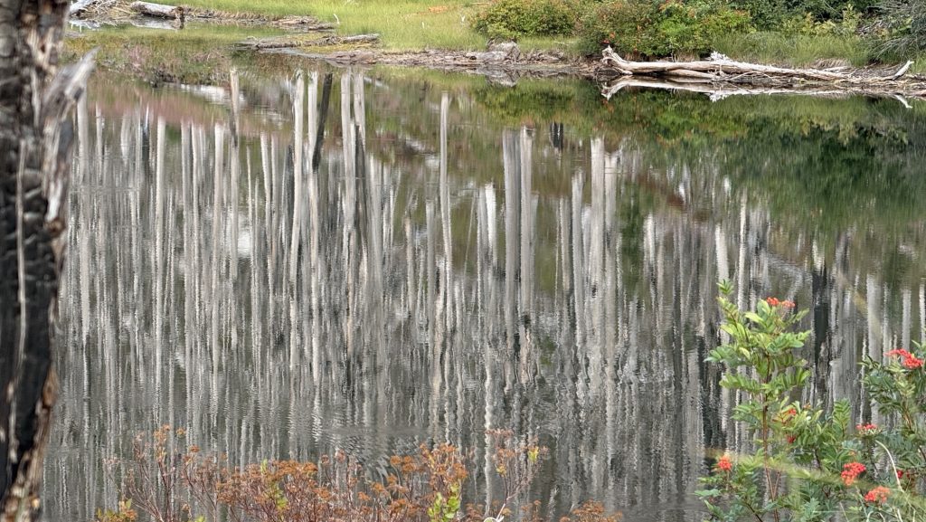
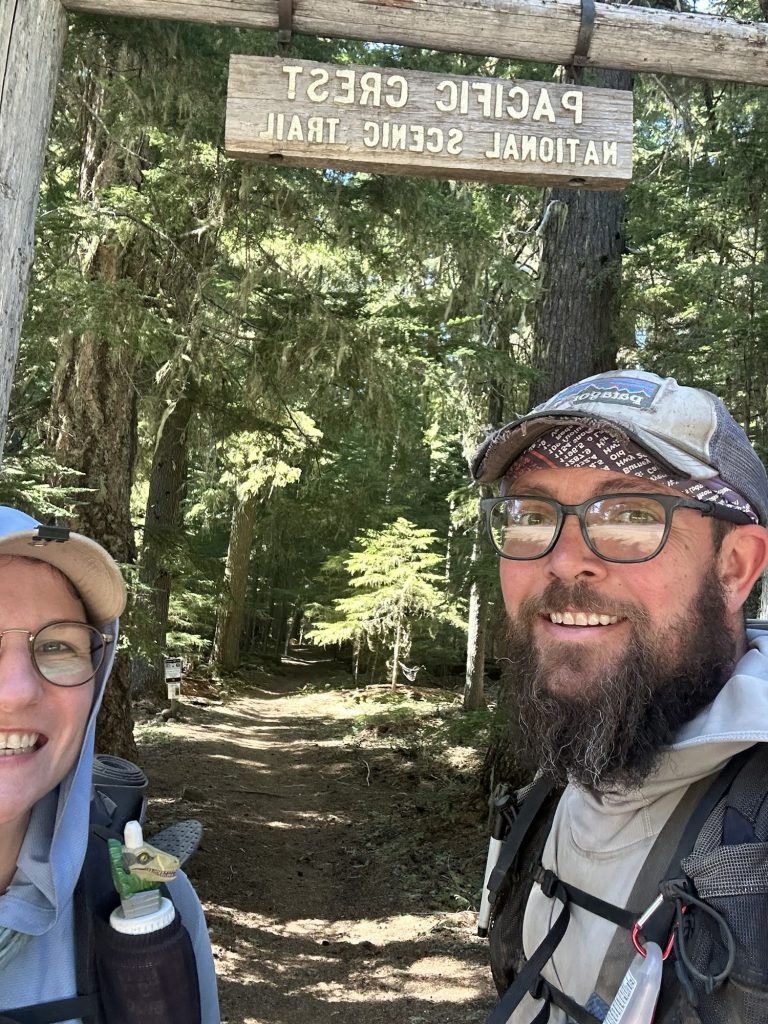
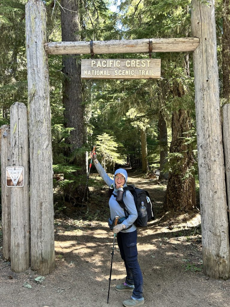
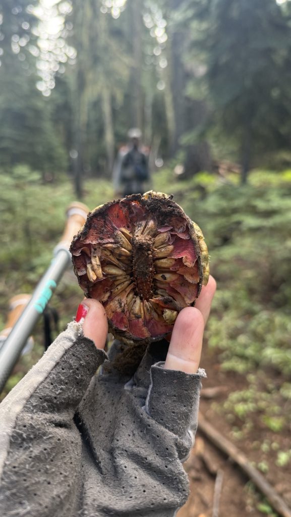
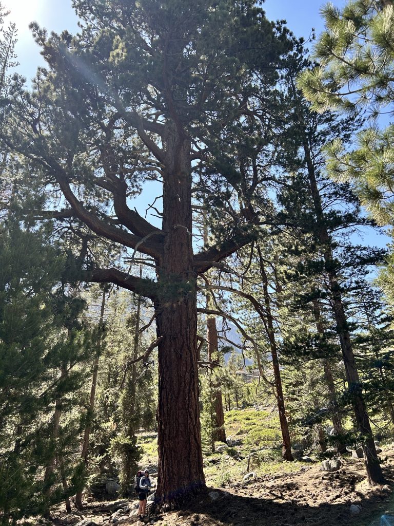
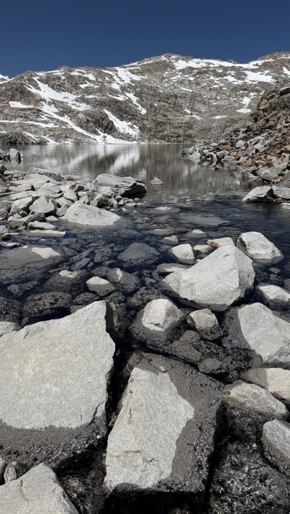
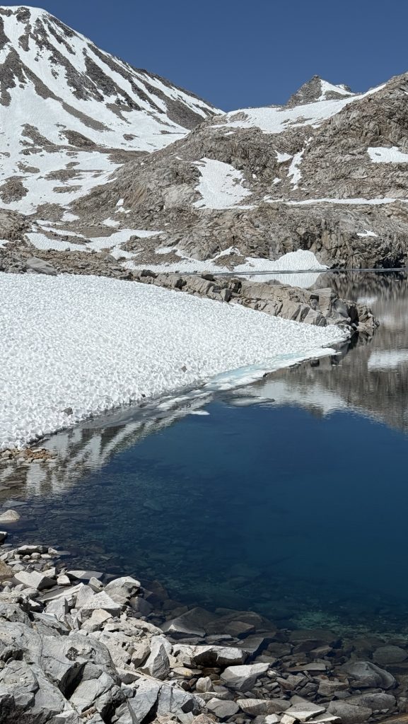
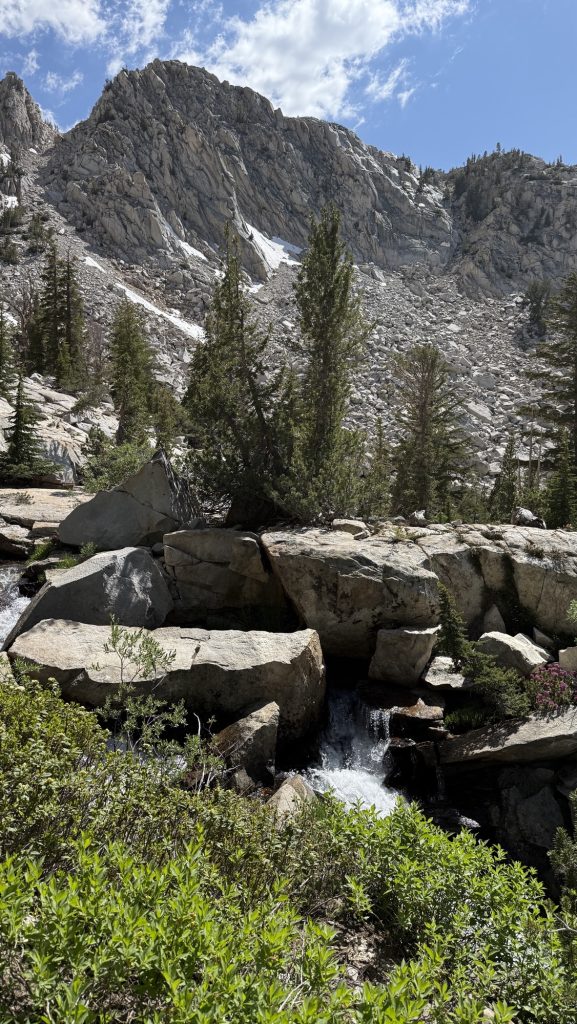
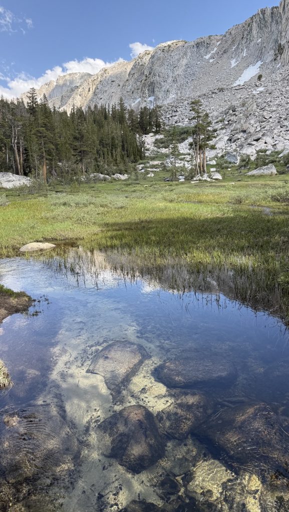
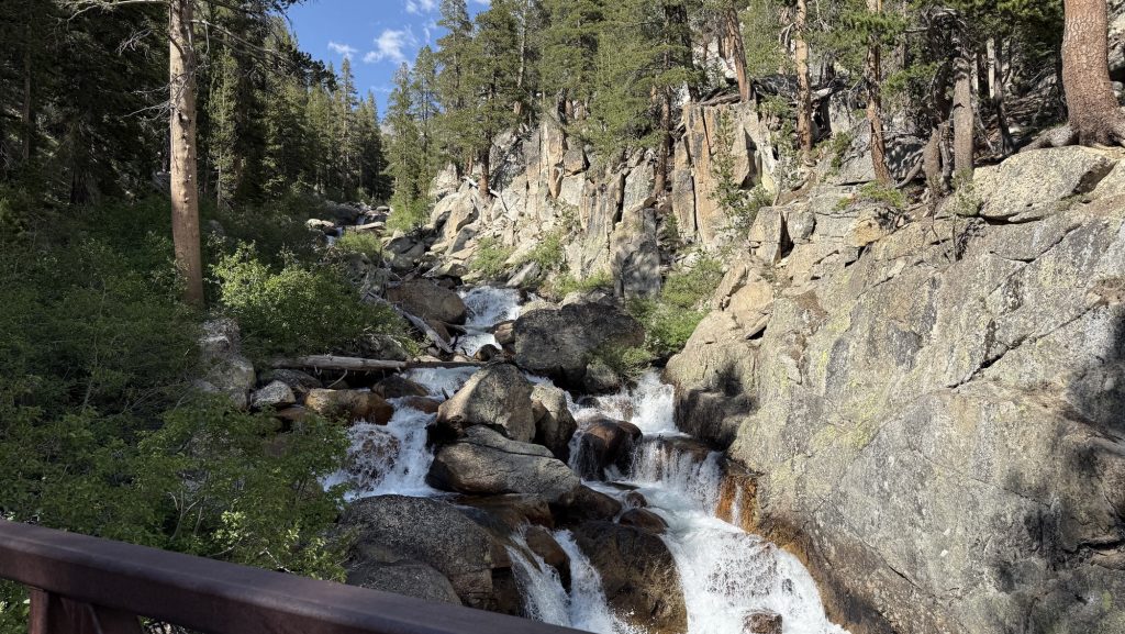
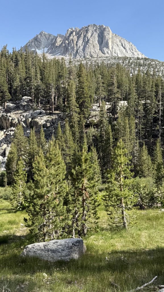
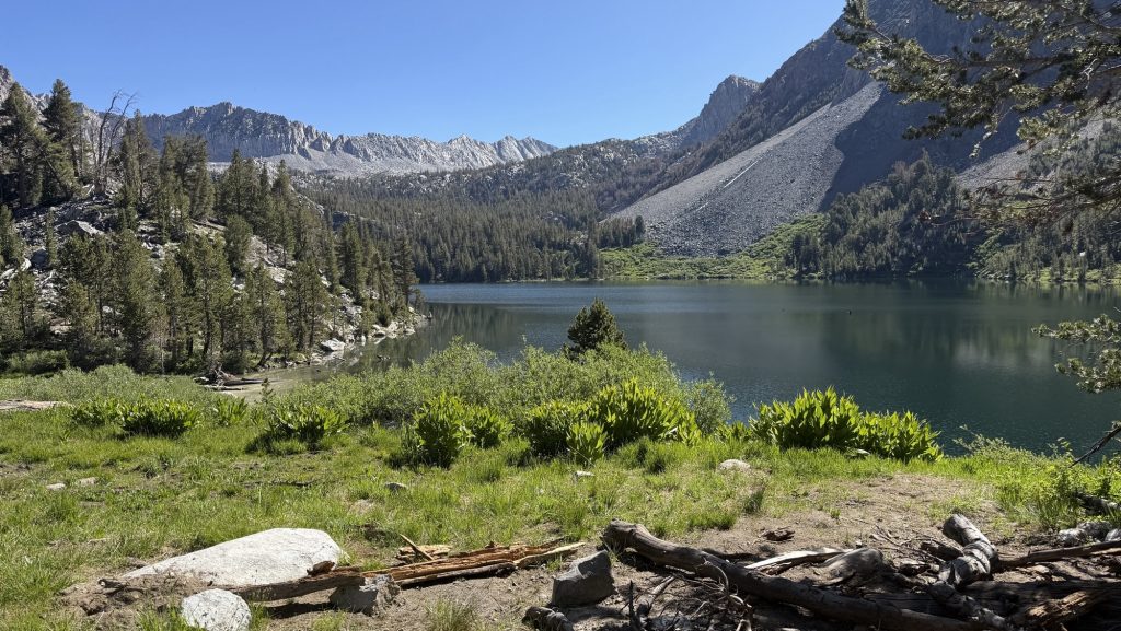
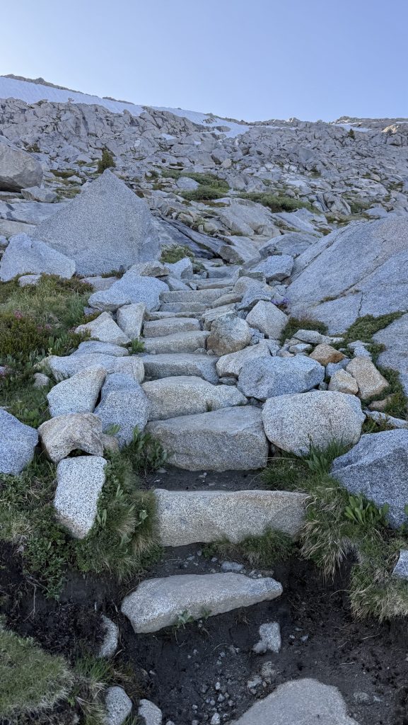
Days 138 – 142: Canada!! (2575.1 – 2655.5 + 30)
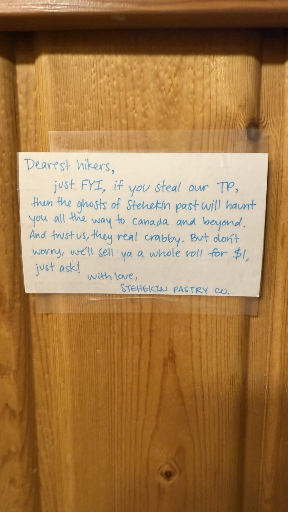
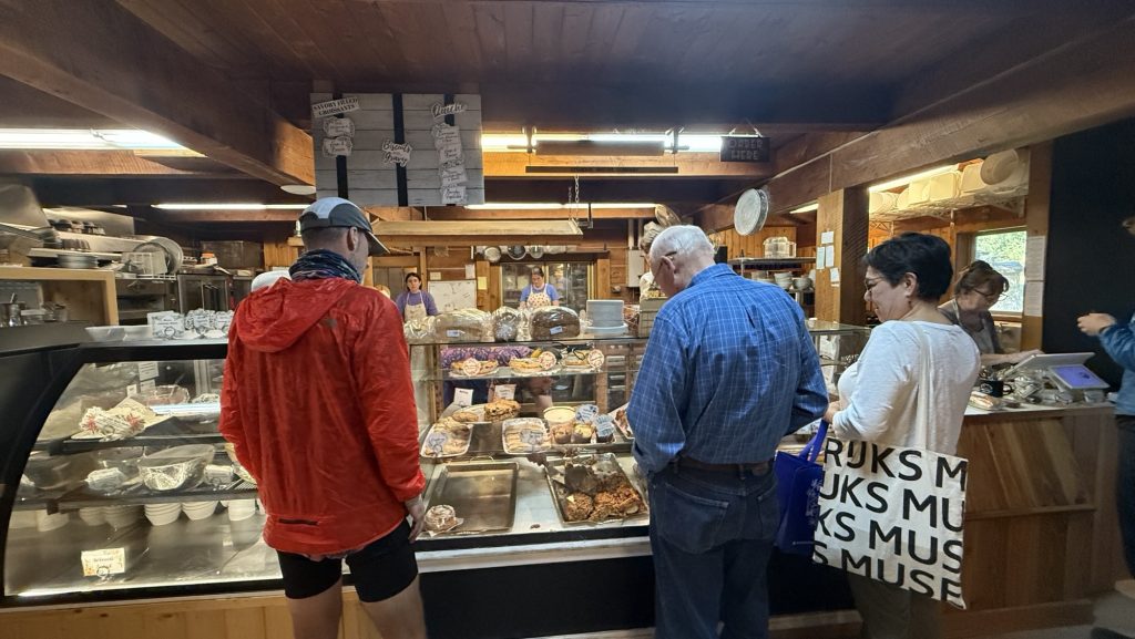
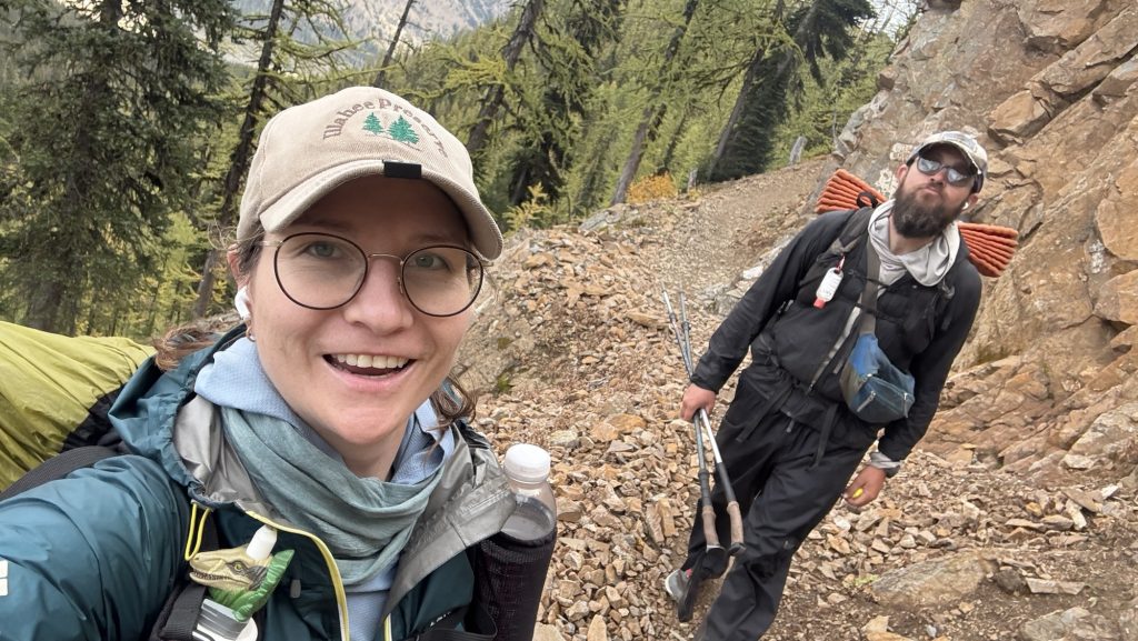
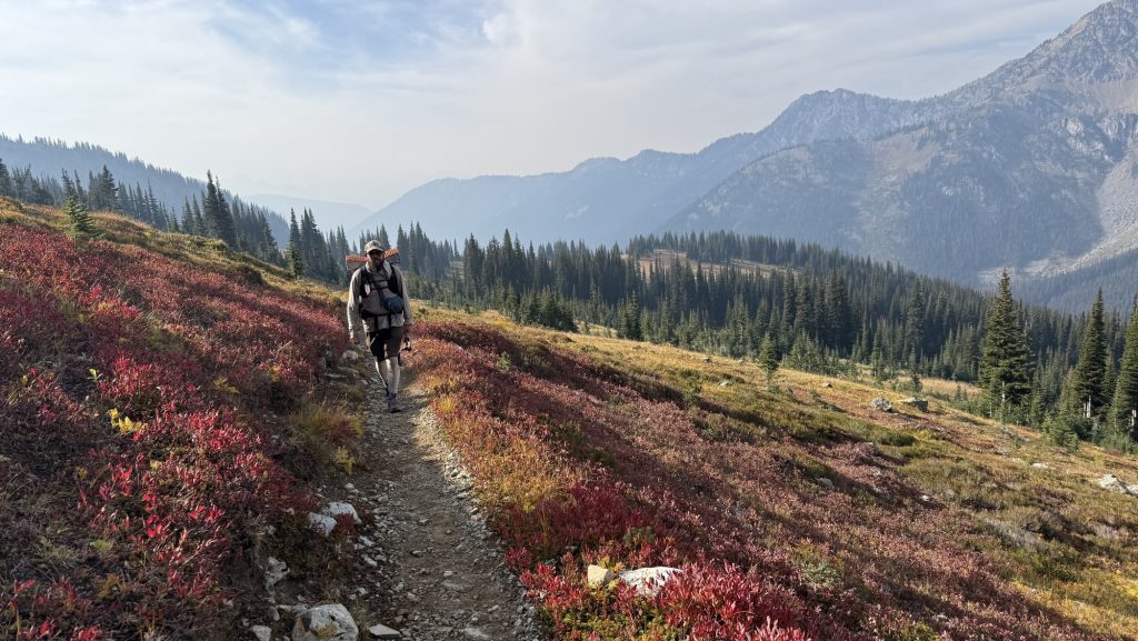
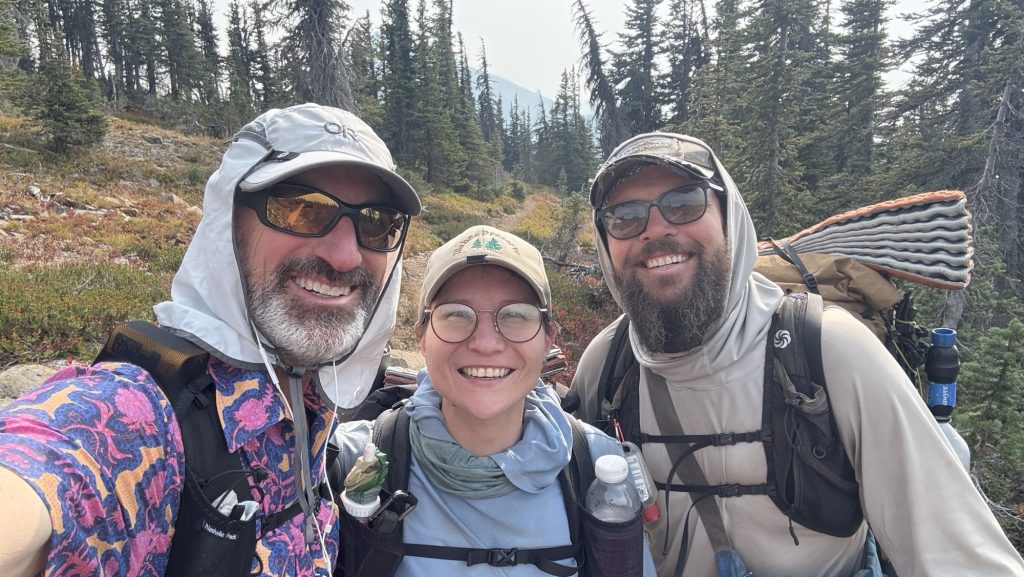
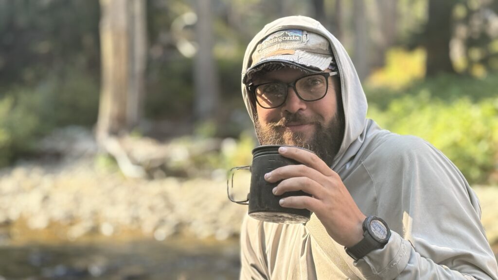
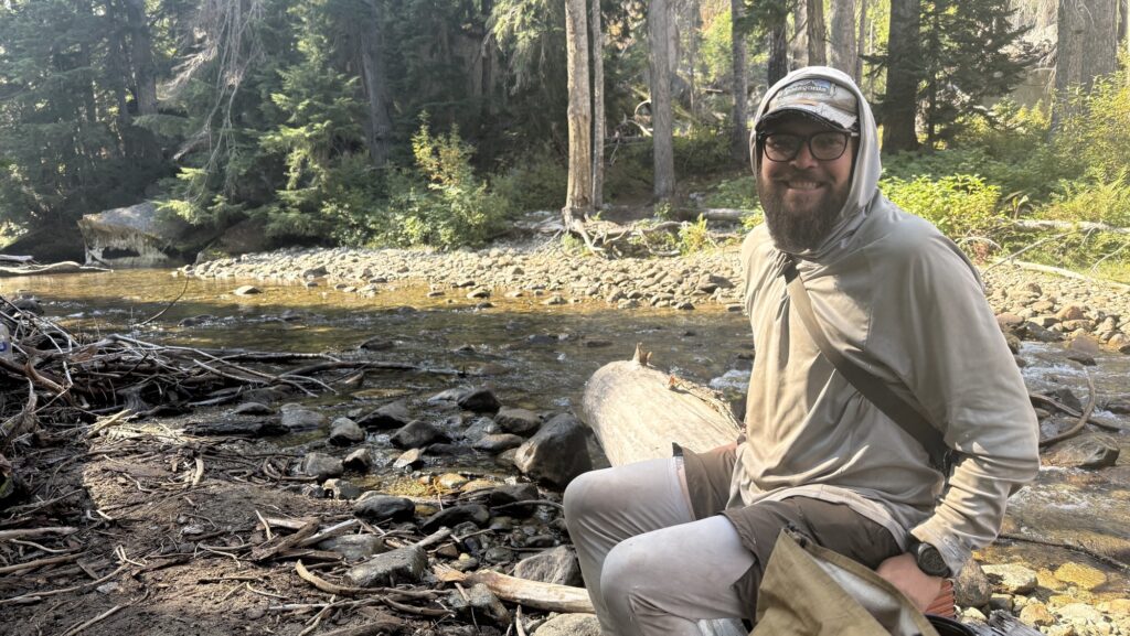
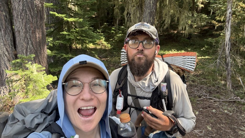
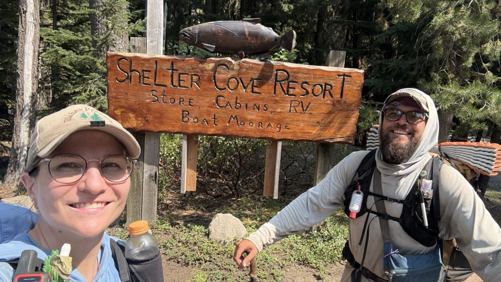
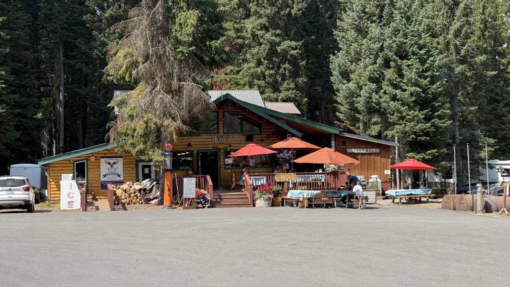
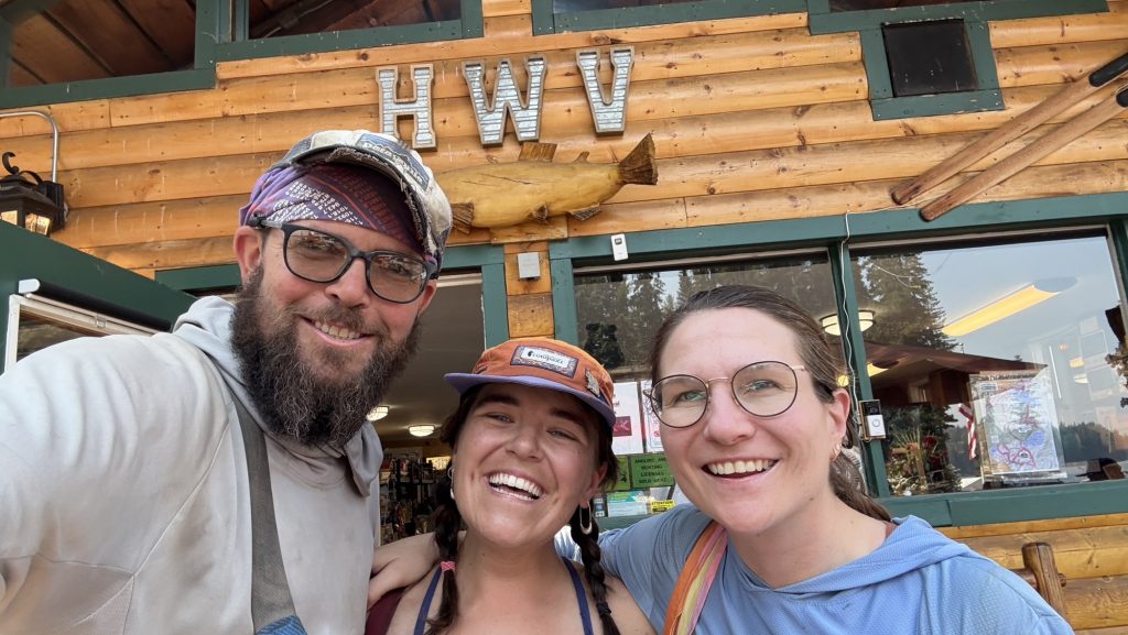
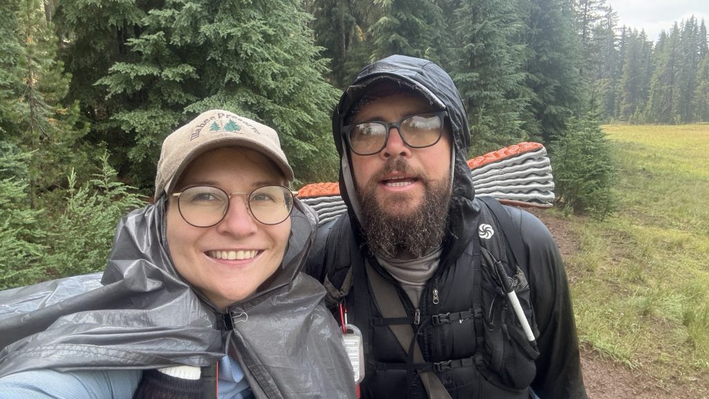
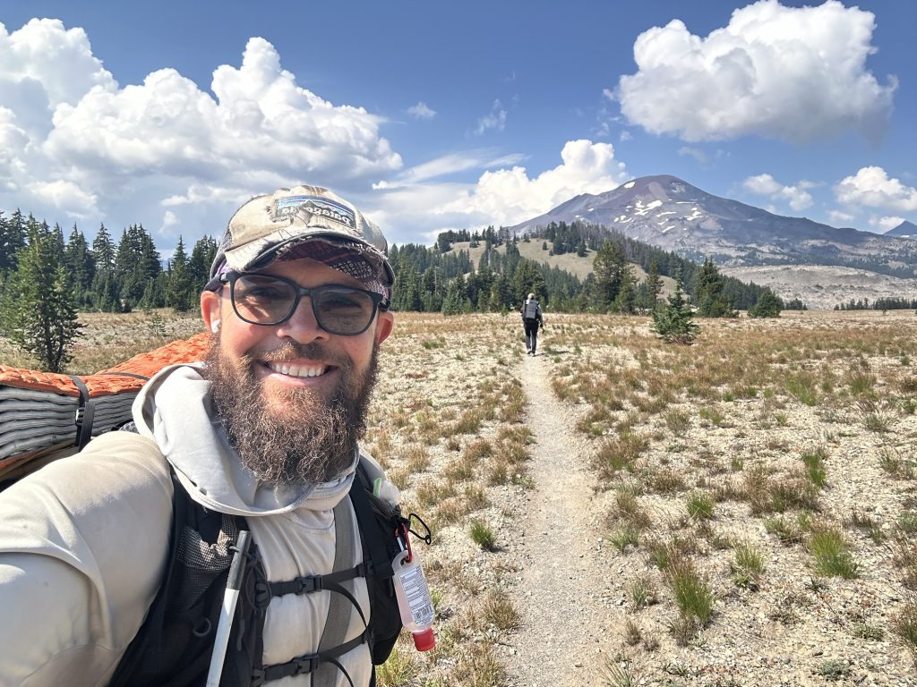
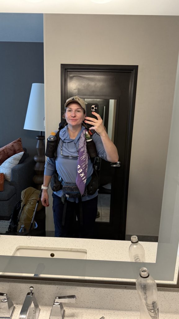
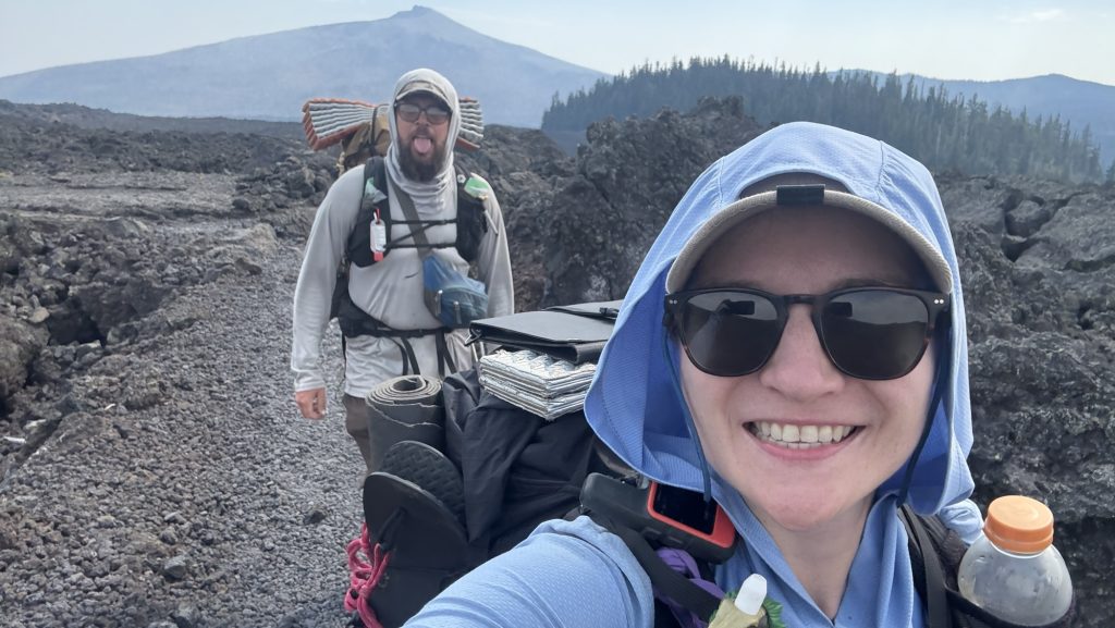
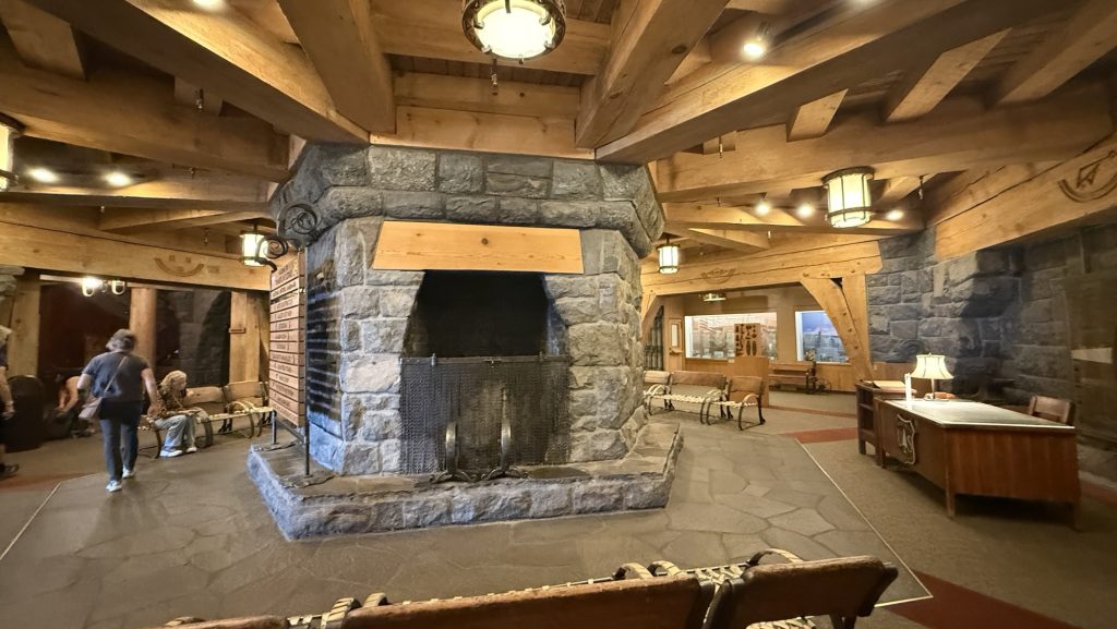
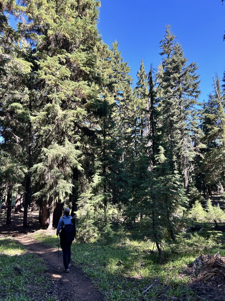
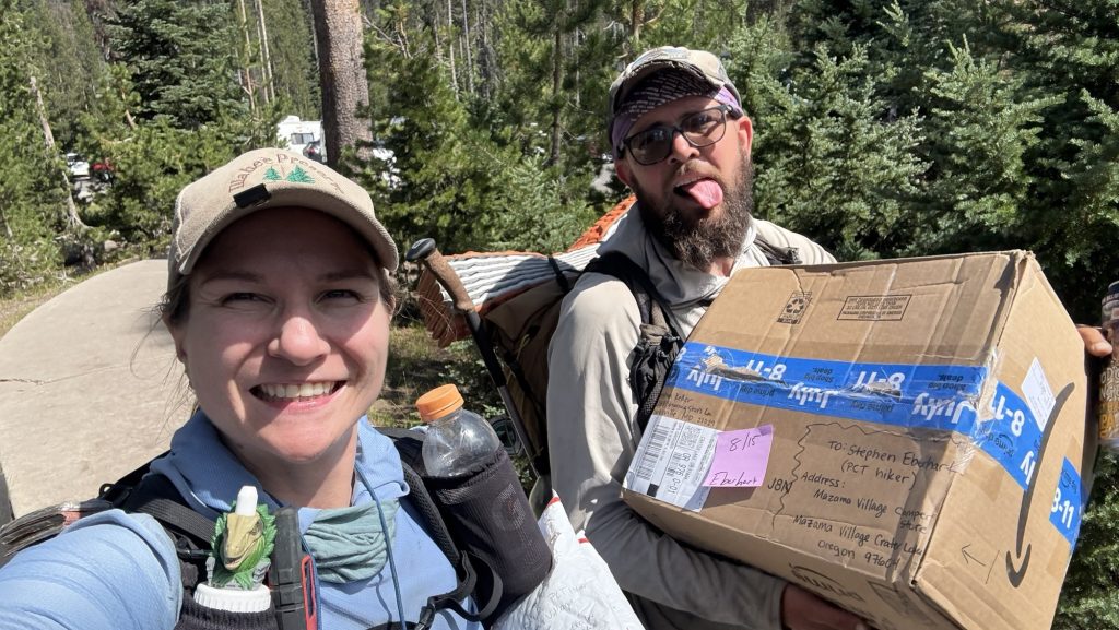
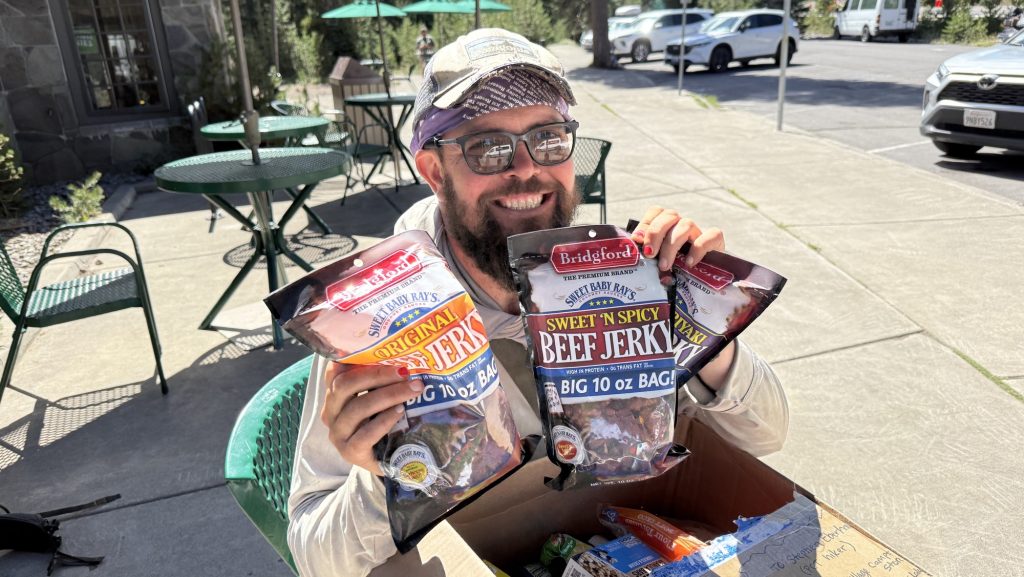
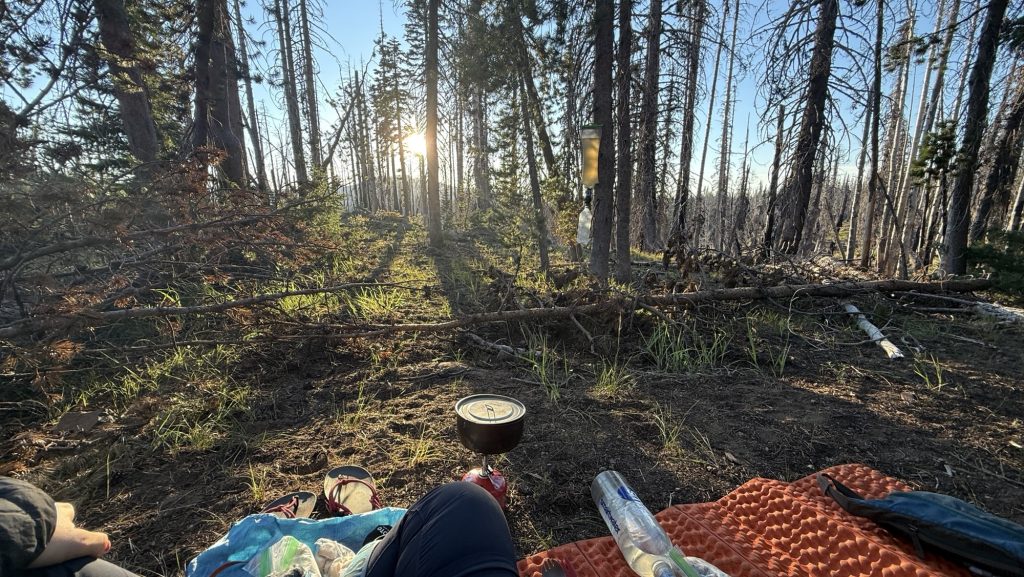
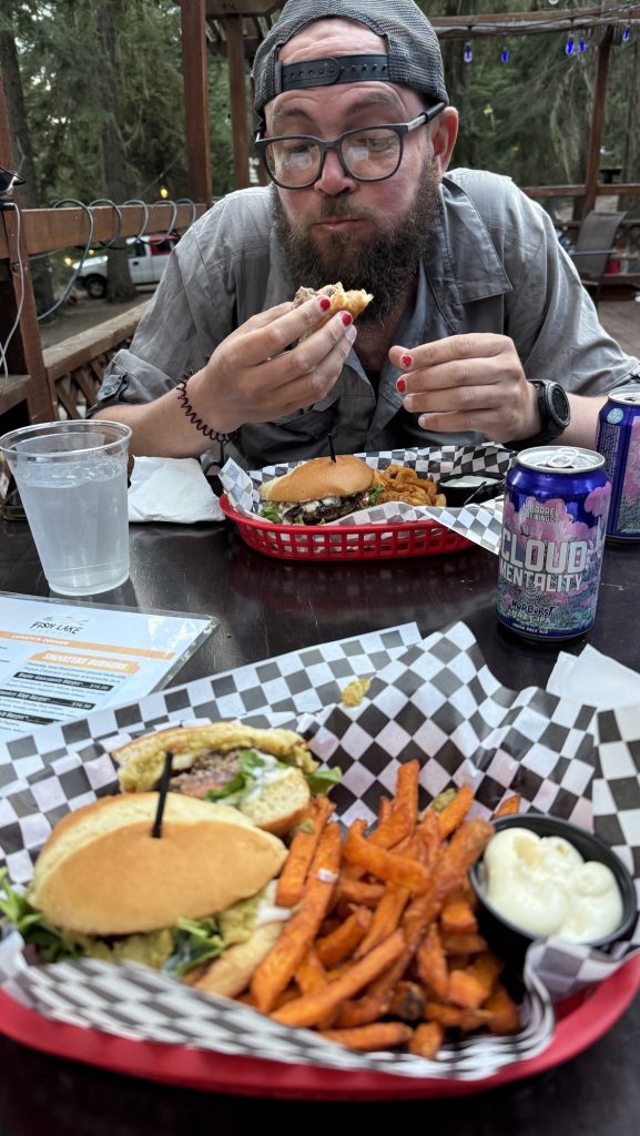
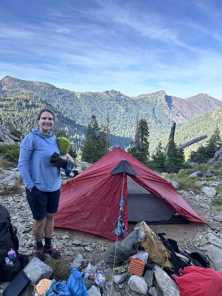
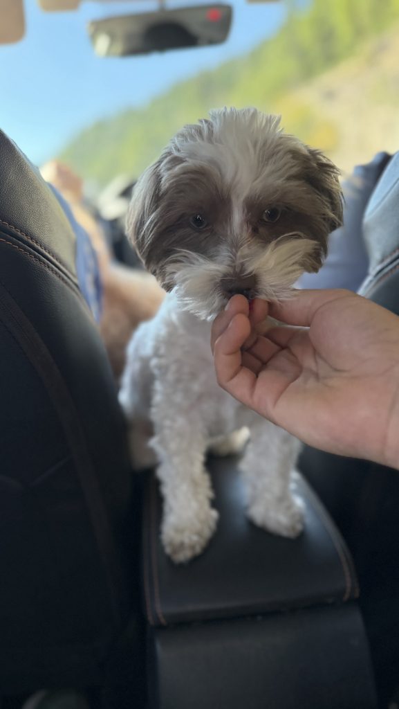
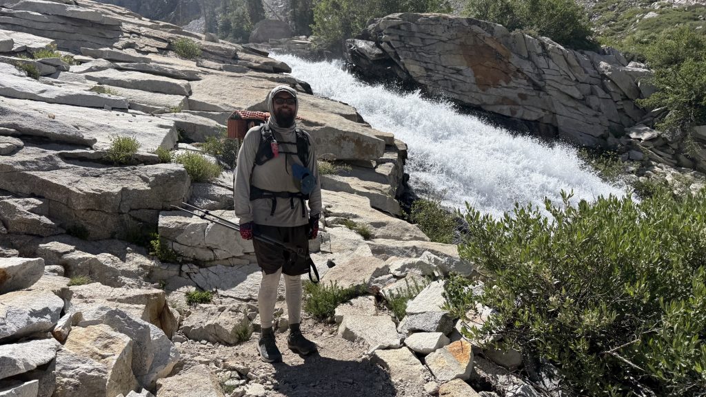
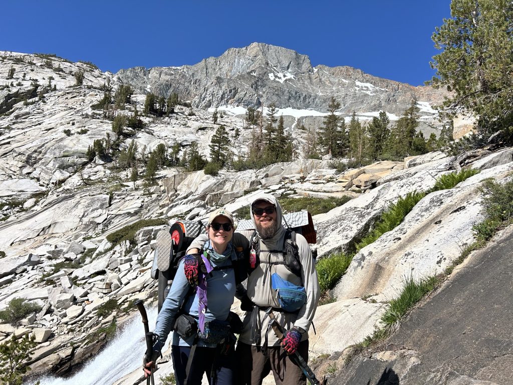
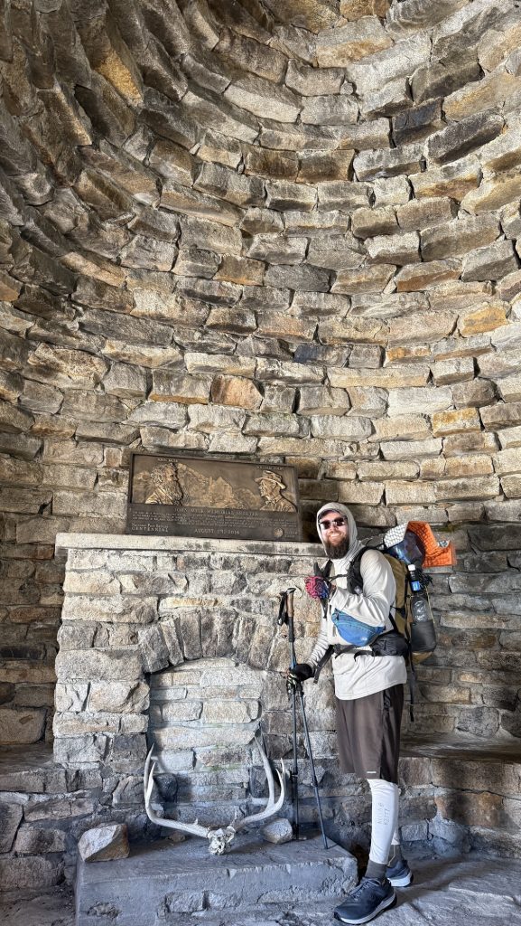
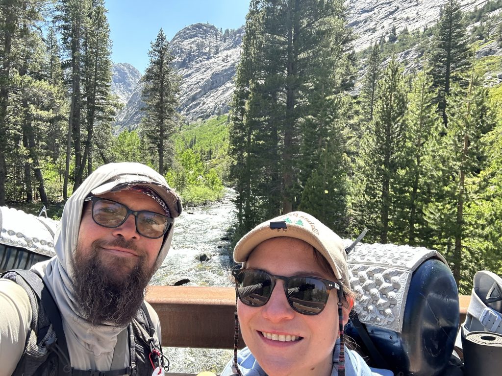
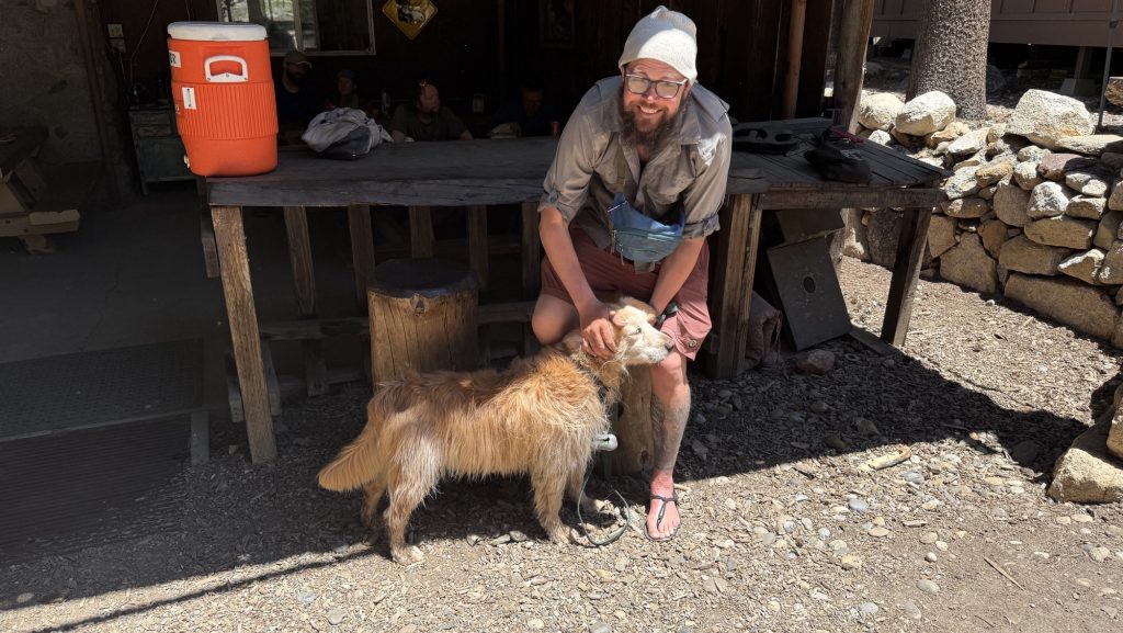
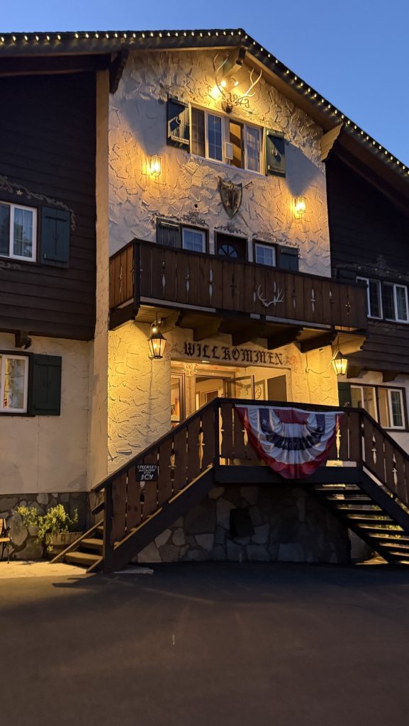
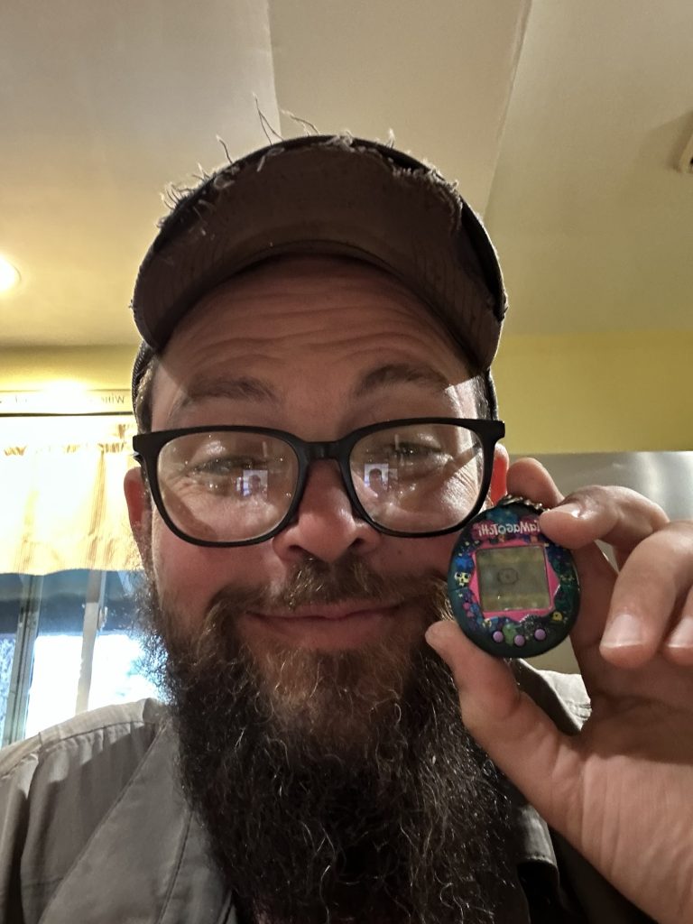
Day 138: Stehekin Valley Ranch – Last Resupply Before the Final Stretch (PCT Mile 2588.5)
I woke up at 6:00 a.m. without my alarm — nature’s way of reminding me I’m still human, I guess. Unfortunately, I also woke up with the unmistakable signs of a Urinary Tract Infection. Not surprising after months on trail, but it’s a bit alarming when you’re in one of the most remote corners of Washington. I couldn’t help but wonder — can I even find medicine out here in Stehekin?
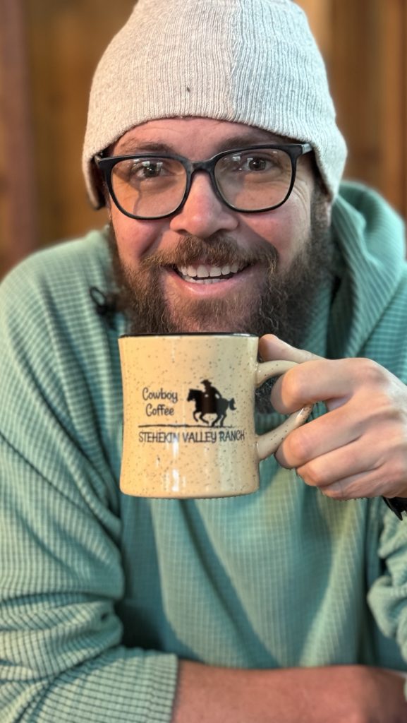
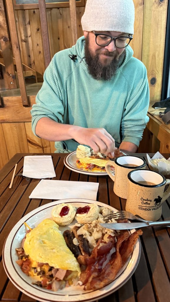
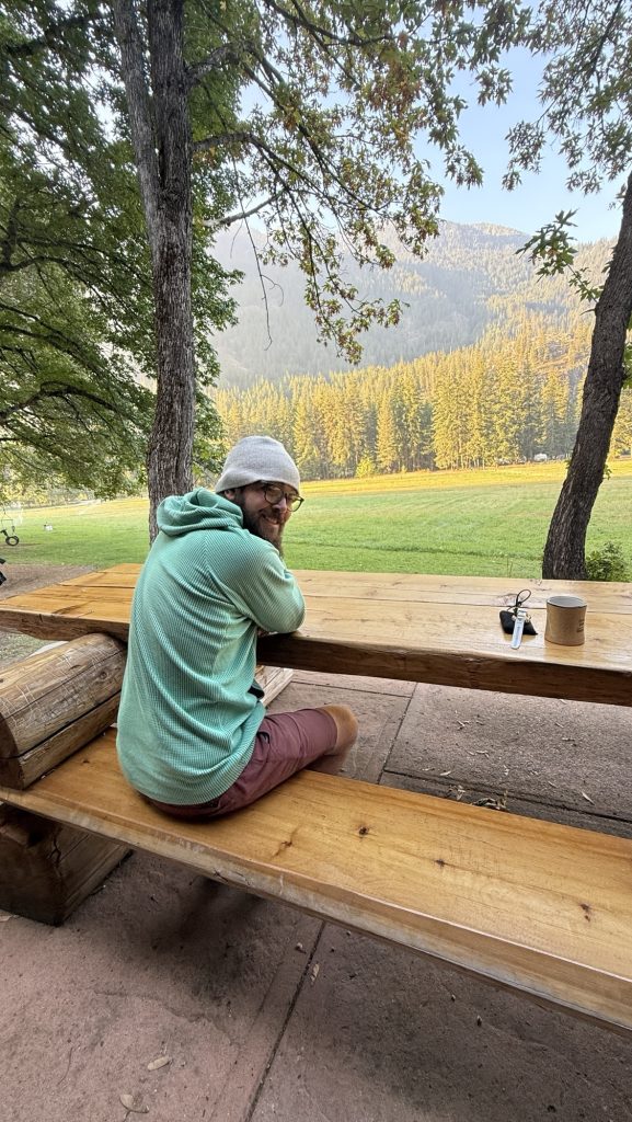
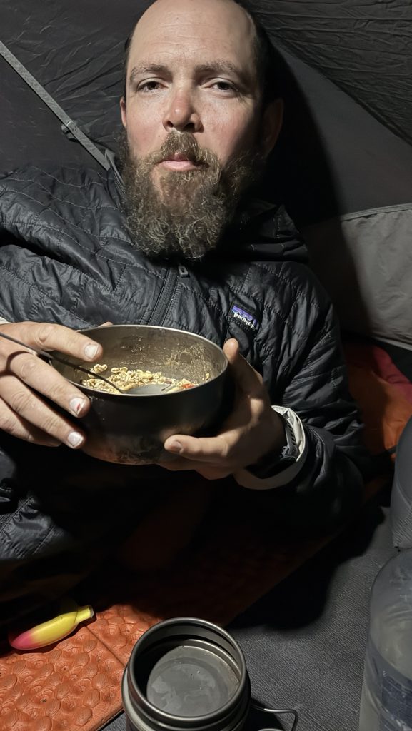
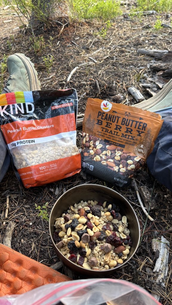
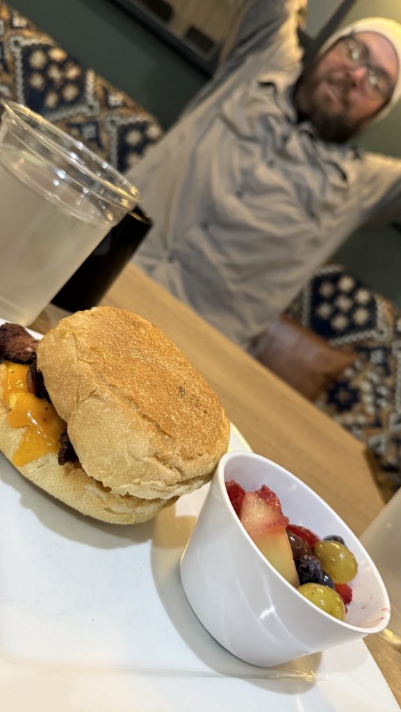
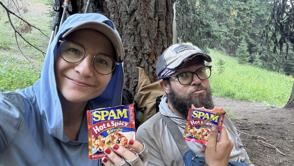
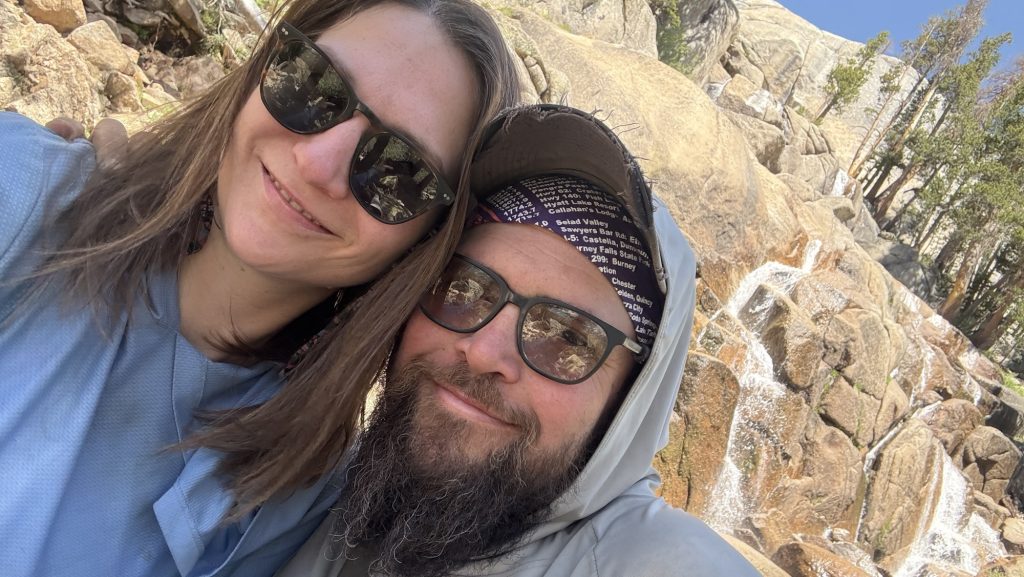
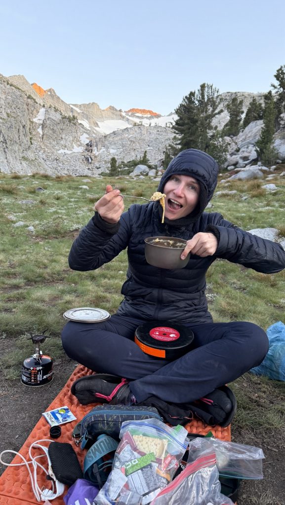
Iceman slept in until 7:15, and by then I was more than ready for breakfast. The big kitchen cabin at Stehekin Valley Ranch served up a hiker’s dream: crispy bacon, a full omelette, and a sandwich bar that doubled as our lunch prep station. We packed hefty sandwiches and snacks, knowing it would be a long day ahead.
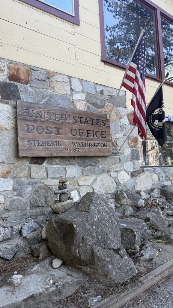
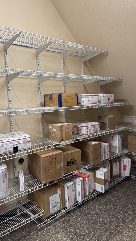
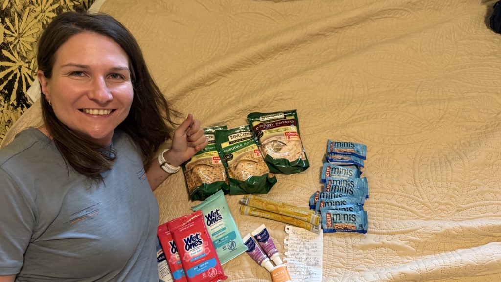
After breakfast, we plugged in every electronic device we owned — batteries might not be essential for survival, but out here, they’re close. Once everything was fully charged, we caught the iconic blue bus to Stehekin Landing to fetch our final resupply box. It hit me then: this was the last box of the journey. The last taste of home-packed supplies before the finish line.
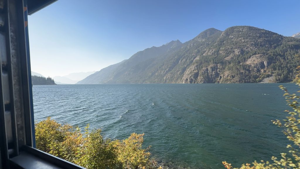
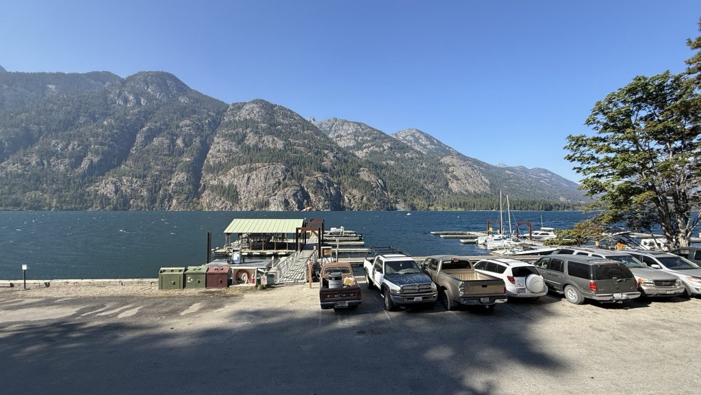
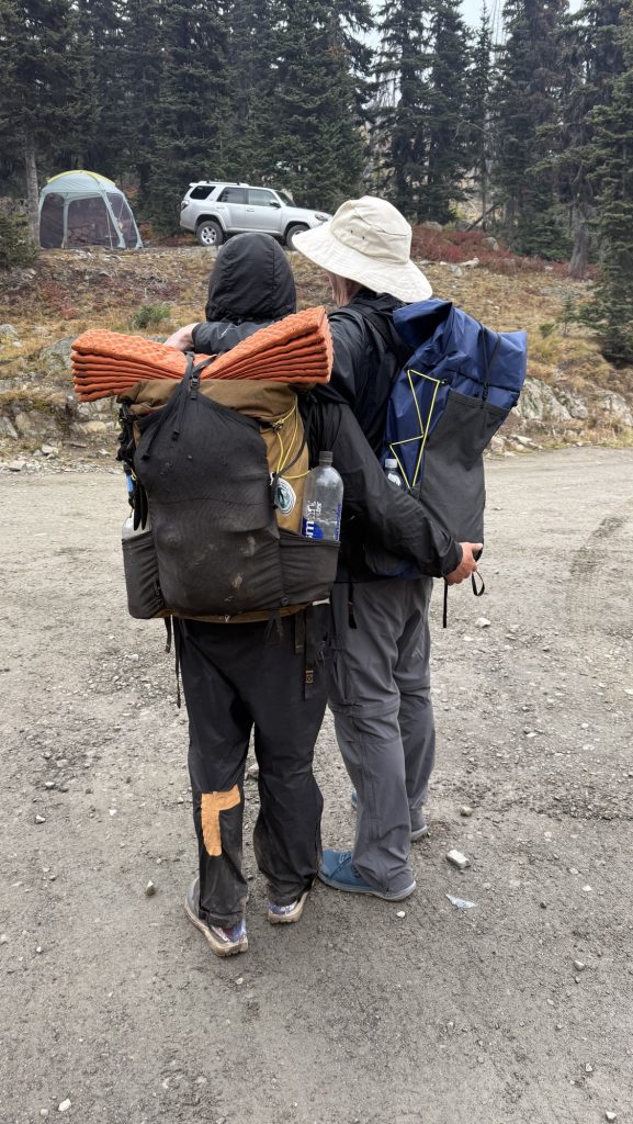
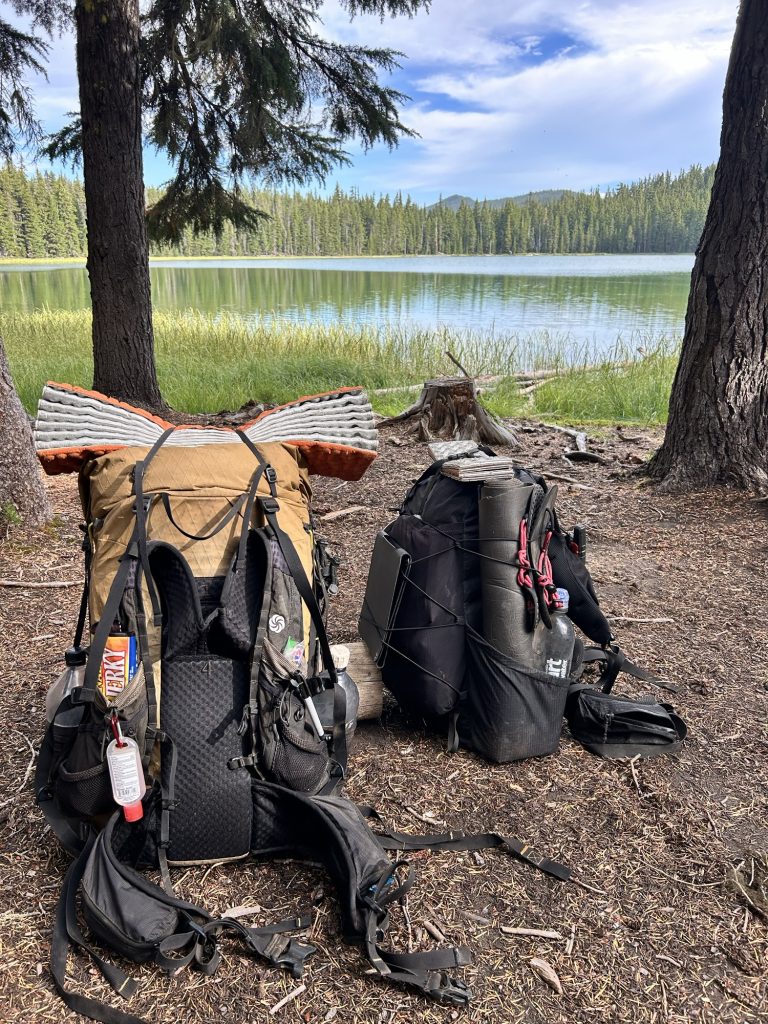
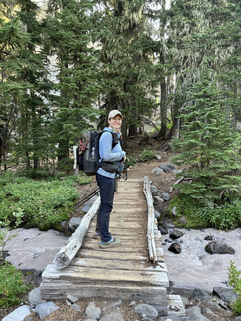
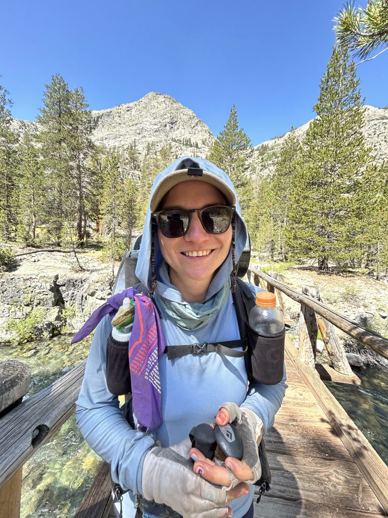
We squeezed in laundry before heading back, clothes draped over our packs and the bus railing to dry in the mountain breeze. Lunch was devoured during the ride — a picnic on wheels as we bounced our way back toward the trailhead. At 1:30 p.m., we shouldered our freshly replenished packs and stepped back onto the Pacific Crest Trail.
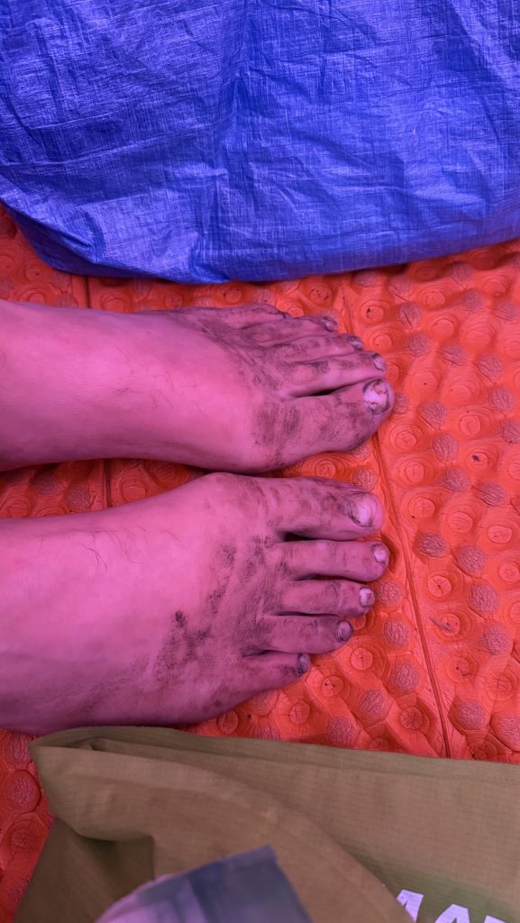
Almost immediately, exhaustion hit me. My legs felt heavy, and my body refused to find a rhythm. Symptoms of a UTI? I eventually gave Iceman some of my gear to lighten my pack, grateful (again) for a partner who doesn’t hesitate to help. The effort was worth it, though — by 7:00 p.m., we had covered 14 miles, climbing 3,399 feet and descending 1,597. My watch later logged 34,662 steps.
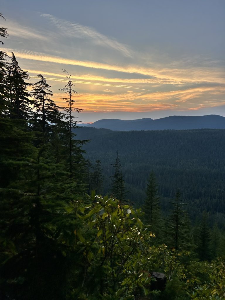
As twilight settled over the forest, I felt a strange mix of fatigue and fulfillment. The last resupply is more than just logistics — it’s a milestone, a turning point. Ahead lies the final stretch of the PCT, and though my body’s fraying at the edges, my spirit’s holding strong. Stehekin’s calm valley faded behind us, and the mountains ahead whispered one message: almost at the end. 🥲
Miles hiked: 14.01
Ascent: 3399 ft
Descent: 1597 ft
Steps: 34662
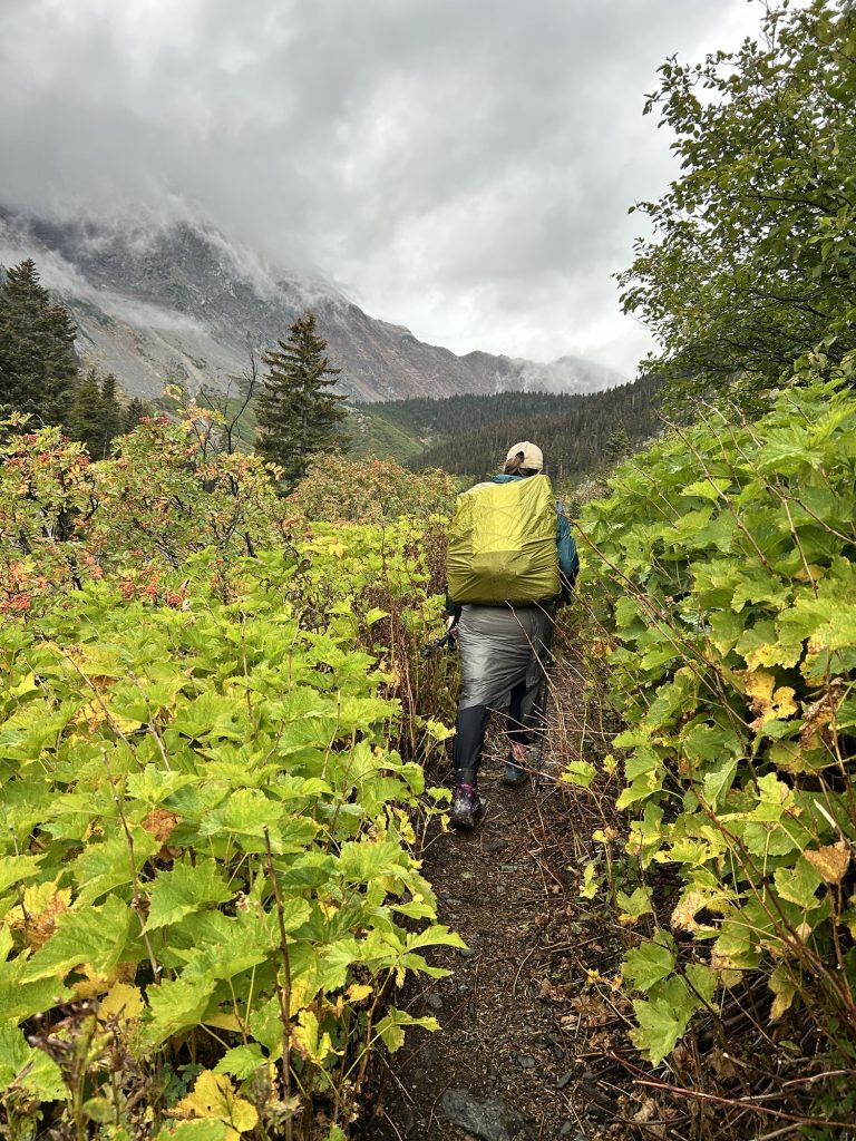
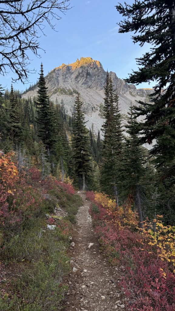
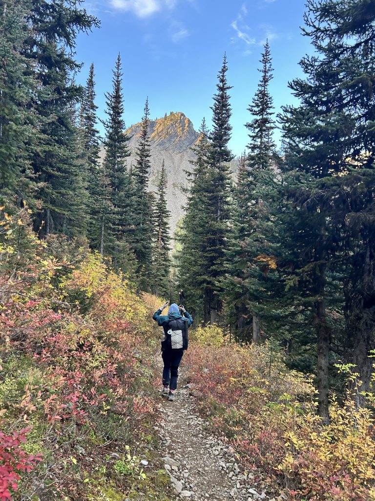
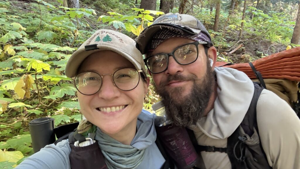
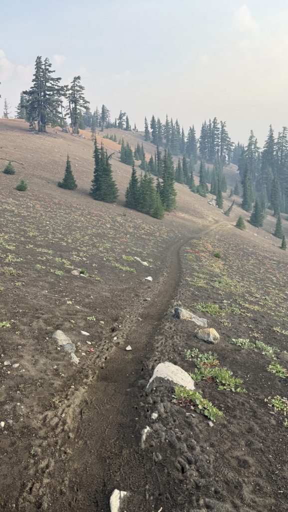
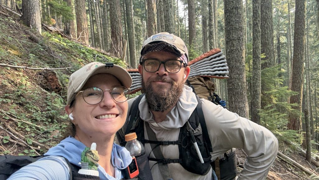
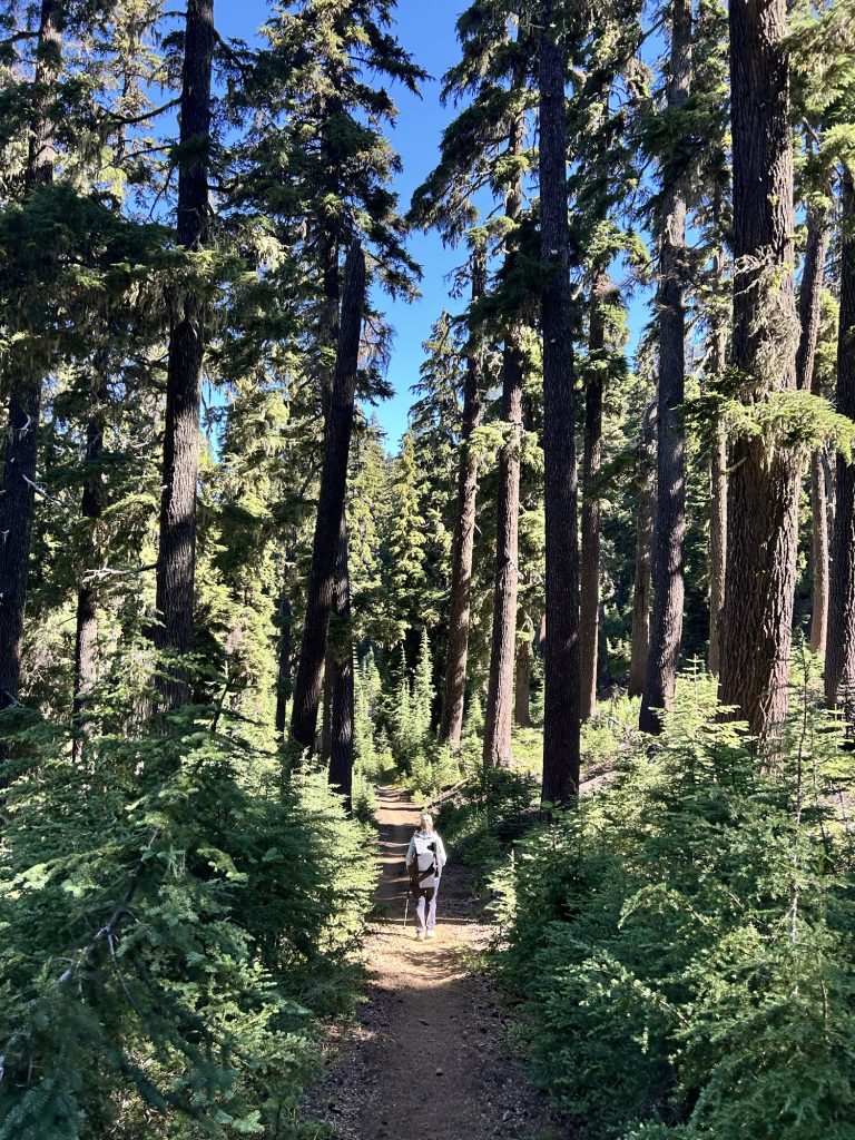
Day 139: Winthrop Detour, Trail Pain, and a 22-Mile Push (PCT Mile 2609.7)
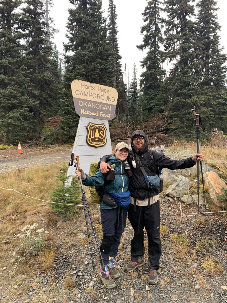
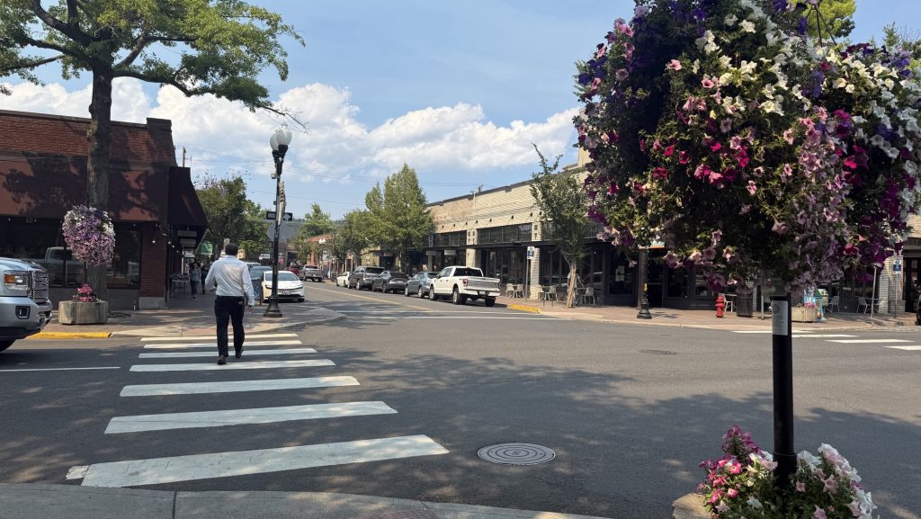
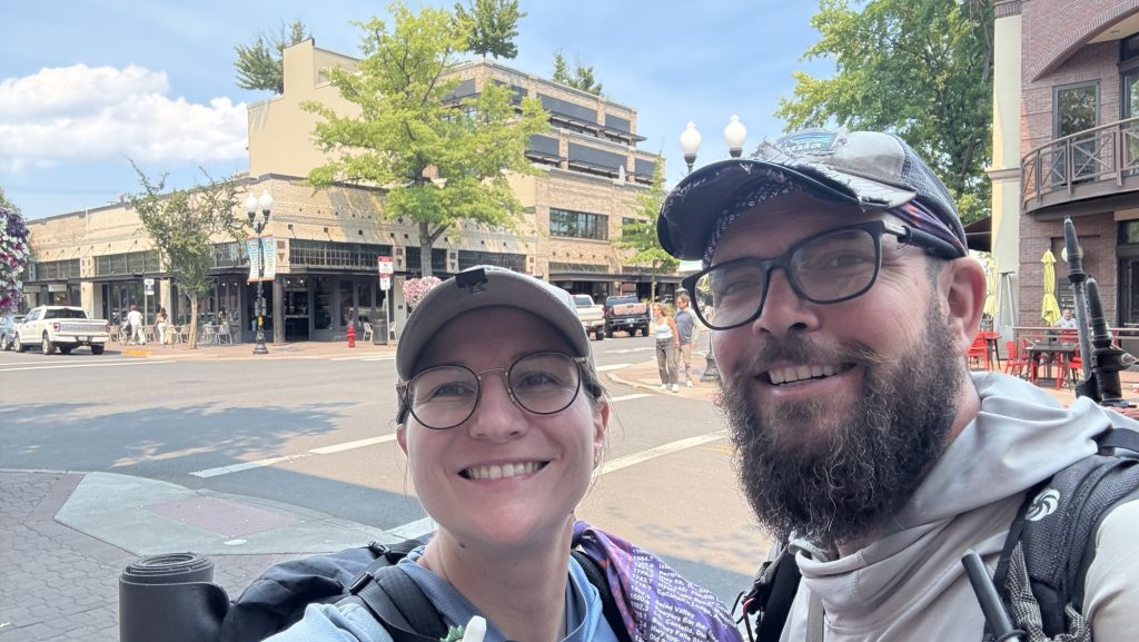
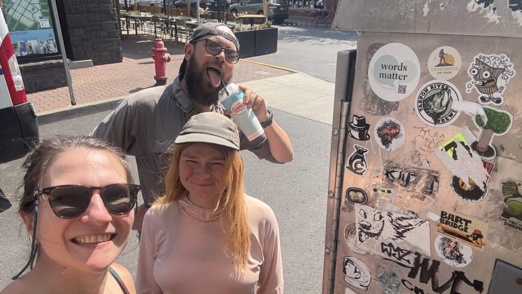
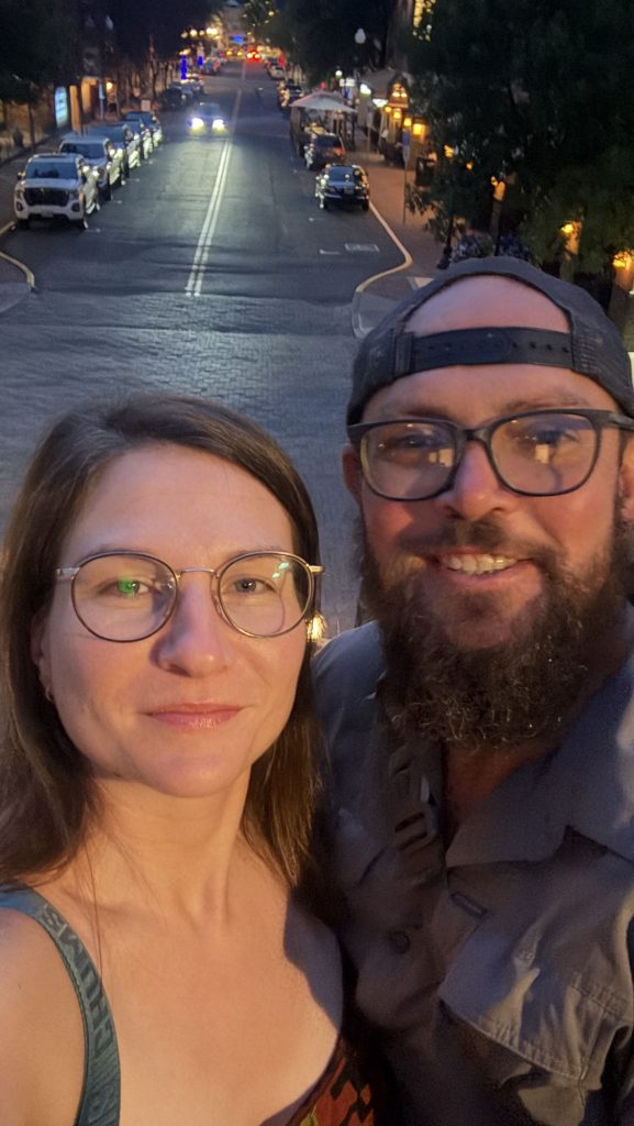
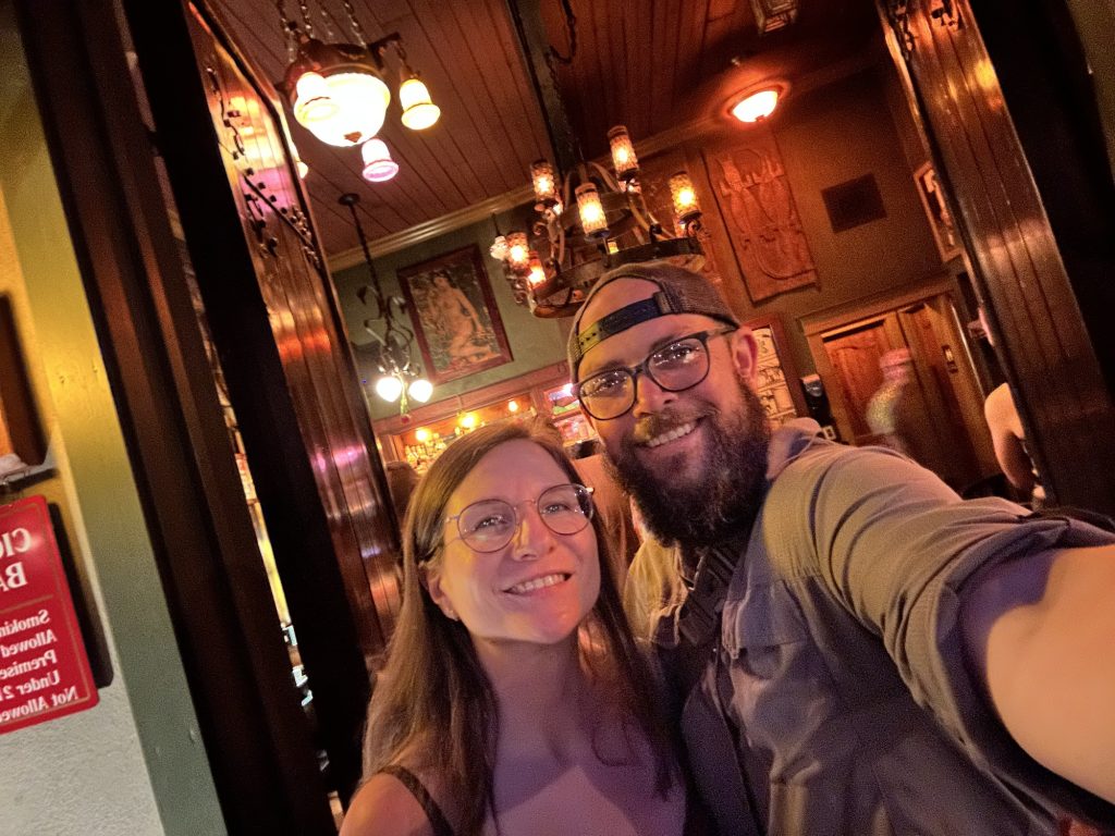
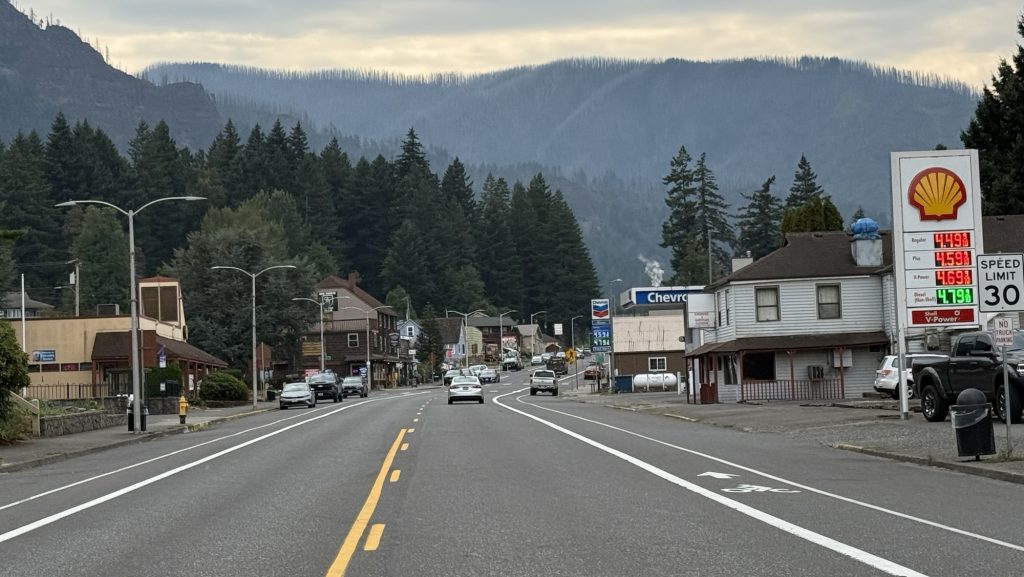
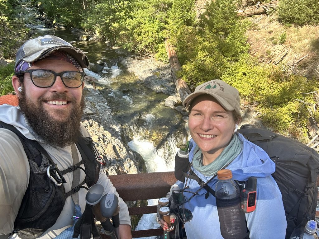
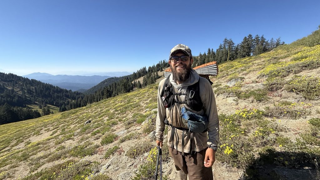
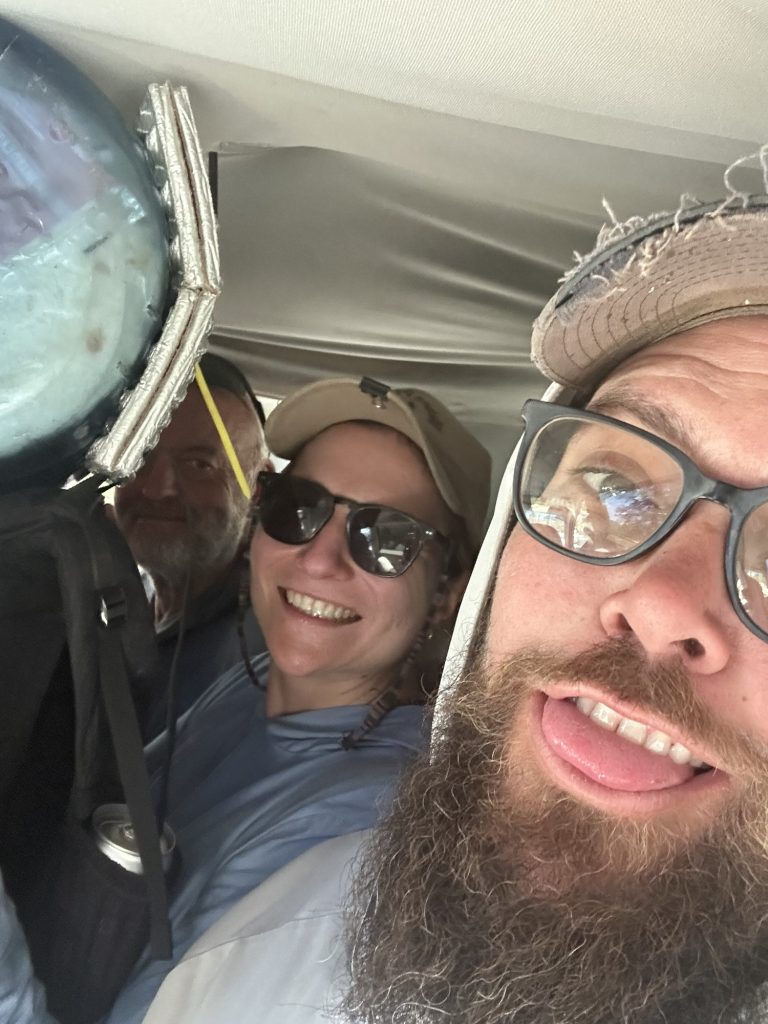
We were back on trail early, starting our hike at 7:00 a.m. under a cool, overcast sky. It was supposed to be a steady climbing day, but things rarely go as planned out here. By 9:30, we had caught a ride into Winthrop with Doug — an unexpected side trip that turned into one of the best little adventures of the trail.
Winthrop turned out to be an incredible town — rustic, welcoming, and full of life, with its old Western storefronts and friendly locals. The main goal, though, was medical: I needed to figure out what was going on with some uncomfortable symptoms that had been creeping up. The folks at Confluence clinic treated me right away, and thankfully, the result came back negative — no white blood cells, no infection. It was a relief just to rule out anything serious. Iceman’s legend Brother in law, Mike, an MD from Baltimore was incredibly supportive, talking me through the result and confirming that I was indeed fine.
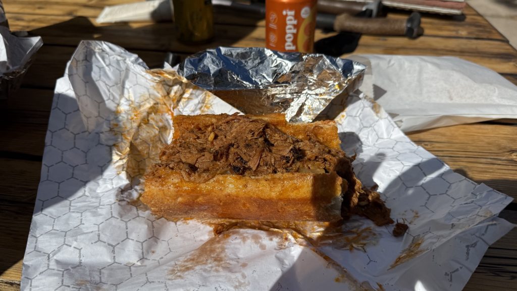
After that, we hitched a ride to the Mazama Store with Gary and refueled properly — an incredible pulled pork sandwich that instantly lifted our spirits and energy. Few meals on trail compare to that one. Fully recharged, we caught another ride back to the trailhead with an ex-lawyer whose trail stories and wisdom kept us smiling the whole way.
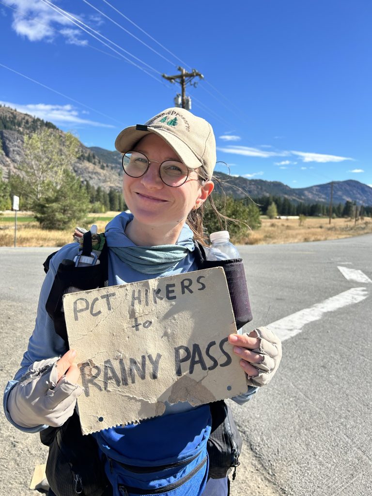
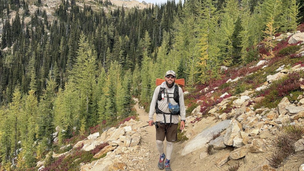
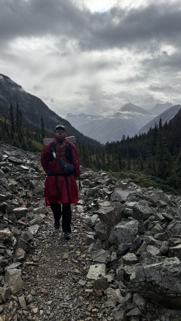
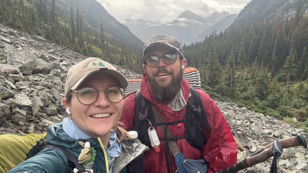
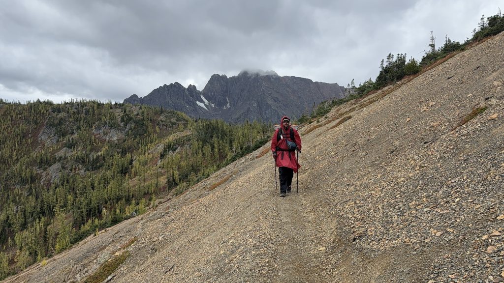
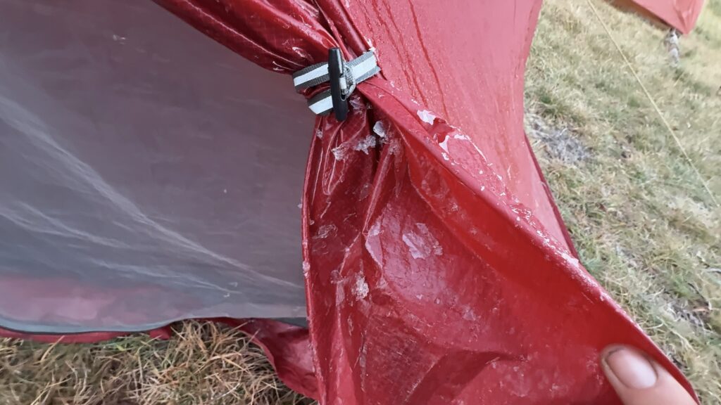
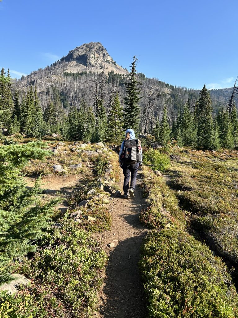
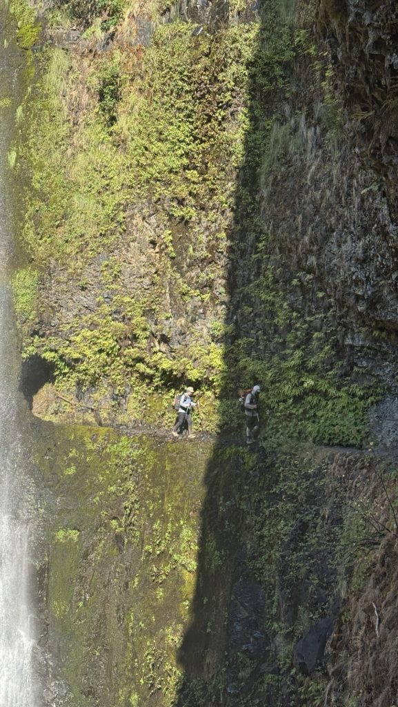
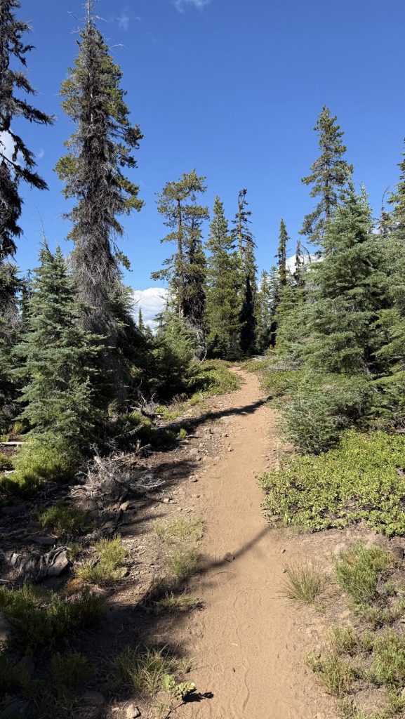
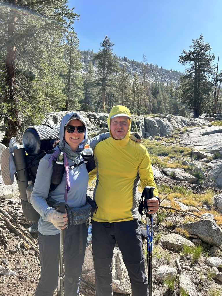
We started hiking again at 1:30 p.m., determined to make up for the morning detour. Despite the late start and the side quest into town, we crushed 22 miles by the time night fell. The trail wound through quiet forest and open slopes, and even though our bodies complained, our momentum carried us forward. By sunset, though, we were feeling every step — a strong pain in my tailbone had grown worse through the day, tender to the touch and marked by sharp pain every time I moved. Whatever it is, it made hiking painful, and I had to rely on ibuprofen just to push through.
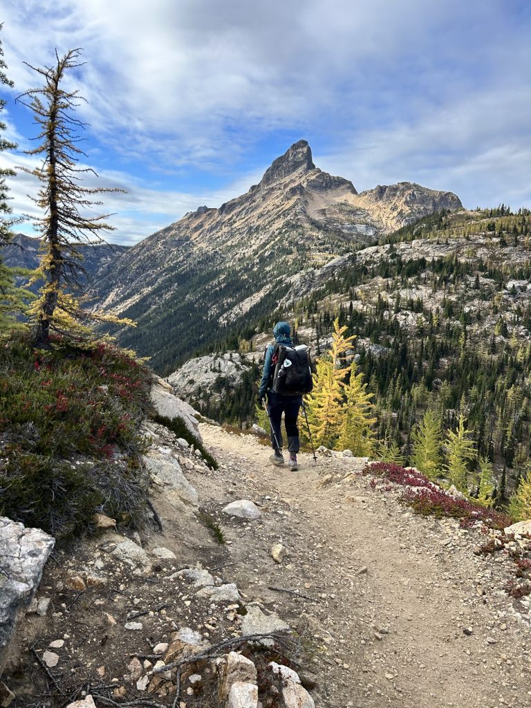
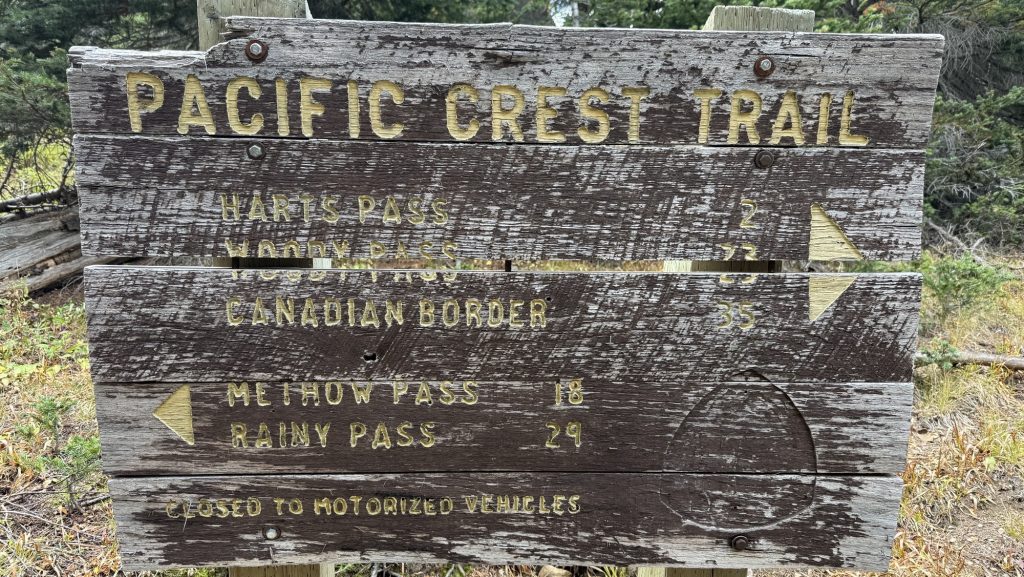
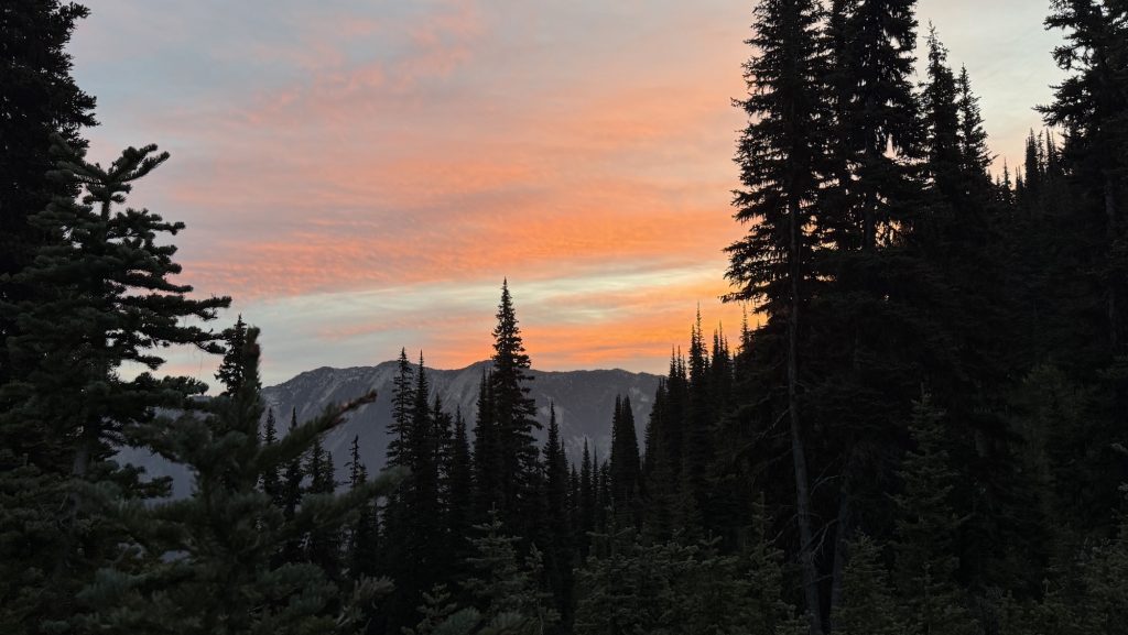
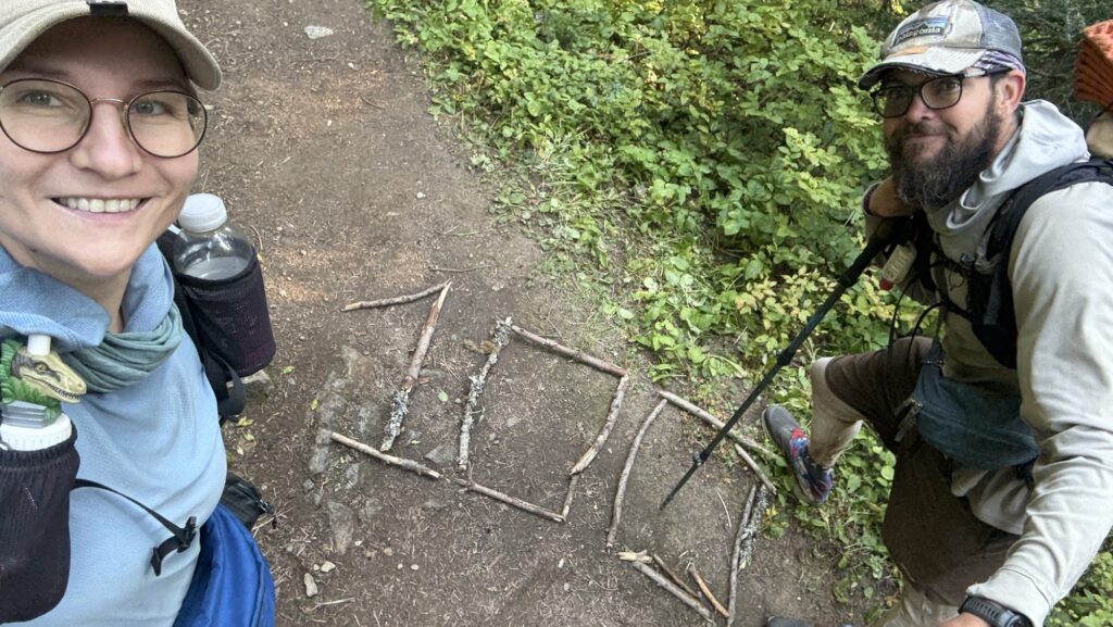
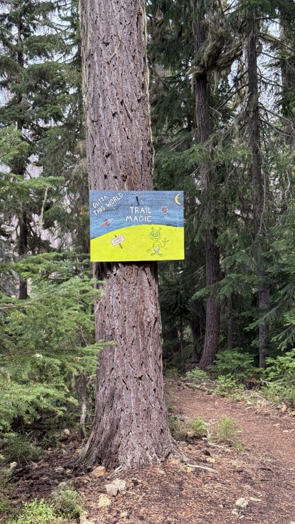
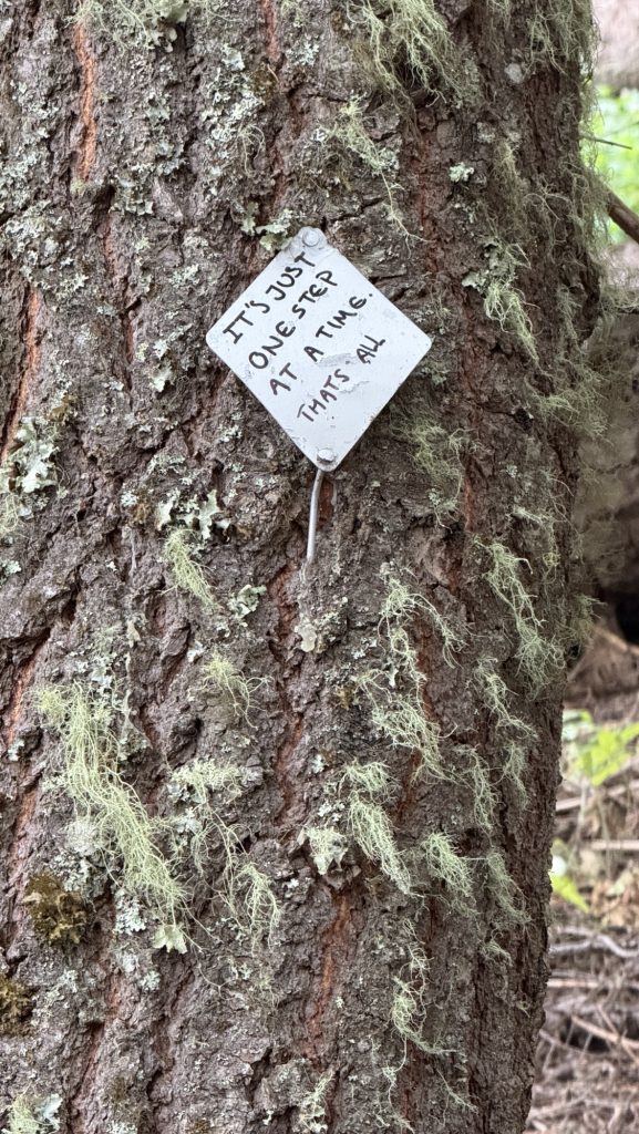
Only three long days remain: two around twenty-seven miles and a final twenty-one to reach the northern terminus. The pain is real, but so is the motivation. With every mile now, we can feel the end drawing closer, the promise of Canada just ahead. Scary. I don’t know if I want this adventure to be over. But we have a deadline to reach!!
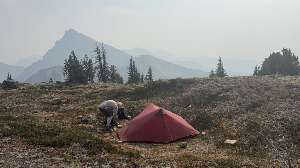
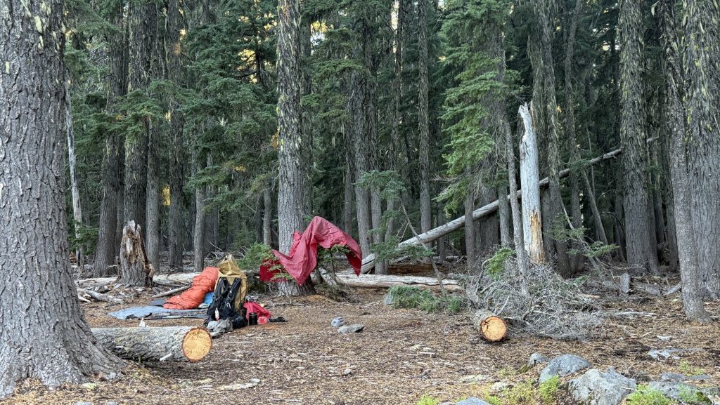
Day 140 – PCT Mile 2632.2
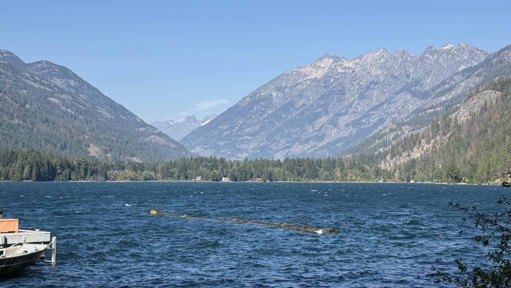
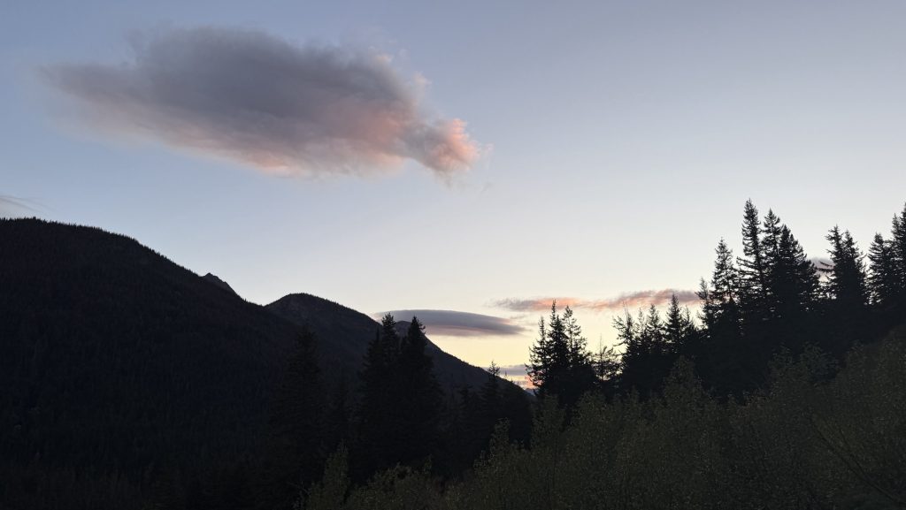
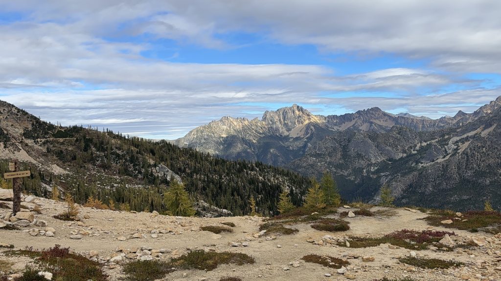
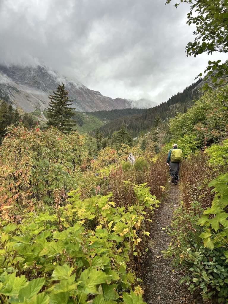
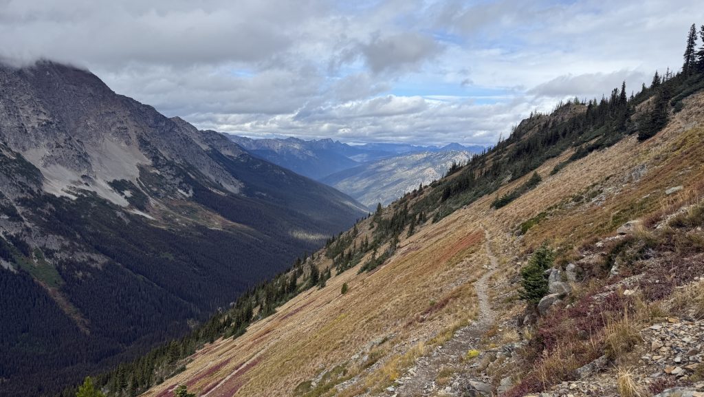
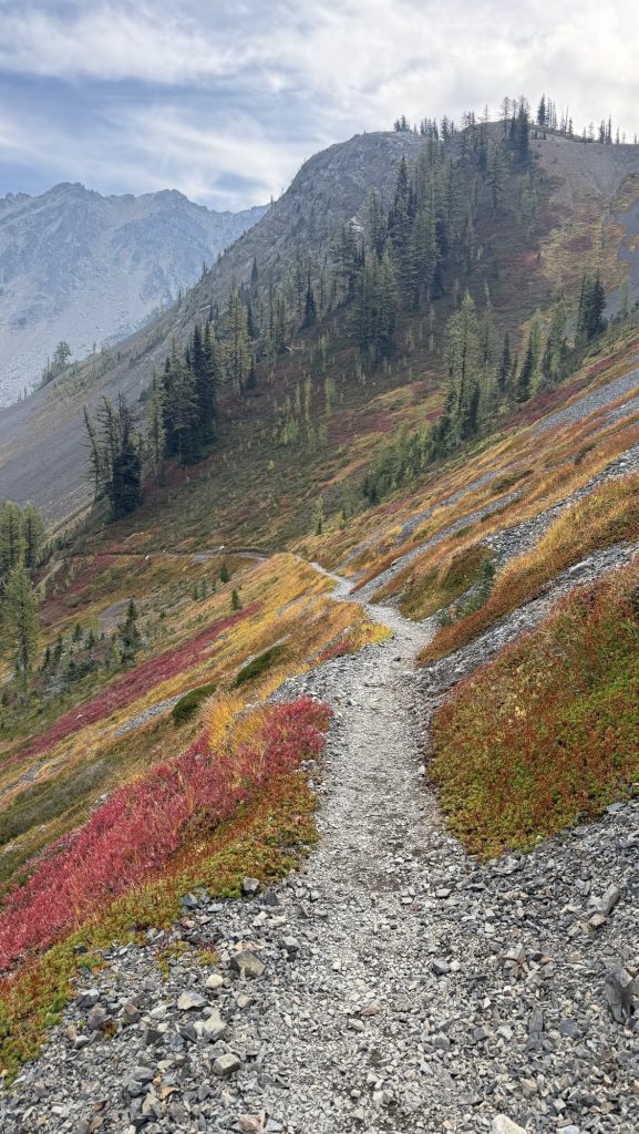
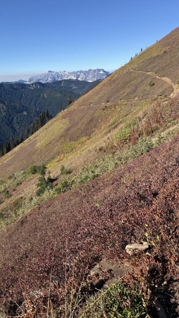
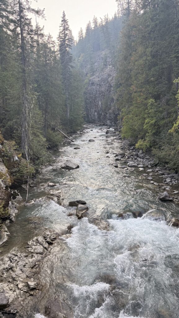
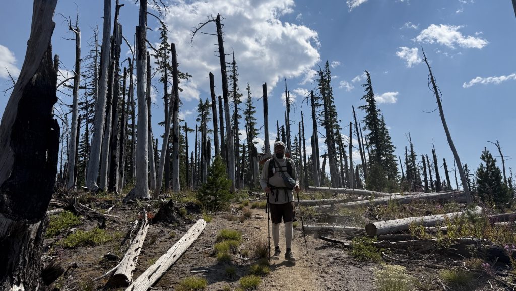
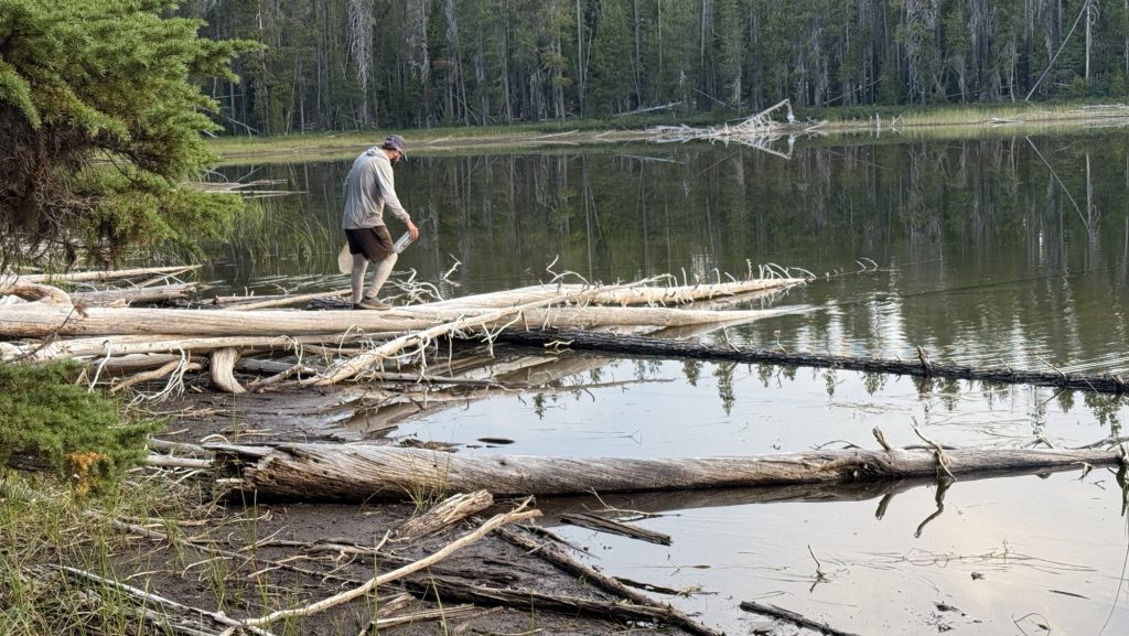
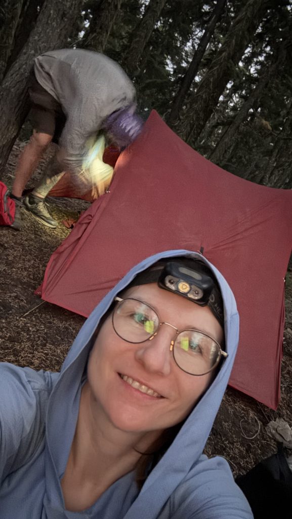
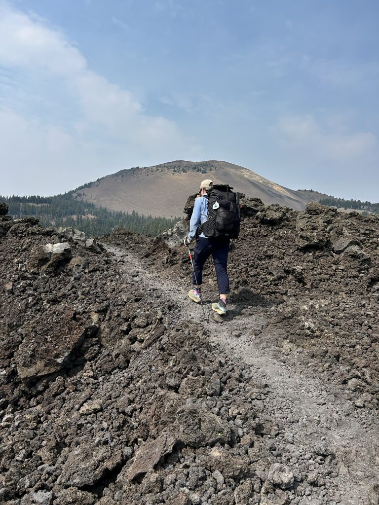
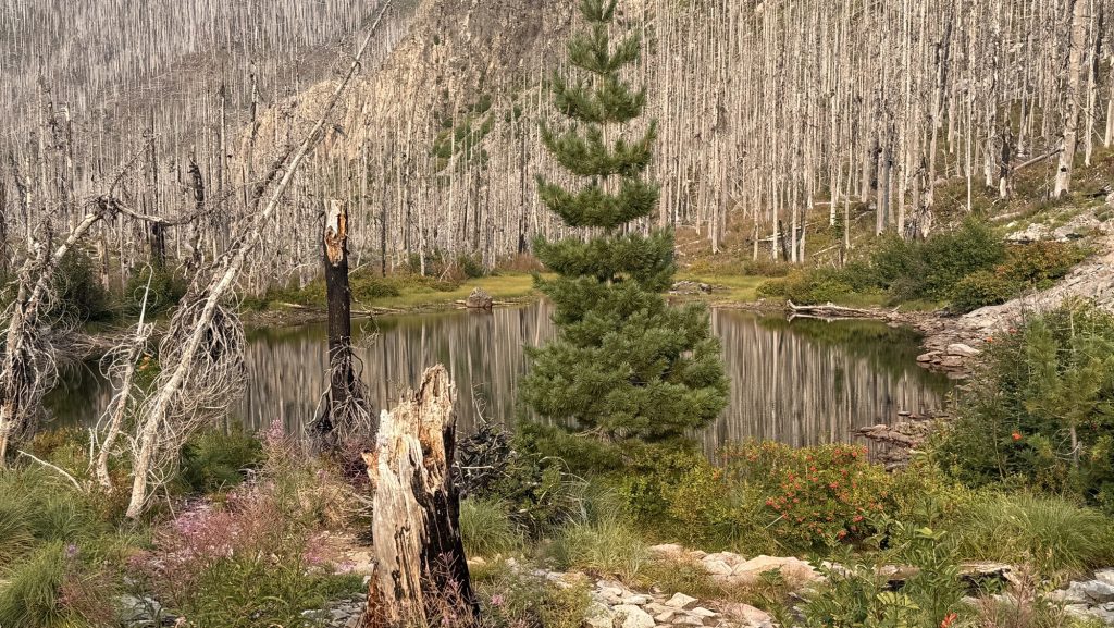
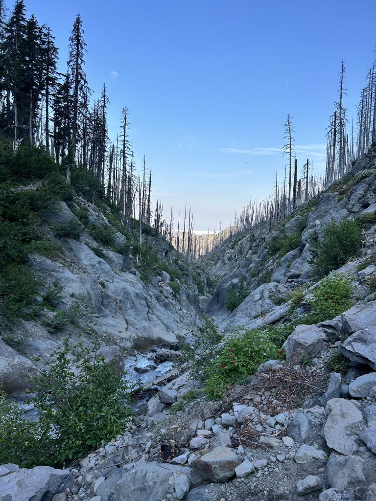
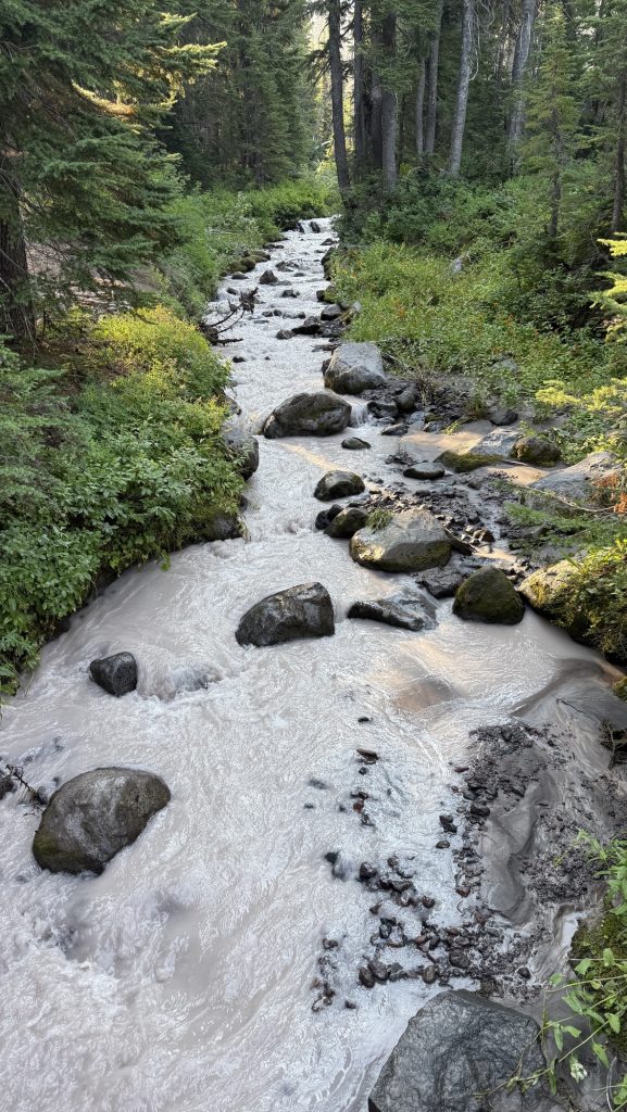
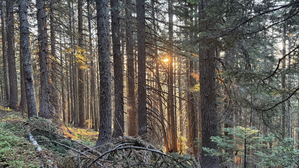
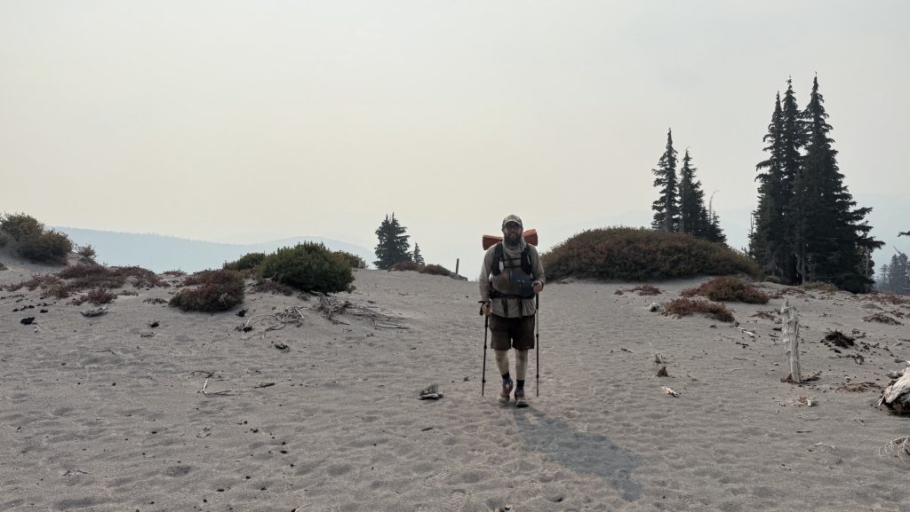
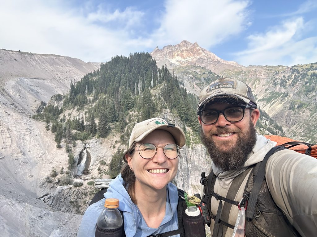
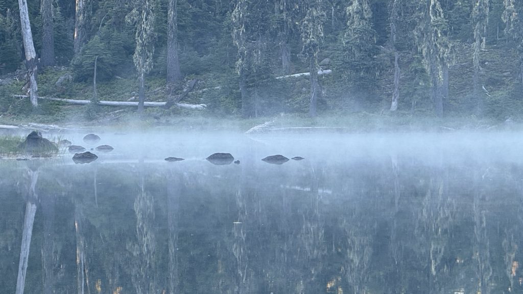
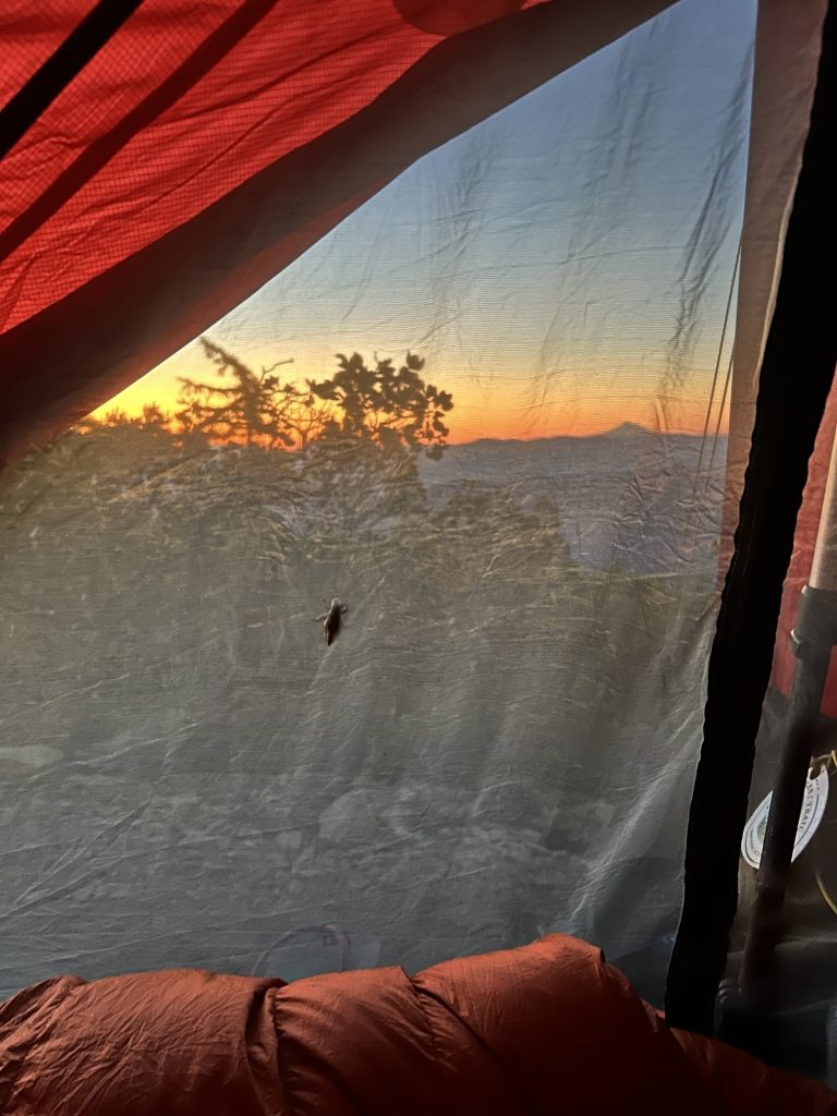
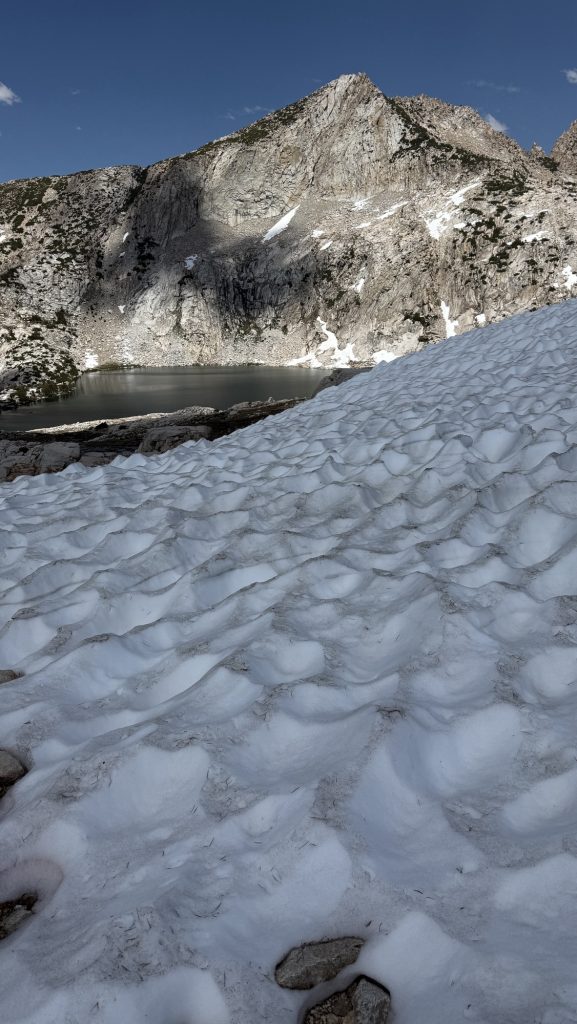
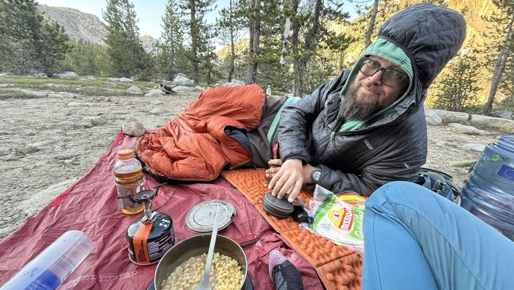
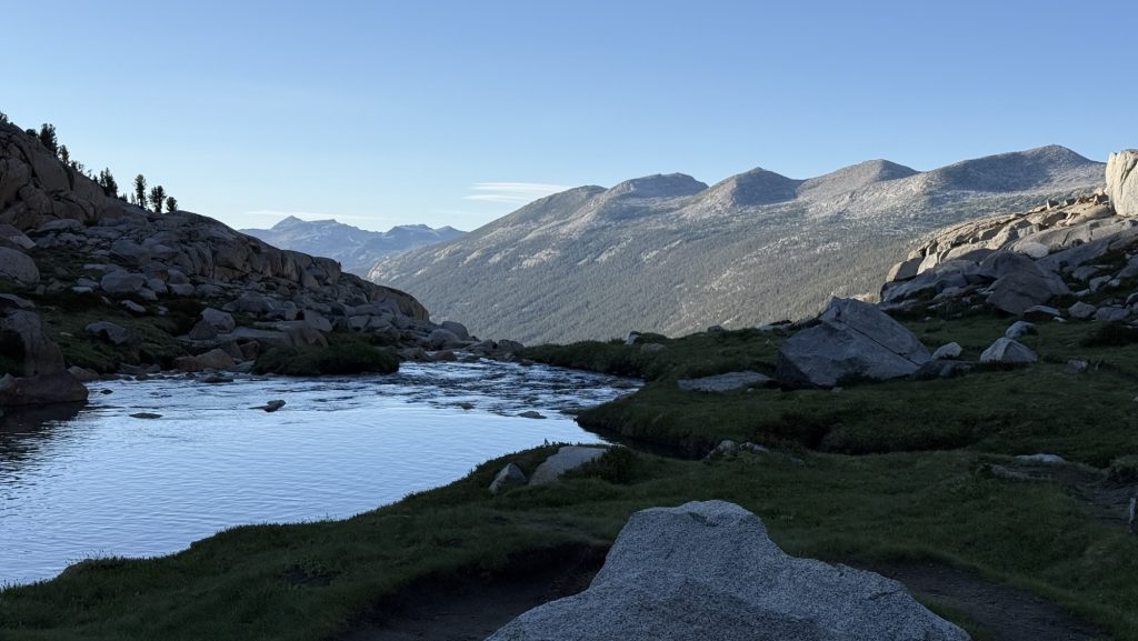
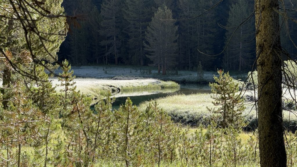
We crawled out of our tents at 7:40 am to a world wrapped in rain and cold. The forest was dripping, mist curling around the tree trunks as we trudged the first 3 miles to a water source. Hands numb, hoods tight, everything smelled like wet pine.
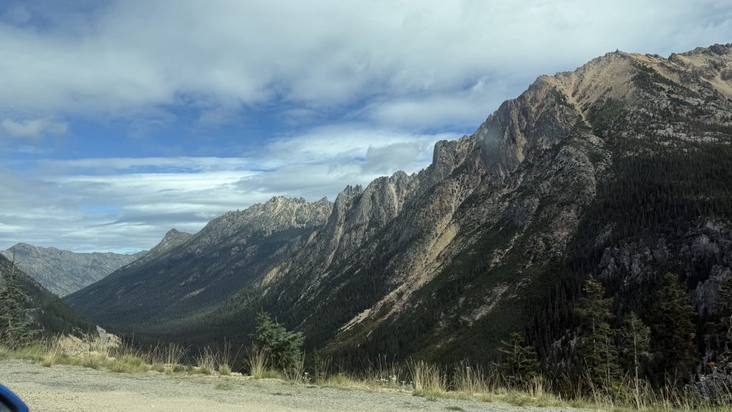
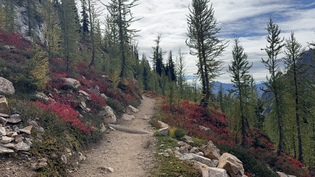
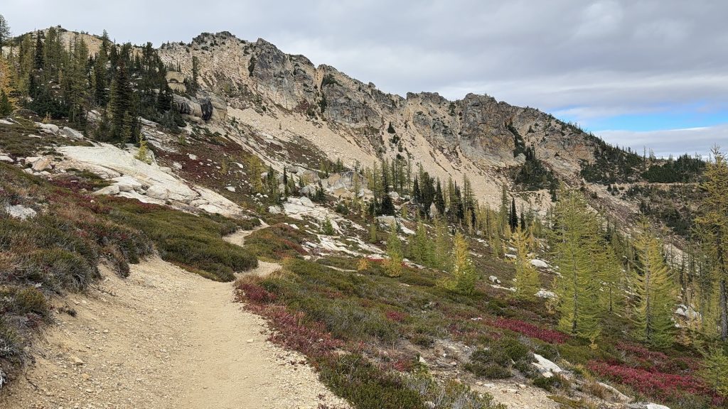
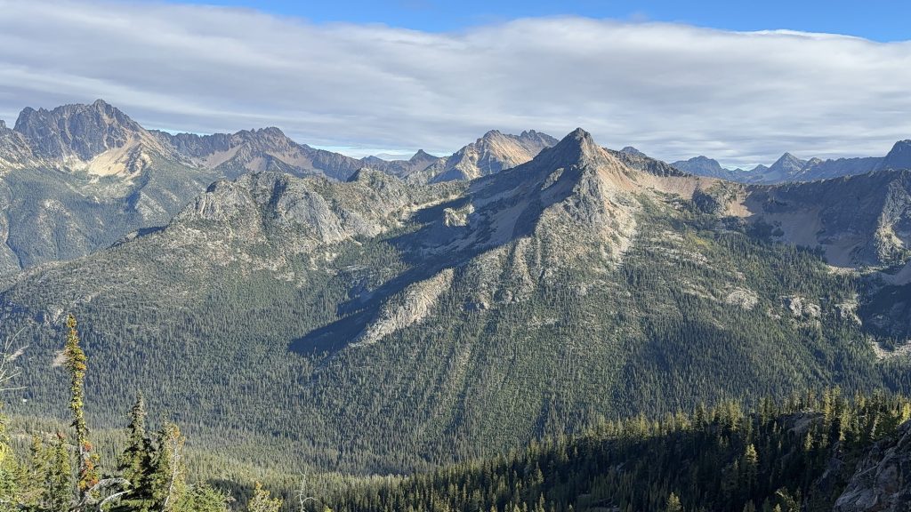
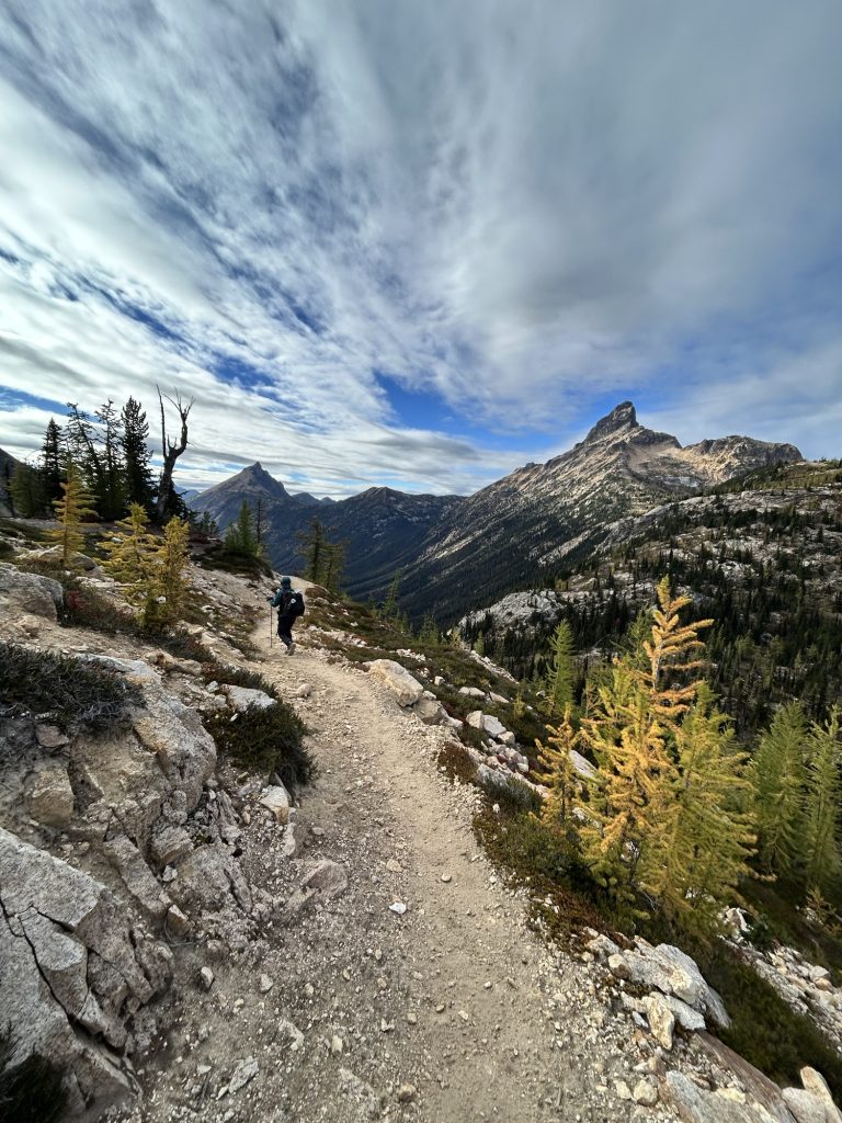
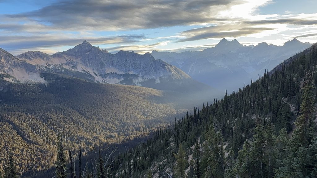
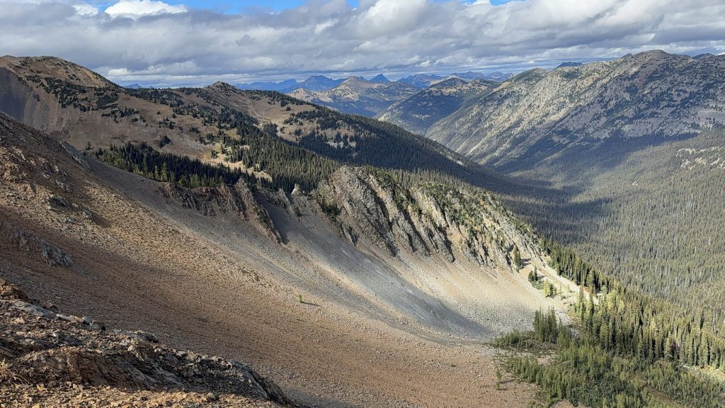
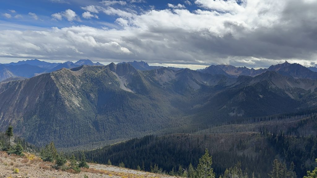
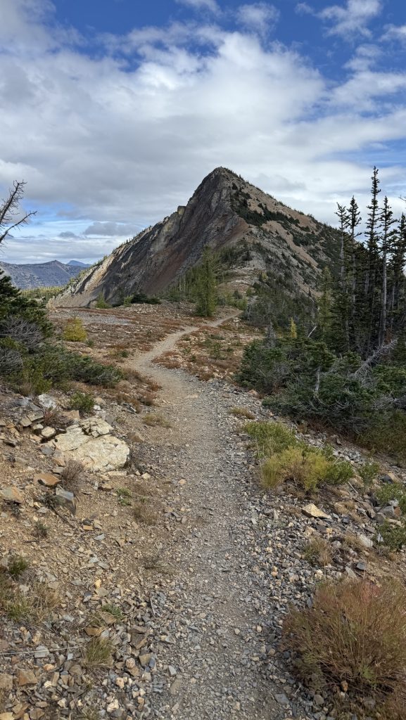
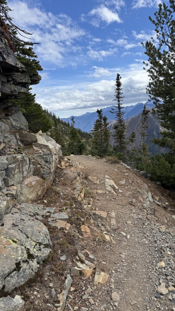
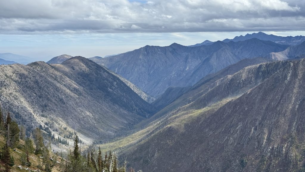
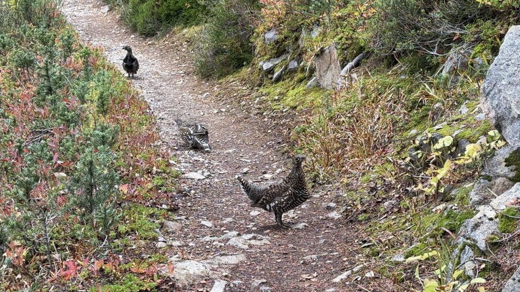
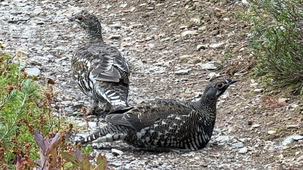
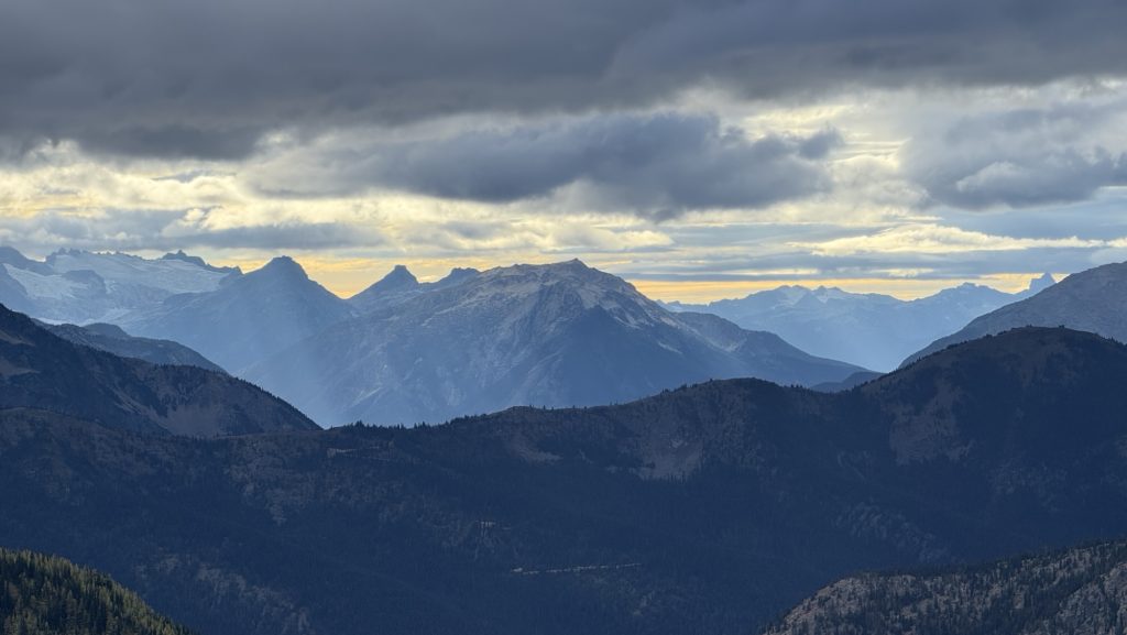
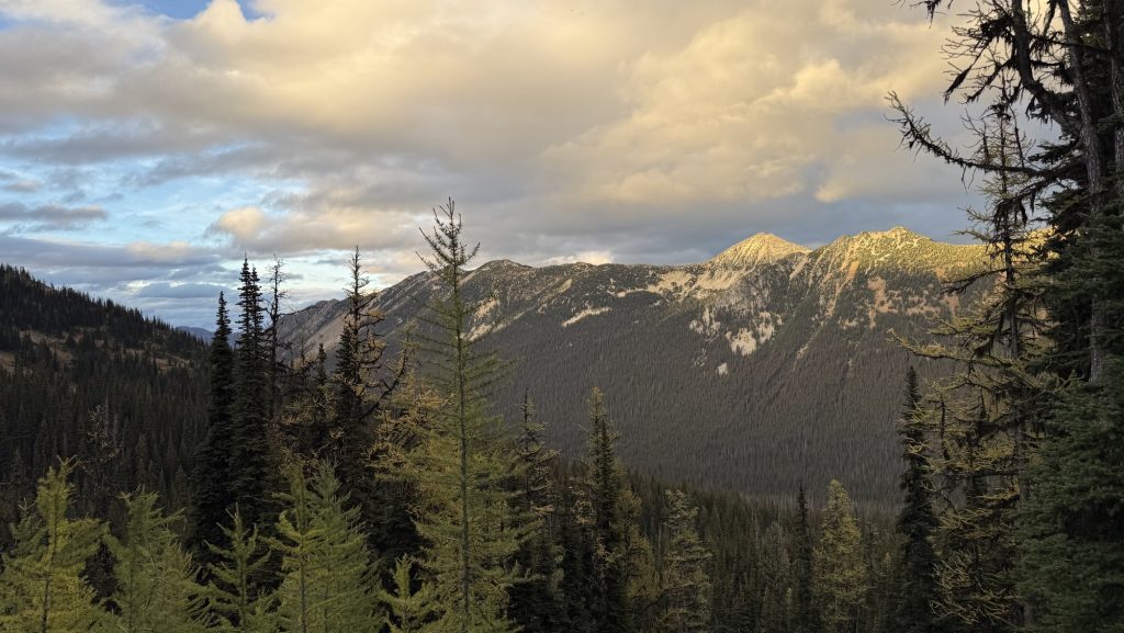
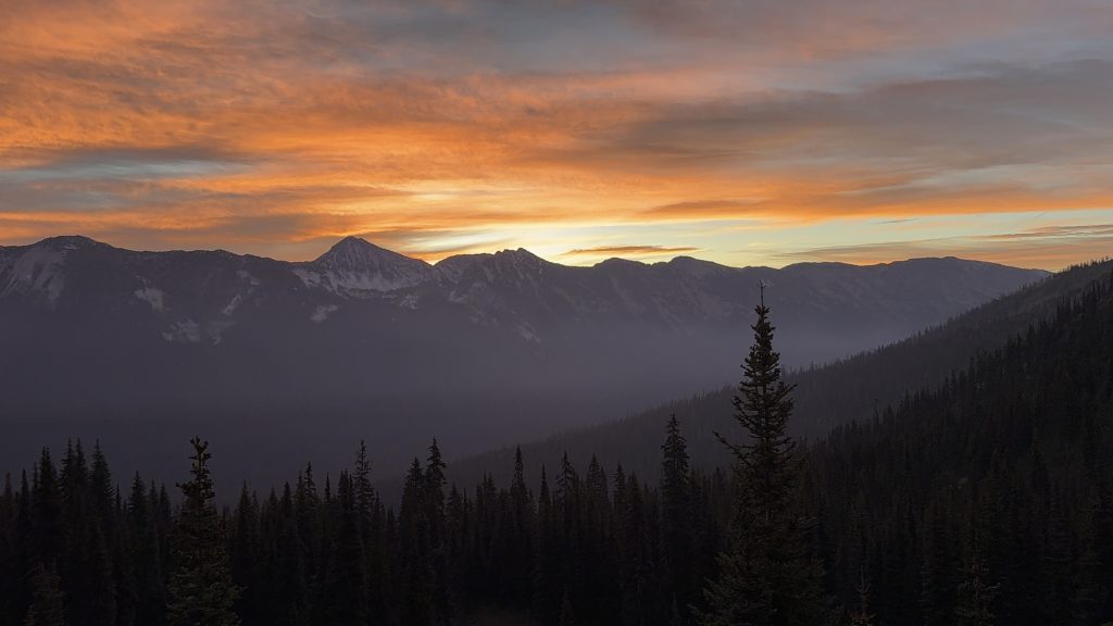
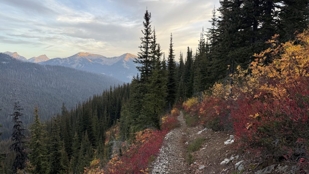
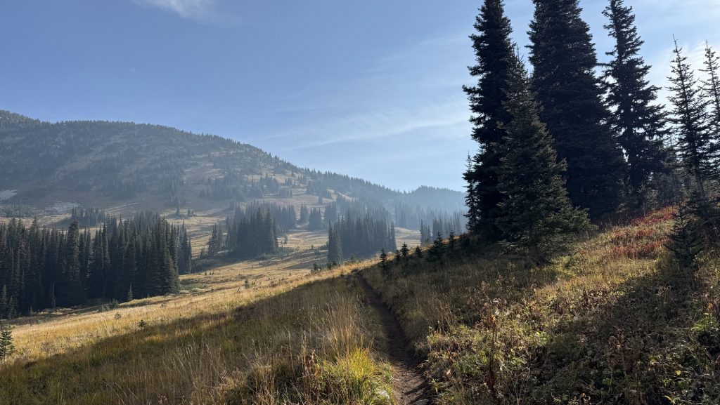
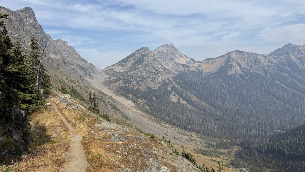
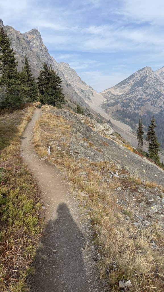
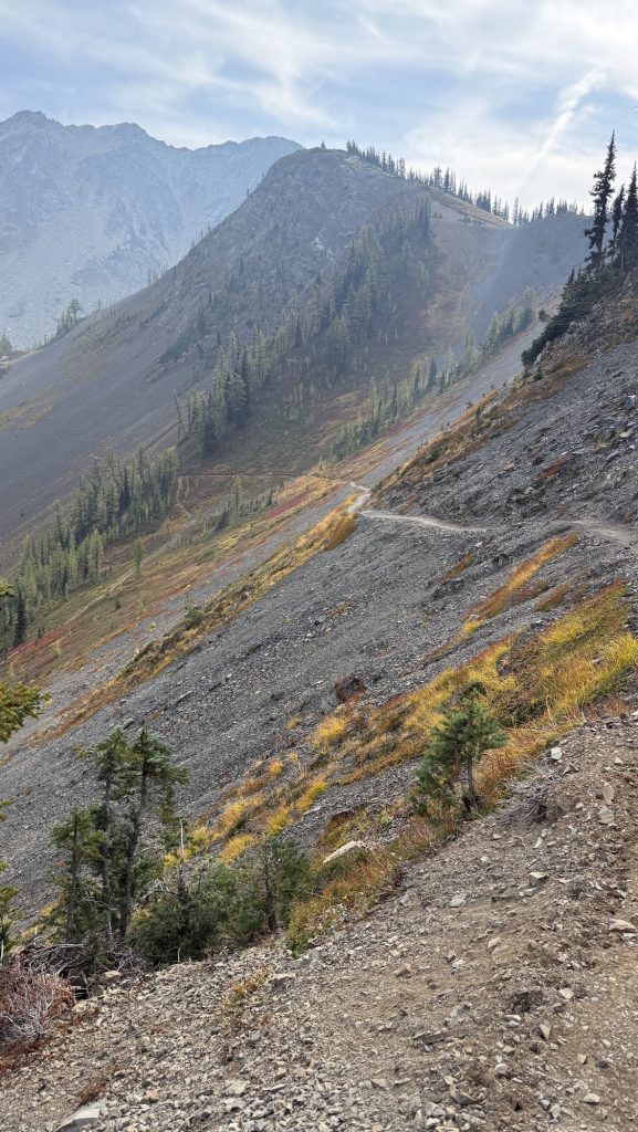
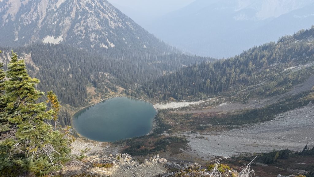
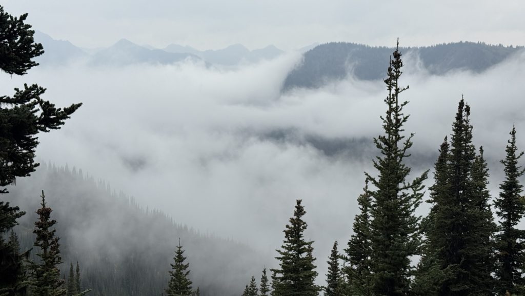
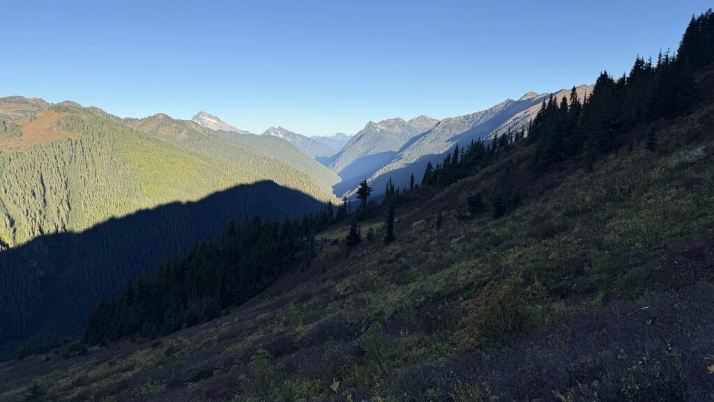
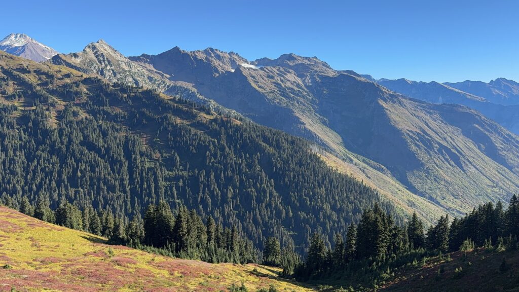
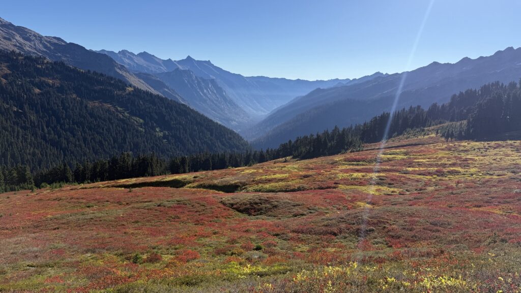
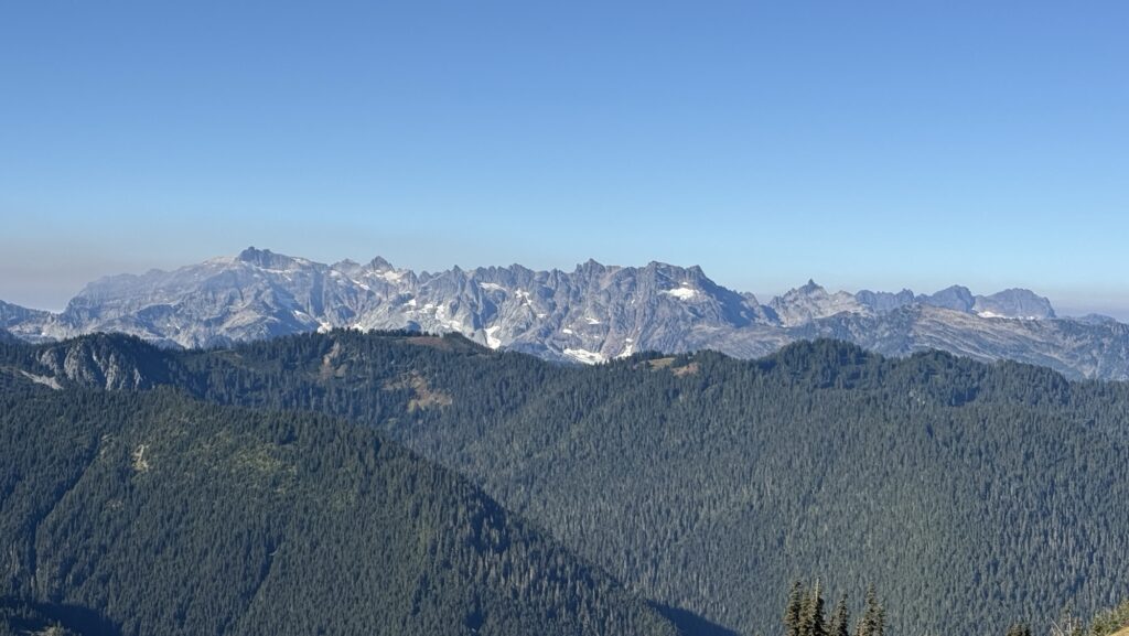
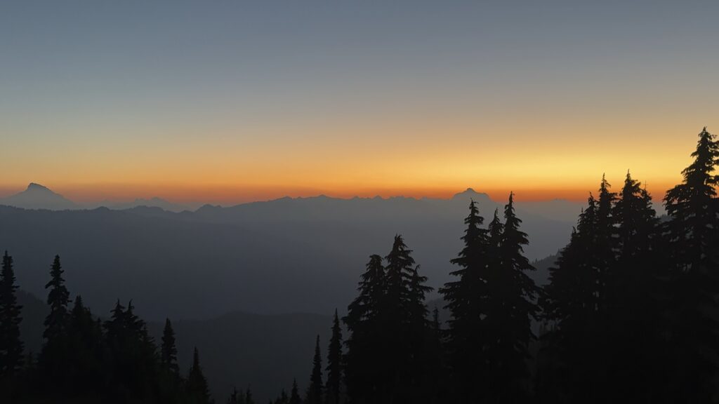
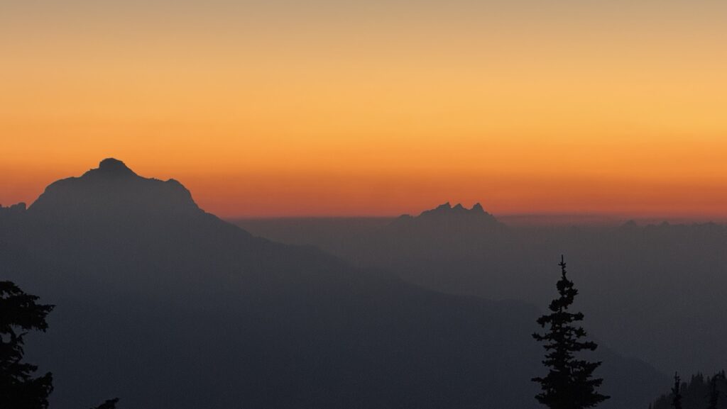
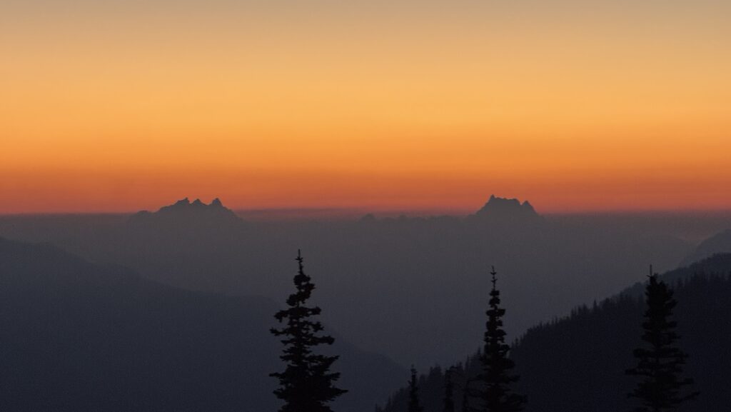
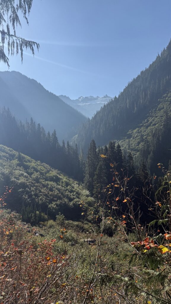
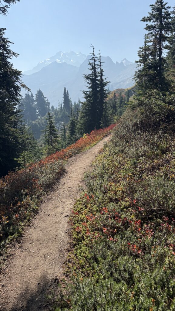
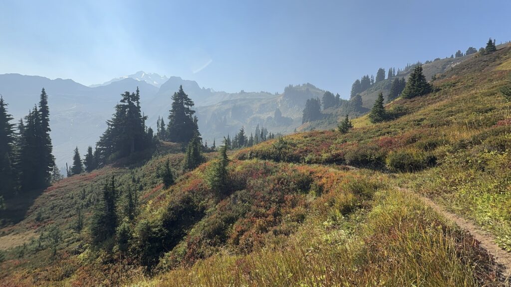
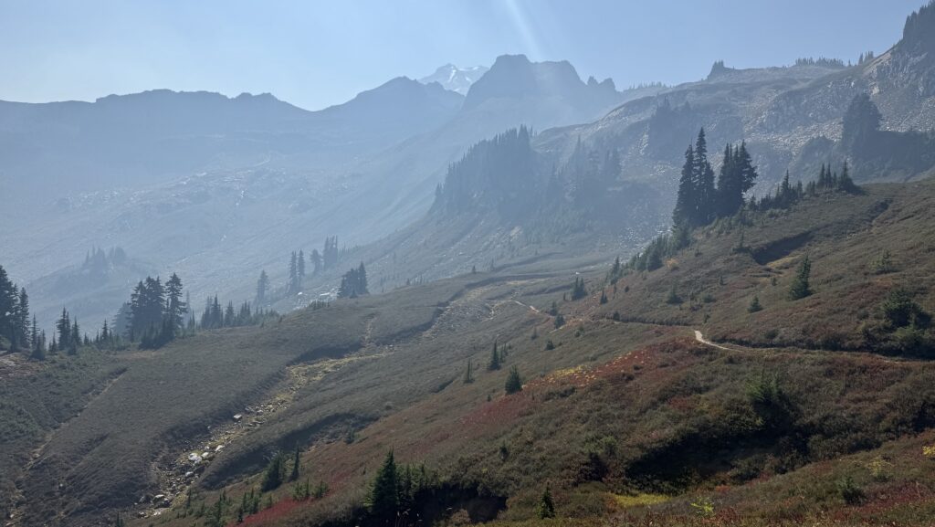
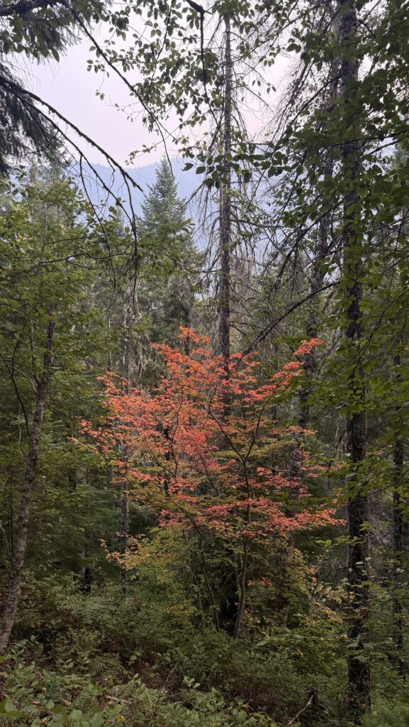
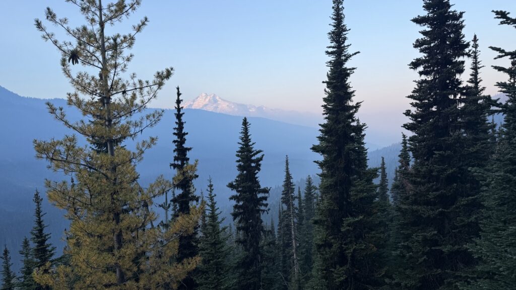
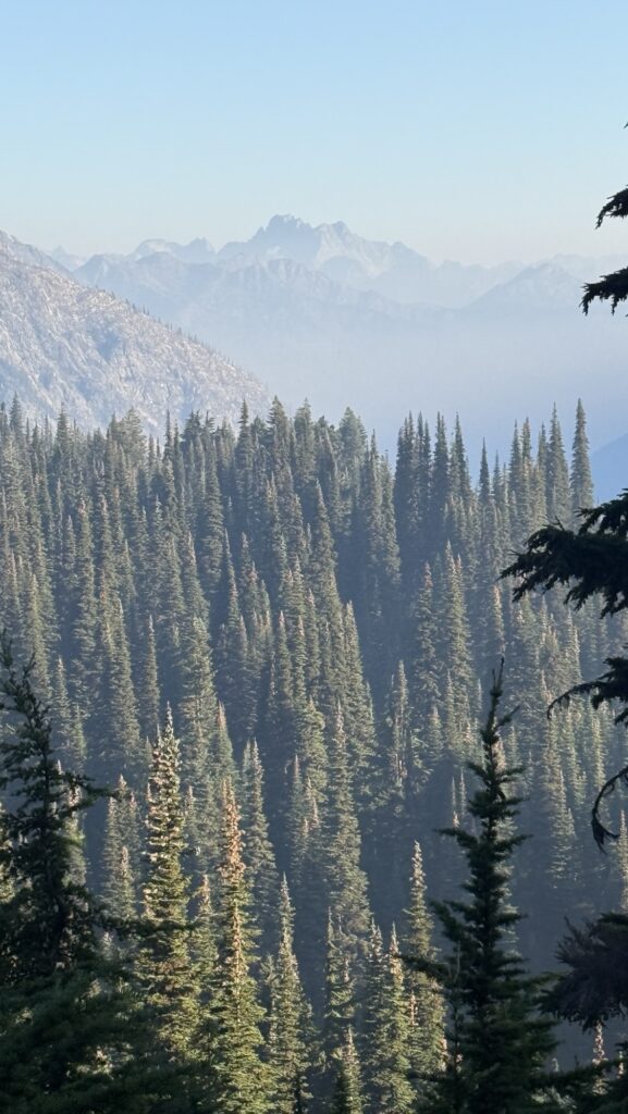
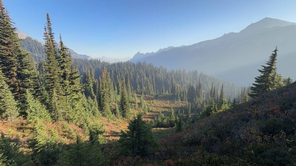
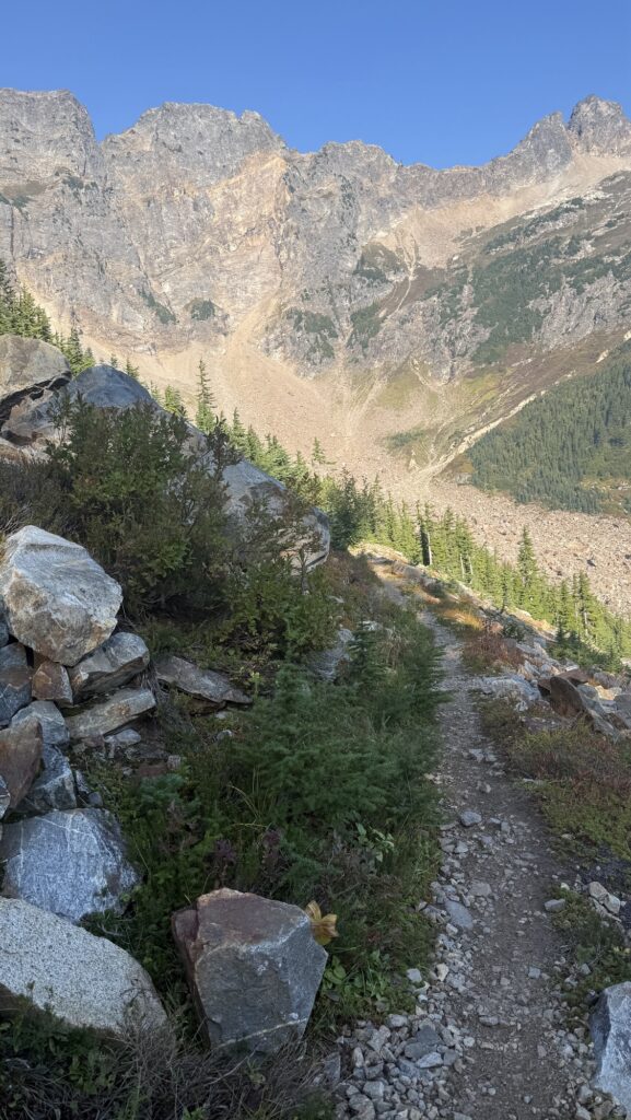
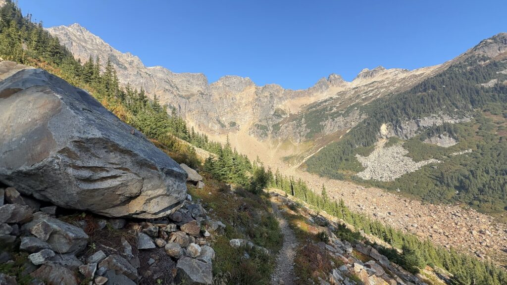
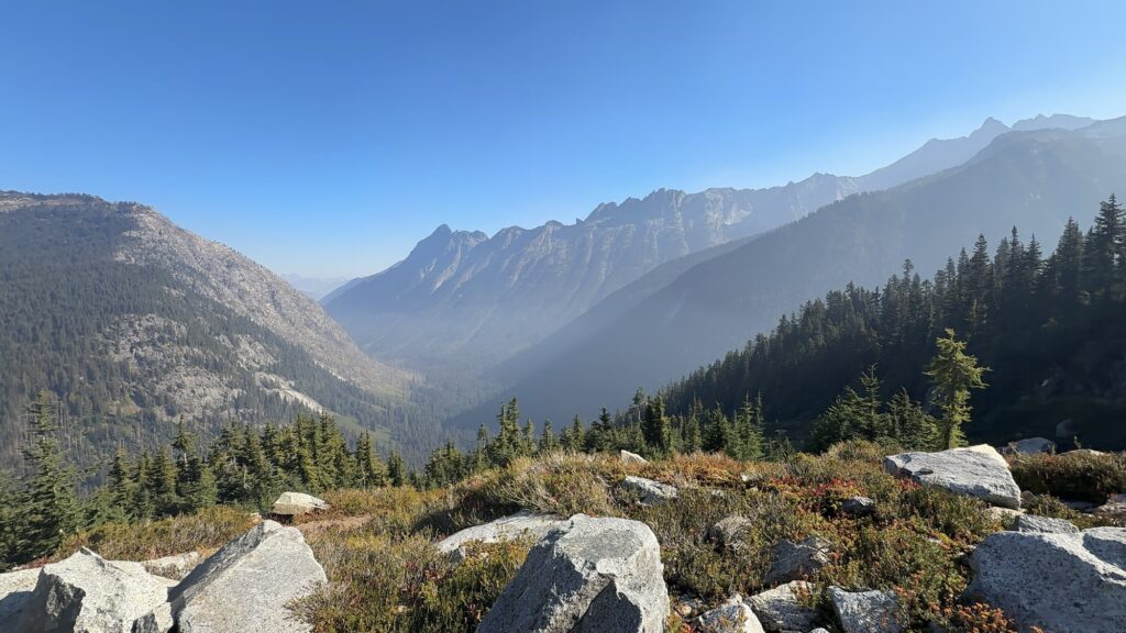
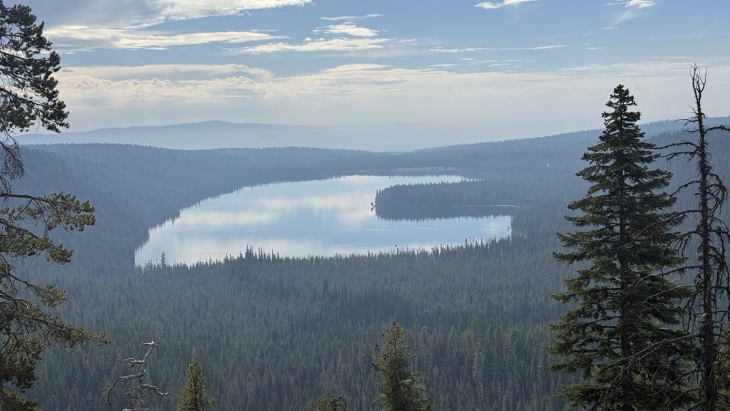
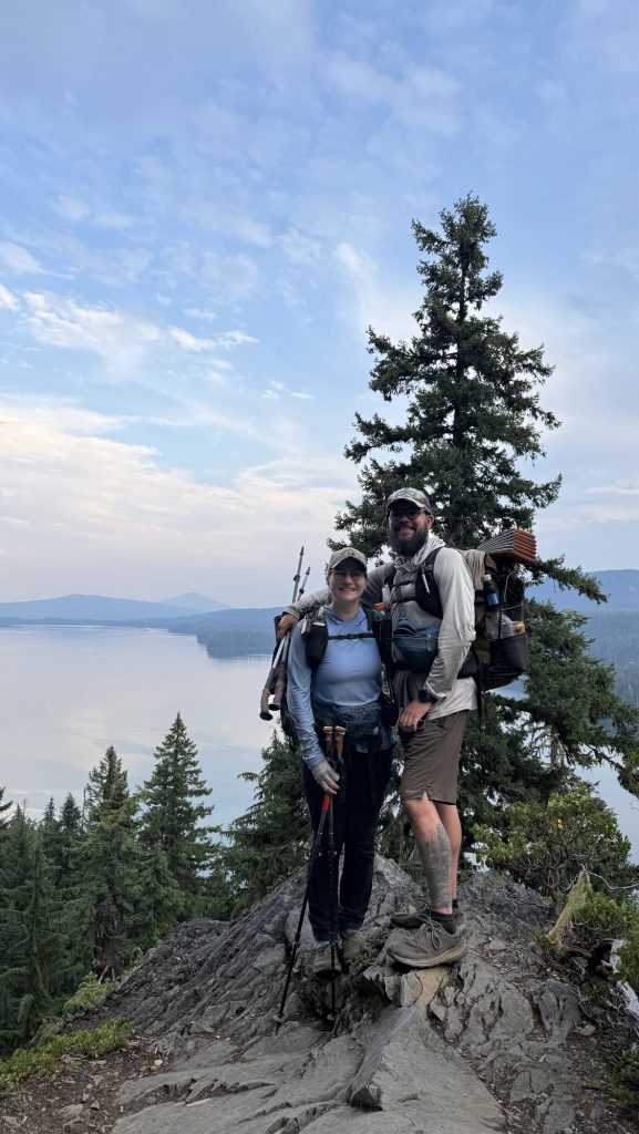
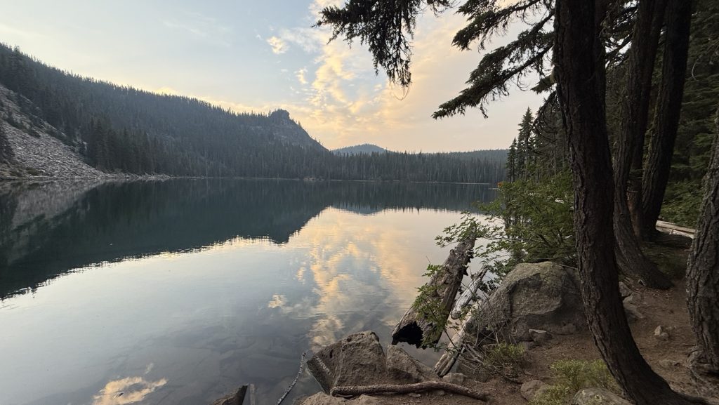
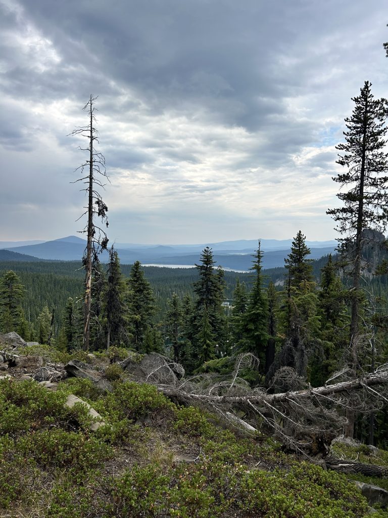
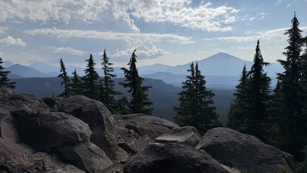
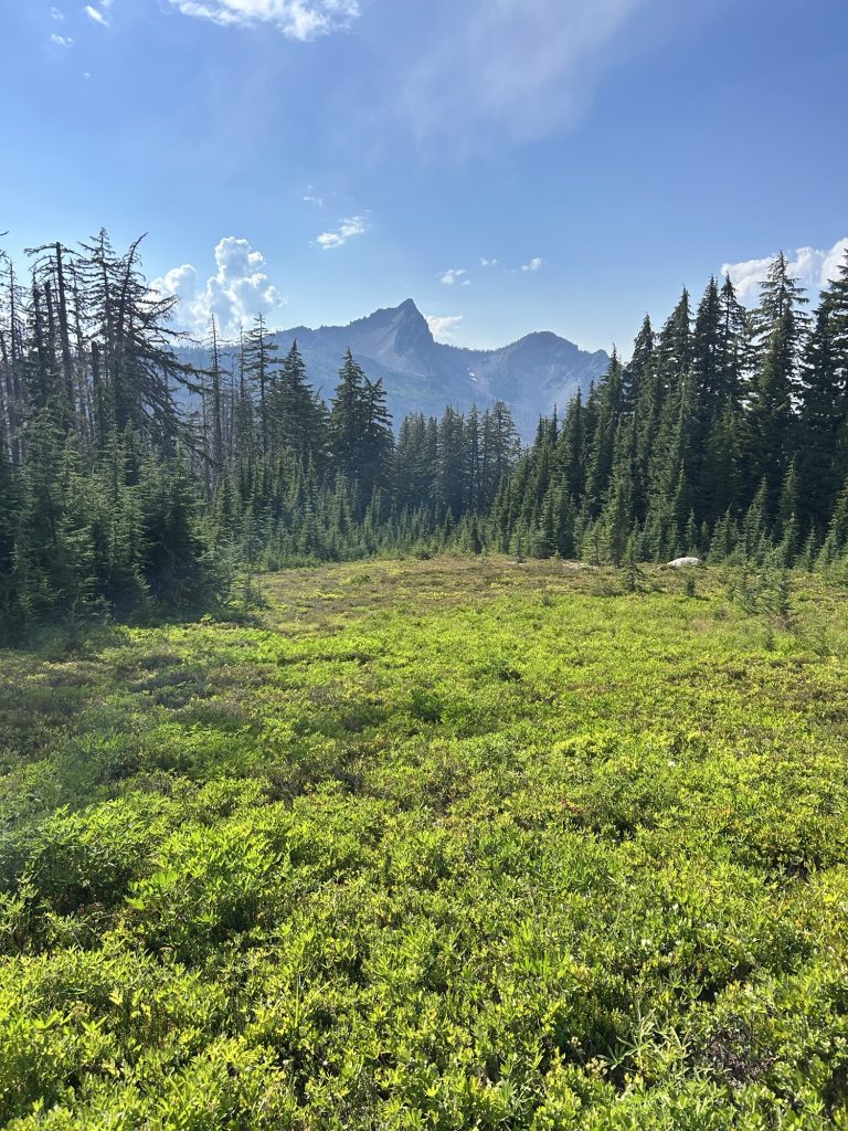
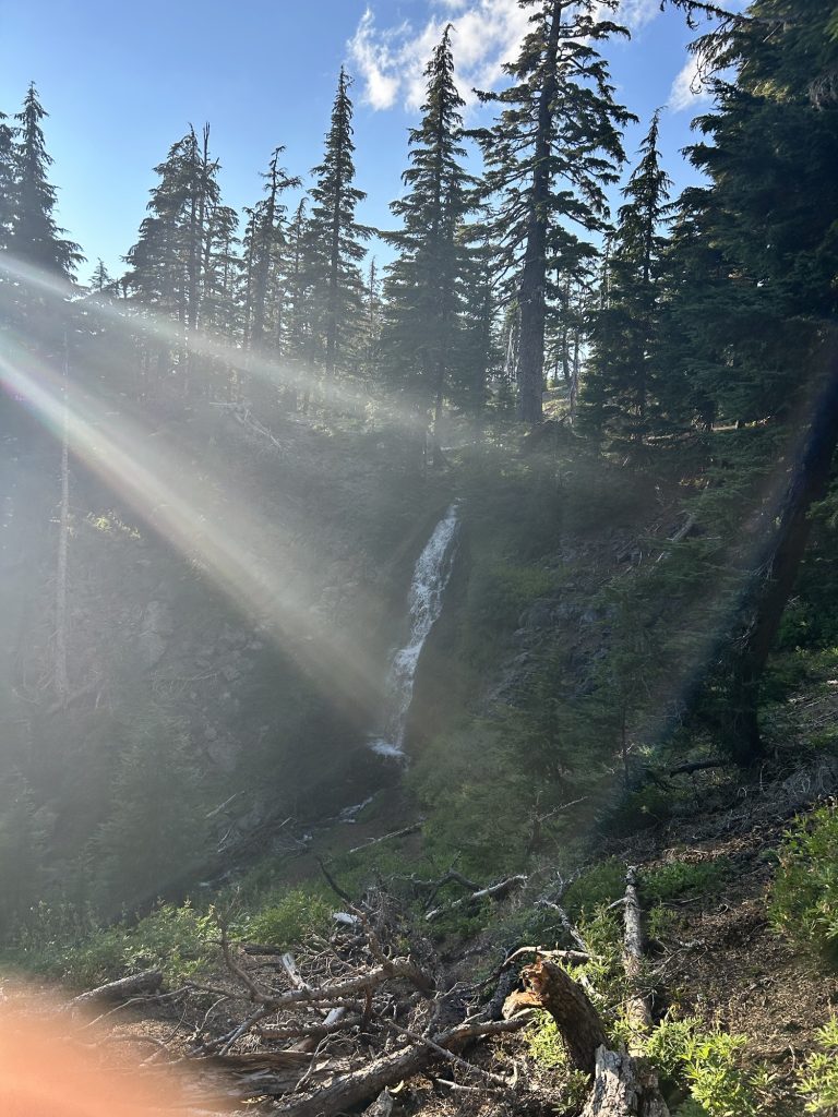
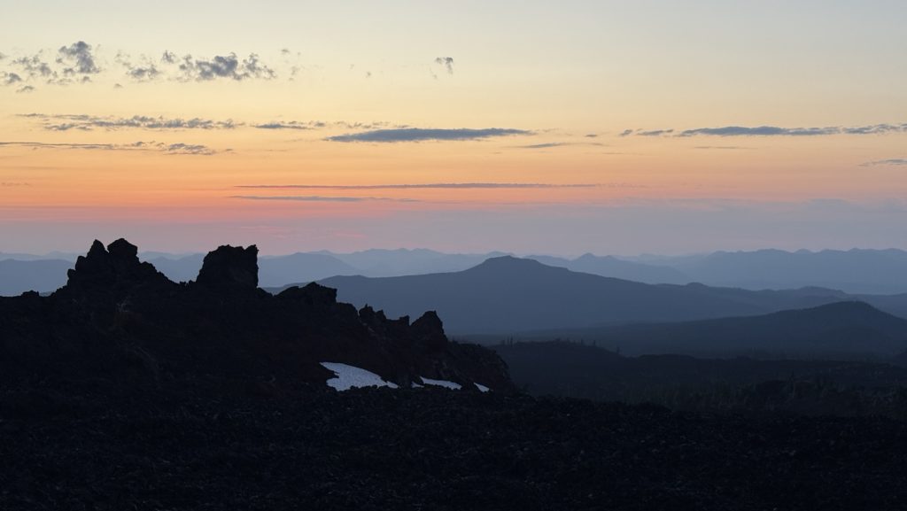
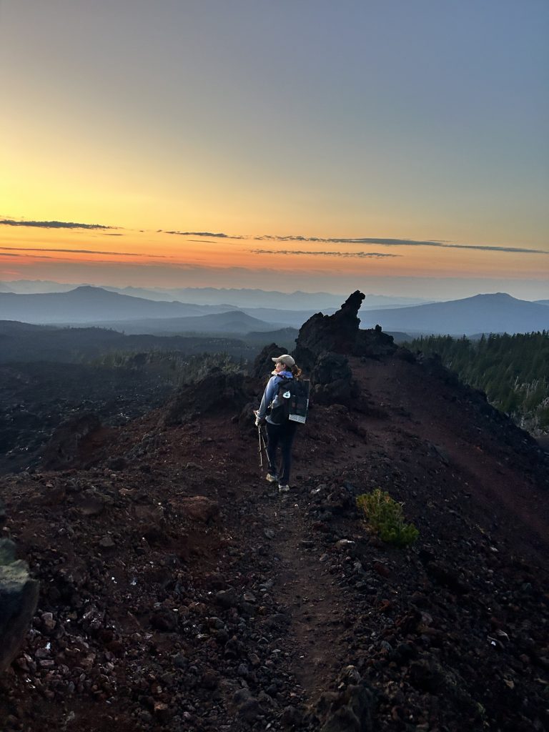
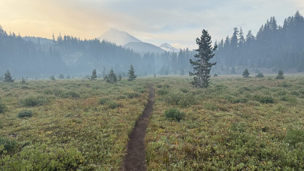
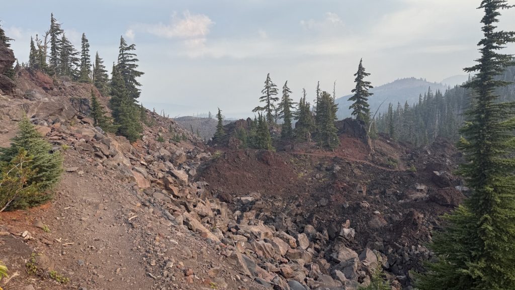
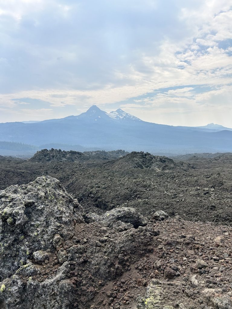
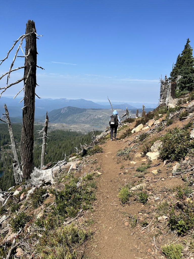
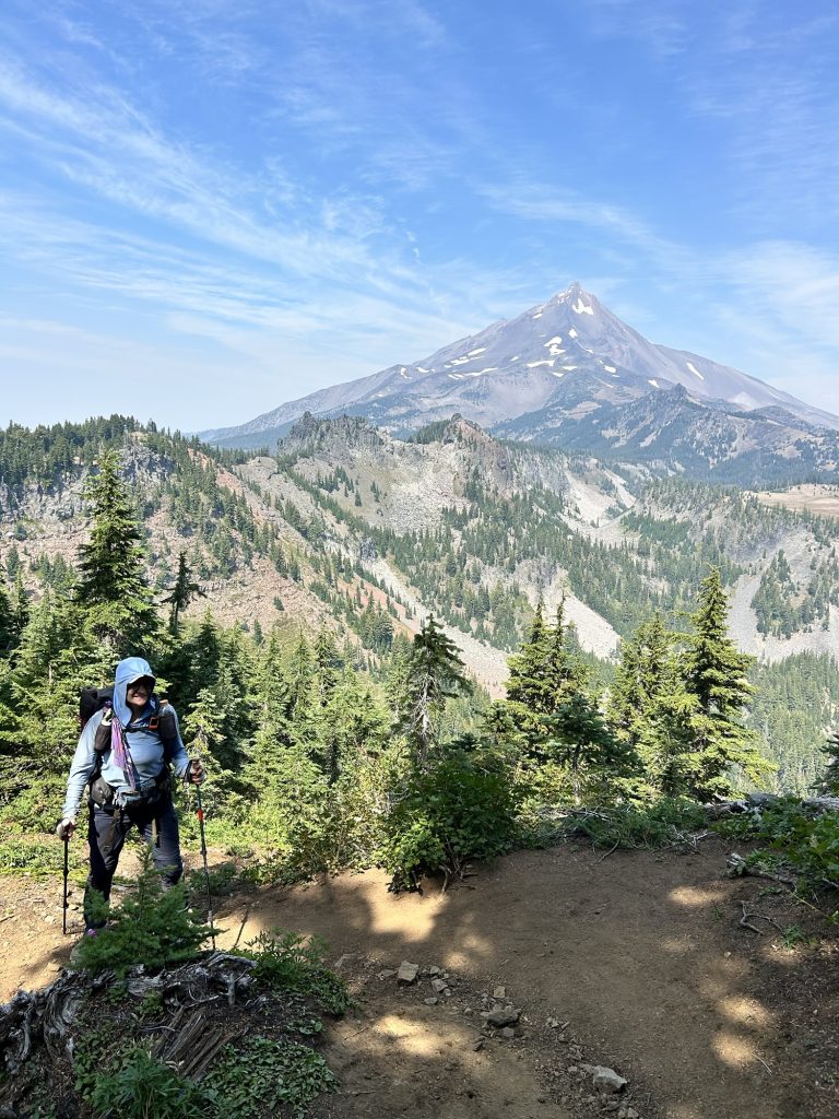
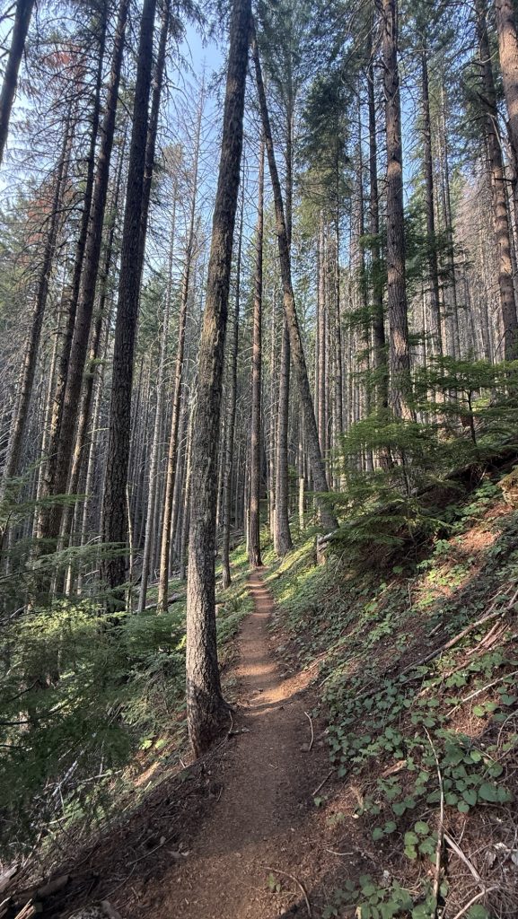
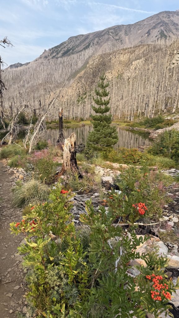
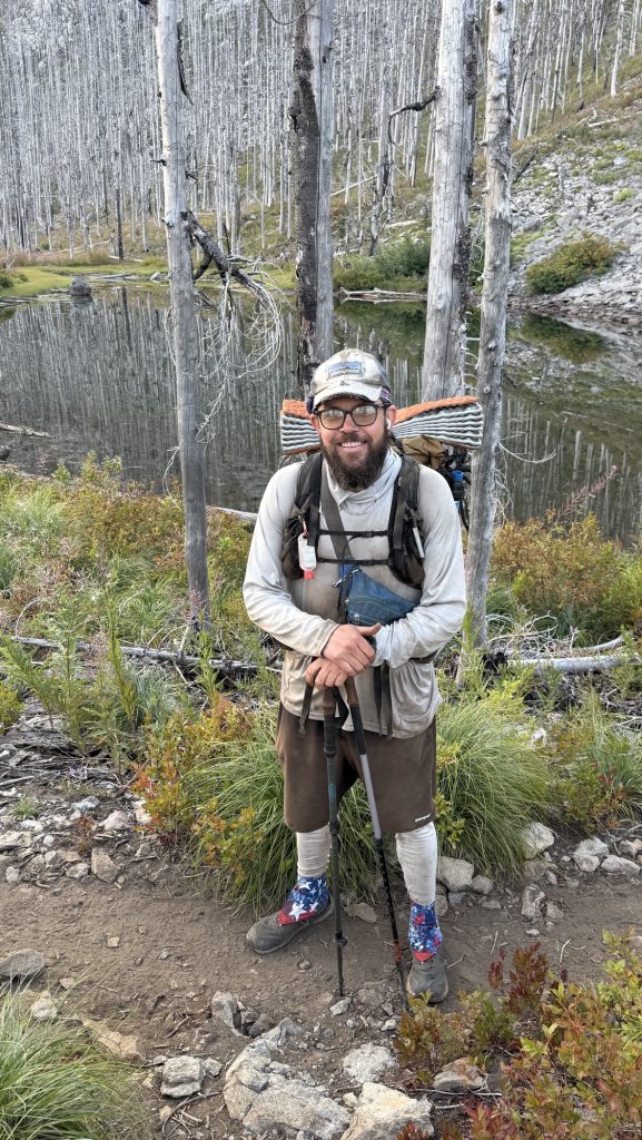
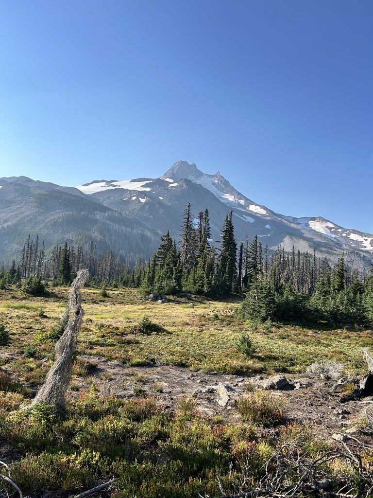
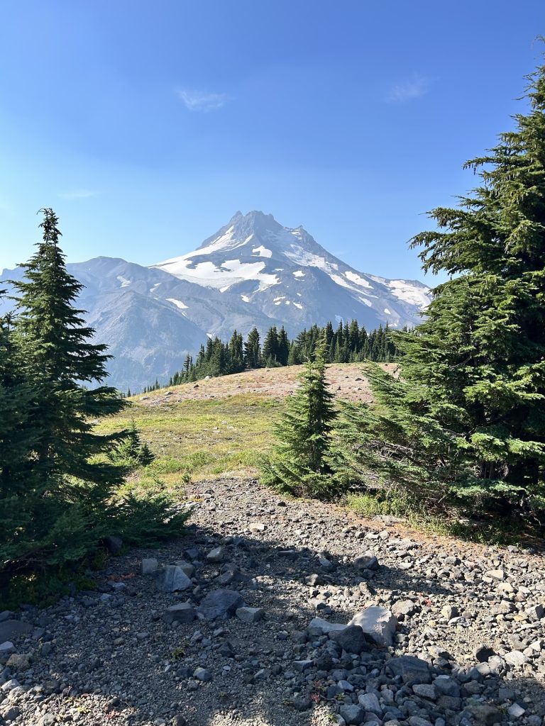
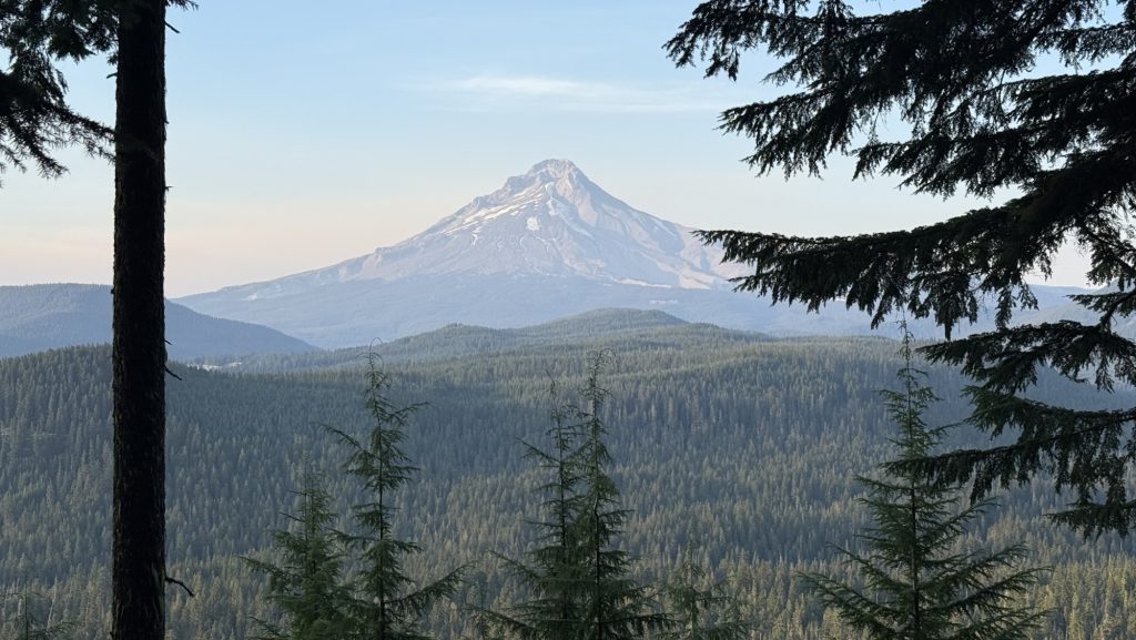
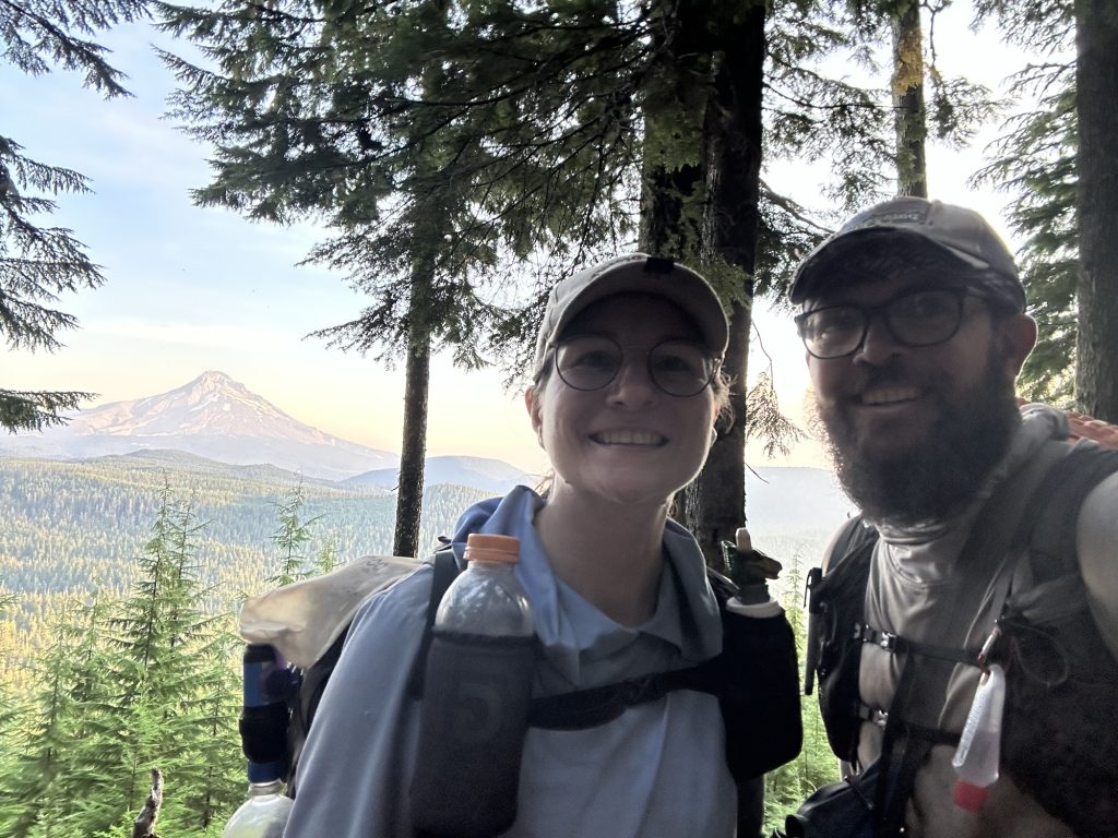
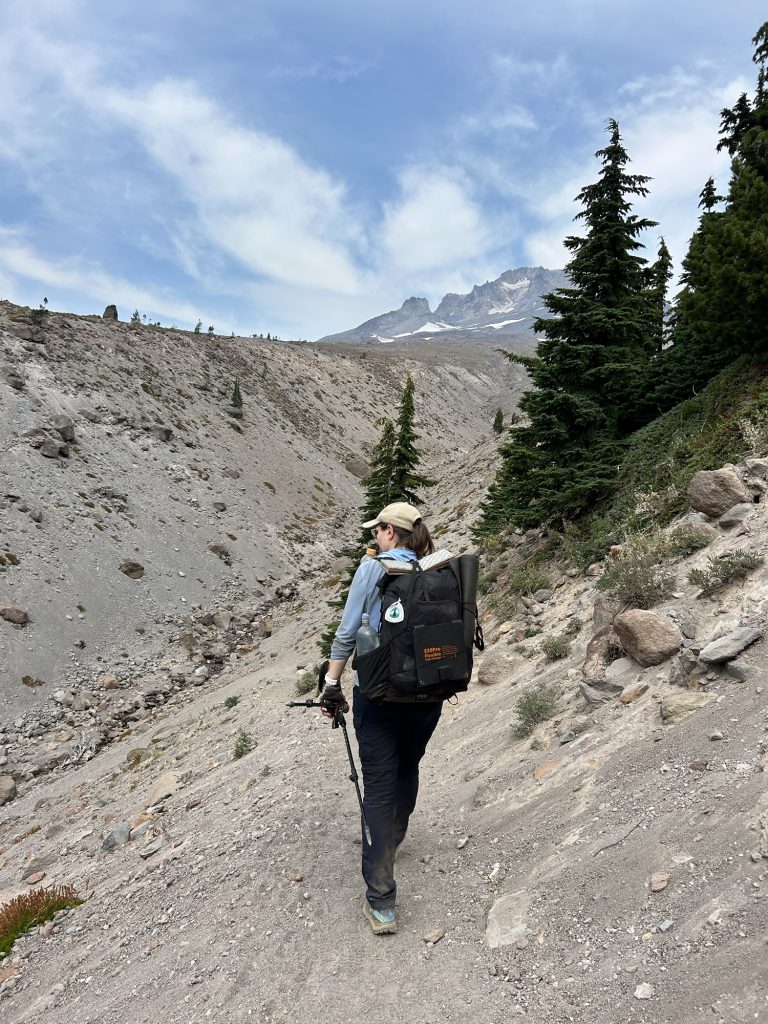
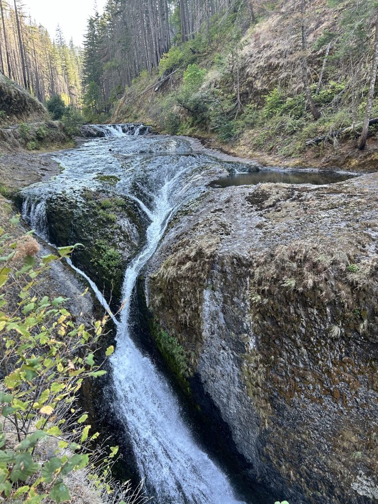
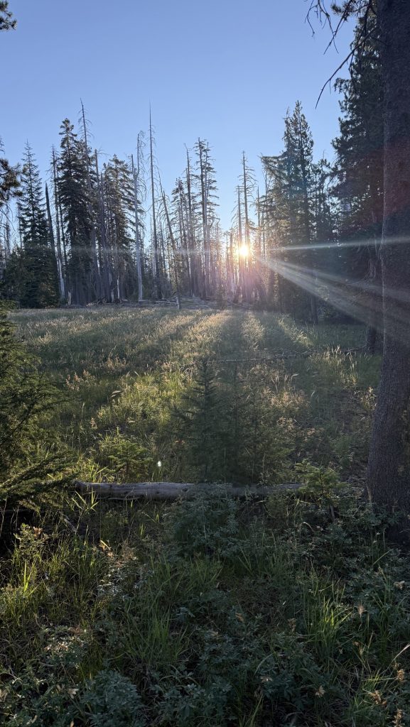
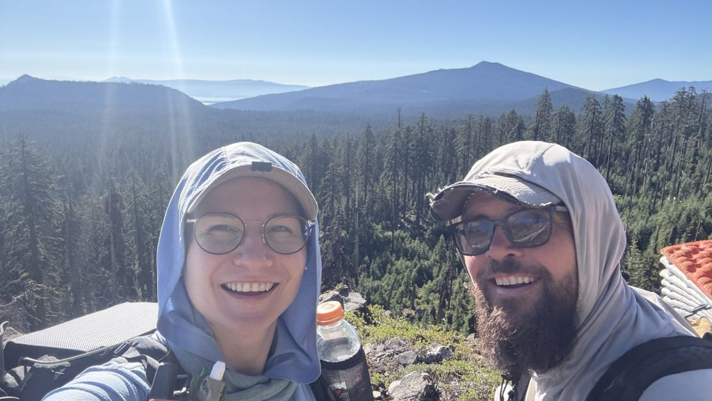
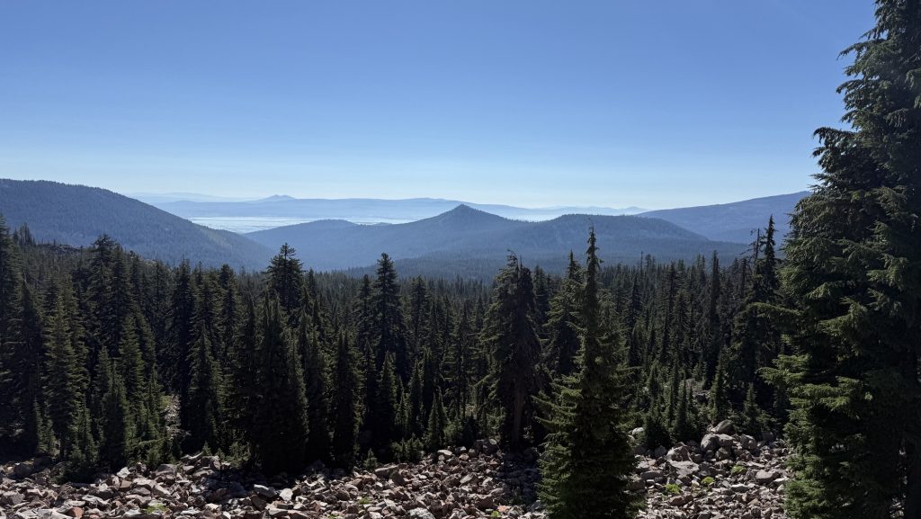
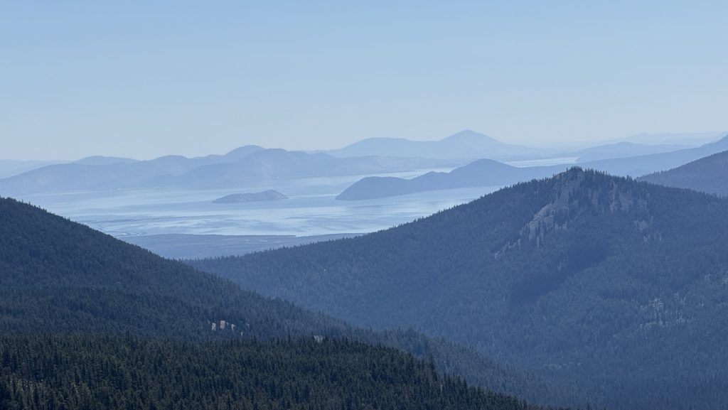
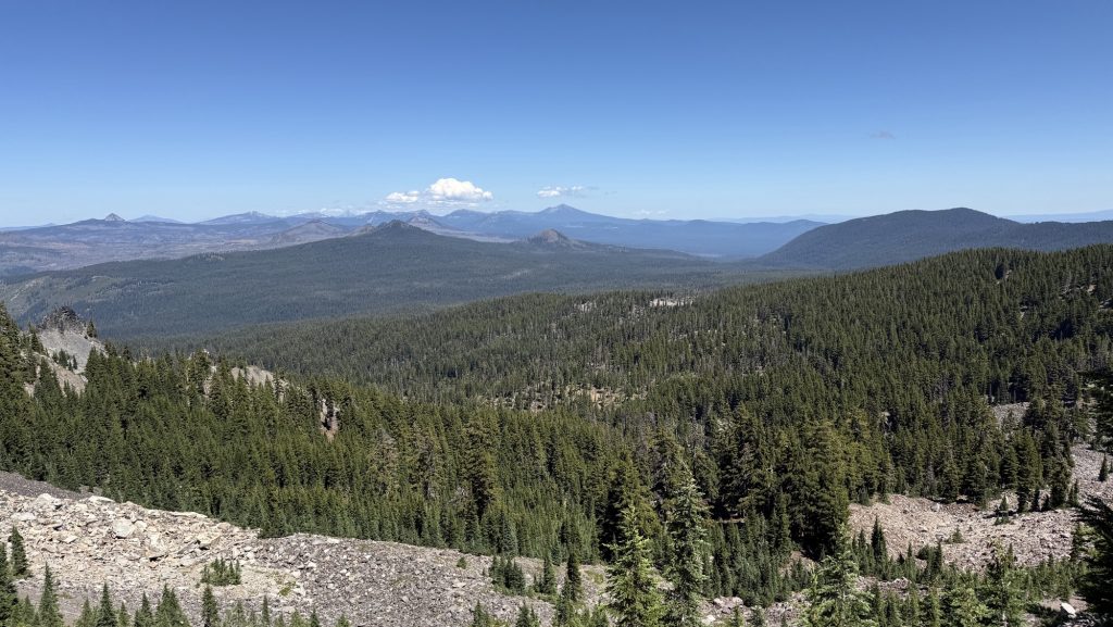
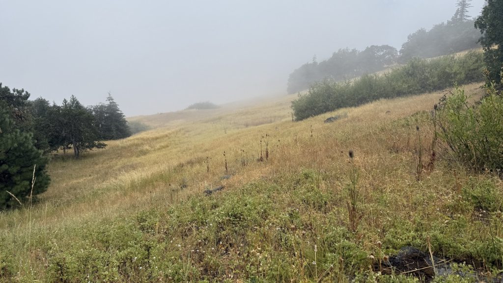
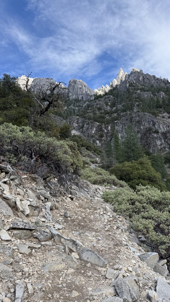
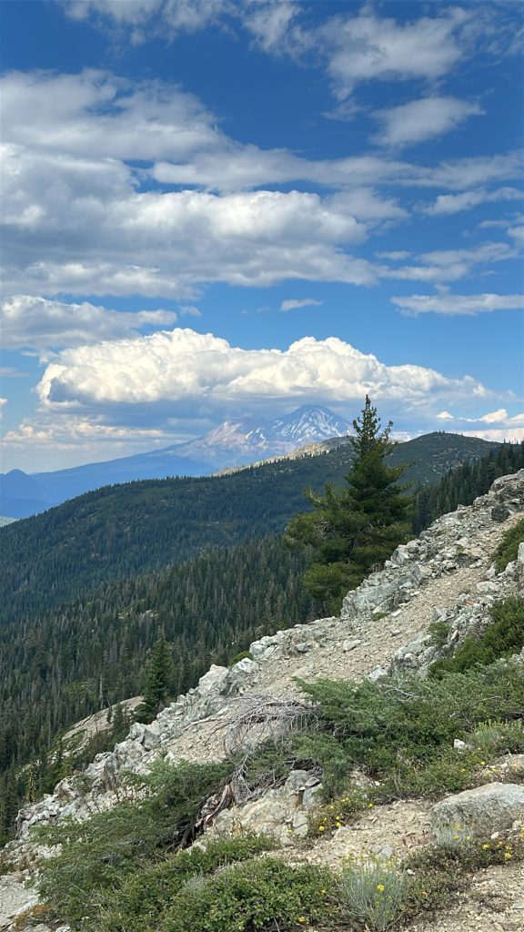
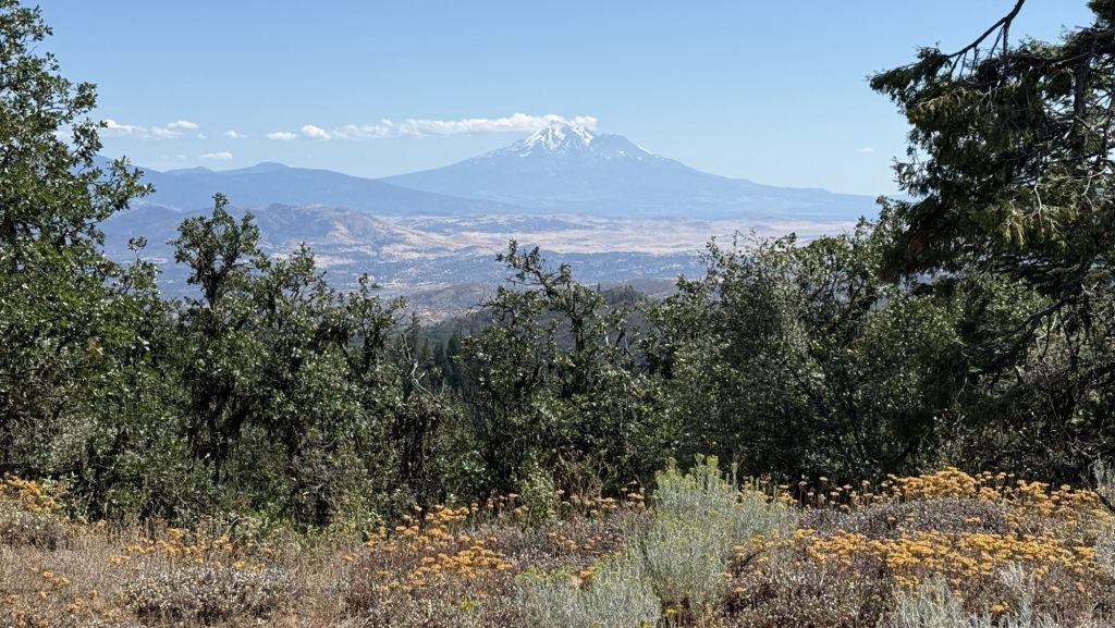
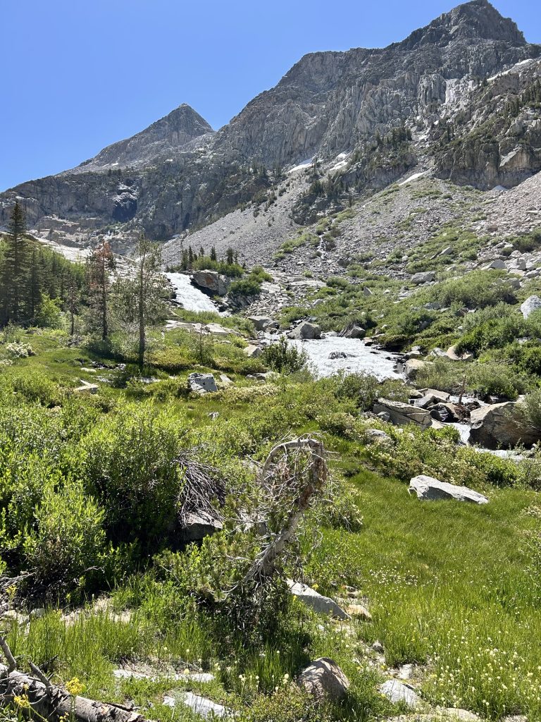
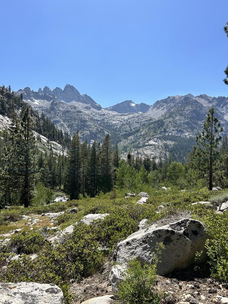
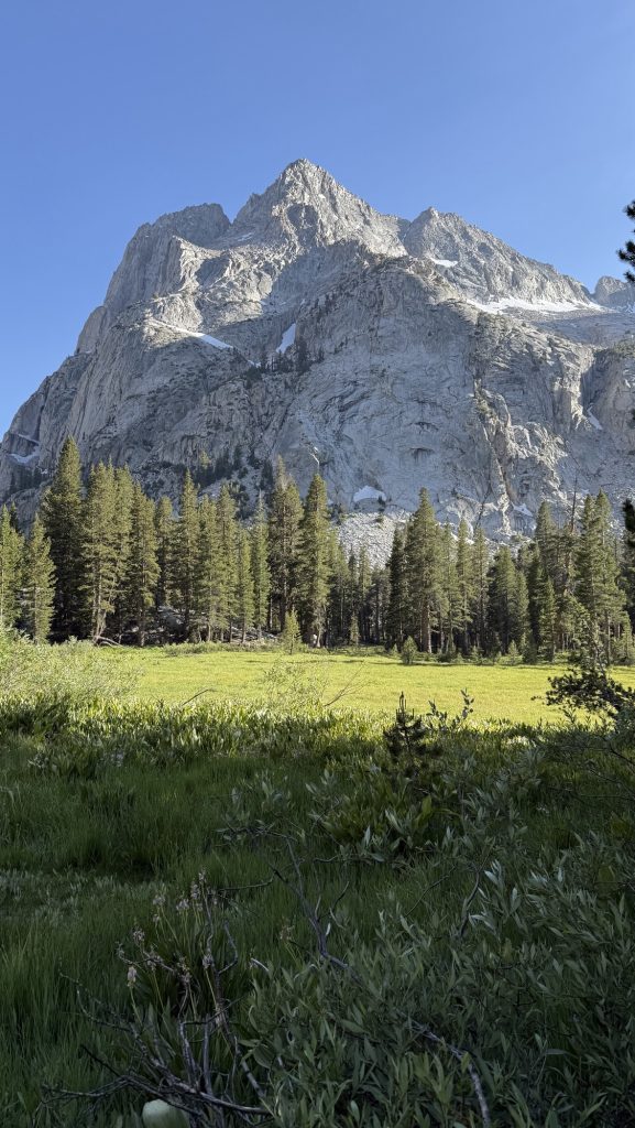
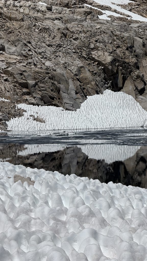
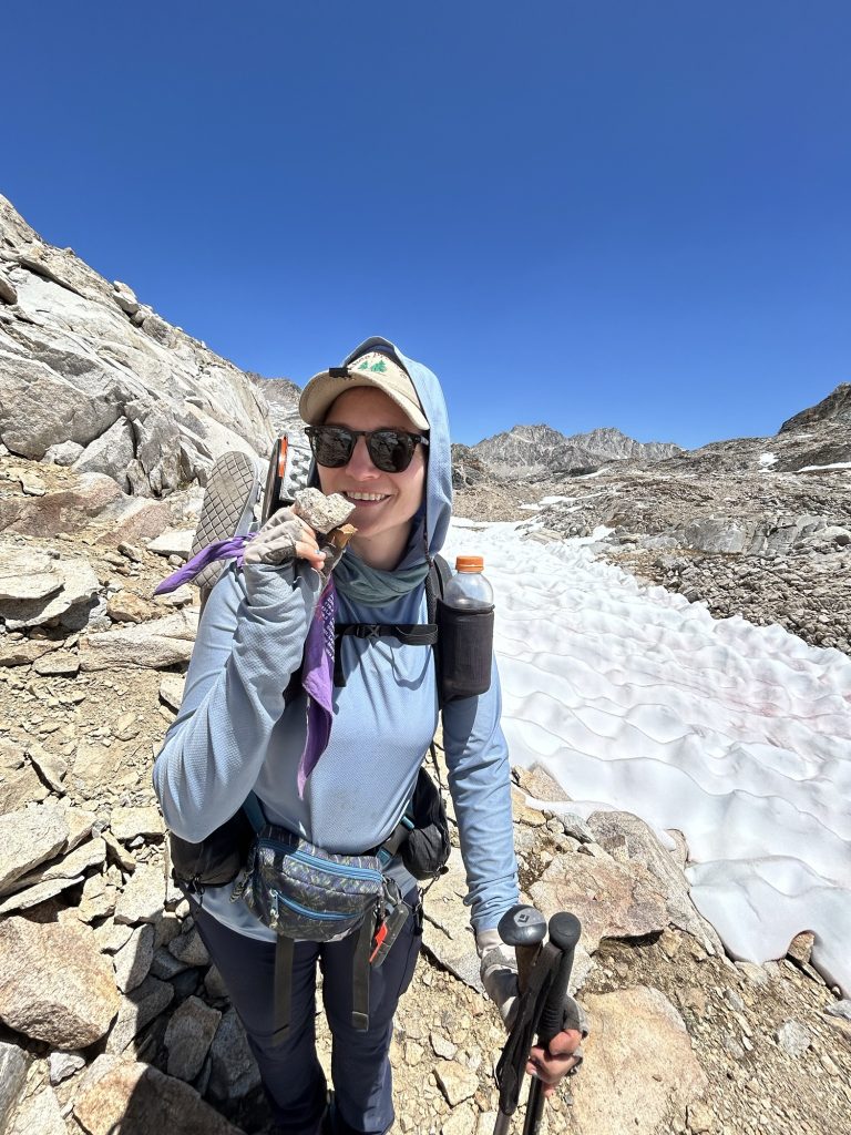
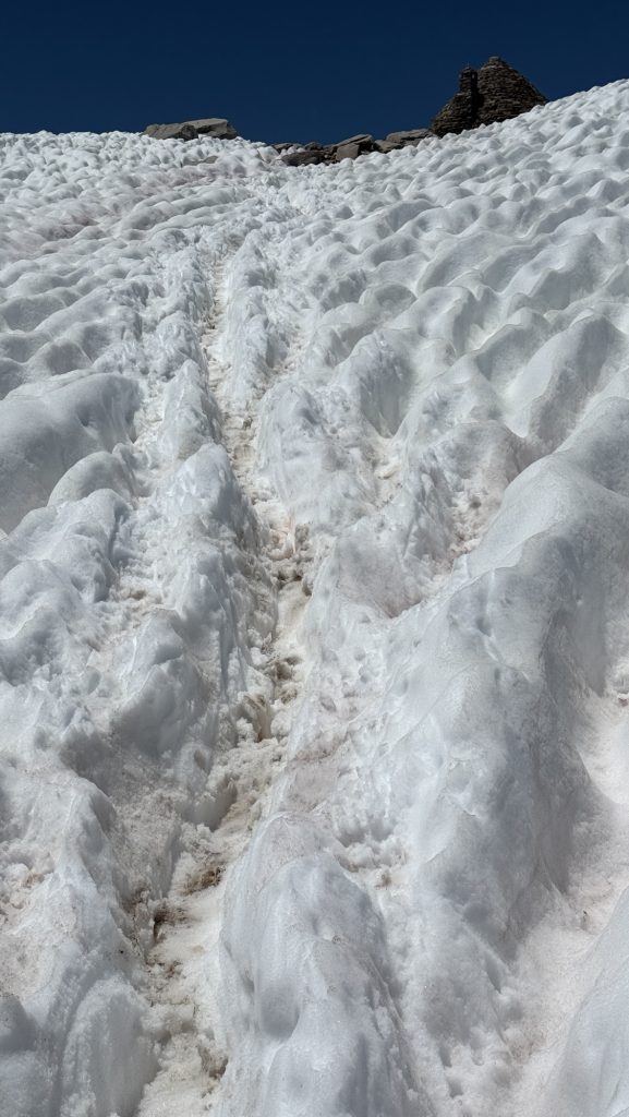
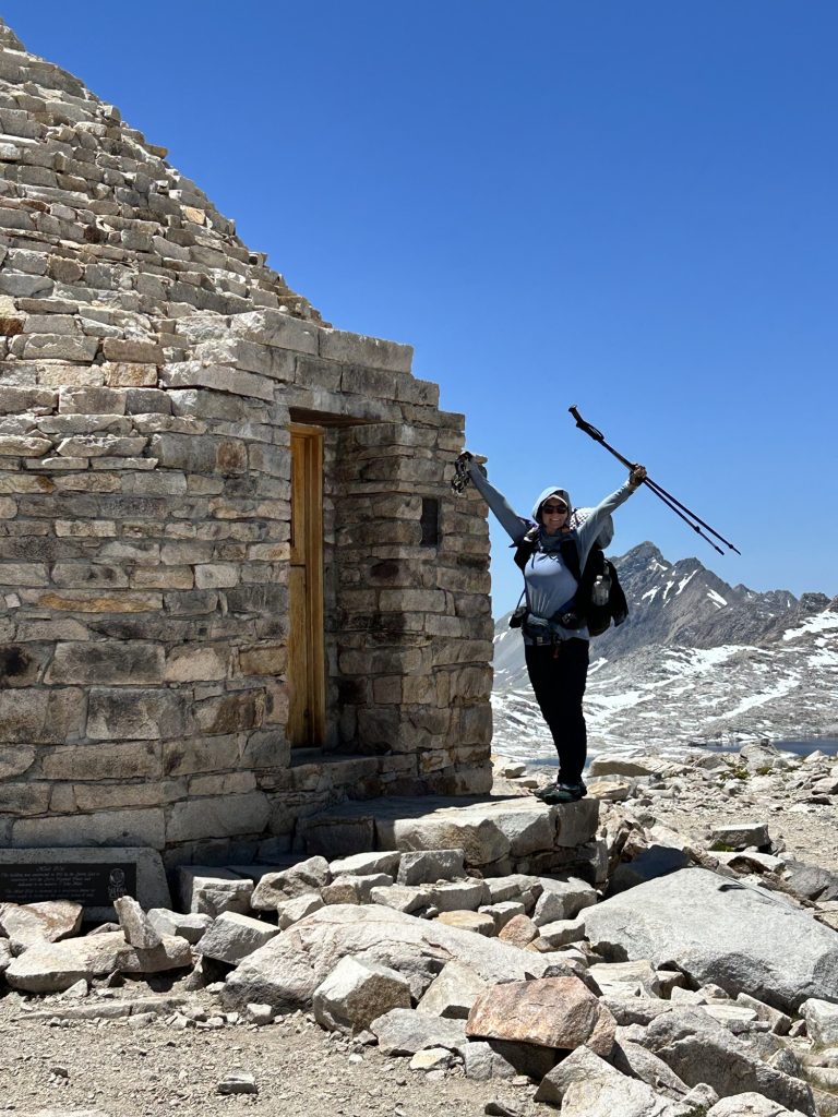
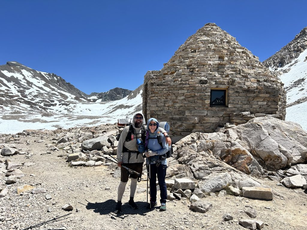
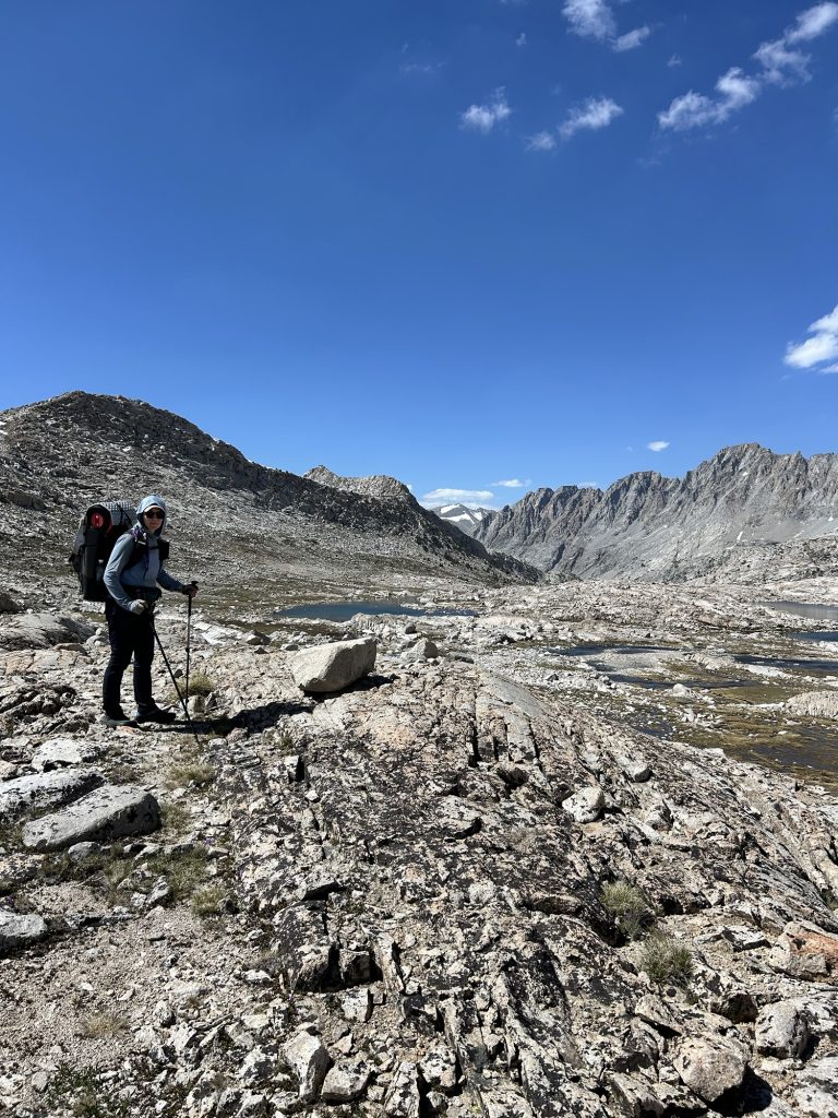
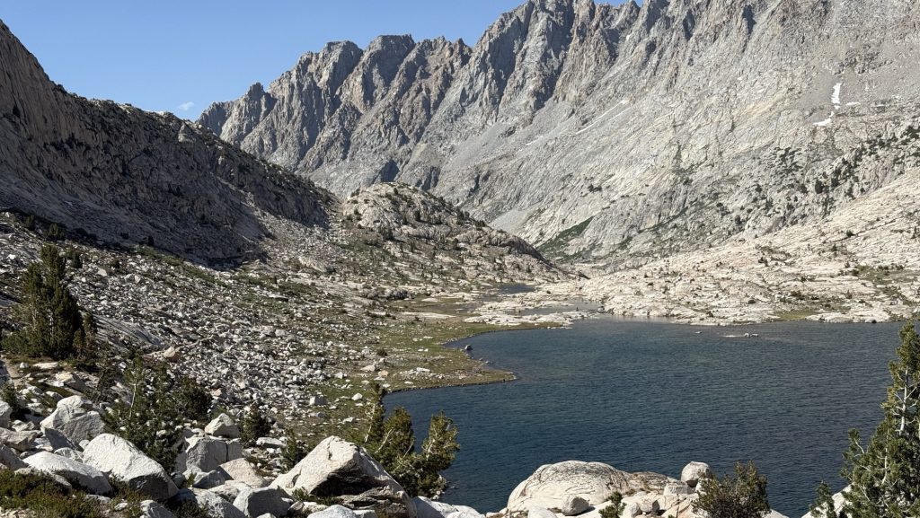
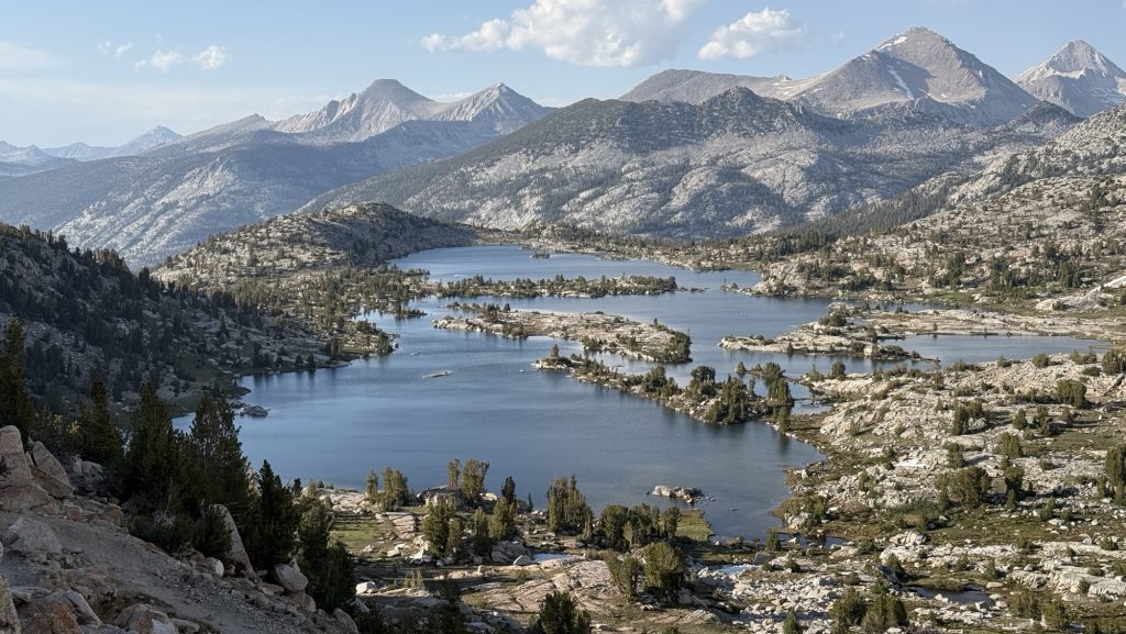
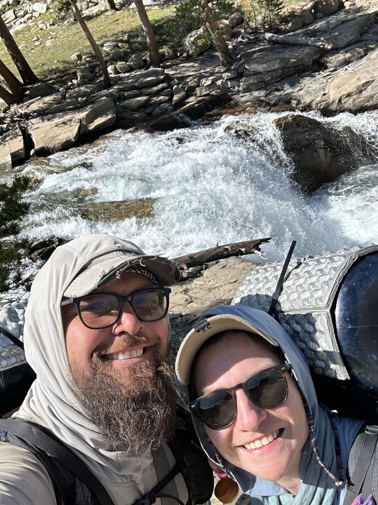
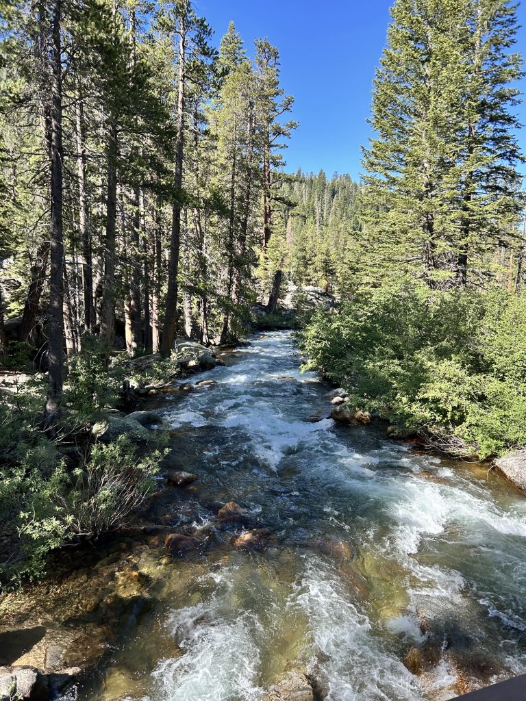
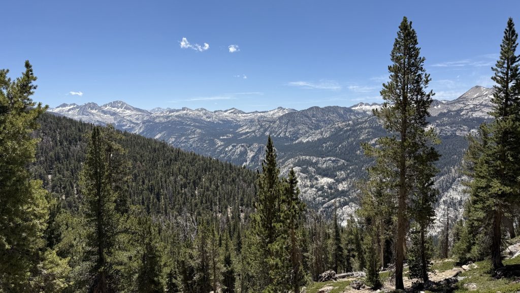
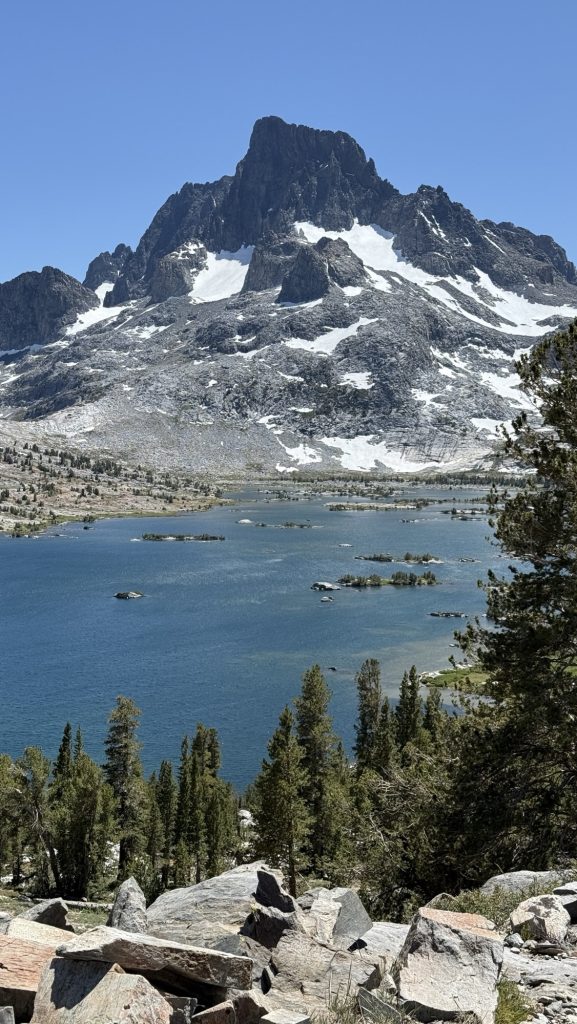
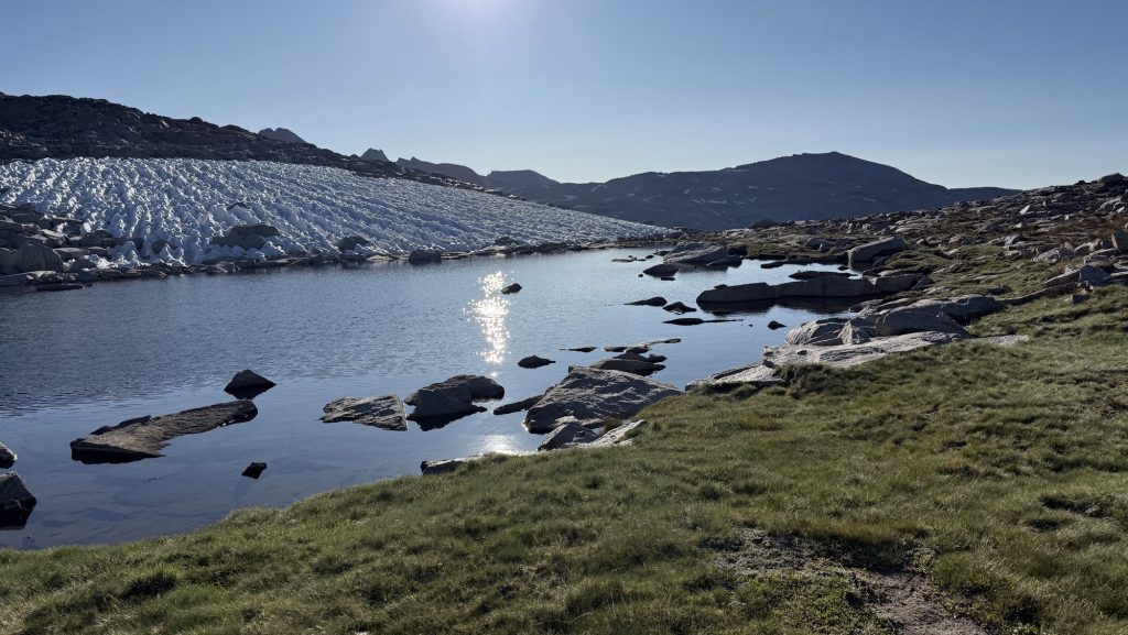
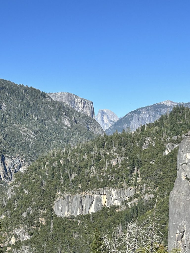
From there, the trail climbed—four miles of steady uphill—to Grasshopper Pass. The wet chill gave way to wind, and then… views. The kind of sweeping ridgelines where you forget you’re cold, just staring, every muscle telling you to stop and take it in. We did exactly that—lunch on the very top, looking out at endless green folds and distant peaks.
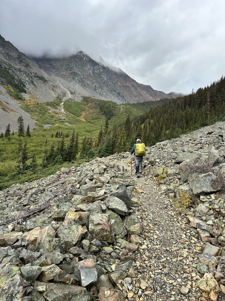
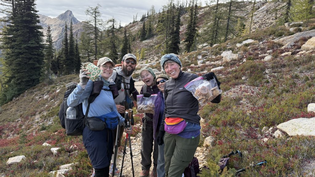
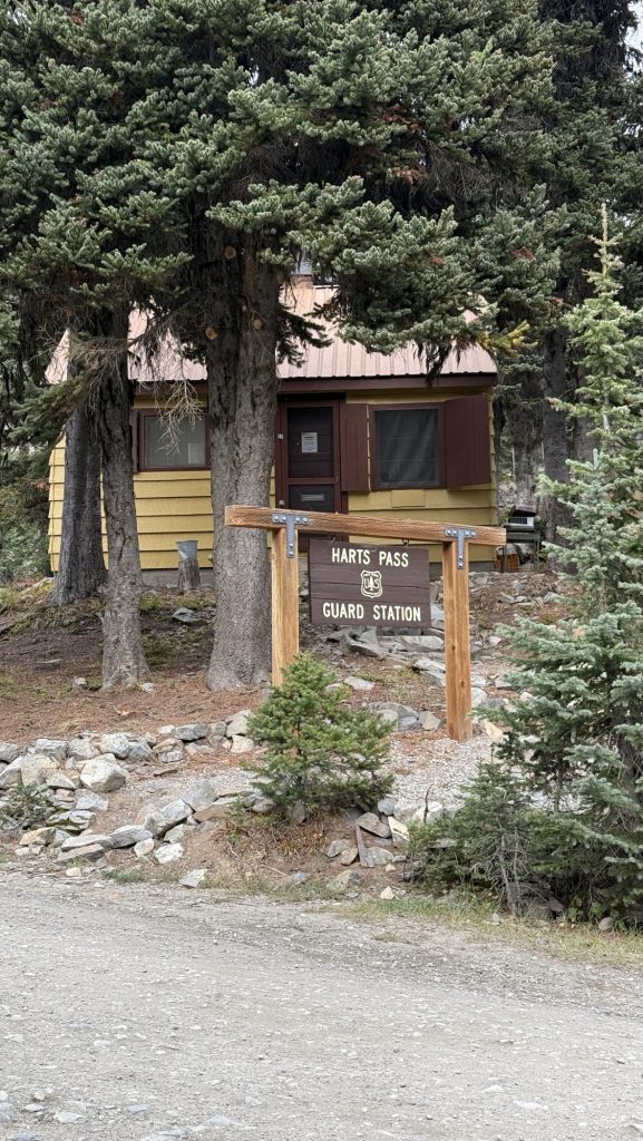
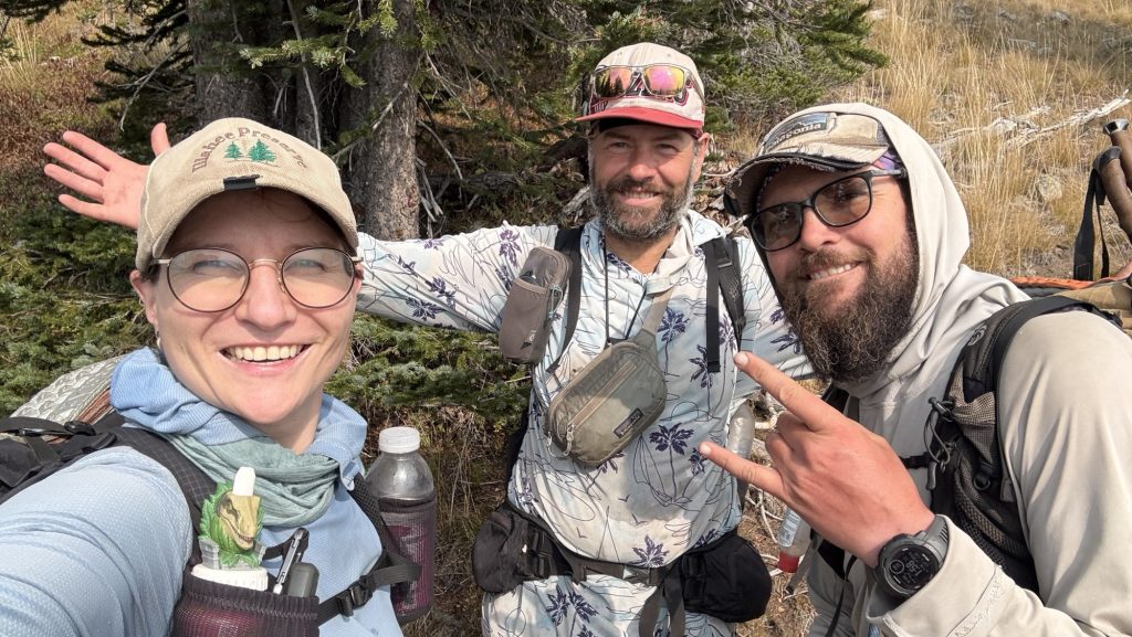
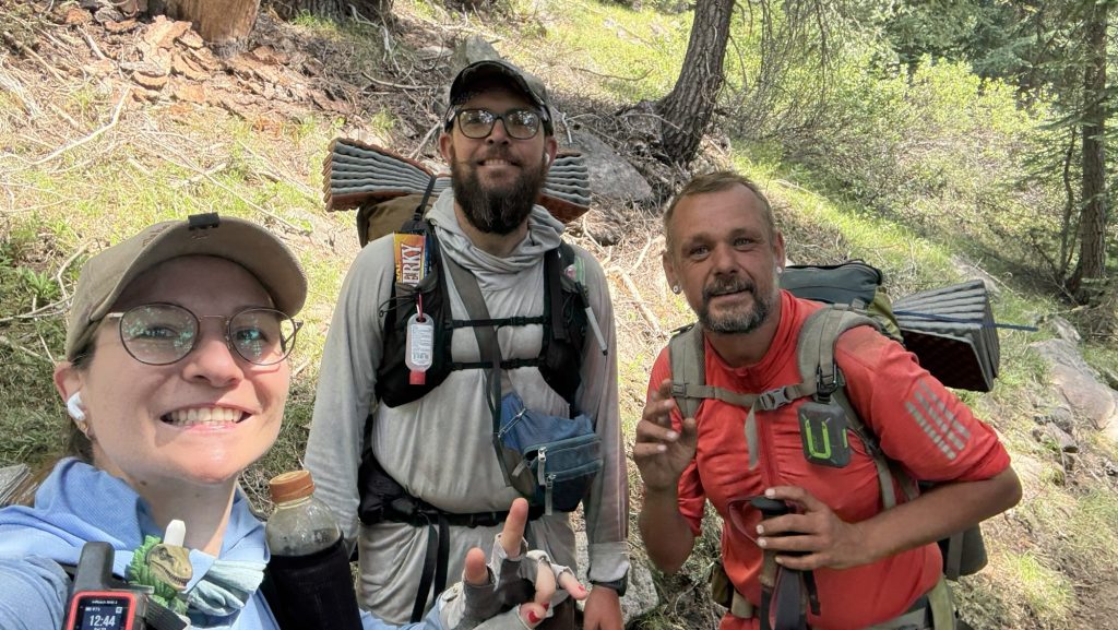
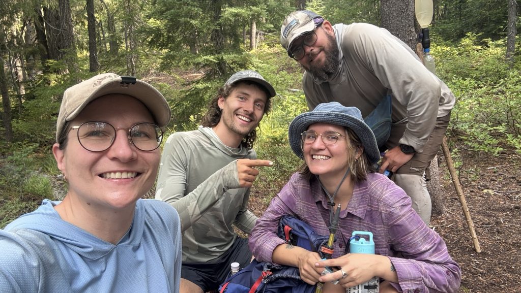
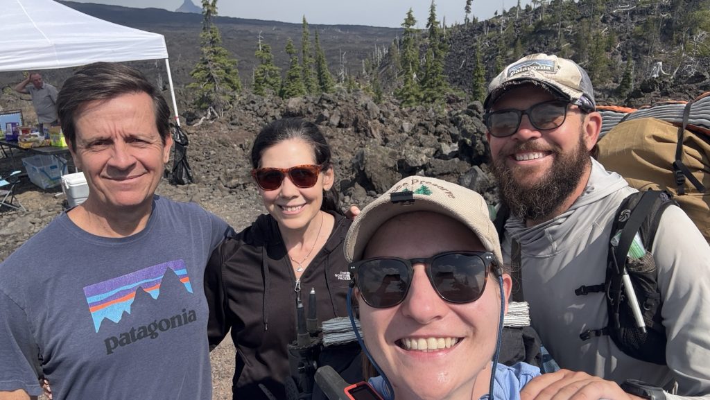
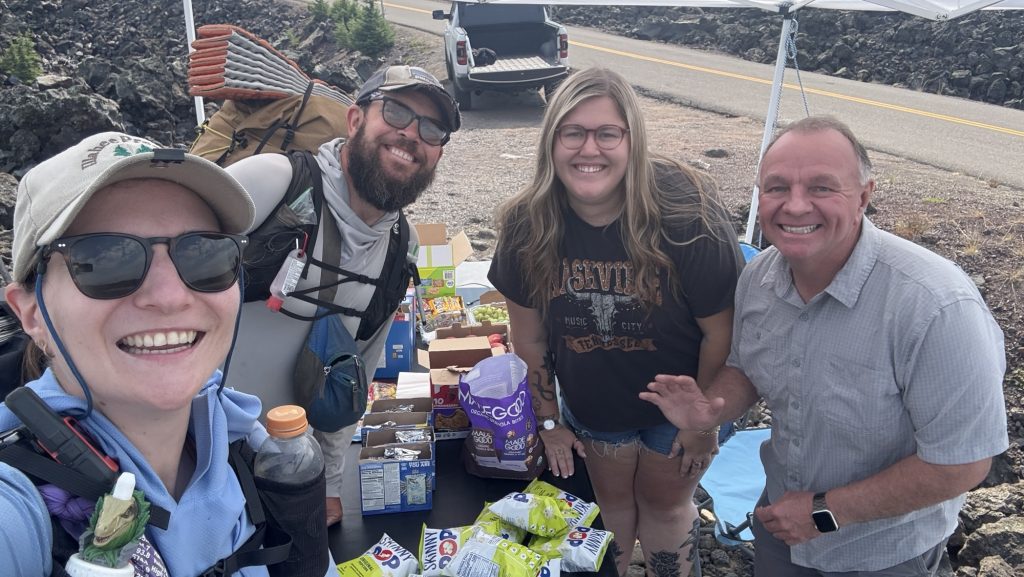
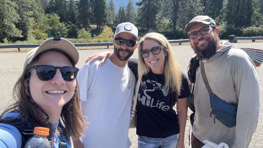
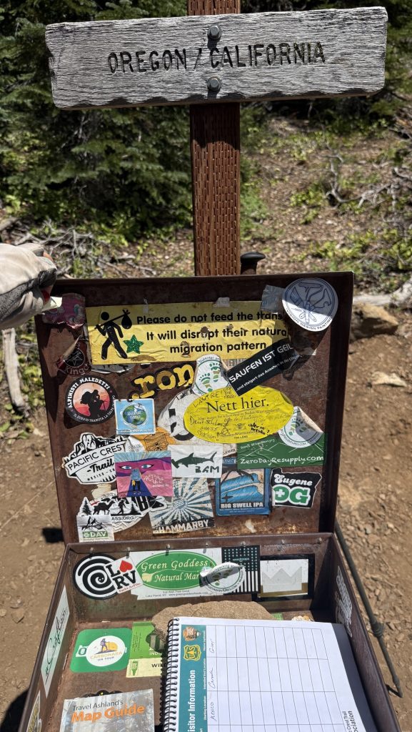
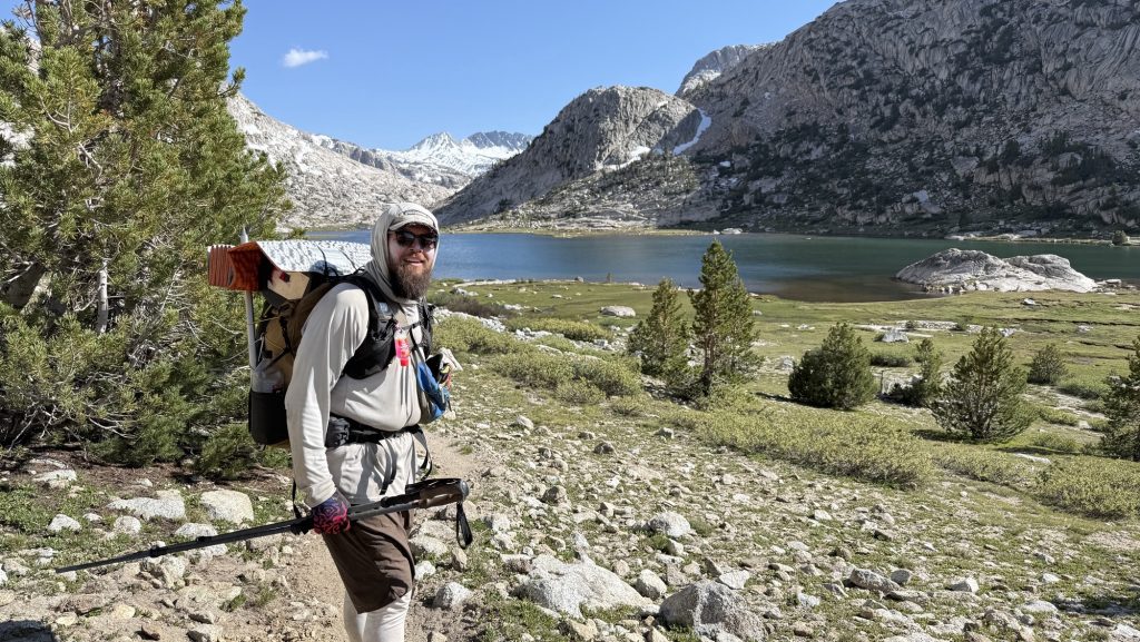
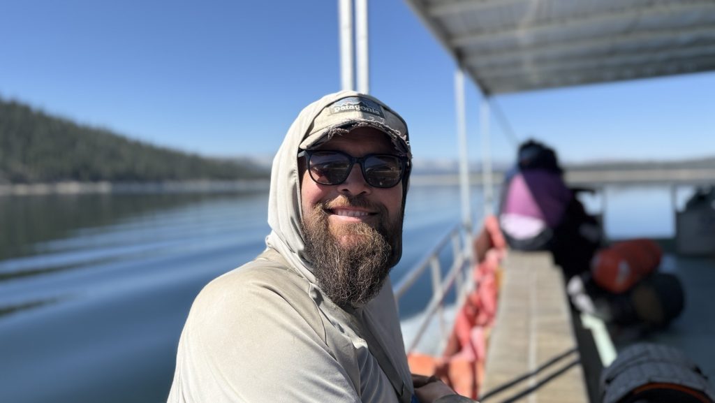
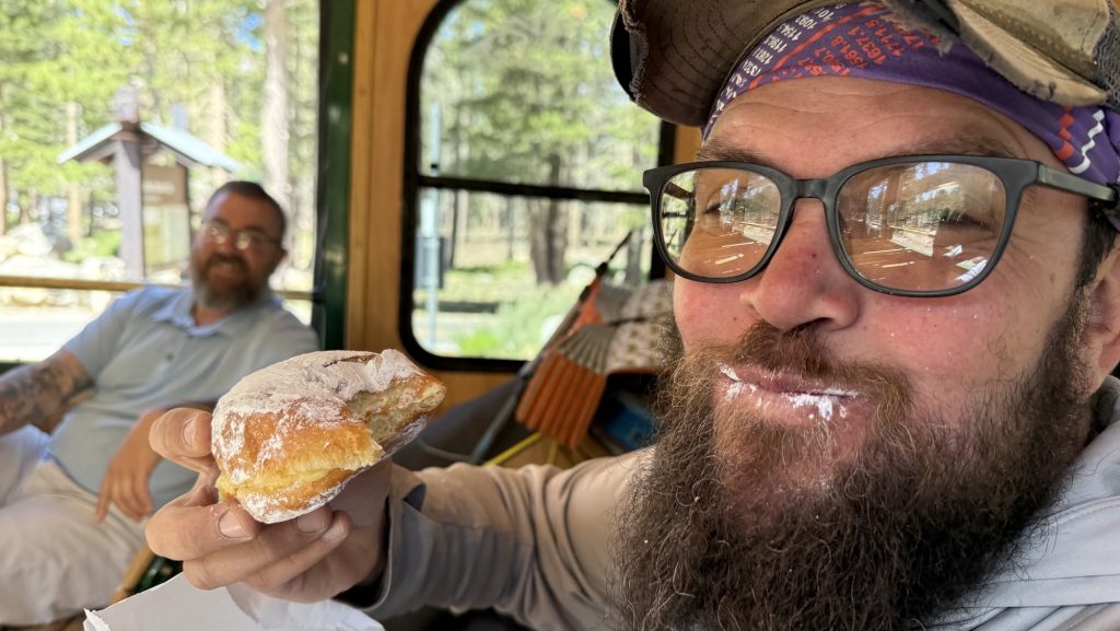
By 4:15 pm we rolled into Harts Pass. And there they were—Noah and Rambo—freshly done with the Pacific Crest Trail. It was surreal. They were grinning, handing out donuts like some magical trail angels of victory. Four other hikers milled around, all freshly finished. The air felt electric, like the trail itself was humming. This is where Iceman’s dad will pick us up in two days. Suddenly that fact was more real than ever.
Leaving the pass, we didn’t get far before bumping into Meatbrick—more hugs, congrats, and incredulous laughter. Then came Bubbles, bounding down the trail, and everything dissolved into chaos: hugging, filming, tearing up. It’s happening—this is it. We’re watching our trail friends one by one cross that invisible finish line.

We only did around 23.5 miles today, stopping before dark at 7:00 pm. Tomorrow is going to be huge: over thirty miles.
Tomorrow, we finish the PCT.
Crazy.
Unreal.
I can feel the lump in my throat already.
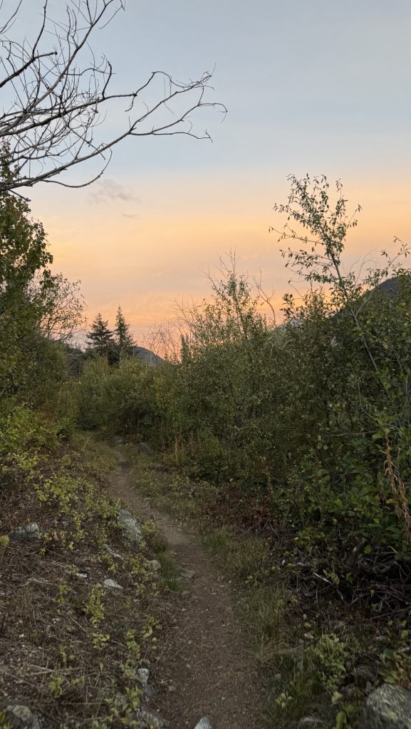
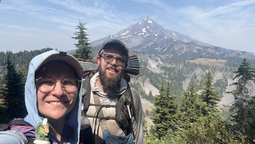
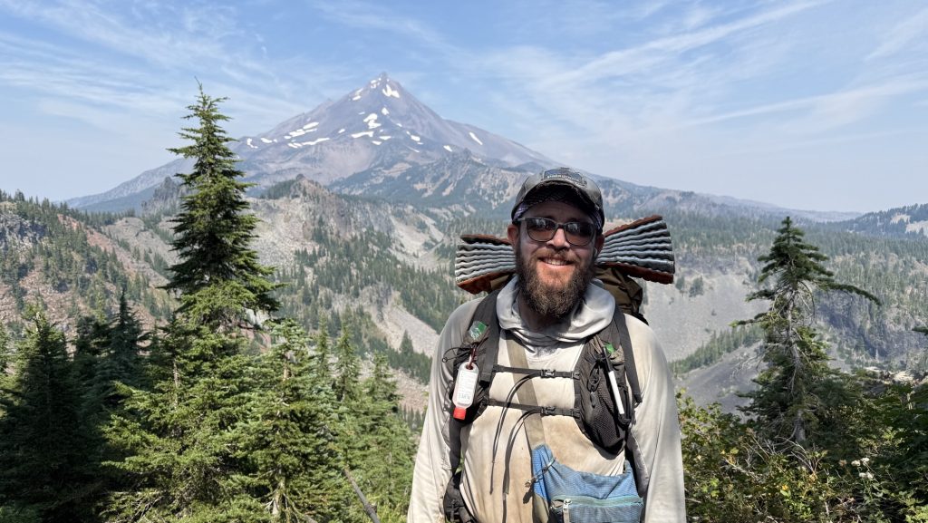
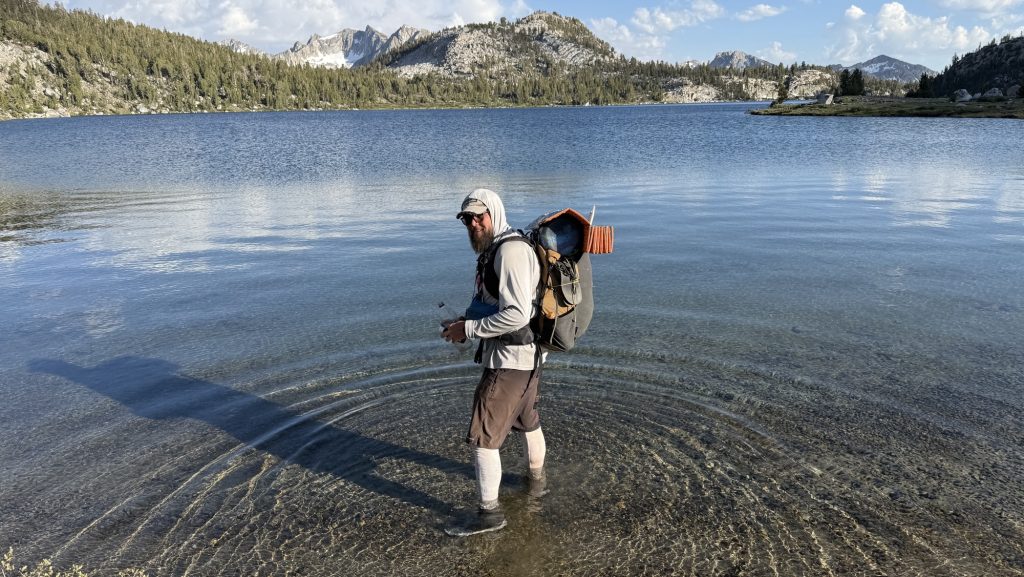
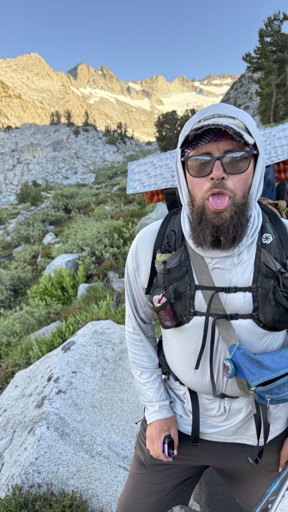
Day 141: PCT Mile 2647.9: Canada! And 8 Miles Back South
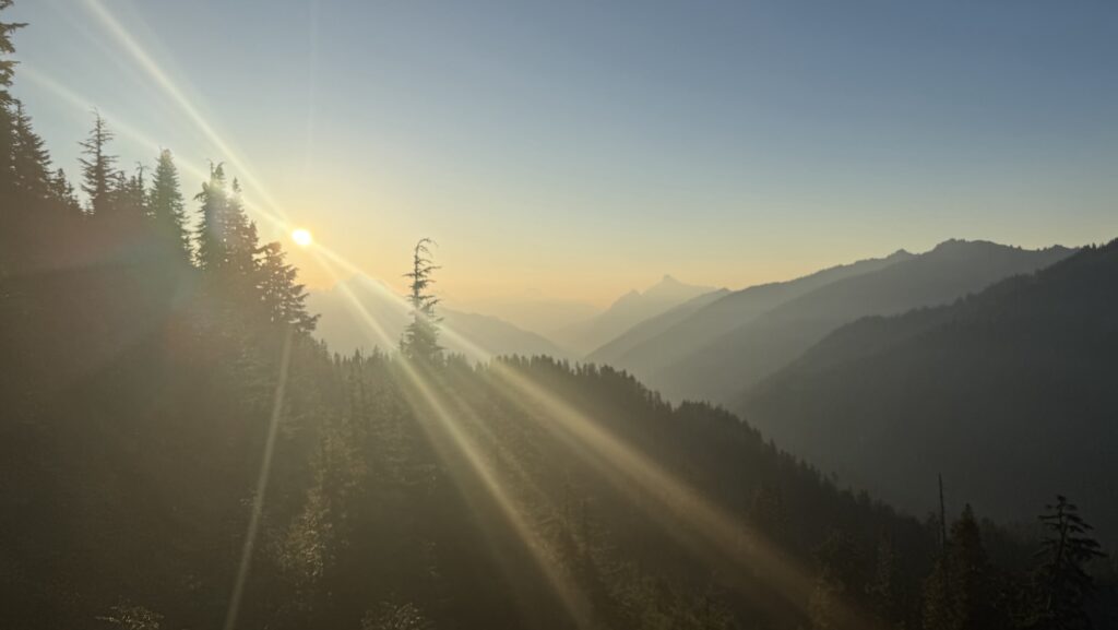
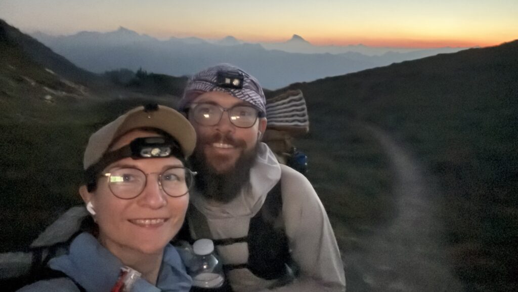
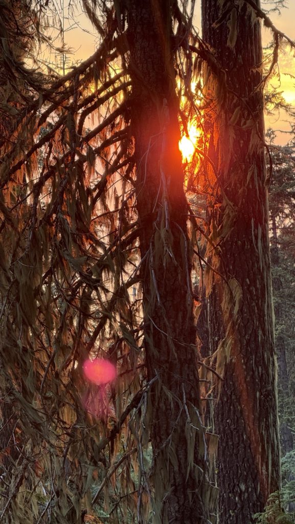
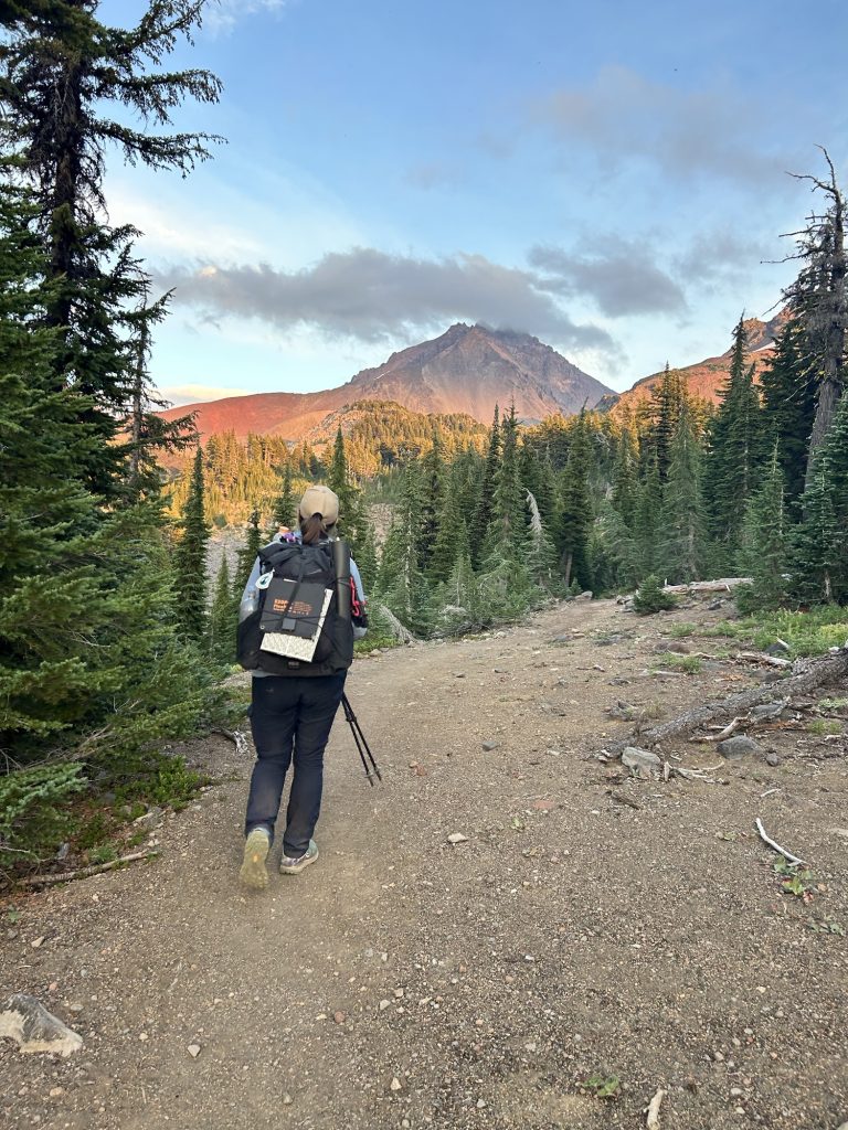
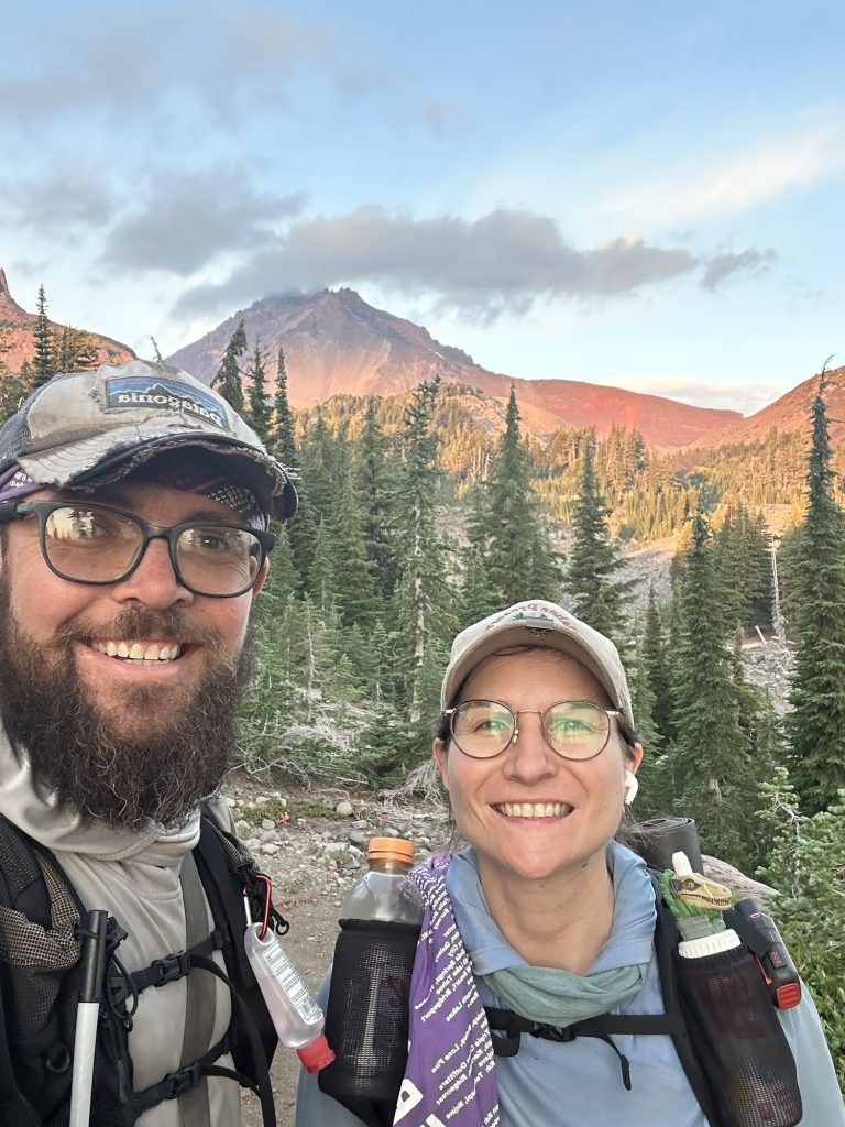
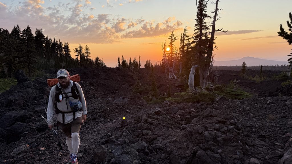
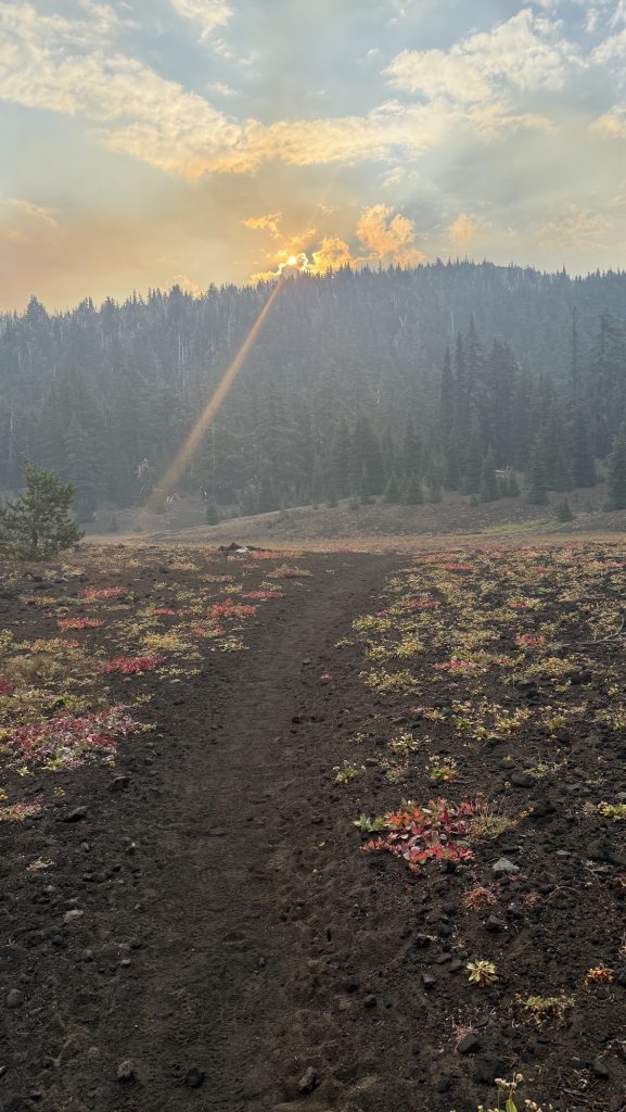
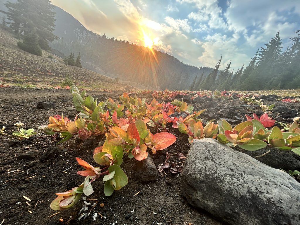
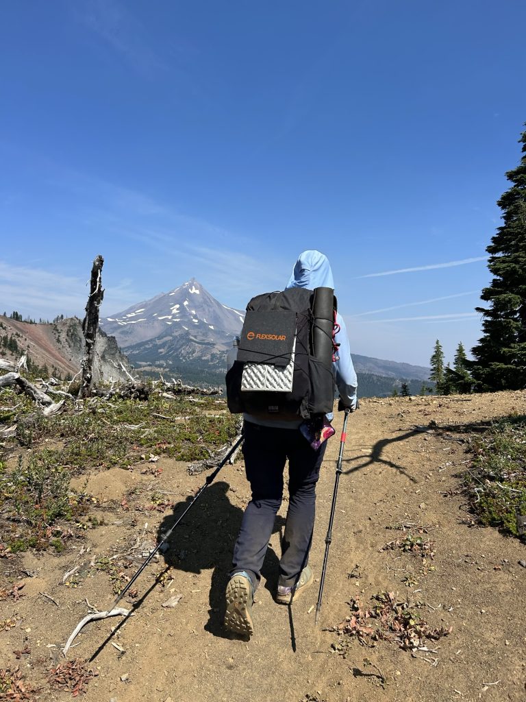
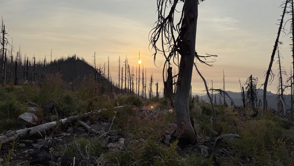
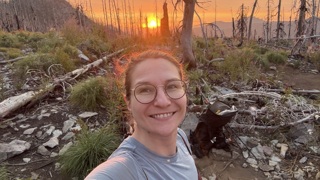
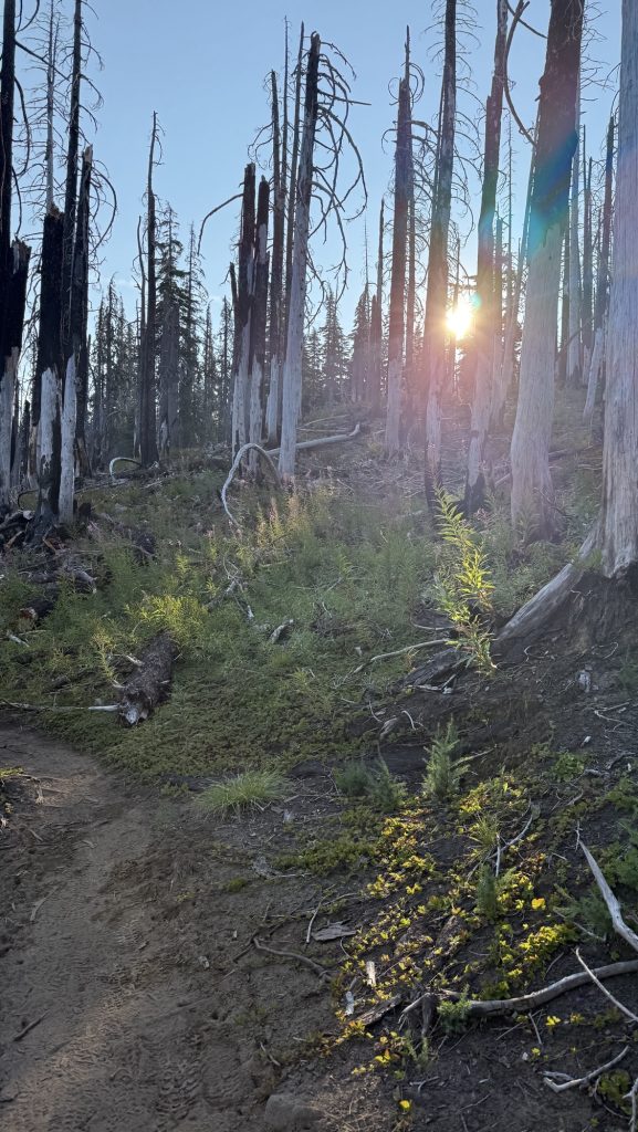
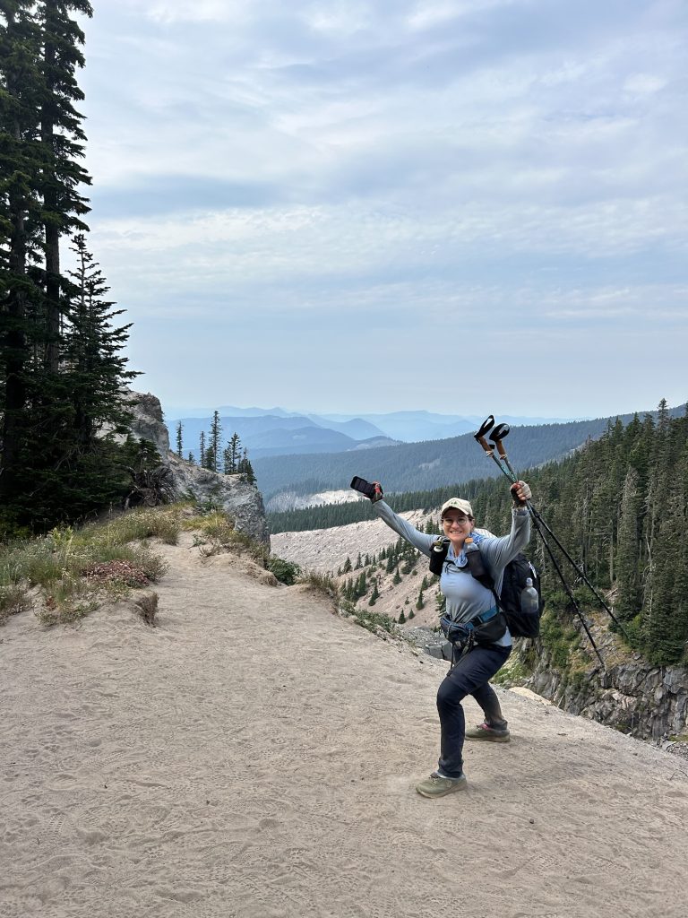
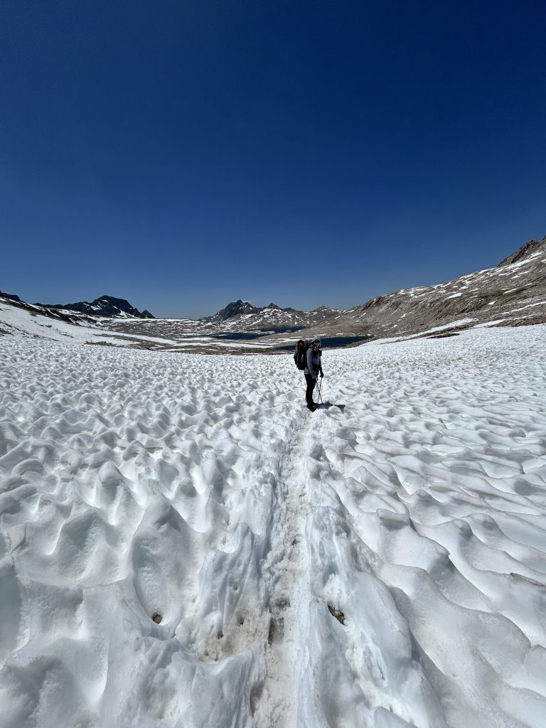
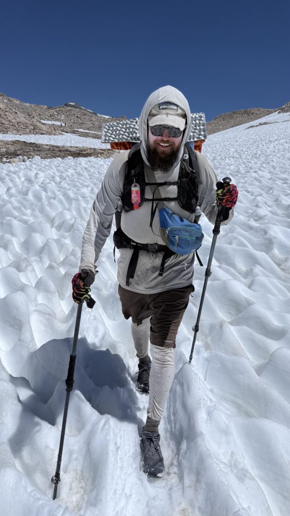
The alarm shrilled at 5:00 am. One last early start. One last day. We were out by 6:22 am, packs snug, shoes laced, determination buzzing in the morning stillness. This might be our longest day yet. Luckily the skies were kind—no rain, and the tent was blessedly dry. No frozen fingers today. We whispered a wish for sun, but waited for the horizon to catch its first light.
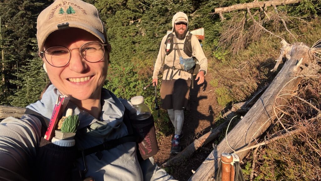
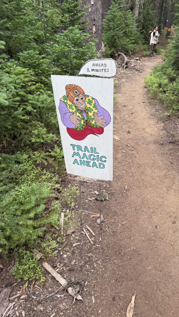
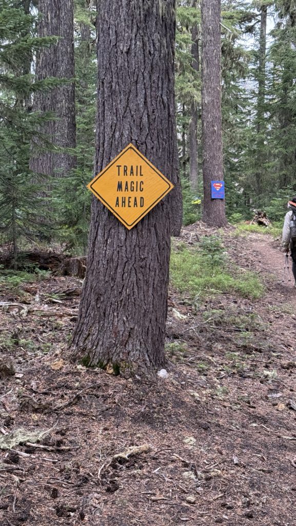
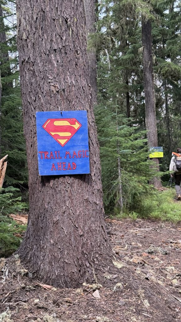
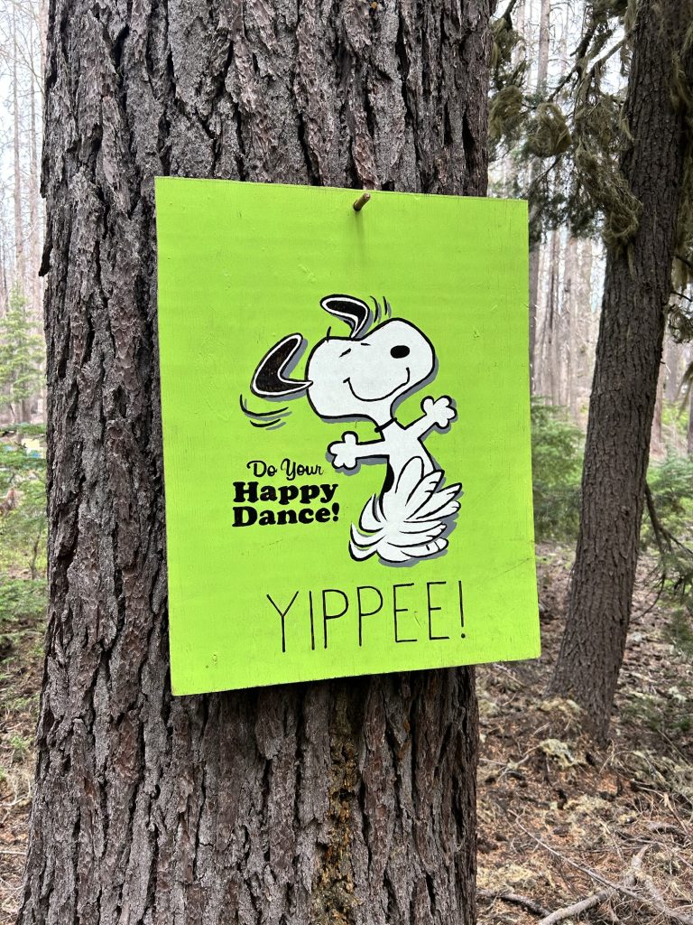
When it came, the day was flawless—bright blue skies, golden warmth spilling over the peaks. A day as perfect as the journey itself. The last trail magic wasn’t donuts, it was high-fives. We passed 37 hikers heading south from the Northern Terminus, each grinning, each congratulating us, and each reminder sending our excitement skyrocketing.
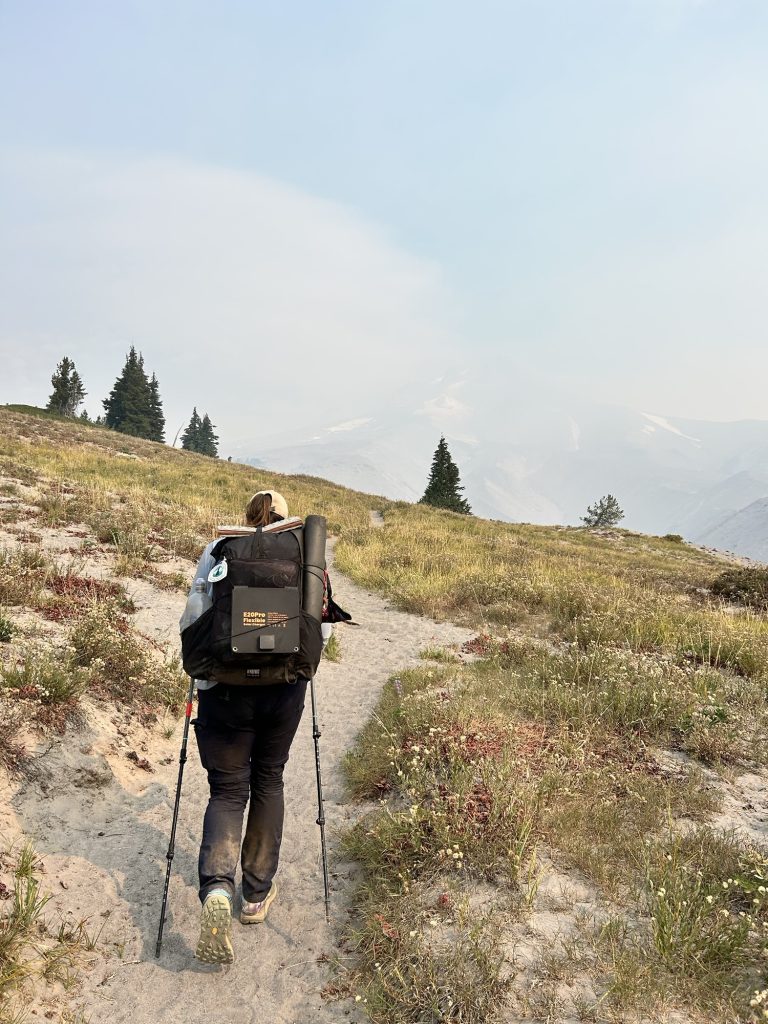
Still, reality kept us moving—today wasn’t just about reaching the border. We had to go big: big miles, big climbs. Tomorrow we need to make it back to Harts Pass to meet Iceman’s dad, so the two of them can fly halfway across the world to Everest Base Camp. The elevation gain was relentless. I wasn’t sure we had it in us… but the pull of the deadline is stronger than doubt.
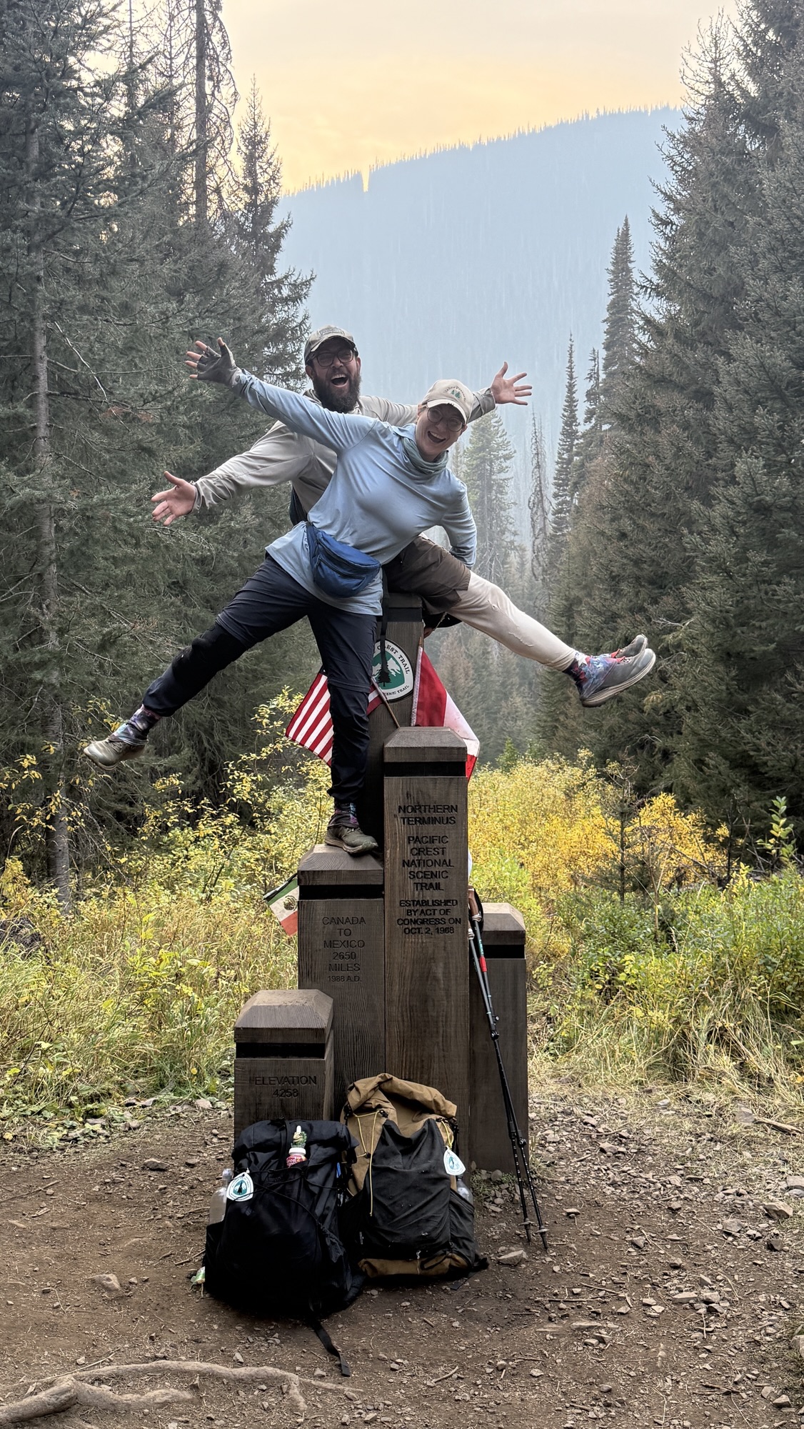
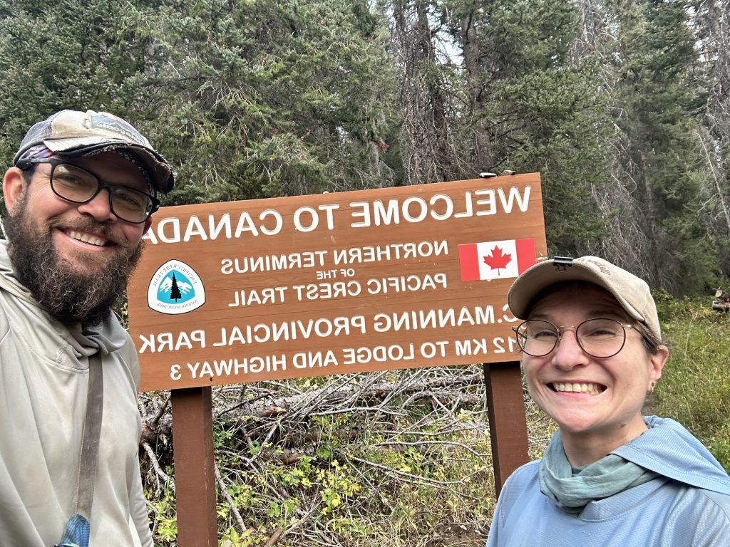
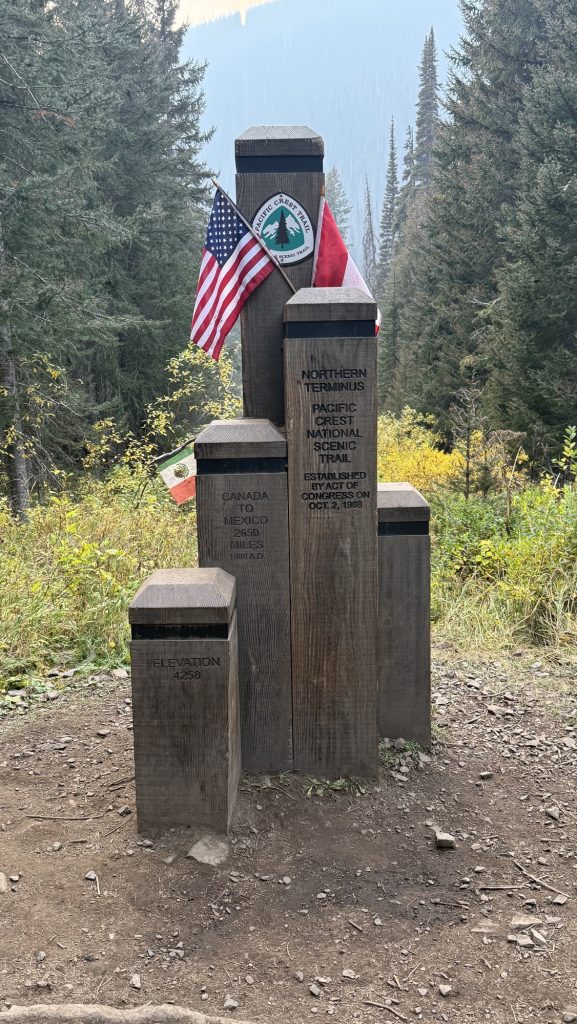
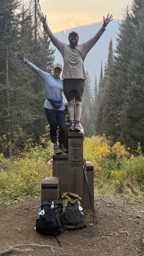
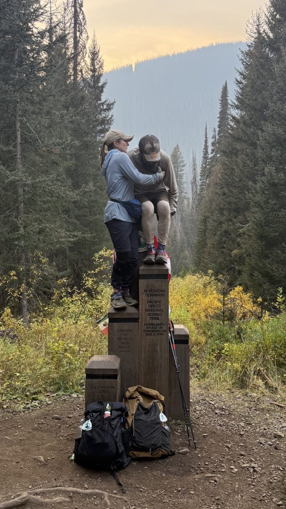
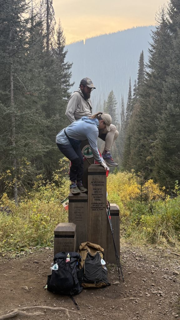
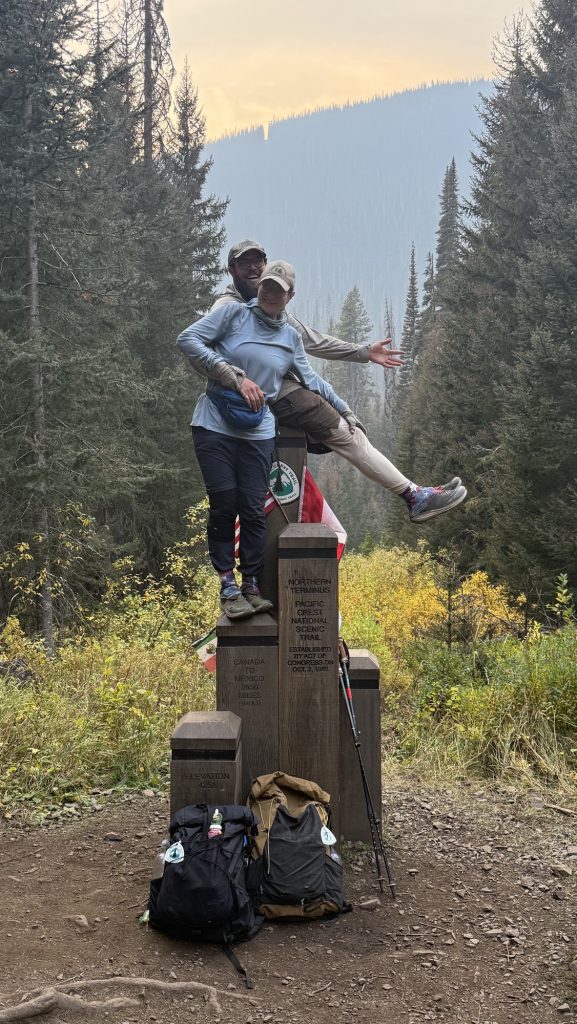
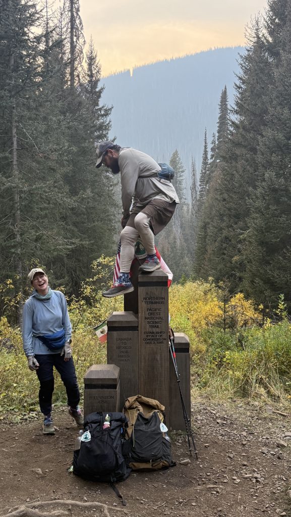
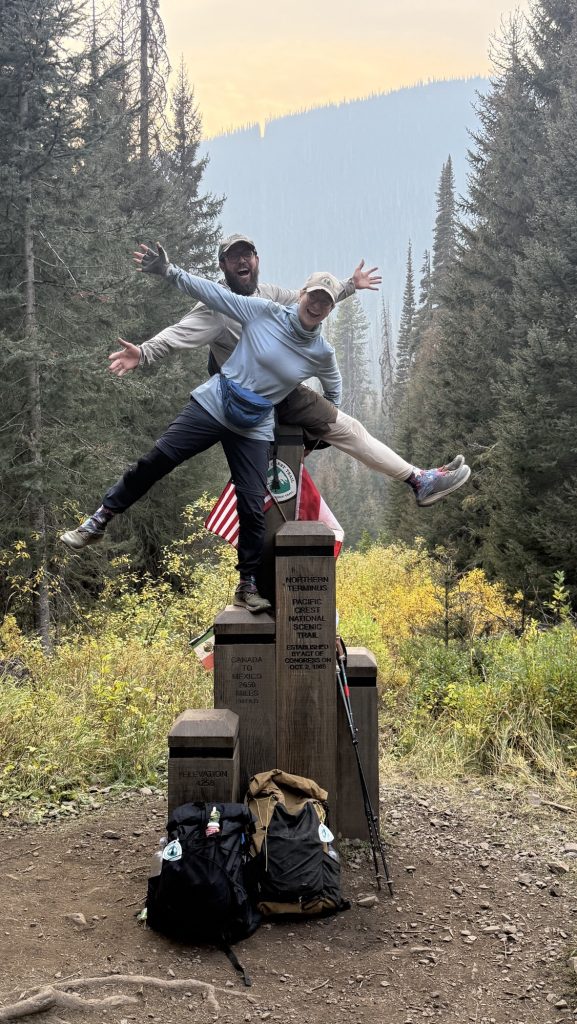
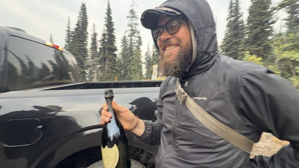
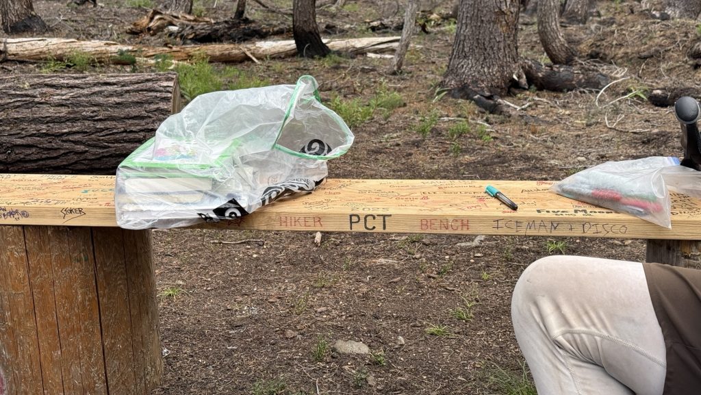
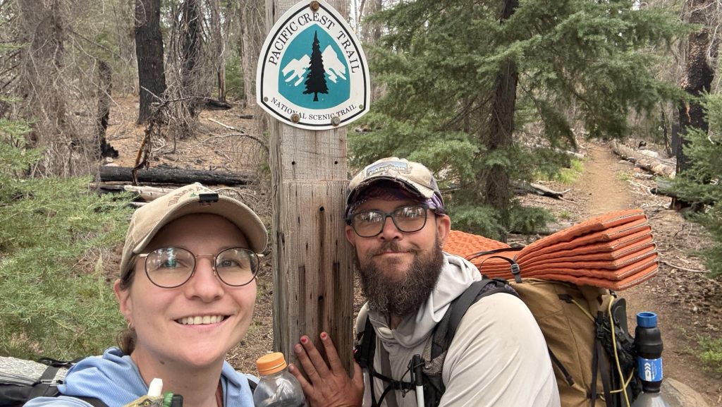
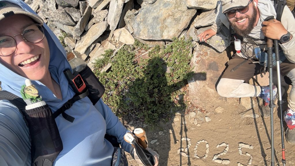
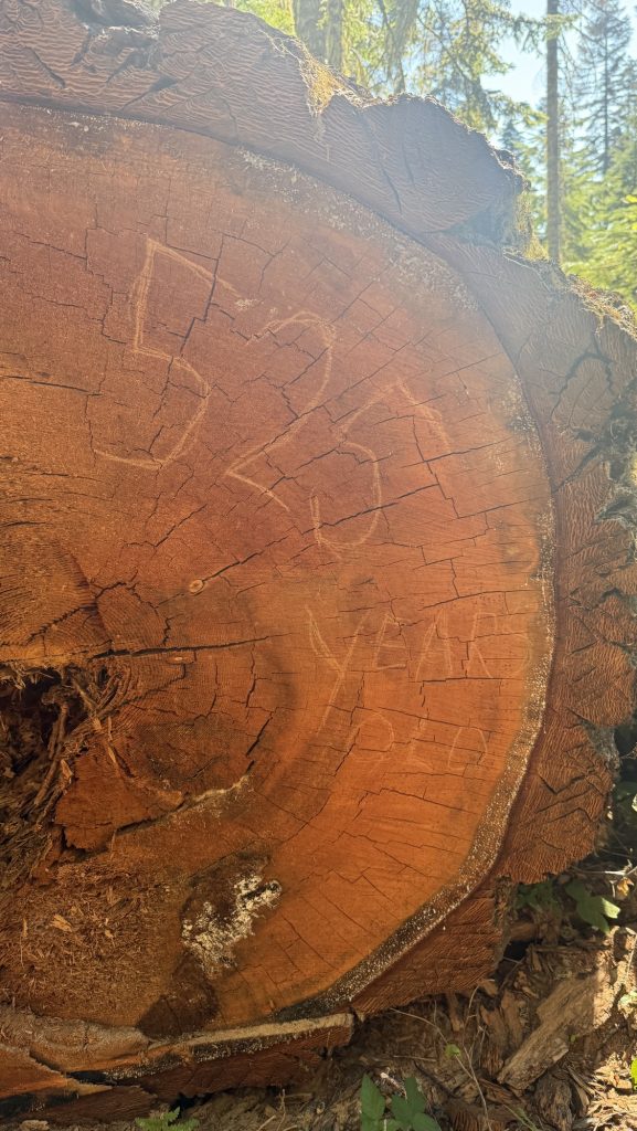
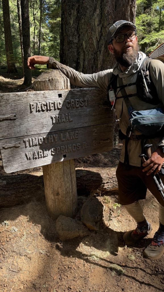
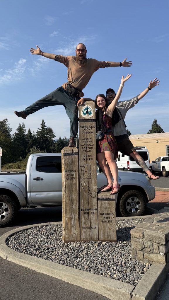
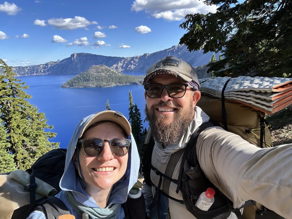
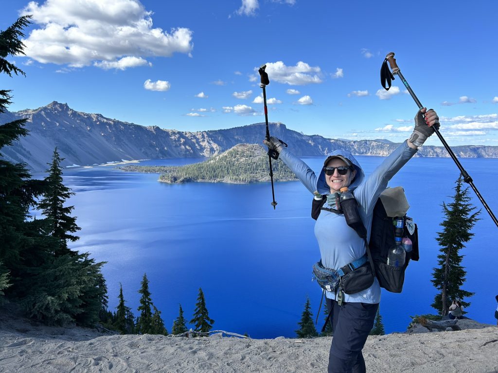
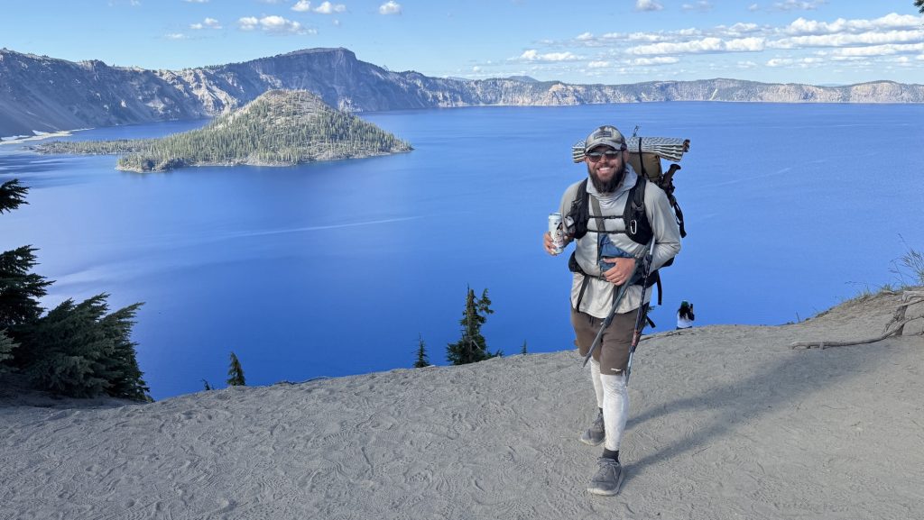
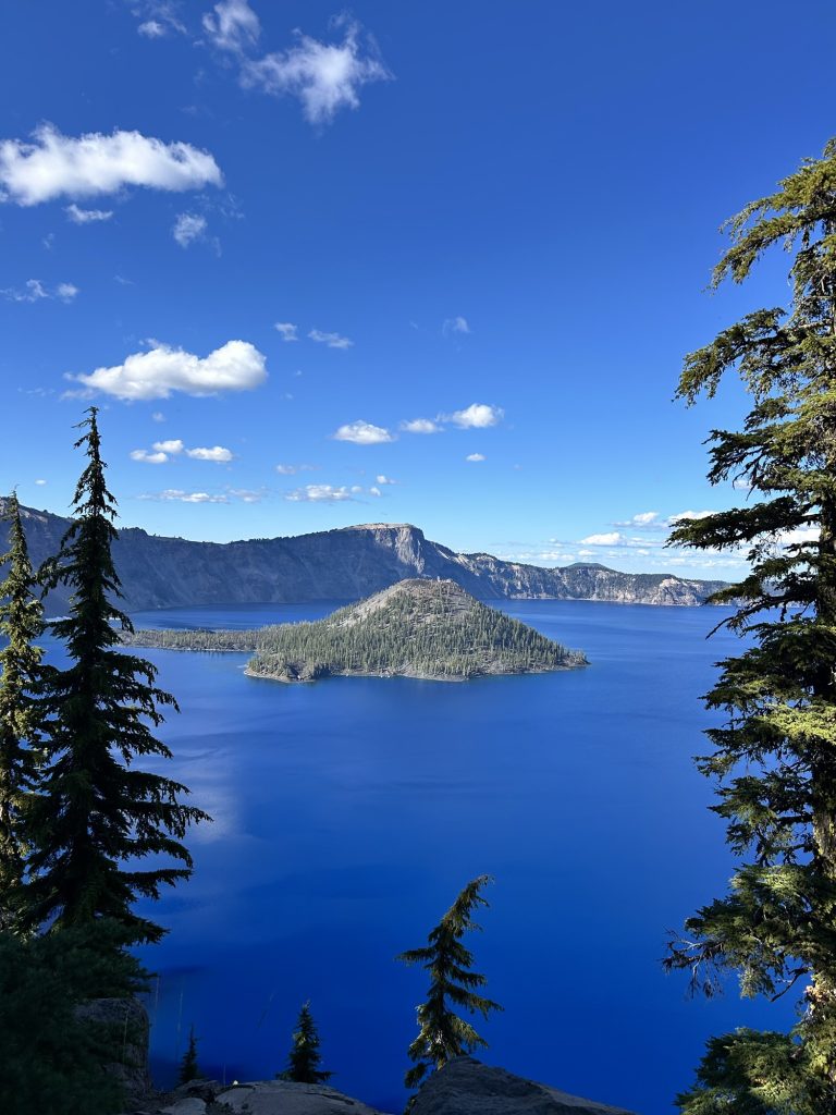
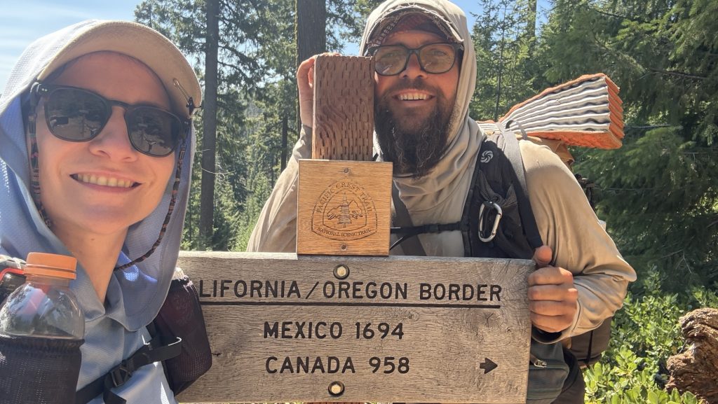
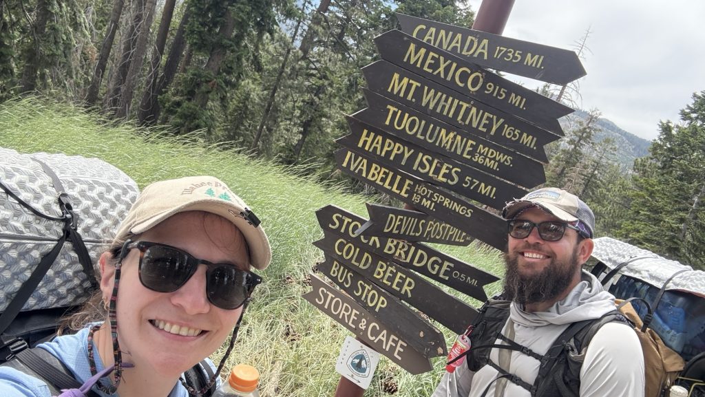
The last 8 miles northbound of the PCT are downhill—a gentle, beautiful roll into the border. The catch? We can’t cross. As of this year, hikers aren’t allowed to walk into Canada and simply exit to the nearest trailhead. Instead, the finish comes with a twist: you tag the monument, take it all in… and then you turn around. Thirty miles back south to Harts Pass is how the journey ends now.
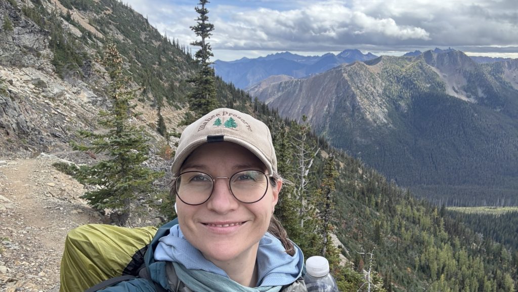
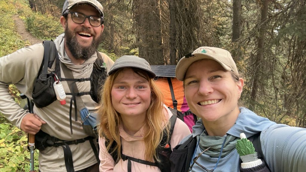
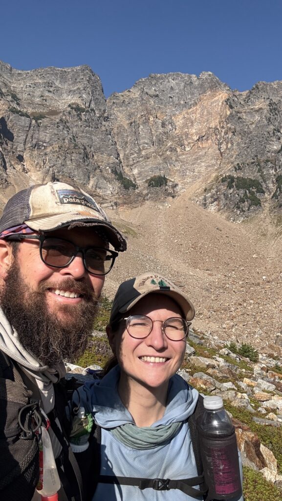
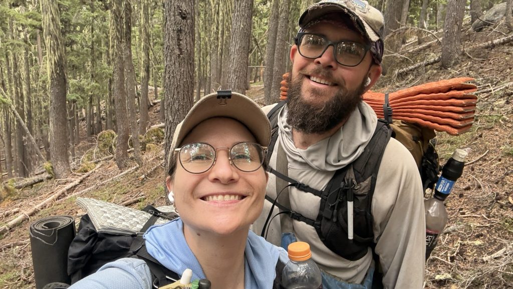
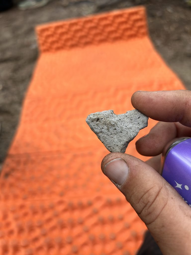
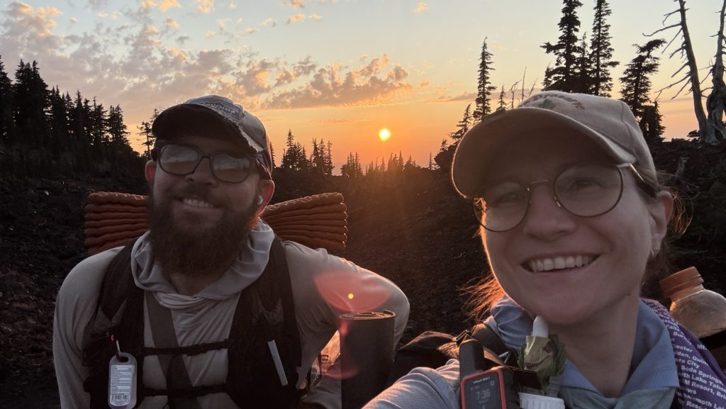
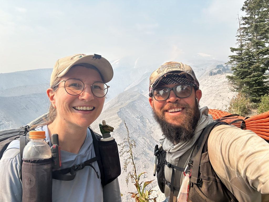
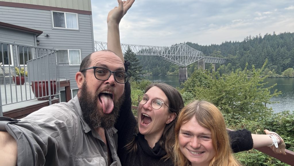
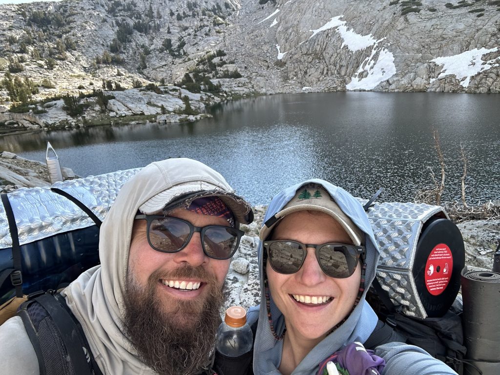
When the wooden Monument finally came into view, the air caught in my throat. Canada was a whisper away. We hugged and danced. We drank wine and took pictures. We ate German chocolate. We touched the monument, leaned against it, climbed it and almost fell off, hugged friends, and laughed, and then the tears came—quiet, heavy, sharp with joy. Five and a half months, one month off trail, some 2000 miles of the PCT northbound. This was never the moment we’d been chasing – it was always about the journey, never about finishing or Canada. But this moment was incredible nonetheless because it meant ‘the end’, the end of my biggest adventure yet. It also meant the beginning of the rest of my life. I was as excited as I was sad. The whole thing was overwhelming.
And then… we turned around.
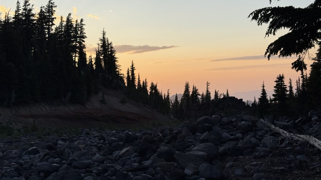
We hiked 8 miles back into the afternoon light, climbing the entire time, breathing hard, watching the shadows grow. By the time we stopped, it was dark, 10pm, cold and the numbers felt colossal:
Miles: 32.06 / 51km!!!!
Ascent: 6,472 ft
Descent: 5,680 ft
Steps: 72,846 – what?
My legs are destroyed. My heart is full. Tomorrow, we will walk back into Harts Pass and this chapter will close. The PCT is behind us.
It’s over. For now.
Day 142: In the end we’re all SOBOs / Victory Lap back to Harts Pass – The Last Steps of a long Adventure
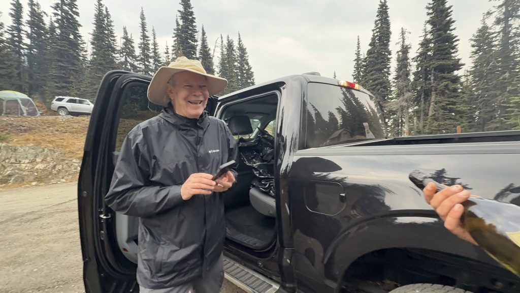
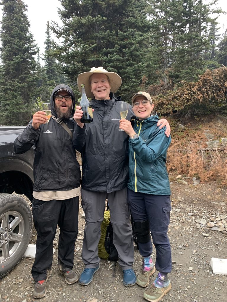
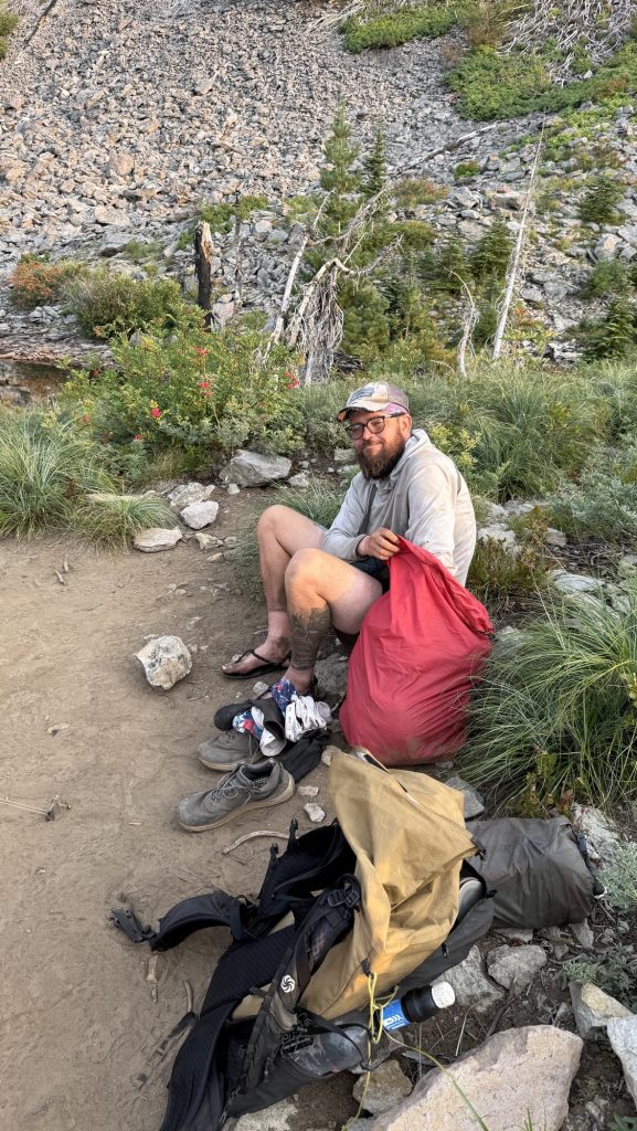
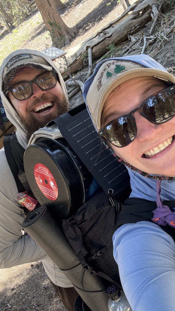
Our last morning on trail. It rained through the night, and when we crawled out of the tent, the sky was heavy and the air sharp. We knew Iceman’s dad would meet us between five and six at Harts Pass, so we planned to be there by four—no way were we going to make him wait. It felt fitting, really. Iceman got all his love for hiking from his dad—an Appalachian trail thru-hiker himself—so having him there at the very end of the PCT felt poetic. Iceman was sure his dad would want to hike the final few miles with us, to finish the journey side by side. I can’t imagine anyone better to meet us at Harts Pass. Exiting for me to finally meet the legend that is Icemana dad, having heard countless adventure stories over the last 5 months.

Twelve miles in, with about ten left to go, I started scanning the misty ridgelines for a tall man in a wide-brimmed hat and a blue rain jacket, just as Iceman had described his dad, trail name: Tin Man. But there was no sign of him. The world was gray and quiet, fog swallowing everything beyond a few meters. The rain came in sheets, cold and unforgiving. We were soaked but grateful—grateful for this incredible adventure, grateful we didn’t have to do this again tomorrow. It could have snowed any minute. We were exhausted but happy.
When we finally reached the trailhead and stumbled into a parking lot, relief washed over us—until we realized we were in the wrong place. Not Harts Pass. One wrong turn. My heart sank. I told Iceman we had to get back on the PCT quickly. His dad didn’t have a satellite phone, and there was zero reception out here. If we missed him, he could’ve hiked for hours looking for us, completely off-grid.
We pushed our way back through dripping trees and tangled brush, shouting his name into the fog. Then, through the rain, a figure appeared—a tall man, wide-brimmed hat, black jacket. We yelled again, louder this time. And then came a cheerful call back through the mist:
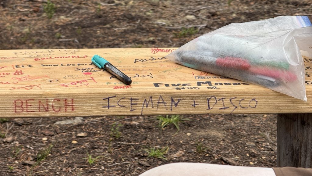
“I’ve got an Uber Eats delivery for Iceman and Disco!”
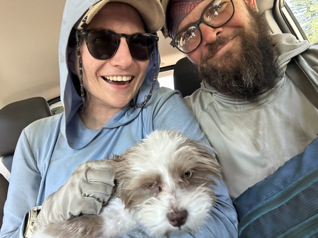
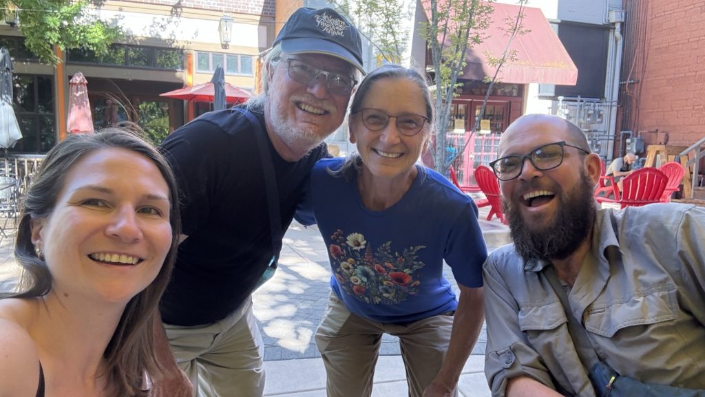
There he was. The legend himself—Iceman’s dad, Tin Man. We laughed, shouted, hugged, the tension melting away. For the last fifteen minutes of trail, we walked together through the rain toward Harts Pass. A proper ending.
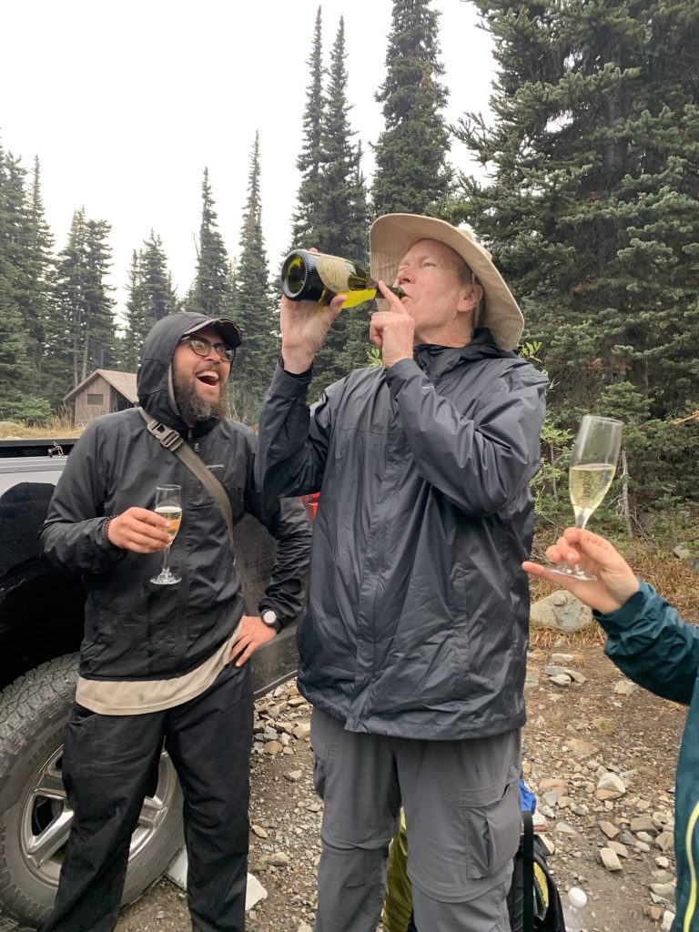
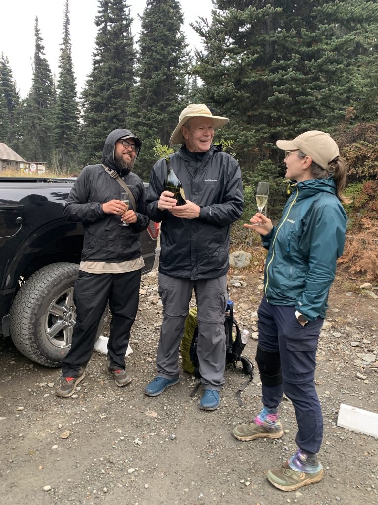
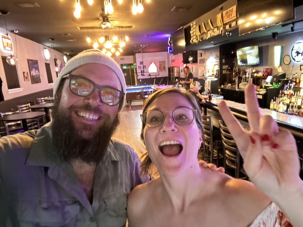
At the parking lot, Tin Man pulled out a white towel. Inside: a bag of ice and a bottle of 2015 Dom Pérignon Champagne. Two crystal glasses followed. He handed them over, grinning ear to ear. We popped the cork—loud and triumphant—and picked it up – leave no trace. Champagne foamed into the glasses, and we all took turns sipping, even pouring a taste for a nearby ranger who wandered over to check what the commotion was about. There we stood in the drizzle, drinking champagne at a remote trailhead, laughing, buzzing, completely alive. 🥰
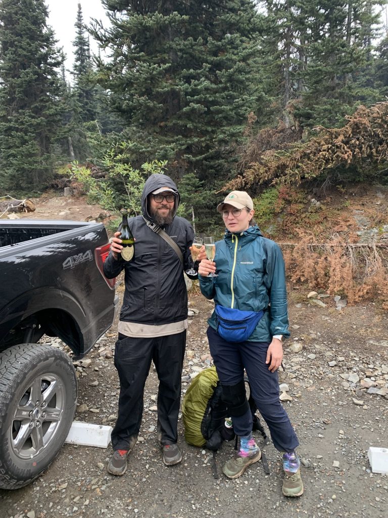
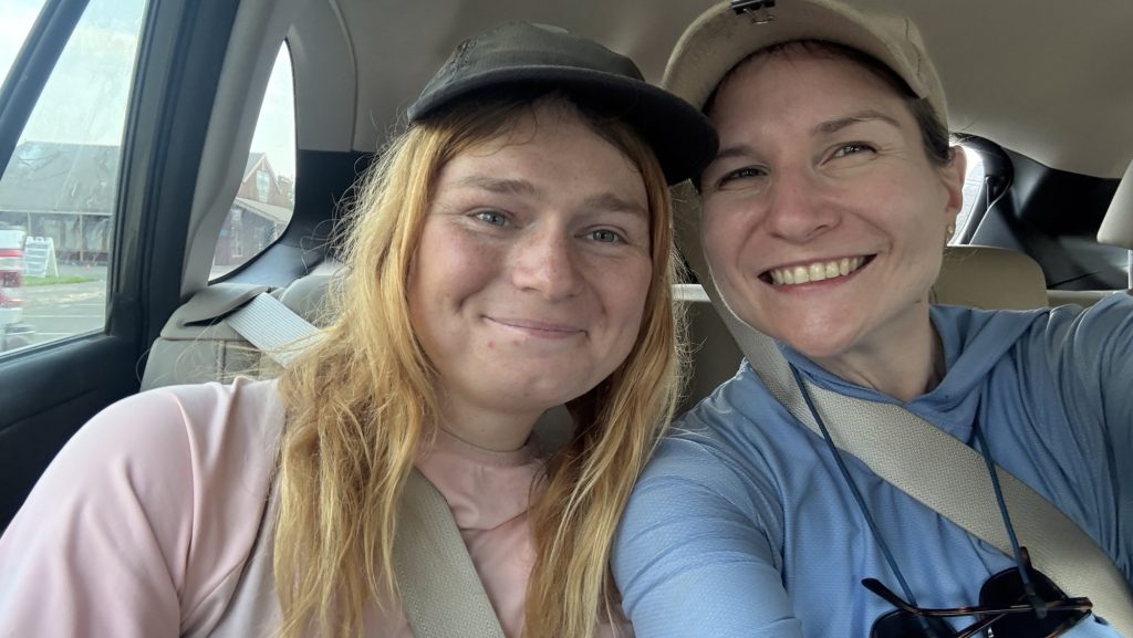
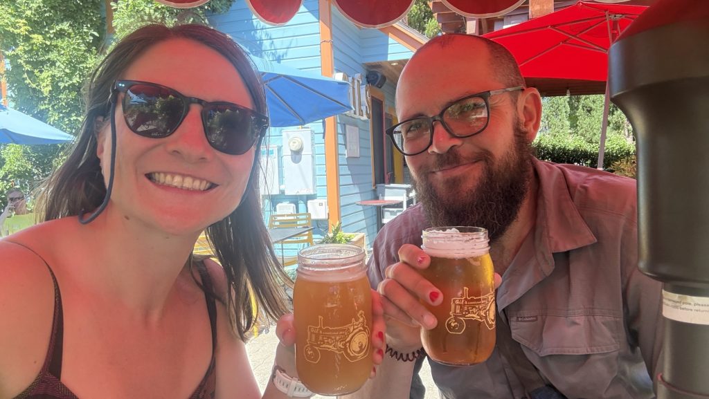
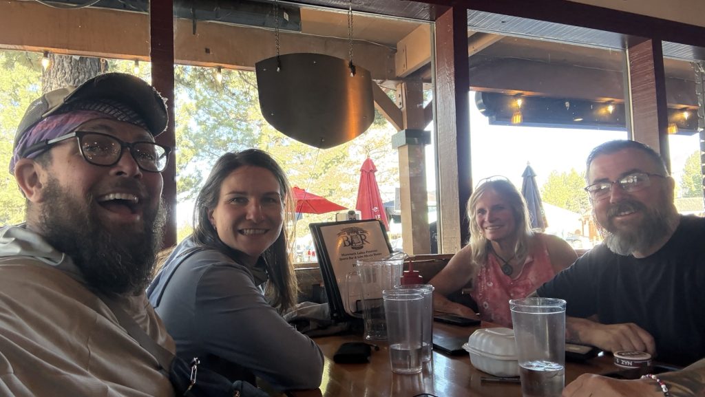
We stayed there for nearly an hour, time flying away in a trance, basking in the joy and disbelief of finishing the Pacific Crest Trail—five and a half months of mountains, deserts, snow, rain, and everything in between. Then we piled into the car and wound our way down the forest road toward Mazama, where our friend Kate waited for us at the bakery. One last reunion, one last round of hugs, one last familiar face from this strange and wonderful world.
The drive to Seattle took us through 5h of dark forest and quiet roads. We stopped for burgers on the way—nothing has ever tasted so good—and rolled into the city around 11 pm.
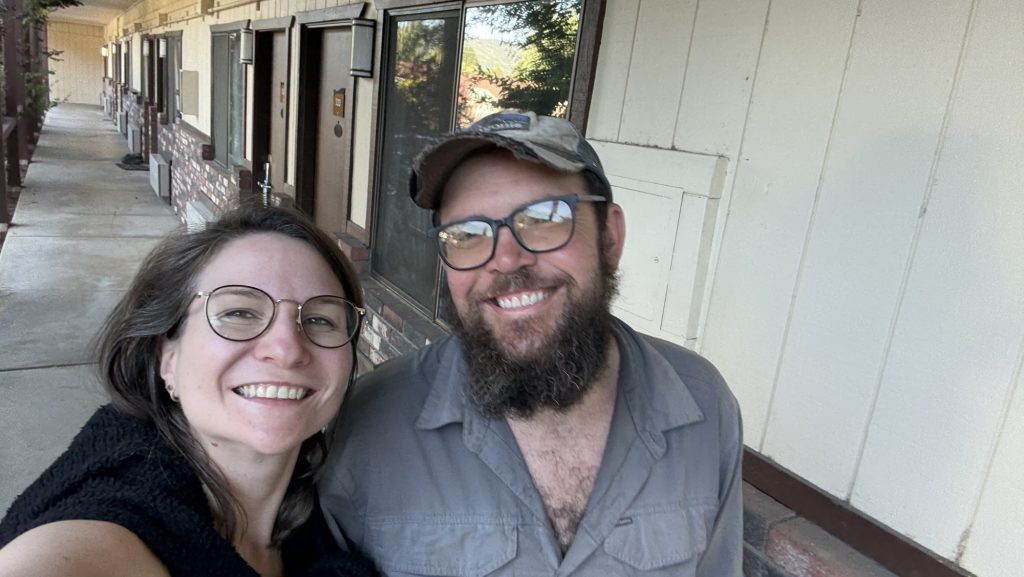
Kate wanted to catch an early flight back to the UK the next day. We said our goodbyes in the hotel lobby, sleepy but smiling. Then finally—soft beds, clean sheets, silence.
The PCT was over. And the rest of our life’s began. And Iceman and I had made a lot of plans in the last 5 months. 🤩
And for the first time in 142 days, we didn’t have to walk anywhere.
The End
After 2,198 miles / 3398 km and more blisters than I care to count, and plenty of trail dust in places it shouldn’t be, I’ve reached the end of the Pacific Crest Trail. It’s hard to put into words how it feels to be done, but here we are.
I want to thank everyone who made this journey so special — the hikers I met along the way, the incredible trail angels, the drivers who scooped up us dirty, tired wanderers, and every single person who supported us from near or far. Your kindness made the miles lighter and reminded me how much good there is in the world.
This isn’t goodbye for the blog. More adventures are on the horizon, and maybe a few reflections once my head and feet have caught up with the fact that we’re no longer walking.
Thank you, truly. It wouldn’t have been the same without you.
🫶🫶🫶
Disco
Statistics overall
Miles hiked:
• April: 177.4 (start April 17th and low mileage 1st 4 weeks)
• May: 458.9
• June: 345.2
• July: 66.8 (mostly in Germany not hiking)
• August: 503.8
• September: 646.7
Total: 2,198.8 mi
Ascent:
• April: 24,259
• May: 76,510
• June: 70,792
• July: 8,944
• August: 73,640
• September: 117,938
Total: 372,083 ft
Steps:
- April: 557,100 (start April 17th and low mileage 1st 4 weeks)
- May: 1,098,962
- June: 850,719 (Sierra Nevada, high elevation)
- July: 309,951 (mostly in Germany not hiking)
- August: 1,126,373
- September: 1,408,273 (killing it)
Total steps = 5,351,378 steps
Time (hh:mm:ss)
• April: 82:45:27
• May: 211:07:54
• June: 173:28:06
• July: 30:50:08
• August: 205:14:13
• September: 272:44:54
Total: 976:10:42
Calories
• April: 22,716
• May: 56,107
• June: 46,025
• July: 7,252
• August: 47,205
• September: 60,499
Total: 239,804 Cal
Numbers in perspective / Scope / for fun:
Here are some comparisons for those ridiculously large numbers:
Calories Burned: 239,804 Cal
- A 155-lb person burns roughly 300 calories in 30 minutes of brisk walking or 360–420 calories in 30 minutes of running at 6 mph (10-min mile).
- To burn 239,804 calories would take about 666–800 hours of brisk walking or 285–333 hours of running at 6 mph—this would require years of regular exercise for most people.
Hiking Distance: 2,198.8 miles
- Average hiking speed is 2–4 miles per hour.
- At 3 mph, it would take around 733 hours to hike this distance, or nearly 30 straight days of non-stop hiking.
- The distance is similar to hiking from New York City to Salt Lake City, Utah.
Total Ascent: 372,083 ft
- Mount Everest is 29,032 feet high.
- Your ascent is equivalent to climbing Mount Everest about 12.8 times (372,083 / 29,032 ≈ 12.8).
Total Time: 976 hours 10 minutes (976.18 hours)
- A standard full-time work year is 2,080 hours (40 hours per week × 52 weeks).
- 976 hours of hiking is equivalent to roughly 24.4 work weeks, or about 6 months of full-time work.
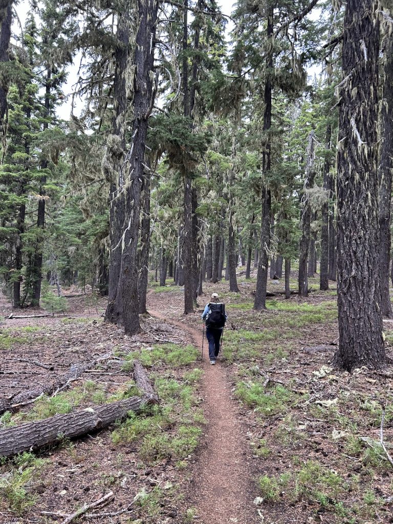
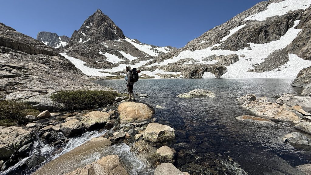
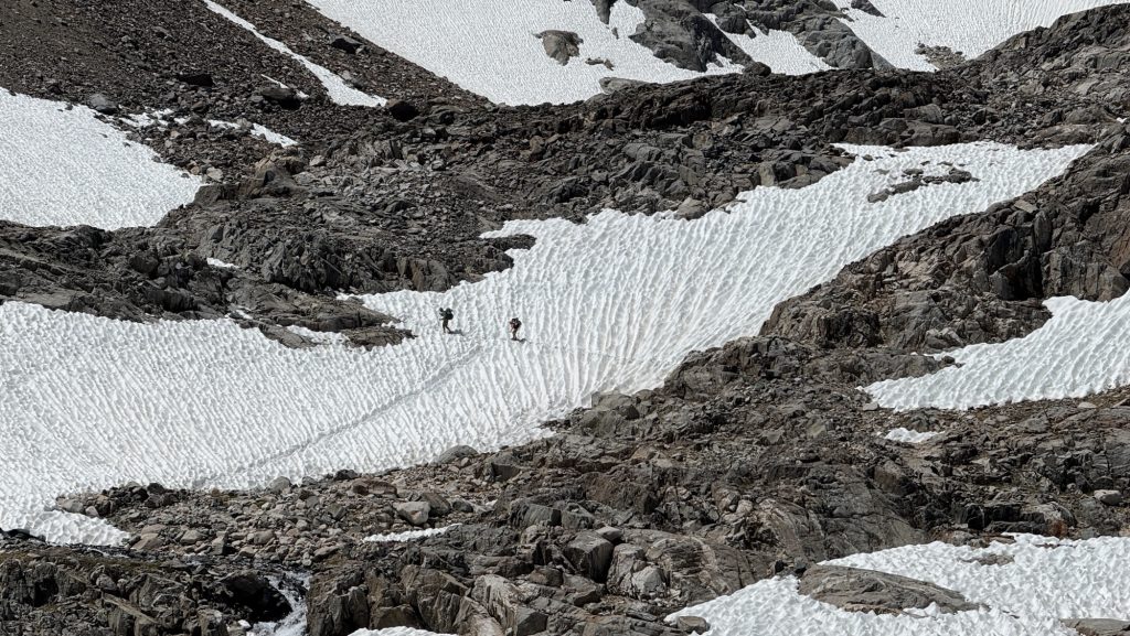
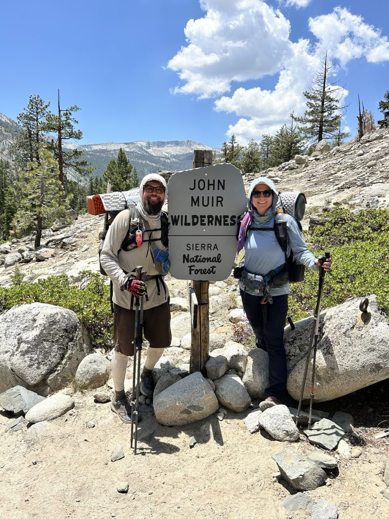
Days 135 – 137: PCT Miles 2500.73 – 2575.1
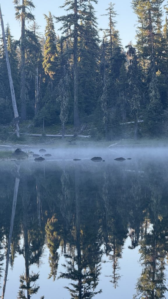
Day 135: Hiking into the night 2524.5 (23.77)
The morning was cold and we kept sleeping till 6am. It was below 10C. We left at 7.30am. We saw the sun come out. It was so great.

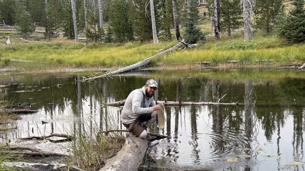
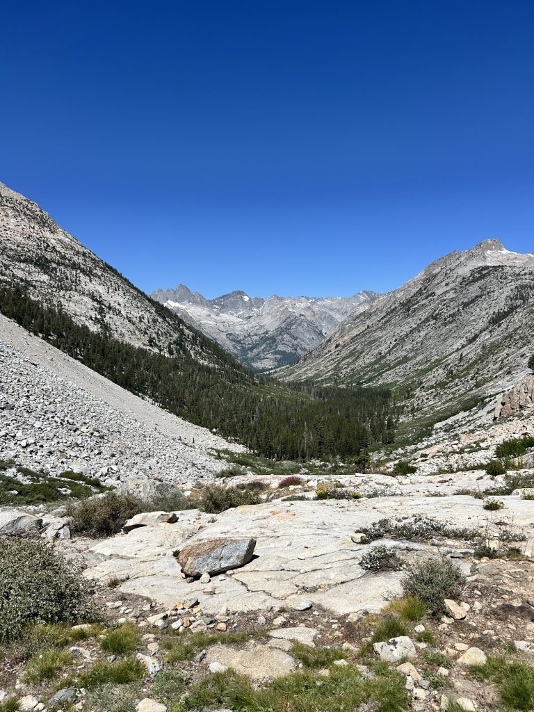
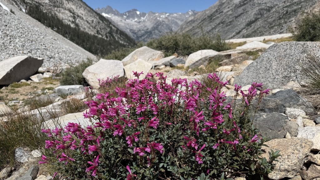
We warmed up and I solar charged my power bank. We climbed a lot and soon saw glacier covered peaks and red mountain tops. It was so beautiful. My left shin hurt a little but not to bad. We went over a saddle down into a deep valley and for the rest of the day stayed in a forest. We had lunch near a stream where the sun could dry our sleeping bags and tent.
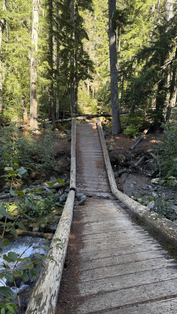
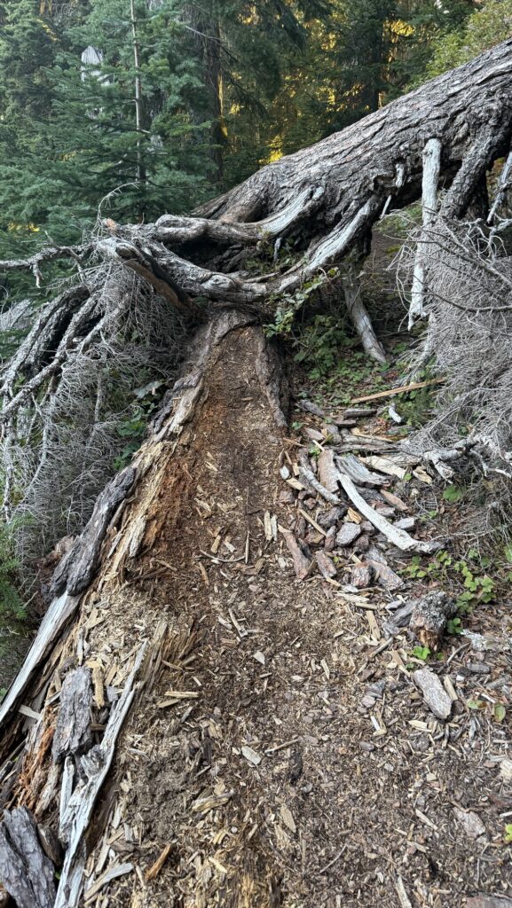
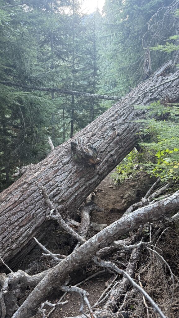
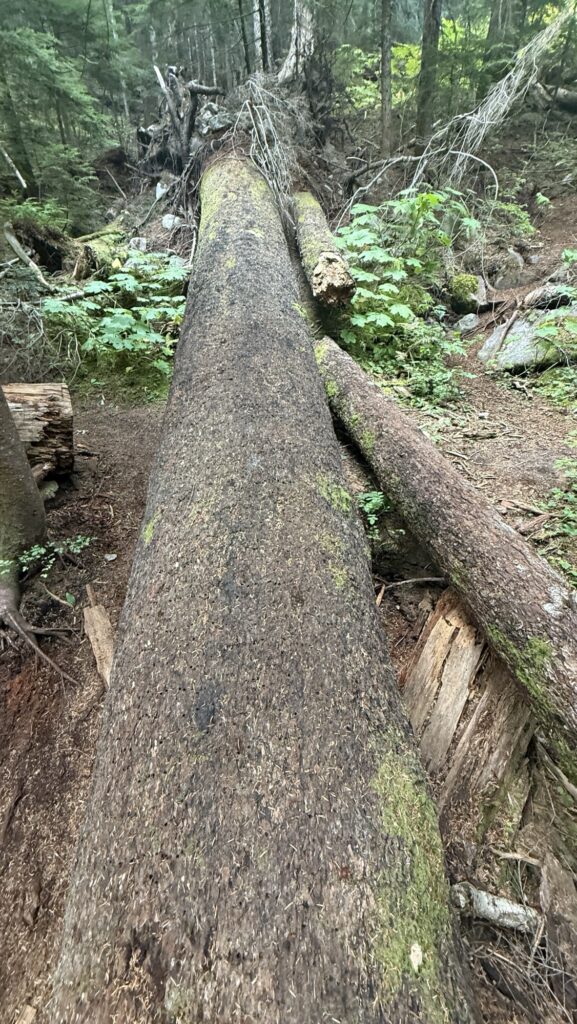
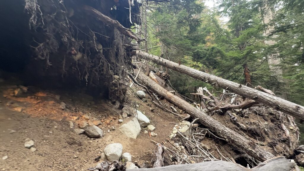
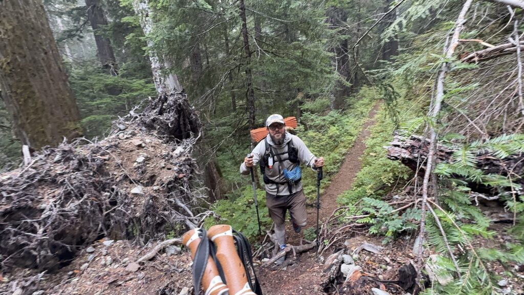
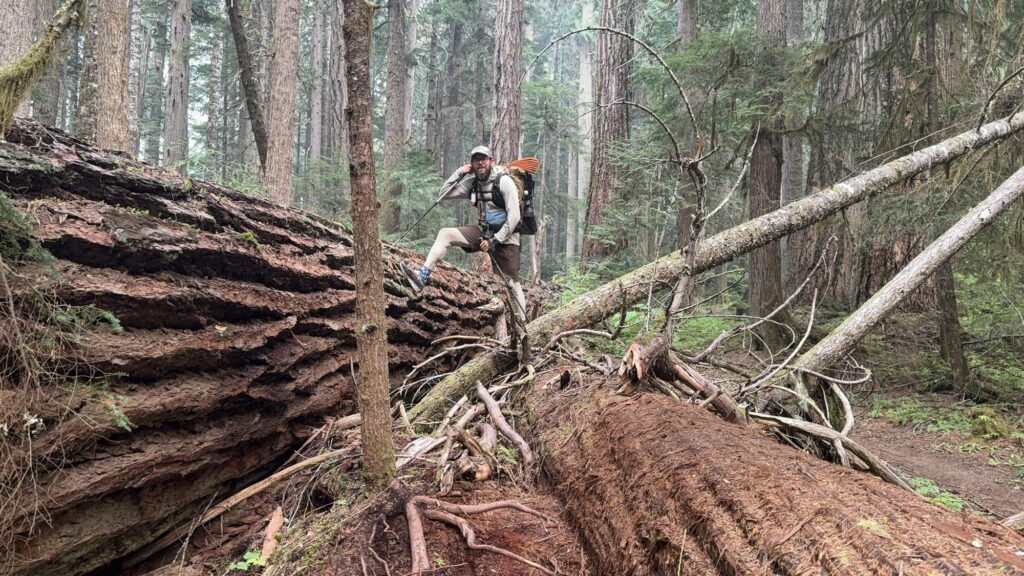
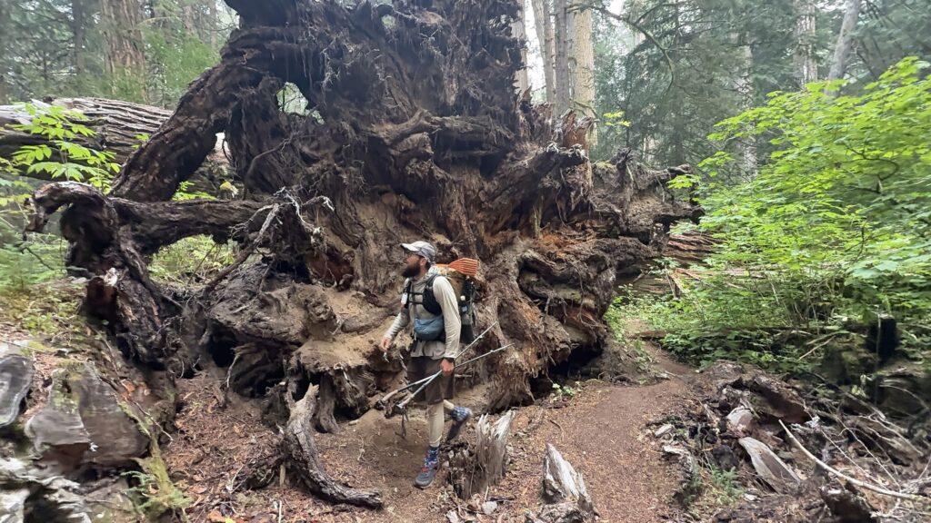
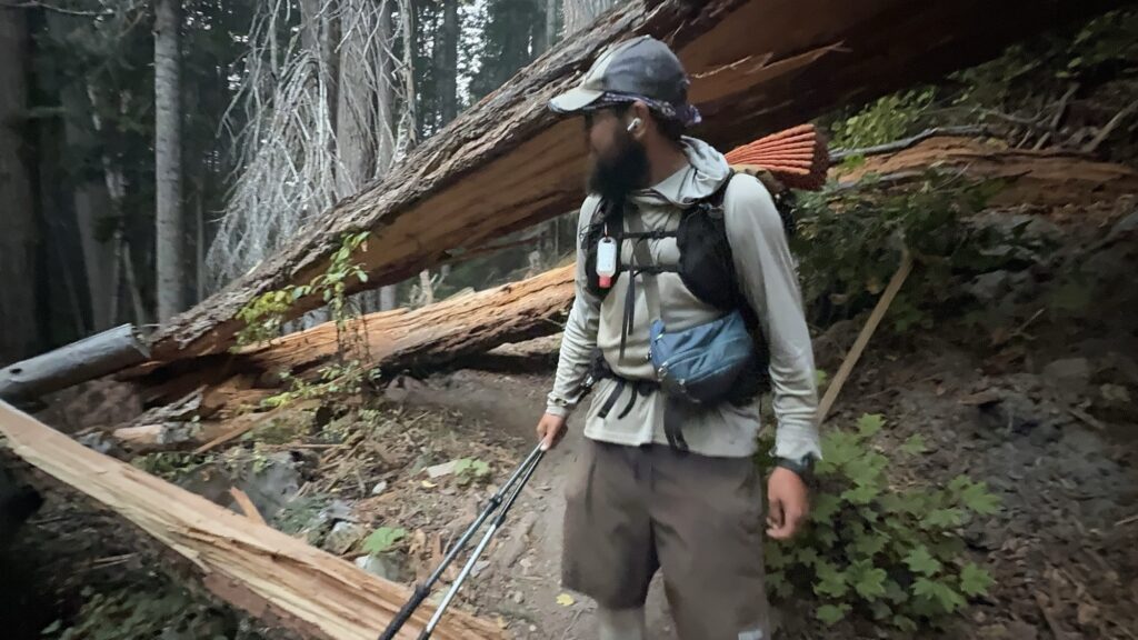
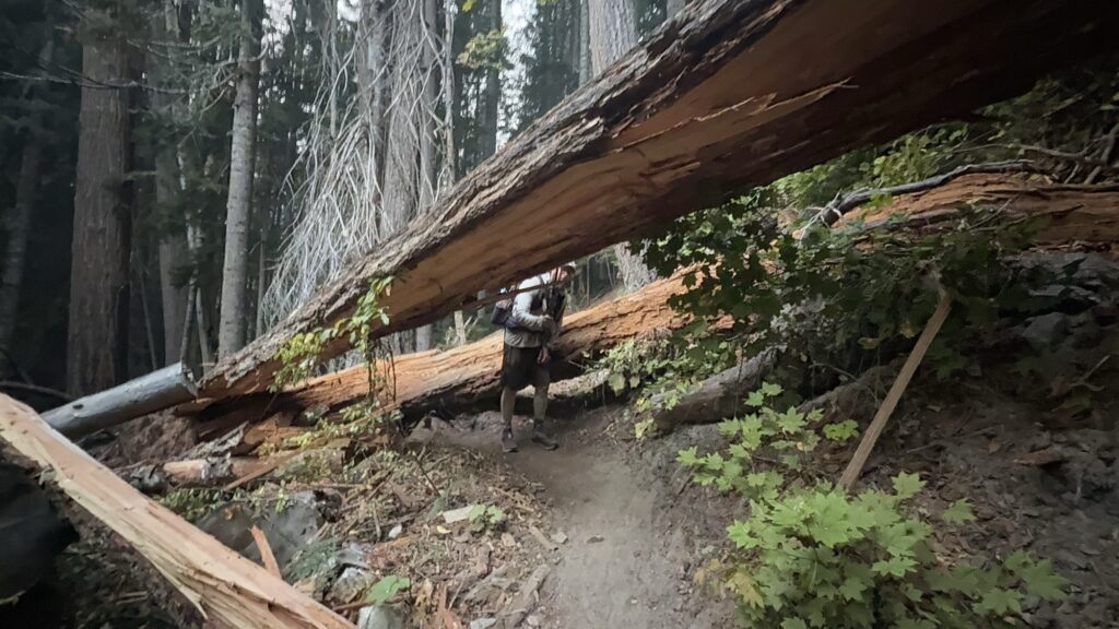
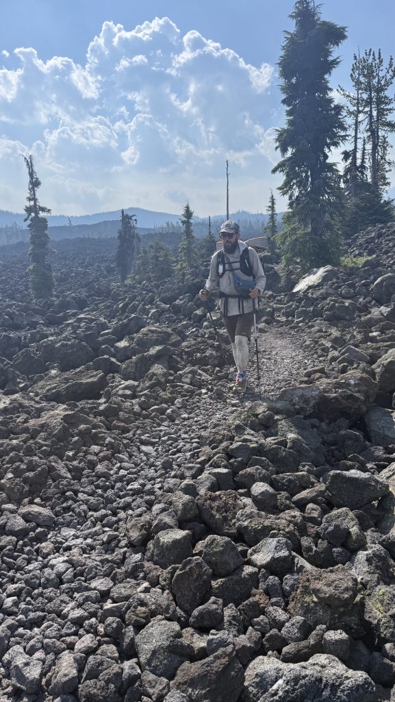
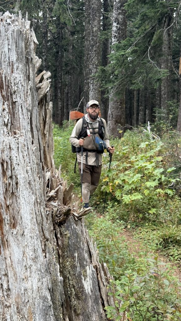
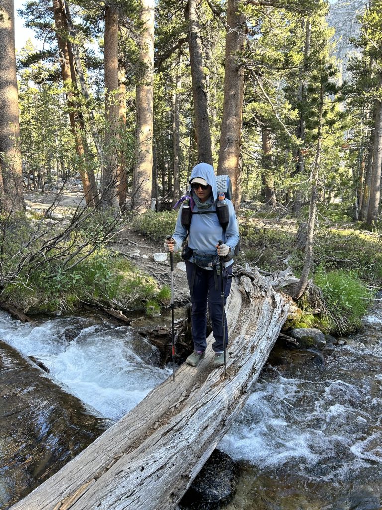
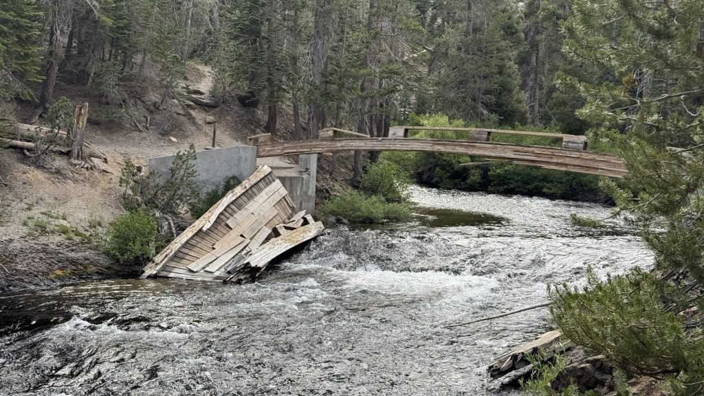
We had to climb countless fallen trees, sometimes several on top of each other and in many places there was no trail and we went straight up a slippery mud slide. At some point Iceman slipped into a tree and his hip belt buckle broke. Oh no! He could tie it together somehow but the hip buckle is essential, with no service the next few days, this is an issue. Section K is infamous for having over 30 massive fallen red wood trees on trail. Sometimes Iceman had to push me up one side of the tree.
We calculated in order to make the 6.15pm shuttle to Stehekin we should hike 25 miles today and tomorrow and 20 miles the third day. Weirdly, in the afternoon my left shin hurt so bad I had to take Ibuprofen and cool my foot in a glacial stream. It seemed to help.
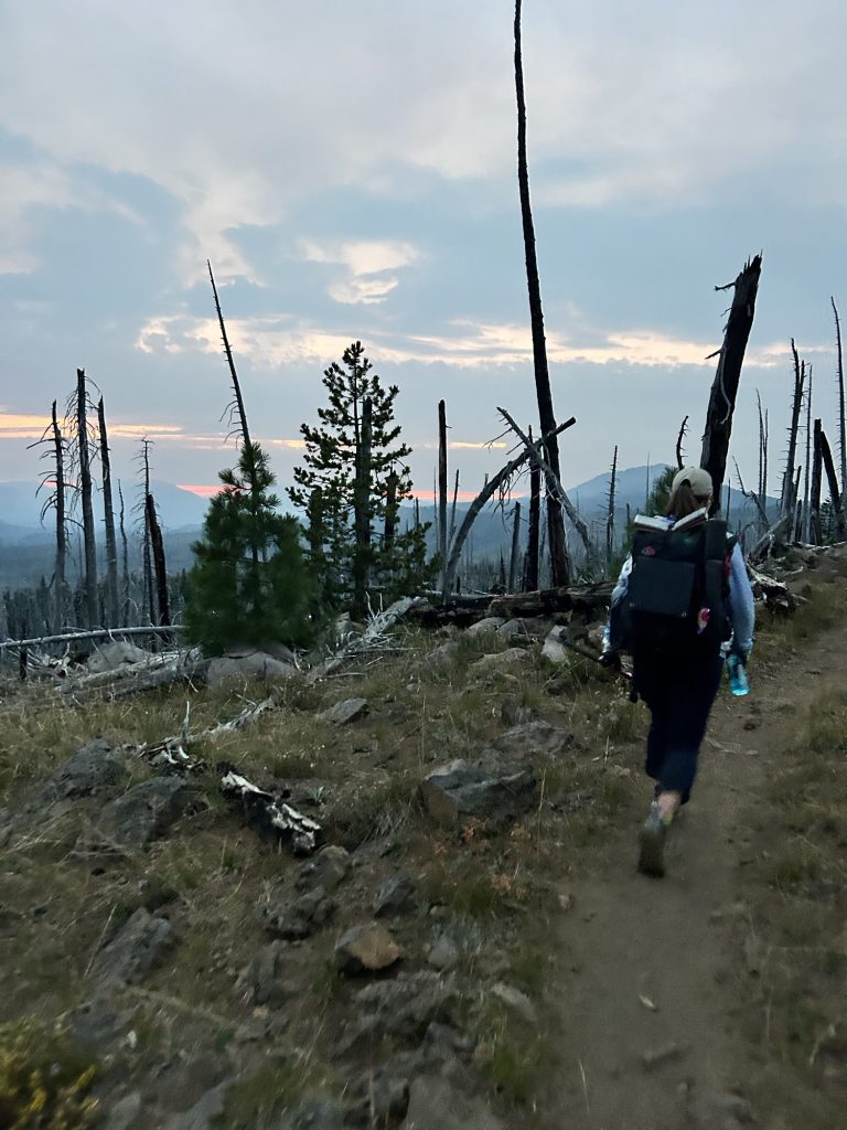
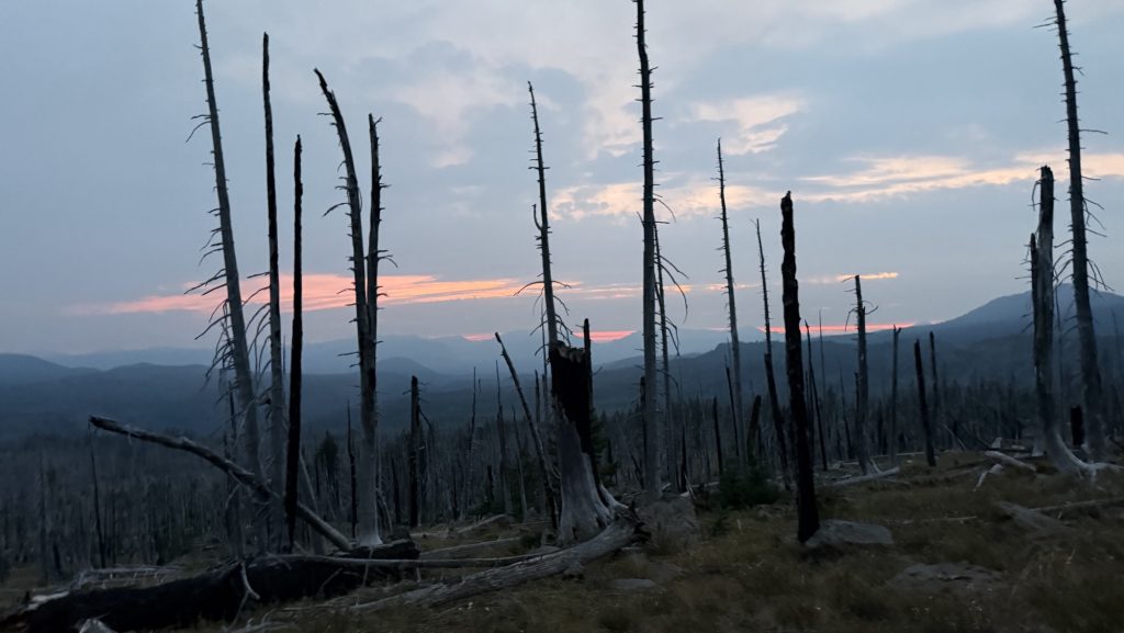
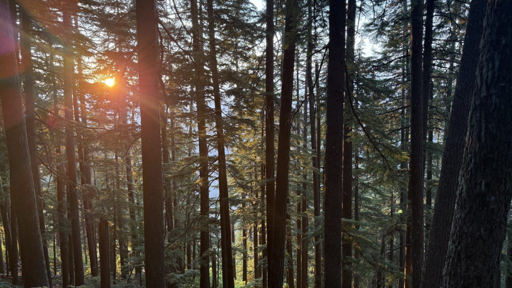
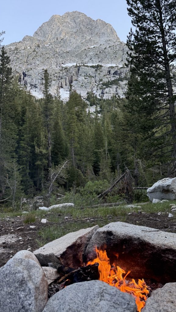
We hiked up some more and saw an incredible sunset over rugged mountains. With still at least 3 miles to go, we had to night hike. This is always spooky to me as you see only a little bulb in front of you. It’s scary. We climbed over a ridge line and down on the other side.
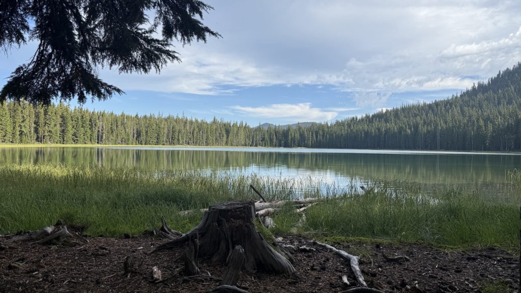
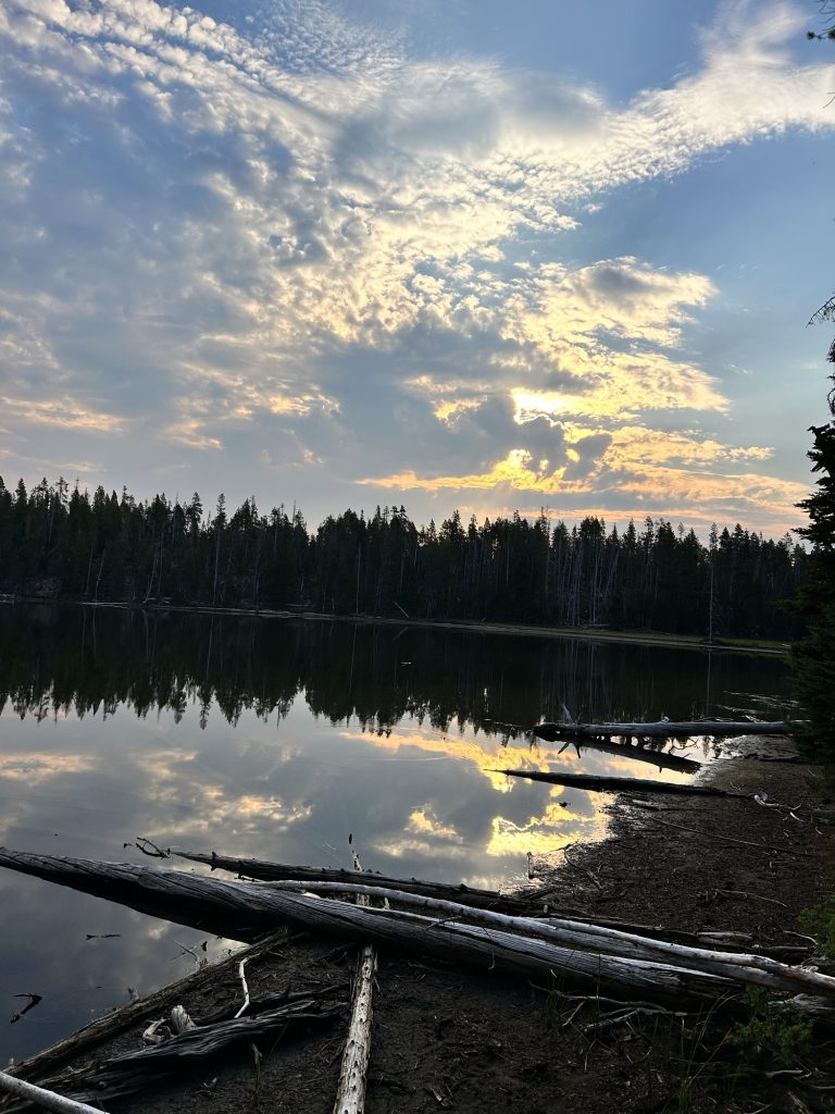
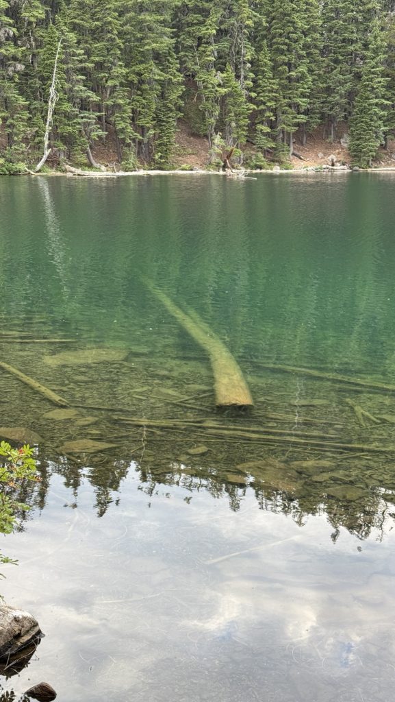
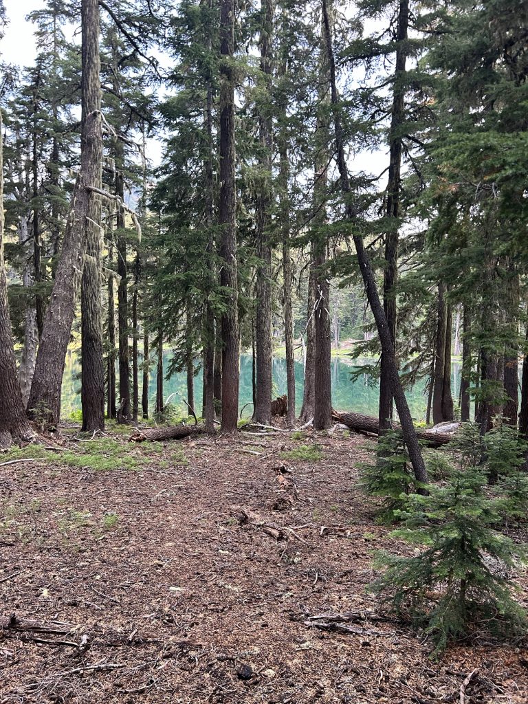
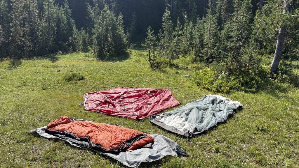
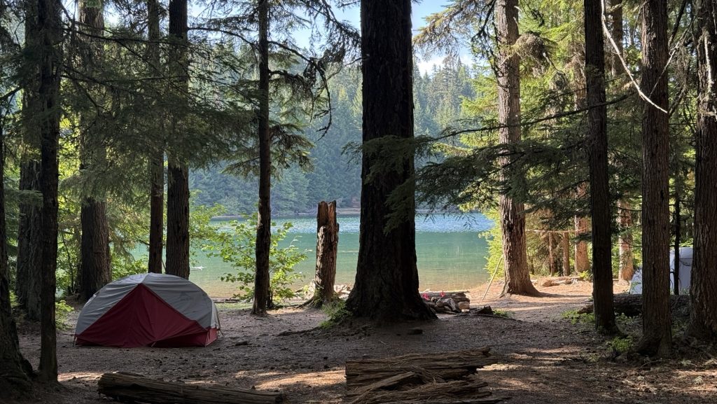
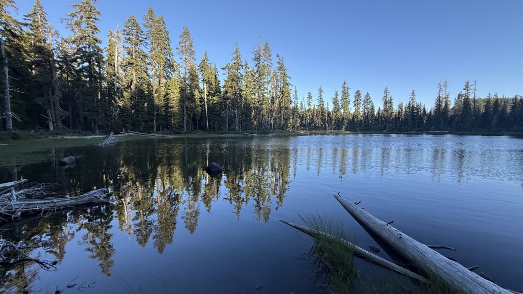
The lake we wanted to stay at has about 10 tents so we kept going. Another mile out so and we were almost alone, just one other tent. Much better. Amazing stars all around.
Miles hiked: 23.77
Ascent: 5799 ft
Descent: 5643 ft
Steps: 54.786
Day 136: Miner Creek 2552.3 (28.9)
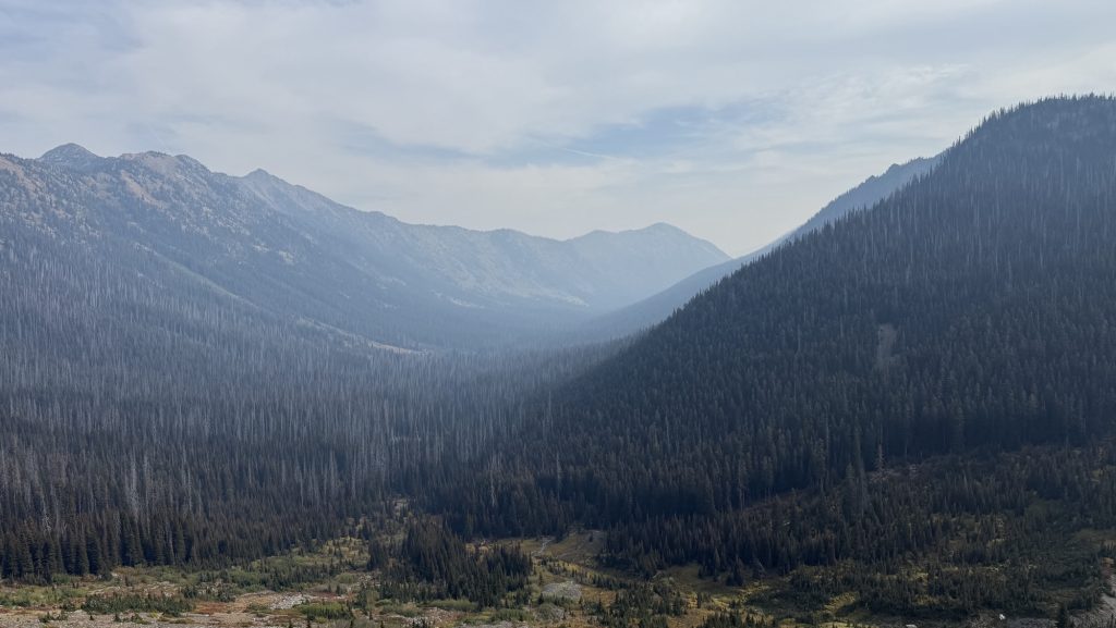
The day began in the most responsible way possible — by turning off my 6 a.m. alarm and falling blissfully back asleep. When we finally stumbled out of our tent at 6:30, the world was already smoky, and we were already behind schedule. Things only went downhill from there — well, first they went uphill, eight miles and 2,500 feet of it.
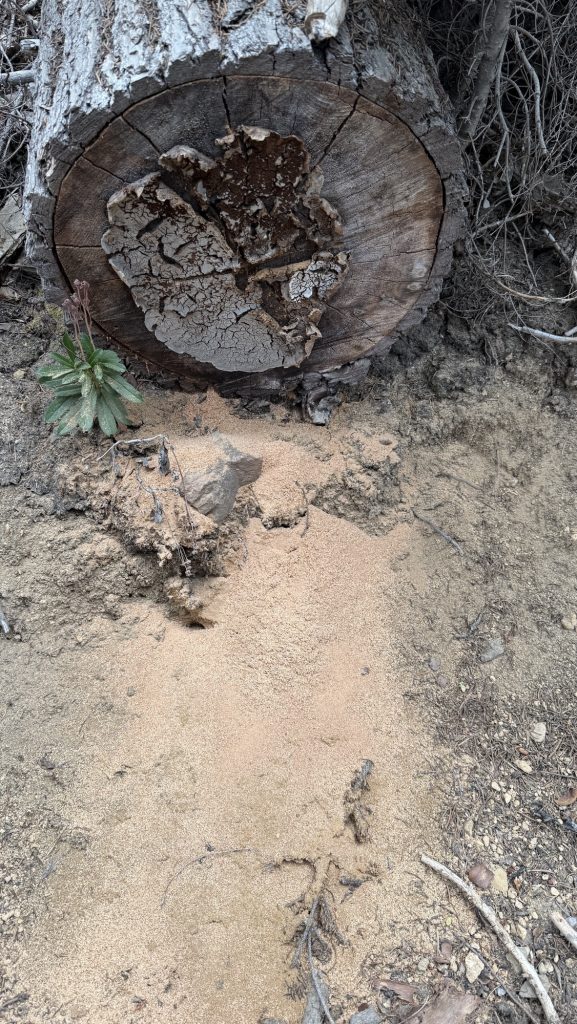
I also made an unfortunate early-morning contribution to the PCT landscape. I thought I’d found a discreet side trail, but nope — turns out it was visible from the main path. Somewhere out there, a hiker is probably still wondering about my life choices. Sorry about that.
By lunchtime, things got real. We’d only covered 10 miles, it was already 1 p.m., and we realized that to catch the 6:15 p.m. shuttle to Stehekin tomorrow, we needed to crank out another 20 miles today. Nothing motivates quite like the threat of missing your ride to civilization (and real food).
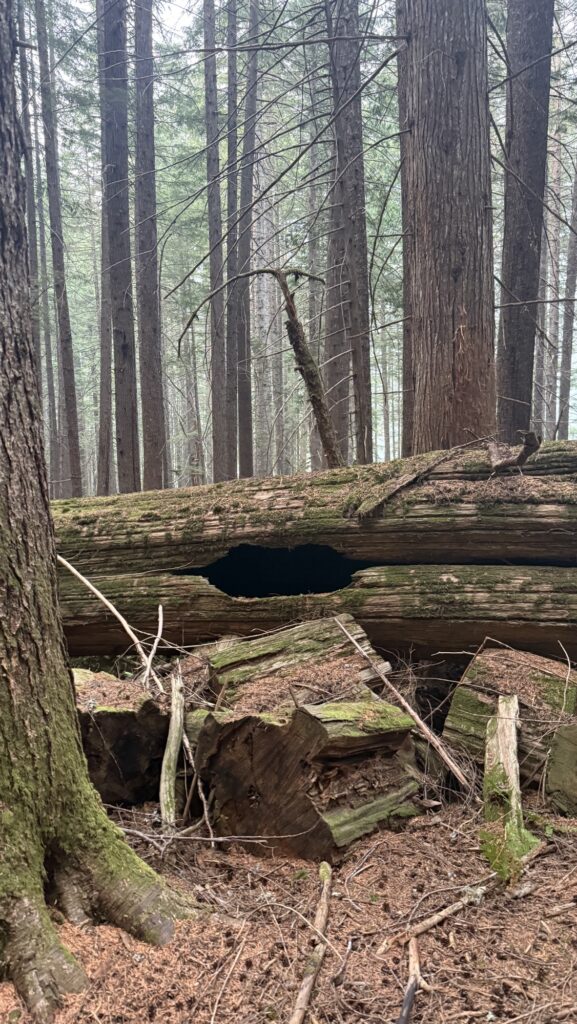
The trail responded like a cranky old gatekeeper. Blowdowns everywhere — tree trunks taller than us, forcing awkward climbs, yoga moves, and questionable language. Progress was slow and sweaty. Somewhere between fallen trees, we finished our audiobook ‘The Last Season’, a fascinating read about a backcountry ranger’s disappearance in Sequoia & Kings Canyon, my favorite section of the PCT. It made me grateful that, unlike him, I only have to worry about getting to Stehekin on time and not going missing entirely.
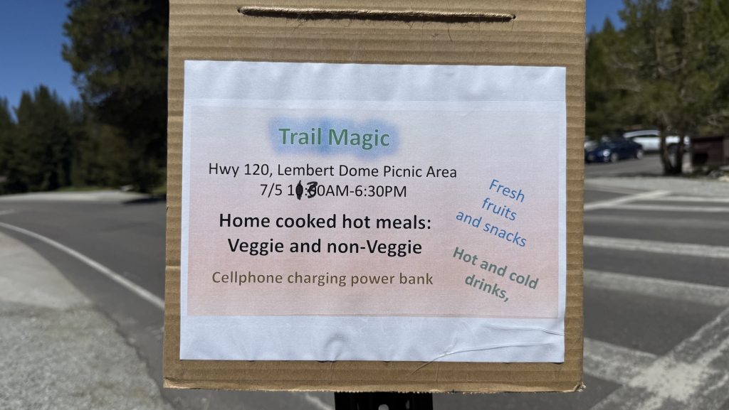
To keep the mental wheels turning, we switched to ‘21st Century UFOs’ on audiobook. Nothing adds atmosphere to a smoky mountain night like aliens. The haze stuck around all day, making our heads throb just enough to add an extra layer of misery. Meanwhile, Iceman managed to embody trail magic by gifting a lighter to a fellow hiker, and Arnoud worked some satellite-messaging magic to book us a cabin in Stehekin. Civilization was calling — faintly, through the smoke.

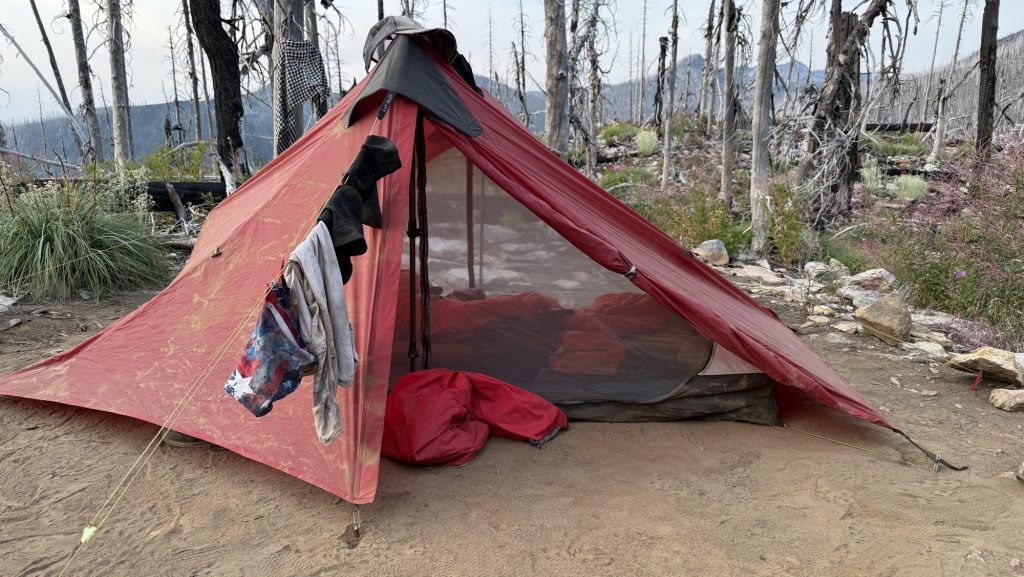
We kept hiking until 9 p.m., headlamps cutting through the gloom, stumbling over roots like zombies on a mission. Luckily, we found a flat camp spot with room to spare — and just one other hiker, no witnesses to our late arrival. My hip was complaining, but my left shin was quiet, and my right knee seems to have accepted its fate after weeks of stretching.
The stats say it all:
Miles hiked: 28.9 😝
Ascent: 5,668 ft
Descent: 2,650 ft
Steps: 66,178
A long day, a smoky sky, and a hard-earned camp. Tomorrow, Stehekin — assuming we can still stand up in the morning.
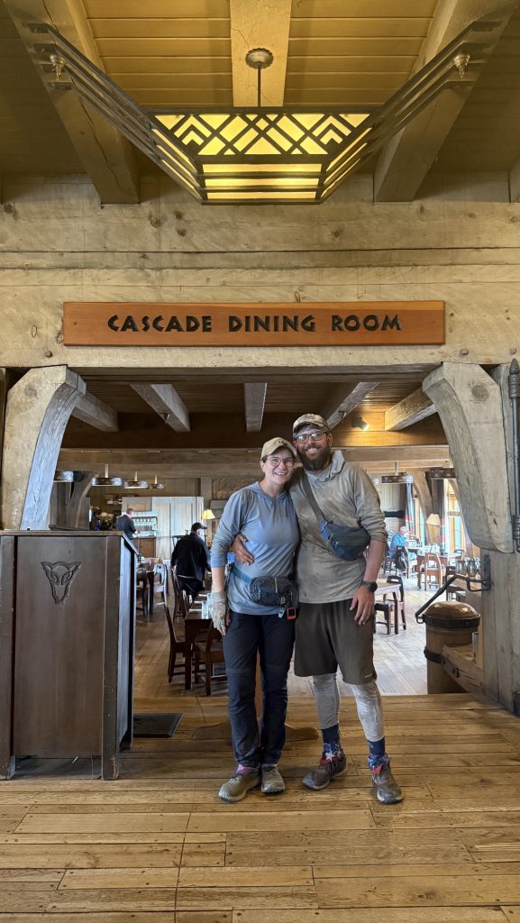
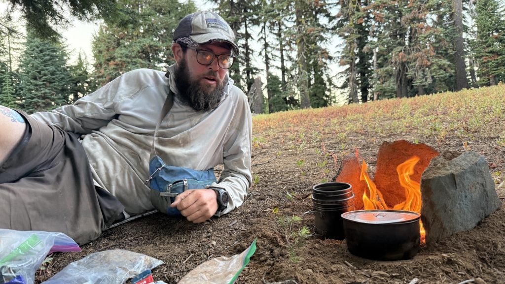
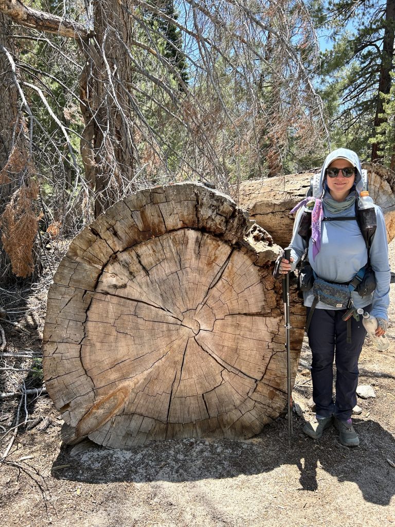
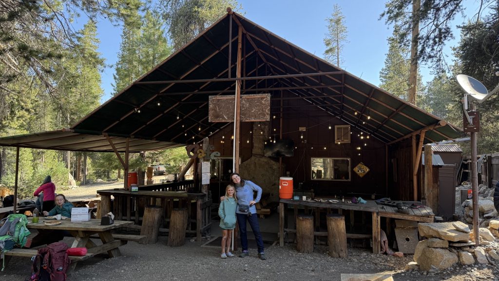
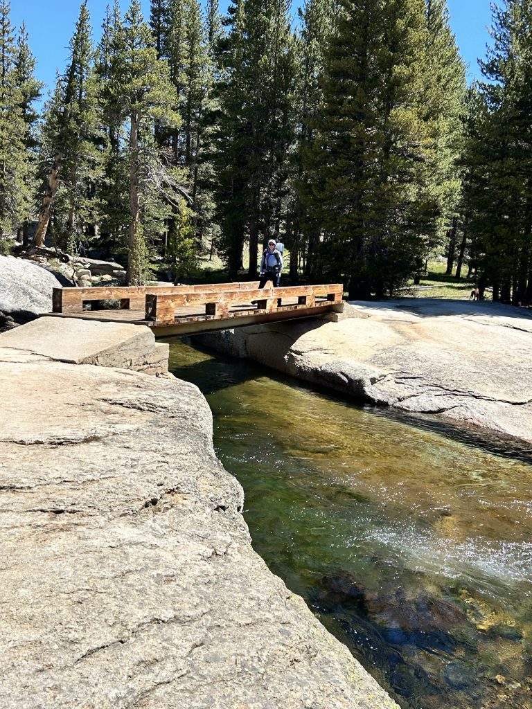
Day 137: The Day We Chased Stehekin (and Steak) 2575.1 (23.56)
Some mornings, adventure starts with a sunrise. Ours started with an alarm that laughed in our faces at 5:30 a.m. You know that blurry-eyed moment when you question every decision that led you to this exact point in the timeline? That was us while stuffing breakfast into our faces at dawn, convincing ourselves that the early bird gets… a shuttle seat, apparently.
By 7:00 a.m. on the dot, we stepped into the wilderness like punctual legends. If there’s a spiritual reward for hitting the trail before coffee fully hits your bloodstream, we earned it.
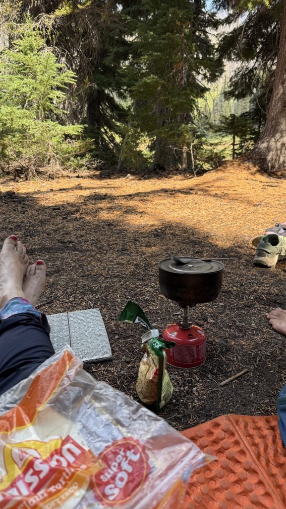
Around midday, we stopped at “the Creek”—which sounds poetic but is really just a gorgeous creek. There, we assembled what can only be described as a mourning burrito: tortillas, rice, beans, and the faint scent of regret that we didn’t pack cheese and salami. It was warm, which automatically made it the best lunch of the week.


With tortillas in hand and questionable enthusiasm in our legs, we pressed on.
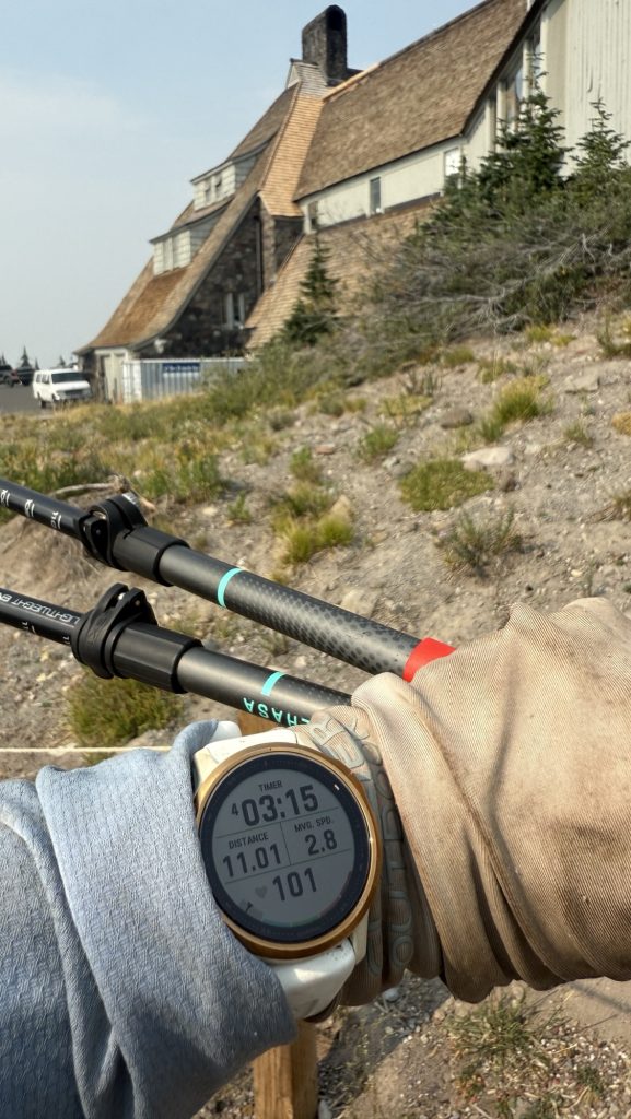
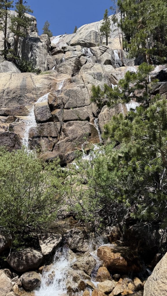
After 10 hours of steady climbing, descending, and pretending to enjoy nature’s cruel beauty, we rolled into the High Bridge Ranger Cabin at a precise 5:50 p.m. (Is this what adulting looks like?)
We even had time to check out the salmon under the bridge—serene little zen masters of the current, gliding in circles while we contemplated our own mortal fragility and whether we smelled as bad as we thought. Spoiler: we did.


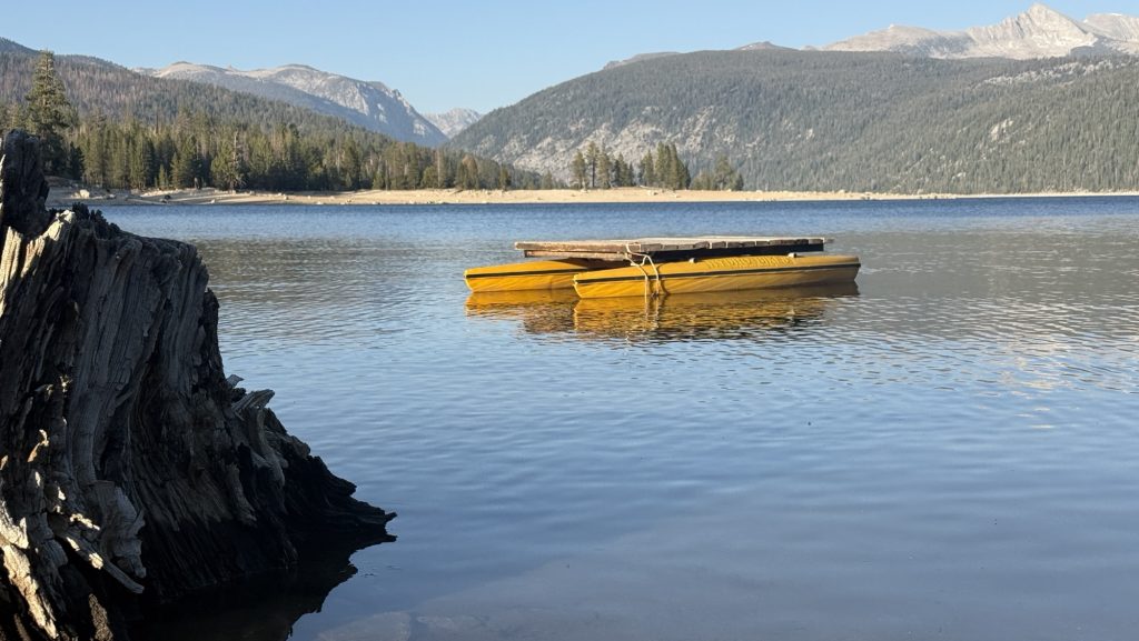
Then, at 6:15 p.m., the shuttle appeared like a chariot of glory. Destination: Stehekin Valley Ranch. Estimated mood upon arrival: feral delight.
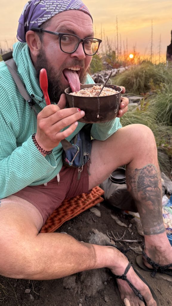
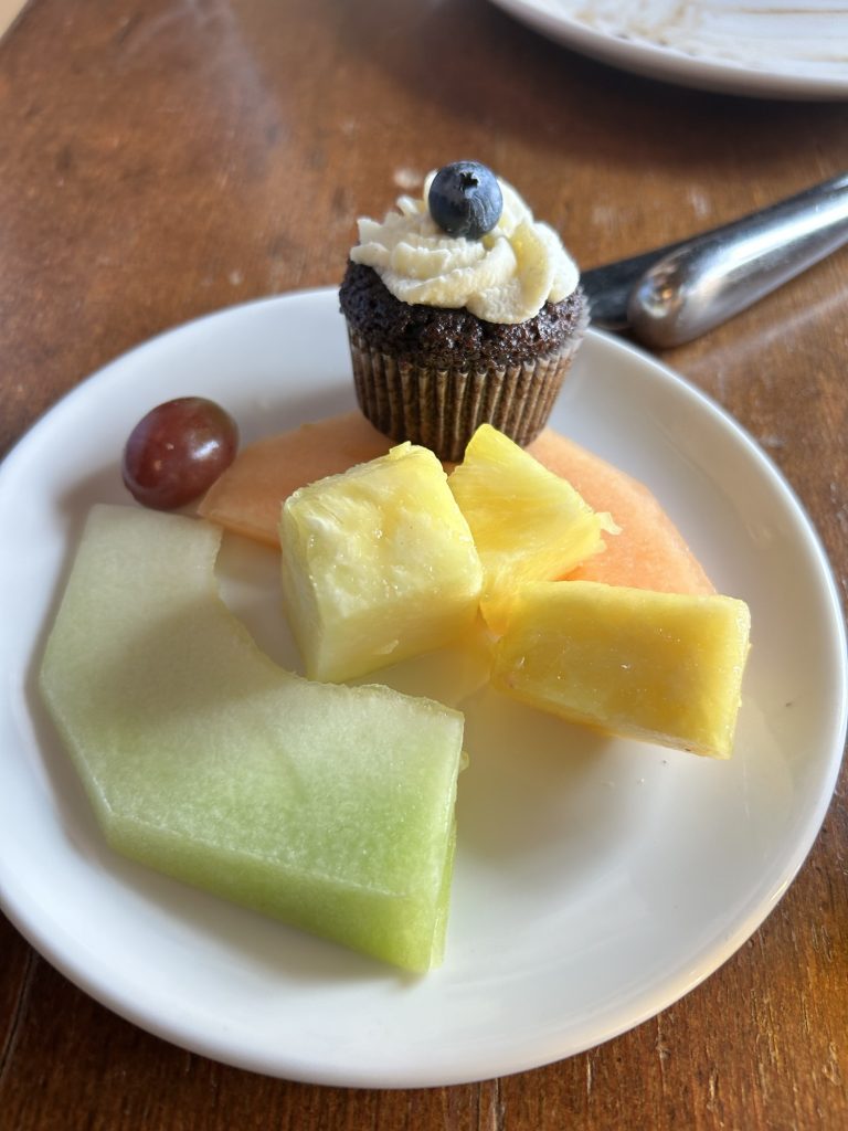
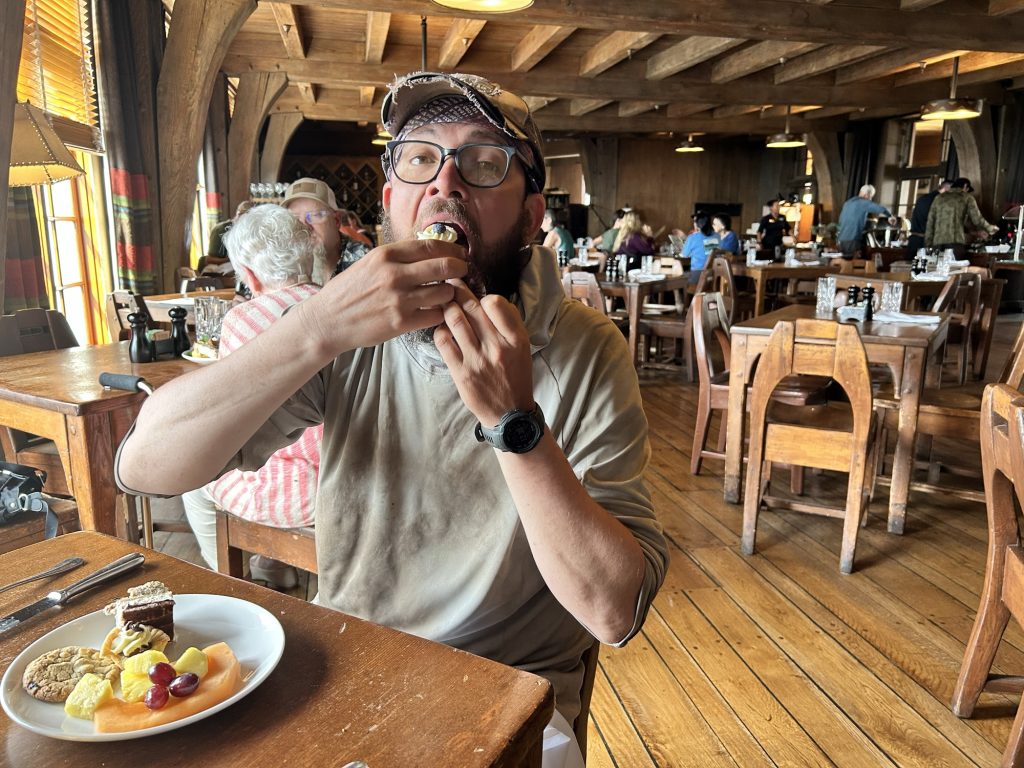
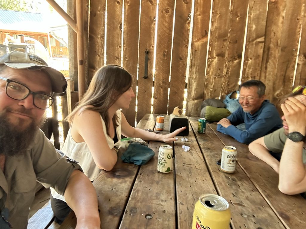
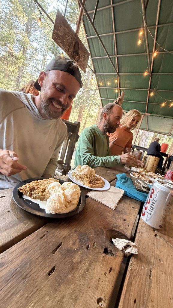
When we got there, we ditched our packs with the grace of collapsing storks and beelined to dinner in the “big kitchen cabin.” And oh, dear reader, let us tell you—this was no sad freeze-dried affair. This was the banquet of our wildest backpacker fantasies: a salad buffet starter, a 12-ounce steak flanked by potatoes and carrots, and a dessert buffet that almost made us cry.
Every bite whispered, “You did it. You’re not just hiking—you’re living.”
We checked into the trapper cabin, which had all the rustic charm you’d expect—wood walls, mountain silence, and precisely zero outlets. Charging our phones became a social ritual in the communal bathroom, where guests mingled in that half-desperate, half-zen camaraderie that only comes from trying to hold your toothbrush and your charging cable at the same time.
Stats That Don’t Lie
- Miles hiked: 23.56
- Ascent: 3160 ft
- Descent: 6181 ft
- Steps: 54,146
- Steak satisfaction level: 10/10, would hike again for dinner
In the end, the day wasn’t just about the distance. It was about how far you can push your body, your patience, and your love of tortillas before realizing that heaven might just look like a ranch kitchen filled with tired people and unlimited dessert.
Thanks for reading. Let me know if you have any questions or comments. I always love to hear from you.
🫶🫶🫶
Disco
Days 105 – 118: 1912 – 2150 / End of Oregon
Day 105: Bingham Lakes (18.9 Miles)
We started hiking at 9.30am. We were tired. Haven’t done a zero since Ashland.
We took alternate route to cut 10 miles and some elevation to Shelter Cove. We will reach it tomorrow, 15 miles instead of 25.
I am very tired and will go to bed now (8:44pm)
Stats
Distance: 18.9 miles
Steps: 39.799
Ascent: 2124 ft
Descent: 2621 ft
Day 106: Shelter Cove & Lower Rosary Lake mile 1912.2 (21.94)
Breakfast at 7.30am by a beautiful lake. It’s completely quiet except for birds and the noises we make.
Granola and trail mix and coffee. 15 miles to Shelter Cove Resort where we can shower and eat a burger.
We haven’t had a day off in a while so we’re both feeling tired. Won’t have a bed for another 5 days till we reach the city of Bend.
We hiked through forest all day and it rained a little bit for the first time in a long time.
We made it by 2.30pm and had a burger – the burger was really good.

We took a shower and bought two dinners for trail and some snacks.
We ran into Fruit Loop and she told us Roadrash skipped to Washington. She also said Kate is ahead of us. We must catch her haha we thought she’s behind us!
We hiked out until it was almost dark and camped at Lower Rosary lake.
Miles hiked: 21.94
Steps: 49.985
Ascent: 2247 ft
Descent: 2020 ft
Day 107: 1912.2 Lower Rosary Lake to Jezebel Lake 1935.8 (longest day yet: 24.06 miles)
We left at 8.15am and hiked 7 miles to water. We continued hiking through beautiful forests.
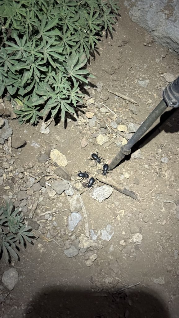
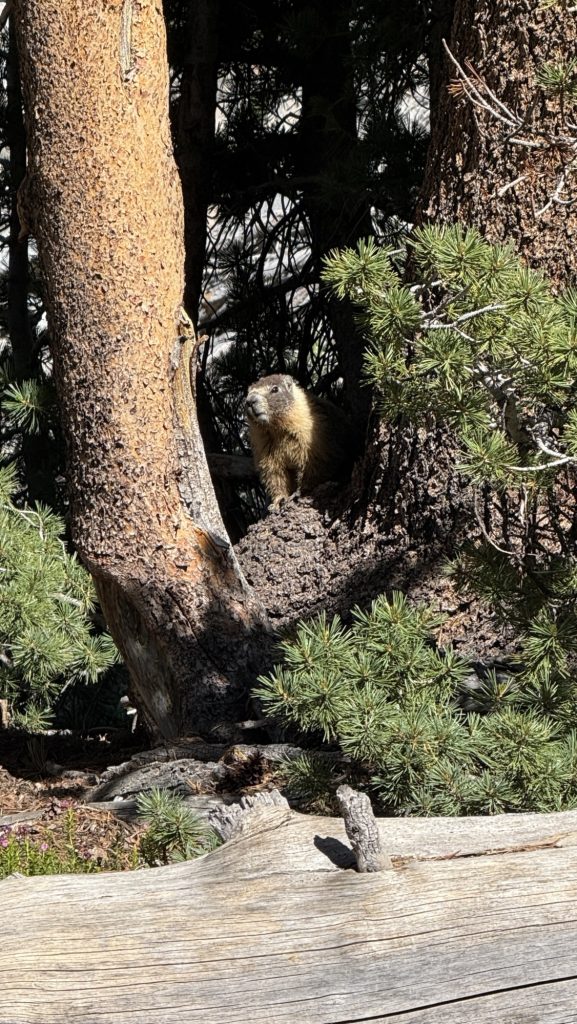
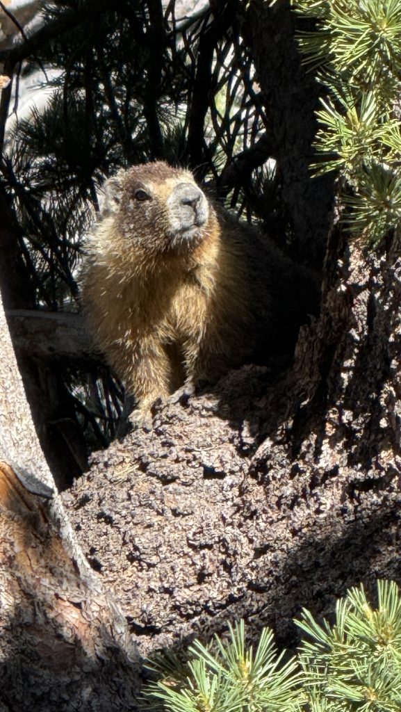
We saw carpenter ants eating through a dead tree and throwing out sawdust (took a video) in a very efficient way. Nature is showing us fascinating things every single day!
Had lunch on some rocks – after finishing our “climb” for today. We have to ration lunch food a bit because we have a lot of snacks but only 6 tortillas and 5 chicken packets for 3 days – we would need 12 tortillas and 12 chicken packets. We have trail mix, and beef jerky to supplement with so it ll be fine.
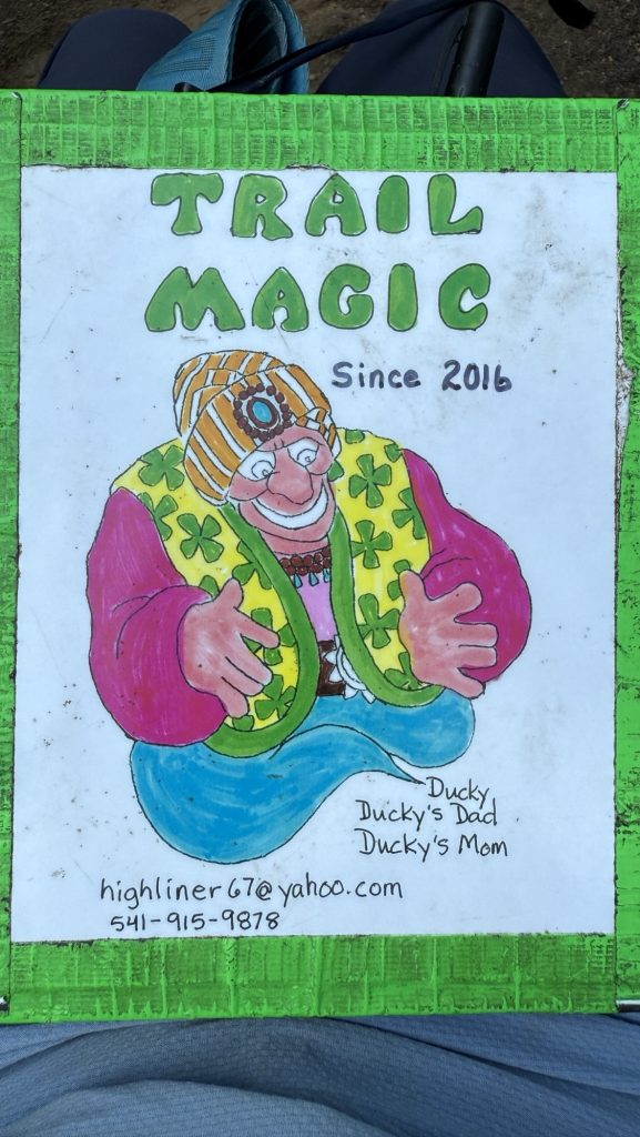
Just as we were talking about rationing food, these beautiful colorful signs started showing up every 10 m. We thought we were hallucinating but it was real! trail Magic!!
Stats:
Miles hiked: 24.06
Ascent: 2929 ft
Descent: 2834 ft
Day 108: 1955.5 Elk Lake Resort (22.28 miles)
Alarm went off at 6am, we hiked out at 7.11am. I actually left without iceman for the first time because I was ready to go and the moskitos were so bad. We met at the next water.
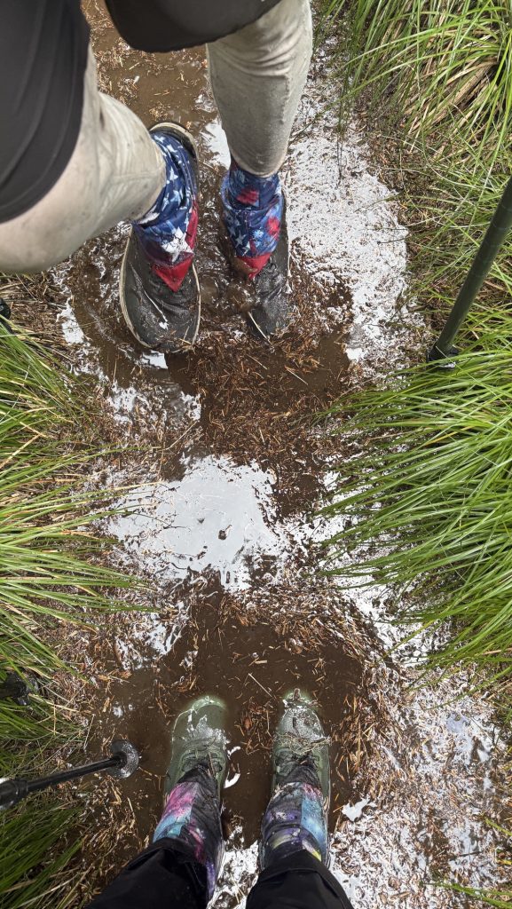
It was hard today and we both felt sluggish. Time and miles weren’t passing. We talked a lot and eventually it started raining really hard and we got totally wet. But it was so much fun!! We jumped in the puddles and walked right through them, with water up to our ankles as the trail turned into a river. A kid again at last! We became a trail maintenance crew and wherever pine needles and other debris clogged up the flow of water we’d use both of our poles, dug them into the ground forcefully and destroyed the dams to build little canals for the water to flow off trail.
We did this as many times as necessary; until the water gained momentum and carried the remaining debris off trail. Sometimes raging rivers would form as the huge and deep puddles on trail were finally liberated to flow off trail down the hill. This activity slowed us down immensely but we didn’t care, it took a few hours, we were having the best time. Iceman was in front of me and kept looking back, shaking his head and laughing but eventually he joined in and we broke down dams together.
We got to Elk lake Resort around 5pm and everything hurt. We haven’t had a zero since Ashland- 10 days or so? We’re looking forward to reaching Bend in 1.5 days – 29 miles.
We had a good pizza there and some drinks and got back on trail – 1.8 miles back to the PCT.
We found camp just when the sun was setting at 7.57pm. Right next to the trail. But for free (not 20$/person like at Elk Lake Resort) and not 1.8 miles from trail but on trail! Yay!
21:15pm – exhausted but happy
Miles hiked: 22.25 miles
Steps: 46.523
Ascent: 2063 ft
Descent: 2683 ft
Day 109: Minnie Scott Spring 1977.7 (22.4 miles)
Left at 9.15am – took it slow. We hiked through beautiful forests and met “Grey Salamandar” – a section hiker – a few times who shared his snacks with us.
We had late lunch at 13.30 and after that hiked along the Three Sisters the rest of the day. It was rough on the feet – lots of volcanic rocks but really beautiful. We hiked into the evening and had the most amazing sunset.
Miles hiked: 22.4
Steps: 47.496
Ascent: 4014 ft
Descent: 2786 ft
Day 110: 1985.3 Bend! (7.5 miles)
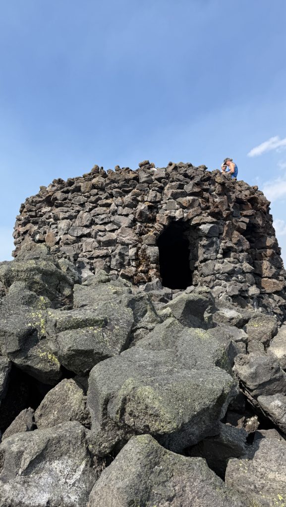
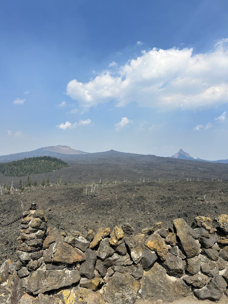
Got up at 6am, left at 7am. It was really smoky. We hiked 7.5 miles through beautiful volcanic rocks and got to McKenzie Pass/Dee Wright Observatory at 11.00am.
A nice lady called Katie gave us a ride to Sisters and en route offered to bring us all the way to Bend.
We got to the hotel at 1pm. Iceman’s parents had booked a really nice hotel for us so we were in for a treat: right in downtown with a hot tub and pool
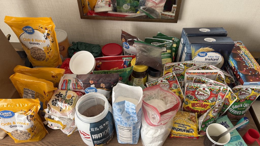
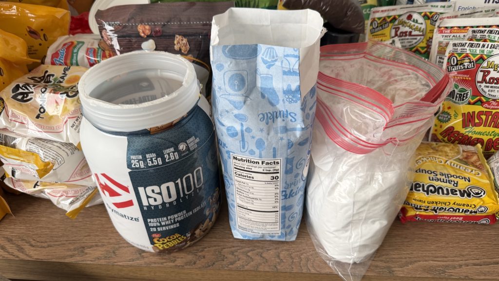
We took a shower and went to the post office and wallmart, to resupply for Washington, we bought 4 weeks of food so filled both our empty backpacks with food.
Day 111: Zero in Bend!
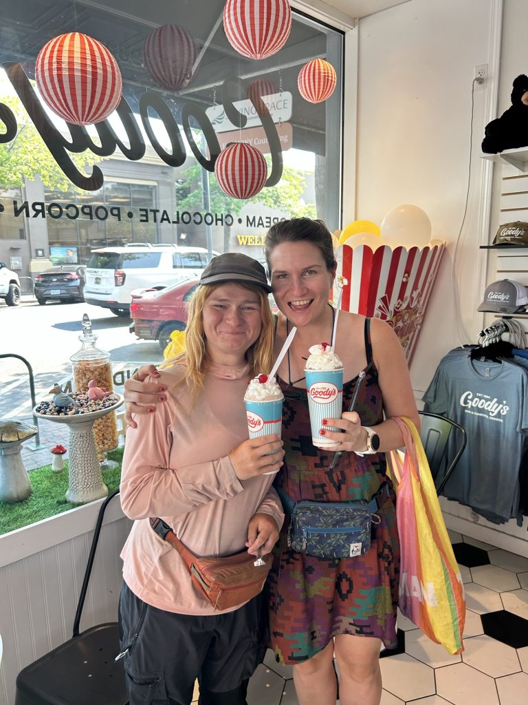
We sent our packages and then met Kate for lunch! it was so good catching up with her. We hadn’t seen her since Kennedy Meadows South as well, over 1200 miles ago but we kept in touch and almost saw each other almost, like in Ashland when she hitched a ride to the hotel with the lady that dropped us of at trail 5 min before.
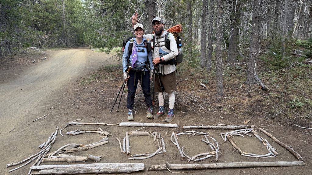
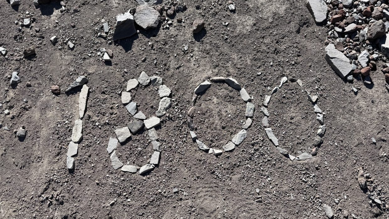
Day 112: 2012.5 27 Miles out of Bend & 2000 miles marker (longest day yet)
We got up at 7am, packed and had breakfast at the hotel. We arranged a ride to McKenzie pass with trail angels Angelique and Adrian at 10.15 from Thump coffee downtown Bend. Kate met us there. We dropped her at Sisters where she planned to hitch a ride to Santiam pass, 17 miles up trail.
We got to the trailhead around 11.00 and there was trail Magic by Tracy and Caroline. We had a soda and a quick chat and hiked off, 11.30ish.
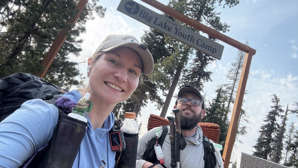
We hiked through burn areas and beautiful scenery and felt strong. Our goal was to hike 30 miles but with such a late start that meant hiking until 11.00pm. We had a warm lunch at the Big Lake Youth Camp, which has a great PCT building with an electric cattle, and I made 4 tortillas with cheese and pepperoni for dinner.
Shortly after leaving BLYC, we passed the 2000 mile marker. Wohoooo

We hiked till it was dark and some more. We ate the tortillas while hiking around 9.00pm and stopped hiking at a lake around 10.30pm at mile 2012.5.
Stats
Miles hiked: 27.01
Steps: 57.945 phew
Ascent: 3812 ft (lots of elevation for such a long day)
Descent: 3667 ft
Day 113: Mile 2031.7 (19.38)
We left at 8.15am and hiked through beautiful sceneries.
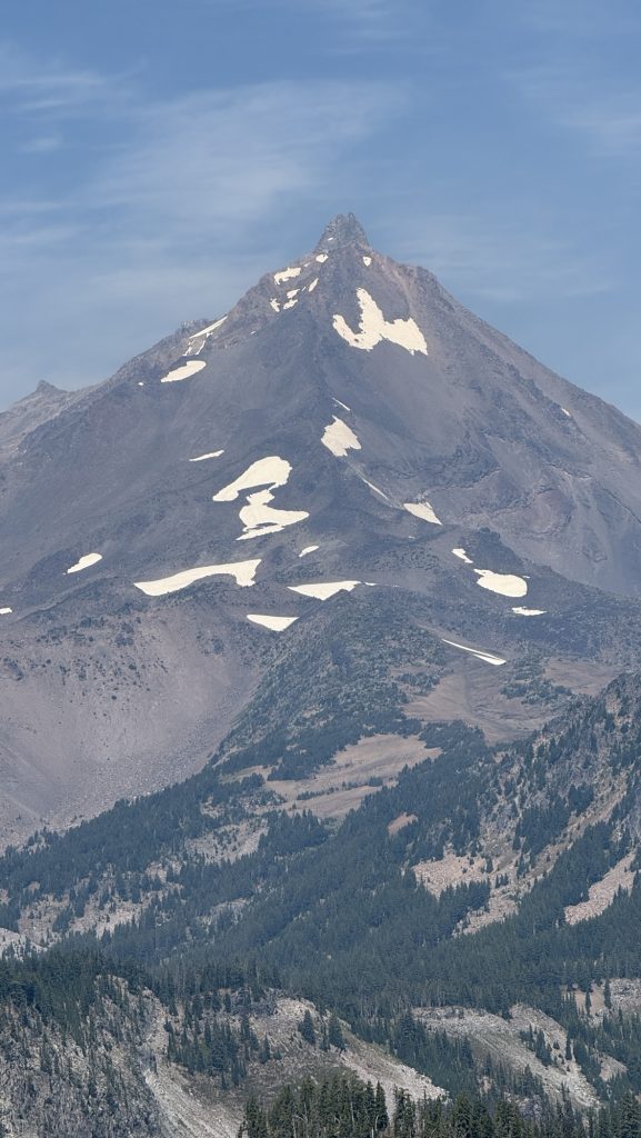
Got to Shae Lake at 14.45 with Great views of Mt Jefferson. It’s a beautiful pointy mountain, listening to Player of Games, a sci fi book.
We got to camp at 6.30pm, a bit early, as all campsites the next 10 miles are in dead fall zones, so we decided to camp here. Because we were also tired from the previous 27-mile day.
Stats
Miles hiked: 19.38
Steps: 40.333
Ascent: 2785 ft
Descent: 3369 ft
Day 114: 2061.4 First 30 mile day (29.81)
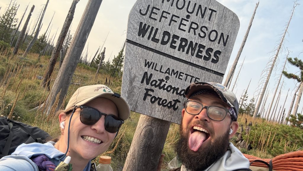
We hiked through Mt Jefferson Wilderness area which is really beautiful – I love it. Since it was a long weekend, there were many day hikers and even hunters here
Camped on top of hill, got there when it was dark.
Miles hiked: 29.81
Steps: 60.864
Ascent: 4468 ft
Descent: 4363 ft
Day 115: 2089.7 Frog Lake (29.65 miles)
Left at 6.42am. We hiked 15 miles before 1pm. Good to get half the days miles out of the way before lunch.
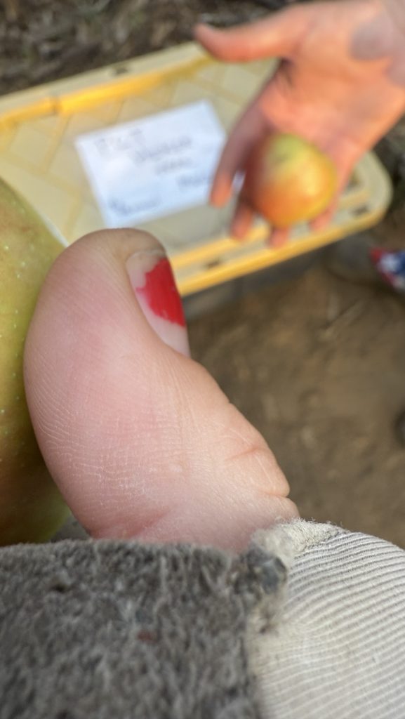
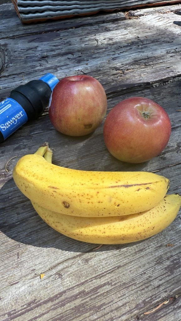
A lovely lady at the horse camp gave us 2 apples and three bananas – fresh fruit on trail is always a highlight since we’re eating only dehydrated or processed foods.
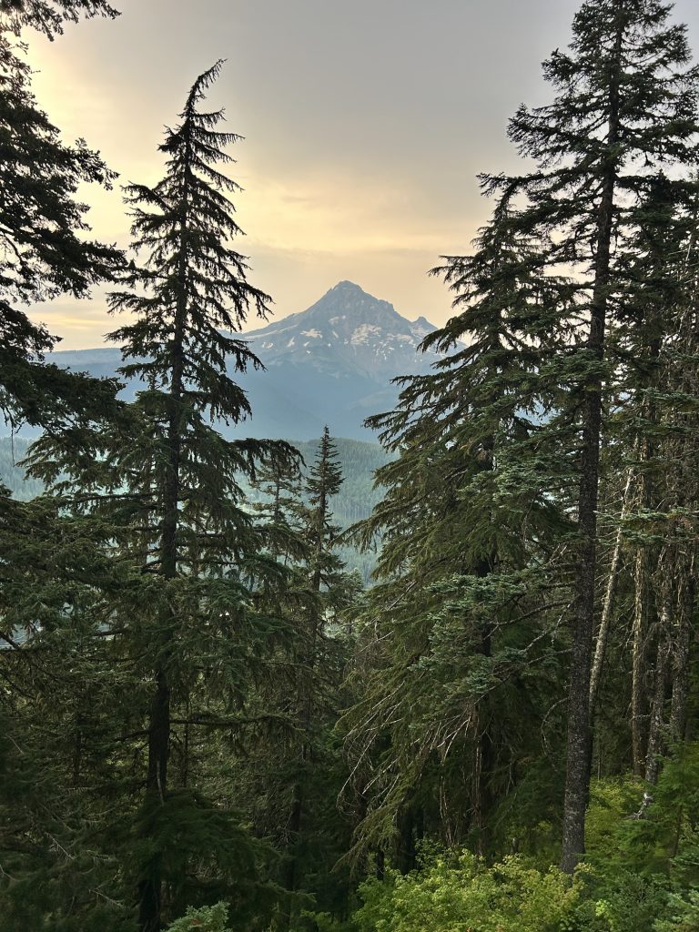
Second day doing 30 miles. Saw Mount Hood for the first time. Beautiful! Since we needed water, we had to camp at a campground. We got there in the dark. Price is 26$ per site. Wowsy! Some section hikers offered us to stay at their site for free which was really nice but we prefer to camp away from other hikers to get a good night of sleep. We didn’t pay.
Had dinner with “Meat Brick”, a nice guy from Olympia, WA we’ve been running into the last few days.
My feet really hurt today.
Excited for the iconic Timberline Lodge tomorrow.
29.65 Miles hiked
61.375 steps
Ascent 2845 ft
Day 116: 2117.3 Lolo pass (29 miles)
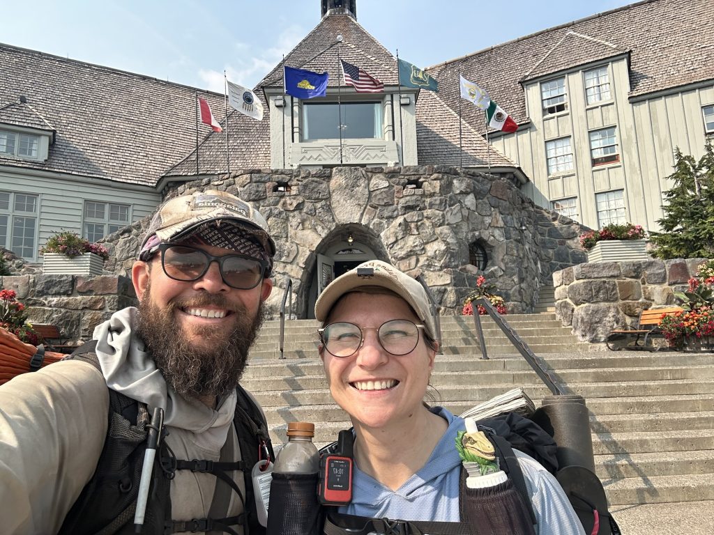
Left at 6.30am today. Got to Timberline Lodge at 10.45, just to learn the famous Buffett is closed from 11-12. We waited an hour to get the lunch buffet and it was well worth the wait.


Got to camp at 21.00, very tired. It was dark.
Did 28.97 miles
65242 steps
Ascent 5673 ft
Descent 6138 ft
Loooong steeeeeeep day. not sure how long I can keep this mileage up! But we have to get to Canada!! Ahh!!
Day 117: Tunnel Falls / Cascade Locks / End of Oregon 2150 (27.3 miles)
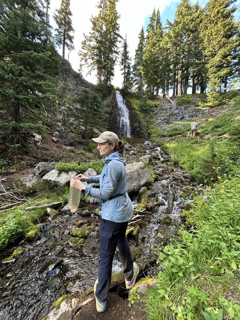
Alarm at 5, woke up very tired, didn’t sleep well. Since we dry camped, we packed up and left at 6.30am without breakfast. Hiked 0.4 miles to the next water, filtered 4l and had breakfast there.
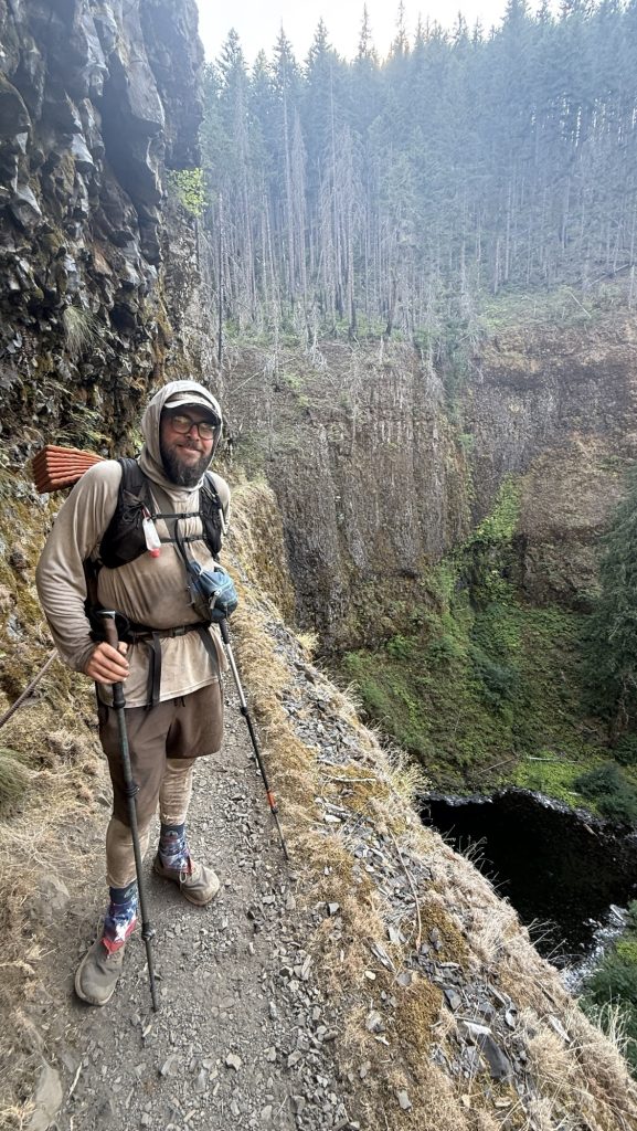
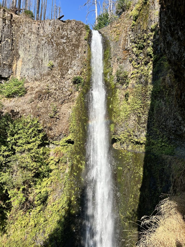
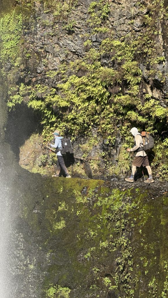
Took Eagle Creek alternate route to see Tunnel Falls. It was extremely steep at the top but it was worth it – we hiked behind a waterfall. Next to the trail a steep cliff – if you slip and fall it would surely be the end.
Made it to Cascade Locks around 6.30 and went straight to Whiskey Flats Tavern pub to get dinner, even though we usually like to shower and change first due to how filthy we are after 6h on trail. Kate had made it to Cascade Earlier that day and met us for dinner. Yay!!
Miles hiked: 26.44
Steps: 55001
Ascent: 2420 ft
Descent: 5716 ft (yup, we felt this)
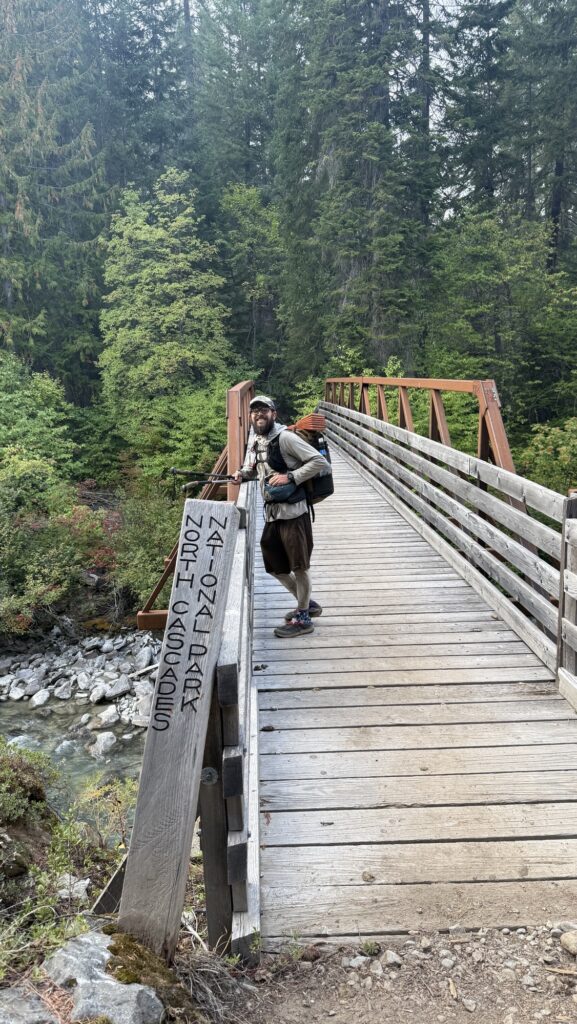
Cascade Locks is the lowest point on the PCT with 120 ft of elevation. This also means we gotta climb back up after crossing the infamous Bridge of the Gods and crossing into Washington state.
Day 118: Zero in Cascade Locks
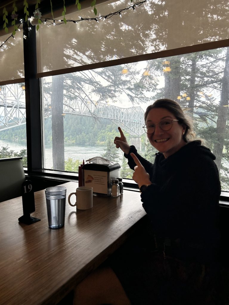
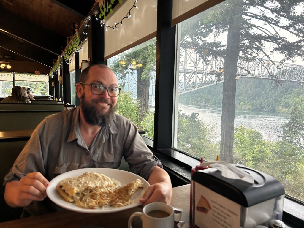
We slept in, which is 7am nowadays and met Kate for breakfast at the wonderful Bridgeside cafe, overlooking the iconic Bridge of the Gods, the border to Washington State. We were planning to hike it today but decided to take a zero as we felt so beat. Our bodies needed a rest after 5 dates of 30 miles a day.
After breakfast, we went to the room to relax and fix some gear. We got a burger and milk shake for lunch across the street at Eastwind Drive in
Thanks for stopping by and happy trails,
Disco
- Days 138 – 142: Canada!! (2575.1 – 2655.5 + 30)
- Days 135 – 137: PCT Miles 2500.73 – 2575.1
- Days 130 – 134: Snoqualmie to mile 2501.3 (2396.3 – 2501.3)
- Days 119 – 129: Miles 2150.3 – 2396.3 / Cascade Locks to Snoqualmie Pass
- Days 105 – 118: 1912 – 2150 / End of Oregon

Day 102: Crater Lake 1824.6 then Rim Trail
Woke up at 5.38am and started hiking at 7.15am.
Slept on my mattress all the way inflated and it was comfortable!! Maybe that’s why my back has been hurting? Cause I’ve been only inflating it half way?!
Heard elk roars all night which was cool but we didn’t see any.
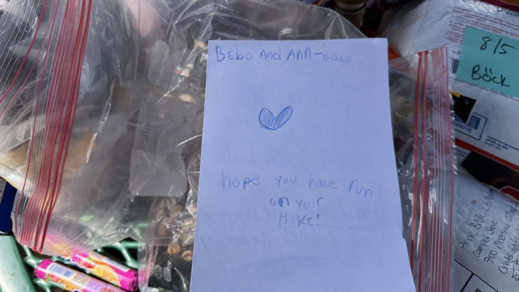
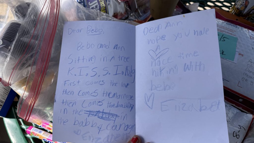
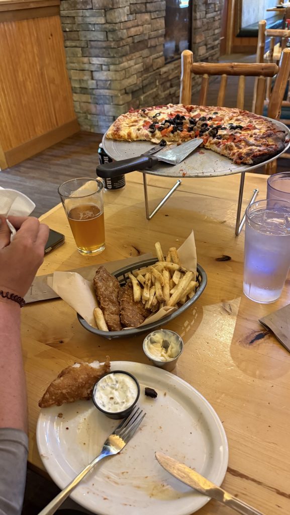
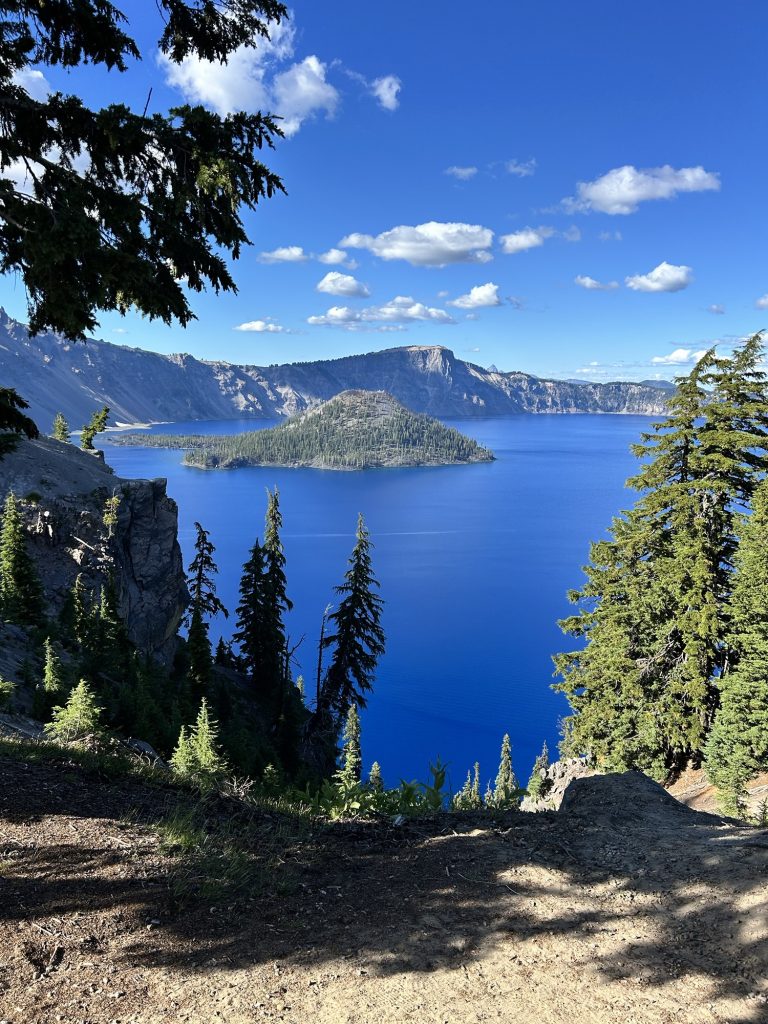
We hitched into mazama village and got 3 boxes, one huge one from Iceman’s sister, Christina, and two I sent. Christina‘s box had so much good food in it! And the best part were drawings and letters Iceman’s nieces draw and wrote. 🥰 We unpacked it and packed it in our packs which got very heavy and then went inside Annie Creek Restaurant to eat a pizza and fish and chips. They brought chicken strips instead so we informed them about their mistake and then they brought fish and chips too so – we had lots of food and packed out 3 big slices of pizza. Hitched back to the PCT and now stoked to see Crater Lake in 1.5 miles!!
Steps: 42.869
Miles: 18.05
Ascent: 3211 ft
Descent: 2522 ft
Thanks for reading and happy trails,
Disco
Day 101: Mile 1812.4 (21.66 miles)
Woke up at 6am and since I fell asleep at 8.30pm the night before, I felt well rested. Not really loving my air mattress. We had breakfast and two coffees in the tent and enjoyed the beautiful Deer Lake with the lake mist, and left at 8am.
It’s been a beautiful morning with nice views. I had service on top of a hill to call my mom. Good news from home, so I feel good. But generally just feel strong today, because we had 1.5 dinners last night. I think I haven’t been eating enough calories so we gotta change that.
Now at water and drying the tent, it’s been wet from condensation.
Also talked to Lisa, Theo, my brother and Tati. Feels good!
It’s sunny again and my solar panel is charging my watch and power bank. The watch charges so fast on the solar panel it’s crazy.
We hiked all day till around 7pm and then found a lovely campsite and had a nice sunset.


Thanks for reading and happy trails!
Disco
Day 100: Deer Lake mile 1791.9 (18 miles)
We didn’t start till 10am this morning.
We mostly hiked through forest and had some nice views of a lake, nothing too crazy.
There were some long water carries which is always annoying because it makes the pack heavy.
We stopped after 18 miles because we both felt super tired and my feet hurt and Iceman’s back hurt.
We took a little side trail at Sky Lakes Trail Junction .5 miles to a beautiful little lake, Deer Lake, in Sky Lakes Wilderness. We’re the only people here. We found a perfectly flat camp spot by the lake and had 1.5 portions of our beloved rice-bean-bone broth dinner because we’ve been hungry. Sadly, we had no unhealthy calorie dense dessert. The only thing you hear are bees and some wood packers and occasionally skeeters.
The scenery has changed alot since entering Oregon: it’s always green! It’s beautiful. We mostly hike through the forest now and get occasional views of blue lakes and volcanos.
We’re now 30.5 miles from Mazama village at Crater Lake, a beautiful extremely blue lake that is inside a former volcano. I’ve been there exactly 20 years ago with my mom and brother and am excited to go back there. If we feel good, we’ll push our first 30+ mile day, for a pizza and a beer, if not, we’ll get there in the morning the next day.
Today we talked all day which was super nice. My feet and neck hurts, my right knee feels stiff and swollen but doesn’t really hurt.
Day 99: Fish Lake Resort 1774.9 (23 miles)
Longest day yet?
Left at 7.30am.
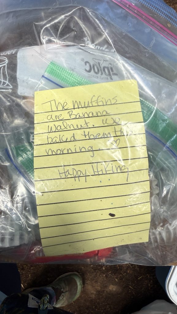
Was still wet, mostly in clouds and forest, had lunch at brown cabin and dried our things, met lovely couple from France hiking South Bound and exchanged best places to eat and stay up and down the trail, hiked around vulcano and then got really lucky with trail magic: someone just dropped off an ice chest filled with fruit and homemade muffins and soda and we just sat down right next to it with another hiker – it was wonderful! Fruit tastes so good after hiking for days and not having fresh produce!
At night, we got a hitch from trail to resort from Idaho couple and had shower and meal at Fish Lake Resort. Also took shower and camped there.
Day 98: Mile 1752.7 (22 Miles)
We were going to get up at 6am to hike 25 miles but we were both tired and slept till 7am. Plus it was raining for the first time in a long time so we didn’t want to leave the tent. We were in a cloud and the tent was wet, although the big beautiful tree we were under protected us a bit from the rain. Our new breakfast mix was good, and plenty.
We hiked mostly through forest all day and didn’t see any views that might have been there because of the clouds.
We had lunch under a big tree that gave us a dry spot to sit overlooking a field and it was very nice.
We did a little over 22 miles and the last 4 were though, my feet hurt and I was tired. But we kept going.
We should be averaging 25 miles. To make it to Canada in time but today we couldn’t. More miles another day.


Thanks for reading and happy trails!
Disco
I’m back on trail, or am I? Days 83 – 97 (Miles 1505.2 – 1731.6)
I’ve been back on trail for almost a month now. For a while, I didn’t know how to write my blog anymore. All my routines were gone, including my journaling / blogging at the end of each day. It felt like starting the thru-hike (definition to follow shortly) all over again: all my routines were gone, hiking was hard as my trail legs were gone, and in addition there was a lot of uncertainty about things at home in Germany.
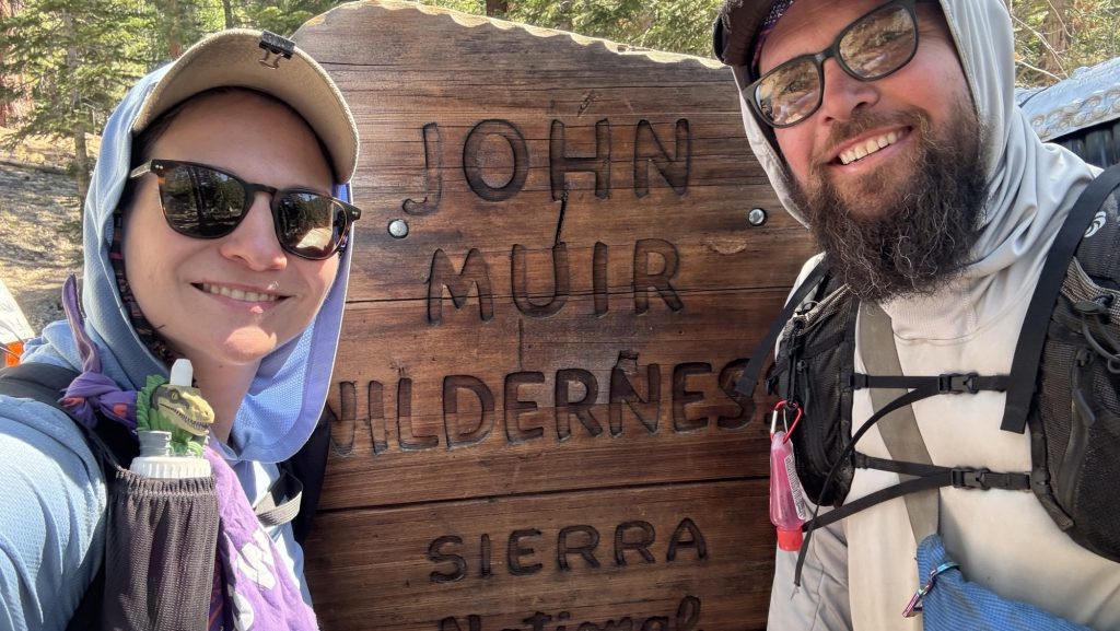
I met Iceman where he was, as he kept hiking while I was in Germany, so I got back on to the PCT at mile 1505.2 near Bobs Hat Trail Junction. I got off at mile 943.7 in Yosemite National Park / Tuolumne Meadows. This means I skipped 561.5 miles. What? This doesn’t fit with my goal to thru-hike the PCT let alone my purist mindset to hike every mile of it and not skip parts like most hikers do these days (no judgement, hike your own hike, just not my thing).
Deciding to thru-hike 2655 miles is a big decision and I knew that many things could potentially get in my way of reaching that goal and get me off trail. I mentally prepared by answering questions of why I am doing it, in which cases I would get off and what I wanted to learn. In my mind there were ever only two reasons to abandon the PCT: a) if I get injured and can’t physically hike anymore or if b) a family emergency demands it. I thought, if at all, case a) was more likely so I prepared for that: I got another life insurance, international health insurance, got a Garmin SOS PLB (Personal Location Beacon) and my Deutsche Alpenverein Membership also includes world wide mountain Search & Rescue.
Never in the world did I expect case b) to happen as it had never happened to my family before and so I wasn’t prepared for it at all. Reality slapped me in the face with a chair. I suppose most people who get off the trail for a month don’t return the same year. How do you return? What is a thru-hike if it isn’t “thru” anymore – meaning after skipping over 500 miles?
The definition of a thru-hike from google is:
“A thru-hike is the act of hiking a long-distance trail from end to end, typically within a single hiking season. It’s characterized by continuous travel on the trail, often involving weeks or months of hiking. While popular long trails like the Appalachian Trail and Pacific Crest Trail are common examples, any trail can be thru-hiked if completed from one terminus to the other in a continuous journey.”
I knew what to do to make sure I don’t injure myself for e.g. overuse injury by starting slowly, stretching several times a day etc and I was mentally prepared for the hard and bad days, I knew how to get over those days and made sure I could keep hiking. What I didn’t know was how to get back on trail after 27 days off trail.
To add insult to injury, I was sick from the flight back to Reno, so the first two weeks of hiking were horrible and my memory is blurry. it was a drag. But I knew it would be hard so I kept hiking and kept pushing. Iceman was there to lighten my load (literally).
Now, after almost a month, I have recovered physically and mentally and got back into a routine of hiking 25 miles a day and got to terms with “only” hiking 2100 miles this calendar year. I am actually in my prime physically now and think soon I can hike 30 miles daily.
Iceman will accompany me in making up the 561 miles I had to skip July 2026.
So now that that’s done, my mind is focused on the goal again. Making it to Canada before September 25th and the first snow in the cascades. Can we make it? It is a time crunch. But not impossible.
Here are some pictures from my first 2 weeks back:

Ashland was our first trail town in Oregon and our favorite trail town on the entire PCT yet: the vibe is amazing and everything is in walking distance, the people are so nice and the town is just so cute.
Off to hike through the rest of Oregon!
Thanks for your patience and thanks for tagging along.
Happy trails,
Disco
- Days 138 – 142: Canada!! (2575.1 – 2655.5 + 30)
- Days 135 – 137: PCT Miles 2500.73 – 2575.1
- Days 130 – 134: Snoqualmie to mile 2501.3 (2396.3 – 2501.3)
- Days 119 – 129: Miles 2150.3 – 2396.3 / Cascade Locks to Snoqualmie Pass
- Days 105 – 118: 1912 – 2150 / End of Oregon
Did you know? You can subscribe to get an email notification with each new post! Try it now!

Day 71 – 81: Sierra Nevada & Yosemite National Park
Welcome again 🙂 This is a longer post, covering multiple days.
Day 71: 823.5 Palisade River to 834.5 Kings River
Didn’t get up till 9AM, had a beautiful campsite so had a slow morning – now that we have two days of extra food, we can slow down and enjoy this beautiful piece of earth fully. Body battery and sleep score (Garmin watch) still bad, feeling weak.
Ran into “Vacuum” (he inhales food despite being a skinny small guy) – we had met him before at the Kearsarge Pass Trailhead, going into Bishop! He’s fast!
We hiked down 4 miles along Palisade River which was gorgeous, endless streams and waterfalls.
Then, we took a break and swam in a beautiful stream and had lunch and dried off in the sun.
Got to camp around 7pm, 5.3 miles below Muir Pass. It’ll be uphill all the way so we did a large part of the climb today. Now at kings river all by ourselves with a fire and many mosquitos.
Left knee hurt a bit but not too bad. Still got a bit of a cold. Glorious views of dramatic raw mountains all around.
Steps: 26.416
Miles: 13
At 9397 feet
Ascent: 1626 feet
Acclimated to 8858 feet
Day 72: 834.5 to 847.7 McGee Canyon /Evolution Creek
Ran out of battery – so I could not write a lot in my diary today. Iceman took many pictures with his phone which I may kindly use here.
Highlights:
Tough but very beautiful 14 mile day.
We climbed Muir pass & enjoyed Muir hut and came across many lakes afterwards.
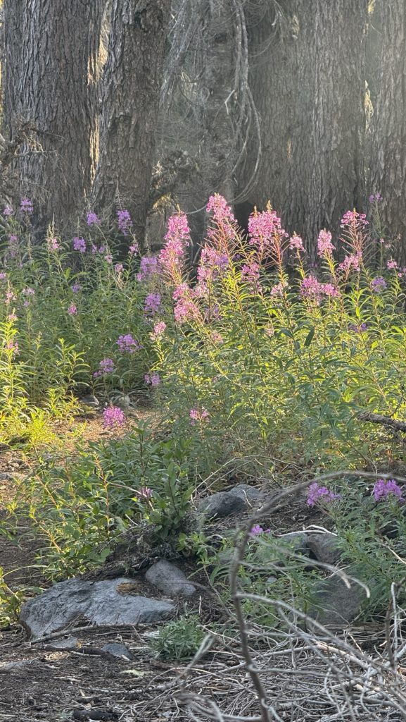
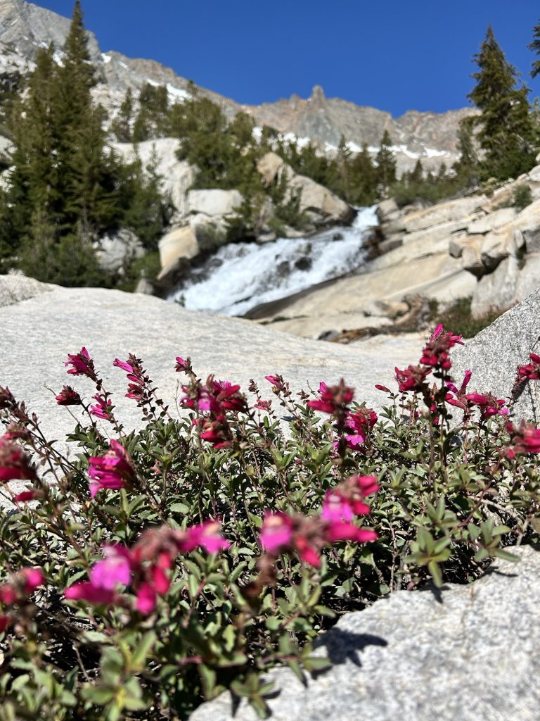
Got a gorgeous campsite by the river at Evolution Creek, on a little peninsula, with lots of pink flowers by the shore.

Stats:
Distance: 13.88 miles
Steps: 23.900
Ascent: 925m
Descent: 796m
Day 73: Miles 847.7 to 869.4
Woke up at 6am, left at 8am.
We hiked down through a forest most of the morning until we got to Evolution creek crossing, the biggest crossing on the PCT so far.
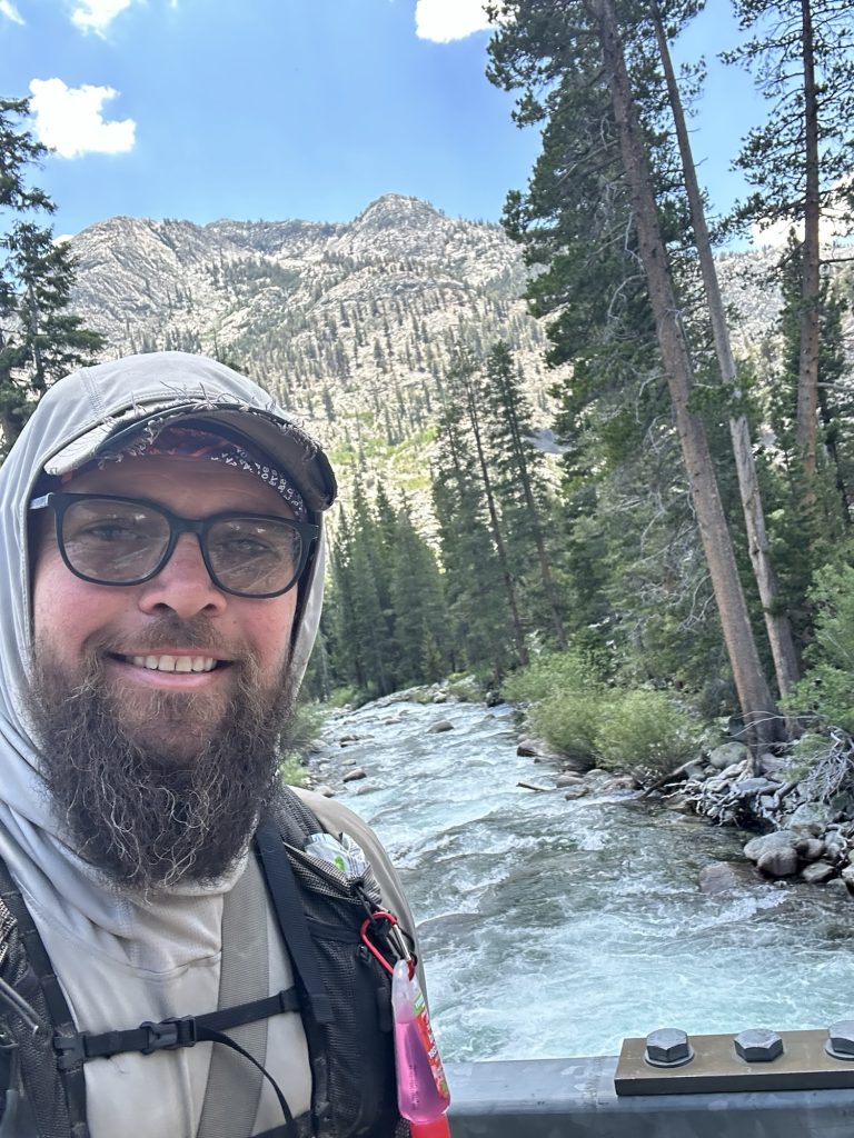
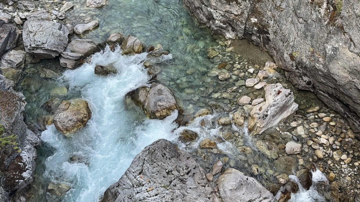
Then we entered a canyon with incredible views of rapids – turquoise water, red rocks, beautiful.
Lunch on the river, Ice saved his last 10% of battery for me so I can write my diary and take videos and pictures. So nice!
We want to make the 9.45am ferry to VVR (Vermillion Valley Resort) tomorrow to have a Nero there to chill. So we hiked 21.7 miles and my feet and hips hurt. It was another “one step in front of the other”-day.
🤩Alarm tomorrow at 4am.
Stats:
Distance: 21.7 miles – longest day in a month
Steps: my Garmin watch died so I don’t know exactly, on 20 mile days I have more than 46.000 steps
Ascent: 3717.8 feet
Descent: 3533.8 feet
Day 74: to Vermillion Valley Resort mile 879.9
We got up at 4AM and it was cold – one of the biggest river crossings – Big Bear Creek – was coming up after 1 mile and it was still dark and I was sleepy, but it wasn’t too bad but a bit scary.
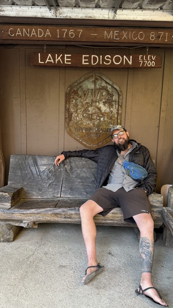
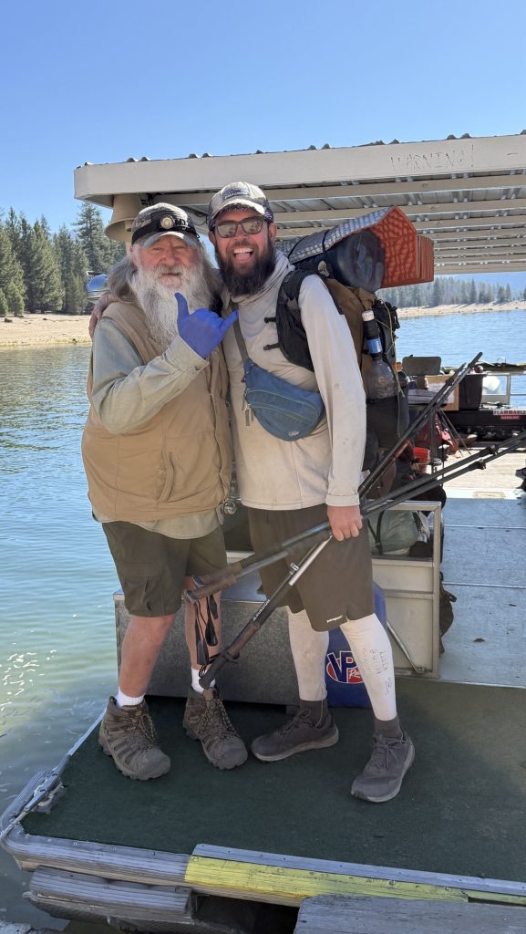
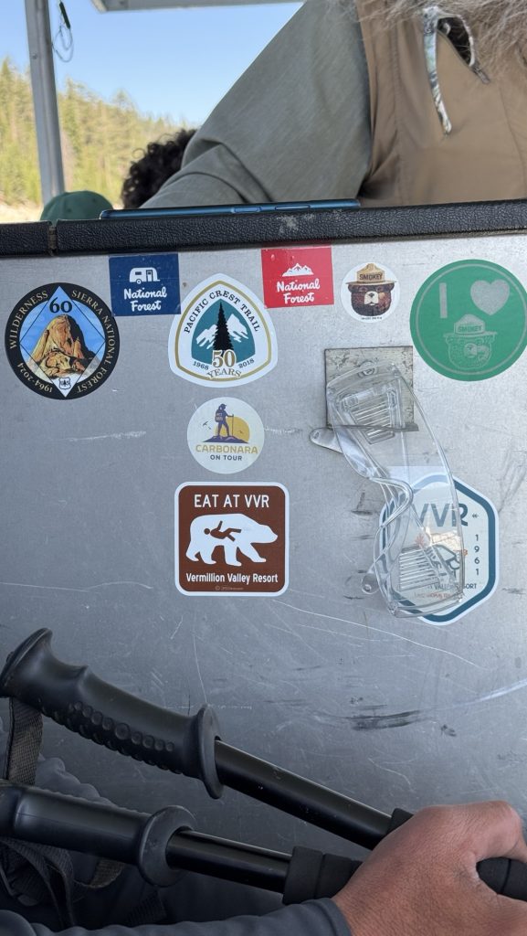
We hiked 12 miles – to get to the VVR ferry – through beautiful forests. VVR is one of the iconic stops on the PCT – you take a ferry across a gorgeous lake, they have some cabins, wash house, cafe, porch, charging. Camping, bit of resupply, very hiker friendly.
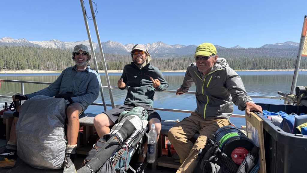
The resort is way off the beaten track and we met nice people on the way there and relaxed all day and had some beers and really good food. Taking a shower and doing laundry was great. Meeting my friend Jonathan again and hanging out with him, Smooth, Goldfish, Slider, Ice and later Gummy Bear and Possum was so fun!
Stats:
Distance: 15.9 miles
Steps: 26.688
Ascent: 1490m
Day 75: VVR to mile 893 Virginia Lake
We got up at 7am, had breakfast – burrito – really good – paid 220$ 😳per person for drinks and food, shower, laundry and ferry ($20 each way) and took the 9.00am ferry back to trail.
“Paint” the boat captain gave us whiskey because Ice met him last year on AZT. Paint gave him a ride and said he would do the PCT this year and visit Paint. Paint remembered. 🙂
On the ferry, we met a lovely couple from Belsen, close to the PCT – Portia and Dean – who were at VVR for a fishing vacation. We exchanged numbers and I shared this blog. Greetings to you, Portia and Dean, if you’re reading this, hope to see you soon!
We hiked up an ascent and later another one to Virginia Lake. Really beautiful.
Stats:
Steps: 26.688
Miles: 15.9
Ascent: 1490 m
Day 76: 16 miles into Mammoth past the 900 mile marker 🥳
Started hiking at 9AM so the sun would reach out tents and dry them and the sleeping bags. We expected to do only 13 miles but the trail to get to the trail head was marked incorrectly on FarOut (navigation app) – it doesn’t go all the way to Horseshoe Lake so in the end we had to do 16 miles and we were tired. We circumnavigated a few mountains and it was an uninspiring view most day.
Got into the parking lot at 3pm and -tada- Kitty picked us up.
Went to a bar to have burgers and to the hostel at 6.30pm.
Later got dinner with Slider at the clockwork cellar and had amazing burgers and IPAs for his birthday 🙂 🤩

Stats:
Miles: 15.9
Steps: 33.282
Ascent: 642 m
Day 77: Zero in Mammoth Lakes
A full zero – how I’ve longed for a day off – not hiking and doing nothing – well, no no! We had so many chores to do haha. But first, drop laundry at laundromat and get a good breakfast at a super cute breakfast place 😍
Then we went to several gear shops, trying to fix my backpack and our poles, which were missing tips, grocery shopping, got all our packages (I ordered new Xero sandals and a solar panel here), including a very special package from Lisa, got our laundry and went back to the hostel for a healthy lunch.

Remember Lisa, the lovely lady who saved me in Tehachapi, when I had to cross a highway and got scared and asked her in a Starbucks if she could help me? We stayed in touch and she wanted to send a resupply box, so sweet! Thank you so much!
I worked on the blog later but had technical issues and it took hours to write one day and upload a few photos because of caching issues 🙁
Day 78: 12.95 miles to 914.6 Middle Fork San Joaquin River
We left Mammoth Lakes on the shuttle at 10.30AM and started hiking at 11.00AM.
Had a detour due to the destroyed bridge – made it almost 13 miles. Slow, hard and boring uninspiring day (Except a few highlights, see photos) due to the heavy packs with 5 days of food and walking on forest roads (detour).
Day 79: 914.6 to mile 932.4 Lyell Fork
It was a tough and really beautiful day. We didn’t leave camp till 9AM. It was a beautiful spot by the river so it’s nice to take time for breakfast and coffee.
We walked through the forest most morning and saw many day hikers because it was 4th of July, a national holiday. We took a wrong turn and walked in parallel to the PCT for a few miles. To get back to the PCT, we had to climb straight up for 0.8 miles.
We had lunch by a beautiful little lake, it was chilly in the shade under our tree, but my new Solar panel was charging my powerbank in the sun – yay it works – no more dead devices after 3 days and no way to charge let alone take pictures.
Back on the PCT, we got to Thousand Island Lakes, where the JMT and PCT split up. We walked through gorgeous alpine meadows with crystal clear water, green grass, grey boulders and prime flowers.
We took a right towards Donahue Pass, 11.200 feet, and reached the top at 6.40 PM.
I usually get tired around 4 or 5 pm but we had to keep going because I have to pick up a package at the post office in Tuolumne Meadows tomorrow before noon.
We climbed down 1000 feet on the other side of the pass and found camp next to River Lyell Fork. Set up camp, got water and filtered it, made dinner, stored all the food in the bear cans, brushed teeth, and crawled into our sleeping bags because it was freezing, below 10 c.
My feet hurt and I’m exhausted. We will get up at 5.30 AM tomorrow to get to the post office in time😴
Stats:
- Distance: 16.68 miles
- Ascent: 4543 feet (damn – I feel it today
- Steps: 31.496
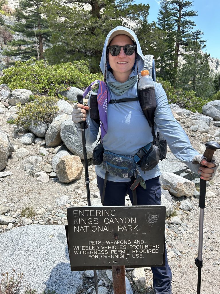
Day 80: Lembert Dome & Hwy 120 (943.7)
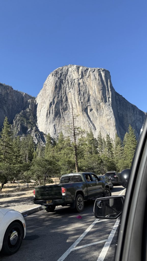
We got up at 4AM and hiked quietly through the cold dark morning. It was beautiful in Yosemite, one of my favorite NPs. I had visited 10 years ago but didn’t do any hiking but swore back then that I would come back to do just that and here I am.
Green lush grass, crystal clear rivers and uninterrupted beauty and nature all day! We had to hike fast and only took one short break to filter water and it felt too rushed. But we had to make it to the post office in time as not to wait till Monday.
We got to the cut off for the PO and saw trail magic on the parking lot! We said we would be back after getting the package.
Next to the PO was a shop and take out place and since it was lunch time, we ordered burgers and beer. We met out friend Slider again 🙂 I got my package and then we got a ride with Cinderella and his gf back to the trail magic, even though it’s less than a mile, but: no off trail miles haha
We went to meet Click & Yichin who had set up a table full of food, ribs, chicken, curry, lentil salad, ice cold drinks, fruit, veggies wow! Even though we had just eaten, we could eat again and enjoyed curry, salad, ribs and chicken.
Everything was home made and incredibly delicious! You guys rock! Thank you so much!
I had service for a second and saw a message from my brother asking to call him. Then from my mother. I got nervous and tried calling but didn’t have enough signal. We texted. I will not go into details, but it wasn’t good and I knew I had to get off trail and go back home to Germany immediately.
A normal and beautiful day, until it wasn’t.
Panic and disbelief. Where is the closest airport, how do I get there? Without a car or even internet to check ? More panic. A very attentive ranger noticed my distress; I got very lucky. This legend ranger, Anika, brought me and Iceman to the Ranger station Tuolumne Meadows and shared their Starlink password so I could communicate with my family and do research.
Her boss later kindly offered to drive us 2h to Yosemite valley – a courtesy trip. From here, we could get a bus or hitch to Merced. Then a train to San Francisco. Then a plane to Germany. In theory.
It was a long weekend and Saturday night, so most people weren’t leaving the park at 7pm on a Saturday. After 30 min, we got lucky and 5 students stopped and took us in. They had to sit on each other’s laps for 2 hours – so kind of them. They asked many questions about the motivations to get on trail, it was a great ride. But I was very sad and worried. They were going to Oakhurst though, hmm. We googled once we had service. 5 min after we would reach their hotel, a bus would leave to Fresno, we would get there at 11.30pm. Ok, we did that instead of going to Merced. So I booked a cheap motel in Fresno.
Day 81: Off trail, back to Germany via San Francisco
The train to San Francisco left at 6am the next morning … Short night, but I made the 4.40pm flight to Germany.
Iceman came with me and dropped me off at the airport, although I asked him to keep hiking. It felt good not doing this alone.
We had 2h in the city, which we spent walking around San Francisco and getting lunch.
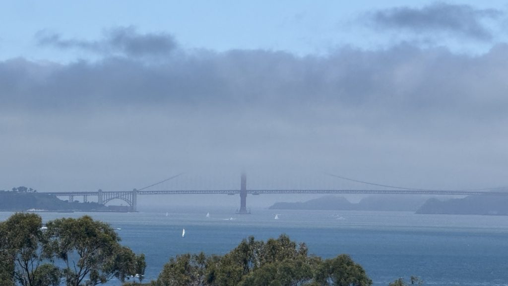
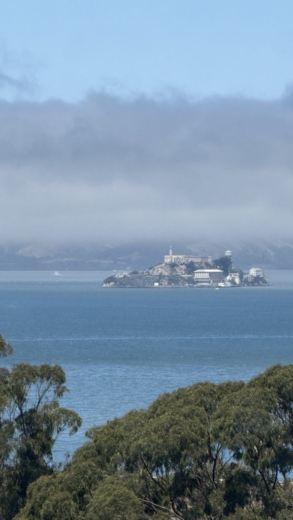
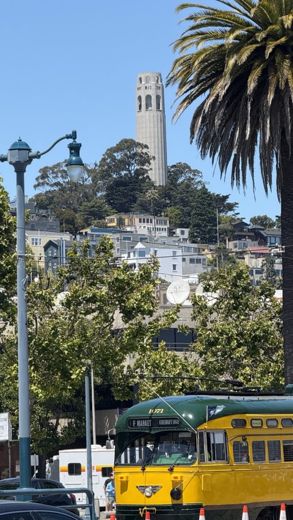
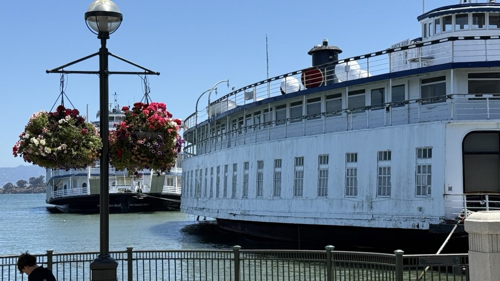
It was nice to be back after 20 years – I visited in 2005 with my mom and brother. I had clam chowder for lunch at the pier, it was nice. But it was a sad day of course. A lot of uncertainty about news from home and if and when I would be able to return to trail.
I went through security with my entire pack after Iceman kindly took my knife, poles and stakes, even though it was probably too big and too heavy. But I couldn’t care less. I just had to get home asap.
We said our sad farewell, and off we went; me on a plane to Germany, Iceman back to trail, somehow making the complicated trip back to Tuolumne Meadows in the backcountry, where we got off the PCT at mile 943.7 2 days before.
This is the last post for now.
Thanks for reading and I hope you’re all well. 🤗 Congrats you’ve made it this far! You must really like the blog 🤗 You can subscribe to get an email notification with each new post.
Disco
Curious how I got here? Check out previous posts: