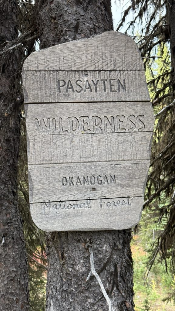
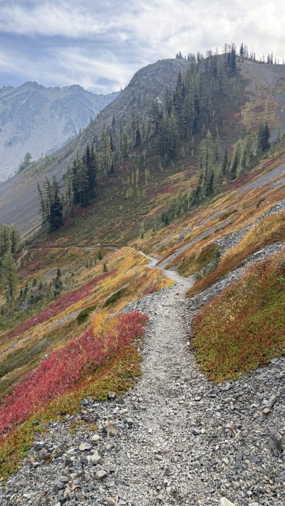
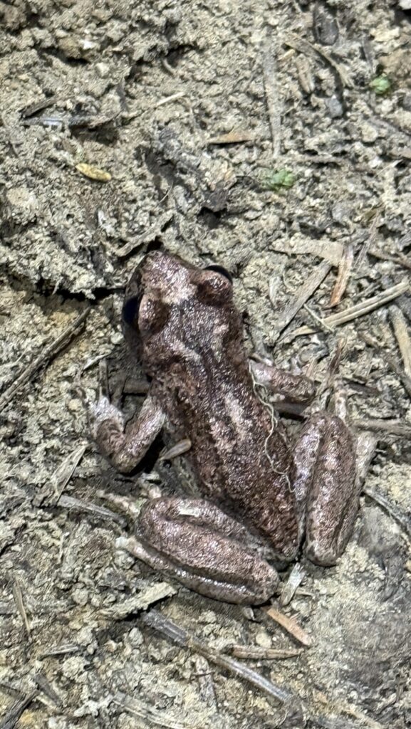
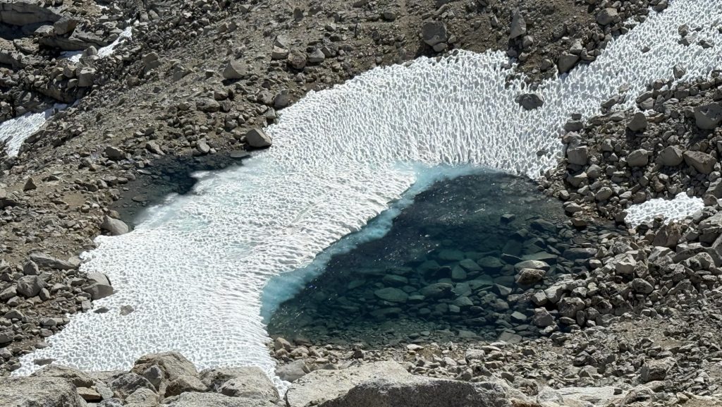
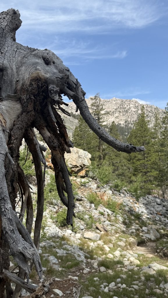
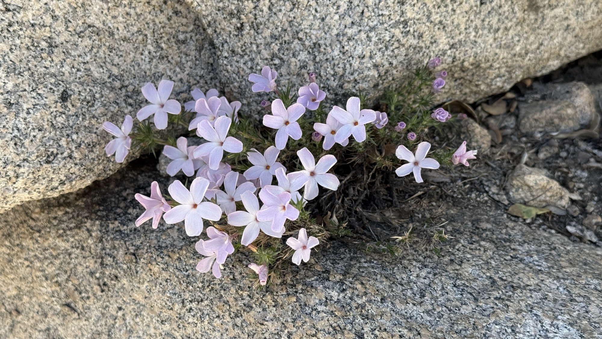
Days 138 – 142: Canada!! (2575.1 – 2655.5 + 30)
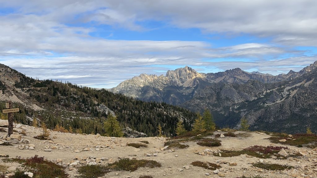
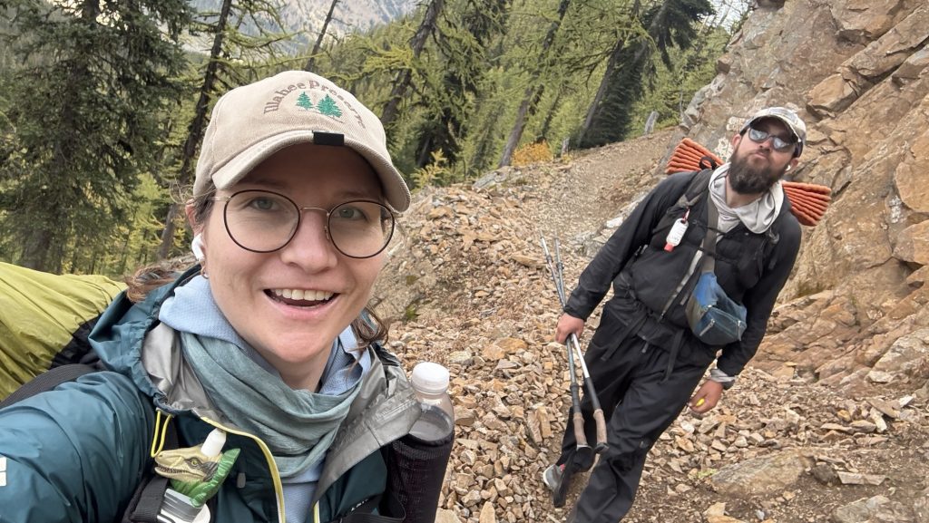
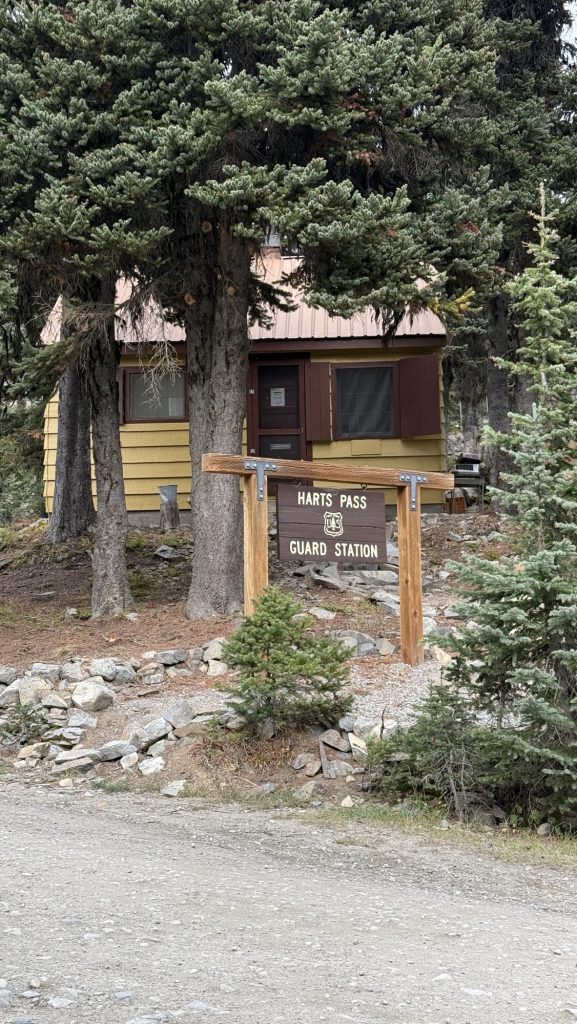
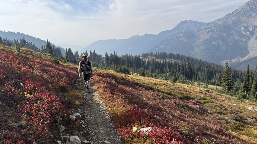
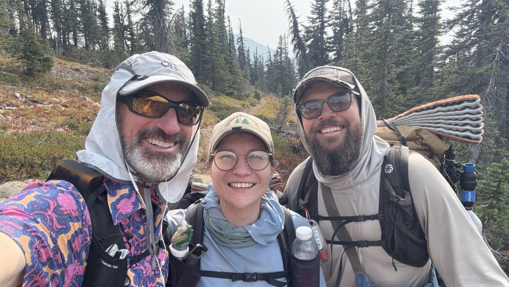
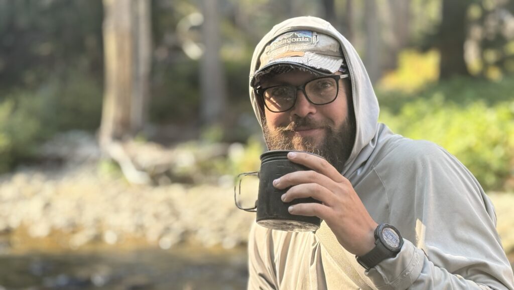
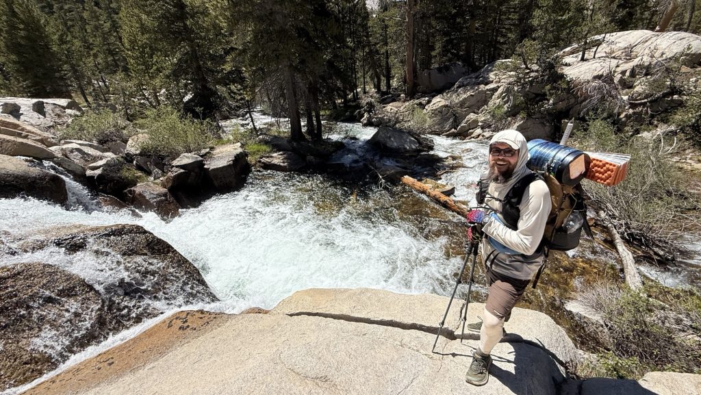
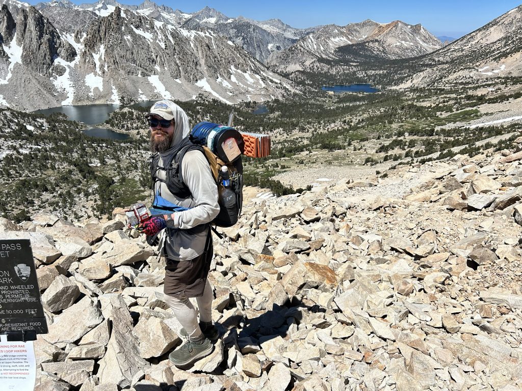
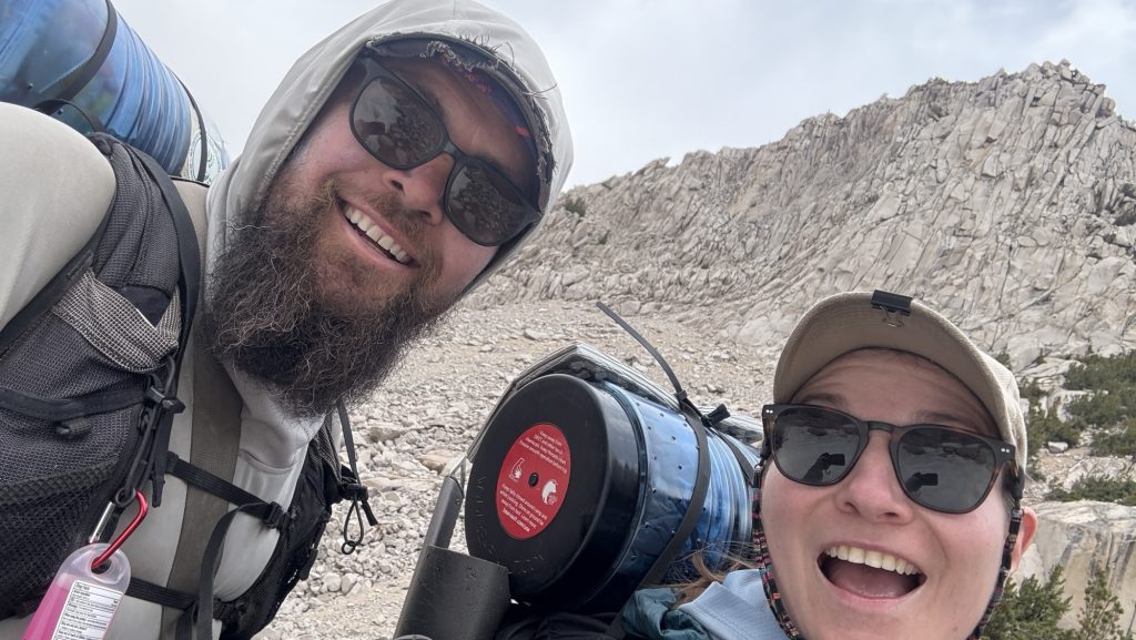
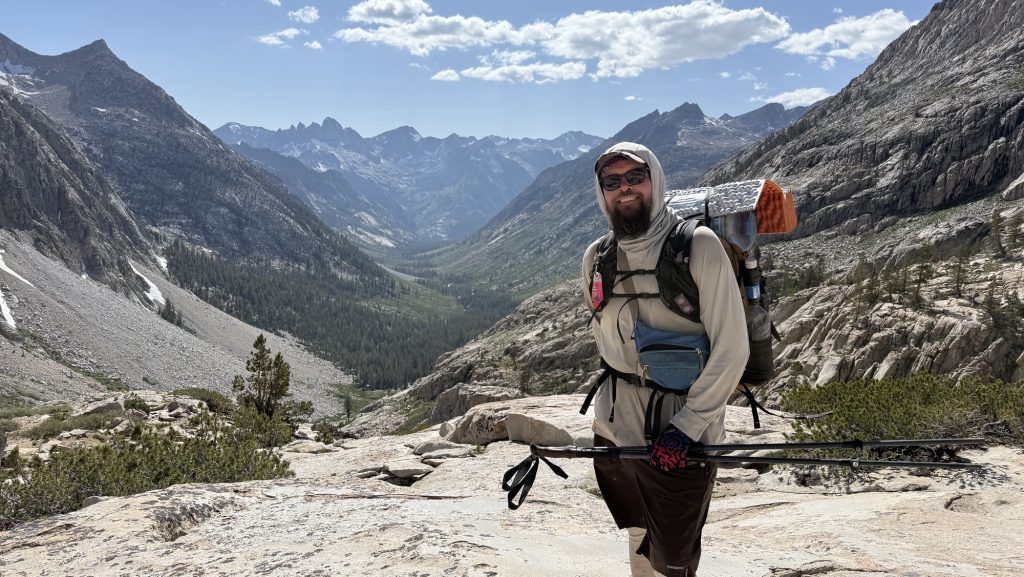
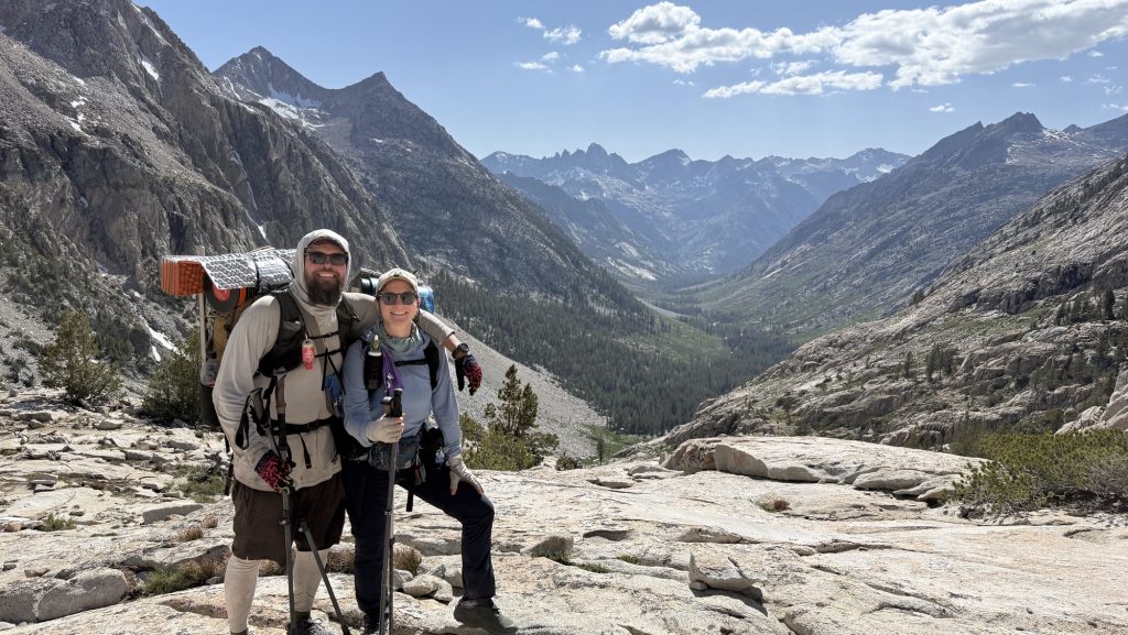
Day 138: Stehekin Valley Ranch – Last Resupply Before the Final Stretch (PCT Mile 2588.5)
I woke up at 6:00 a.m. without my alarm — nature’s way of reminding me I’m still human, I guess. Unfortunately, I also woke up with the unmistakable signs of a Urinary Tract Infection. Not surprising after months on trail, but it’s a bit alarming when you’re in one of the most remote corners of Washington. I couldn’t help but wonder — can I even find medicine out here in Stehekin?
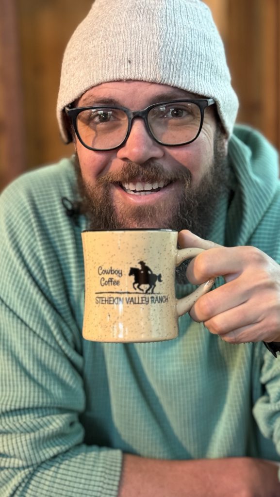
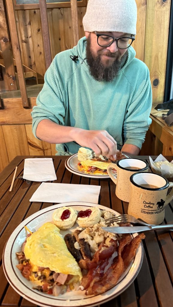
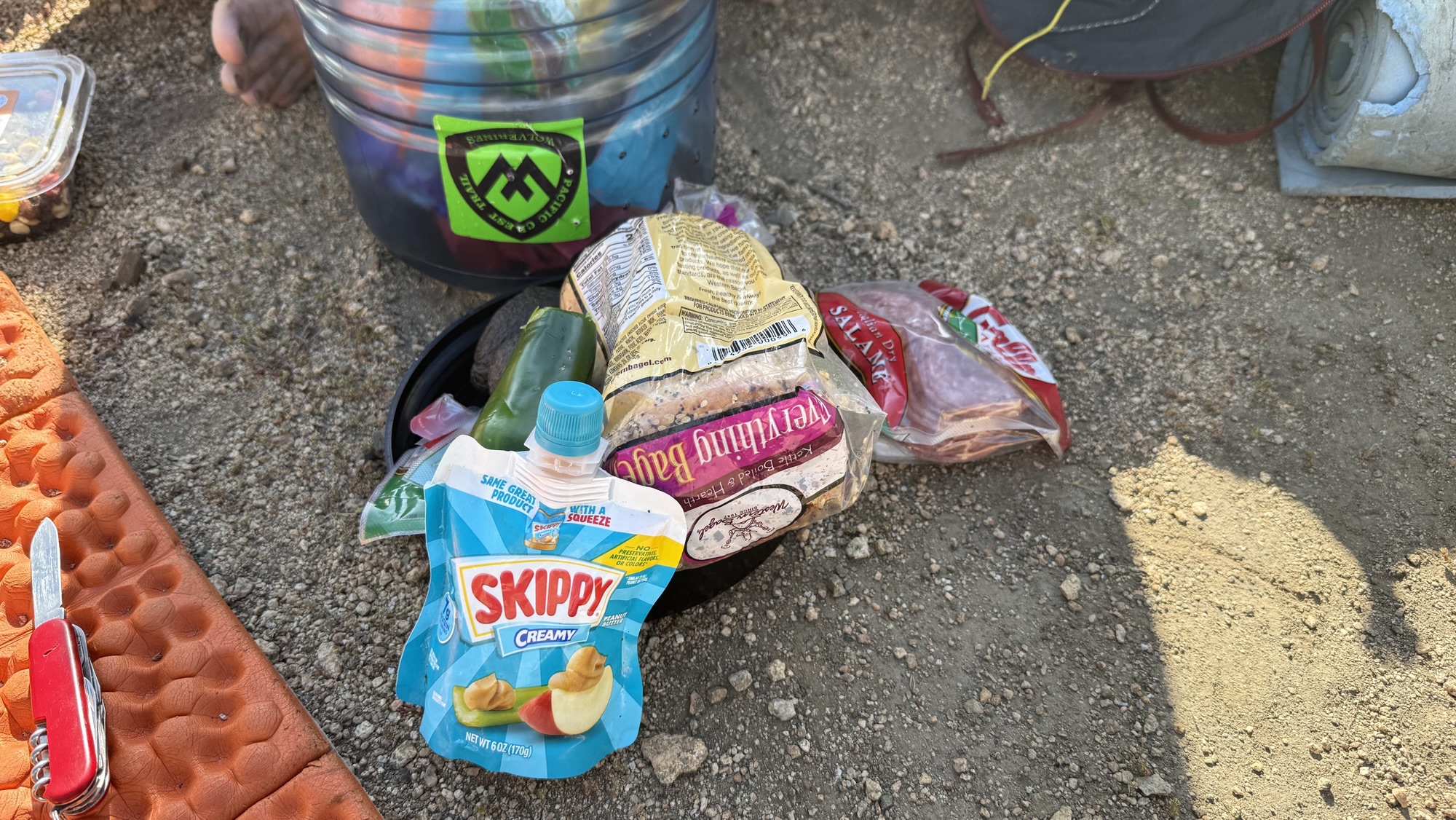
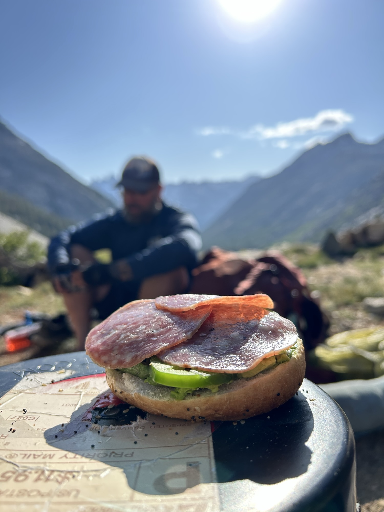
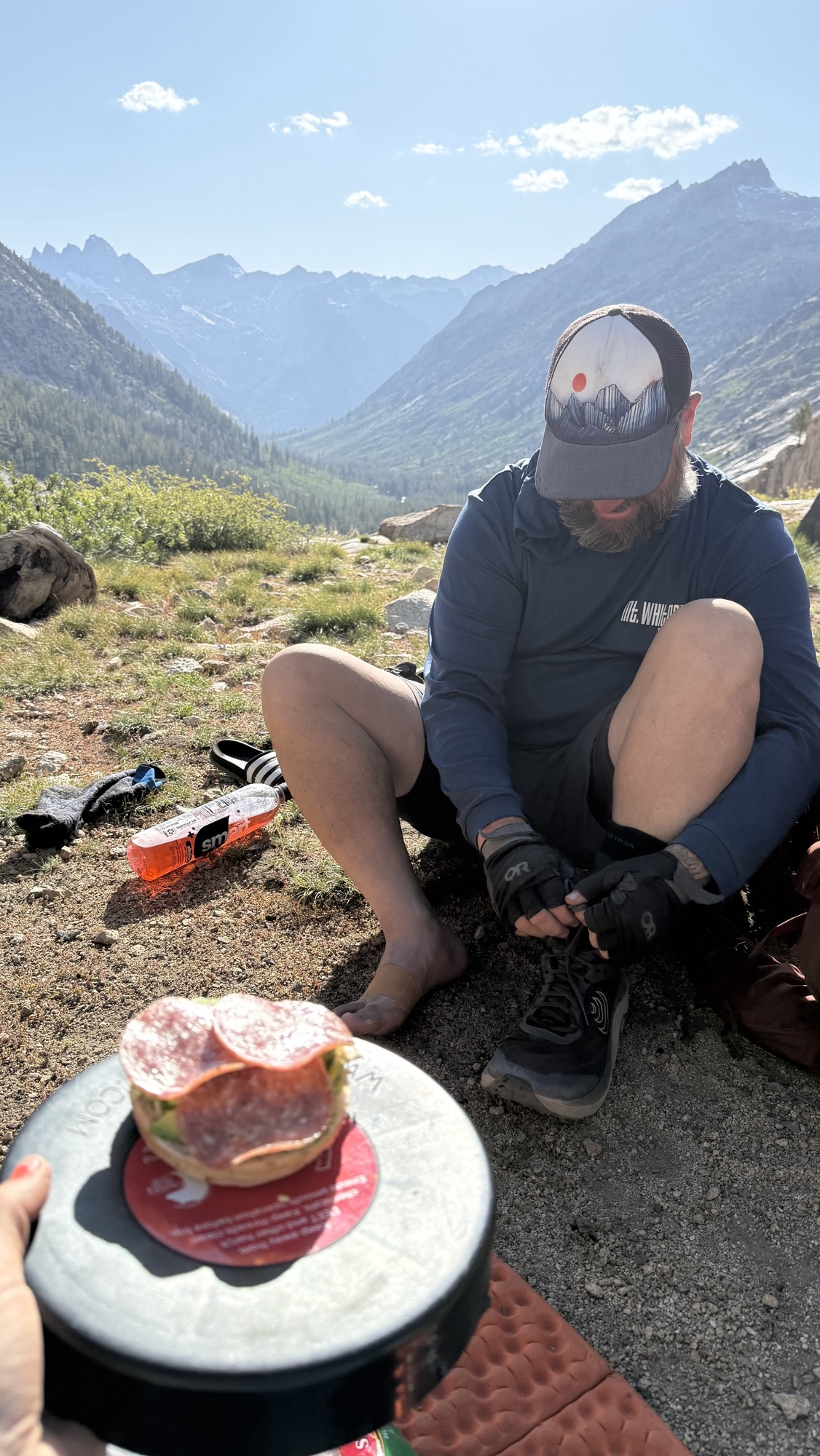
Iceman slept in until 7:15, and by then I was more than ready for breakfast. The big kitchen cabin at Stehekin Valley Ranch served up a hiker’s dream: crispy bacon, a full omelette, and a sandwich bar that doubled as our lunch prep station. We packed hefty sandwiches and snacks, knowing it would be a long day ahead.
After breakfast, we plugged in every electronic device we owned — batteries might not be essential for survival, but out here, they’re close. Once everything was fully charged, we caught the iconic blue bus to Stehekin Landing to fetch our final resupply box. It hit me then: this was the last box of the journey. The last taste of home-packed supplies before the finish line.
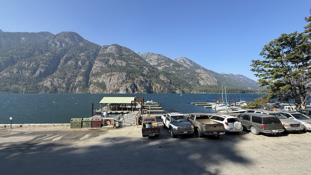
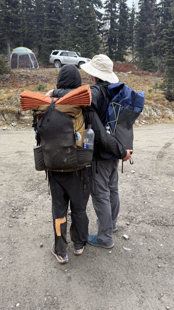
We squeezed in laundry before heading back, clothes draped over our packs and the bus railing to dry in the mountain breeze. Lunch was devoured during the ride — a picnic on wheels as we bounced our way back toward the trailhead. At 1:30 p.m., we shouldered our freshly replenished packs and stepped back onto the Pacific Crest Trail.
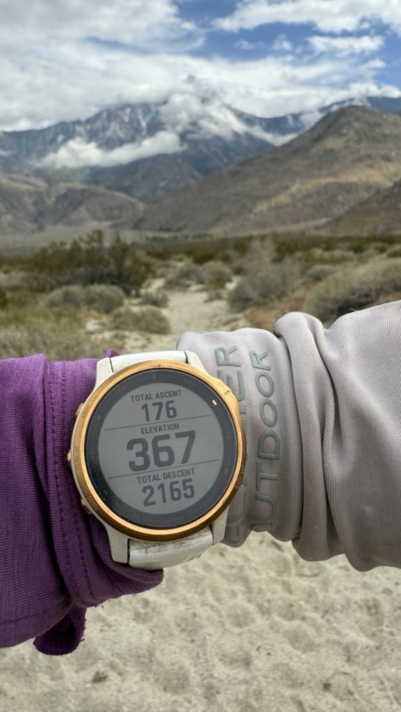
Almost immediately, exhaustion hit me. My legs felt heavy, and my body refused to find a rhythm. Symptoms of a UTI? I eventually gave Iceman some of my gear to lighten my pack, grateful (again) for a partner who doesn’t hesitate to help. The effort was worth it, though — by 7:00 p.m., we had covered 14 miles, climbing 3,399 feet and descending 1,597. My watch later logged 34,662 steps.
As twilight settled over the forest, I felt a strange mix of fatigue and fulfillment. The last resupply is more than just logistics — it’s a milestone, a turning point. Ahead lies the final stretch of the PCT, and though my body’s fraying at the edges, my spirit’s holding strong. Stehekin’s calm valley faded behind us, and the mountains ahead whispered one message: almost at the end. 🥲
Miles hiked: 14.01
Ascent: 3399 ft
Descent: 1597 ft
Steps: 34662
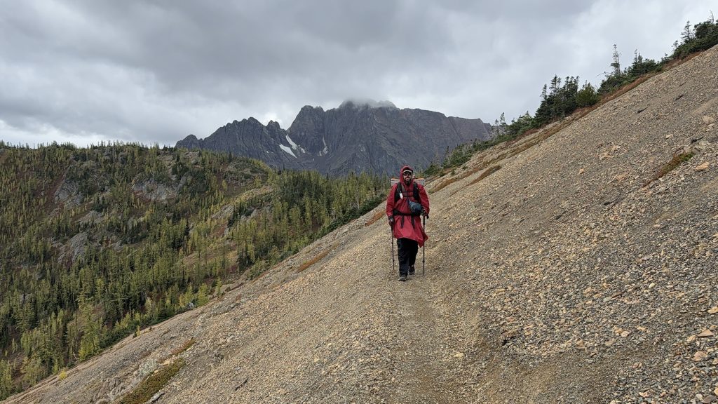
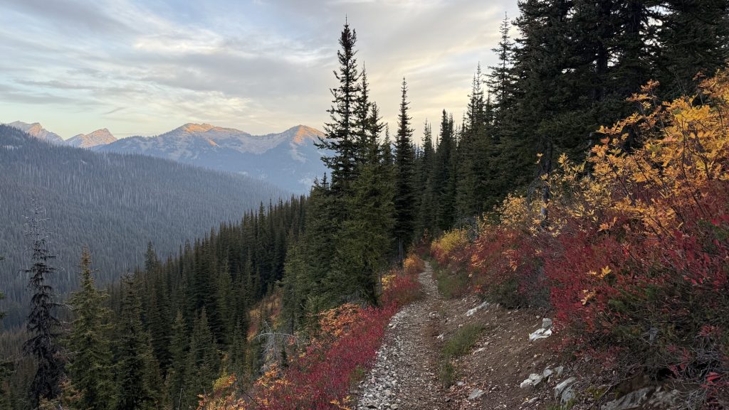
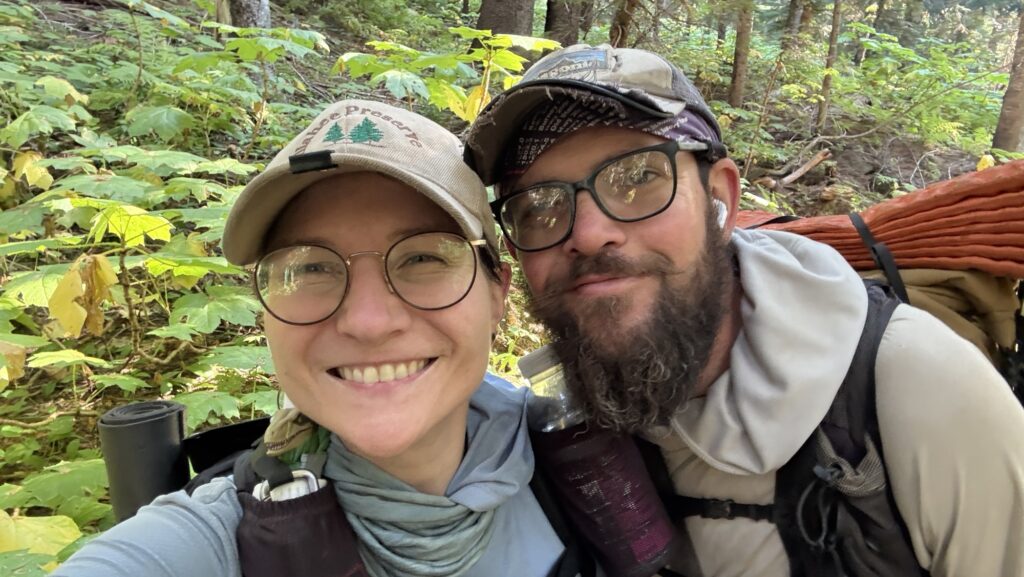
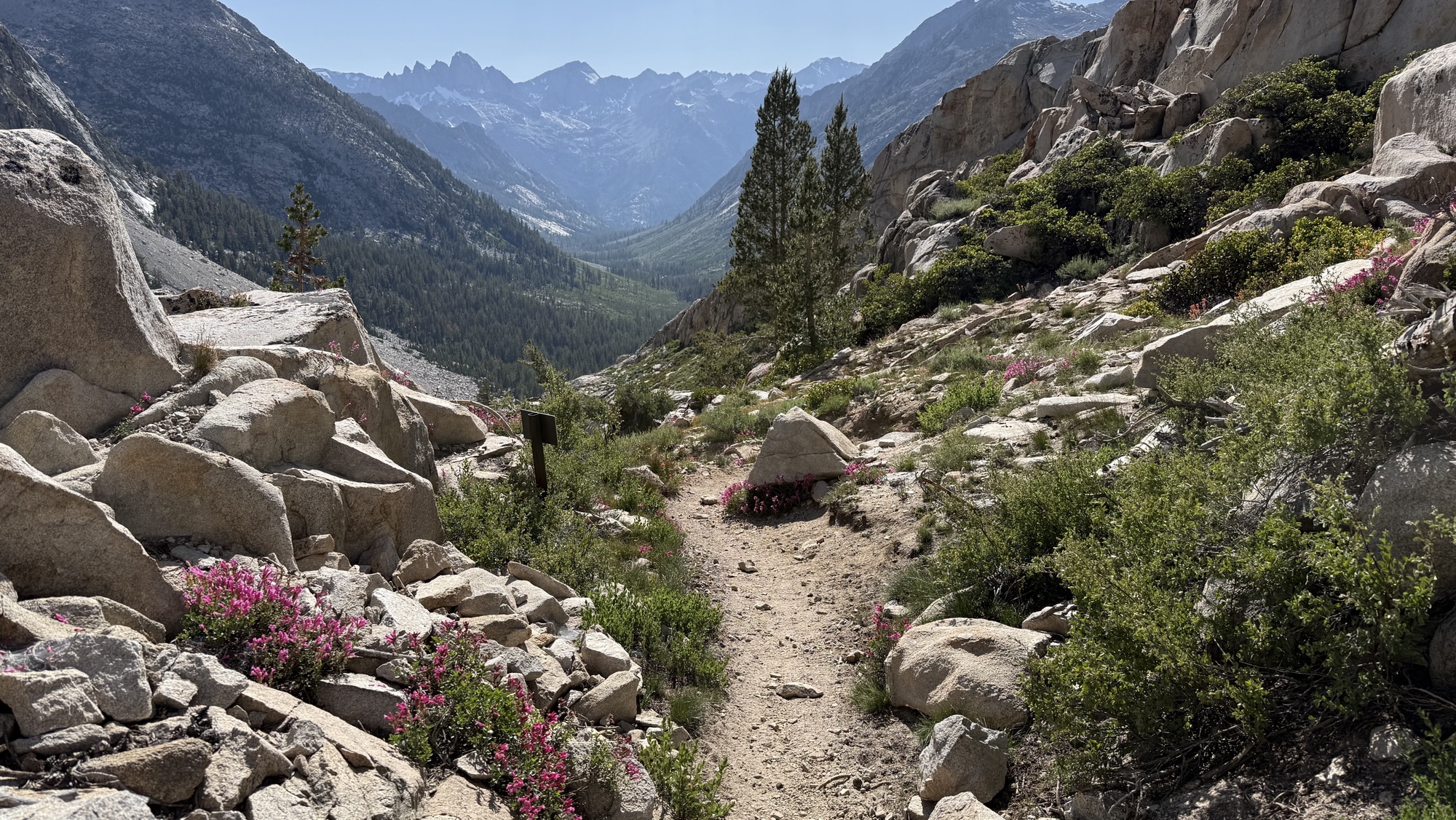
Day 139: Winthrop Detour, Trail Pain, and a 22-Mile Push (PCT Mile 2609.7)
We were back on trail early, starting our hike at 7:00 a.m. under a cool, overcast sky. It was supposed to be a steady climbing day, but things rarely go as planned out here. By 9:30, we had caught a ride into Winthrop with Doug — an unexpected side trip that turned into one of the best little adventures of the trail.
Winthrop turned out to be an incredible town — rustic, welcoming, and full of life, with its old Western storefronts and friendly locals. The main goal, though, was medical: I needed to figure out what was going on with some uncomfortable symptoms that had been creeping up. The folks at Confluence clinic treated me right away, and thankfully, the result came back negative — no white blood cells, no infection. It was a relief just to rule out anything serious. Iceman’s legend Brother in law, Mike, an MD from Baltimore was incredibly supportive, talking me through the result and confirming that I was indeed fine.
After that, we hitched a ride to the Mazama Store with Gary and refueled properly — an incredible pulled pork sandwich that instantly lifted our spirits and energy. Few meals on trail compare to that one. Fully recharged, we caught another ride back to the trailhead with an ex-lawyer whose trail stories and wisdom kept us smiling the whole way.
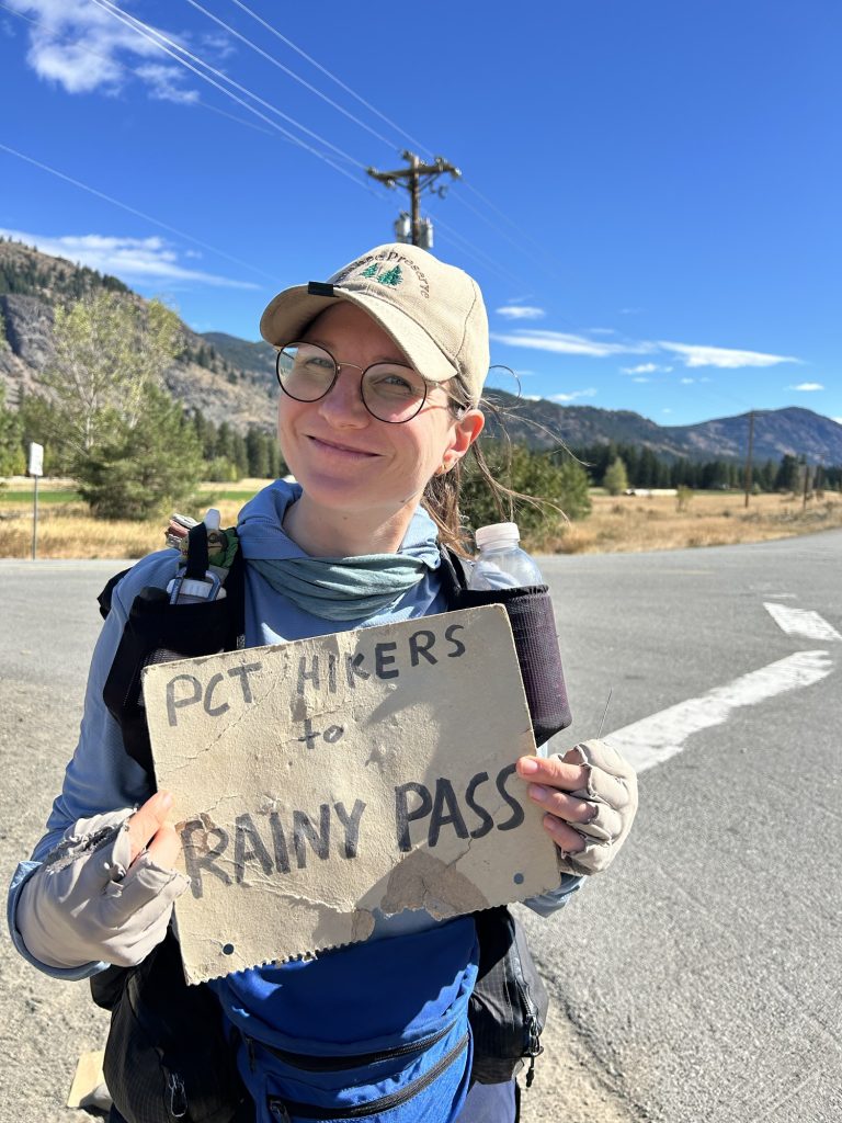
We started hiking again at 1:30 p.m., determined to make up for the morning detour. Despite the late start and the side quest into town, we crushed 22 miles by the time night fell. The trail wound through quiet forest and open slopes, and even though our bodies complained, our momentum carried us forward. By sunset, though, we were feeling every step — a strong pain in my tailbone had grown worse through the day, tender to the touch and marked by sharp pain every time I moved. Whatever it is, it made hiking painful, and I had to rely on ibuprofen just to push through.
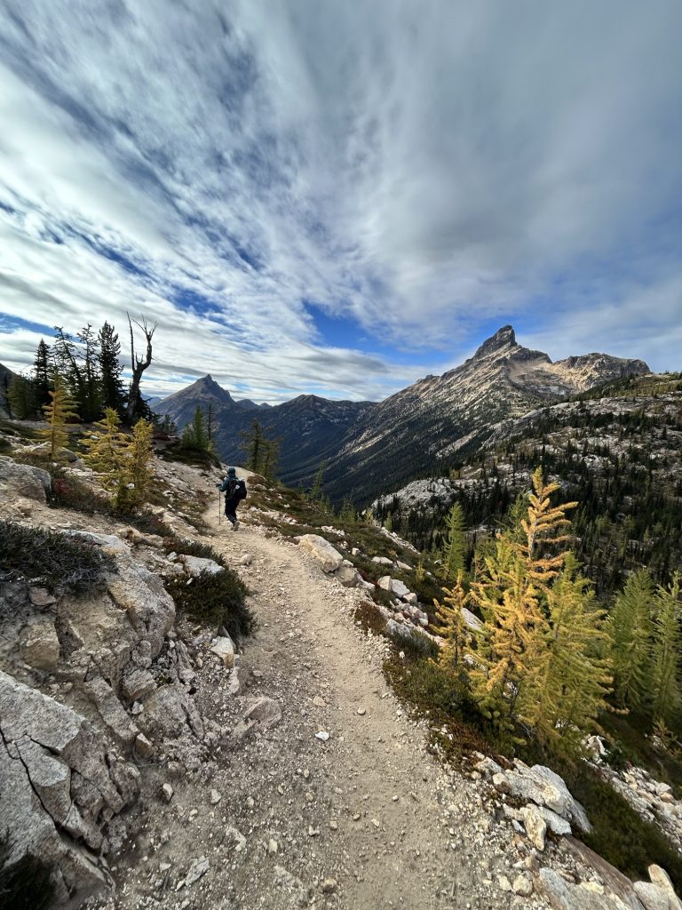
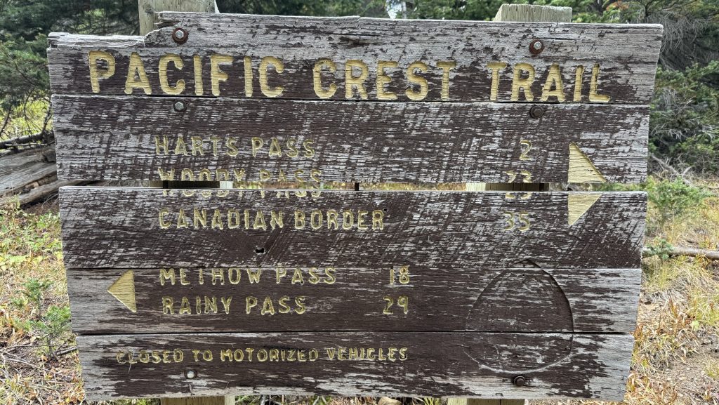
Only three long days remain: two around twenty-seven miles and a final twenty-one to reach the northern terminus. The pain is real, but so is the motivation. With every mile now, we can feel the end drawing closer, the promise of Canada just ahead. Scary. I don’t know if I want this adventure to be over. But we have a deadline to reach!!
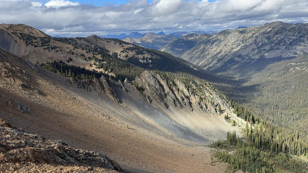
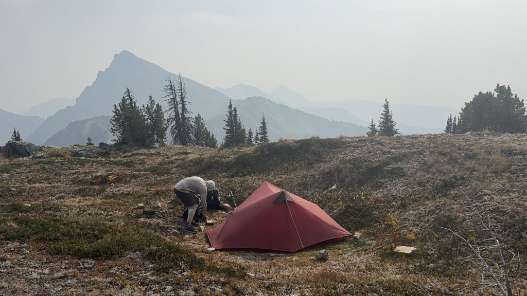
Day 140 – PCT Mile 2632.2
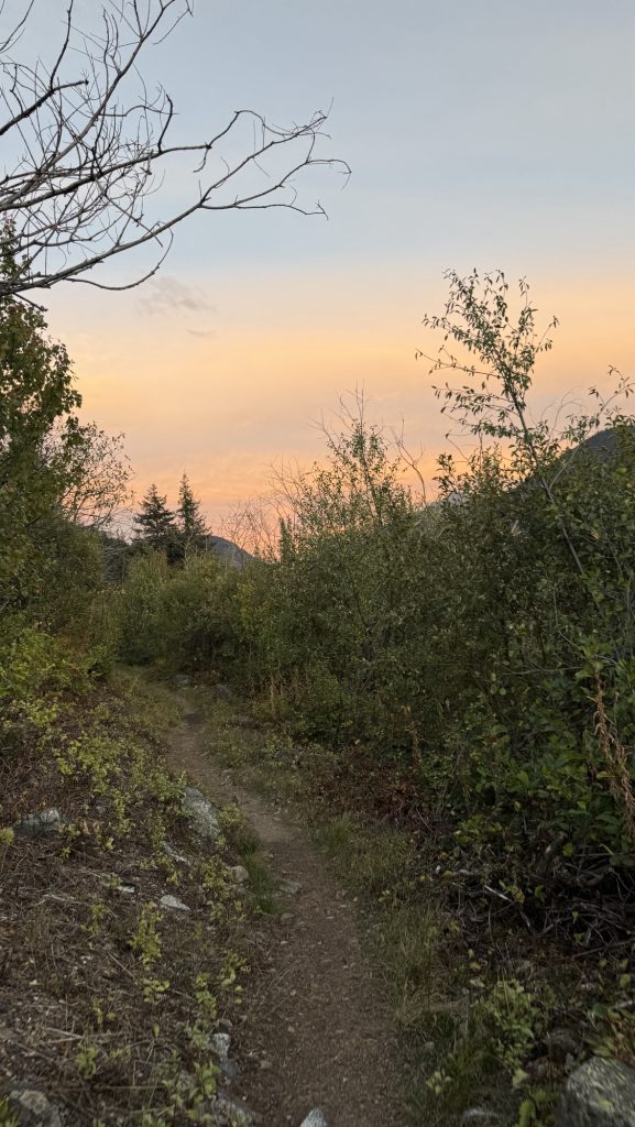
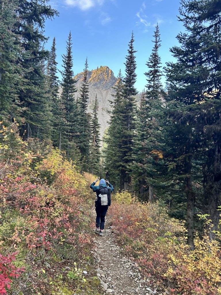
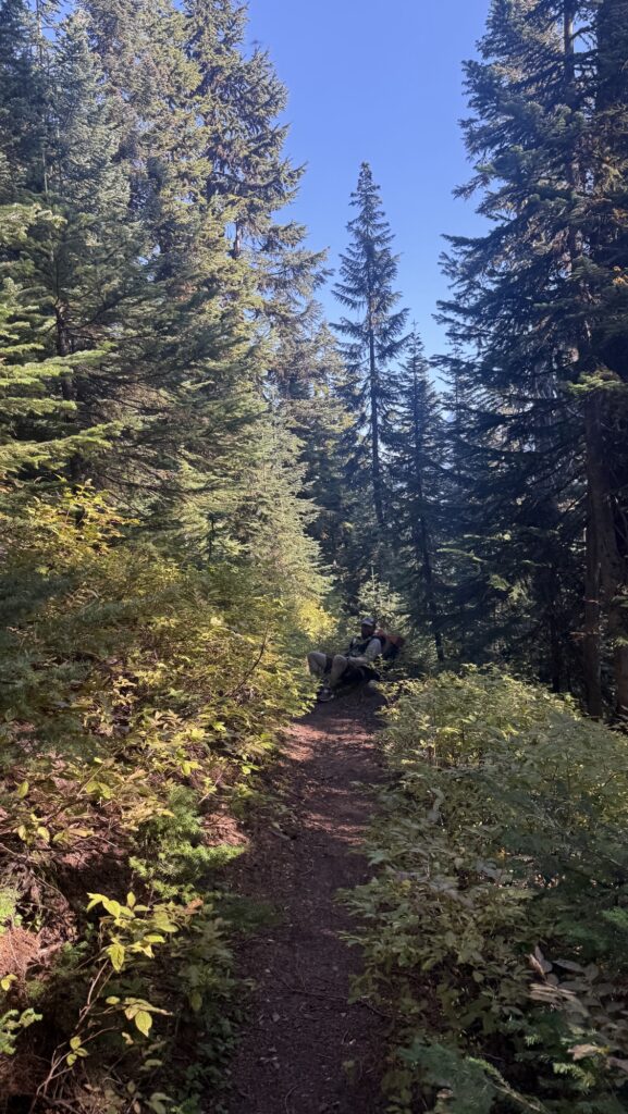
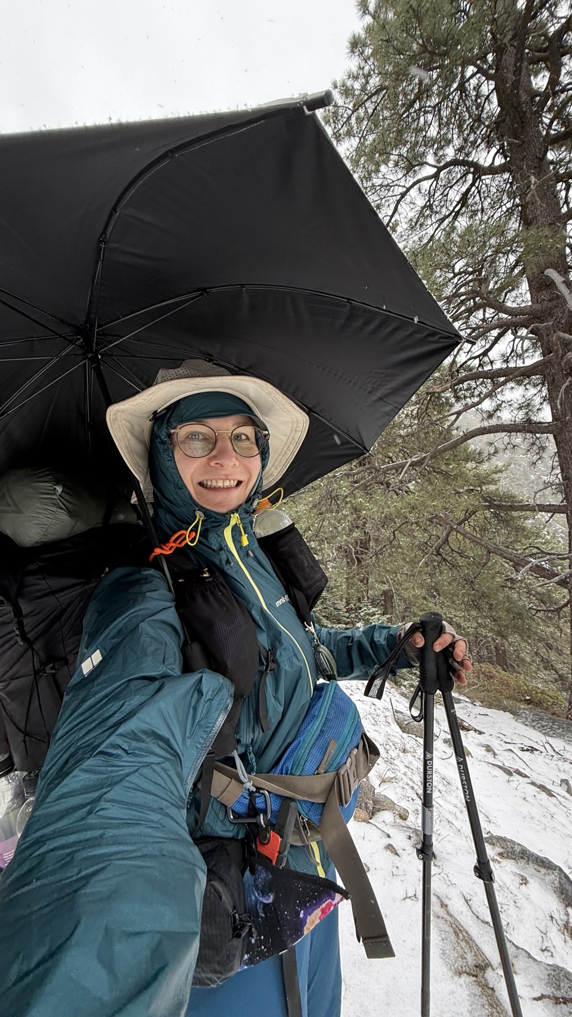
We crawled out of our tents at 7:40 am to a world wrapped in rain and cold. The forest was dripping, mist curling around the tree trunks as we trudged the first 3 miles to a water source. Hands numb, hoods tight, everything smelled like wet pine.
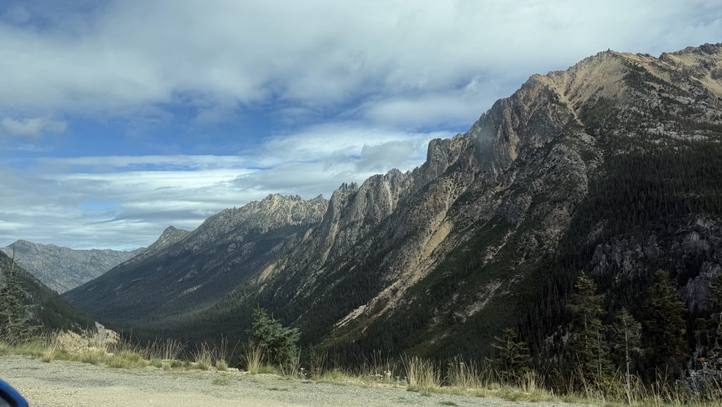
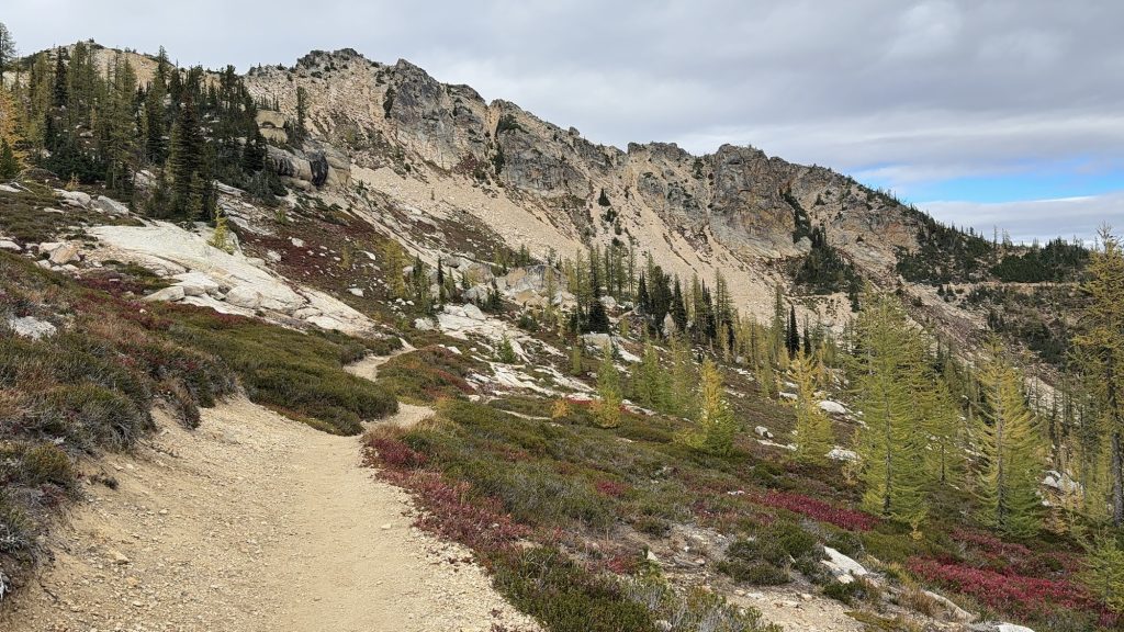
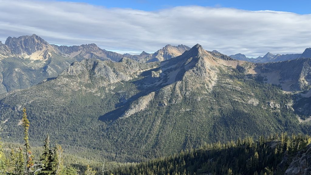
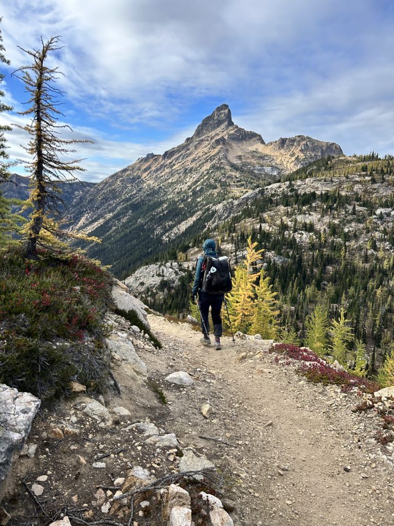
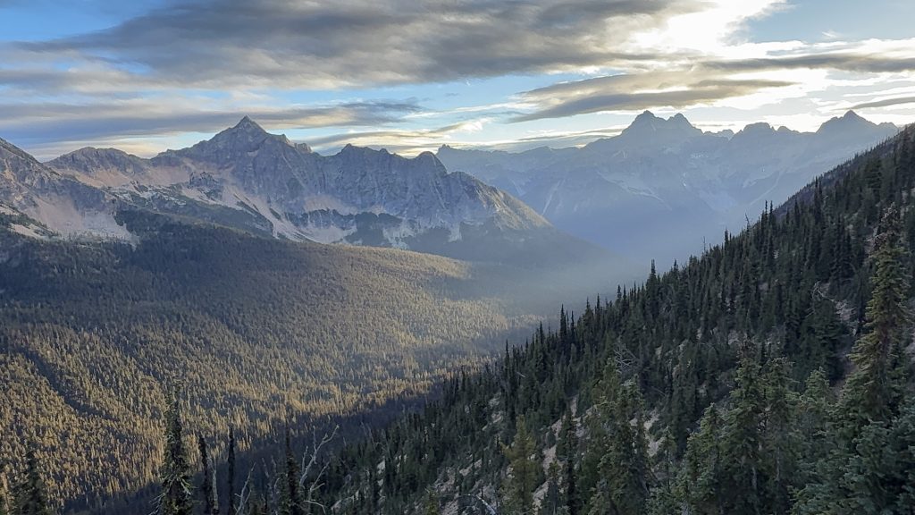
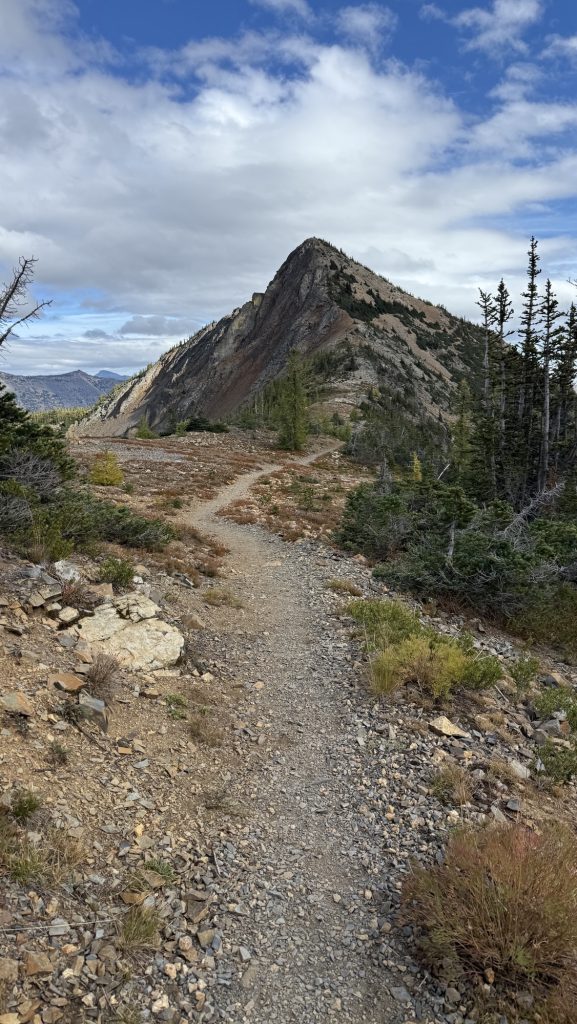
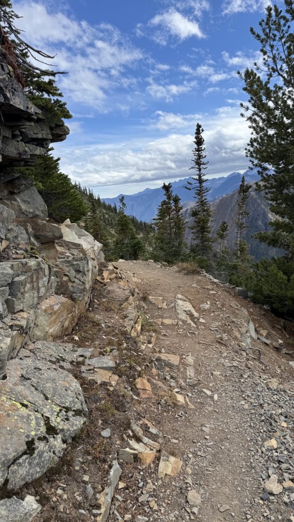
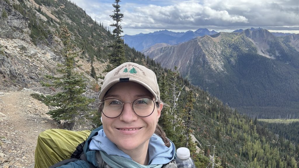
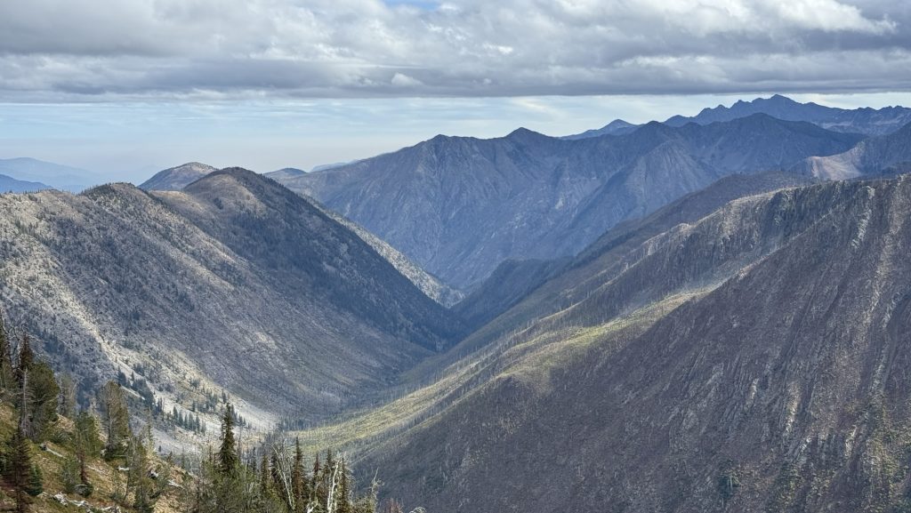
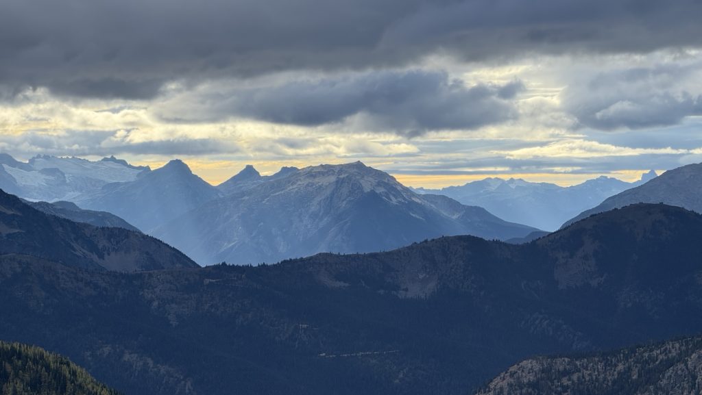
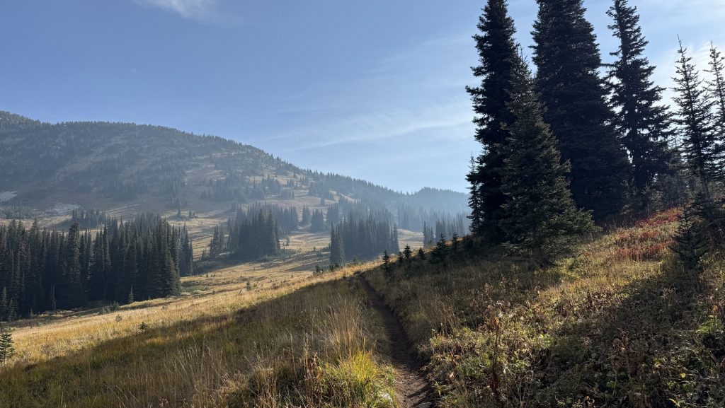
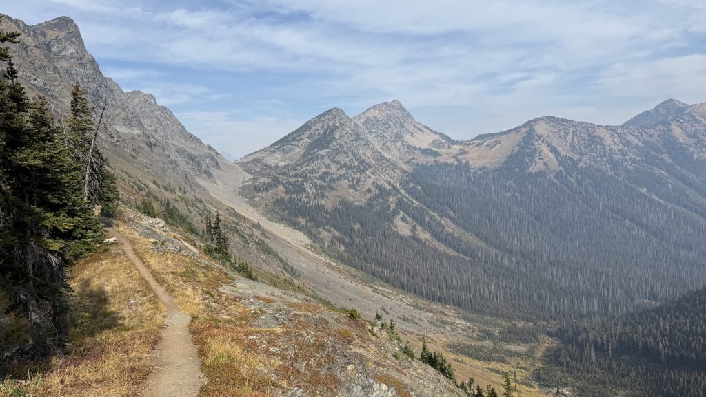
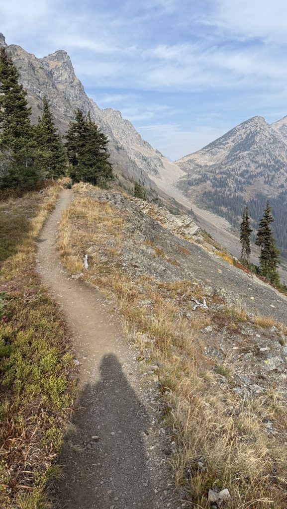
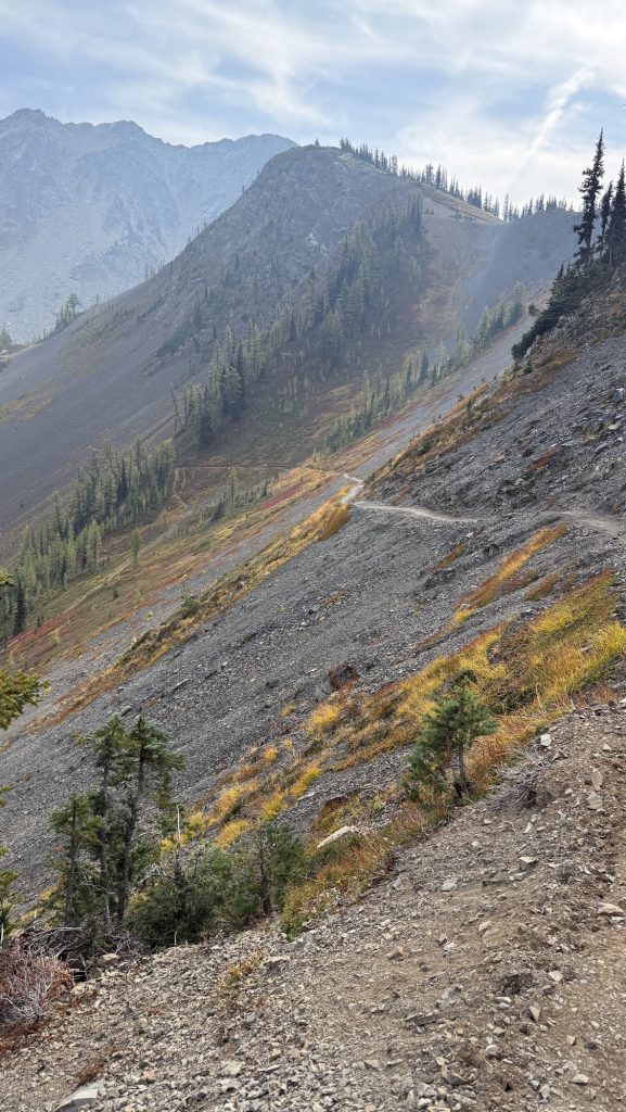
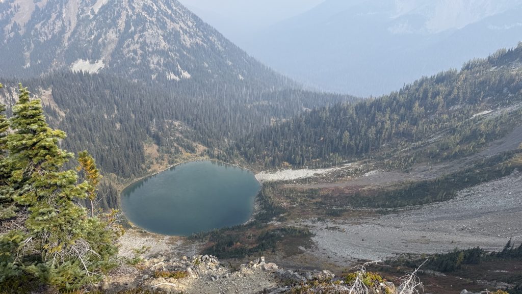
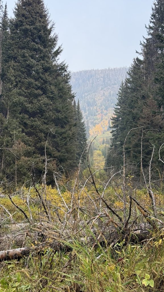
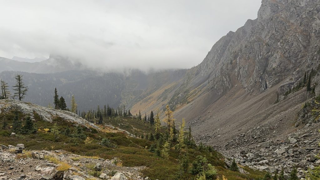
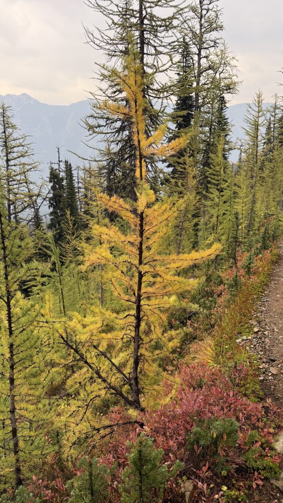
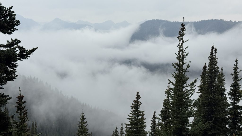
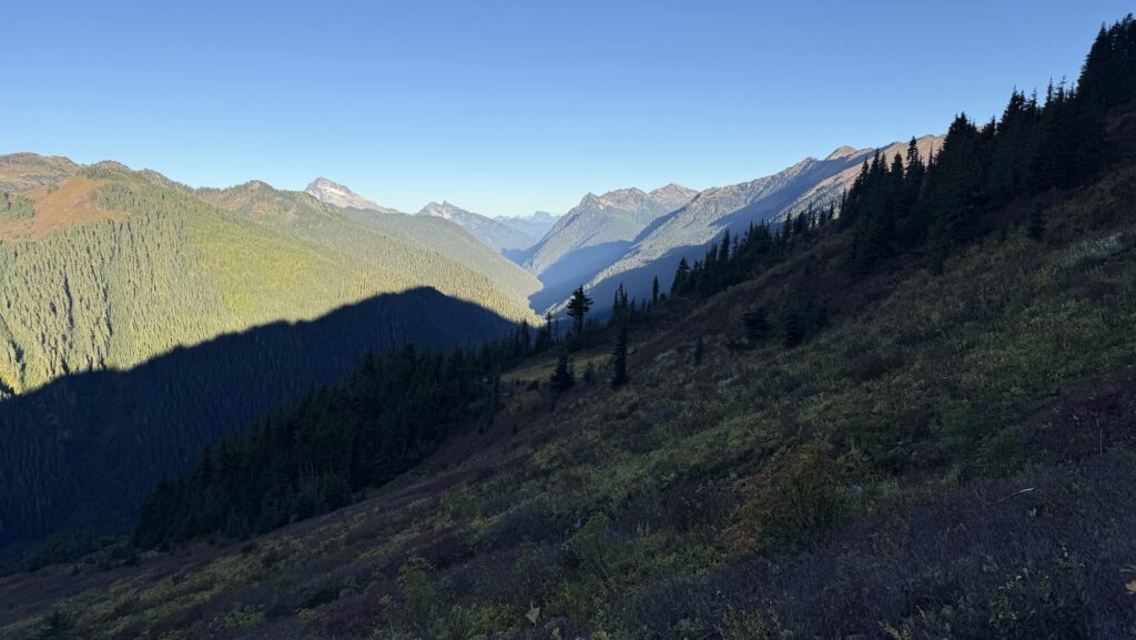
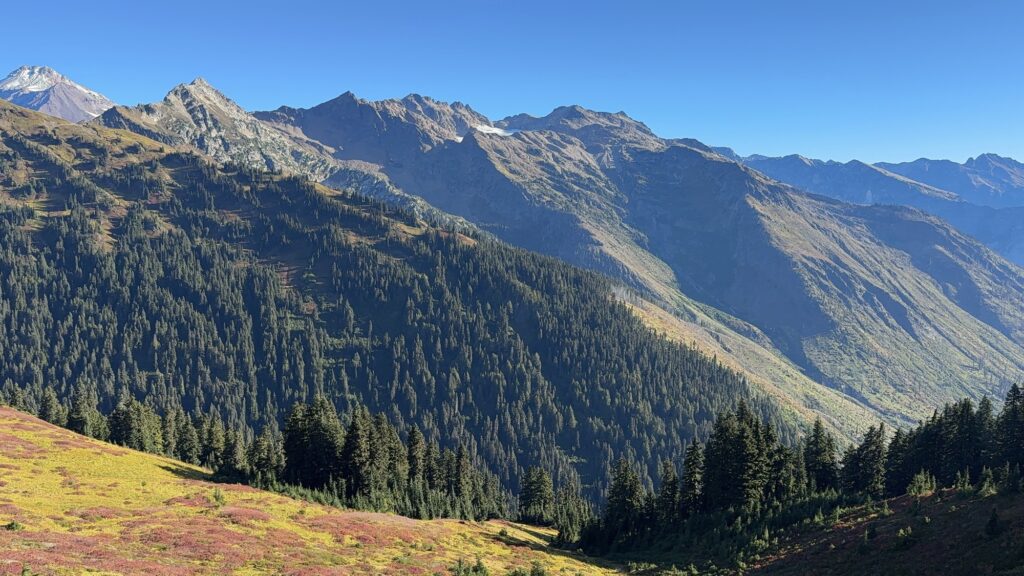
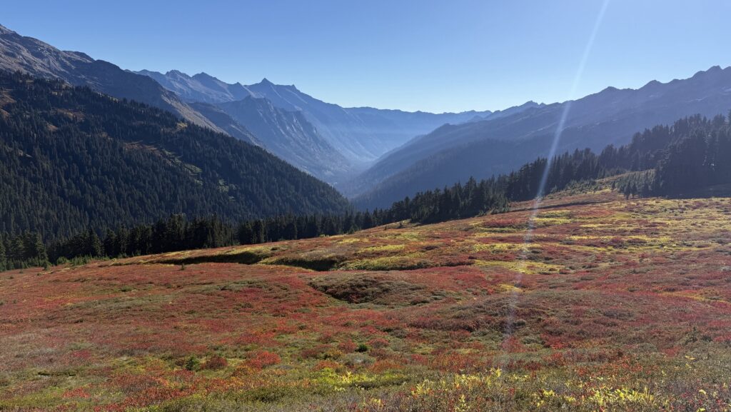
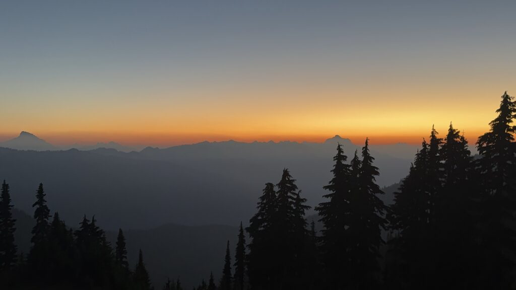
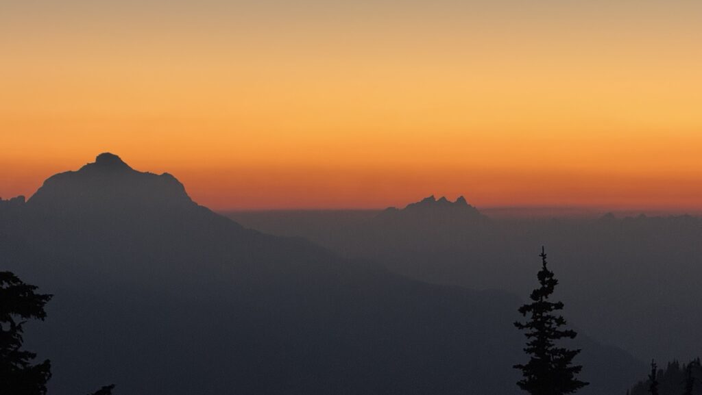
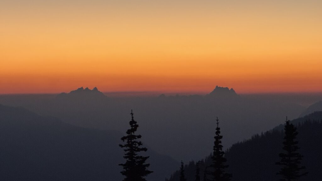
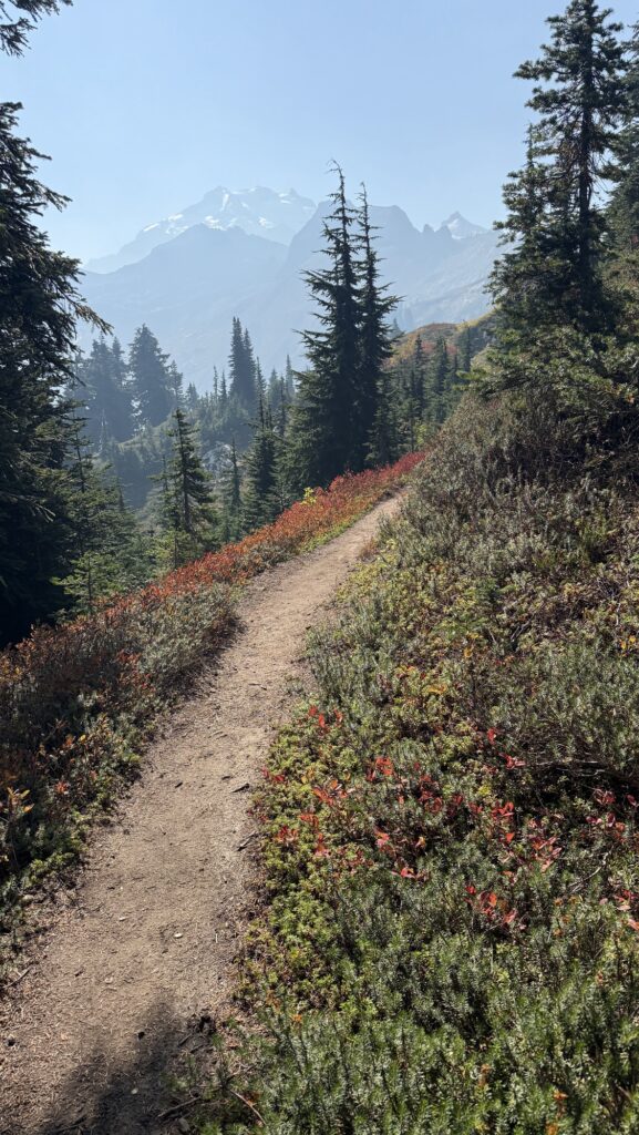
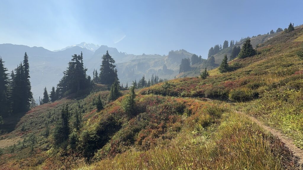
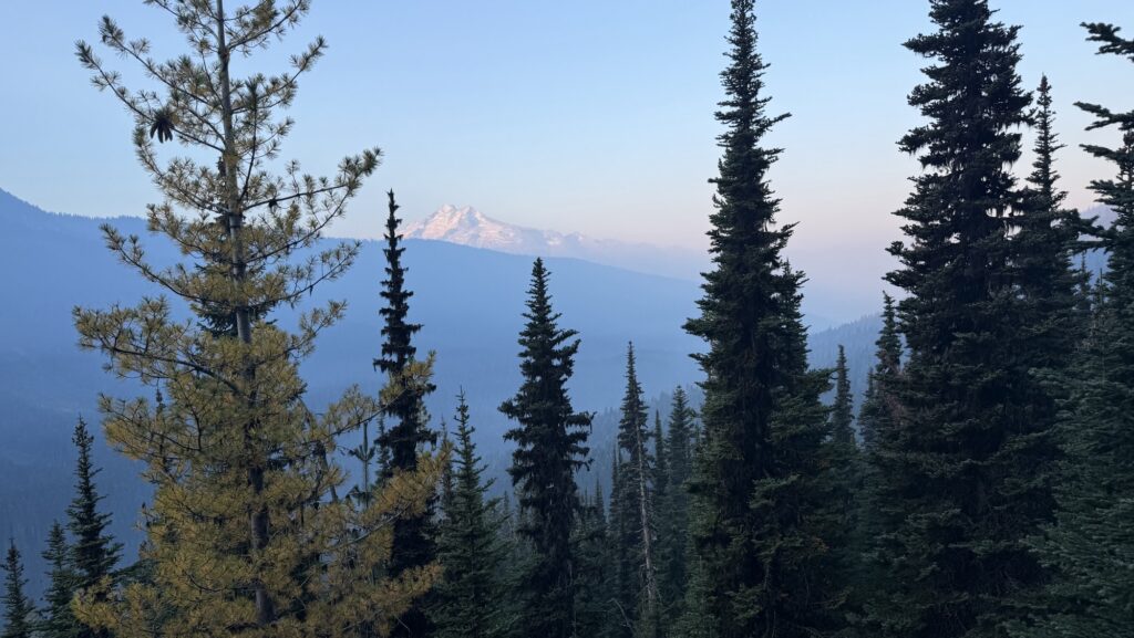
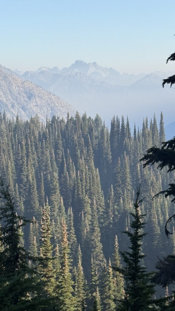
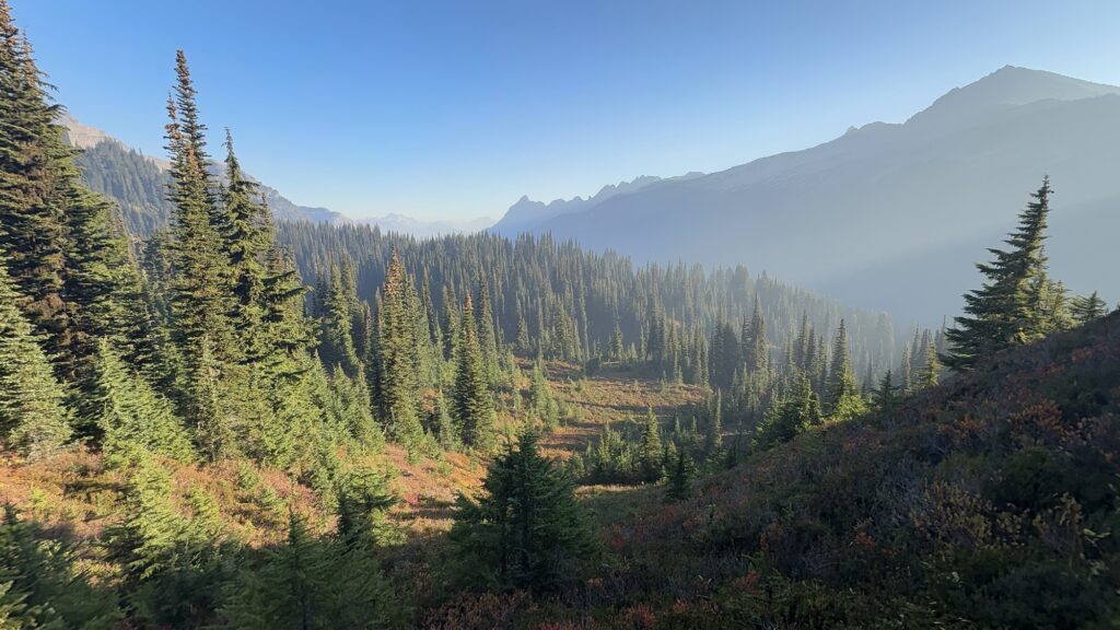
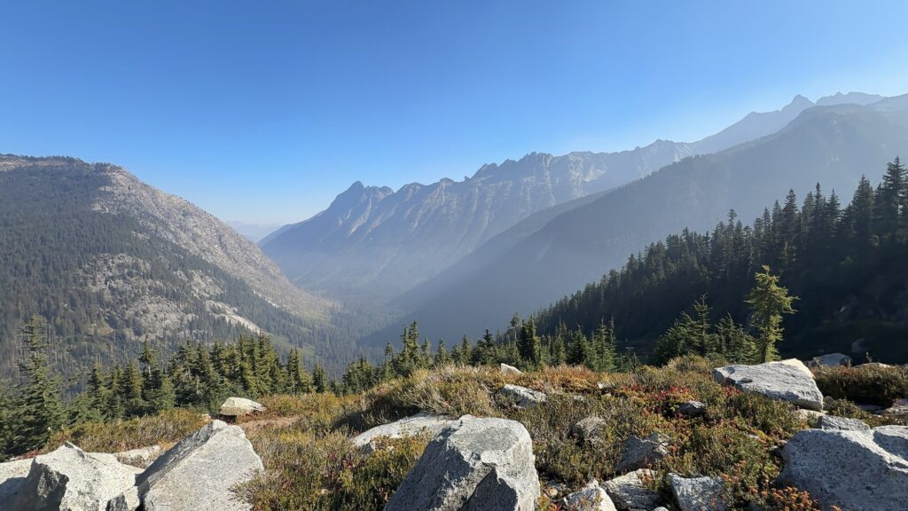
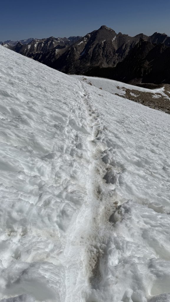
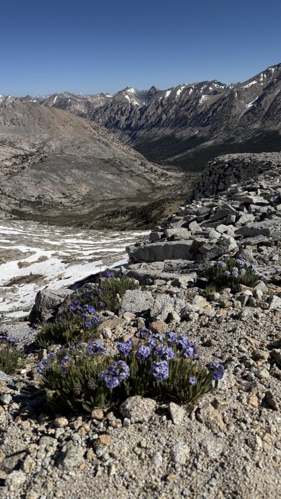
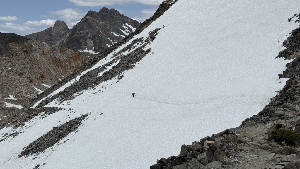
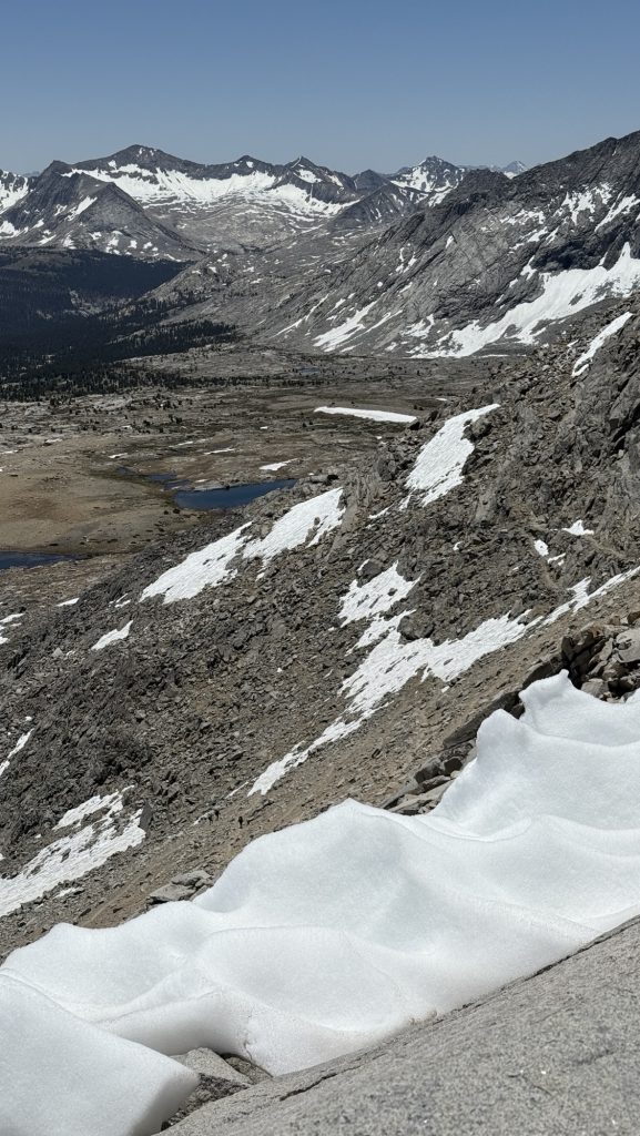
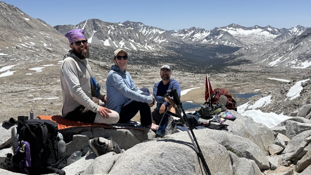
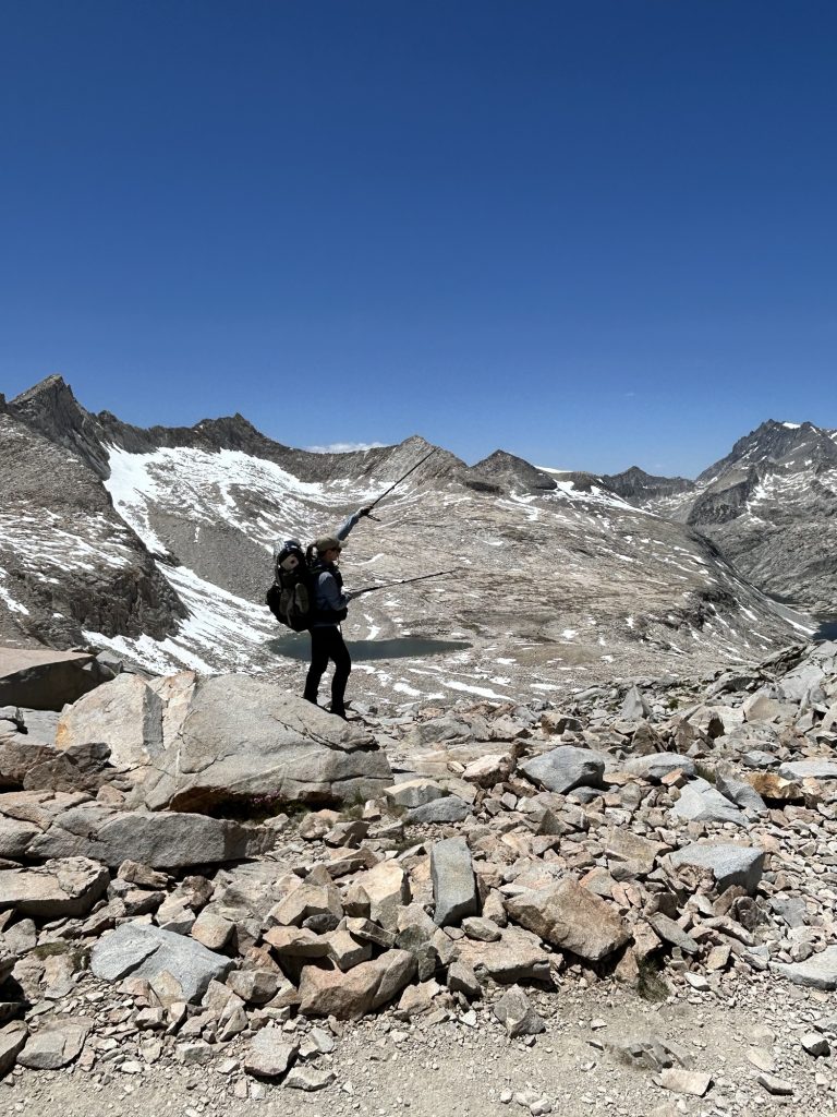
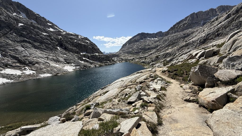
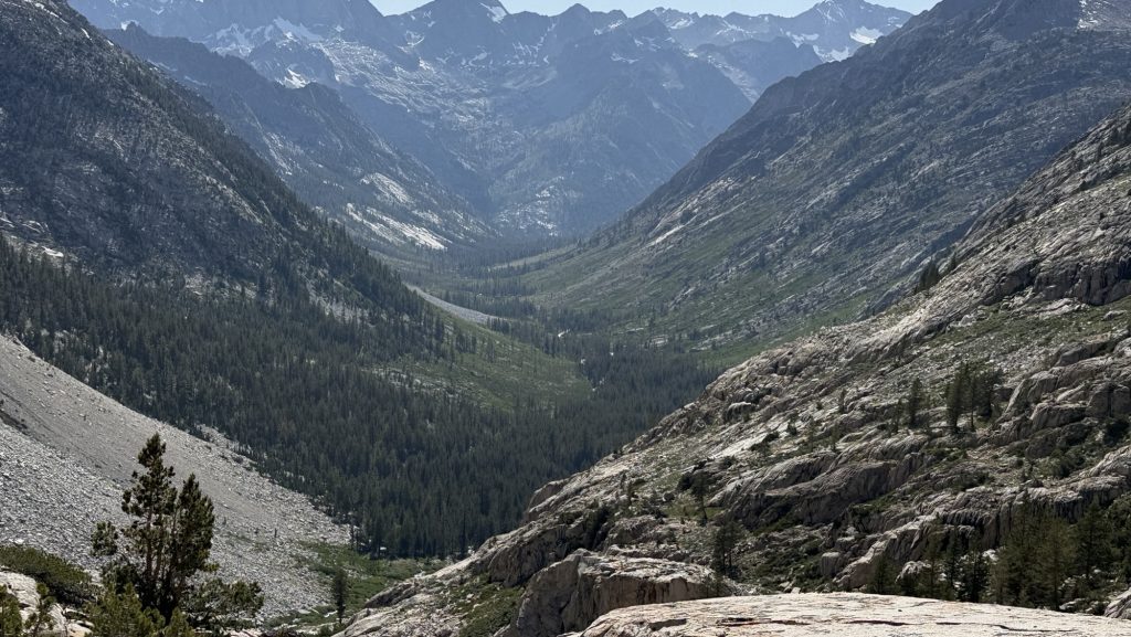
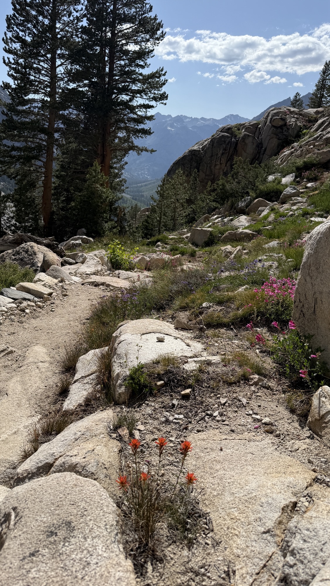
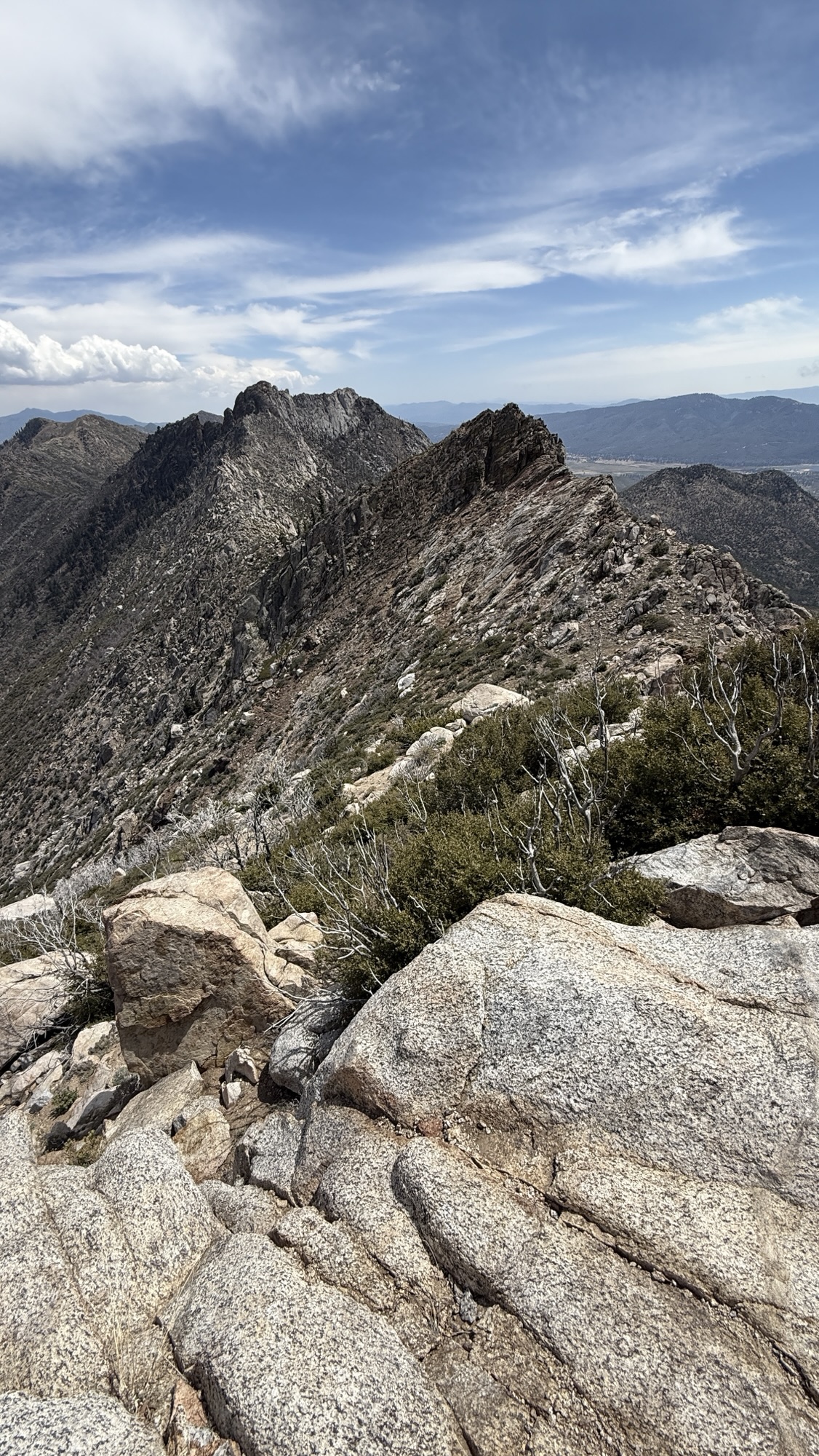
From there, the trail climbed—four miles of steady uphill—to Grasshopper Pass. The wet chill gave way to wind, and then… views. The kind of sweeping ridgelines where you forget you’re cold, just staring, every muscle telling you to stop and take it in. We did exactly that—lunch on the very top, looking out at endless green folds and distant peaks.
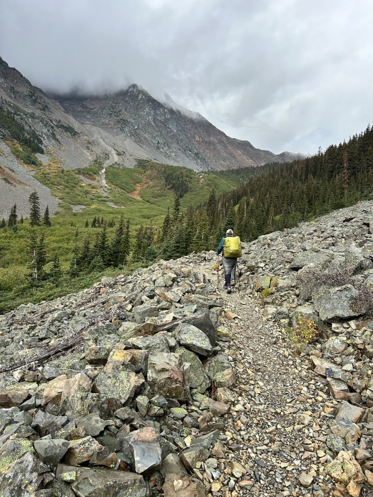
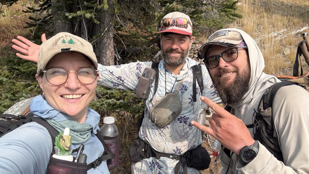
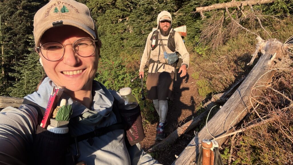
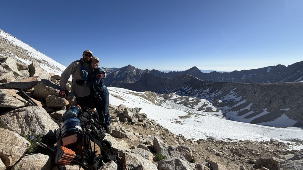
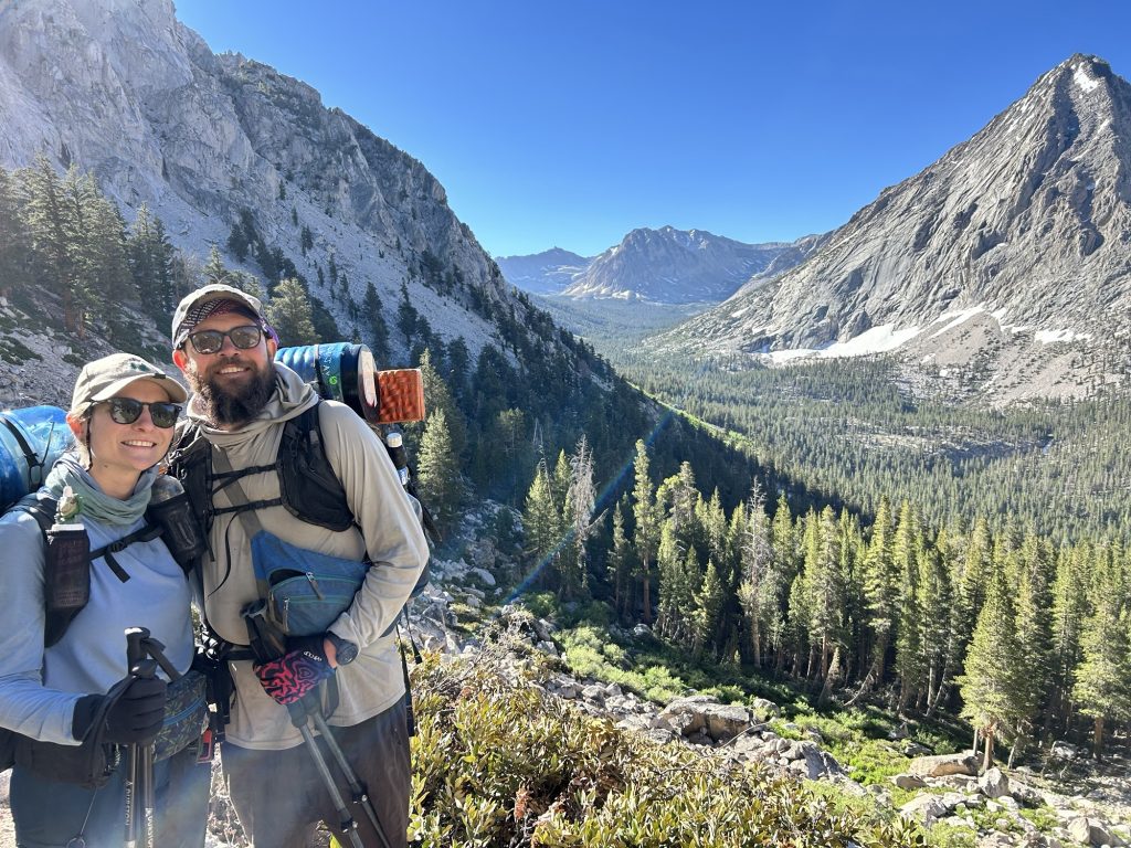
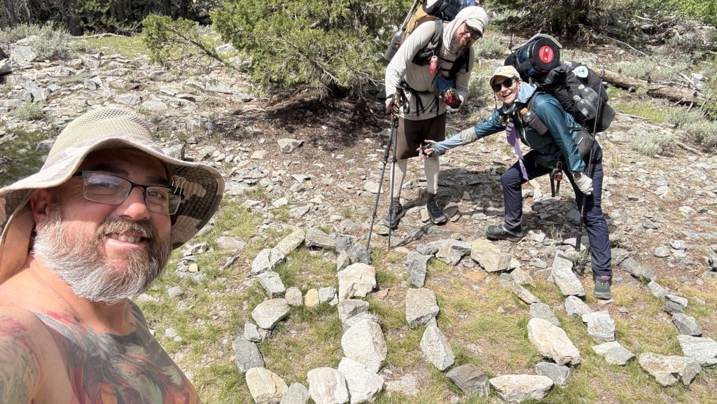
By 4:15 pm we rolled into Harts Pass. And there they were—Noah and Rambo—freshly done with the Pacific Crest Trail. It was surreal. They were grinning, handing out donuts like some magical trail angels of victory. Four other hikers milled around, all freshly finished. The air felt electric, like the trail itself was humming. This is where Iceman’s dad will pick us up in two days. Suddenly that fact was more real than ever.
Leaving the pass, we didn’t get far before bumping into Meatbrick—more hugs, congrats, and incredulous laughter. Then came Bubbles, bounding down the trail, and everything dissolved into chaos: hugging, filming, tearing up. It’s happening—this is it. We’re watching our trail friends one by one cross that invisible finish line.

We only did around 23.5 miles today, stopping before dark at 7:00 pm. Tomorrow is going to be huge: over thirty miles.
Tomorrow, we finish the PCT.
Crazy.
Unreal.
I can feel the lump in my throat already.
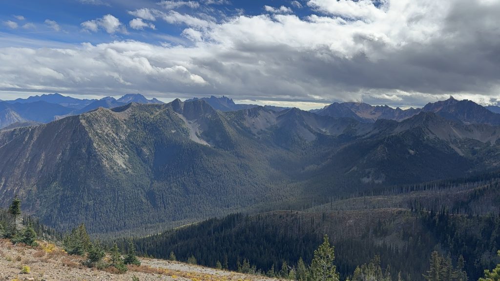
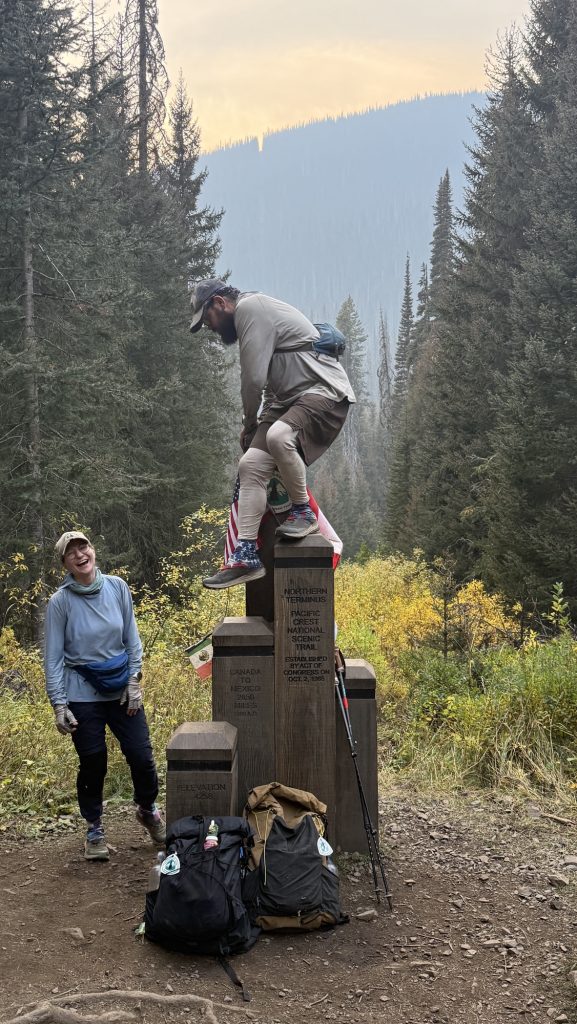
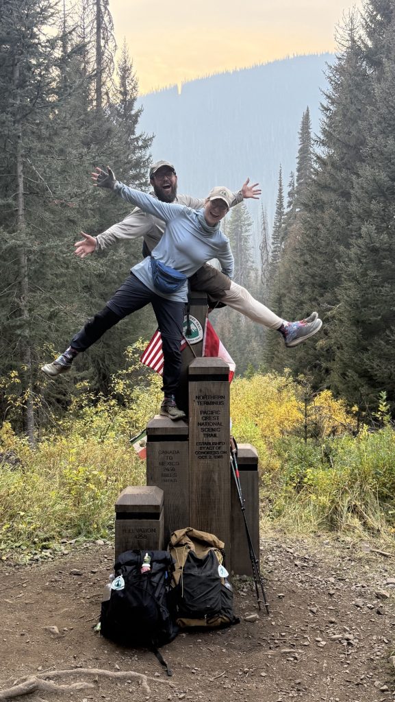
Day 141: PCT Mile 2647.9: Canada! And 8 Miles Back South
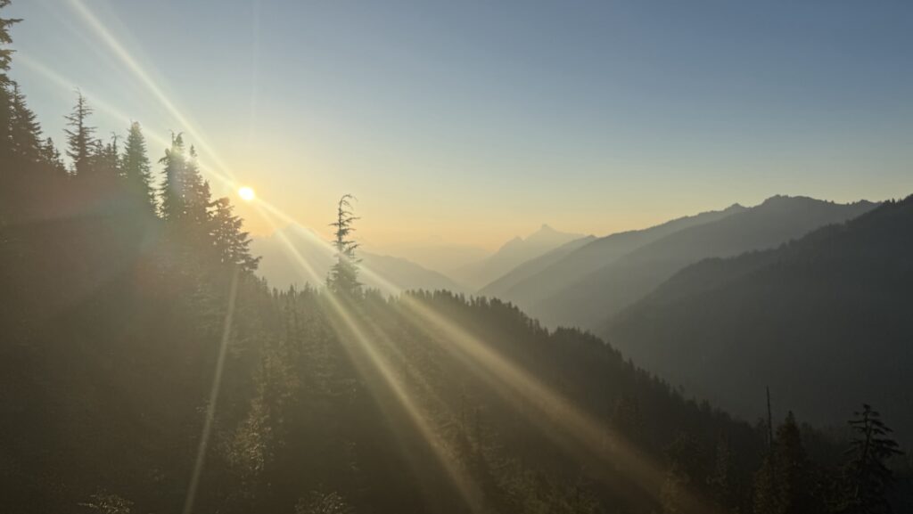
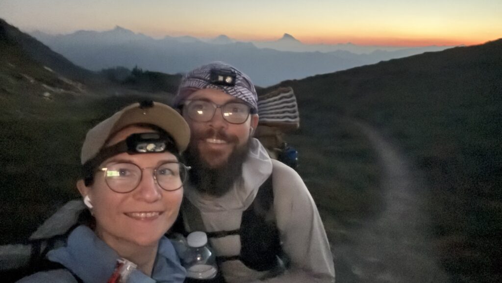
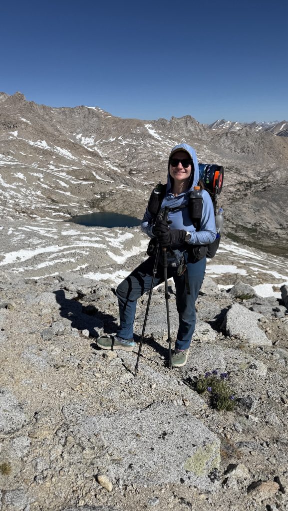
The alarm shrilled at 5:00 am. One last early start. One last day. We were out by 6:22 am, packs snug, shoes laced, determination buzzing in the morning stillness. This might be our longest day yet. Luckily the skies were kind—no rain, and the tent was blessedly dry. No frozen fingers today. We whispered a wish for sun, but waited for the horizon to catch its first light.
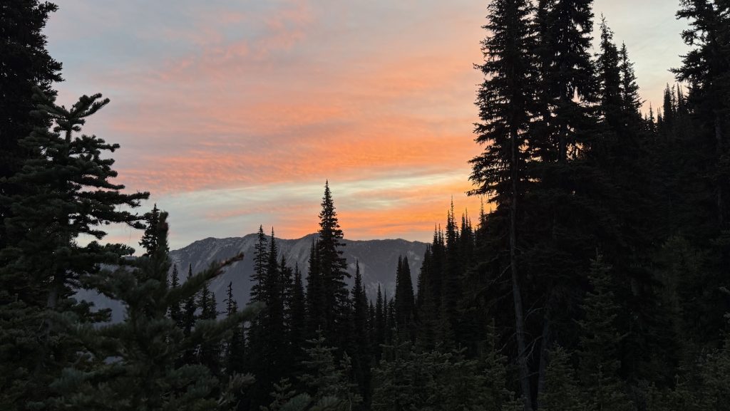
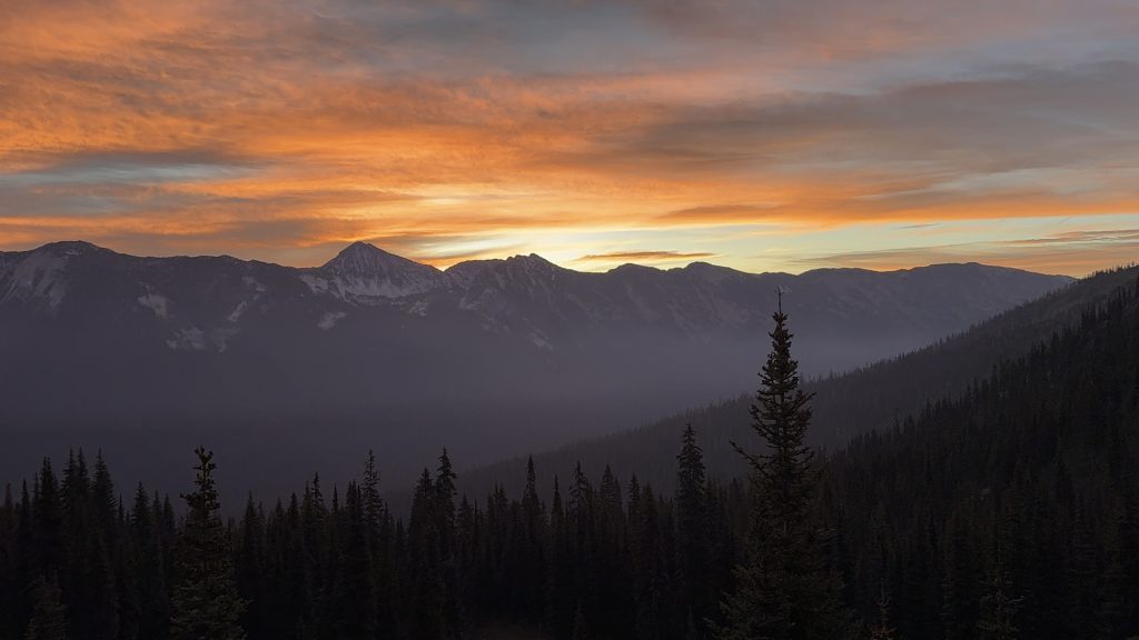
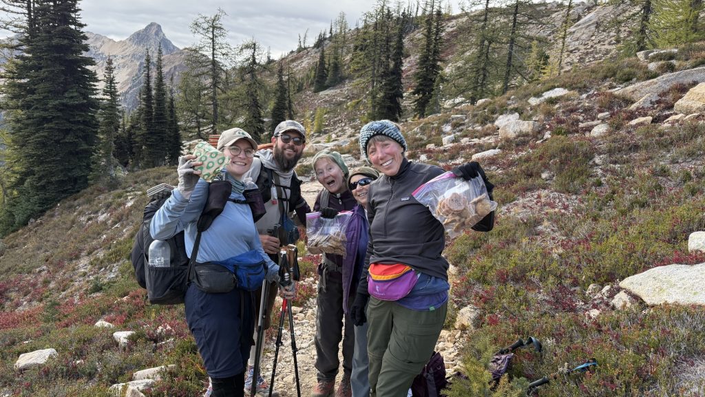
When it came, the day was flawless—bright blue skies, golden warmth spilling over the peaks. A day as perfect as the journey itself. The last trail magic wasn’t donuts, it was high-fives. We passed 37 hikers heading south from the Northern Terminus, each grinning, each congratulating us, and each reminder sending our excitement skyrocketing.
Still, reality kept us moving—today wasn’t just about reaching the border. We had to go big: big miles, big climbs. Tomorrow we need to make it back to Harts Pass to meet Iceman’s dad, so the two of them can fly halfway across the world to Everest Base Camp. The elevation gain was relentless. I wasn’t sure we had it in us… but the pull of the deadline is stronger than doubt.
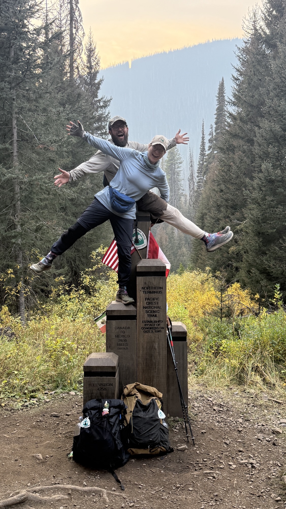
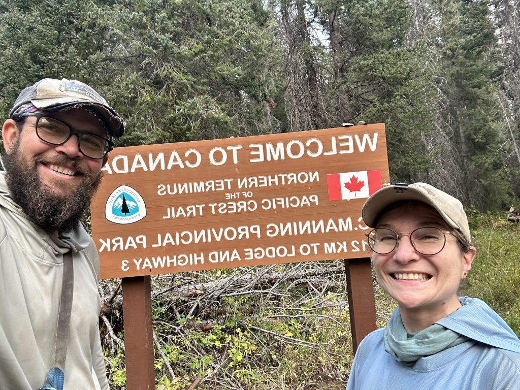
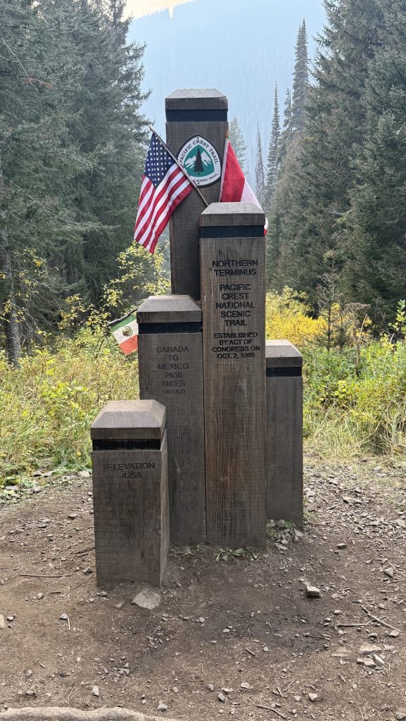
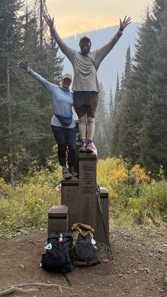
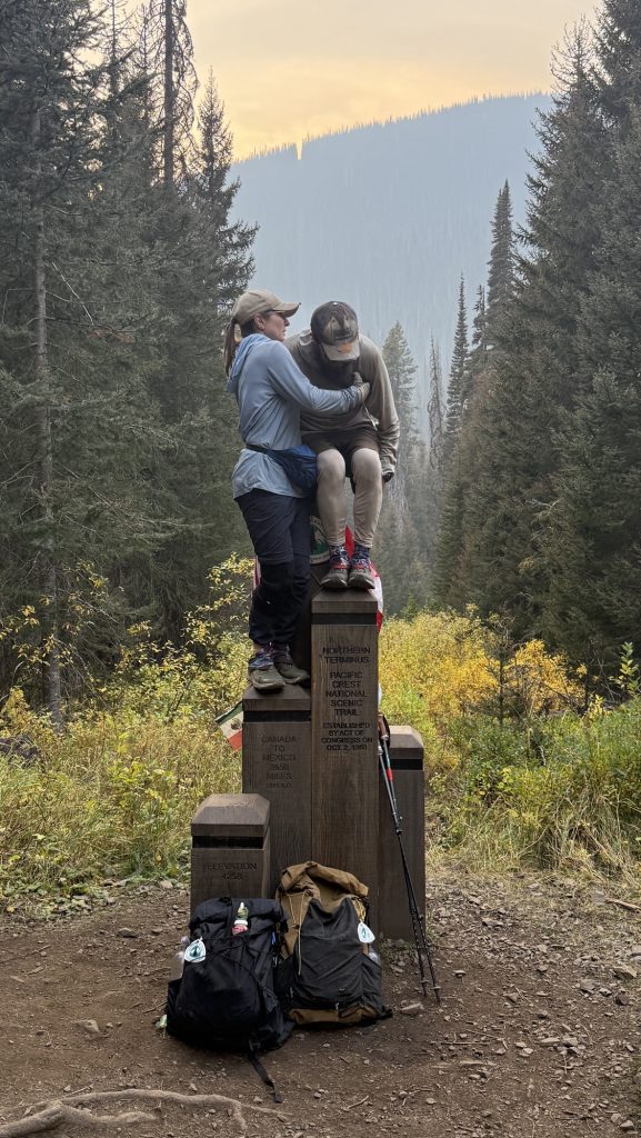
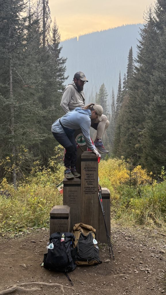
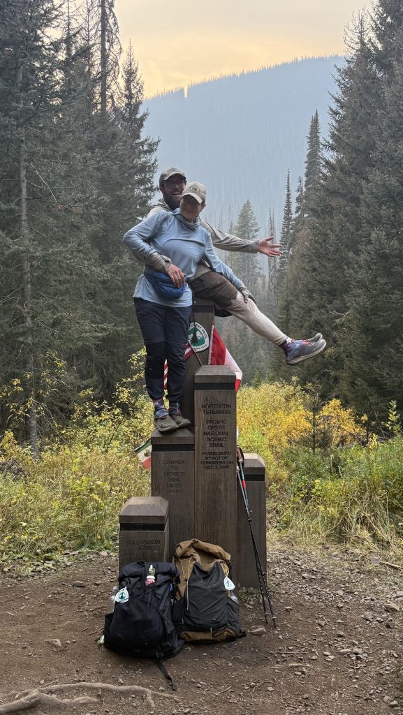
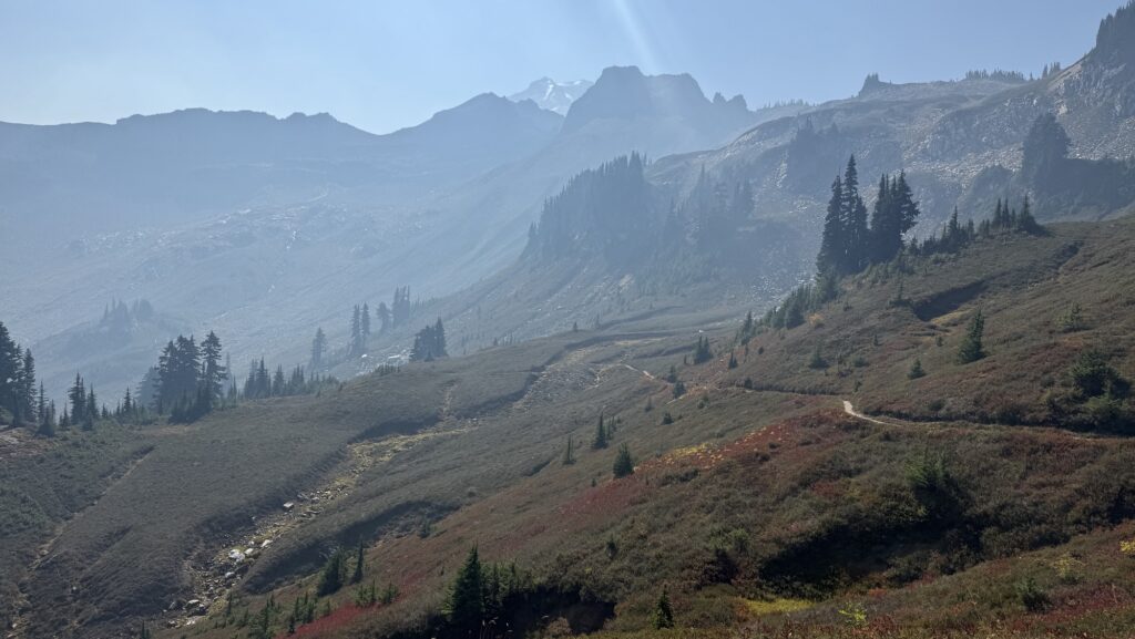
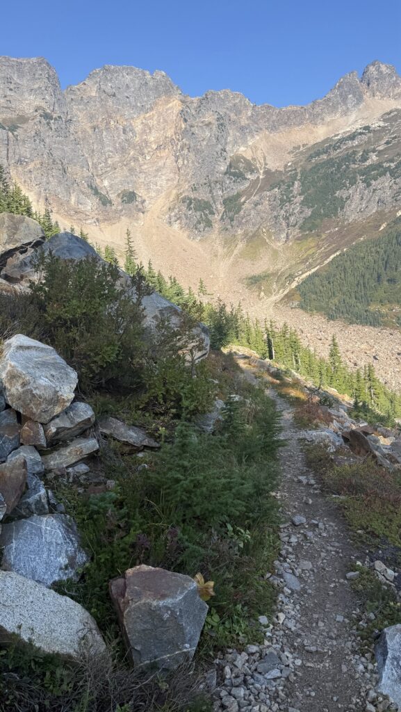
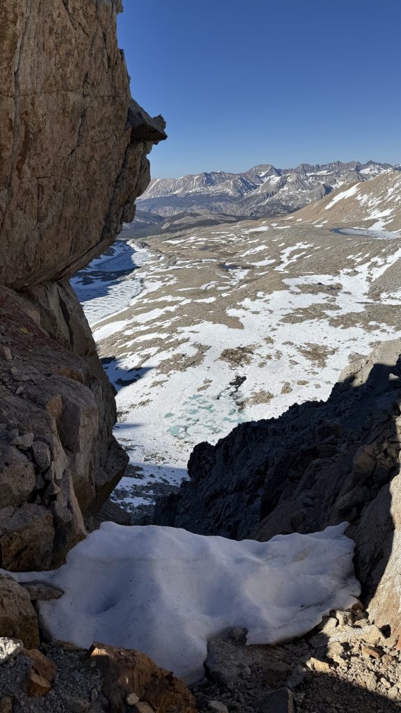
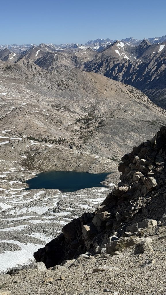
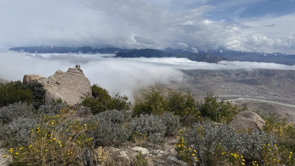
The last 8 miles northbound of the PCT are downhill—a gentle, beautiful roll into the border. The catch? We can’t cross. As of this year, hikers aren’t allowed to walk into Canada and simply exit to the nearest trailhead. Instead, the finish comes with a twist: you tag the monument, take it all in… and then you turn around. Thirty miles back south to Harts Pass is how the journey ends now.
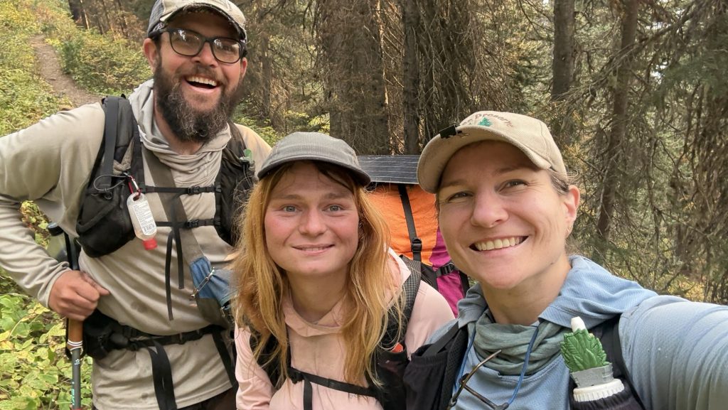
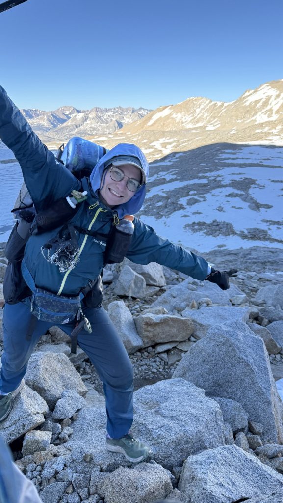
When the wooden Monument finally came into view, the air caught in my throat. Canada was a whisper away. We hugged and danced. We drank wine and took pictures. We ate German chocolate. We touched the monument, leaned against it, climbed it and almost fell off, hugged friends, and laughed, and then the tears came—quiet, heavy, sharp with joy. Five and a half months, one month off trail, some 2000 miles of the PCT northbound. This was never the moment we’d been chasing – it was always about the journey, never about finishing or Canada. But this moment was incredible nonetheless because it meant ‘the end’, the end of my biggest adventure yet. It also meant the beginning of the rest of my life. I was as excited as I was sad. The whole thing was overwhelming.
And then… we turned around.
We hiked 8 miles back into the afternoon light, climbing the entire time, breathing hard, watching the shadows grow. By the time we stopped, it was dark, 10pm, cold and the numbers felt colossal:
Miles: 32.06 / 51km!!!!
Ascent: 6,472 ft
Descent: 5,680 ft
Steps: 72,846 – what?
My legs are destroyed. My heart is full. Tomorrow, we will walk back into Harts Pass and this chapter will close. The PCT is behind us.
It’s over. For now.
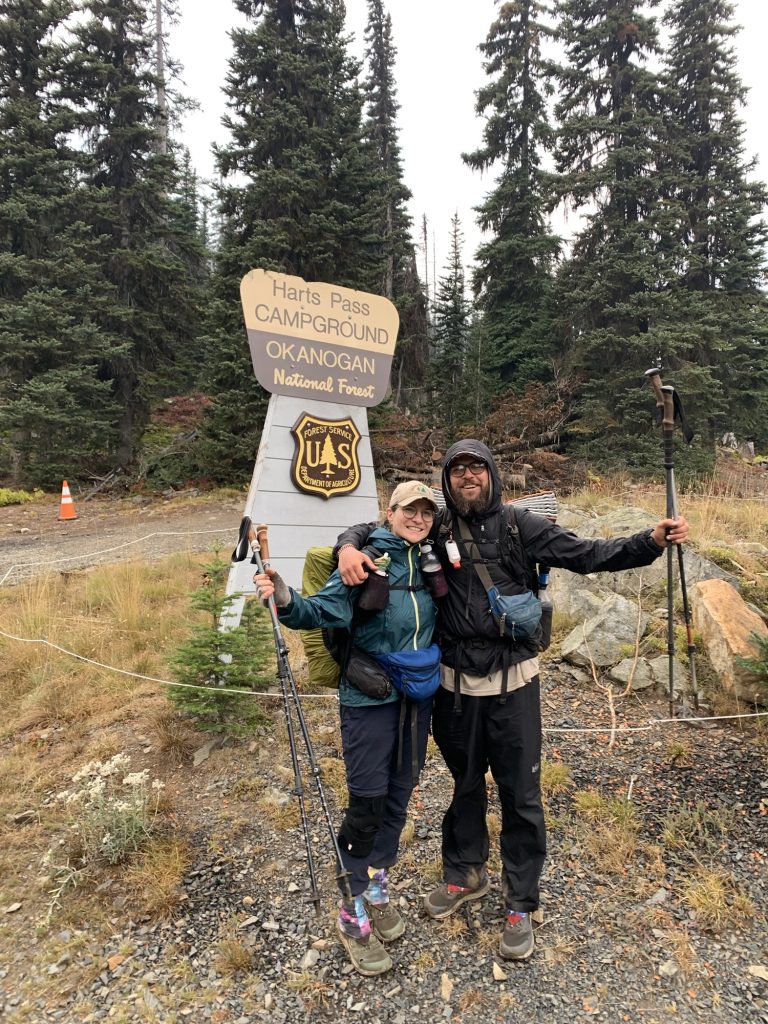
Day 142: In the end we’re all SOBOs / Victory Lap back to Harts Pass – The Last Steps of a long Adventure
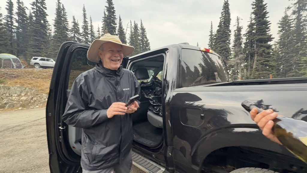
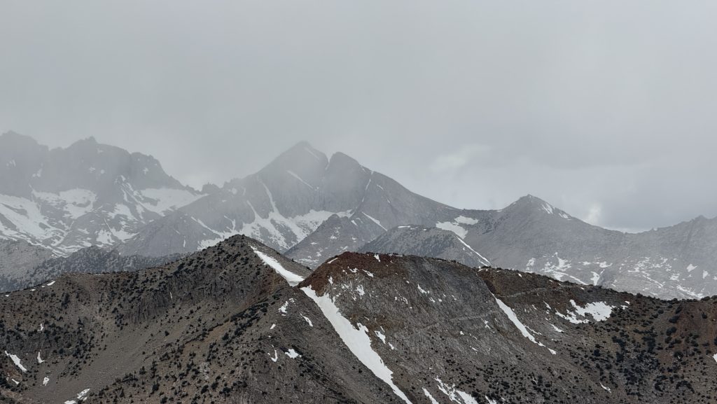
Our last morning on trail. It rained through the night, and when we crawled out of the tent, the sky was heavy and the air sharp. We knew Iceman’s dad would meet us between five and six at Harts Pass, so we planned to be there by four—no way were we going to make him wait. It felt fitting, really. Iceman got all his love for hiking from his dad—an Appalachian trail thru-hiker himself—so having him there at the very end of the PCT felt poetic. Iceman was sure his dad would want to hike the final few miles with us, to finish the journey side by side. I can’t imagine anyone better to meet us at Harts Pass. Exiting for me to finally meet the legend that is Icemana dad, having heard countless adventure stories over the last 5 months.

Twelve miles in, with about ten left to go, I started scanning the misty ridgelines for a tall man in a wide-brimmed hat and a blue rain jacket, just as Iceman had described his dad, trail name: Tin Man. But there was no sign of him. The world was gray and quiet, fog swallowing everything beyond a few meters. The rain came in sheets, cold and unforgiving. We were soaked but grateful—grateful for this incredible adventure, grateful we didn’t have to do this again tomorrow. It could have snowed any minute. We were exhausted but happy.
When we finally reached the trailhead and stumbled into a parking lot, relief washed over us—until we realized we were in the wrong place. Not Harts Pass. One wrong turn. My heart sank. I told Iceman we had to get back on the PCT quickly. His dad didn’t have a satellite phone, and there was zero reception out here. If we missed him, he could’ve hiked for hours looking for us, completely off-grid.
We pushed our way back through dripping trees and tangled brush, shouting his name into the fog. Then, through the rain, a figure appeared—a tall man, wide-brimmed hat, black jacket. We yelled again, louder this time. And then came a cheerful call back through the mist:
“I’ve got an Uber Eats delivery for Iceman and Disco!”
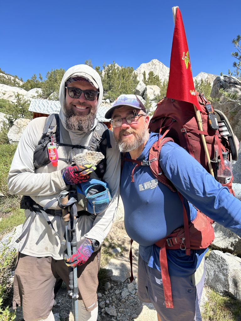
There he was. The legend himself—Iceman’s dad, Tin Man. We laughed, shouted, hugged, the tension melting away. For the last fifteen minutes of trail, we walked together through the rain toward Harts Pass. A proper ending.
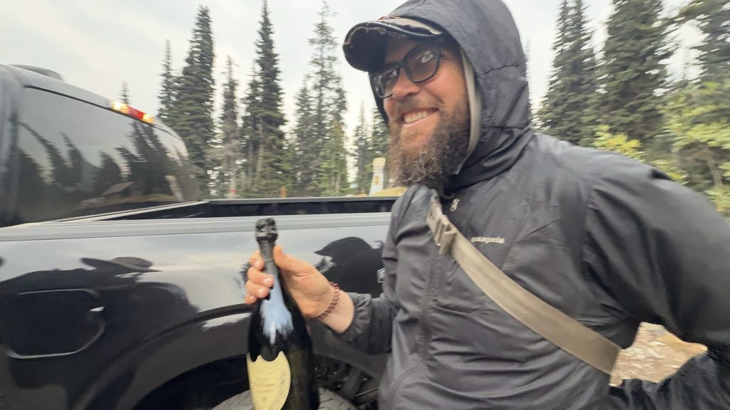
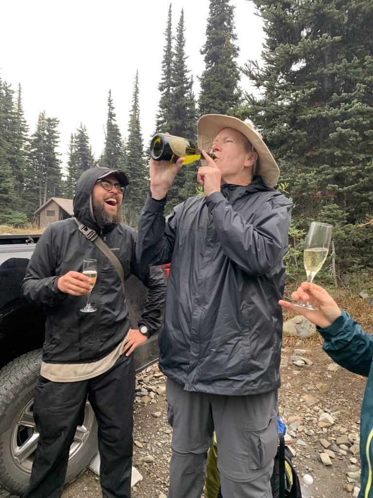
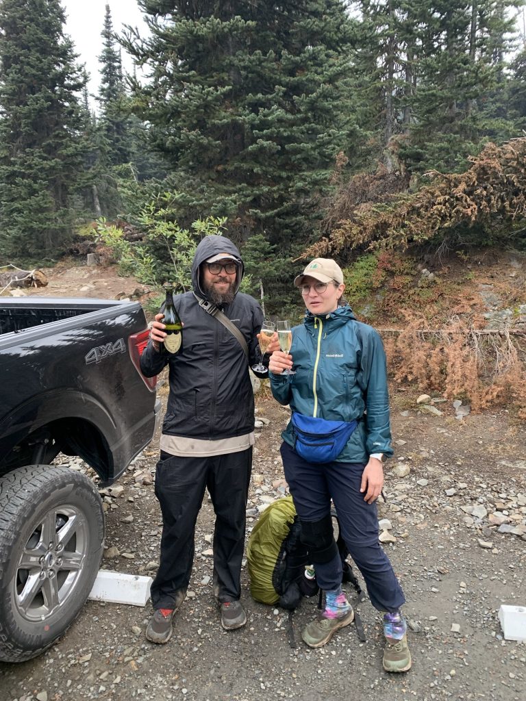
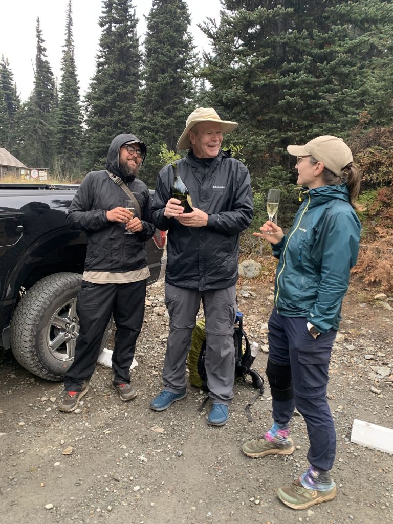
At the parking lot, Tin Man pulled out a white towel. Inside: a bag of ice and a bottle of 2015 Dom Pérignon Champagne. Two crystal glasses followed. He handed them over, grinning ear to ear. We popped the cork—loud and triumphant—and picked it up – leave no trace. Champagne foamed into the glasses, and we all took turns sipping, even pouring a taste for a nearby ranger who wandered over to check what the commotion was about. There we stood in the drizzle, drinking champagne at a remote trailhead, laughing, buzzing, completely alive. 🥰
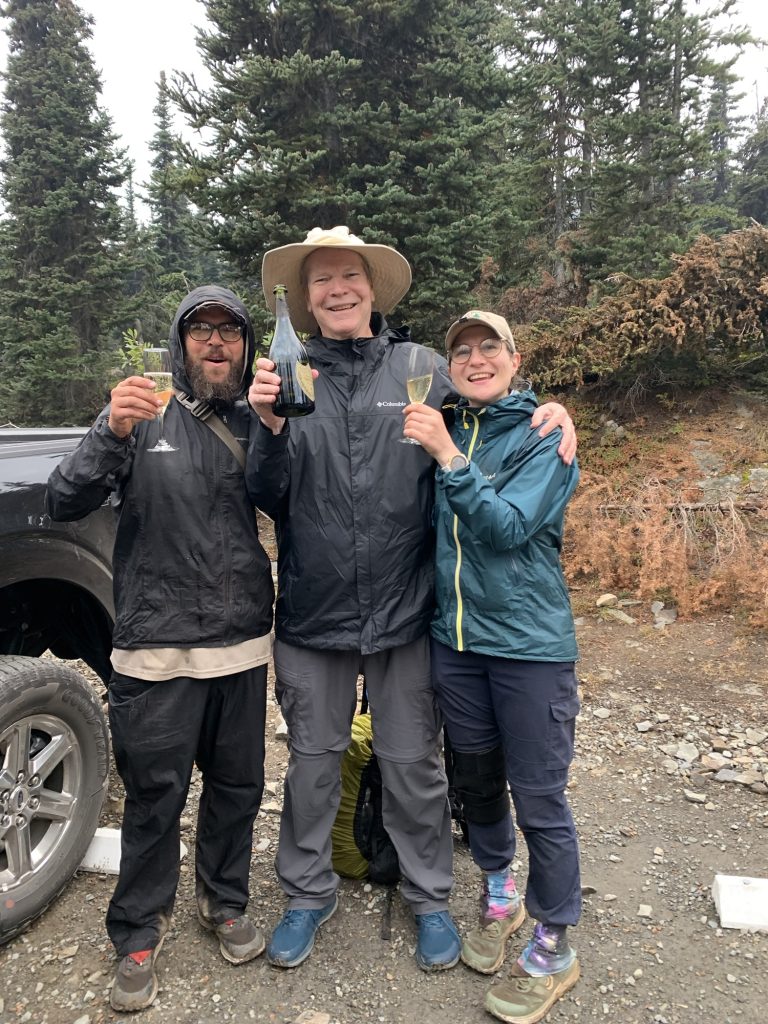
We stayed there for nearly an hour, time flying away in a trance, basking in the joy and disbelief of finishing the Pacific Crest Trail—five and a half months of mountains, deserts, snow, rain, and everything in between. Then we piled into the car and wound our way down the forest road toward Mazama, where our friend Kate waited for us at the bakery. One last reunion, one last round of hugs, one last familiar face from this strange and wonderful world.
The drive to Seattle took us through 5h of dark forest and quiet roads. We stopped for burgers on the way—nothing has ever tasted so good—and rolled into the city around 11 pm.
Kate wanted to catch an early flight back to the UK the next day. We said our goodbyes in the hotel lobby, sleepy but smiling. Then finally—soft beds, clean sheets, silence.
The PCT was over. And the rest of our life’s began. And Iceman and I had made a lot of plans in the last 5 months. 🤩
And for the first time in 142 days, we didn’t have to walk anywhere.
The End
After 2,198 miles / 3398 km and more blisters than I care to count, and plenty of trail dust in places it shouldn’t be, I’ve reached the end of the Pacific Crest Trail. It’s hard to put into words how it feels to be done, but here we are.
I want to thank everyone who made this journey so special — the hikers I met along the way, the incredible trail angels, the drivers who scooped up us dirty, tired wanderers, and every single person who supported us from near or far. Your kindness made the miles lighter and reminded me how much good there is in the world.
This isn’t goodbye for the blog. More adventures are on the horizon, and maybe a few reflections once my head and feet have caught up with the fact that we’re no longer walking.
Thank you, truly. It wouldn’t have been the same without you.
🫶🫶🫶
Disco
Statistics overall
Miles hiked:
• April: 177.4 (start April 17th and low mileage 1st 4 weeks)
• May: 458.9
• June: 345.2
• July: 66.8 (mostly in Germany not hiking)
• August: 503.8
• September: 646.7
Total: 2,198.8 mi
Ascent:
• April: 24,259
• May: 76,510
• June: 70,792
• July: 8,944
• August: 73,640
• September: 117,938
Total: 372,083 ft
Steps:
- April: 557,100 (start April 17th and low mileage 1st 4 weeks)
- May: 1,098,962
- June: 850,719 (Sierra Nevada, high elevation)
- July: 309,951 (mostly in Germany not hiking)
- August: 1,126,373
- September: 1,408,273 (killing it)
Total steps = 5,351,378 steps
Time (hh:mm:ss)
• April: 82:45:27
• May: 211:07:54
• June: 173:28:06
• July: 30:50:08
• August: 205:14:13
• September: 272:44:54
Total: 976:10:42
Calories
• April: 22,716
• May: 56,107
• June: 46,025
• July: 7,252
• August: 47,205
• September: 60,499
Total: 239,804 Cal
Numbers in perspective / Scope / for fun:
Here are some comparisons for those ridiculously large numbers:
Calories Burned: 239,804 Cal
- A 155-lb person burns roughly 300 calories in 30 minutes of brisk walking or 360–420 calories in 30 minutes of running at 6 mph (10-min mile).
- To burn 239,804 calories would take about 666–800 hours of brisk walking or 285–333 hours of running at 6 mph—this would require years of regular exercise for most people.
Hiking Distance: 2,198.8 miles
- Average hiking speed is 2–4 miles per hour.
- At 3 mph, it would take around 733 hours to hike this distance, or nearly 30 straight days of non-stop hiking.
- The distance is similar to hiking from New York City to Salt Lake City, Utah.
Total Ascent: 372,083 ft
- Mount Everest is 29,032 feet high.
- Your ascent is equivalent to climbing Mount Everest about 12.8 times (372,083 / 29,032 ≈ 12.8).
Total Time: 976 hours 10 minutes (976.18 hours)
- A standard full-time work year is 2,080 hours (40 hours per week × 52 weeks).
- 976 hours of hiking is equivalent to roughly 24.4 work weeks, or about 6 months of full-time work.
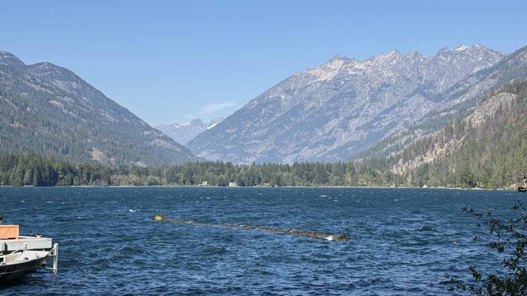
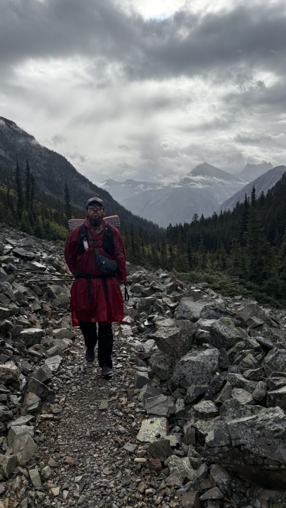
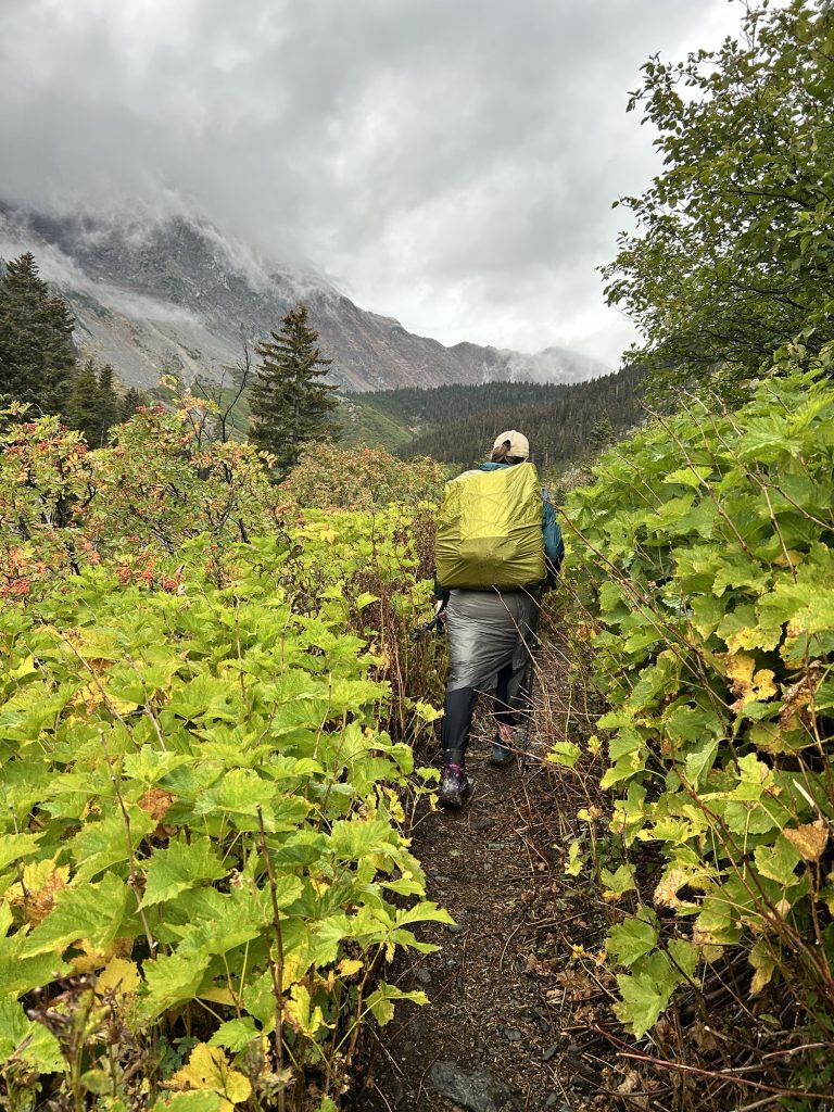
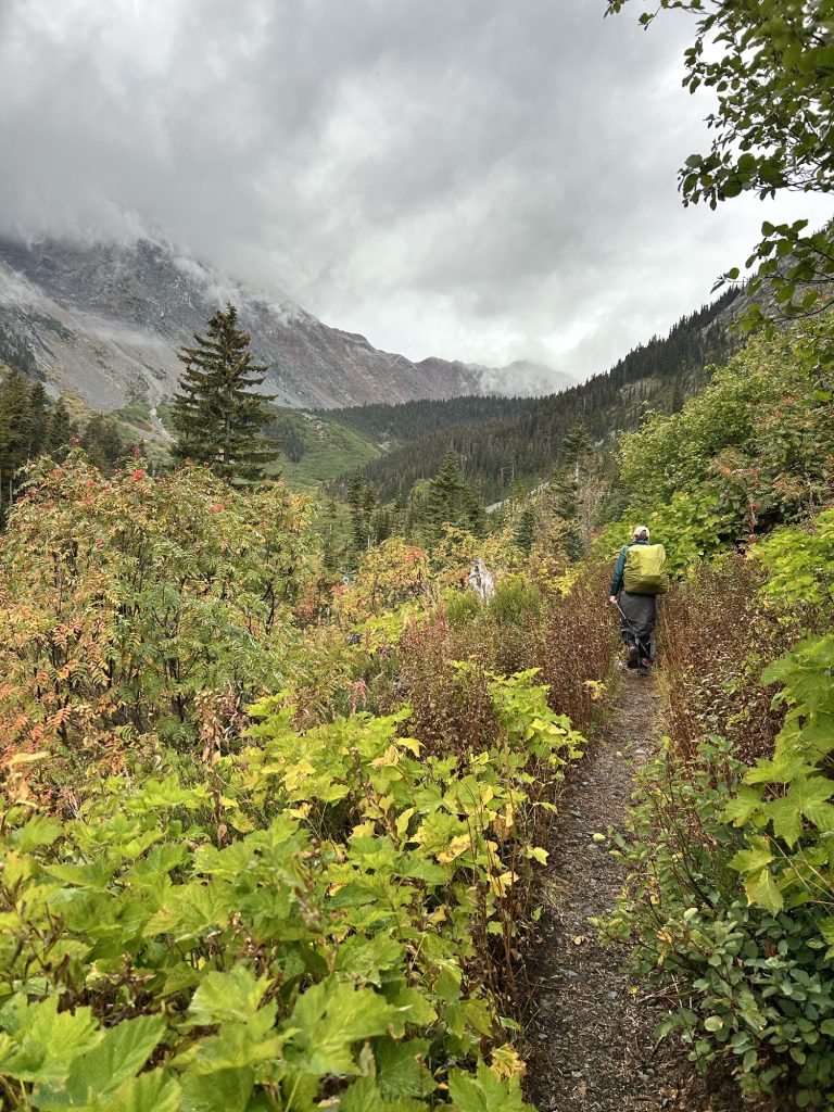
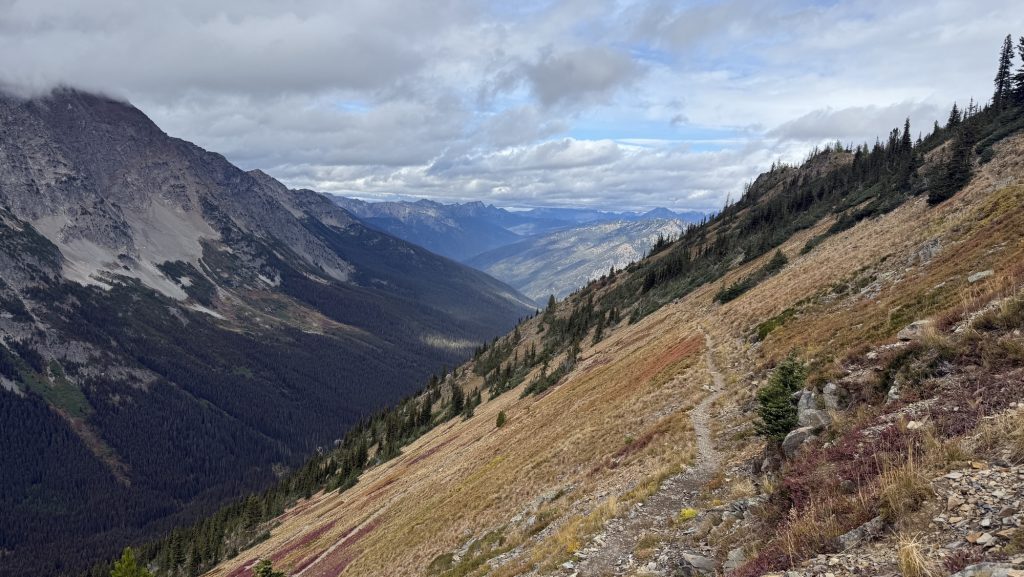
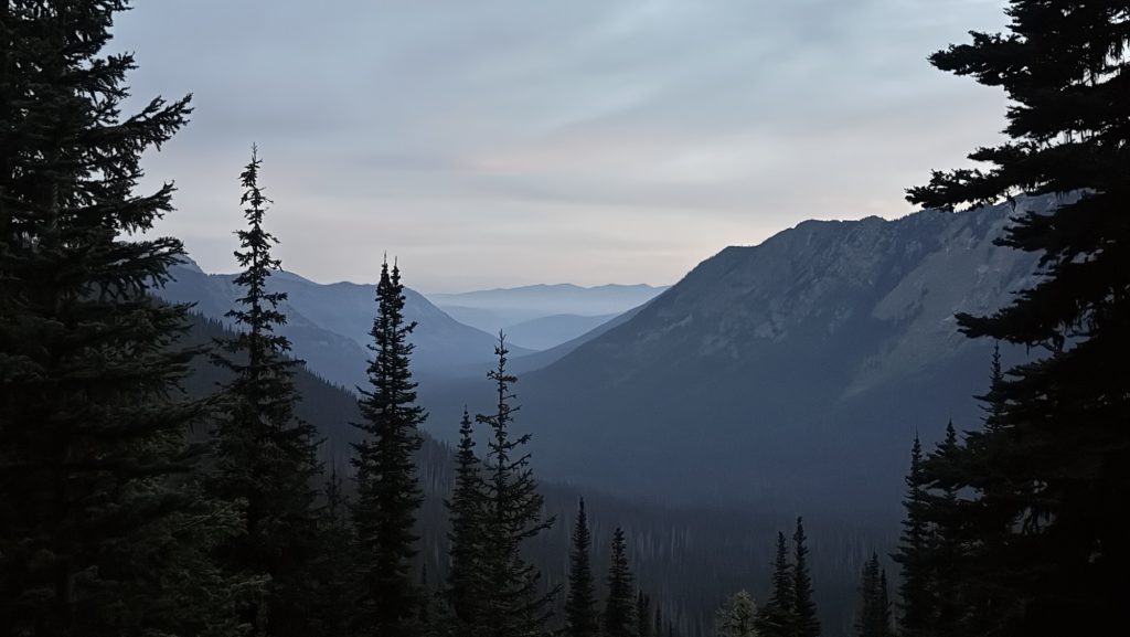
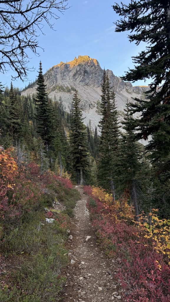
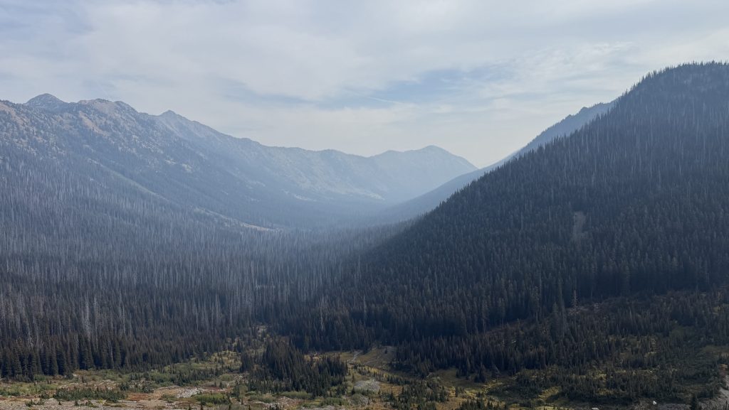
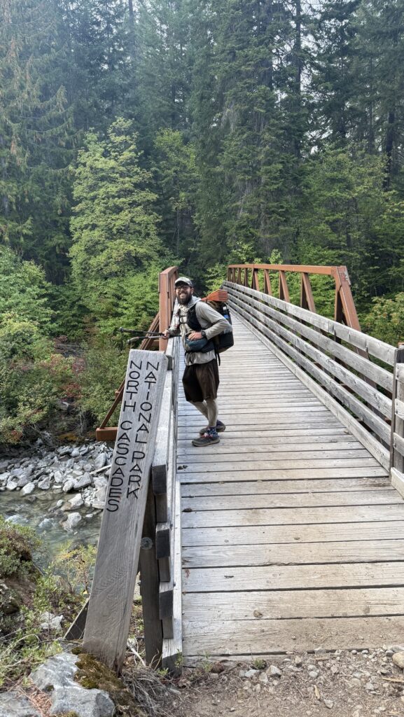
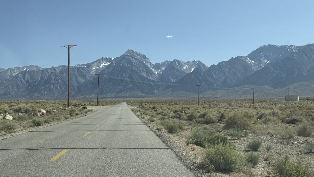
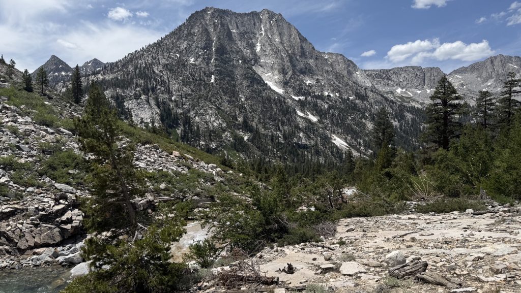
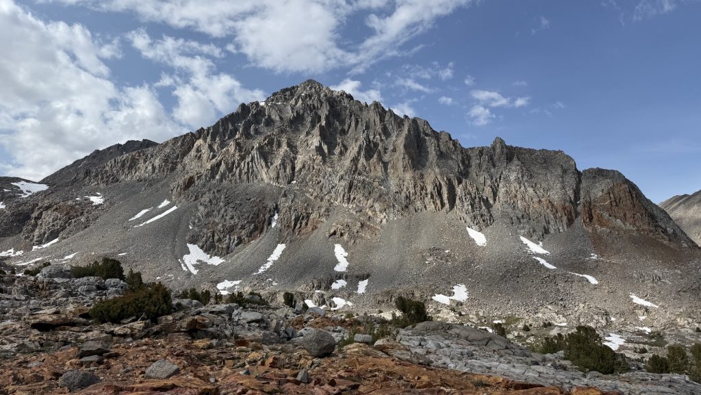
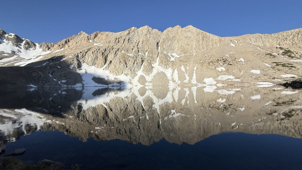
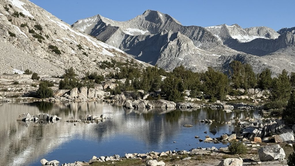
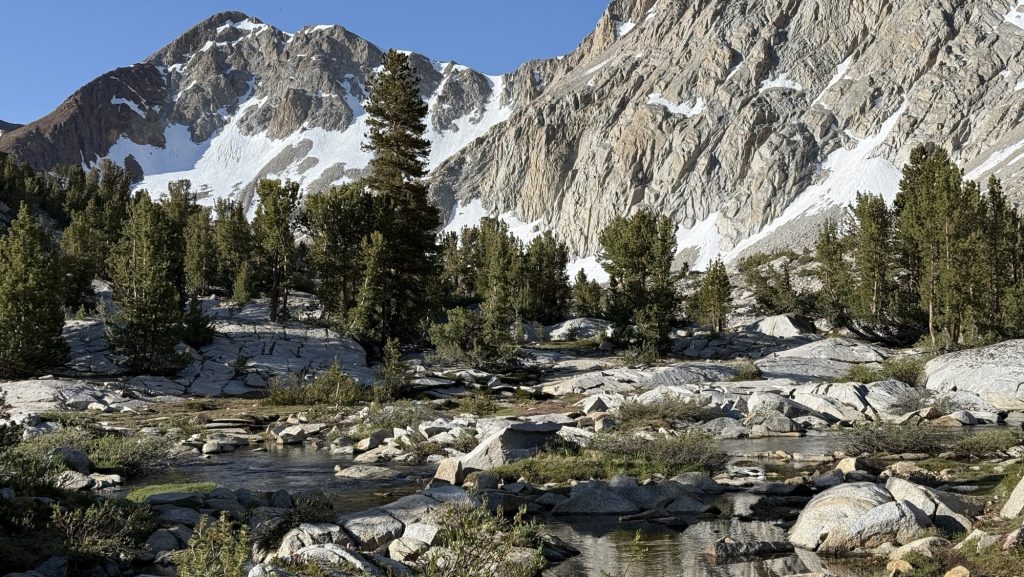
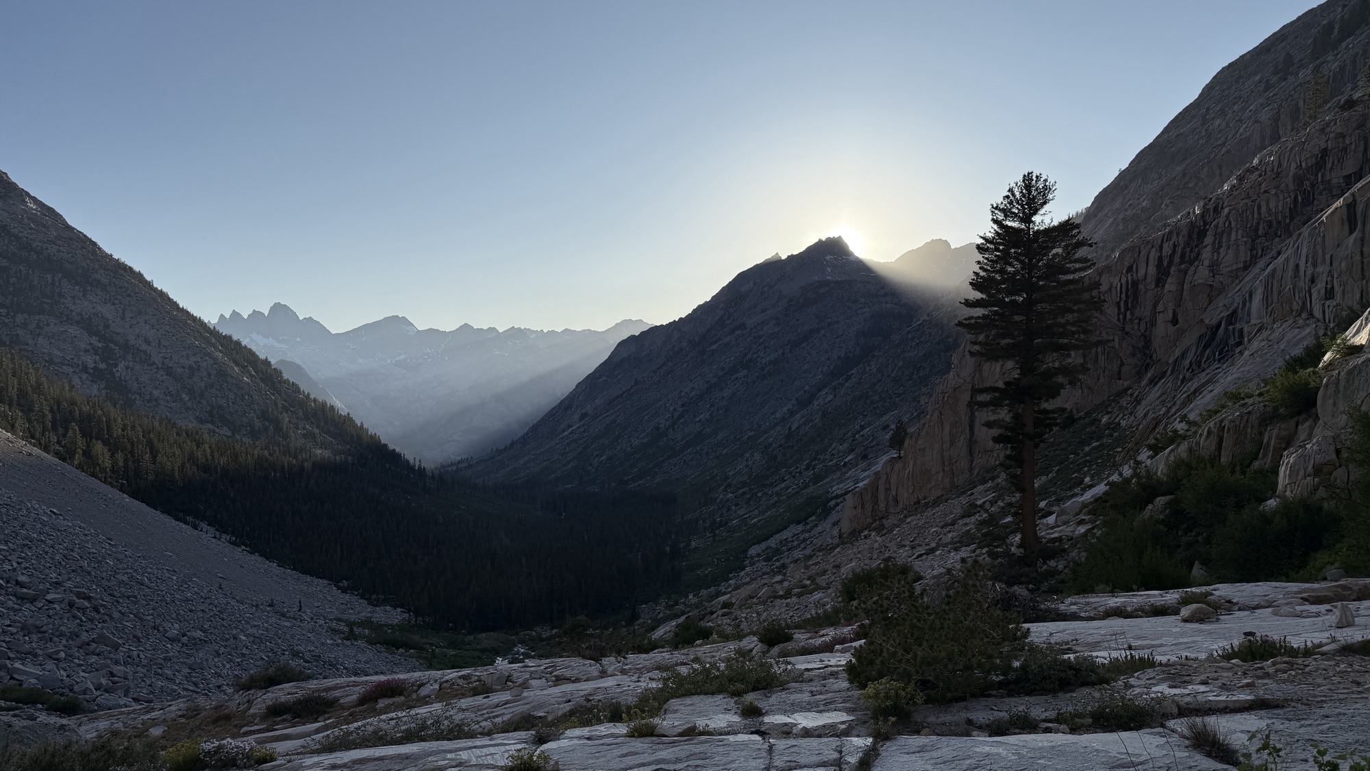
Days 135 – 137: PCT Miles 2500.73 – 2575.1
Day 135: Hiking into the night 2524.5 (23.77)
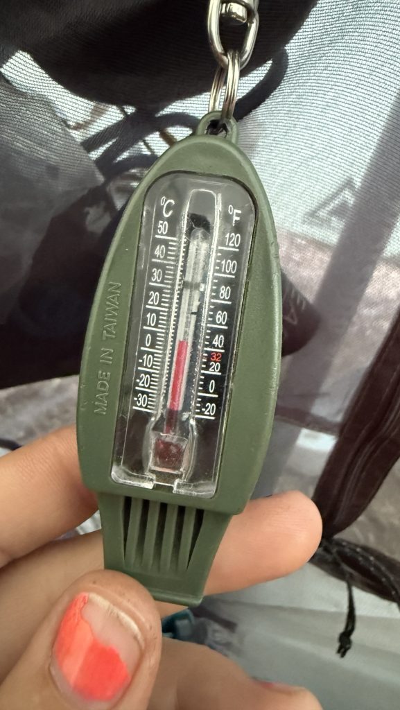
The morning was cold and we kept sleeping till 6am. It was below 10C. We left at 7.30am. We saw the sun come out. It was so great.
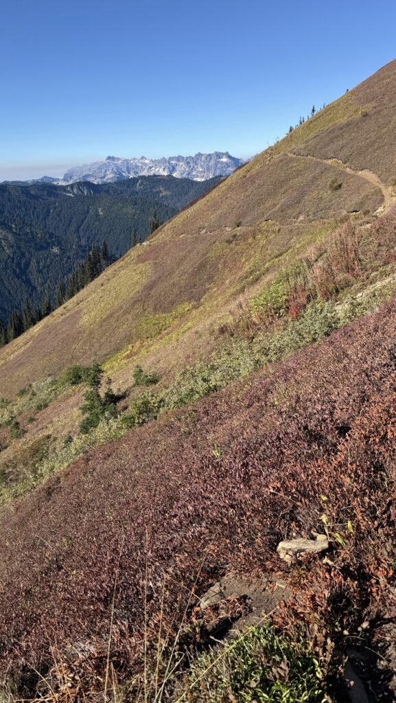
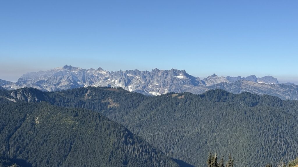

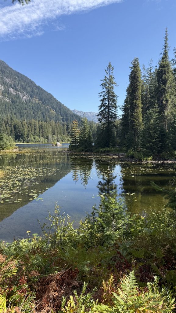
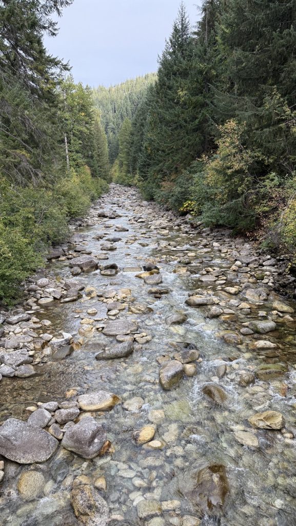
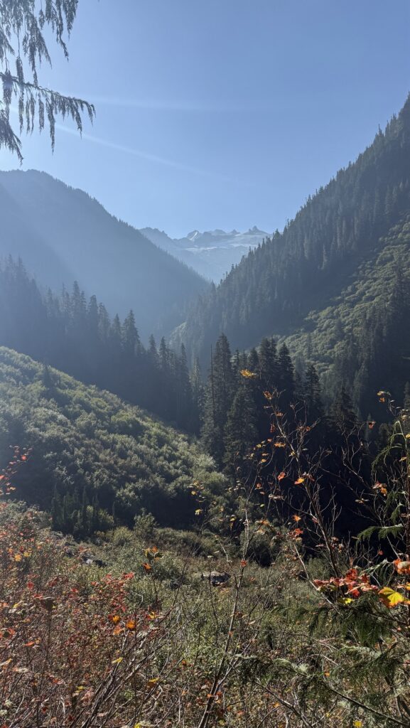
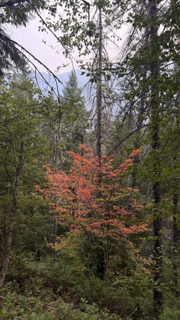
We warmed up and I solar charged my power bank. We climbed a lot and soon saw glacier covered peaks and red mountain tops. It was so beautiful. My left shin hurt a little but not to bad. We went over a saddle down into a deep valley and for the rest of the day stayed in a forest. We had lunch near a stream where the sun could dry our sleeping bags and tent.
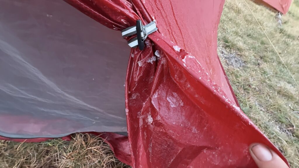
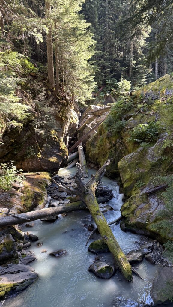
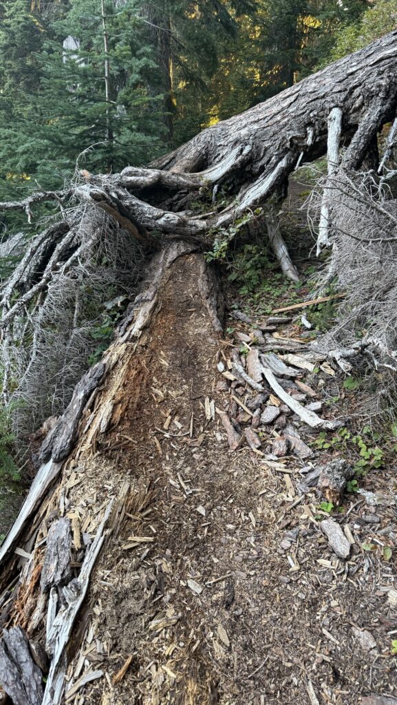
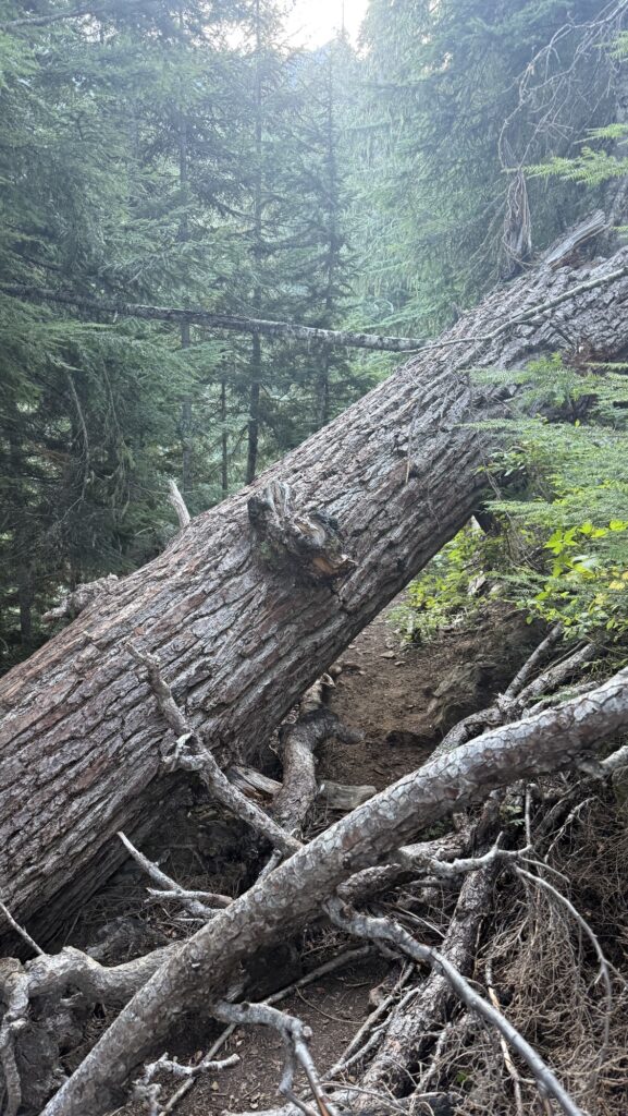
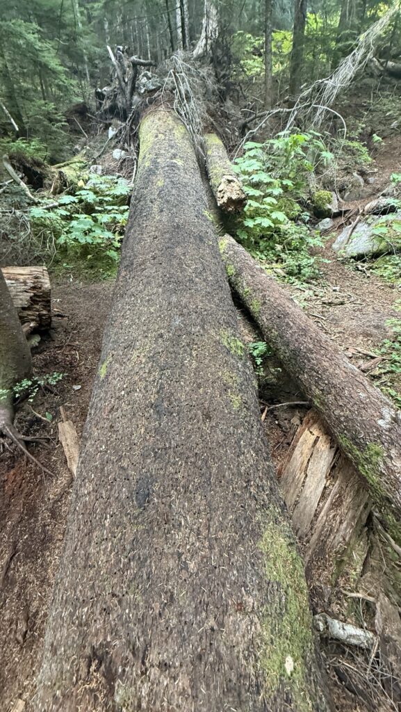
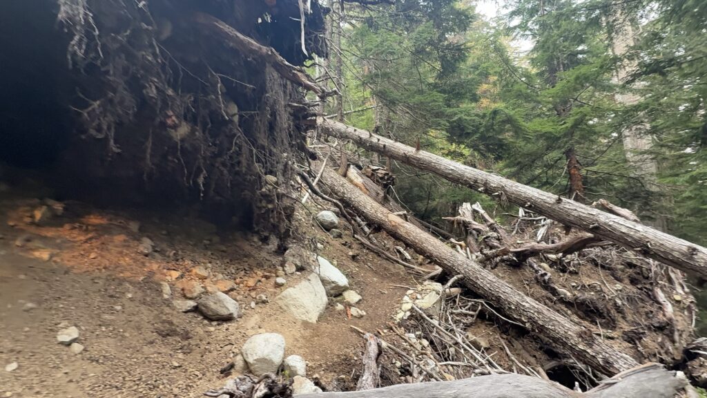
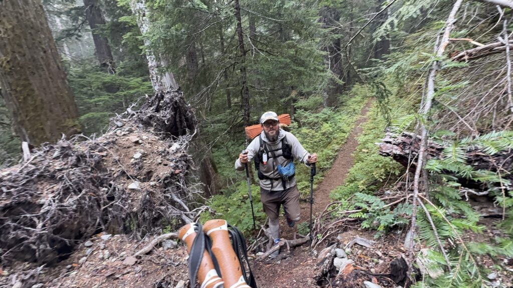
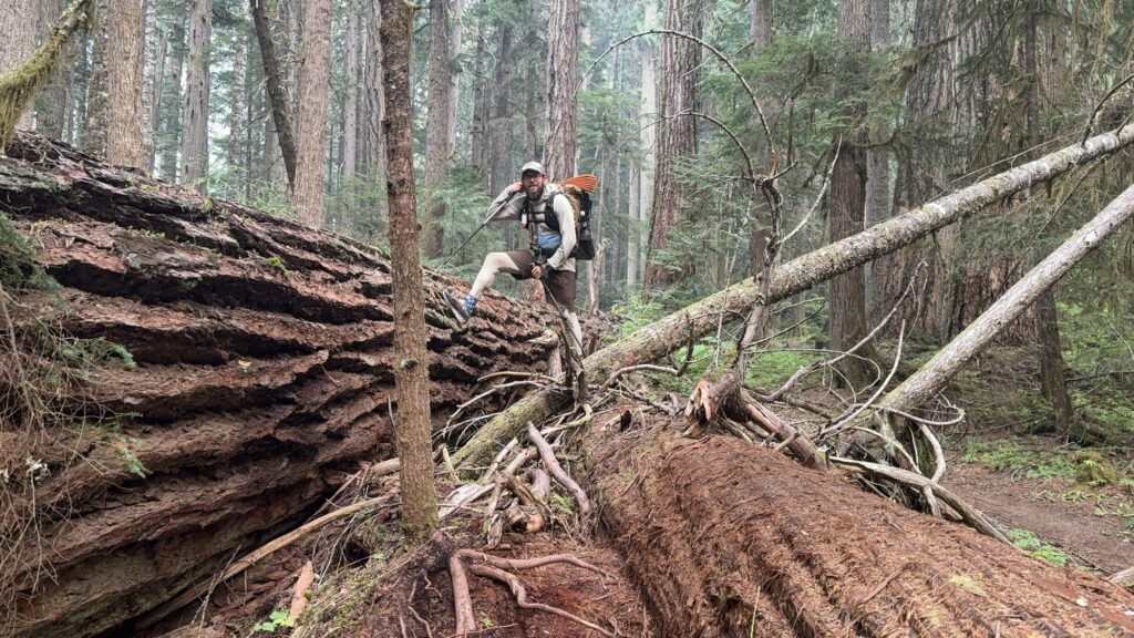
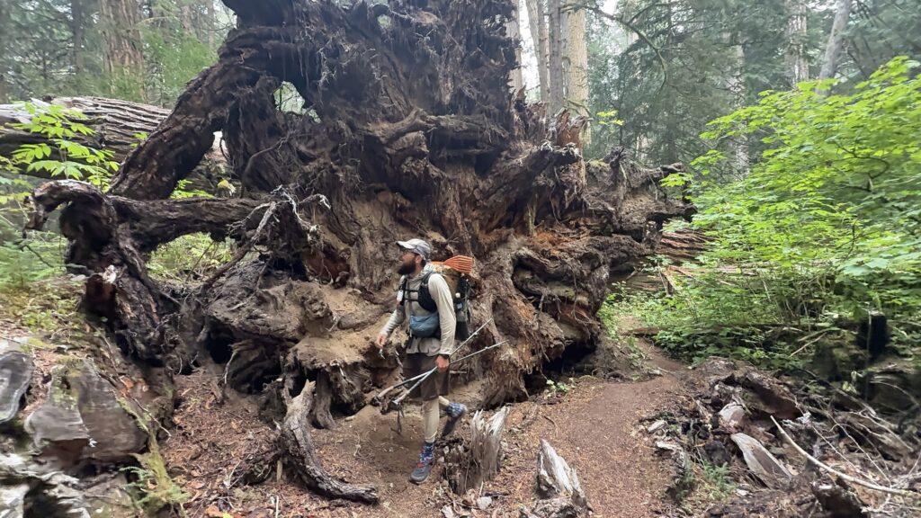
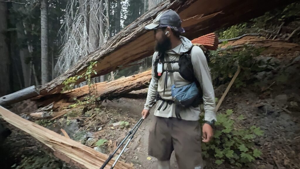
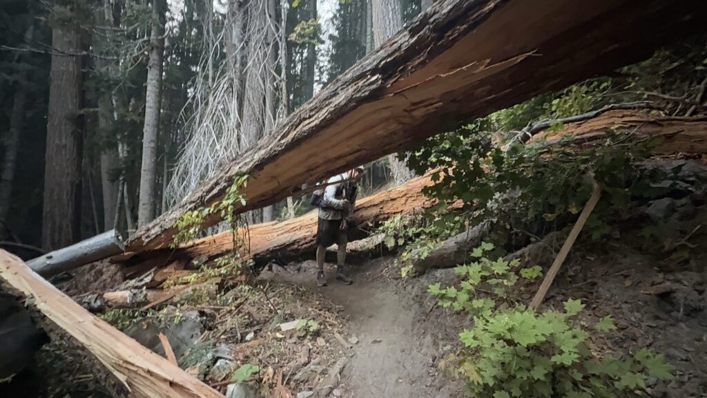
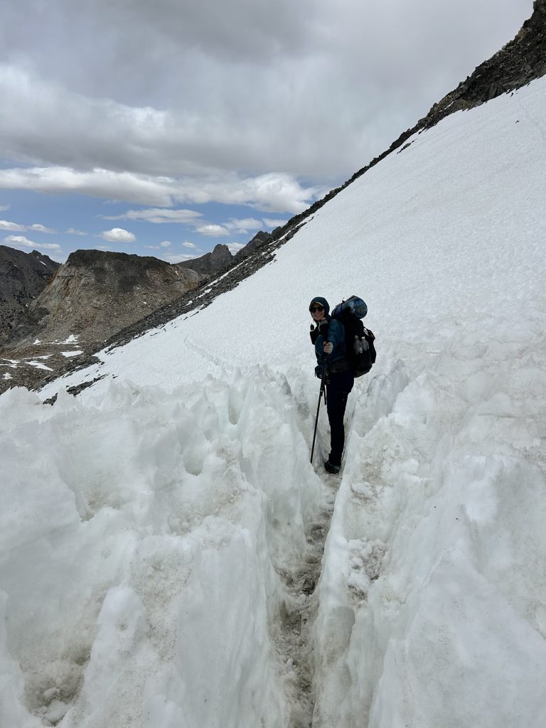
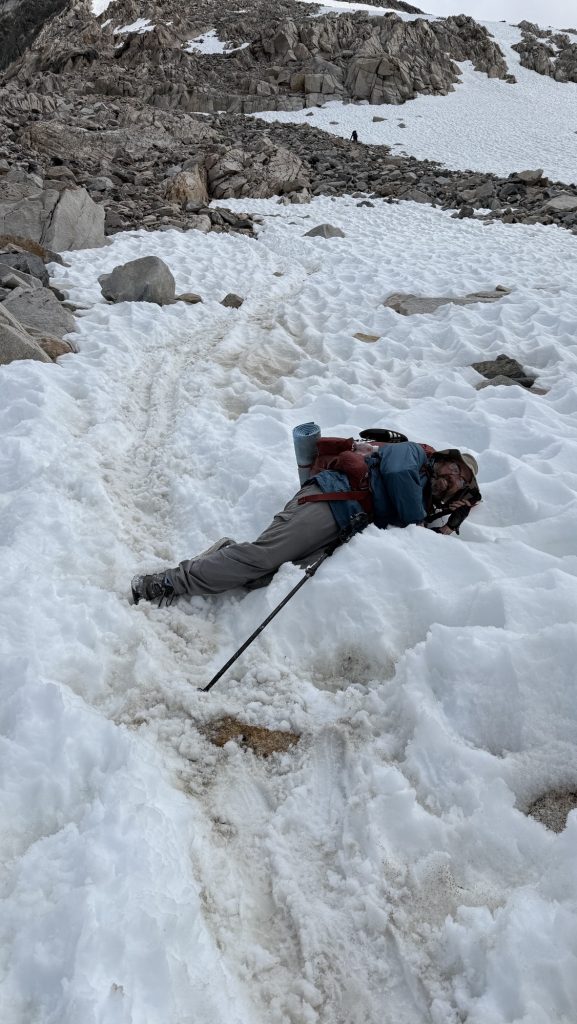
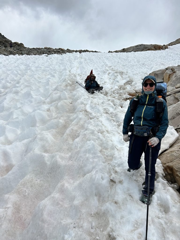
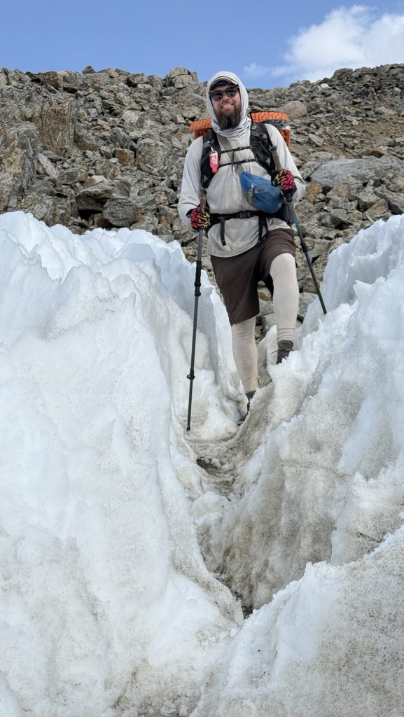
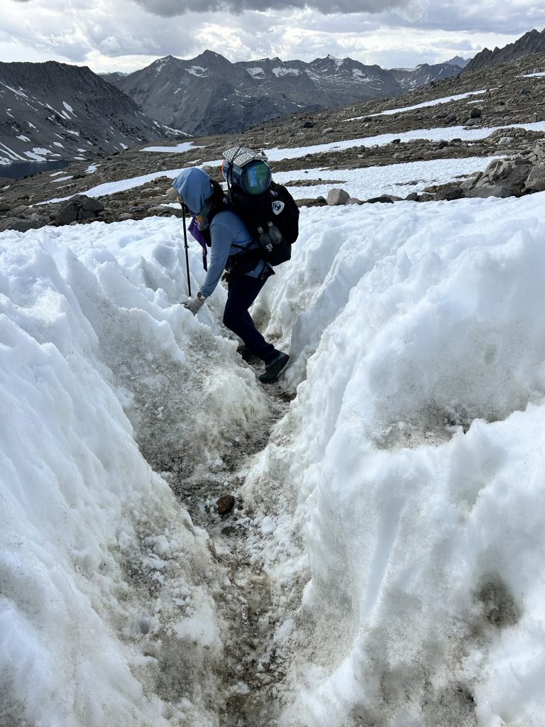
We had to climb countless fallen trees, sometimes several on top of each other and in many places there was no trail and we went straight up a slippery mud slide. At some point Iceman slipped into a tree and his hip belt buckle broke. Oh no! He could tie it together somehow but the hip buckle is essential, with no service the next few days, this is an issue. Section K is infamous for having over 30 massive fallen red wood trees on trail. Sometimes Iceman had to push me up one side of the tree.
We calculated in order to make the 6.15pm shuttle to Stehekin we should hike 25 miles today and tomorrow and 20 miles the third day. Weirdly, in the afternoon my left shin hurt so bad I had to take Ibuprofen and cool my foot in a glacial stream. It seemed to help.
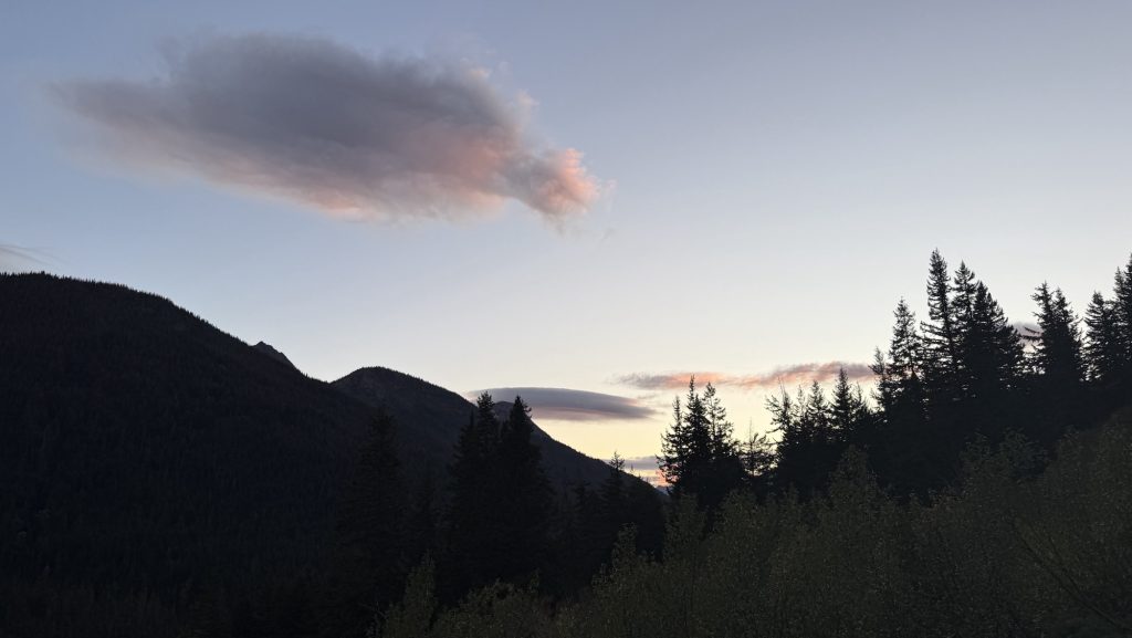
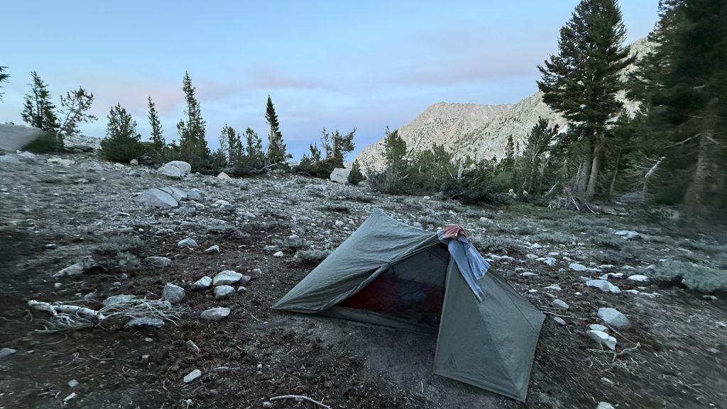
We hiked up some more and saw an incredible sunset over rugged mountains. With still at least 3 miles to go, we had to night hike. This is always spooky to me as you see only a little bulb in front of you. It’s scary. We climbed over a ridge line and down on the other side.
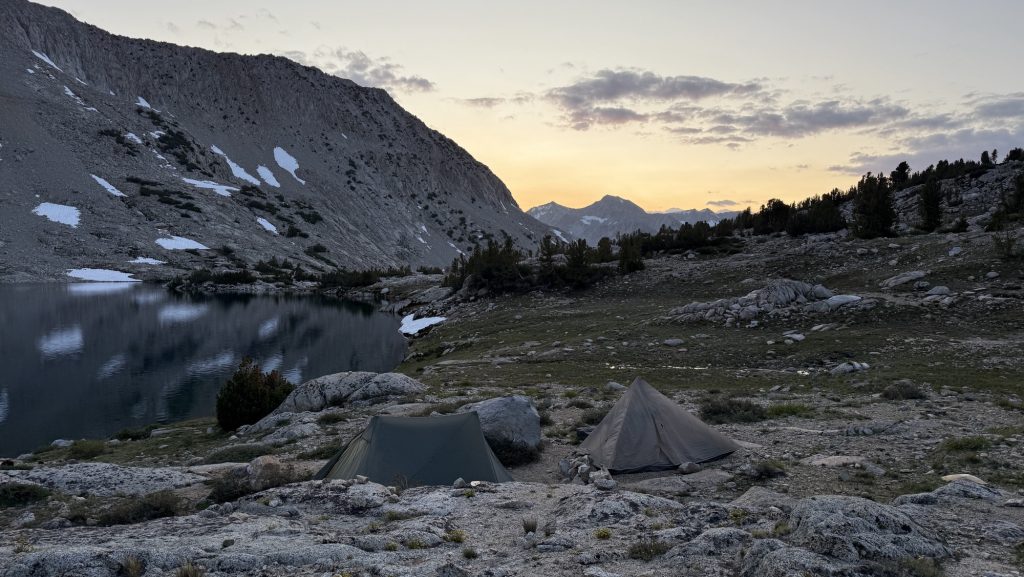
The lake we wanted to stay at has about 10 tents so we kept going. Another mile out so and we were almost alone, just one other tent. Much better. Amazing stars all around.
Miles hiked: 23.77
Ascent: 5799 ft
Descent: 5643 ft
Steps: 54.786
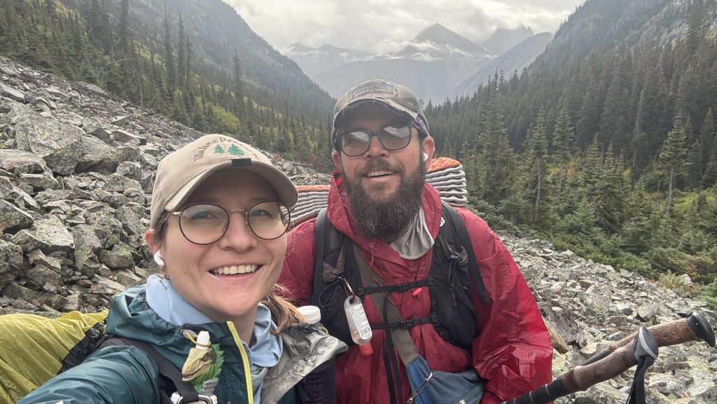
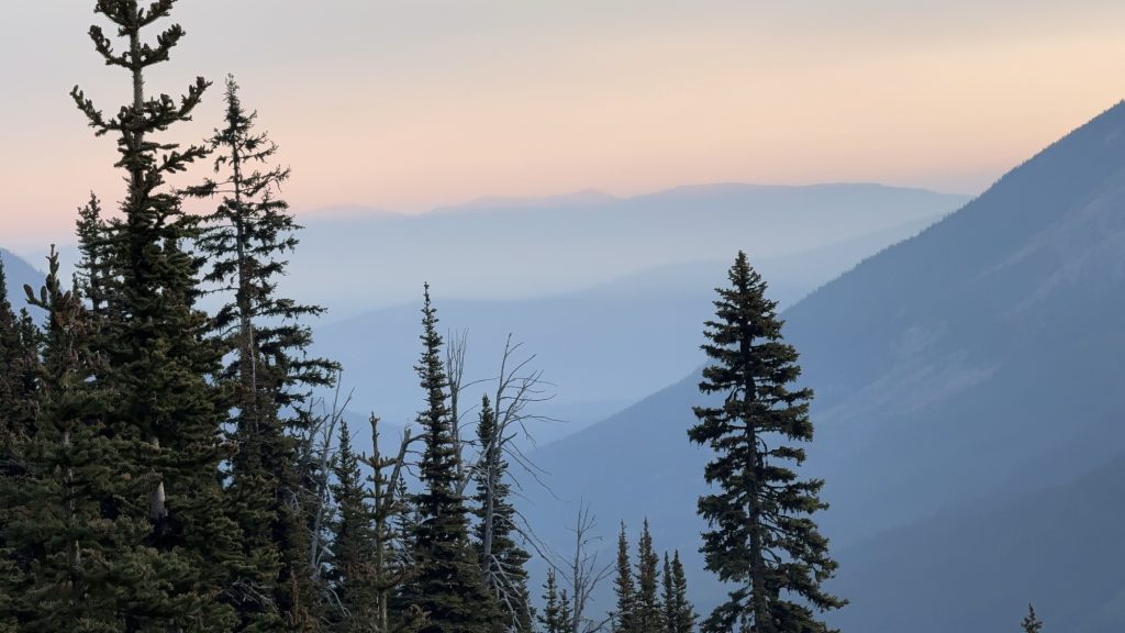
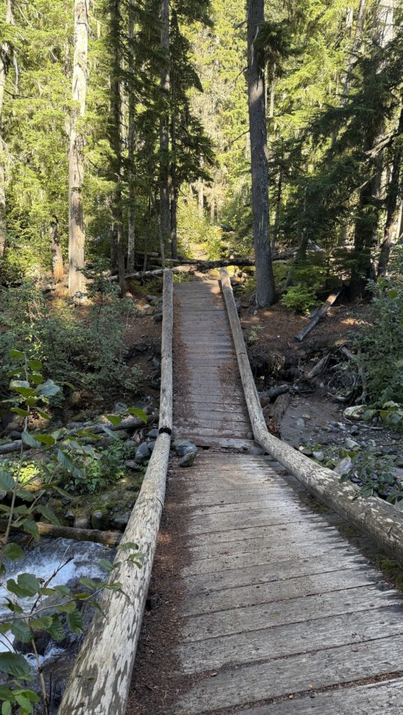
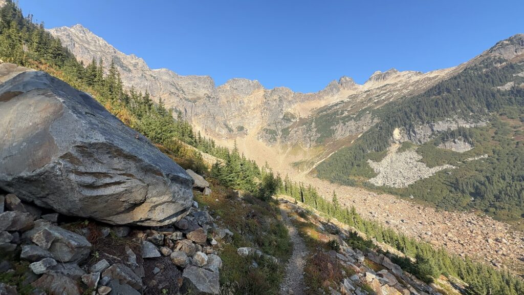
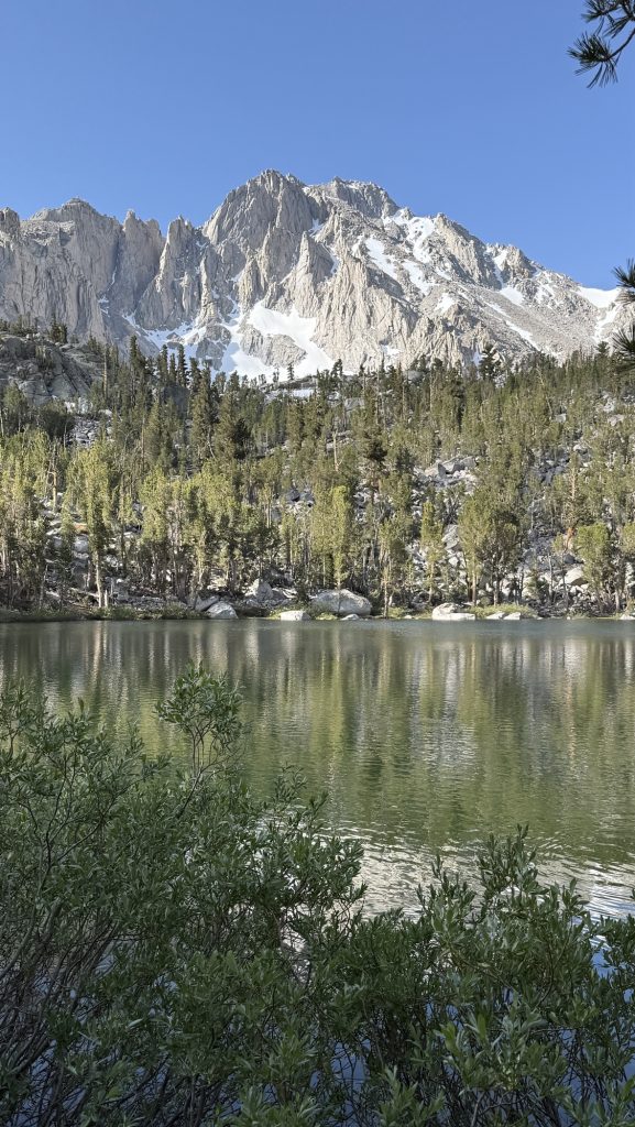
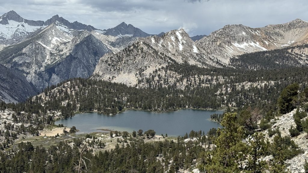
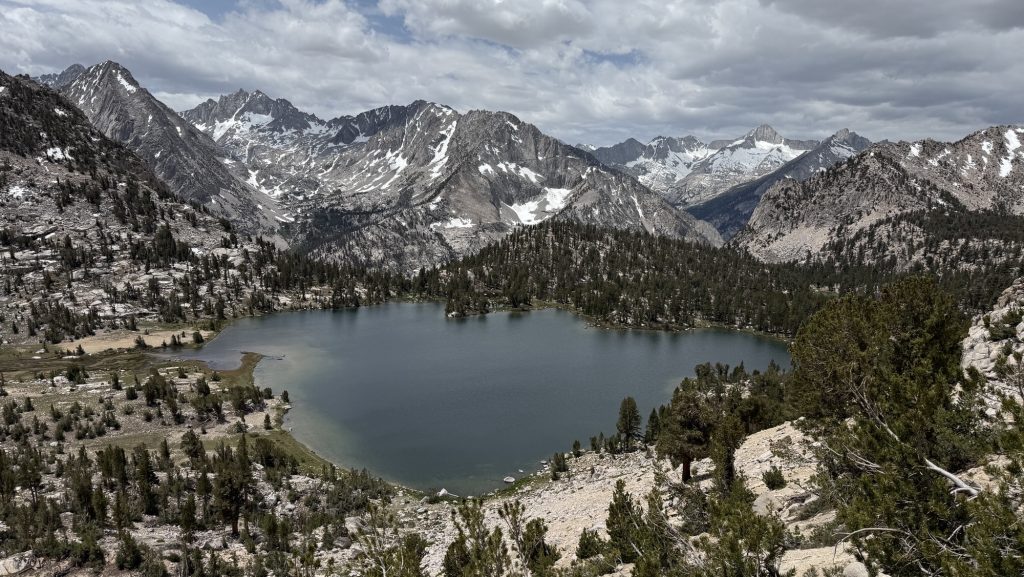
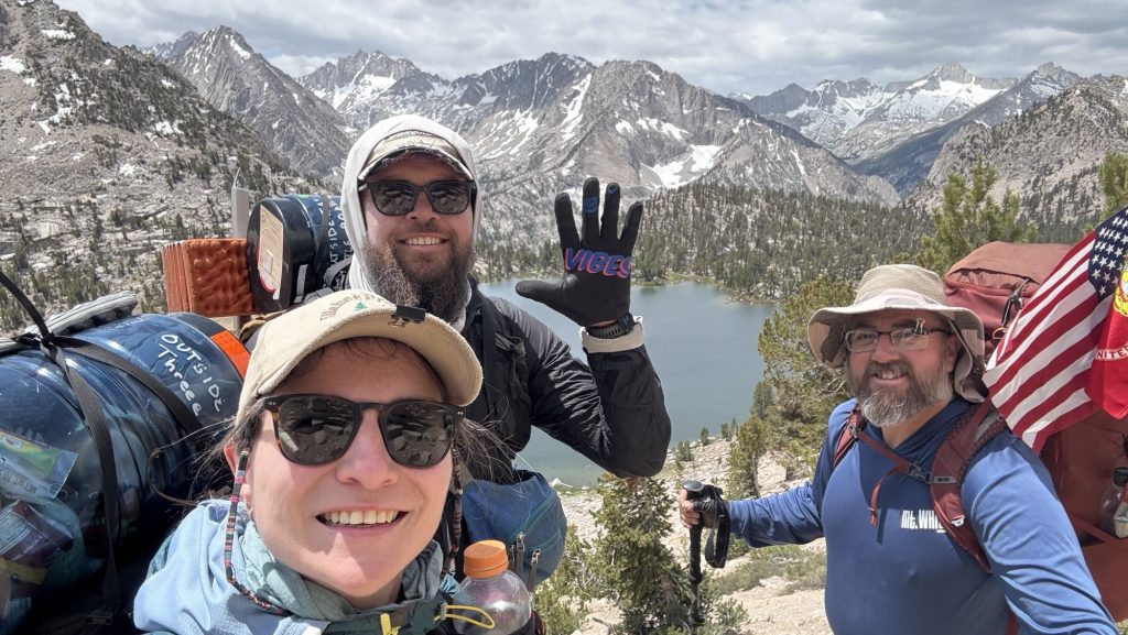
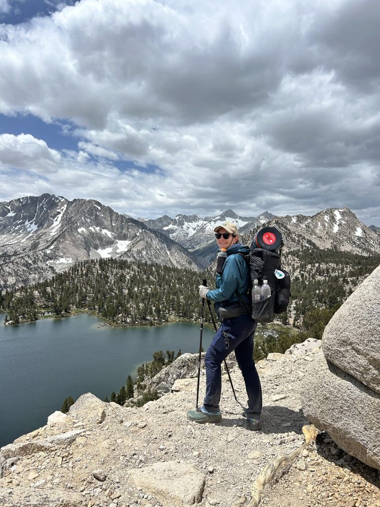
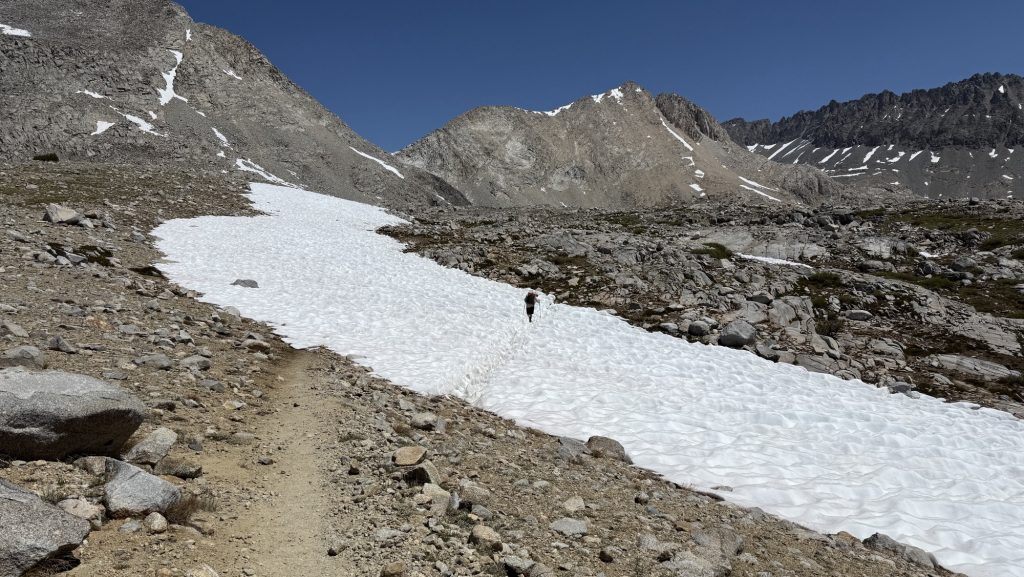
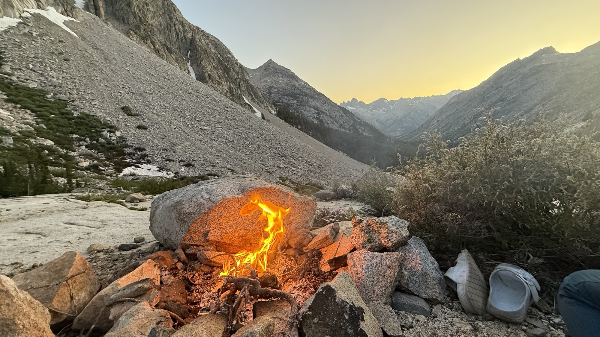
Day 136: Miner Creek 2552.3 (28.9)
The day began in the most responsible way possible — by turning off my 6 a.m. alarm and falling blissfully back asleep. When we finally stumbled out of our tent at 6:30, the world was already smoky, and we were already behind schedule. Things only went downhill from there — well, first they went uphill, eight miles and 2,500 feet of it.
I also made an unfortunate early-morning contribution to the PCT landscape. I thought I’d found a discreet side trail, but nope — turns out it was visible from the main path. Somewhere out there, a hiker is probably still wondering about my life choices. Sorry about that.
By lunchtime, things got real. We’d only covered 10 miles, it was already 1 p.m., and we realized that to catch the 6:15 p.m. shuttle to Stehekin tomorrow, we needed to crank out another 20 miles today. Nothing motivates quite like the threat of missing your ride to civilization (and real food).
The trail responded like a cranky old gatekeeper. Blowdowns everywhere — tree trunks taller than us, forcing awkward climbs, yoga moves, and questionable language. Progress was slow and sweaty. Somewhere between fallen trees, we finished our audiobook ‘The Last Season’, a fascinating read about a backcountry ranger’s disappearance in Sequoia & Kings Canyon, my favorite section of the PCT. It made me grateful that, unlike him, I only have to worry about getting to Stehekin on time and not going missing entirely.
To keep the mental wheels turning, we switched to ‘21st Century UFOs’ on audiobook. Nothing adds atmosphere to a smoky mountain night like aliens. The haze stuck around all day, making our heads throb just enough to add an extra layer of misery. Meanwhile, Iceman managed to embody trail magic by gifting a lighter to a fellow hiker, and Arnoud worked some satellite-messaging magic to book us a cabin in Stehekin. Civilization was calling — faintly, through the smoke.

We kept hiking until 9 p.m., headlamps cutting through the gloom, stumbling over roots like zombies on a mission. Luckily, we found a flat camp spot with room to spare — and just one other hiker, no witnesses to our late arrival. My hip was complaining, but my left shin was quiet, and my right knee seems to have accepted its fate after weeks of stretching.
The stats say it all:
Miles hiked: 28.9 😝
Ascent: 5,668 ft
Descent: 2,650 ft
Steps: 66,178
A long day, a smoky sky, and a hard-earned camp. Tomorrow, Stehekin — assuming we can still stand up in the morning.
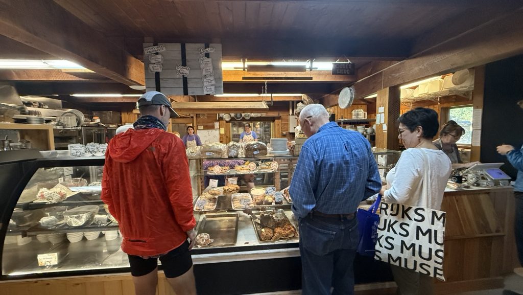
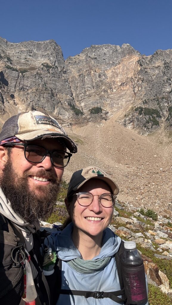
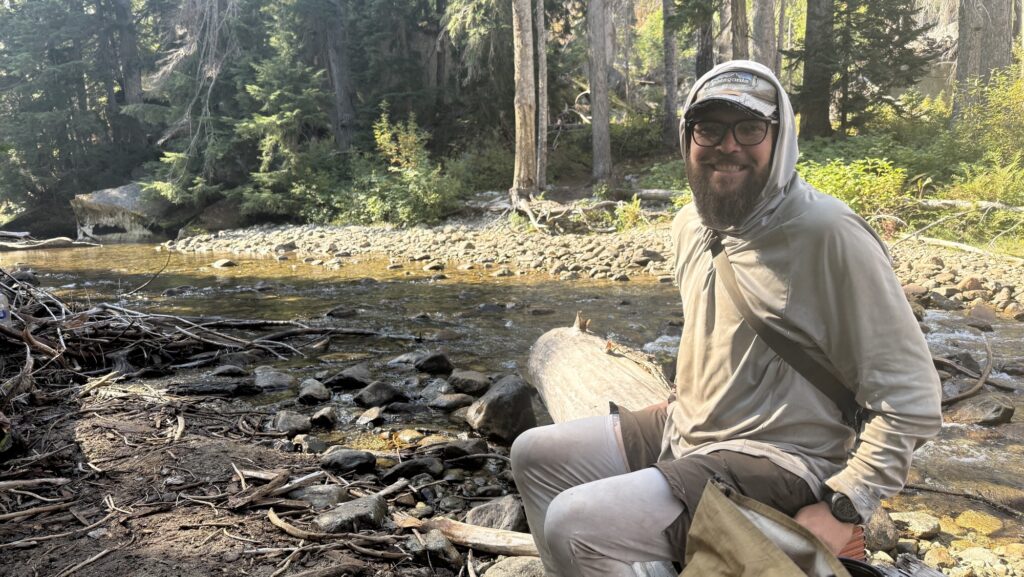
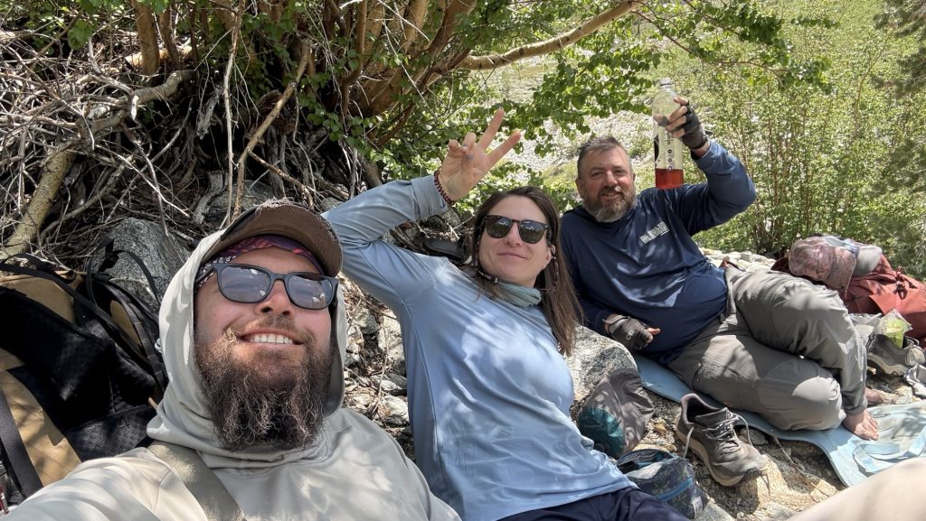
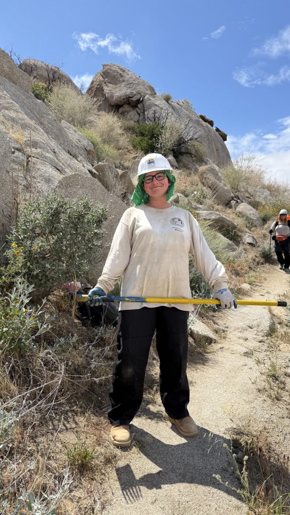
Day 137: The Day We Chased Stehekin (and Steak) 2575.1 (23.56)
Some mornings, adventure starts with a sunrise. Ours started with an alarm that laughed in our faces at 5:30 a.m. You know that blurry-eyed moment when you question every decision that led you to this exact point in the timeline? That was us while stuffing breakfast into our faces at dawn, convincing ourselves that the early bird gets… a shuttle seat, apparently.
By 7:00 a.m. on the dot, we stepped into the wilderness like punctual legends. If there’s a spiritual reward for hitting the trail before coffee fully hits your bloodstream, we earned it.
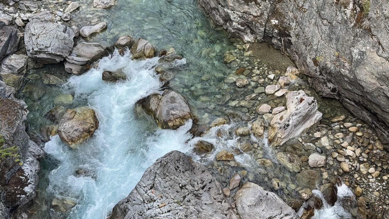
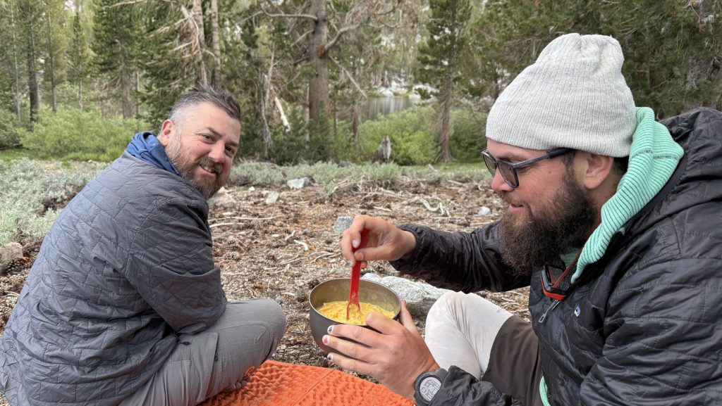
Around midday, we stopped at “the Creek”—which sounds poetic but is really just a gorgeous creek. There, we assembled what can only be described as a mourning burrito: tortillas, rice, beans, and the faint scent of regret that we didn’t pack cheese and salami. It was warm, which automatically made it the best lunch of the week.


With tortillas in hand and questionable enthusiasm in our legs, we pressed on.
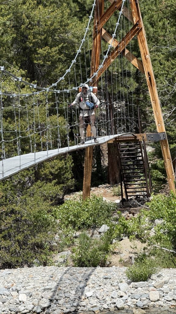
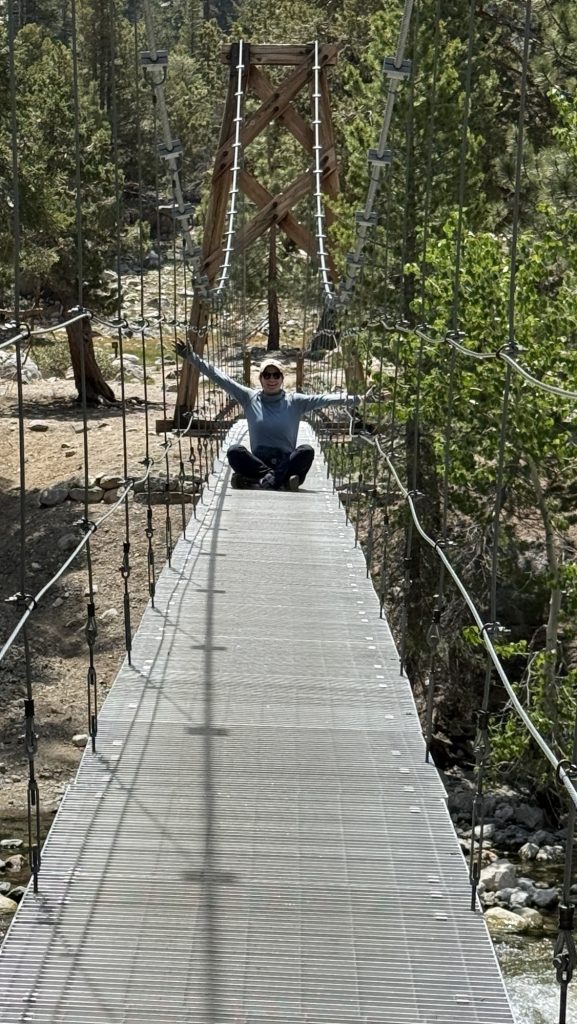
After 10 hours of steady climbing, descending, and pretending to enjoy nature’s cruel beauty, we rolled into the High Bridge Ranger Cabin at a precise 5:50 p.m. (Is this what adulting looks like?)
We even had time to check out the salmon under the bridge—serene little zen masters of the current, gliding in circles while we contemplated our own mortal fragility and whether we smelled as bad as we thought. Spoiler: we did.


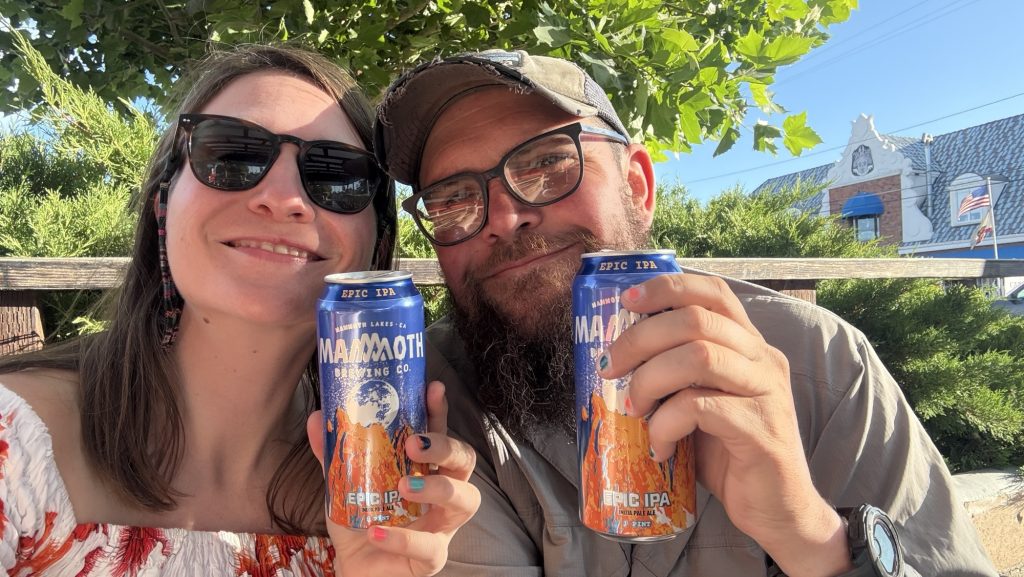
Then, at 6:15 p.m., the shuttle appeared like a chariot of glory. Destination: Stehekin Valley Ranch. Estimated mood upon arrival: feral delight.
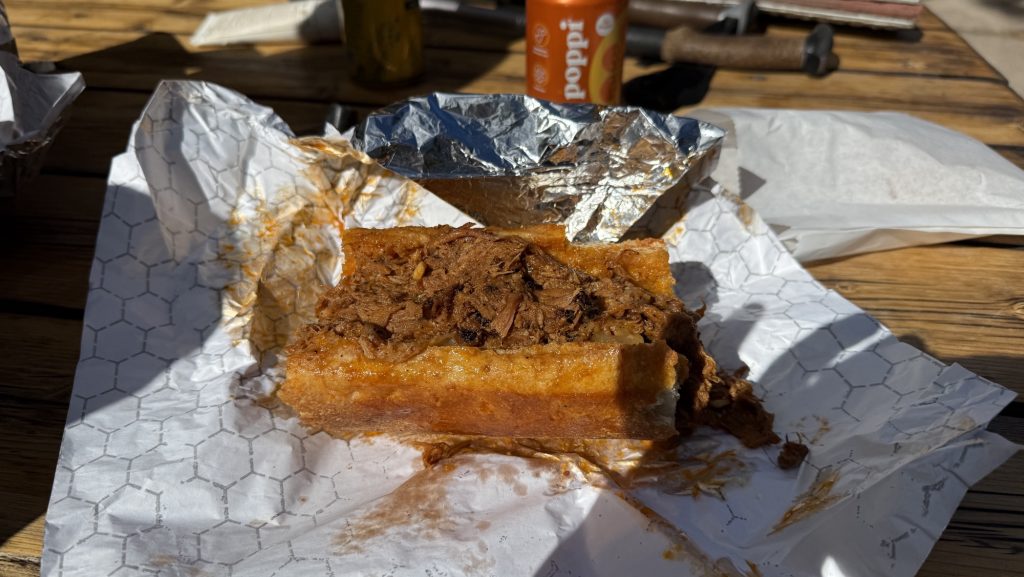
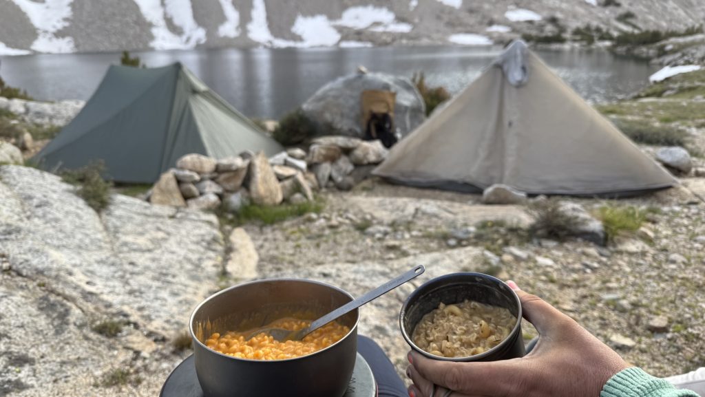
When we got there, we ditched our packs with the grace of collapsing storks and beelined to dinner in the “big kitchen cabin.” And oh, dear reader, let us tell you—this was no sad freeze-dried affair. This was the banquet of our wildest backpacker fantasies: a salad buffet starter, a 12-ounce steak flanked by potatoes and carrots, and a dessert buffet that almost made us cry.
Every bite whispered, “You did it. You’re not just hiking—you’re living.”
We checked into the trapper cabin, which had all the rustic charm you’d expect—wood walls, mountain silence, and precisely zero outlets. Charging our phones became a social ritual in the communal bathroom, where guests mingled in that half-desperate, half-zen camaraderie that only comes from trying to hold your toothbrush and your charging cable at the same time.
Stats That Don’t Lie
- Miles hiked: 23.56
- Ascent: 3160 ft
- Descent: 6181 ft
- Steps: 54,146
- Steak satisfaction level: 10/10, would hike again for dinner
In the end, the day wasn’t just about the distance. It was about how far you can push your body, your patience, and your love of tortillas before realizing that heaven might just look like a ranch kitchen filled with tired people and unlimited dessert.
Thanks for reading. Let me know if you have any questions or comments. I always love to hear from you.
🫶🫶🫶
Disco
Day 63 – 70: 778.2 Forester Pass to 823.5 Palisade River
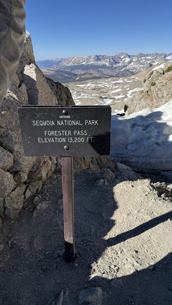
Day 63: Forester Pass (Miles 778.2 to 787.9)
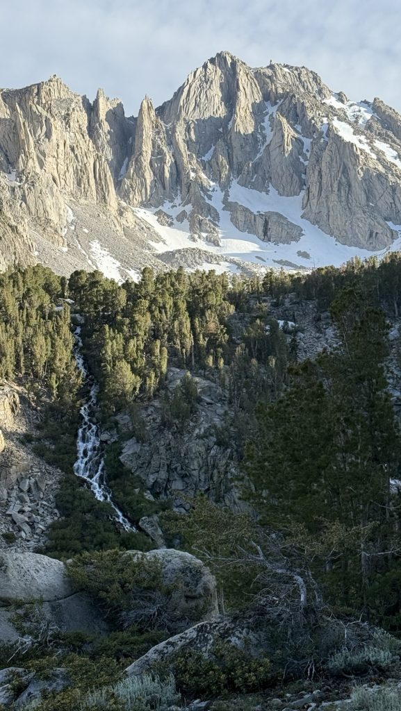
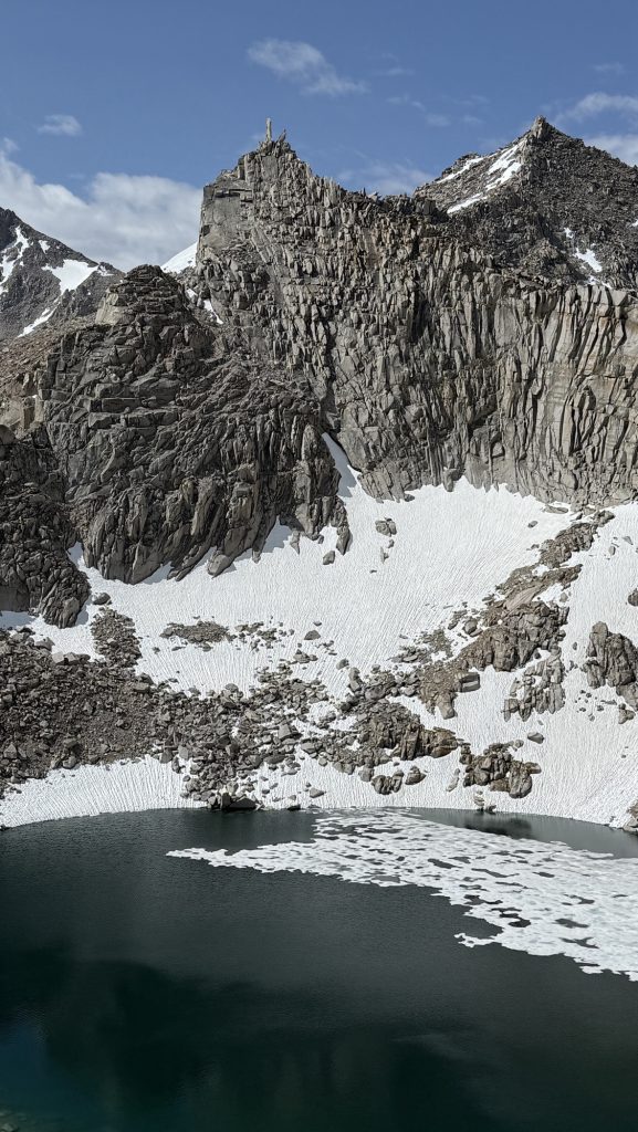
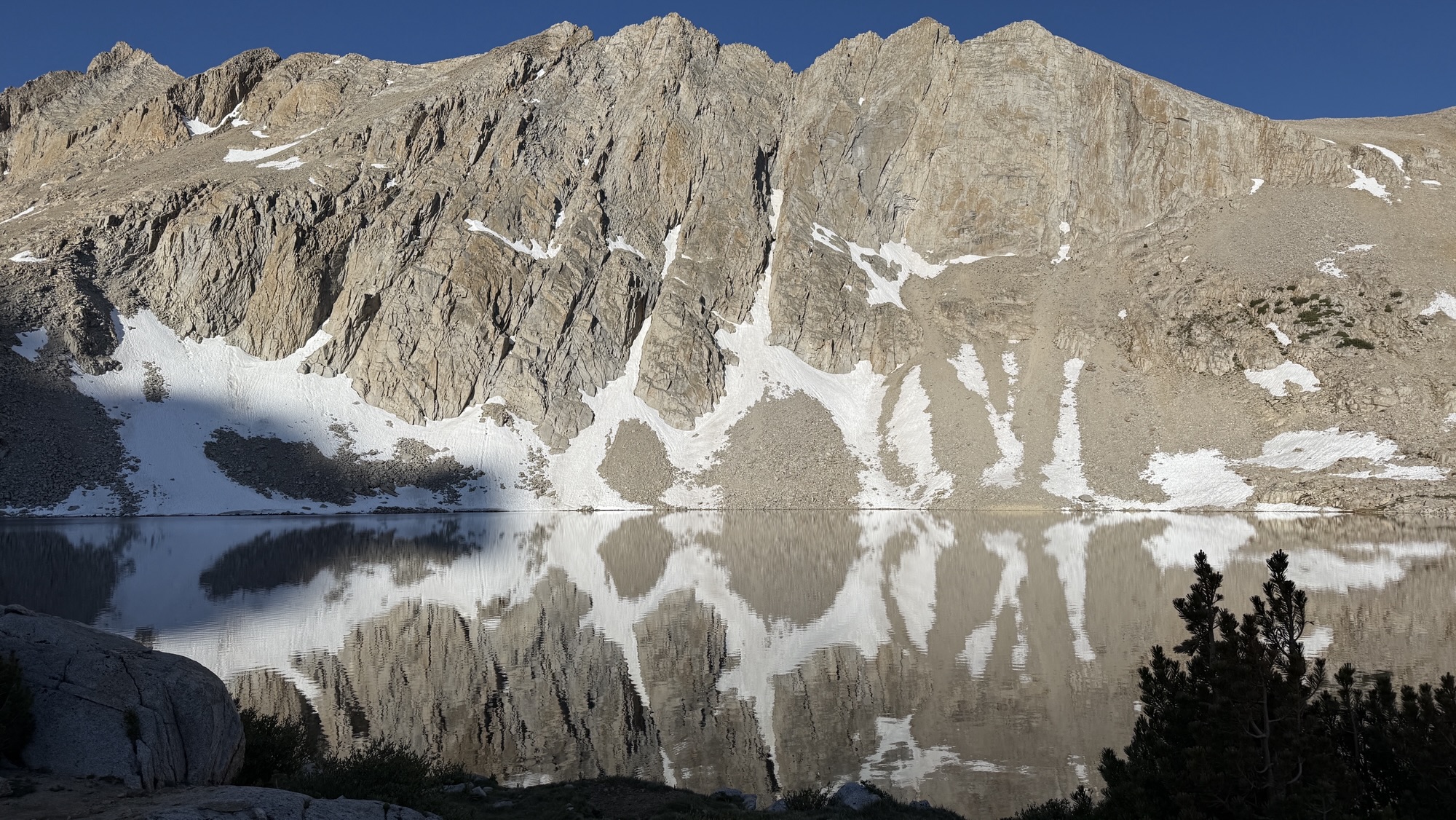
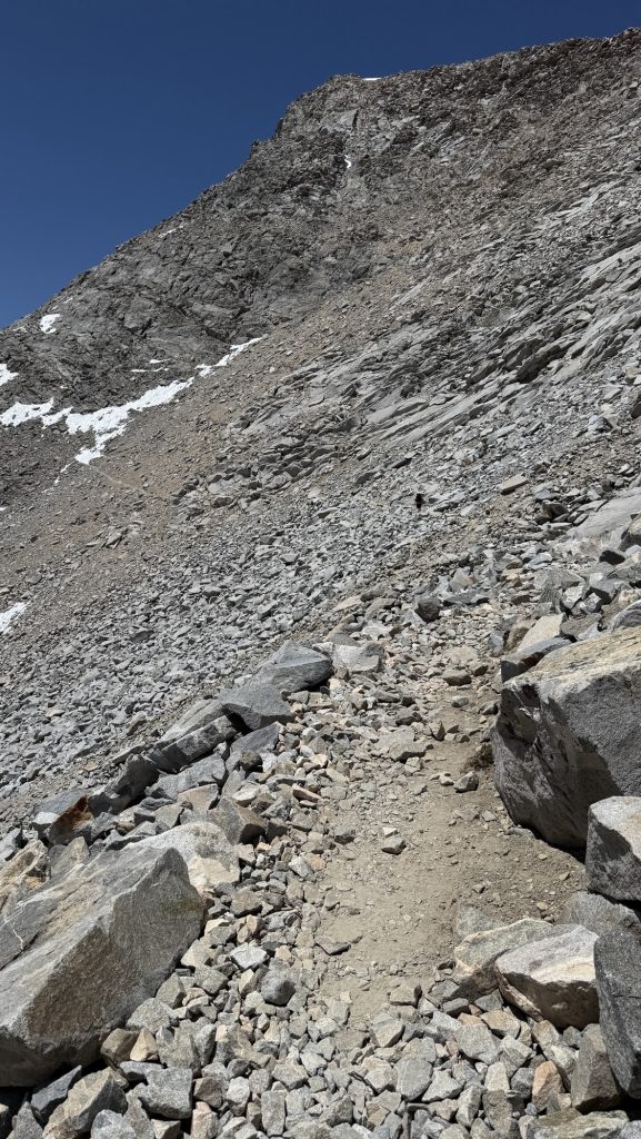
I didn’t sleep all night – well let’s say from 2-5am I just tried to rest – awake in my tent. We made coffee and left at 6am for the big climb up Forester Pass, one of the iconic and feared passes on the PCT, right after Mt. Whitney. The landscape looked like we were on the moon. There were rocks, and frozen lakes and rivers and snow. The climb was steep but I love climbing on steep edges and ridges so it was exciting for me but not too scary. After the pass, we got into this beautiful valley with views all around. Easily one of my favorite days so far if not the favorite one!


Day 64: Nero down Kearsarge Pass to Bishop 787.9 to 789.7 + Blue Blaze to trailhead
I felt very sick and we didn’t have fuel left to cook our coffee. It was very beautiful on the PCT but I was so sick, it was the hardest day so far. The lakes on the blue blaze towards Kearsarge pass were incredibly out of this world beautiful.


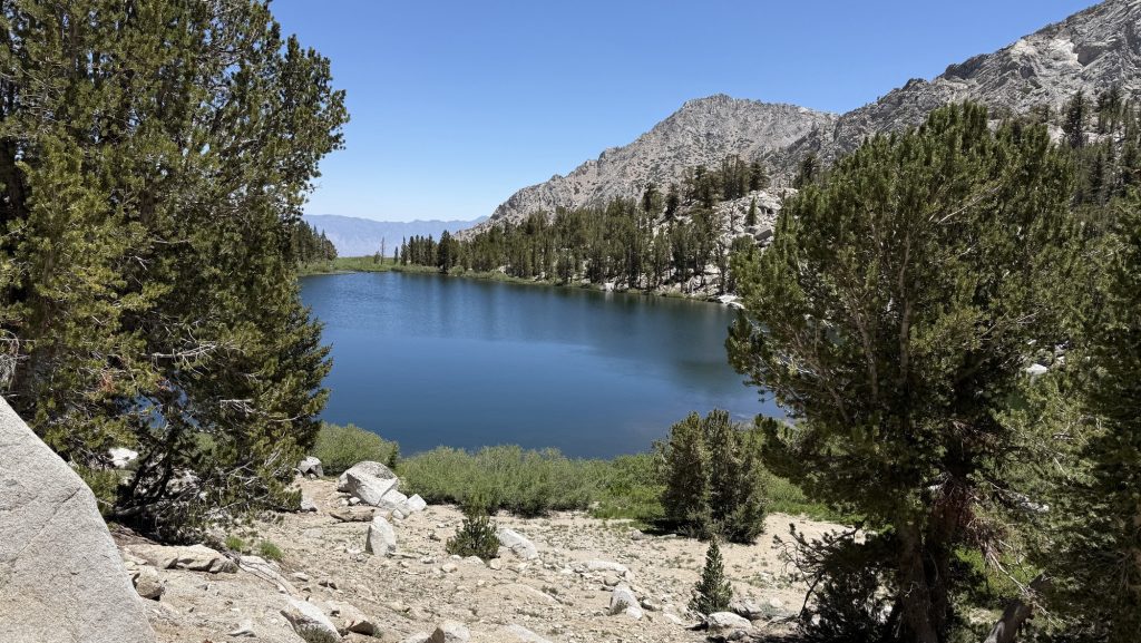
Due to a lack of cold medicine, I took Ibuprofen for the first time in this trail to get me up Kearsarge Pass. Not a good idea, then I had diarrhea … and had to go in the woods several times with all the day-hikers and JMTers (John Muir Trail Hikers – PCT and JMT overlap in the Sierra for 270 miles) flooding the trail so that sucked. Impossible to find a quiet place away from real close to a pass. It felt like forever to get down to the trail head – I literally ran down a few miles to use the privy – and then there were 10 hikers waiting for a hitch right in front of it 😆. Oh well.
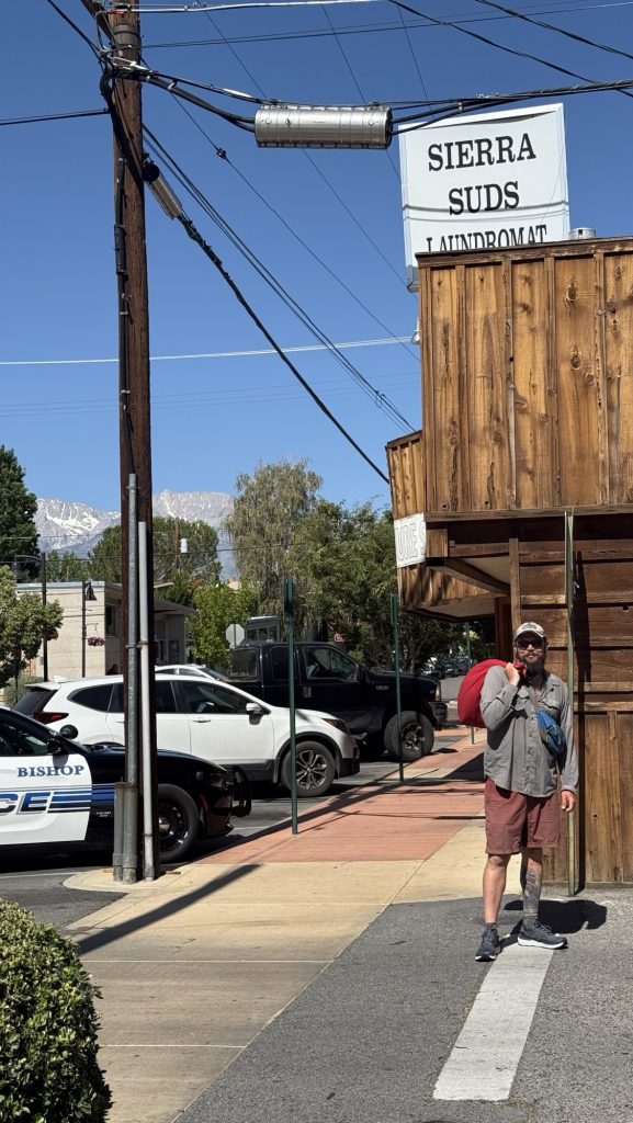
We got a hitch into Bishop – 1h ride – quickly with “Tall Mike”, who was there dropping off PCT hikers, which was awesome and then went to the brewery to eat burgers and salad. We booked 3 nights at motel 6, for 550$ but what are you going to do? They increase prices in hiker season. I need to rest and recover from my cold!! I also need to update my gear, return things and send things back to Seattle so I need time and space.
We ran into our friend Shredded again in Bishop, which was nice.

We went to Vons and bought lots of fruit and vegetables, salad for dinner and fresh juice.
Bishop is beautiful.

Day 65 & 66: 2 zeros in Bishop and 2 dates 😍
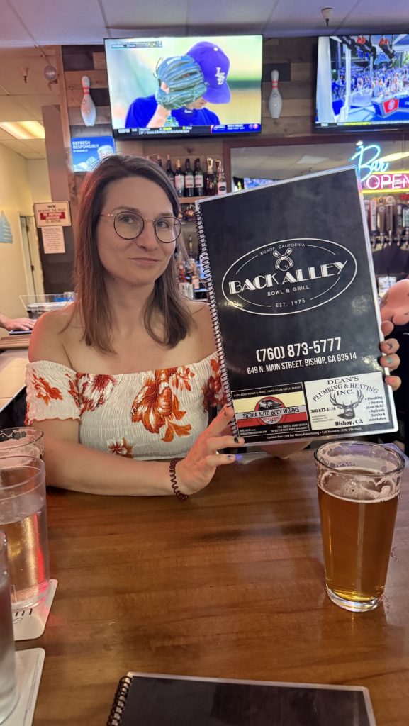
Ice and I met April 18th, second day on trail. We didn’t see each other again till May 13th, when we ran into each other on the bridge after the hot springs, at mile 304. We spent 38 consecutive days hiking 600 miles / 965km together at this point (except the two days after Tehachapi where he decided to sleep in😆). We shared 36 breakfasts, lunches and dinners, and aren’t tired of each other yet. Well, quite the contrary. It’s been incredible hiking with him and getting to know this wonderful human being. When he asked me on a date in Bishop, I was delighted 🙌 We went to the movies and saw “How to train your dragon”.

The next day, he took me out to the bowling alley. It was a Friday and a good band was playing so after our steak dinner, which was delicious, we just watched the band and danced a little and never bowled. Great to be in town doing “normal” things, not feeling like a dirty hiker for a day. Wonderful to go on a lovely date 😍


Day 67: Nero out of Bishop
We didn’t leave till noon – we had lunch at the Chinese place across the street. They were interested in our trip and were very nice. Food was great! We waited 2h for a hitch and finally the sweetest girl picked us up – a thru hiker – she recognized us as fellow thru-hikers and knew Bishop is a popular resupply stop for PCT hikers. Her trail name is “Shimmer” and she hiked the Arizona Trail 4 years ago, and that’s how long she has been dating her boyfriend she met on trail. We counted that as a good omen. “Shimmer” was driving from her boyfriend’s place to LA, where she is doing a PhD, so she was driving through Independence but not our trail head. She quickly offered to take the 45 min detour up to the trail head for us. How kind of her! We stopped in Independence for ice cream.
We didn’t hike far that day and met up with Kitty on trail.


Day 68: Blue blaze back up Kearsarge Pass
We left at 8.30am. It was really cold, and Ice and I both felt sick. I took two knock-off DayQuils but they didn’t work. I felt weak.
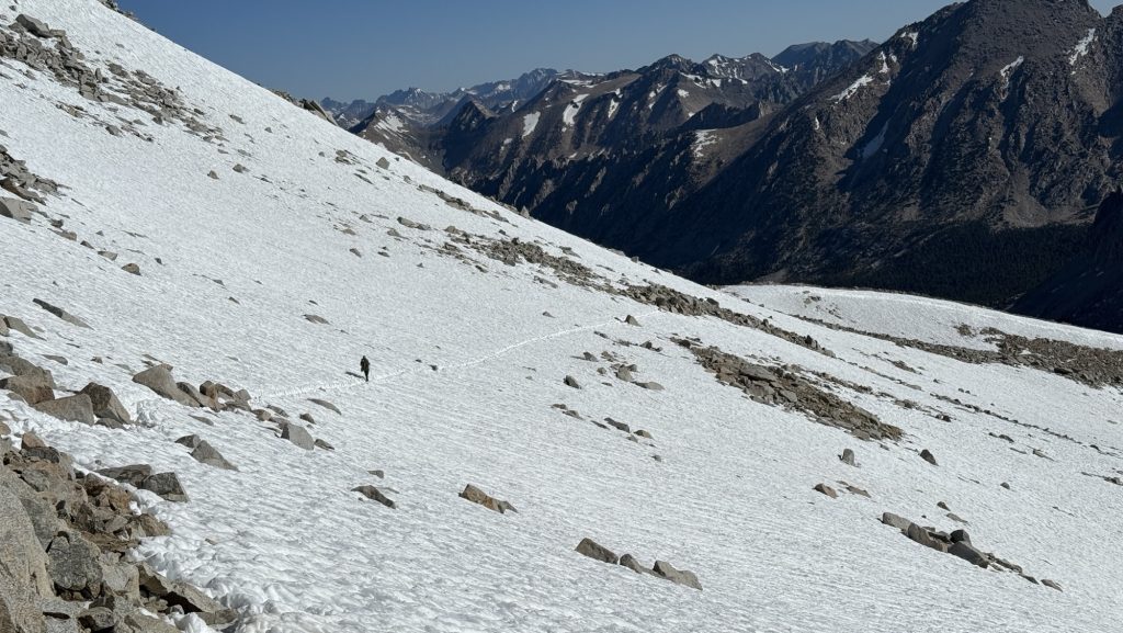
We climbed up Kearsarge Pass before 11am and it was fine and then we did Glen Pass, it was steep and nice on the top, lots of snow and so many lakes, hardly could see the trail, we descended mostly off trail and on snow. Then I broke my pole. Again. 3rd time. I am returning these ultra light non stable poles. I need them to pitch my trekking-pole tent, so they need to be reliable . But Durston, I bought them from, are a great company and will surely issue the refund. But it will suck to do 6 passes with only one pole.
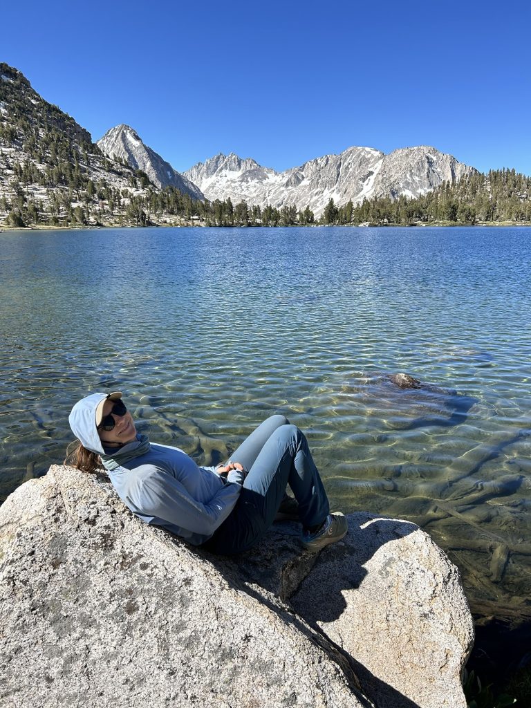
After that beautiful meadows and lakes, Mountains and creeks, we camped at Dollar Lake above 10.000 feet. It’s super cold. But very beautiful, it feels like hiking in a dream.


Distance: 12.7 miles
Steps: 29.249
Ascent: 3212 feet
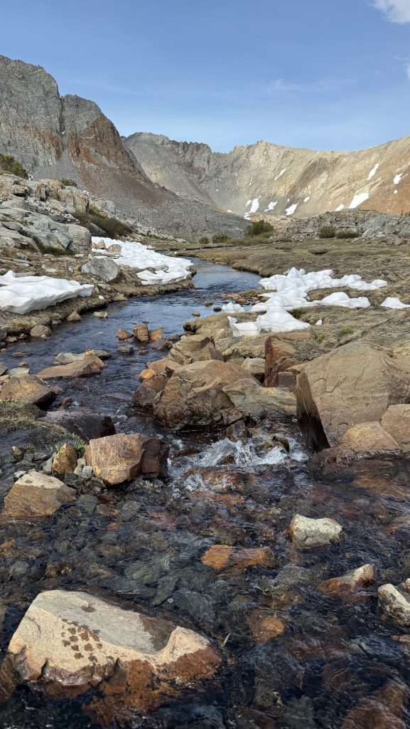
Day 69: Day 69: Pinchot Pass (797.1 – 809.9 Lake Marjorie)
The Sierra – she is kicking my butt. Today we did Pinchot Pass, at 12.127 feet and it was tough. I’m still feeling sick from the cold I got before climbing Mt Whitney and so I wasn’t sure I would make it up there. I took cold medicine in the morning and after lunch but it didn’t make me feel as good as the original DayQuil did 😆 they must out some secret ingredient in there.
I woke up at this beautiful lake and it was really cold, below 10 degrees Celsius 😍 we had coffee and breakfast, and left around 9.00AM.
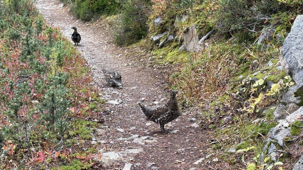
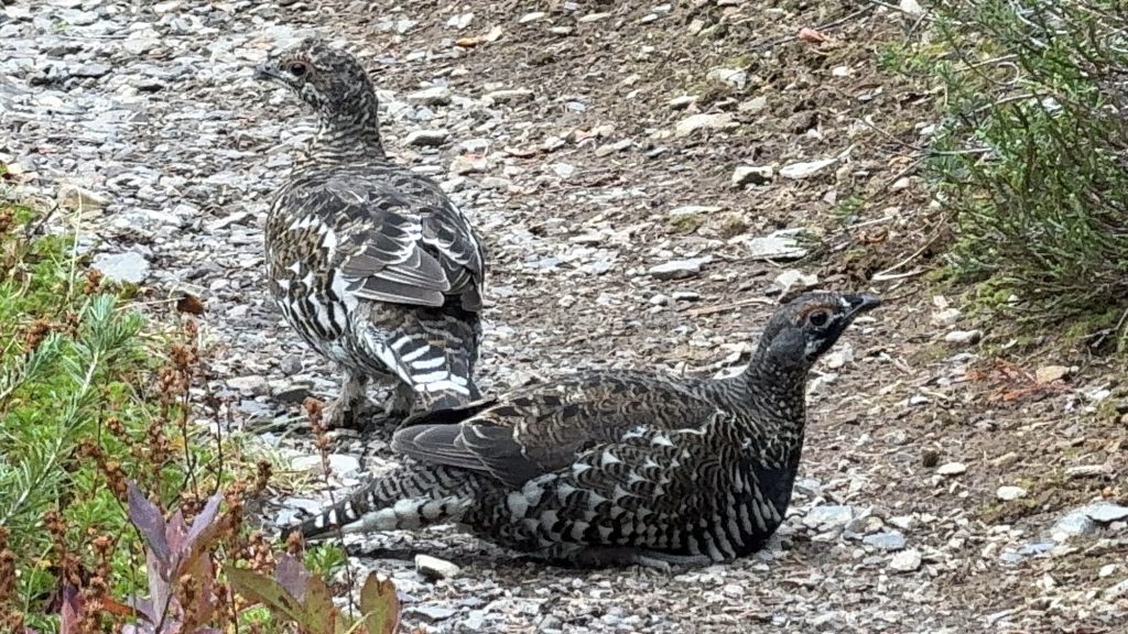
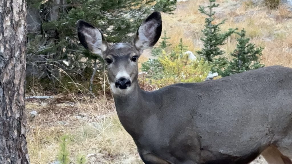
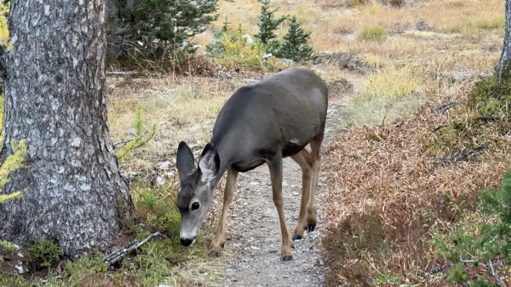
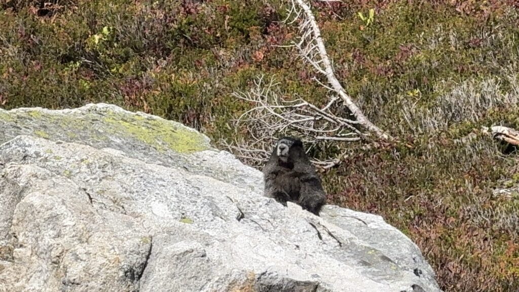
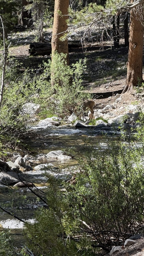
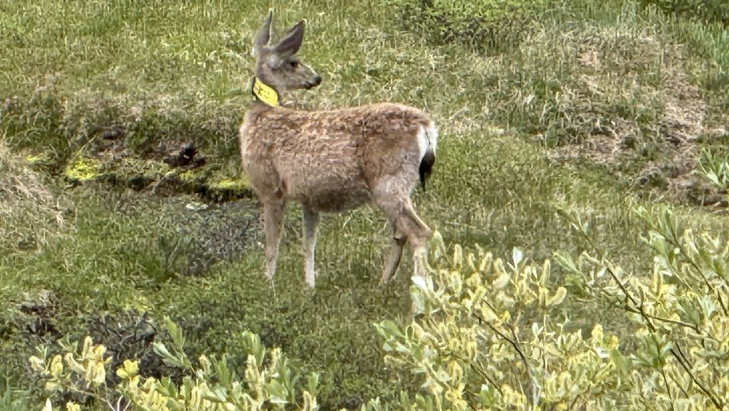
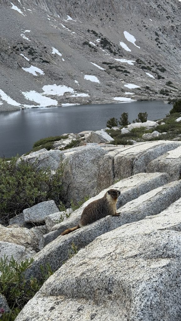
We had to hike down 4 miles to the bottom of the valley at around 8500 feet, and then started to ascent 7.7 miles up to Pinchot Pass. Left and right we had dramatic mountain ranges all day in grey, black and later red colors. We saw several grouse with little ones, many marmots, a deer, pikas and chipmunks. At 7PM, the fish in the alpine lakes eat dinner and you can see them jump up making little rings on the surface. Ice got fishing gear from a guy at Kearsarge Pass Trailhead, but we’ve been getting to camp so late that he hasn’t had time to fish yet.
It is so cold in the Sierra that I can keep my sleeping bag closed for the first time. I had to leave it open the first 700 miles in the desert. And now I wear my merino long John’s, merino socks and two merino longsleeve shirts to sleep and it’s only comfortable. I have a 20 degree F sleeping bag, the Panyam 600, by Polish outdoor brand Cumulus, and it’s great. It kept me warm on Mt Whitney too, while the rest of the Overnight Crew was freezing.
Today was tough and beautiful: one of those days where you just put one foot in front of the other and see how far you get. I didn’t think I would make it up Pinchot Pass. But I did and I was excited when we were finally up there. We went down a few miles to Lake Marjorie at mile 809.8.
I texted Kitty our location but he didn’t respond. He had fallen behind a bit and we didn’t see him all afternoon.
We set up camp and made dinner and then there he was – Kitty made it. Wohooo. It was almost dark.
We had fresh ginger tea and gazed at the incredible sunset over the next mountains we would cross tomorrow, and soon crawled into our sleeping bags, exhausted and blissful from the brutal ups and gorgeous views of the High Sierra.

Stats:
Distance: 13.78 miles
Steps: 38.749
Ascent: 3955 feet
Day 70: 809.9 Lake Marjorie via Mather Pass to 823.5 Palisade River and the most beautiful valley ever
Left at 7AM, because we wanted to make it over Mather Pass early, it’s notorious to be snow covered late in the season. Walked through green meadows with English grass and grey boulders most morning.
Three river crossings before 9.00AM, non too sketchy.
Stopped at 9.18AM to dry our tents and sleeping bags – they were wet / frosty this morning – and to filter water.
We made it up Mather Pass – it was tough. We got there at 12:30 and had lunch. First lunch break on a pass!! Blue skies and mountains all around.
Next we will go down for 10miles.
We stopped in the middle of the climb down to Muir pass. We had the most incredible view of the valley before Muir Pass, sadly I don’t know the name of it.
Mather Pass

Thank you for reading my uncensored, honest account of my PCT adventure. 😄
Be well, until very soon.
Disco

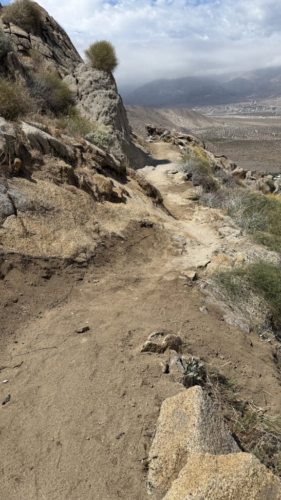
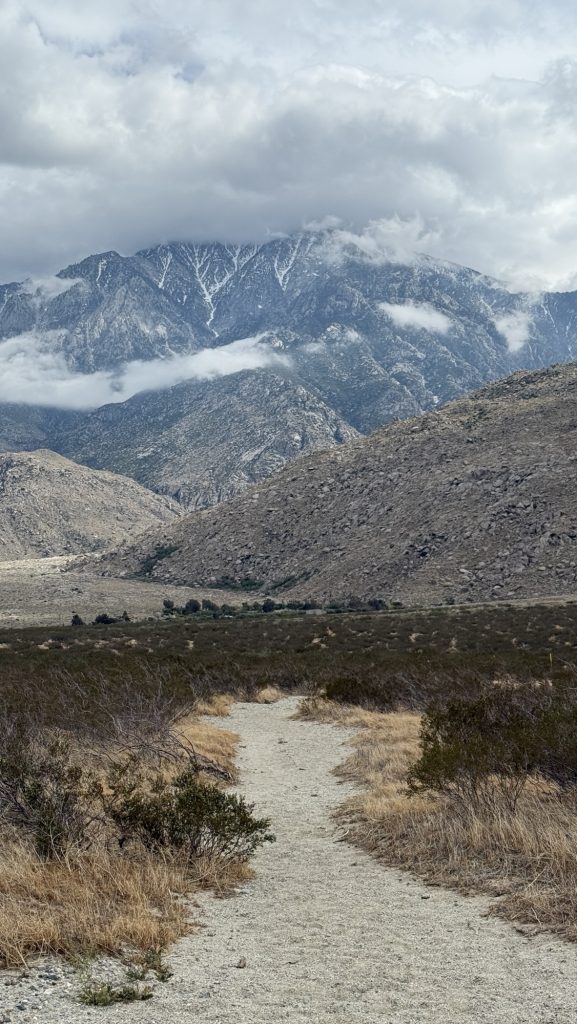
Day 19: The long descent down San Jacinto (Miles 190.4 – 209.6)
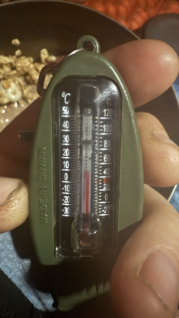
Today, I woke up at 5.40AM and it was STILL raining and cold. My hands froze trying to put together my tent. Coldest day on the PCT yet with 4 degrees Celsius and coldest night – first night I could leave my sleeping bag closed.
Hiked 31km mostly down San Jacinto. The last part from the bottom of the mountain from the water pipe along the desert towards I-10 was horrible in the wind. I had to pee really bad but couldn’t because it would have sprinkled everywhere. 🫣 we finally made it to Kristin’s, an Airbnb right on trail. Lovely place. She greeted us with Gatorade with Ice 🫶 great to shower and do laundry. Left foot blister under my foot, right foot took the tape off that Morgan put on and have to put it on again tomorrow, potentially on both feet and do exercises. Several times a day to prevent injury.
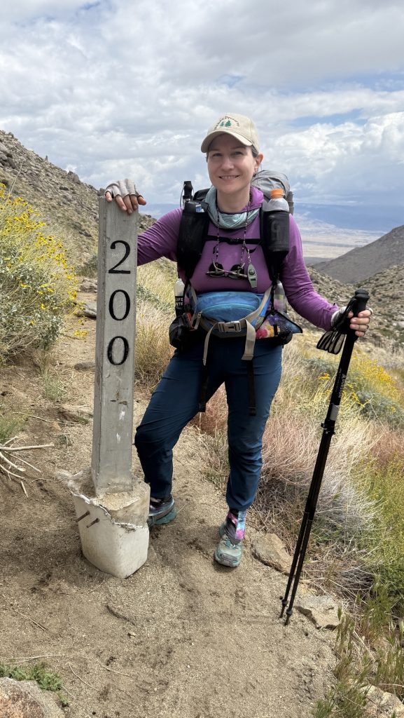
Passed the 200 mile marker today but noticed I am not that excited about it: I am waiting for the 265.54 mile (427.34km) marker to reach the 10% 🙂 in a few days I’ll get there. Still the longest I have ever walked. So an achievement for sure!

Stats:
Miles walked 19.8
Descent: 2253m ‼️⚠️⛔️
Ascent: 312m
Steps: 43.828
Max elevation: 2368m
P.S.: I read that descents don’t hurt your knees, they only reveal your weaknesses – this was my queue to start stretching even more – every two hours on trail now.
Day 18: 177.3 to 190.4 Fuller Ridge
This was the hardest day for me yet. I didn’t sleep at all the night before, so when the alarm rang at 5.30am, I had to stay in bed and slept till 8. Kate left and I stayed behind to make freshly brewed coffee and breakfast.
Day 17: Hardest and most beautiful day yet. (162.6 – 177.3)
Best day ever – we started at the water source cedar spring at 6.30am – and then had alpine ridges, rocks forests, pines, lizards, ascends and declines, hopping over ridges and fallen trees all day long. It was like the obstacle run I always wanted to do but never did.
Day 16: Miles 151.8 to 162.6 PVC to Cedar Springs
Started at 8AM with breakfast at mama eggs which was amazing. Then went to the gear shop again, tried on back packs. Mine is way too heavy with 8 days of food. I Like the Deuter air contact so 45 + 10. 240$ (german brand of course haha) but didn’t get it. Good to know as a back up though. Mine is a frameless pack and this one has steel framing, so it is heavier but offers more support and is comfortable for heavier loads (18-20kg).
Day 15: Made it to Idyllwild (148.2 – 151.8)
Today we got to Idyllwild. We hiked 7.36km.
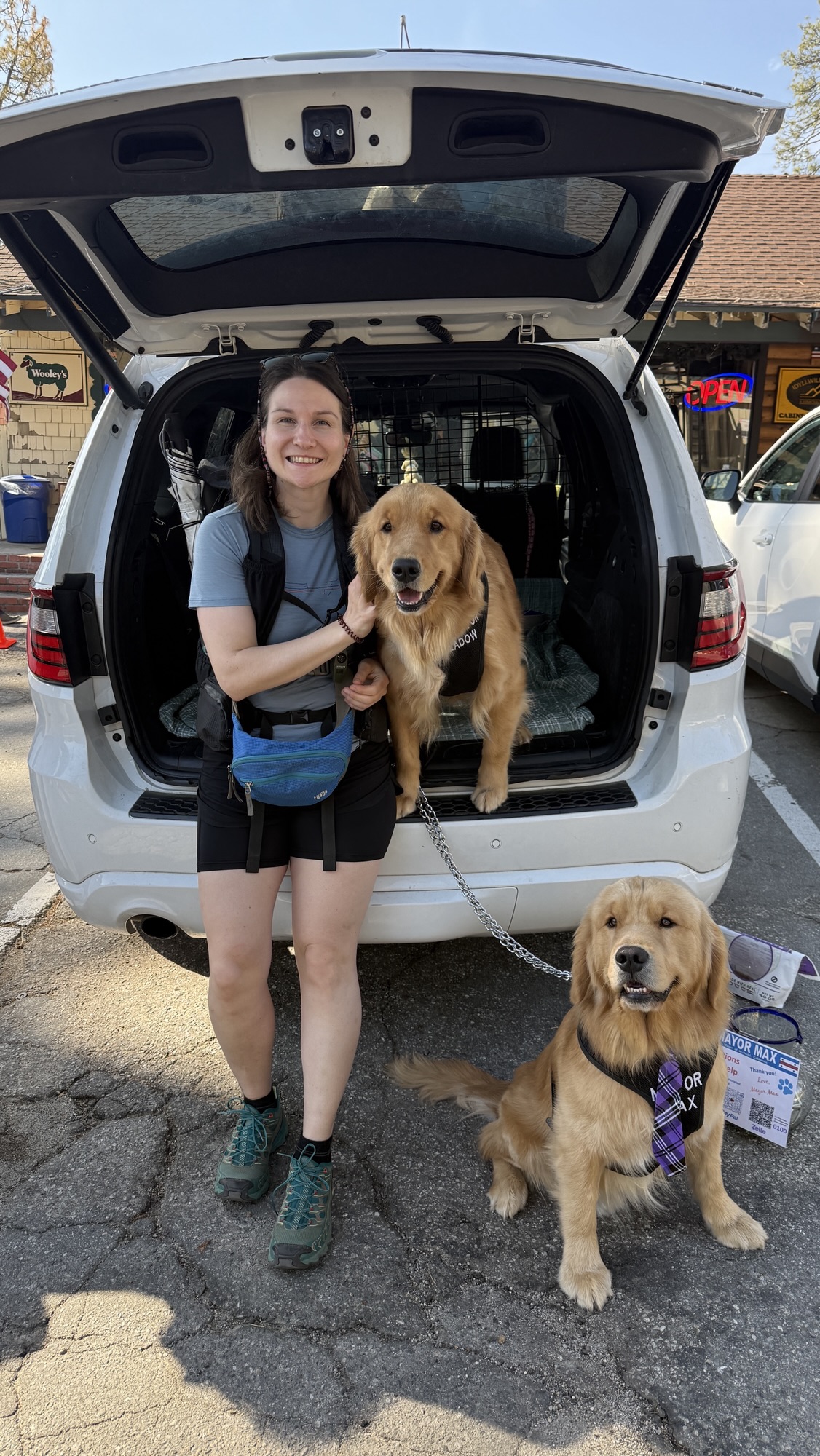
Idyllwild is so nice. We went to the gear shop Nomad and I finally bought a pump. We also saw Mayor Max, the dog.
Day 14: Miles 134 to 148.2
Have you missed my regular 6AM GMT posts? I missed you too! 🫶 Sometimes I won’t be able to post because I don’t have service, battery or time. Then I’ll post as soon as I can.
Day 13: Miles 122 to 134.8
We started quite early – alarm at 5.30 and hiked when it was still cool. I felt sick again today. I guess my body is inflamed from all the processed food I am eating. I have a bump under my right food which is worrying me. It’s like a long worm under my skin. A deep blister?It hurts. We didn’t stop all day except at Mike’s to get water.