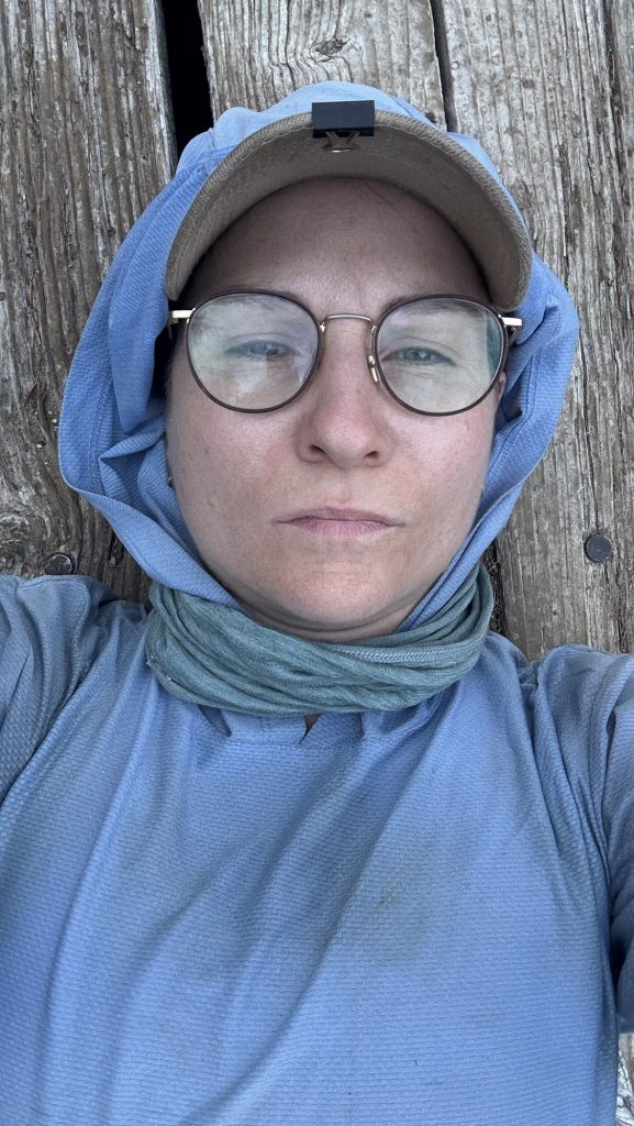
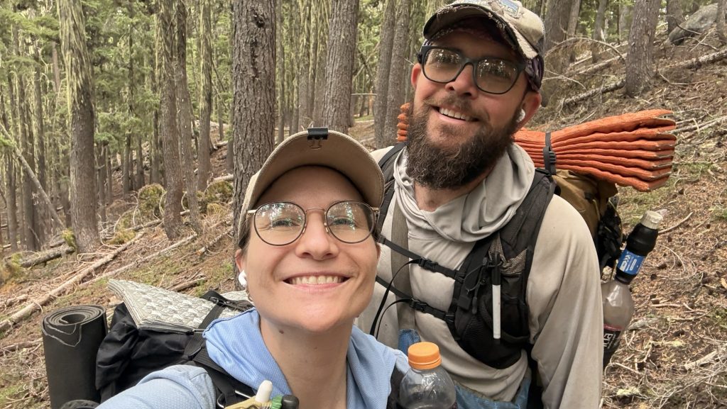
How to physically and mentally prep for the PCT?
Hey A, thanks for your message! Happy New Year – I hope you had a good start into the year.
I was asked by A.:
How do you prepare to hike 2650miles? How physically fit were you?
If you’re preparing for the PCT, you have probably heard or read this: The first month is physically challenging, and the last 4/5 are mentally challenging. The repetition gets to you. I found this to be true, at least for me. So how do you make sure you are physically and mentally prepared?

Well, it’s just a walk, right, so anyone can do it! Well it’s a bit more complicated than that but not so complicated that you should let it discourage you. 🙂
Here I tried to answer the question how fit I was and what I did and what I wish I had done before the hike.
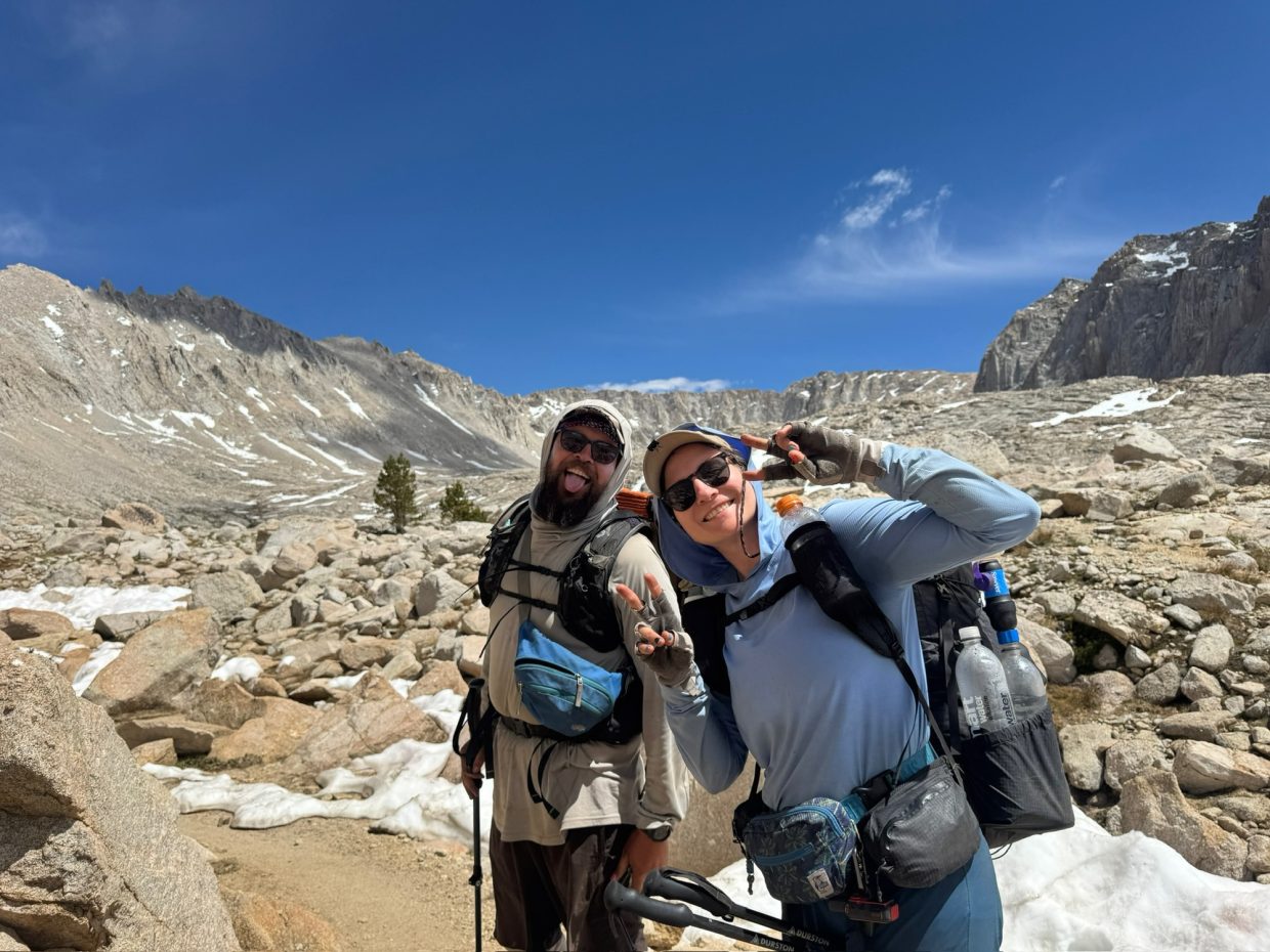
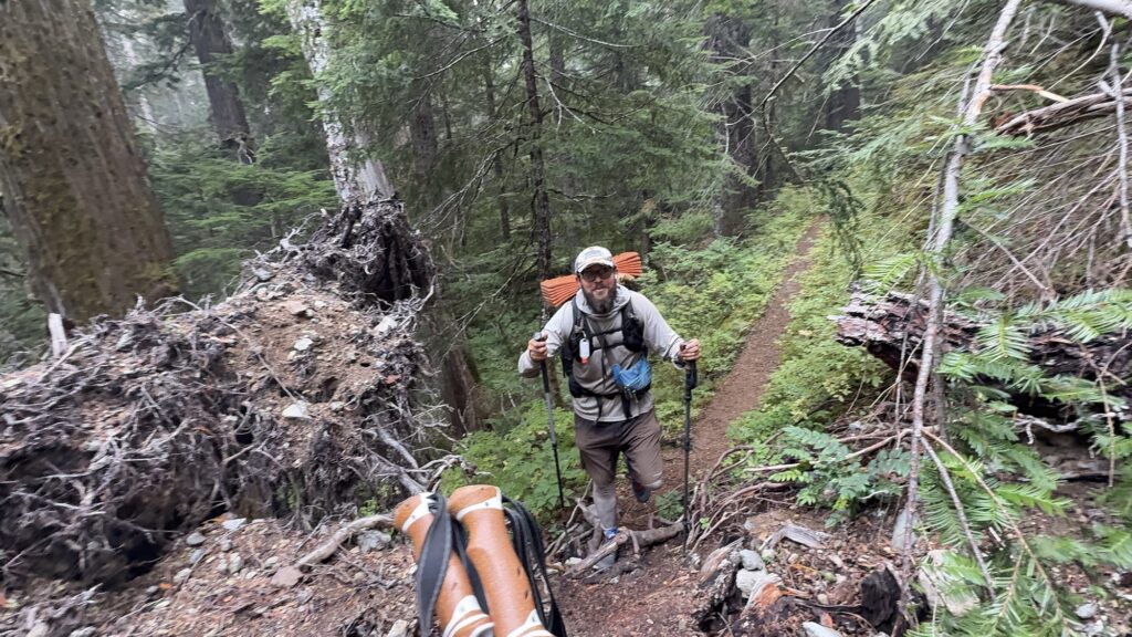
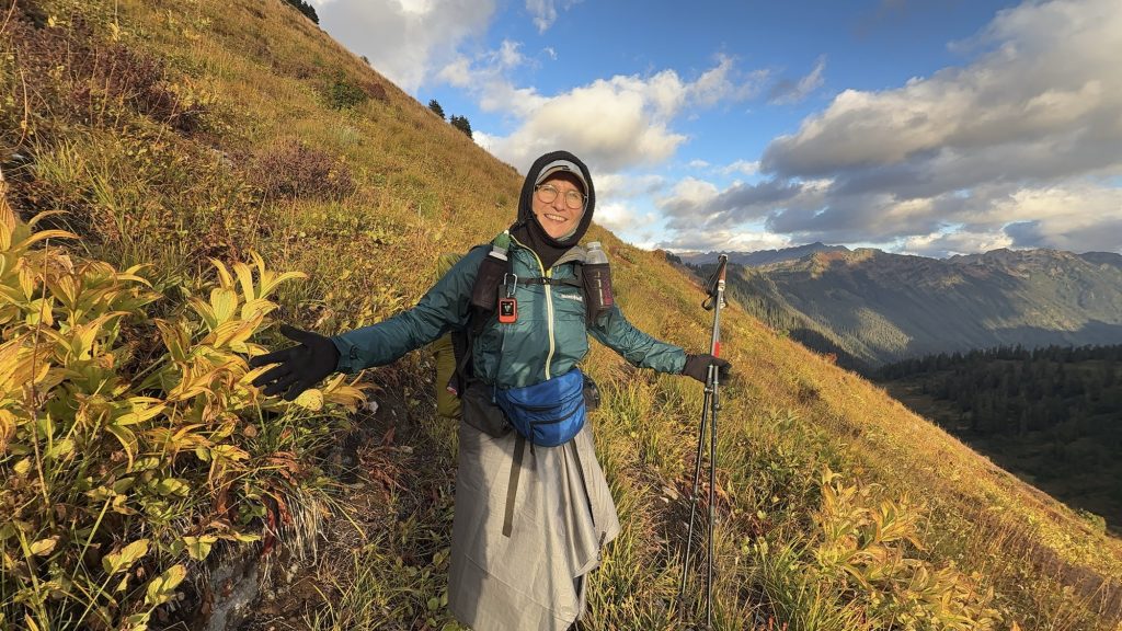
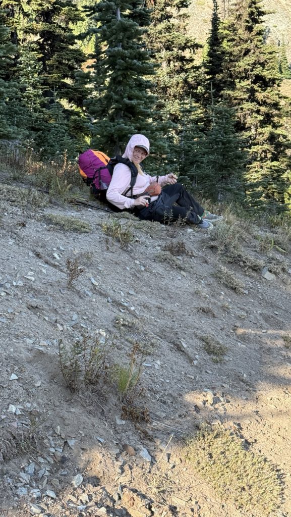
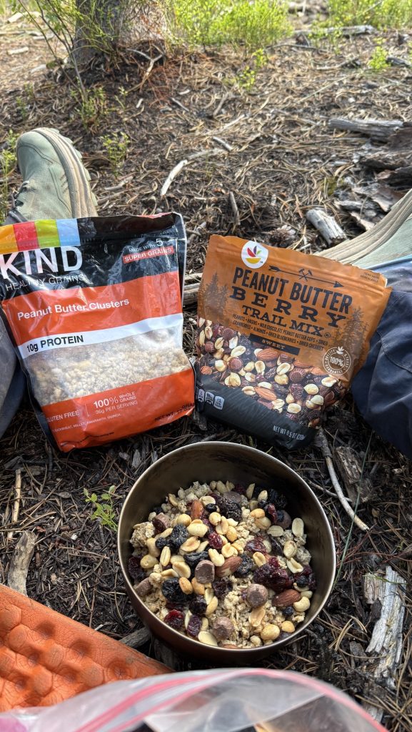
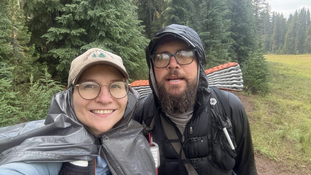
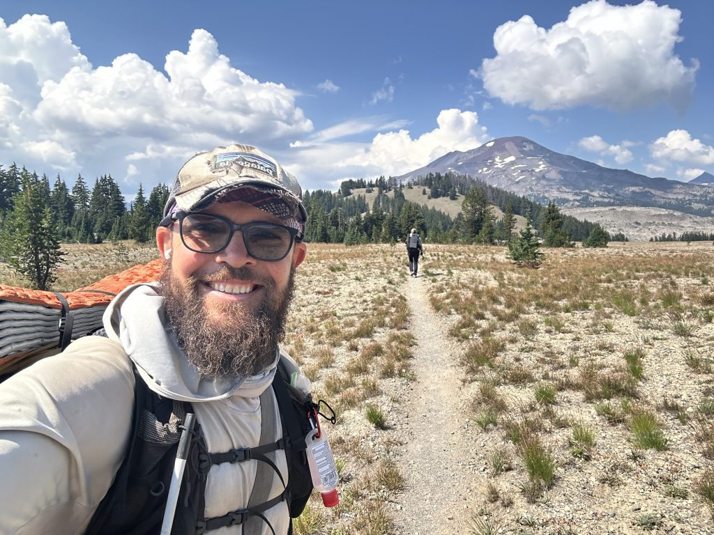
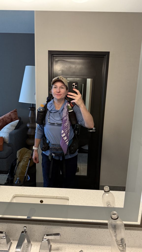
One thing I want to mention is this: starting slow was probably my best strategy to avoid overuse injury: I forced myself to only hike 12-15 miles the first four weeks of the PCT. This was the best decision ever. But this can be tough. You might fall behind friends you just made on trail. But you gotta find your own rhythm and #hikeyourownhike 🤭 Starting slow will allow your body to adapt to the new “normal” and build up everything needed to successfully finish (hopefully).
The expert on this topic how to physically prepare is @blazephysio – one of the people I wish I would’ve known before I started hiking – check out her page for all things thru-hiking.
I also worked with a nutritionist beforehand to calculate my macros and micros @yade.nutrition – and I loved that! I probably have to do a new post on that topic! But most people don’t do that and that’s ok. You gotta find the things that worry you and get behind them. But 80% is good enough. Pareto principle – at some point you just gotta go. Things will get clearer once you start hiking! Those were mine concerns. I just like to best prepare and give my body what it needs to perform best.
This is a difficult topic because everybody is different, and for some people it’s super easy while for others it’s super hard. However, I believe the fitter you are before starting such a long trail, the better you’ll feel on trail.

That being said, it is “just walking with a backpack,” so anyone can do it and should start and try. But I do believe it’ll be harder for the less fit: you might be slower, take longer to recover, have more pain, and have less fun; potentially one or all of the above. We’re all unique and react to stress like thru-hiking differently, so knowing yourself and what hiking several consecutive days does to you is really important.
Here is what I did and what I’d do differently:
What I did and would do again:
- Walk as much as you can with the full PCT backpack weight on from the moment you know you’ll hike the PCT – I mean as much as you can, every weekend and during the week. I worked in tech, so I would “hike” to work through Berlin city (lol) – yes, it takes much longer than biking or public transport or driving, but it was the only way I could get that many miles in.
- Strength train – I was a regular (2x/week) at the gym doing full-body strength training, so I was relatively fit (I can tell you more about my specific workout routine if you’re interested). I did a lot of Farmers carry 🙂
What I wish I would have done differently:
- Know about Blaze Physio – she’s a mobile physio who follows the PCT bubble each year and has specific thru-hiking exercises on her IG (https://www.instagram.com/blazephysio/?hl=en). I would do those every day for 10 min leading up to trail to prepare ligaments, muscles, joints, etc. I only learned about her on trail and had an appointment when my foot pain got too bad – she’s awesome, and I wish I had known about her beforehand.
- There is even evidence of higher fitness equaling a higher likelihood of finishing the PCT in the Halfway Anywhere Survey, which you probably know – this was one of the main reasons I trained as hard as I could before the PCT too 🙂
That is just my opinion and mindset. I hope it answers your questions a bit. My mind was never focused on finishing the trail but always on enjoying the journey – and how do you enjoy? If you’re in your best state, mentally and physically. All that being said: The hike itself will make you fitter, day by day. And if you start slow, like I did, you will be very fit at the end.
BTW, I also noticed I spent 80% of prep on gear (reading!), 15% on training (hiking), and only 5% on mental preparation. Although I’d say shakedown hikes and mental prep are more important, so I’d make it 33% gear, 33% hiking, 33% mental next time. But hiking and camping more in winter wasn’t possible for me, so oh well.
For the mental game, which is almost more important than the physical game, I recommend this book: ‘Pacific Crest Trials: A Psychological and Emotional Guide to Successfully Thru-Hiking the Pacific Crest Trail’. I read it and loved it.*
It asks valuable questions which are great to answer before starting the hike. It prepares you for the days when it gets tough. And it will get tough! And it’ll make it clear why you’re doing it!
I’m curious: How are you preparing for the PCT? Or how did you prepare for the PCT? What do you wish you would have done?
Leave me a comment here or on my PCT 2025 Diary on Instagram: hikeyourownhikepct2025. <3 Here I share almost daily posts about my days on the PCT last year.
Let me know if this was helpful, also would appreciate your feedback and let me know if you have any more follow-up questions in the comments!
If you’re new here: Why am I writing about my experience?
First of all, I love writing. I studied English literature in my first life and writing lets me reflect and process my experiences. Text is a mirror to the human experience and society.
Second, hiking the PCT is such an intense experience, and ‘trail brain’ is real – many nights I would journal but I couldn’t think straight, let alone have deep thoughts or learnings. The PCT can be a life-changing experience but it won’t be automatically; it is subtle. You have to put in the work. I believe: You will get as much out of it as you put in. While hiking the PCT, I tried to focus on the here and now, nature, animals, fellow hikers and humans I met along the trail, and let thoughts come and go. But don’t expect to return home a new human being. At least I wasn’t fundamentally changed once I got back home. And “home” didn’t change much either. For me, this blog and my IG page is a way to share my photos and thoughts and relive my experience and discover the deeper meaning behind what such an extremely hard and beautiful experience might hold for me and my life.
Last but not least, I remember being quite overwhelmed with all the information out there on gear and maps and this and that. As someone who falls into rabbit holes and is quite nerdy about many things, I spent many nights leading up to my start date April 17th 2025 online, research, reading etc. As someone who had never hiked more than 200 miles in one trip, I was overwhelmed with all the choices, especially gear and how to prepare, physically and mentally. So I hope this takes some of this burden off of you. Although of course you have to do your own research. But you maybe you can avoid some of the detours I had to go on. At the end of the day, you can figure out most of the things on trail, too. So don’t be discouraged. I even would go as far as saying with common sense, a few overnight hiking trips and a basic set of gear, you can start the PCT, without studying the maps, sending any resupply boxes or ever having used FarOut before. There is a lot of fear-mongering going on the PCT and while you learn from other hikers, and you need to be cautious and don’t hike into a snow storm e.g., I encourage you to form your own opinions, especially about services and restaurants along the PCT. There is a lot of competition, money-making and false information by competitors on FarOut – quite sad. Be cautious and make sure not to be careless, it is the backcountry, you will pass snow covered mountain passes, so do your due-diligence, but don’t listen to all the negative fear-mongering comments you read on FarOut. We didn’t and we are glad we didn’t.
I hope this helps one or the other person, let’s you learn from my experiences and mistakes, as I did from the experience of people before me, and let’s us connect and exchange over the most beautiful trail in the world!
Affiliate Marketing Links
My goal is to get rich with my blog. HAHA Just kidding. I write for personal pleasure and initially, I wrote to take my family and friends along on my travels and share my thoughts and photography. Just a few weeks ago, I have signed up for the amazon affiliate marketing program, as I am recommending a few items that can be purchased on Amazon, because maybe it might help cover some of the costs of hosting this blog. So if you do decide to buy one of the items I used and loved, I’d be stoked if you used the link provided here. <3
<3 Disco

* If you decide to buy this book and use my affiliate link, I get a few cents from Amazon, which would be awesome to help me cover some costs of hosting this website 🙂 I would never recommend anything I wasn’t convinced of just to get money, but since it’s free for both of us and Amazon earns enough as it is, why not benefit from recommending?
2.5-week Taiwan Itinerary – Whole Island
Why This Taiwan Guide Rocks
Love amazing food, turquoise water, rainforest hikes & lovely people? Taiwan is for you – and so is this blog post!
• 2.5-week detailed itinerary
• All favorite restaurants + street food must-tries
• All Google Maps links – save to your lists (you’re welcome 😊)
• Short & sweet – just the highlights!
💡 Pro Tip: Use this as your base – mix with other blogs and create your perfect trip!
General Info
How to travel within Taiwan

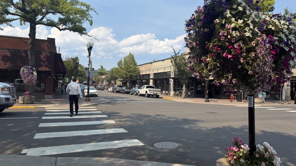
You’ll most likely fly to Taiwan Taoyuan International Airport, from which you can take the purple local train / subway Airport Line (Express) (only takes about 30min) to get to central Taipei. We arrived late, so took an uber to our AirBnB, but took the Airport Line back to the airport at the end of our trip. Just like other countries, Taiwan hast it’s own little payment card for public transport in Taipei, the Easy Card. It also works in convenience stores and busses country wide.
We did not rent a car because public transport is super easy to use. It’s also super easy to navigate in Taiwan because you can simply use Google Maps to get the general idea and train and bus numbers. To book High Speed Rail tickets, you can either go to the train station, HSR desk for the fast train and or ticket machines, they are also in English.
Buy the Easy Card for 100 (currently = 2,74€) to 150 TWD ( Taiwanese $) at any Seven-11 or Family Mart, of which you’ll find more than you could possibly need in Taiwan. Here you can buy everything from water, food, drinks (incl. very interesting alcoholic cocktails, which I’ll talk more about later).
🇹🇼 Taiwan Convenience Store Magic!
Did you know? Taiwan has the most convenience stores per capita in the world (1 per 1,703 people!) – 7-Elevens are everywhere!
Pro Travel Hack: Load 500-1000 TWD on an EasyCard for Taipei MRT, buses nationwide, and convenience store payments. Skip foreign credit card fees!
💳 Bonus: If you don’t already have this, get a Visa with free foreign transactions for future trips
Useful apps for Taiwan
🇹🇼 Essential Taiwan Travel Apps
These iOS apps are game-changers (Android versions likely available too). Perfect for your itinerary!
Book local TRA trains online. Skip station lines (weekends/HSR sell out fast!). Note: First screens Mandarin – hamburger menu → 語言 → English.
High Speed Rail tickets between major cities. Fastest way Taipei → Taichung → Tainan!
Every receipt = lottery ticket! Scan to check numbers automatically. Keep originals if you win (travel back required 😅).
Not just stars! Search “Near Me” → “Distinctions” → “Bib Gourmand” for amazing affordable eats like Fu Tai Table & Din Tai Fung from your itinerary.
💡 Pro Tip: Bib Gourmand = Michelin-quality meals under price cap. Perfect for foodies!
Our 2.5-week itinerary
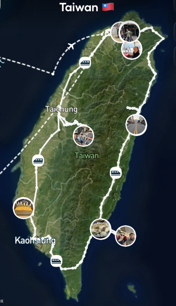
We wanted to see west and east coast, so we went around the whole island once: We spent 3 nights in Taipei, 2 nights in Sun Moon Lake, 3 nights in Tainan, 2 nights in Taitung, 2 nights in Hualien, 2 nights in Wulai and 2 nights in Taipei at the end. We’d do it again like this.
What we missed: Next time we will visit Alishan National Recreation Area, but this wasn’t possible due to the Typhoon that was over Taiwan while we were there.
🇹🇼 2.5-Week Taiwan Itinerary: Taipei to Taroko & Beyond
Day 1: Arrival in Taipei
- Arrive in Taipei
- Visit Chiang Kai-Shek Memorial Hall (free)
- Head to Taipei 101 observatory
- Grab ticket for Din Tai Fung 101 (2h wait, ask for earlier)
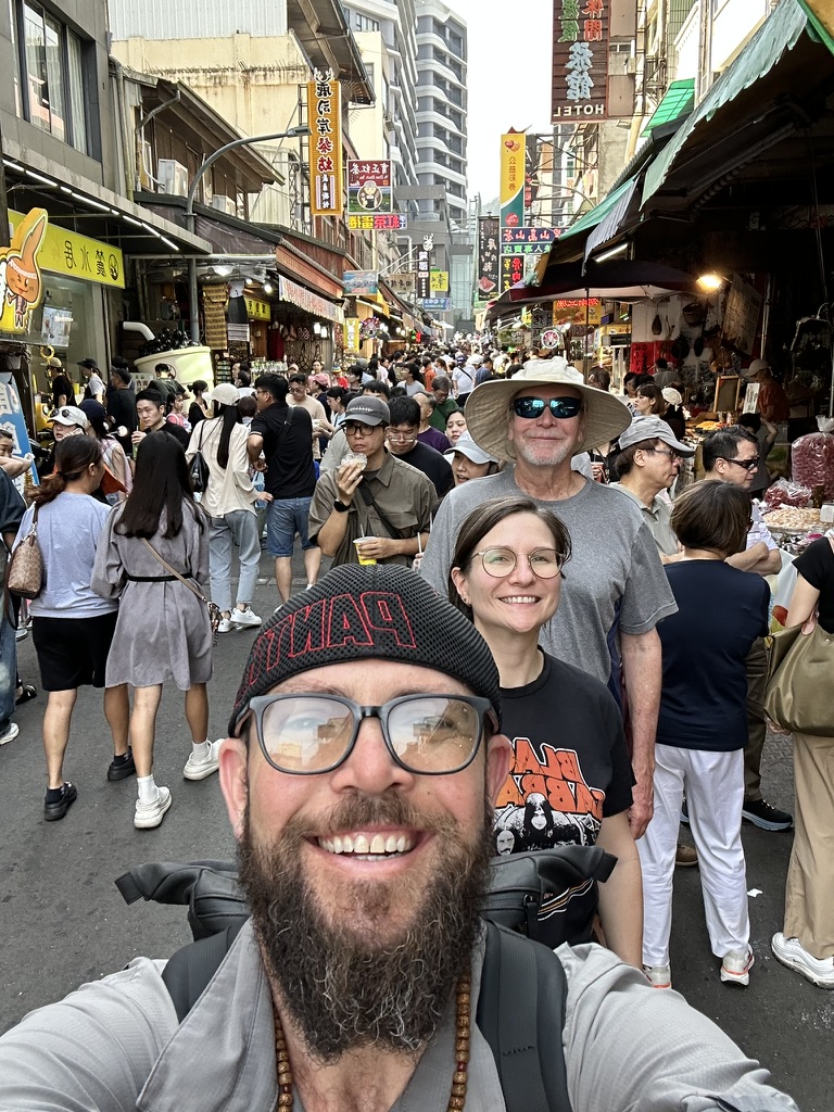
- Afternoon night market for dinner
Day 2: Taipei Museums & Markets
- Morning: National Palace Museum (china, calligraphy)
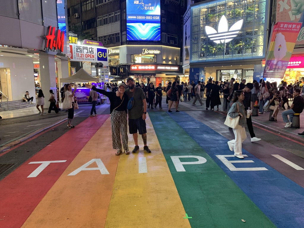
- Afternoon: Subway to Ximending walking area
- Dinner & drinks there or night market
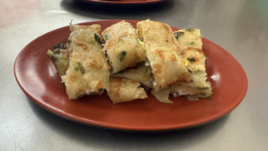
- Breakfast: Taiwanese scallion pancake (street vendors everywhere)
- Lunch: Garlic sausage at food stall (5min from museum)
- Dinner: Shilin, Raohe or Ximending Night Market
Day 3: To Sun Moon Lake
- Morning: HSR to Taichung, bus to Sun Moon Lake
- Afternoon: Walk to Nine Frogs Stack & old town
- Lunch: Lu Shih An Restaurant (fish, seasonal greens)
- Street food: Cabbage bun (early!), Taiwanese burger, black tea ice cream
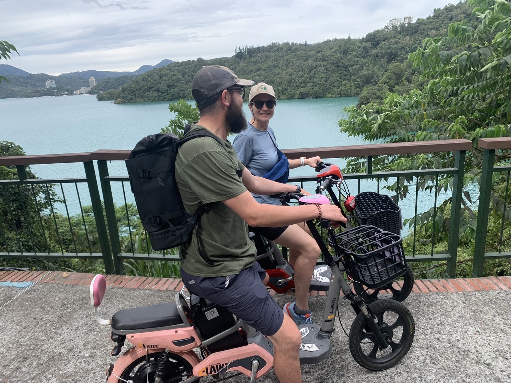
Day 4: Sun Moon Lake E-Bike Day
- Lunch: Shuishe little restaurant
- Dinner: Shang-Hao Snack Bar (set menu, fresh fish)
Day 5-7: Tainan Exploration
- Day 5: HSR to Tainan HSR, free bus to center. Anping Old Street, Fort, Tree House
- Day 6: West Central – Kaiji Temple, Chihkan Tower, etc.
- Day 7: Typhoon recovery – city walk & rest
- Day 5 Lunch: Beef noodle soup. Cheese cake! Cocktails at Old Bone Bar
- Day 6: Breakfast here, Lunch Fu Tai or Jin Man noodles
Day 8-9: Taitung & Green Island
- Day 8: Train to Taitung, free hotel bikes for beach/city
- Day 9: Ferry to Lüdao (Green Island) – scooter loop, Lighthouse, caves
- Lunch Day 8: Home’s Kitchen (winter melon pork! Went twice)
- Dinner: M’loma (beef standout)
- Day 9: Lunch box Diao Yu Ren, Dinner back to Home’s
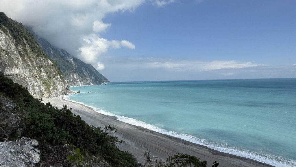
Day 10-11: Hualien & Taroko Gorge
- Day 10: Train to Hualien, Dongdamen Night Market
- Day 11: Early to Taroko – drive to gorge end, turquoise viewpoint
- Lunch Day 10: Hua Lien buns & dumplings
- Dinner: Beef noodles
- Day 11 Lunch: Tainan Yi Wei Pin | New spot
Day 12-14: Wulai Hot Springs & Hikes
- Day 12: Train/bus to Wulai, explore town
- Day 13: 10km hike from Chenggong
- Day 14: Wulai Scenic Train to Falls, bus to Taipei
- Day 12: Breakfast pancakes, Coffee view, Dinner Taiya
- Day 13 Lunch: Sanbao Beef
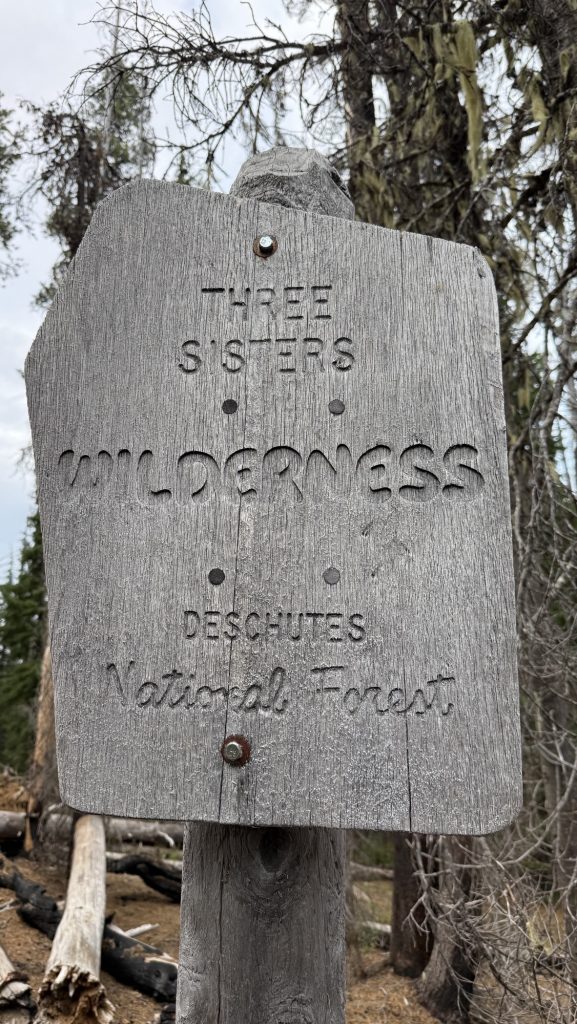
- Day 14 Coffee: Tonyx
Day 15-17: Taipei Finale
- Day 15: Dihua Street souvenirs, Don Donki, Yongkang St
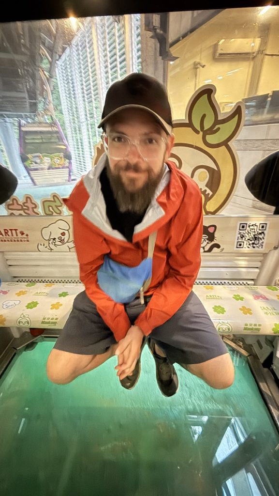
- Day 16: Maokong Gondola (glass floor!)
- Day 17: Elephant Mountain hike (2h loop), to airport
- Day 15 Lunch: Mingfu (1-star, crab!). Din Tai Fung to-go
- Day 16 Lunch: Longya Tea House, Dinner: Hosu (1-star, 13-course – book ahead!)


🇹🇼 Must-Try Taiwan Food Guide
Complete list from our 2.5-week itinerary – all Bib Gourmands, Michelin stars & personal favorites. 📍 Full Google Maps List
🏙️ Taipei (Days 1-2, 15-17)
World-famous xiao long bao (18-fold dumplings) + spicy shrimp wontons. Get ticket early (1-2hr waits). Day 1 lunch perfection!
Legendary breakfast – thick soy milk w/ youtiao, sweet/savory pancakes. 40+min queues. Day 1 highlight (long lines!)
Rice-stuffed crab, wild chicken, Buddha jumps wall soup. Book 2wks ahead. Day 15 finale – amazing crab!
14-course indigenous tasting menu. Seasonal mountain/sea ingredients. Day 16 trip highlight (book early!)
🌅 Sun Moon Lake (Days 3-4)
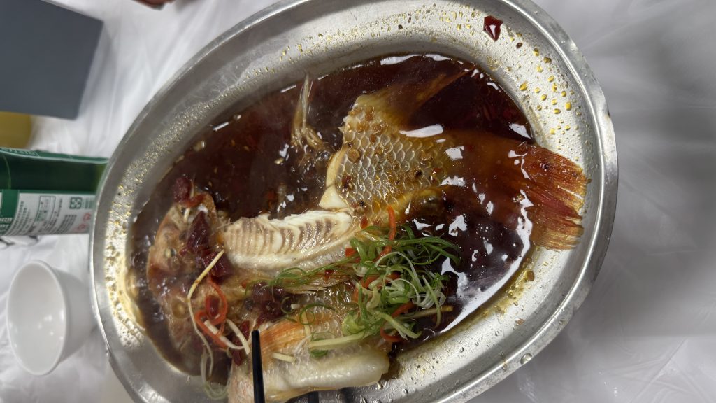
Lakeside Chinese – crispy sharpbelly fish, baked water bamboo w/cheese. Reserve ahead. Day 3 lunch perfection!
Fresh set menus w/3-cup chicken. Family-run gem. Day 4 dinner after e-biking!
Must-try street food – get early! Day 3 classic
Local gua bao-style – one of a kind!
Perfect lake refreshment.
🍲 Tainan (Days 5-7)
Michelin-rated sticky rice w/ braised pork, cucumber, fish floss & peanut powder. Peppery gravy + herbal soup famous since 1985. Migao rice bowl = pork lard + radish perfection!
80+yr legacy – braised pork rice + milkfish “fan zhuo zai” style. Clean 3rd-gen shop. Fried milkfish legendary. My Tainan favorite! Got seconds to-go 😋
Rich spicy dry noodles that sell out fast. Caught 2nd lunch before closing – worth it!
Classic Taiwanese comfort food. Day 5 lunch after Anping – perfect!
Great cocktails after sightseeing. Day 5 cheese cake + drinks!
🏝️ Taitung (Days 8-9)
Winter melon pork ribs. Went twice – trip favorite!
🏔️ Hualien (Days 10-11)
Rich broth after Taroko. Day 10 dinner classic!
♨️ Wulai (Days 12-14)
Hearty trail lunch. Day 13 hike fuel!
🥤 7-Eleven + Night Markets
📸 Blog Gold: Full Maps List + 180+ spots w/ personal notes and foodie tips


🇹🇼 Ready for your Taiwan adventure?
This 2.5-week itinerary blends city vibes, epic hikes, night markets & Michelin eats. We loved Taiwan and want to go back already! A few foods weren’t our taste (that’s adventure!), but we’ll keep trying new things.
📸 If you visit any of these places, share your pics with #CarbonaraInspired & tag @carbonaraontour!
Hope this helps plan your trip! Anything missing? Let me know in the comments!
Disco x

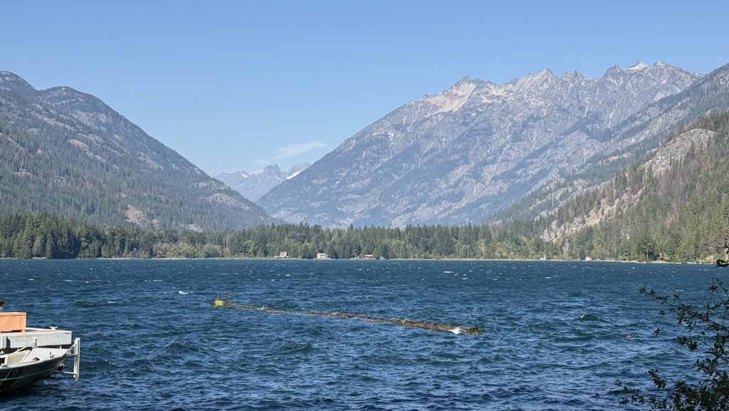
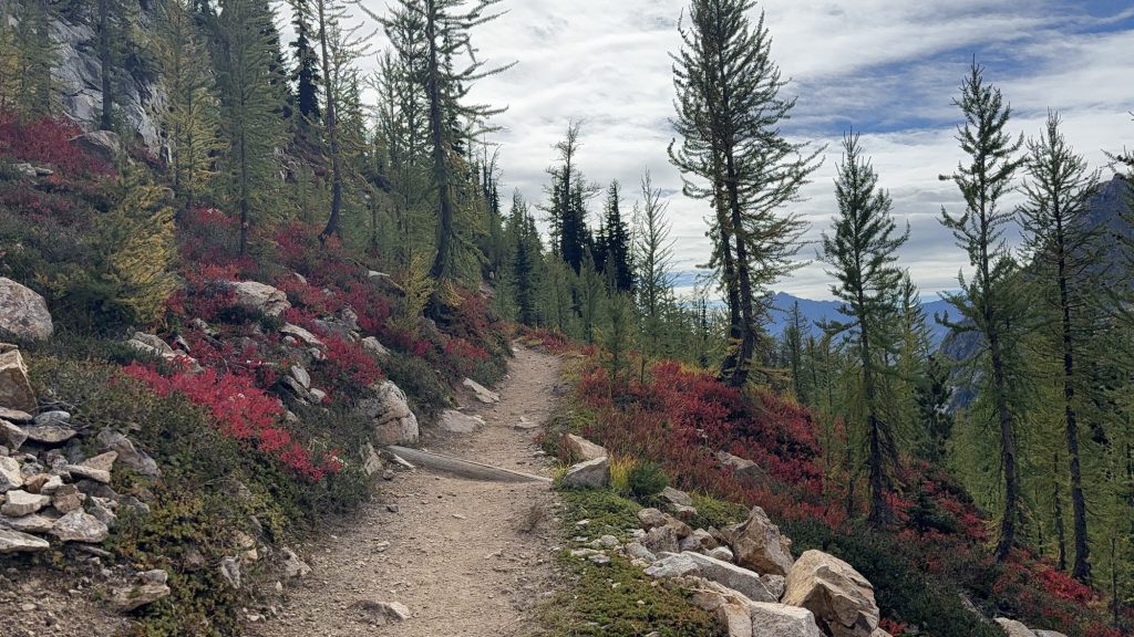
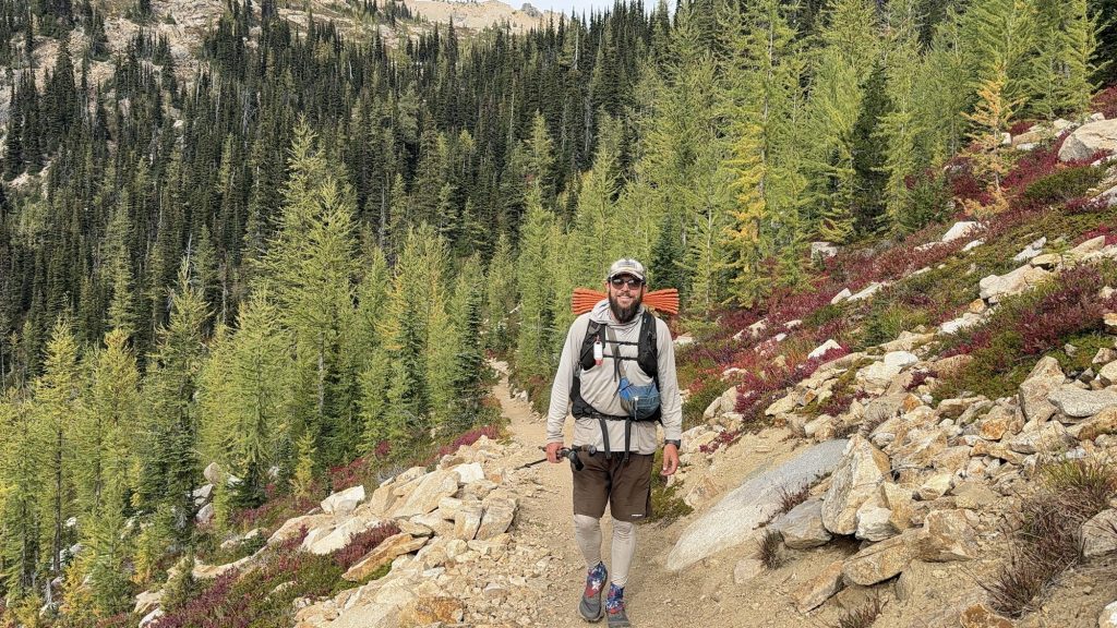
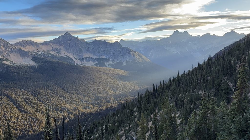
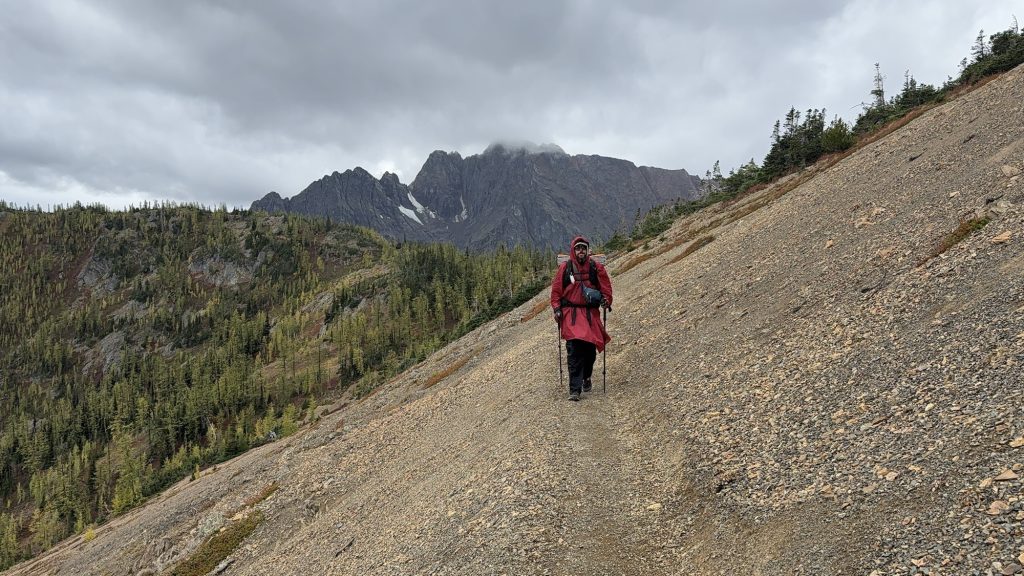
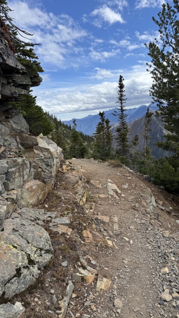
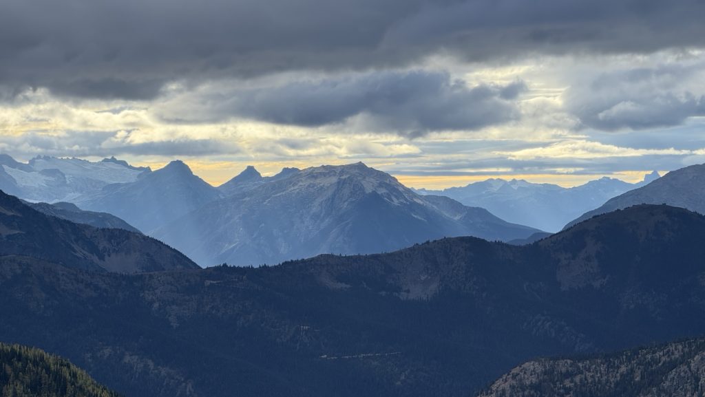
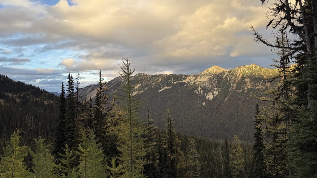
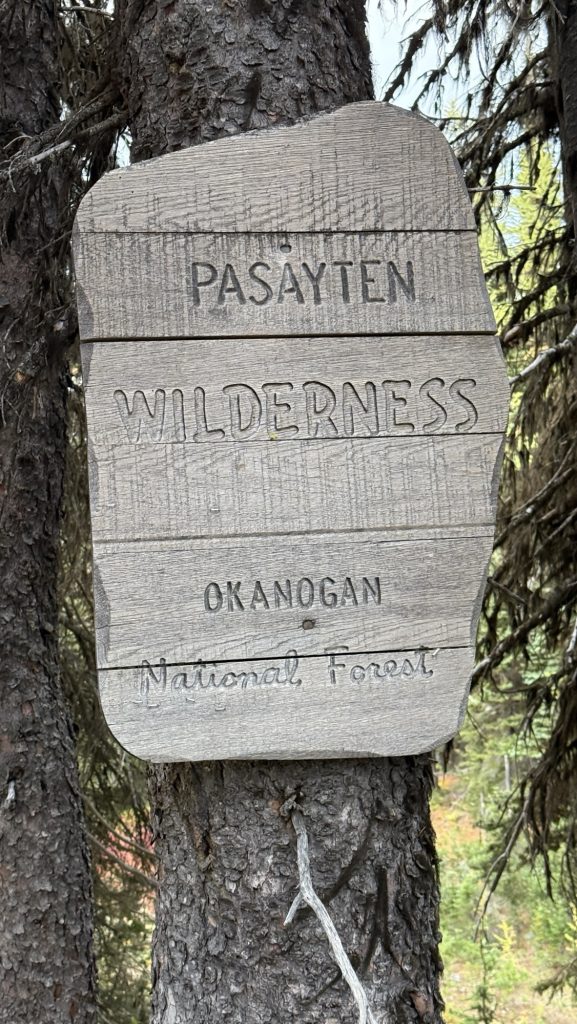
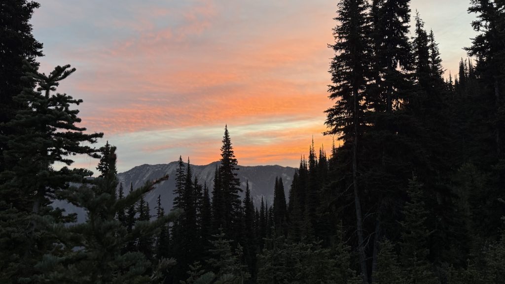
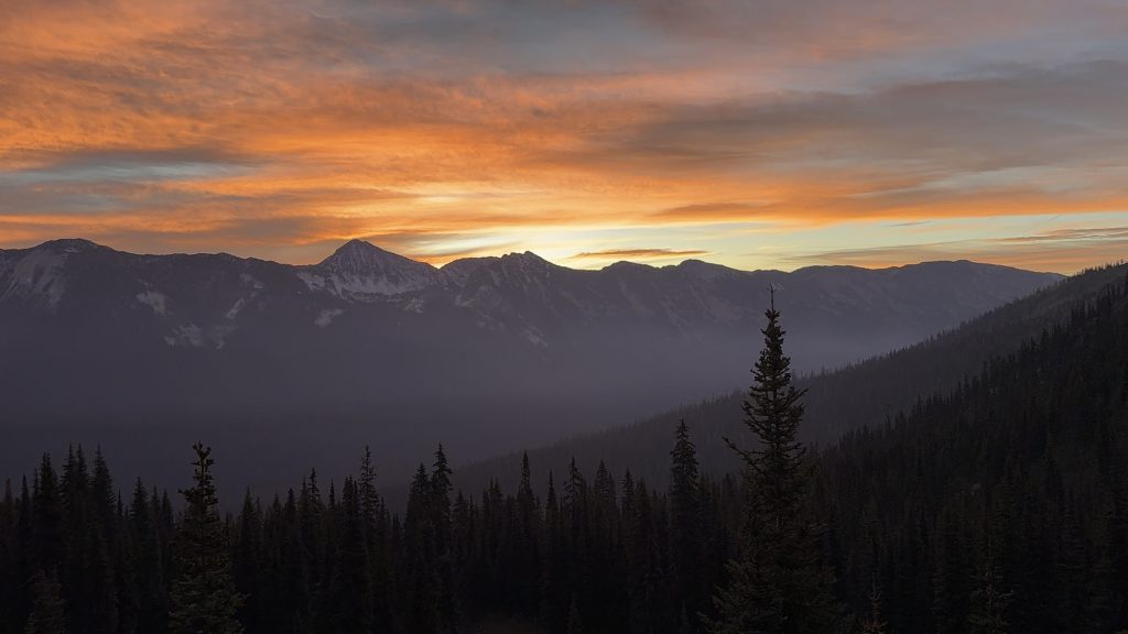
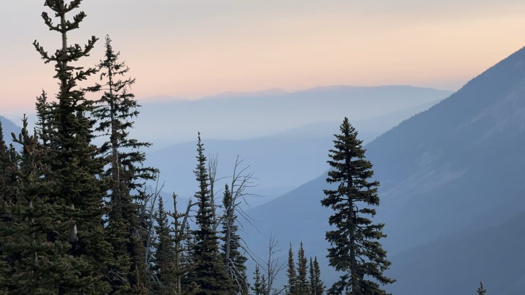
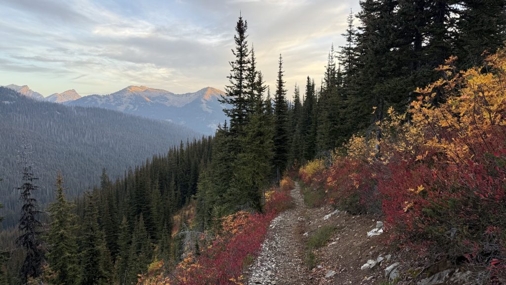
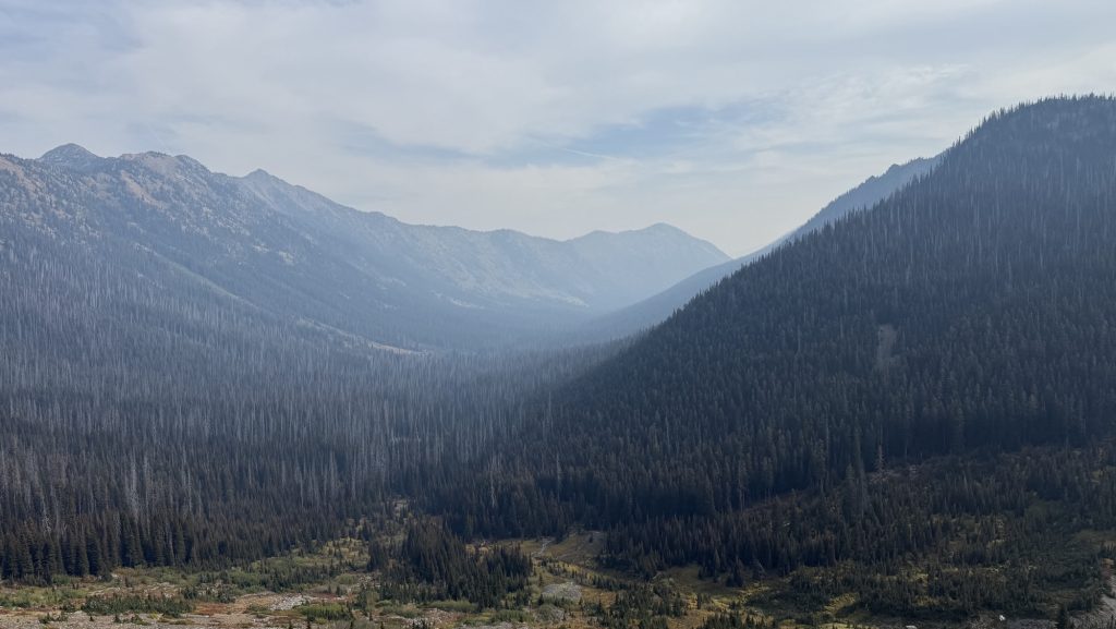
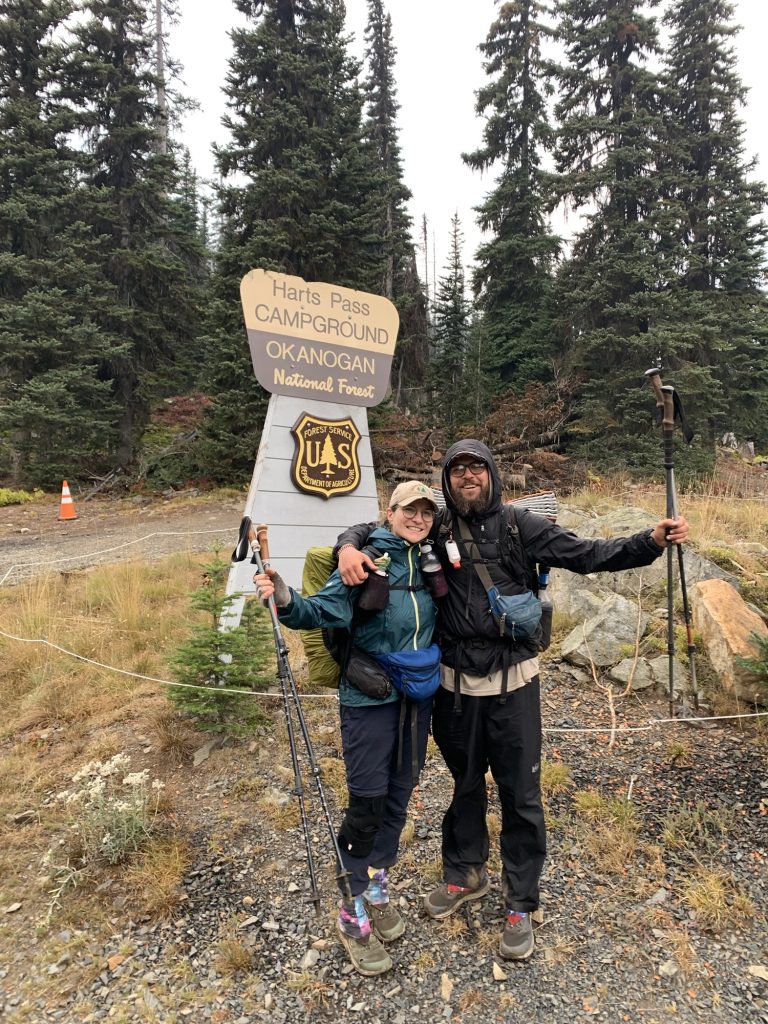
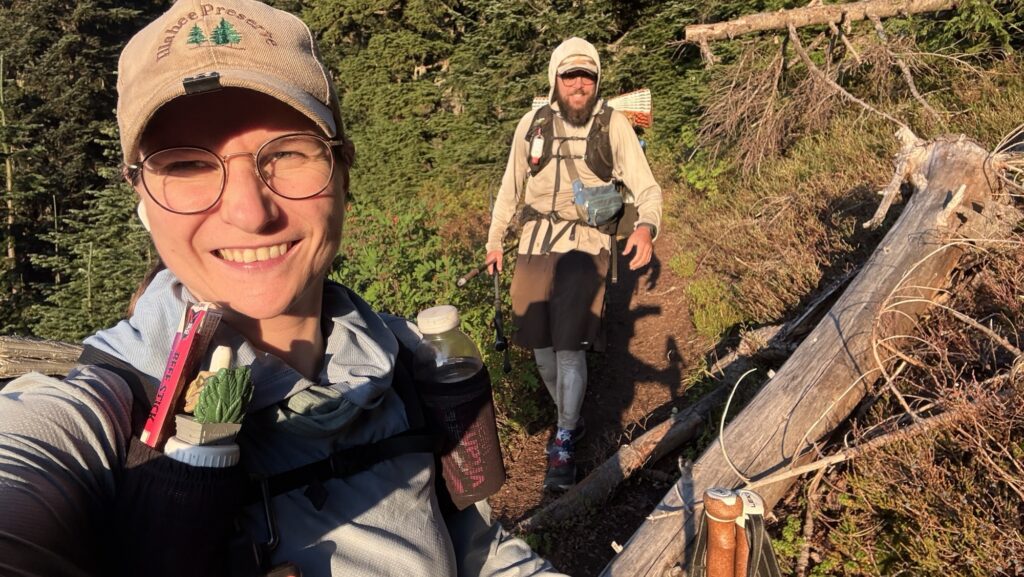
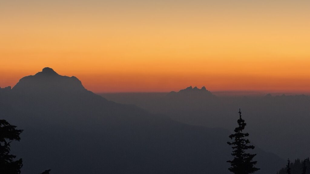
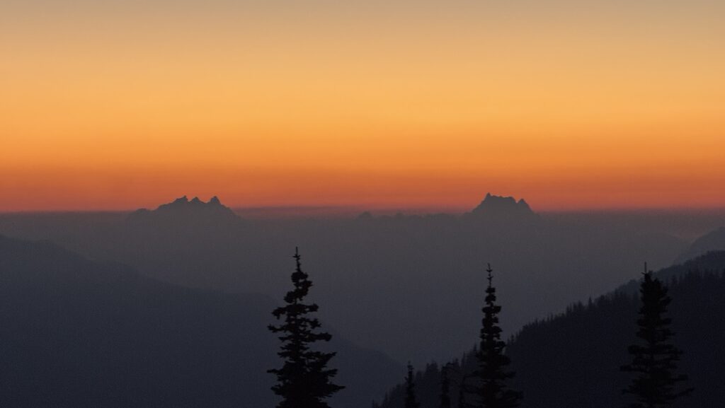
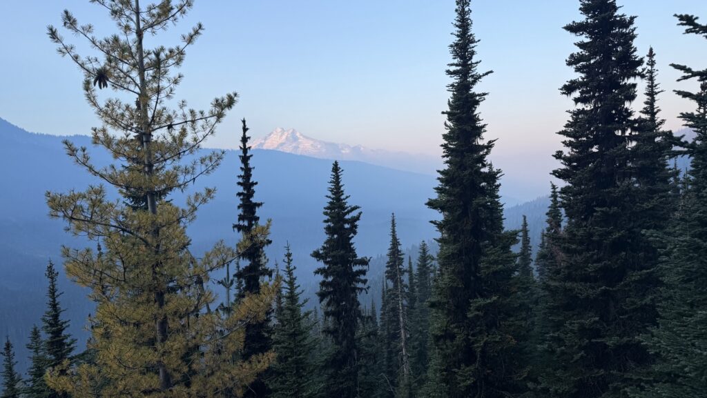
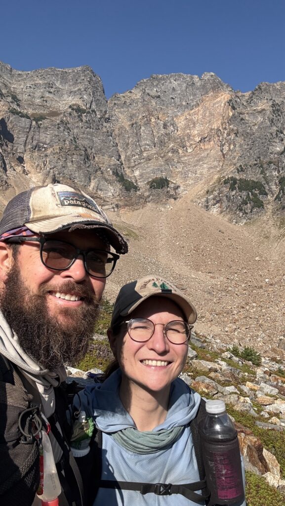
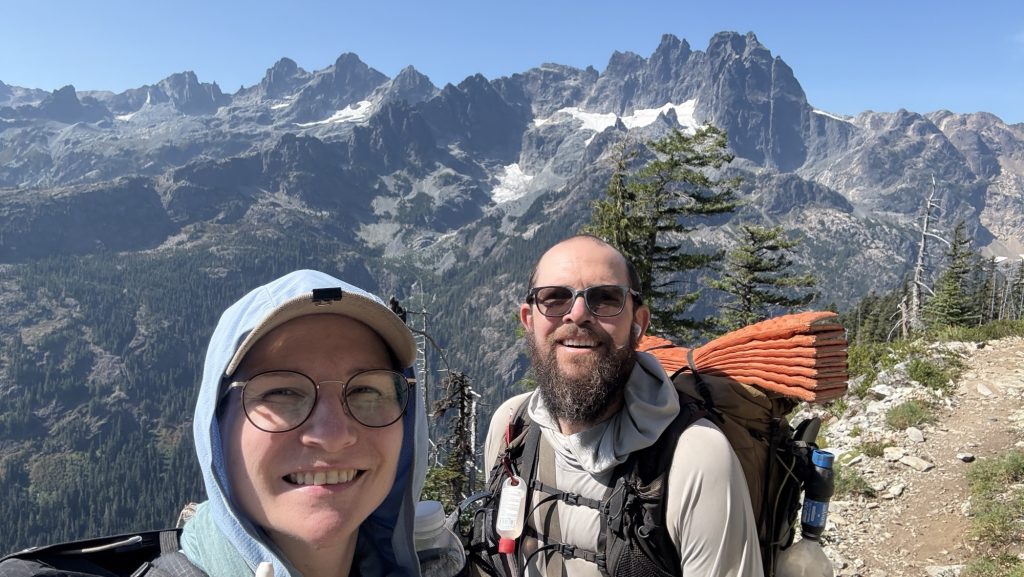
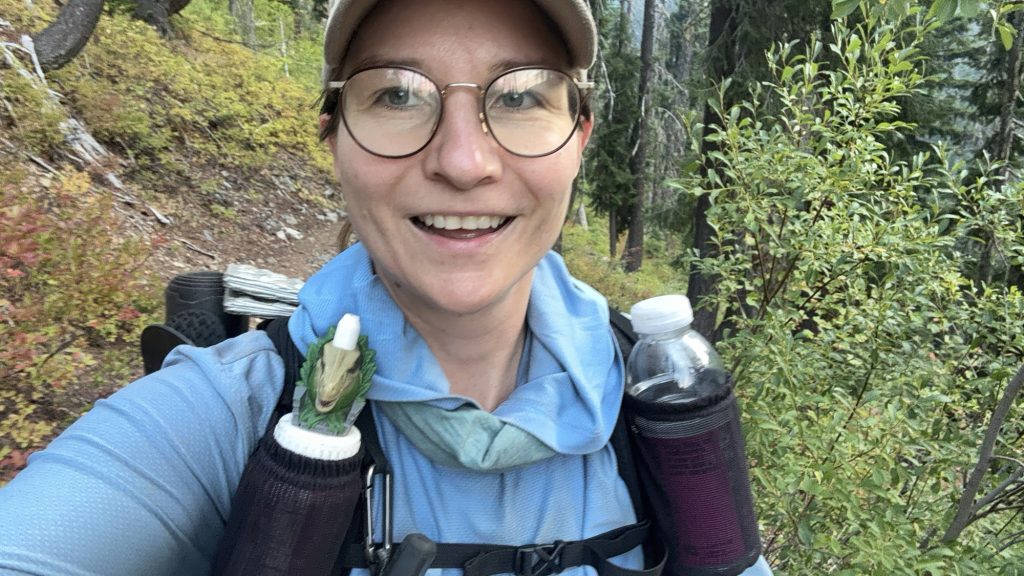
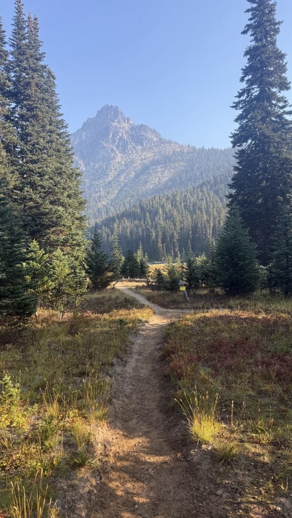
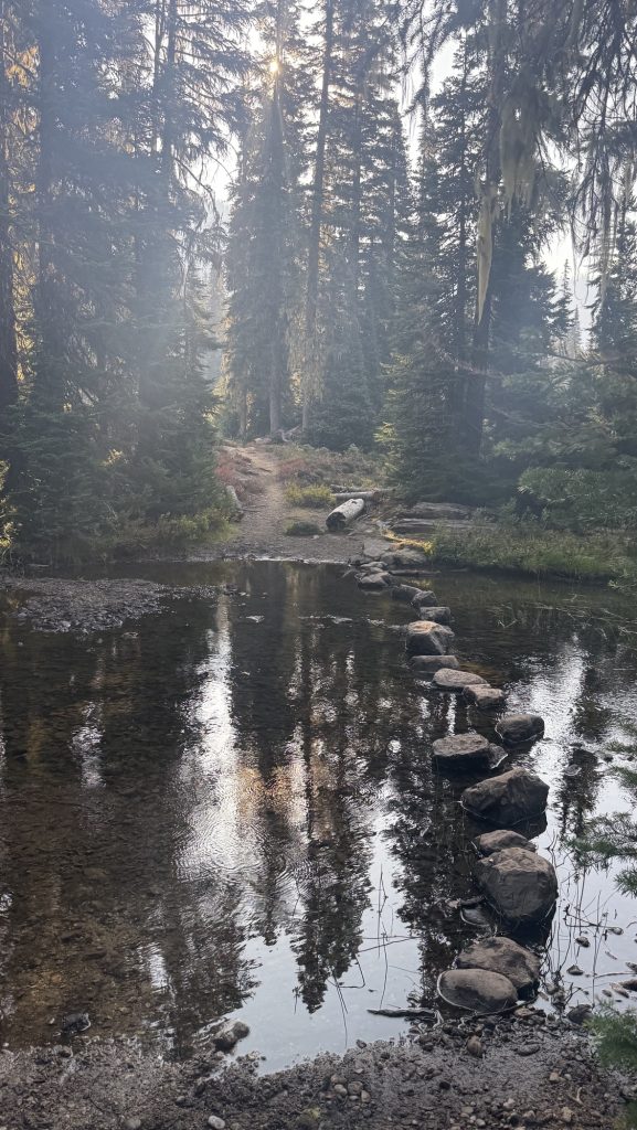
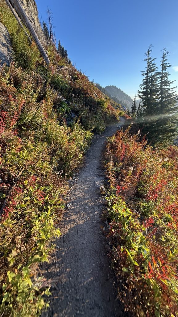
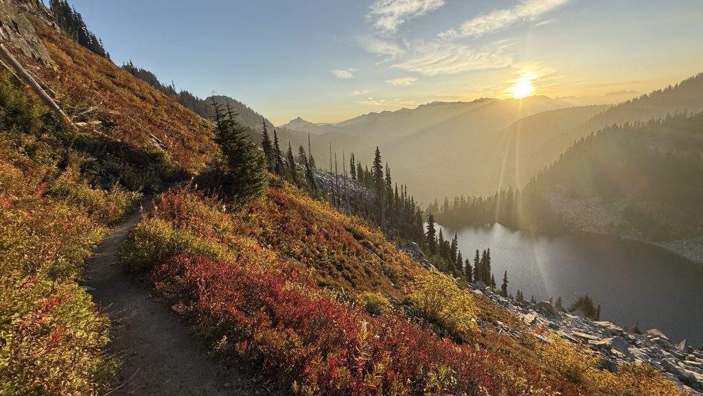
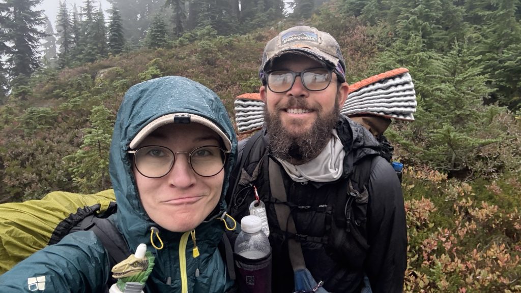
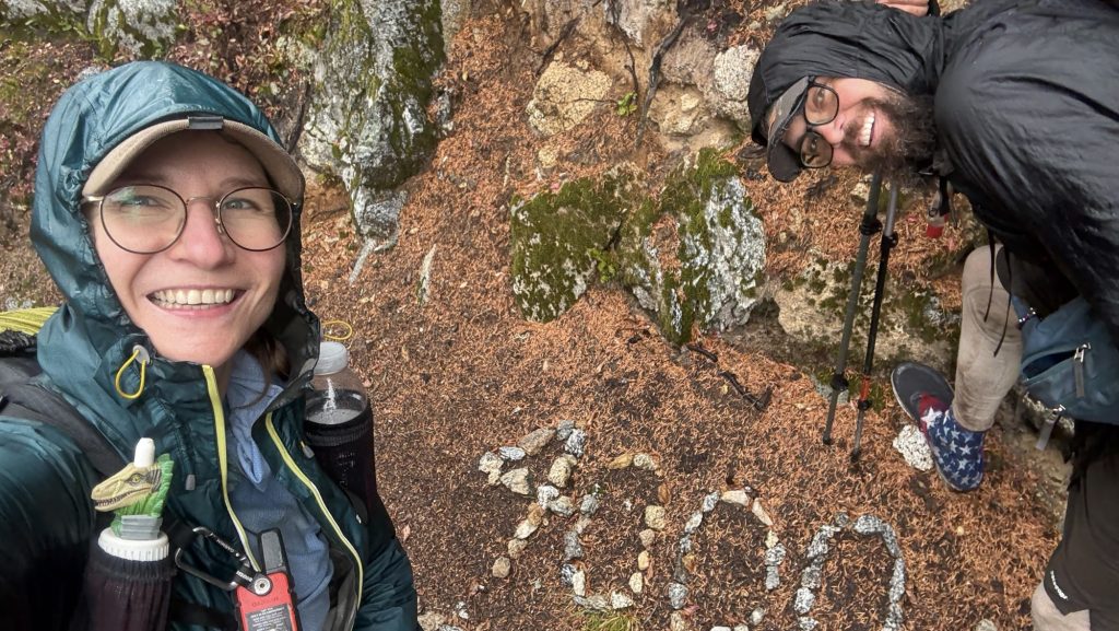
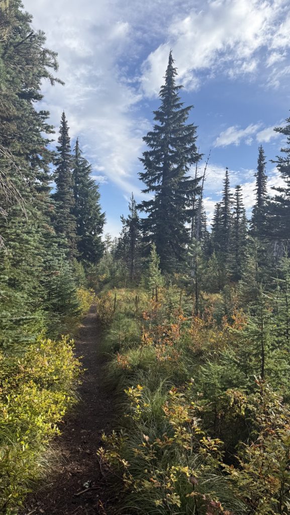
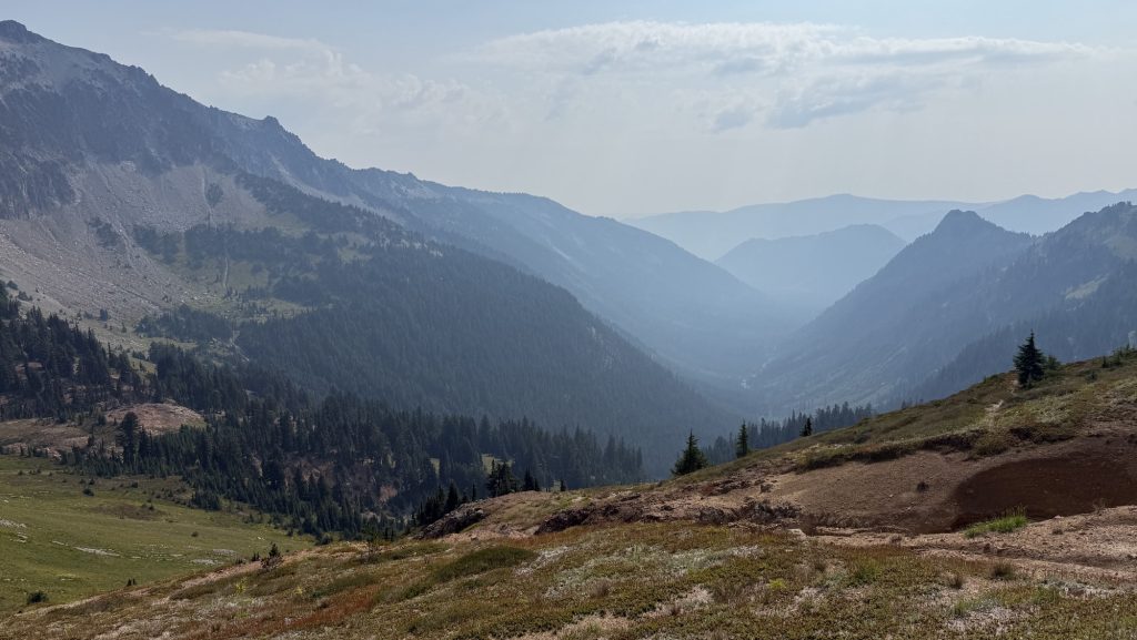
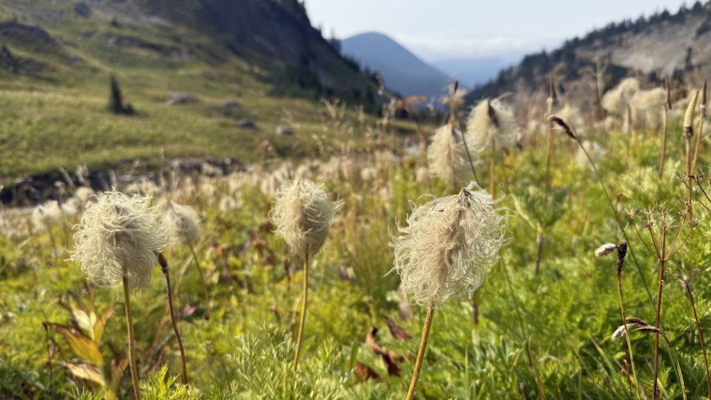
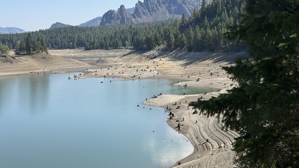
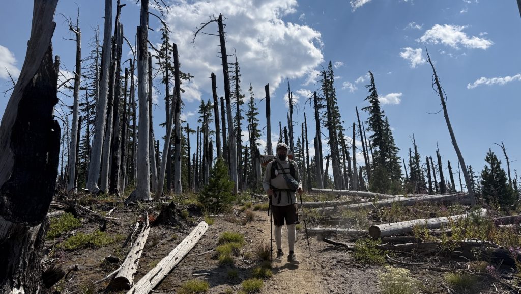
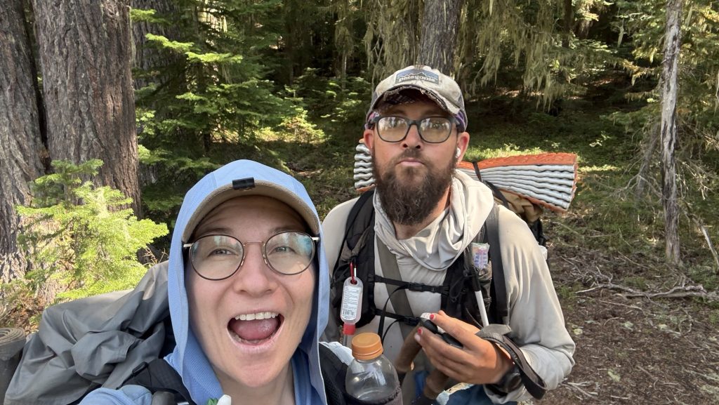
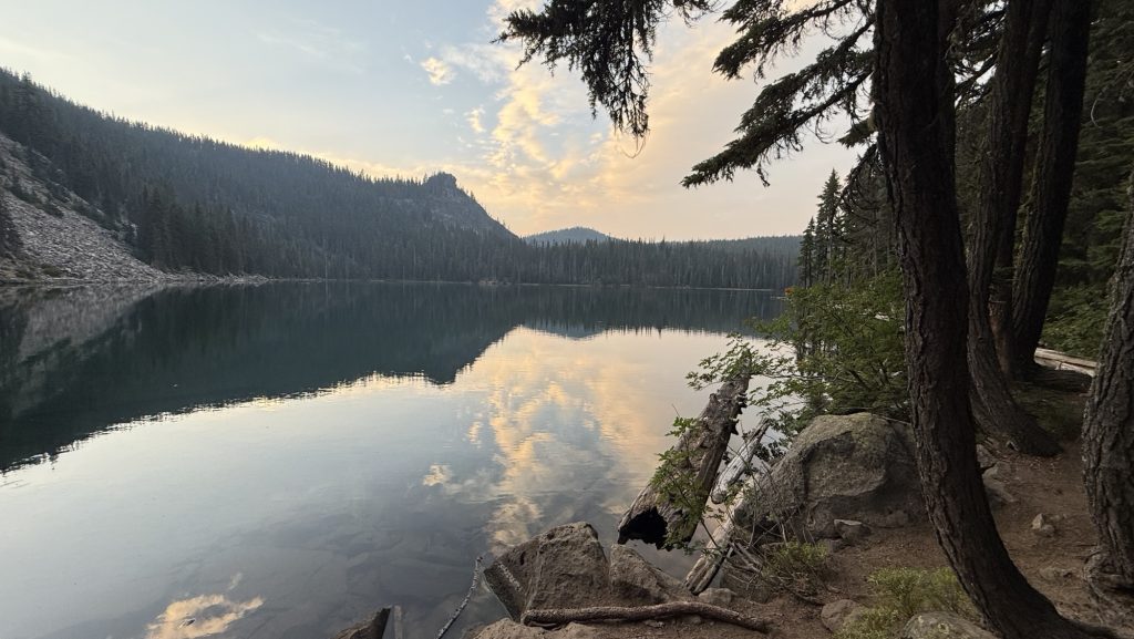
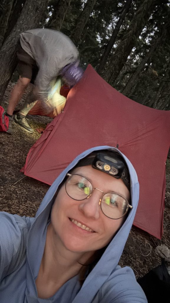
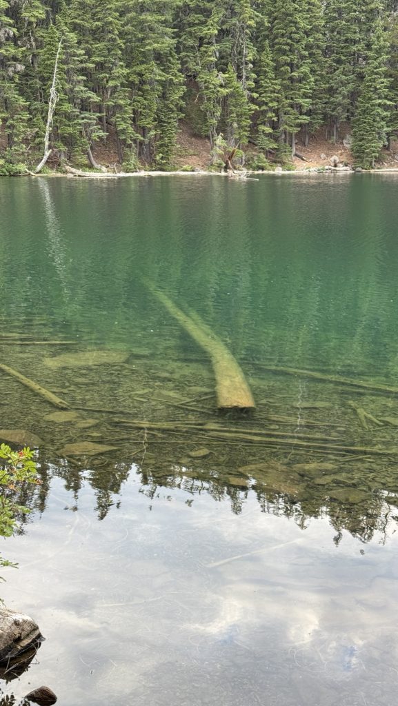
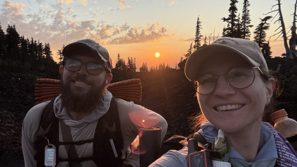
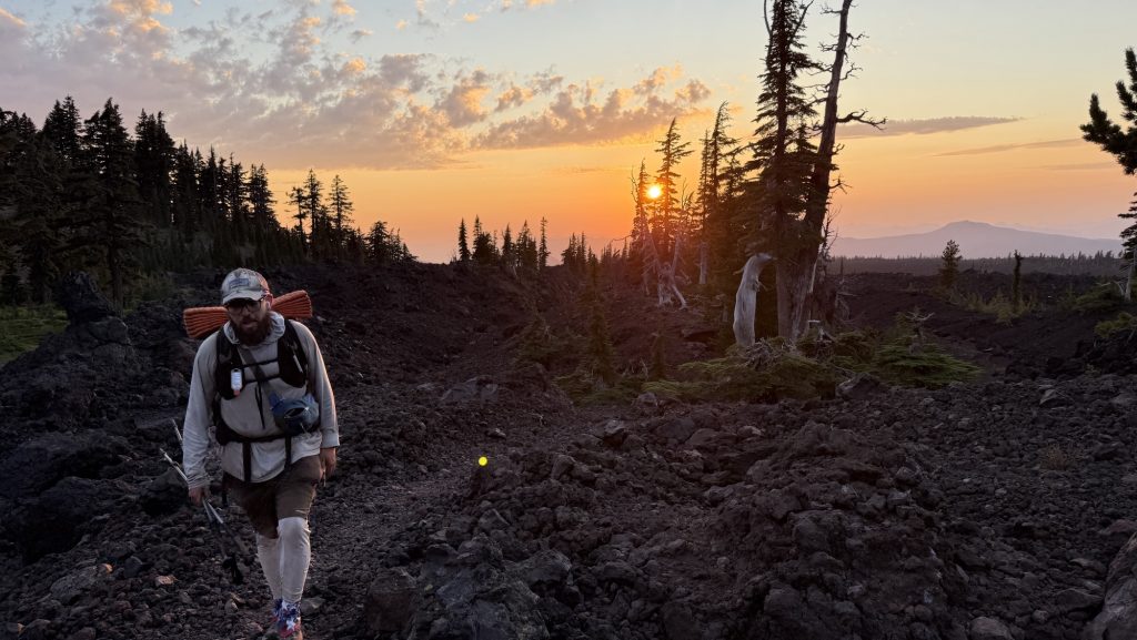
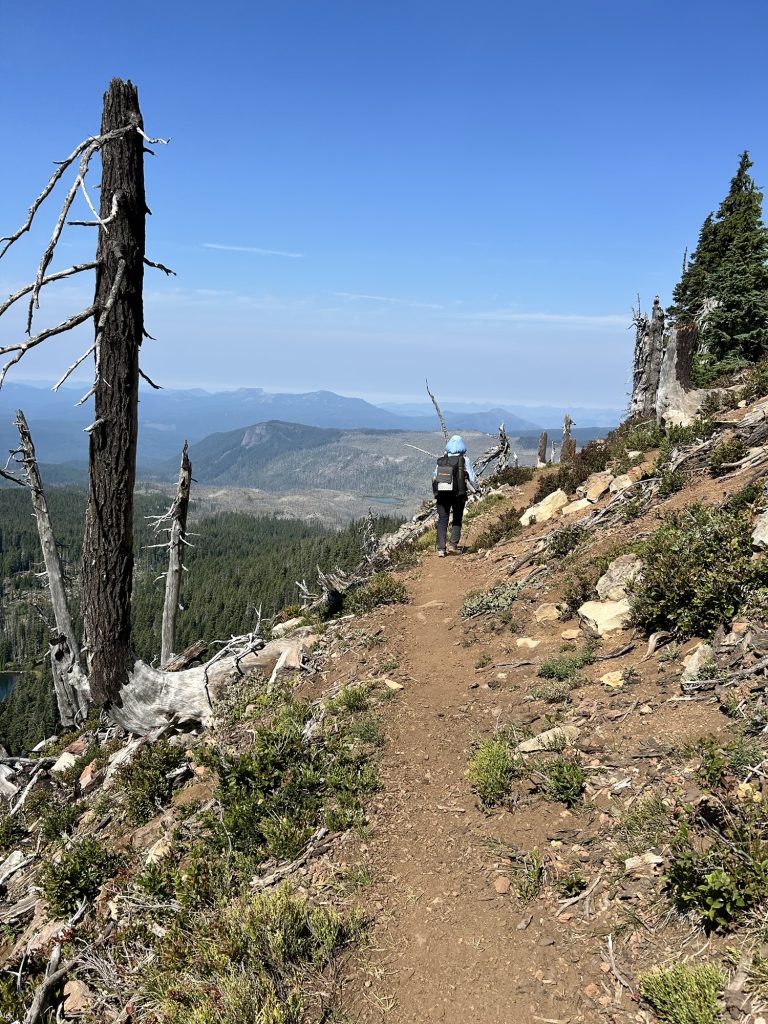
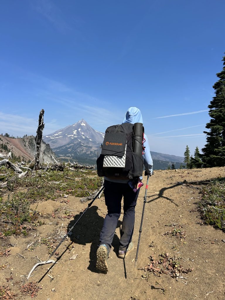
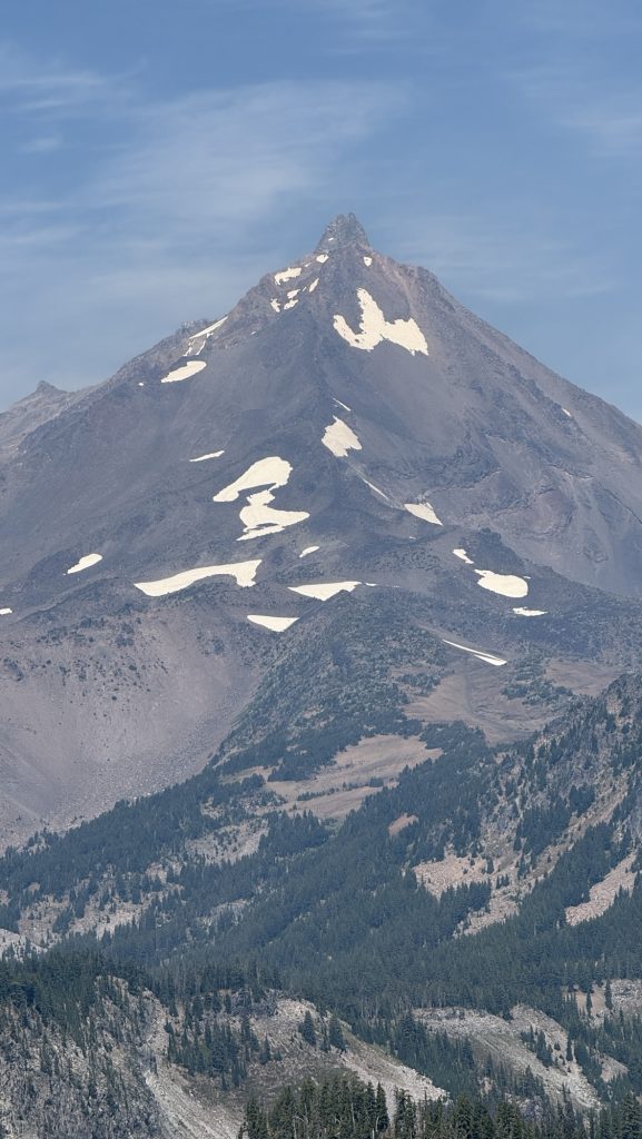
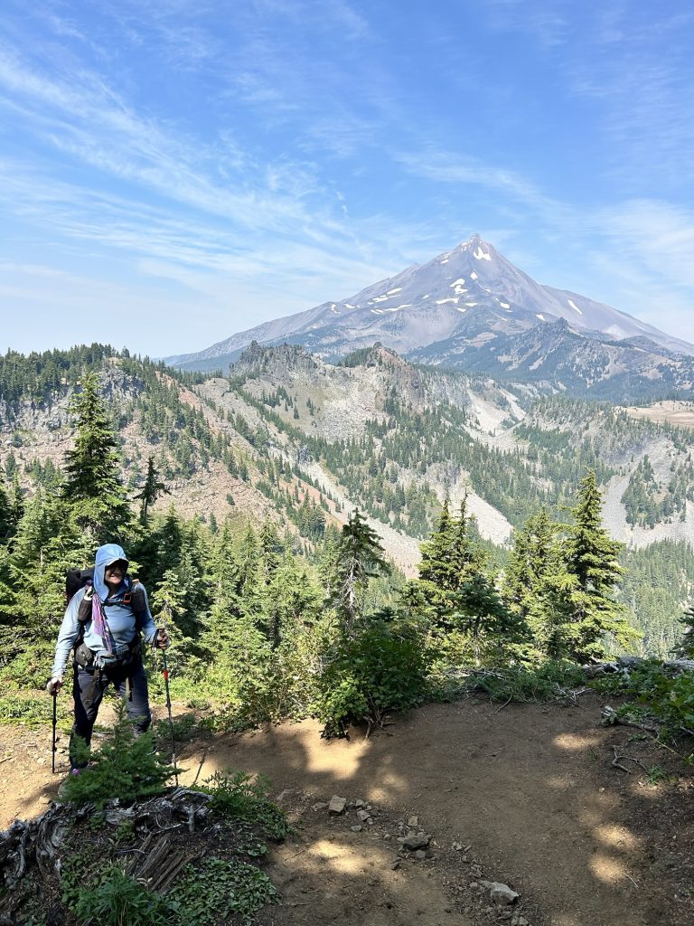
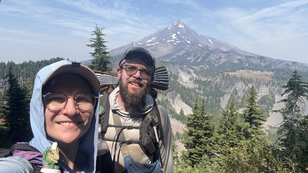
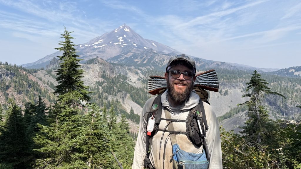
Days 138 – 142: Canada!! (2575.1 – 2655.5 + 30)
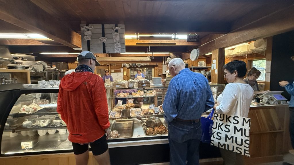
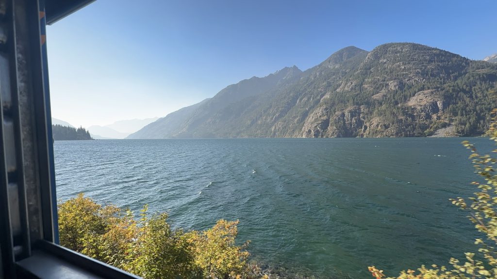
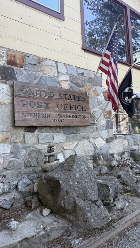
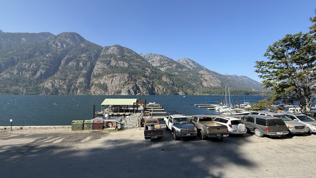
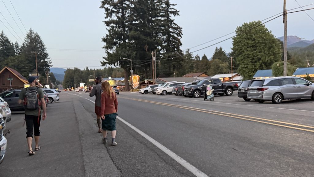
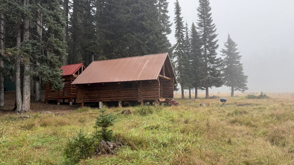
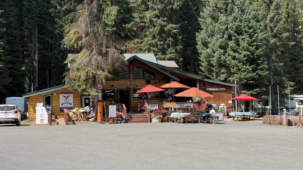
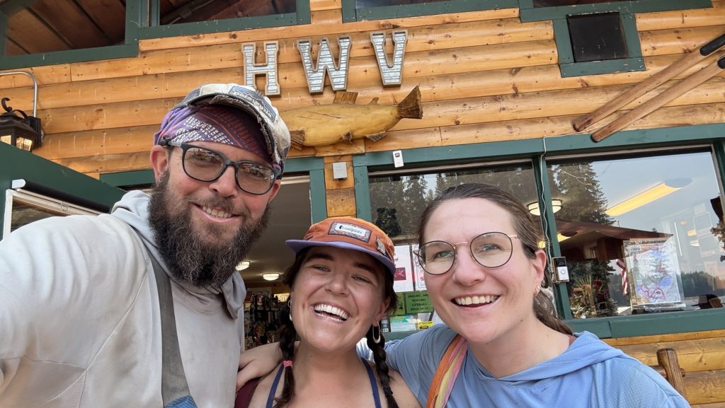
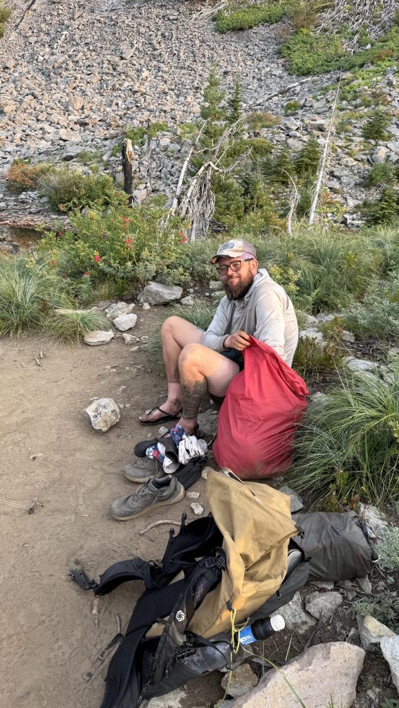
Day 138: Stehekin Valley Ranch – Last Resupply Before the Final Stretch (PCT Mile 2588.5)
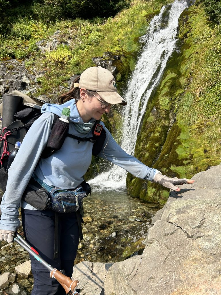
I woke up at 6:00 a.m. without my alarm — nature’s way of reminding me I’m still human, I guess. Unfortunately, I also woke up with the unmistakable signs of a Urinary Tract Infection. Not surprising after months on trail, but it’s a bit alarming when you’re in one of the most remote corners of Washington. I couldn’t help but wonder — can I even find medicine out here in Stehekin?
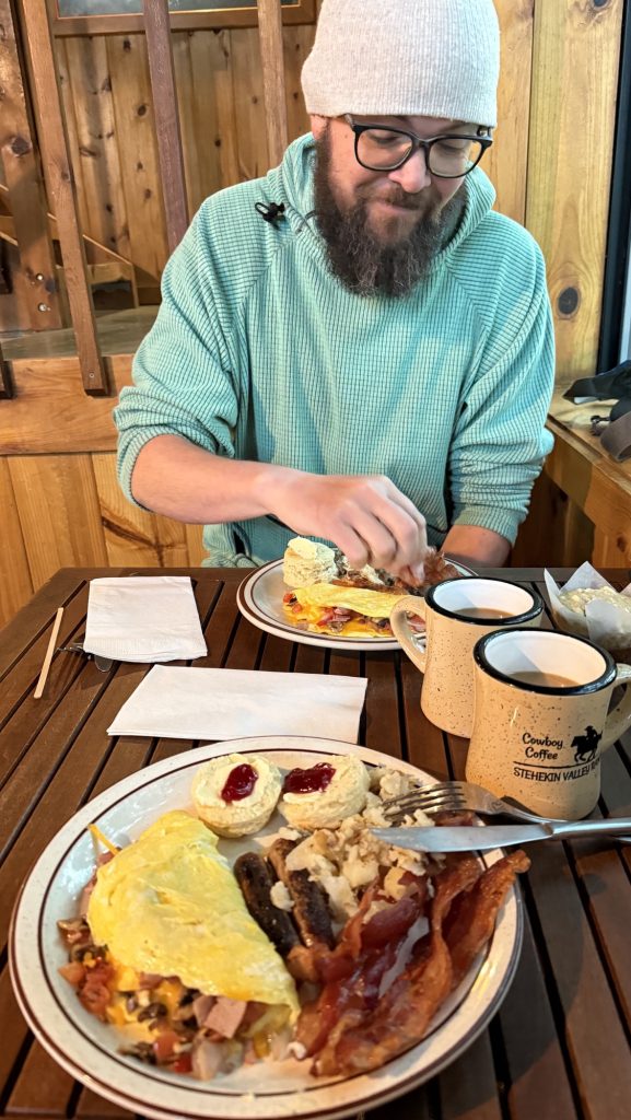
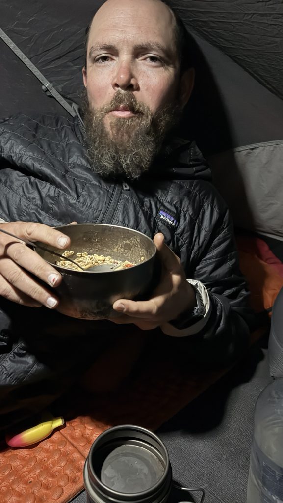
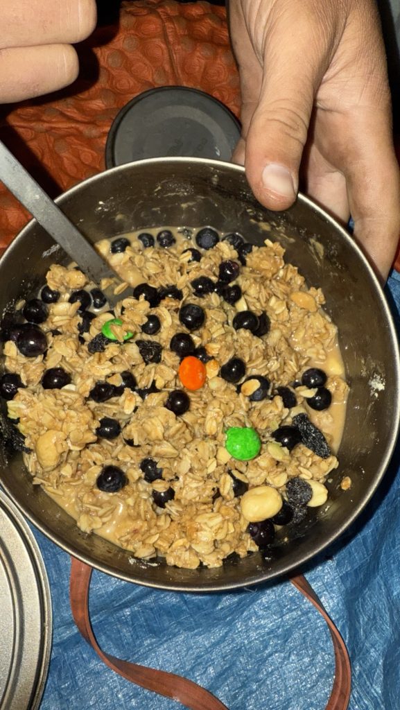
Iceman slept in until 7:15, and by then I was more than ready for breakfast. The big kitchen cabin at Stehekin Valley Ranch served up a hiker’s dream: crispy bacon, a full omelette, and a sandwich bar that doubled as our lunch prep station. We packed hefty sandwiches and snacks, knowing it would be a long day ahead.
After breakfast, we plugged in every electronic device we owned — batteries might not be essential for survival, but out here, they’re close. Once everything was fully charged, we caught the iconic blue bus to Stehekin Landing to fetch our final resupply box. It hit me then: this was the last box of the journey. The last taste of home-packed supplies before the finish line.
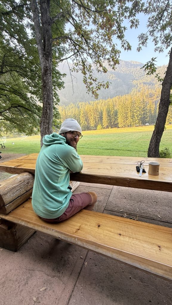
We squeezed in laundry before heading back, clothes draped over our packs and the bus railing to dry in the mountain breeze. Lunch was devoured during the ride — a picnic on wheels as we bounced our way back toward the trailhead. At 1:30 p.m., we shouldered our freshly replenished packs and stepped back onto the Pacific Crest Trail.
Almost immediately, exhaustion hit me. My legs felt heavy, and my body refused to find a rhythm. Symptoms of a UTI? I eventually gave Iceman some of my gear to lighten my pack, grateful (again) for a partner who doesn’t hesitate to help. The effort was worth it, though — by 7:00 p.m., we had covered 14 miles, climbing 3,399 feet and descending 1,597. My watch later logged 34,662 steps.
As twilight settled over the forest, I felt a strange mix of fatigue and fulfillment. The last resupply is more than just logistics — it’s a milestone, a turning point. Ahead lies the final stretch of the PCT, and though my body’s fraying at the edges, my spirit’s holding strong. Stehekin’s calm valley faded behind us, and the mountains ahead whispered one message: almost at the end. 🥲
Miles hiked: 14.01
Ascent: 3399 ft
Descent: 1597 ft
Steps: 34662
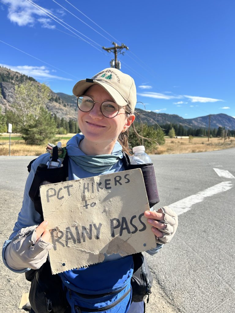
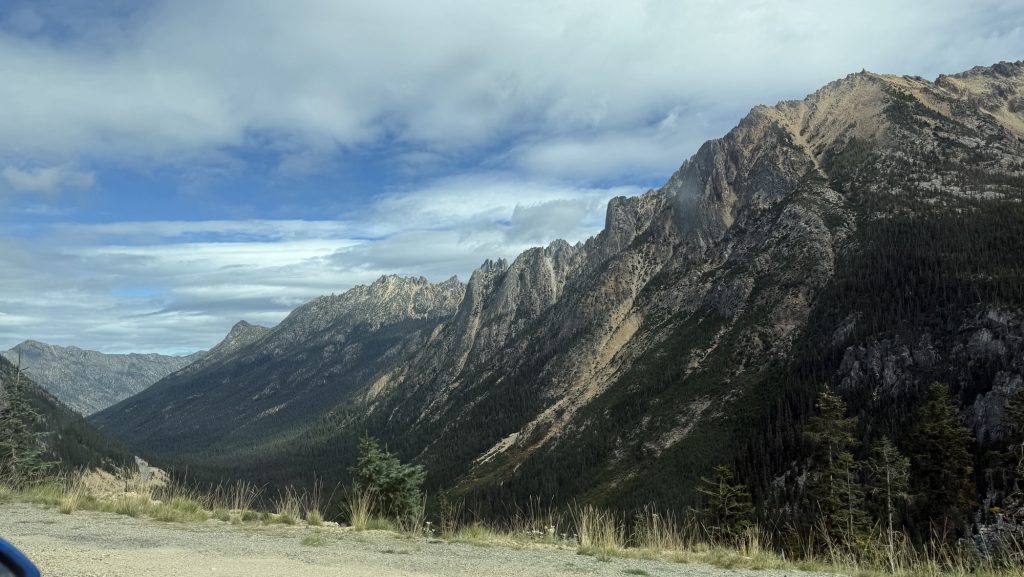
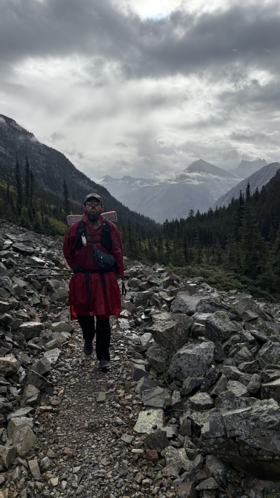
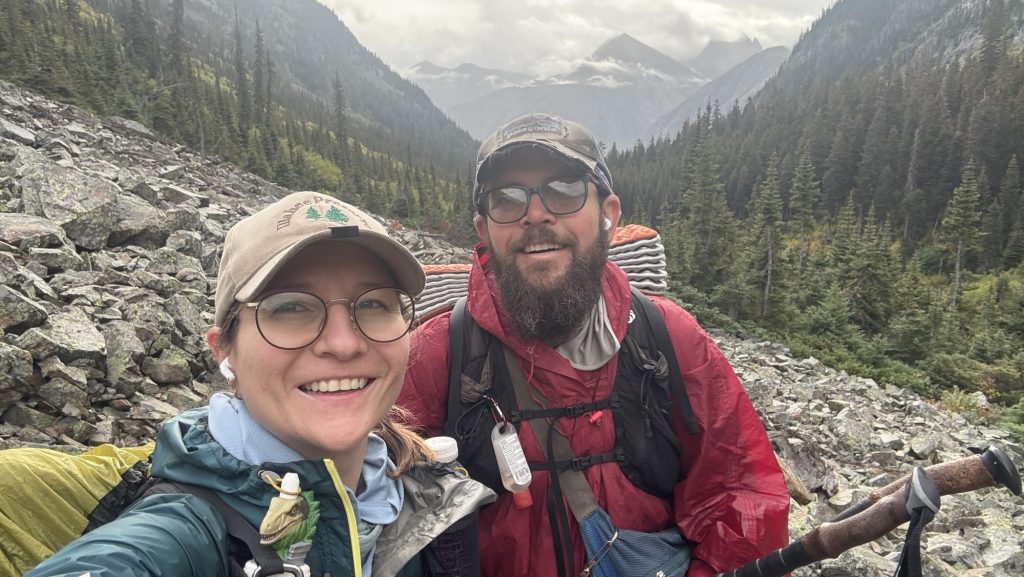
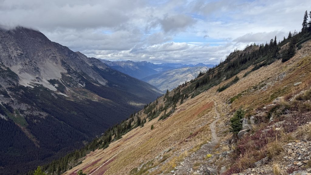
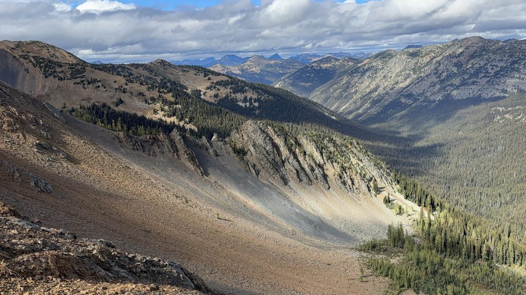
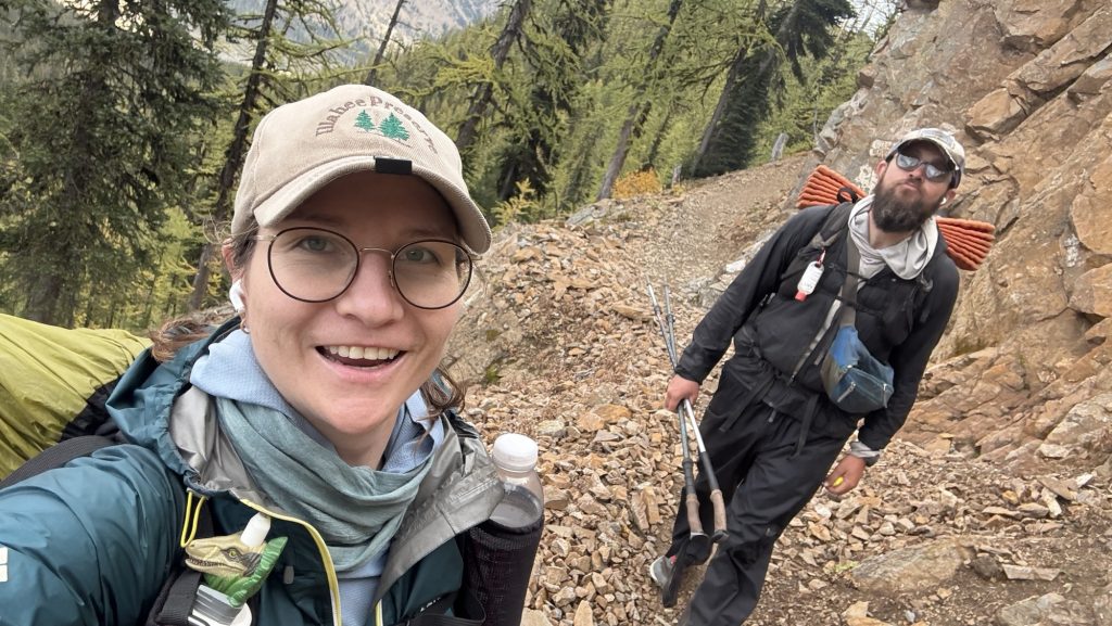
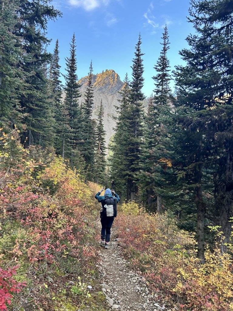
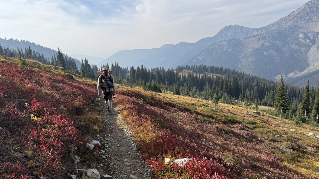
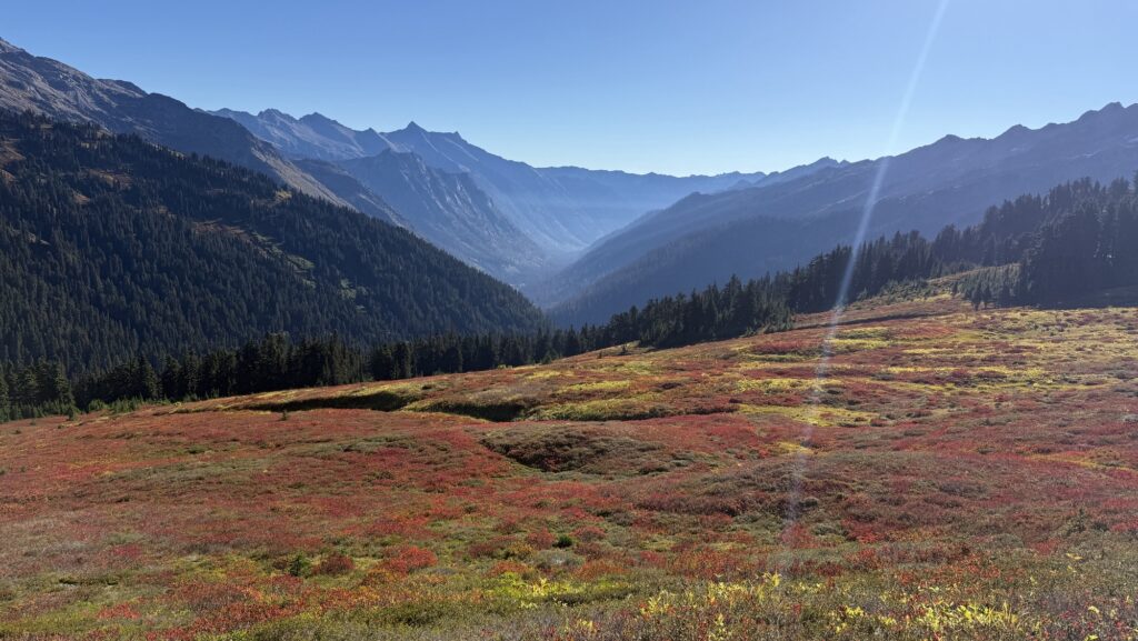
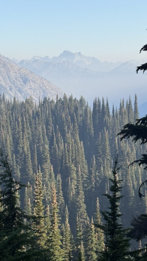
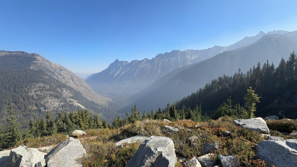
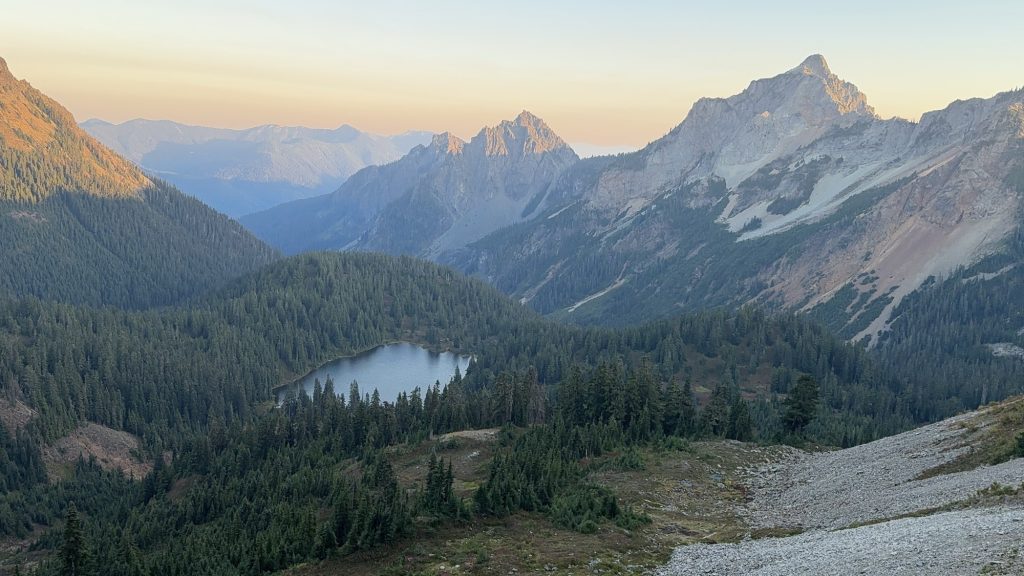
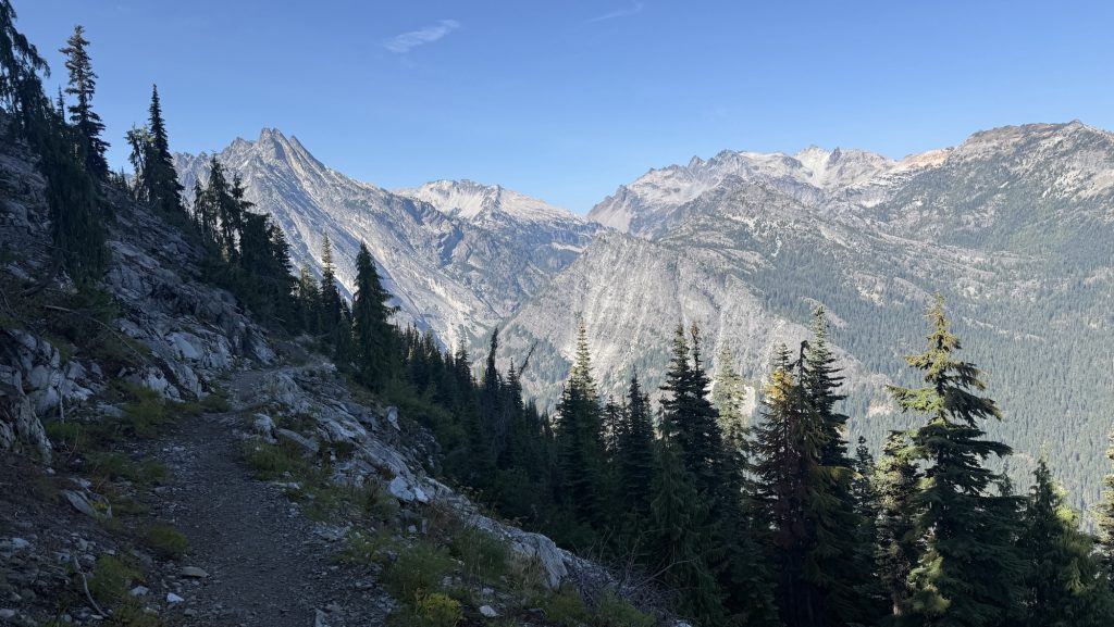
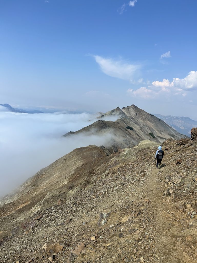
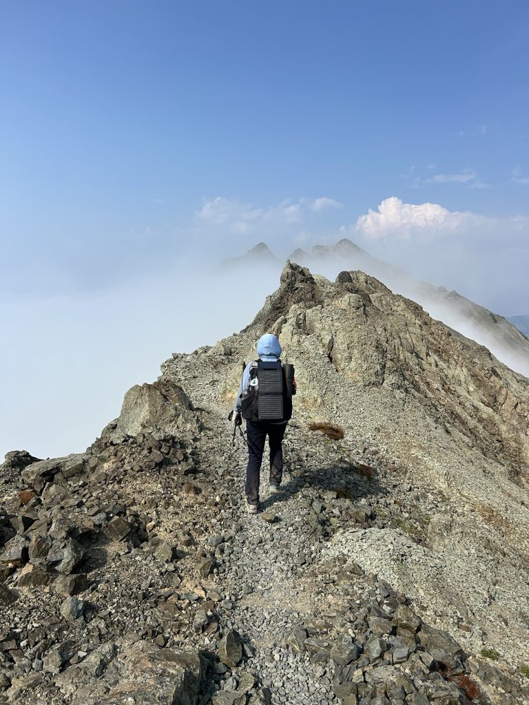
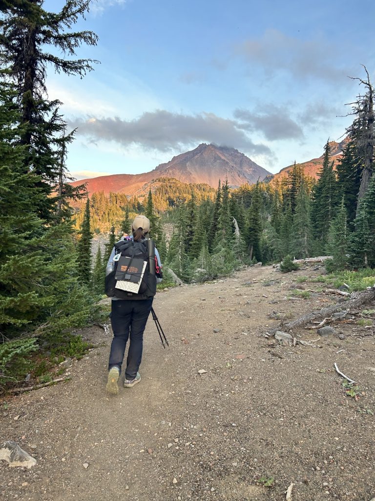
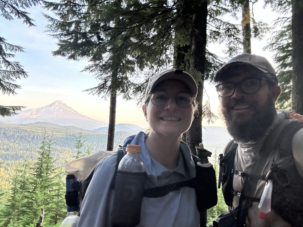
Day 139: Winthrop Detour, Trail Pain, and a 22-Mile Push (PCT Mile 2609.7)
We were back on trail early, starting our hike at 7:00 a.m. under a cool, overcast sky. It was supposed to be a steady climbing day, but things rarely go as planned out here. By 9:30, we had caught a ride into Winthrop with Doug — an unexpected side trip that turned into one of the best little adventures of the trail.
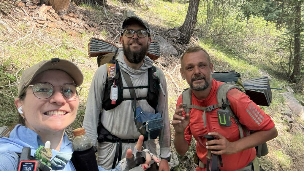
Winthrop turned out to be an incredible town — rustic, welcoming, and full of life, with its old Western storefronts and friendly locals. The main goal, though, was medical: I needed to figure out what was going on with some uncomfortable symptoms that had been creeping up. The folks at Confluence clinic treated me right away, and thankfully, the result came back negative — no white blood cells, no infection. It was a relief just to rule out anything serious. Iceman’s legend Brother in law, Mike, an MD from Baltimore was incredibly supportive, talking me through the result and confirming that I was indeed fine.
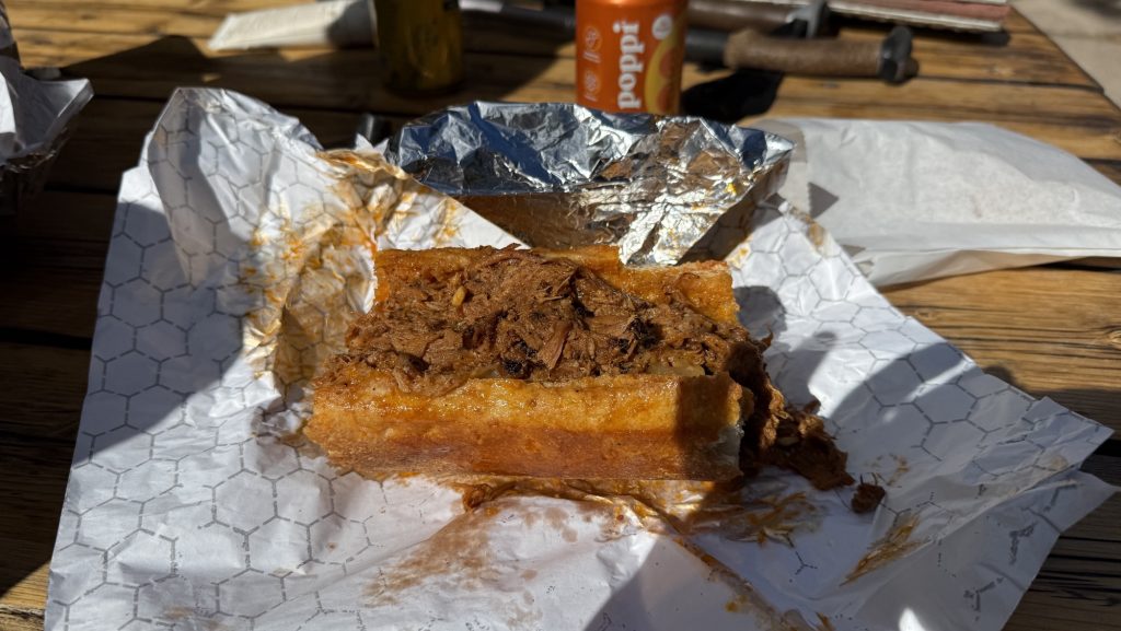
After that, we hitched a ride to the Mazama Store with Gary and refueled properly — an incredible pulled pork sandwich that instantly lifted our spirits and energy. Few meals on trail compare to that one. Fully recharged, we caught another ride back to the trailhead with an ex-lawyer whose trail stories and wisdom kept us smiling the whole way.
We started hiking again at 1:30 p.m., determined to make up for the morning detour. Despite the late start and the side quest into town, we crushed 22 miles by the time night fell. The trail wound through quiet forest and open slopes, and even though our bodies complained, our momentum carried us forward. By sunset, though, we were feeling every step — a strong pain in my tailbone had grown worse through the day, tender to the touch and marked by sharp pain every time I moved. Whatever it is, it made hiking painful, and I had to rely on ibuprofen just to push through.
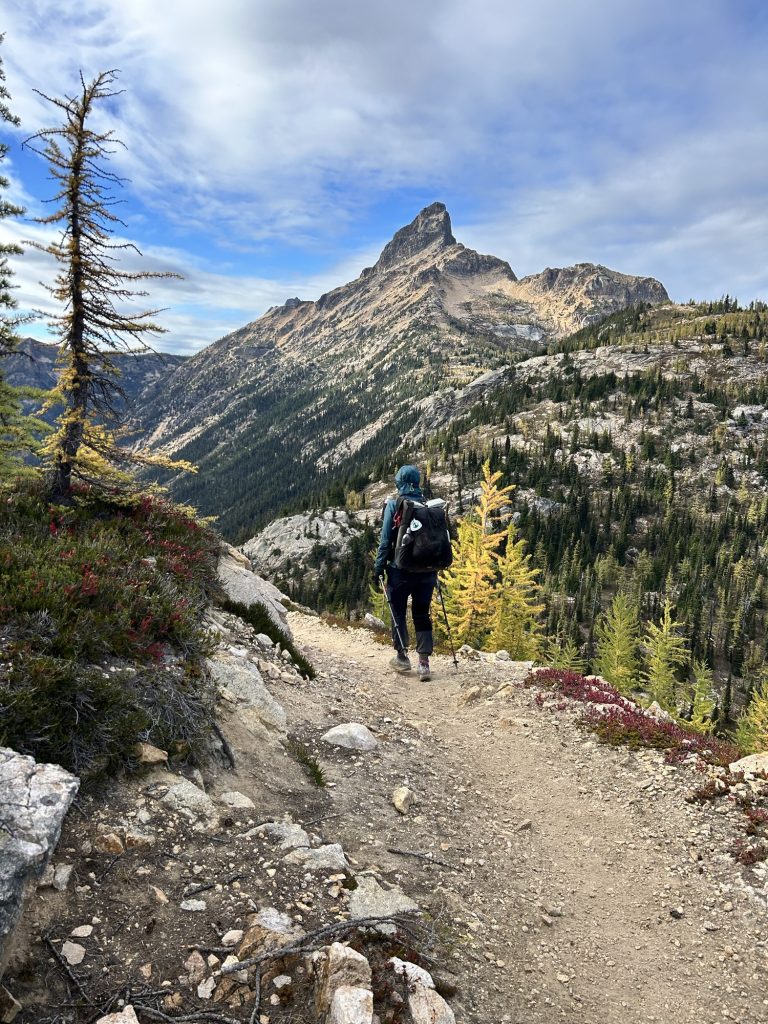
Only three long days remain: two around twenty-seven miles and a final twenty-one to reach the northern terminus. The pain is real, but so is the motivation. With every mile now, we can feel the end drawing closer, the promise of Canada just ahead. Scary. I don’t know if I want this adventure to be over. But we have a deadline to reach!!
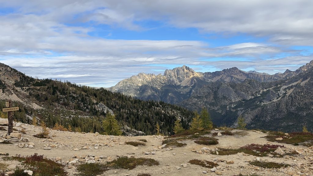
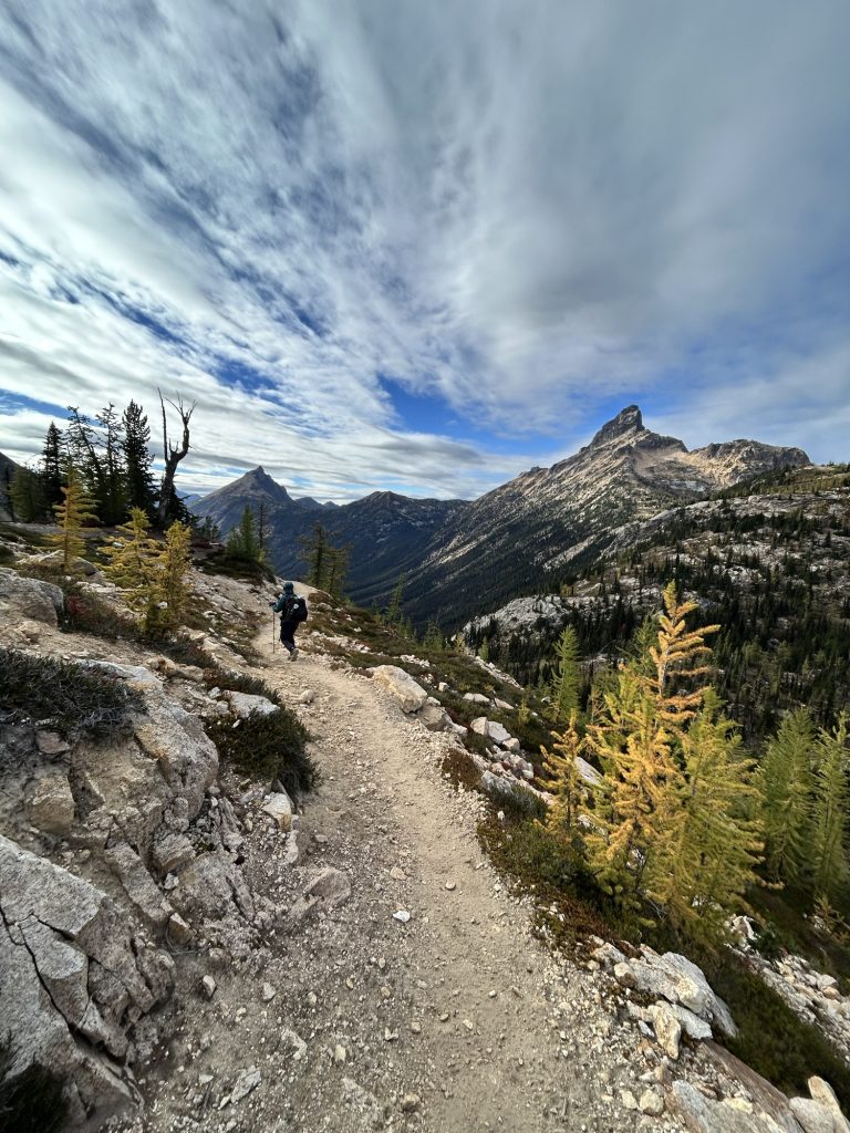
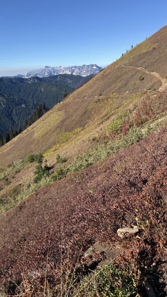
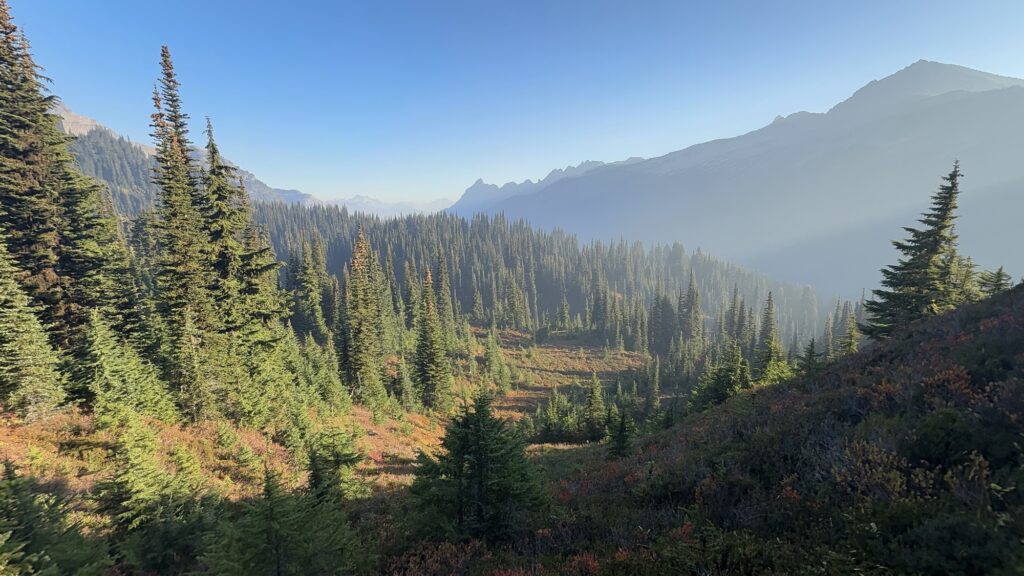
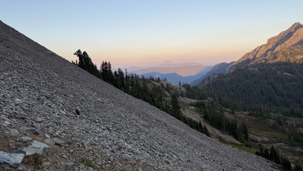
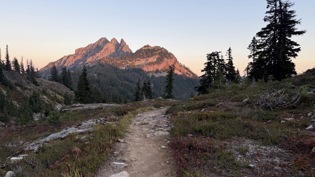
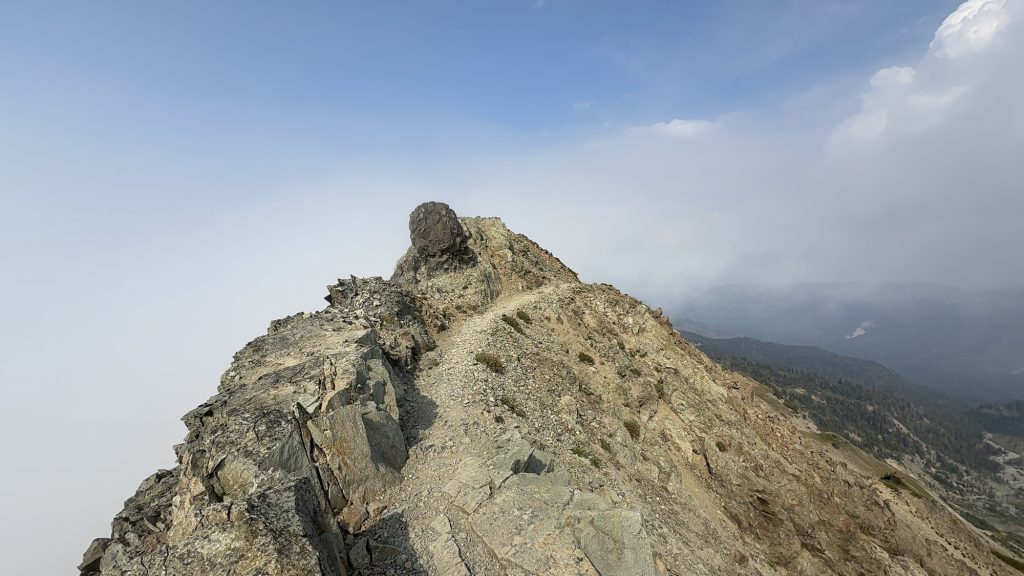
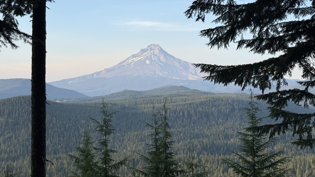
Day 140 – PCT Mile 2632.2
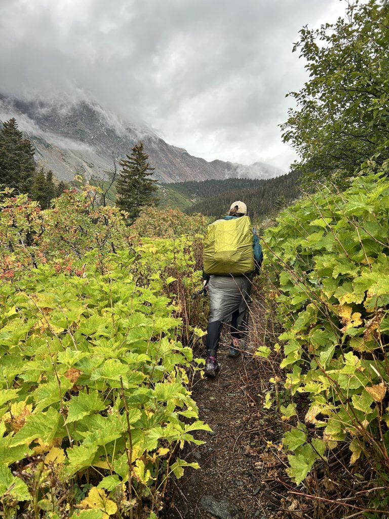
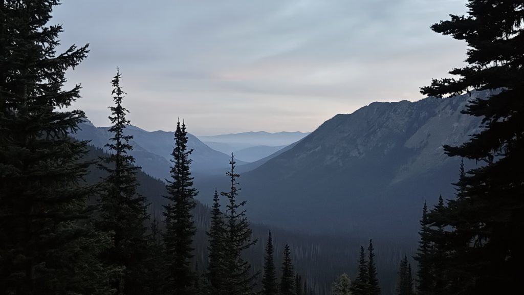
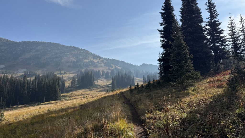
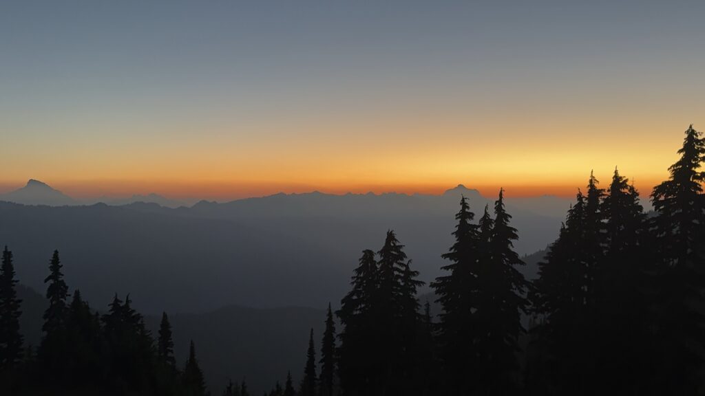
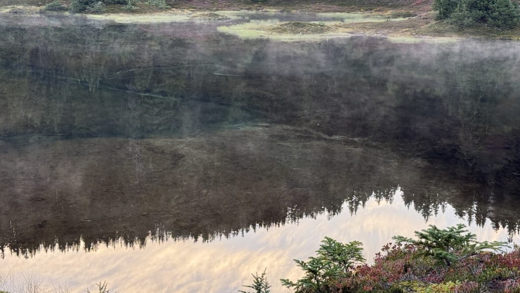
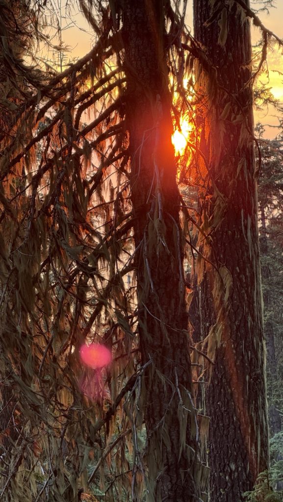
We crawled out of our tents at 7:40 am to a world wrapped in rain and cold. The forest was dripping, mist curling around the tree trunks as we trudged the first 3 miles to a water source. Hands numb, hoods tight, everything smelled like wet pine.
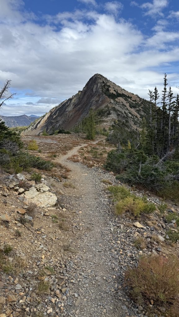
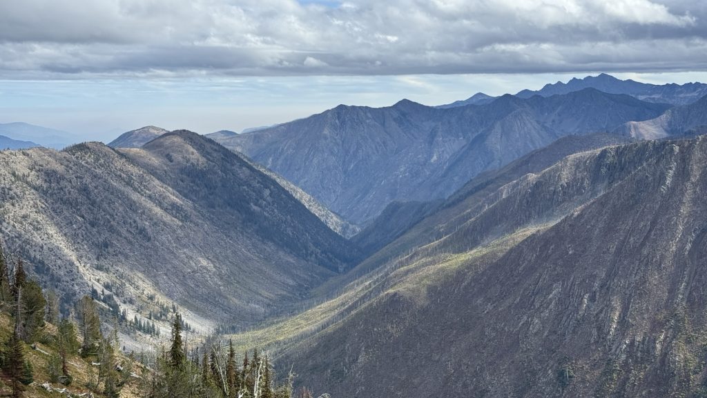
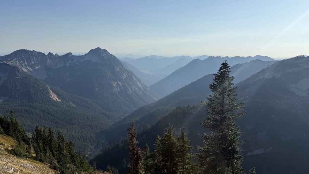
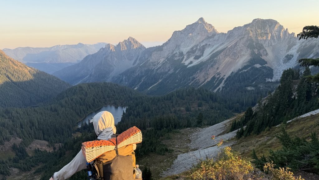
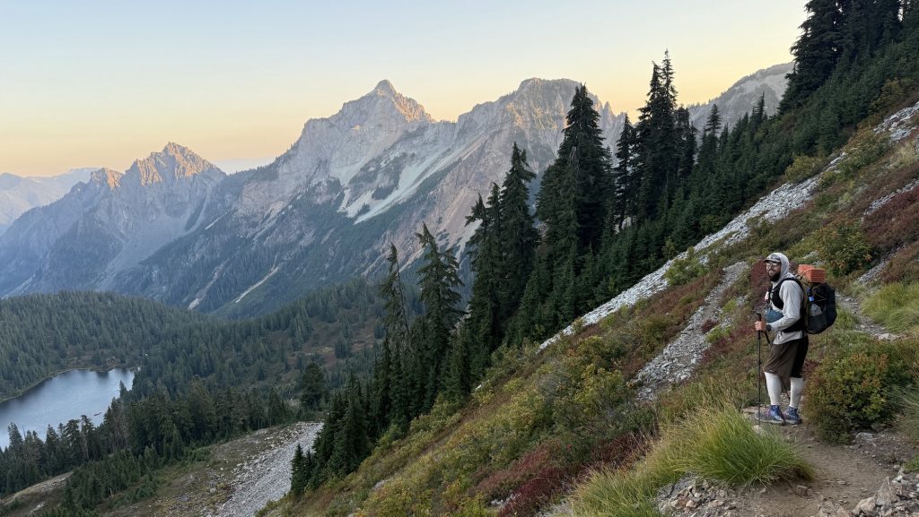
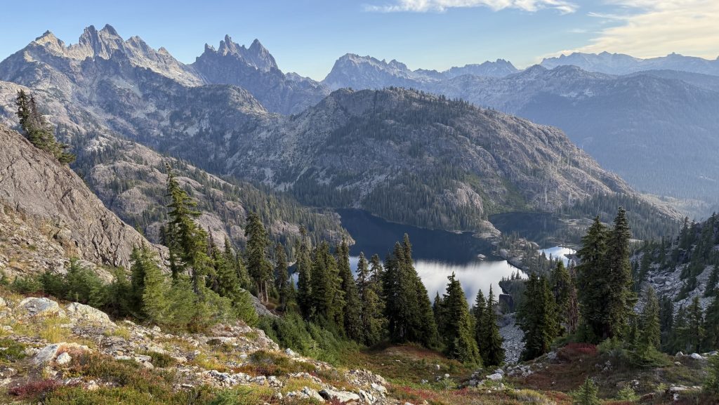
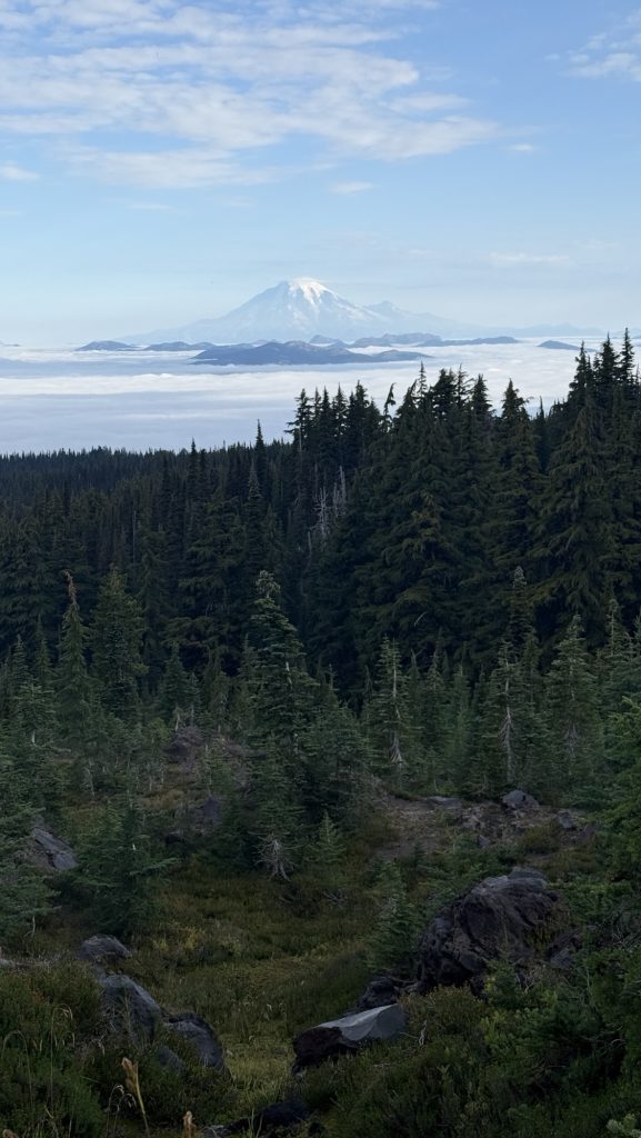
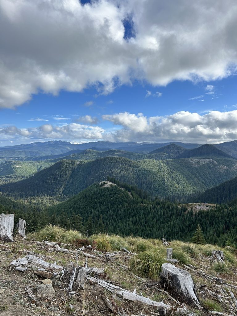
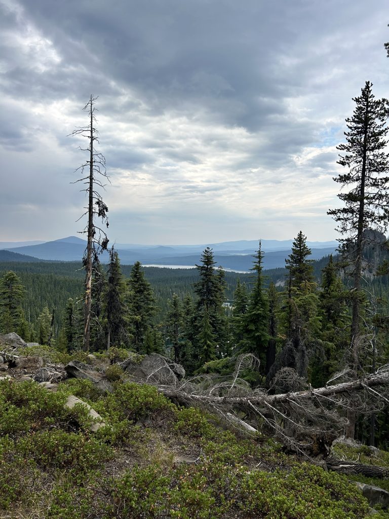
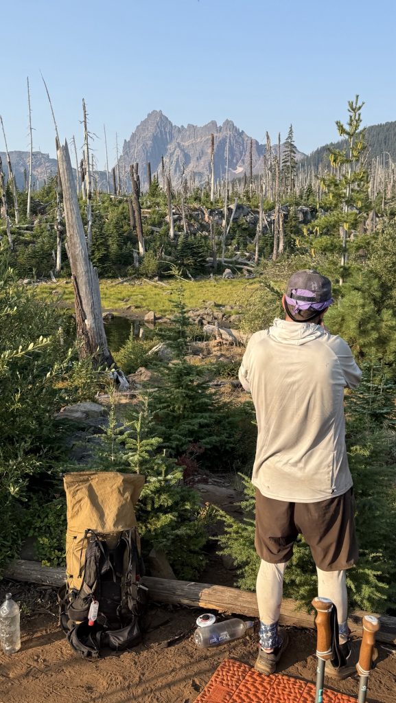
From there, the trail climbed—four miles of steady uphill—to Grasshopper Pass. The wet chill gave way to wind, and then… views. The kind of sweeping ridgelines where you forget you’re cold, just staring, every muscle telling you to stop and take it in. We did exactly that—lunch on the very top, looking out at endless green folds and distant peaks.
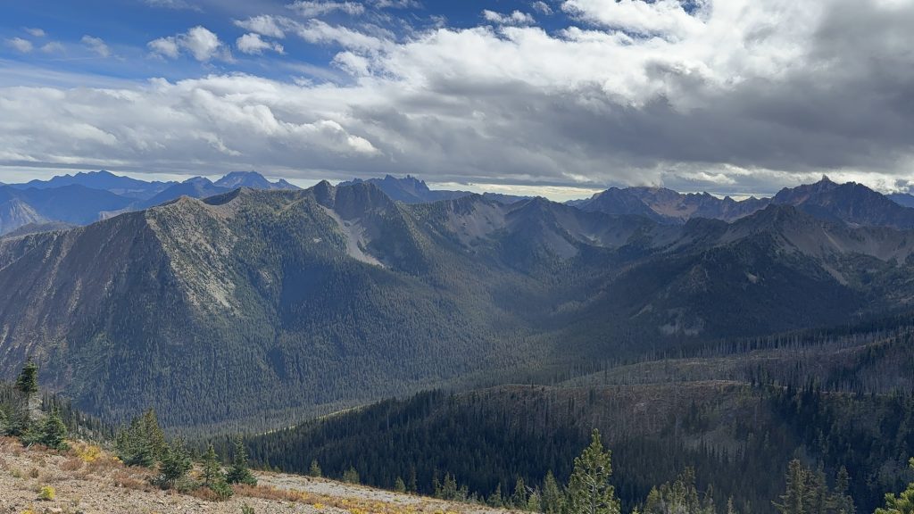
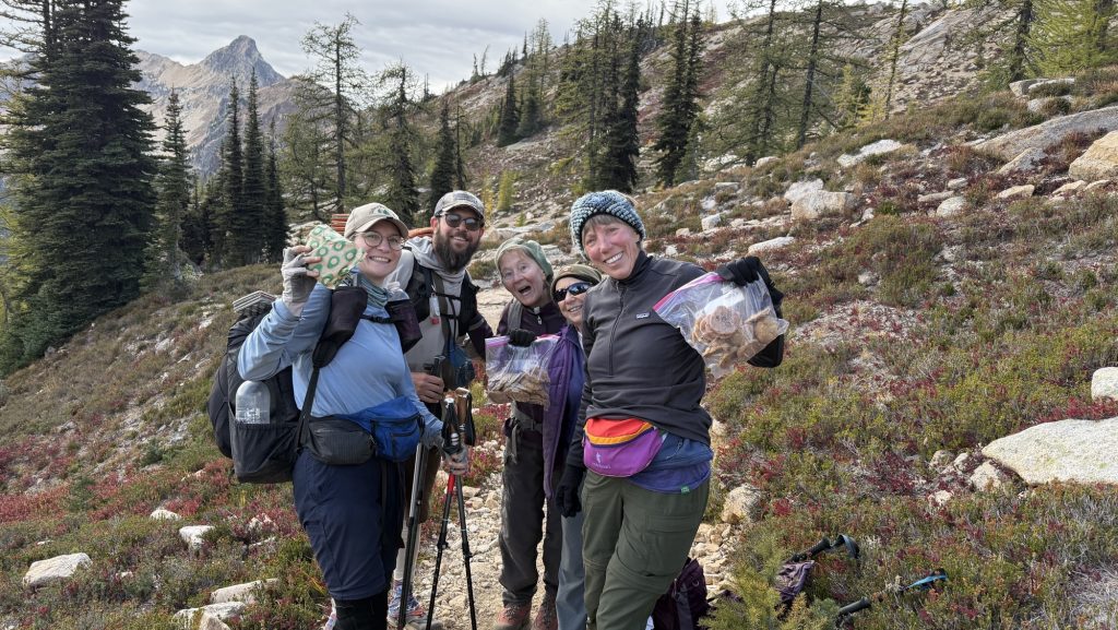
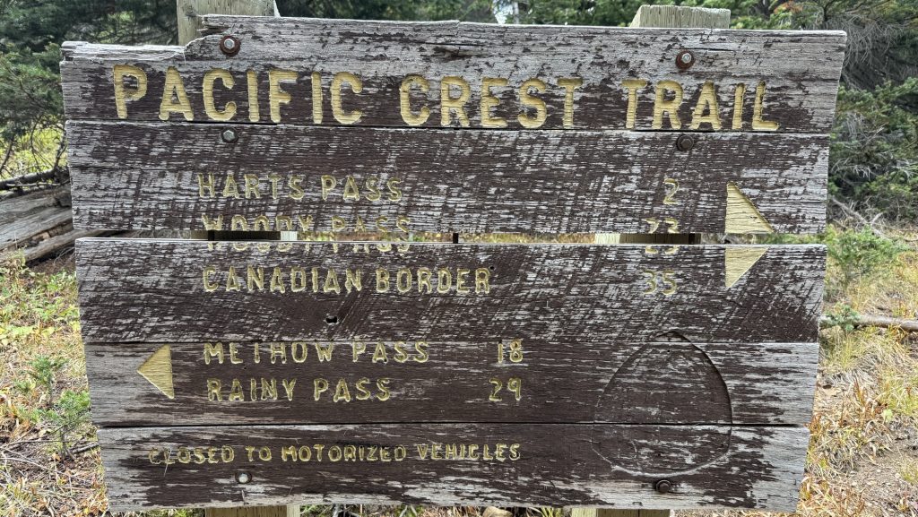
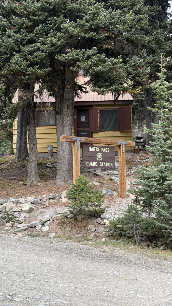
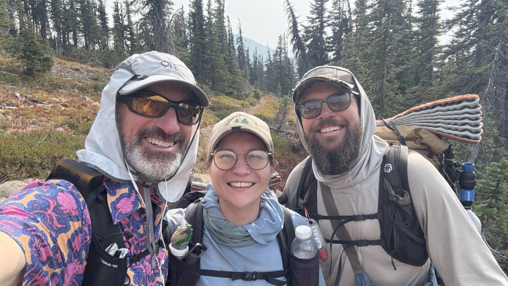
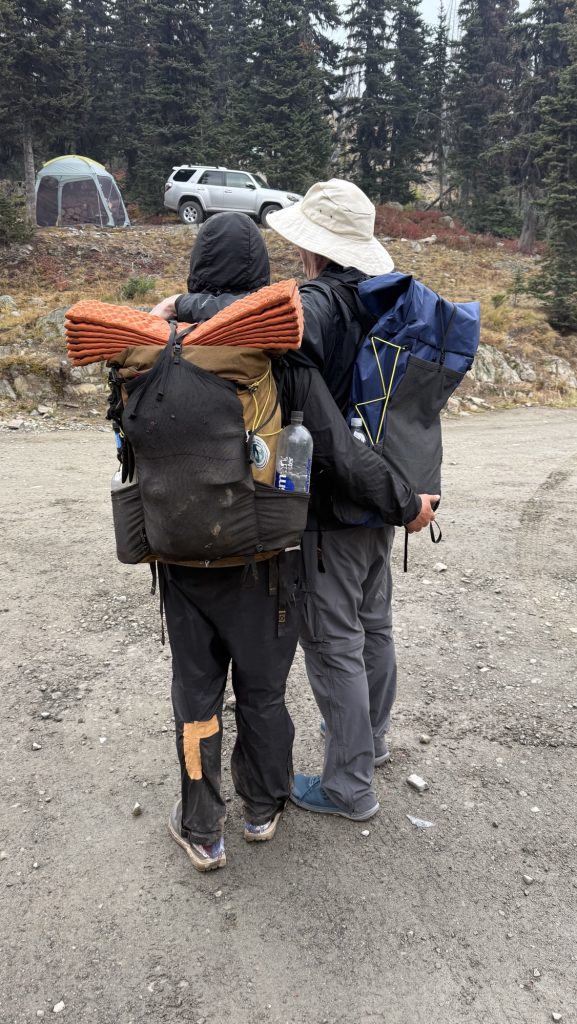
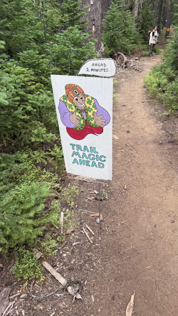
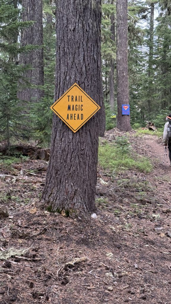
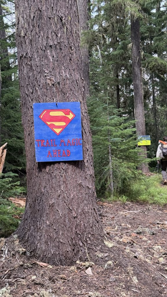
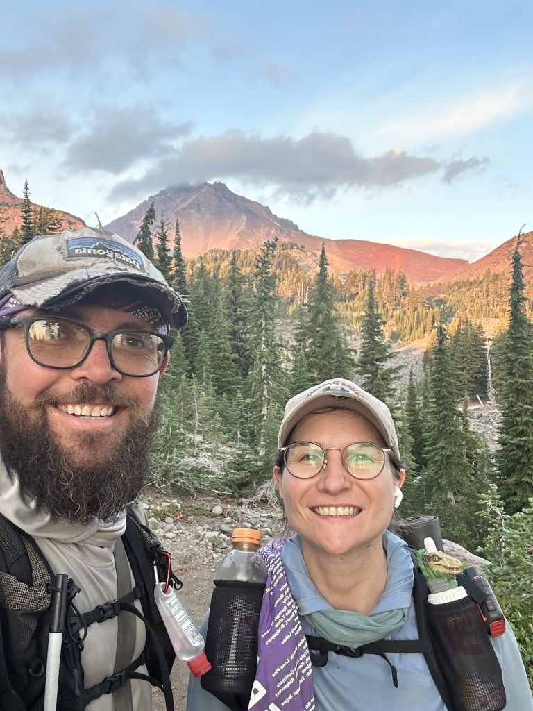
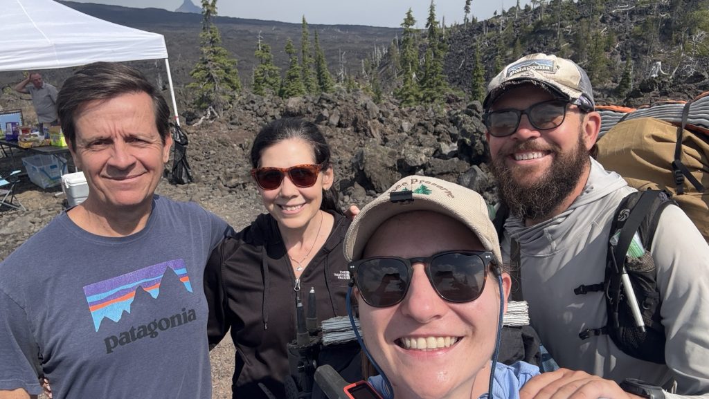
By 4:15 pm we rolled into Harts Pass. And there they were—Noah and Rambo—freshly done with the Pacific Crest Trail. It was surreal. They were grinning, handing out donuts like some magical trail angels of victory. Four other hikers milled around, all freshly finished. The air felt electric, like the trail itself was humming. This is where Iceman’s dad will pick us up in two days. Suddenly that fact was more real than ever.
Leaving the pass, we didn’t get far before bumping into Meatbrick—more hugs, congrats, and incredulous laughter. Then came Bubbles, bounding down the trail, and everything dissolved into chaos: hugging, filming, tearing up. It’s happening—this is it. We’re watching our trail friends one by one cross that invisible finish line.

We only did around 23.5 miles today, stopping before dark at 7:00 pm. Tomorrow is going to be huge: over thirty miles.
Tomorrow, we finish the PCT.
Crazy.
Unreal.
I can feel the lump in my throat already.
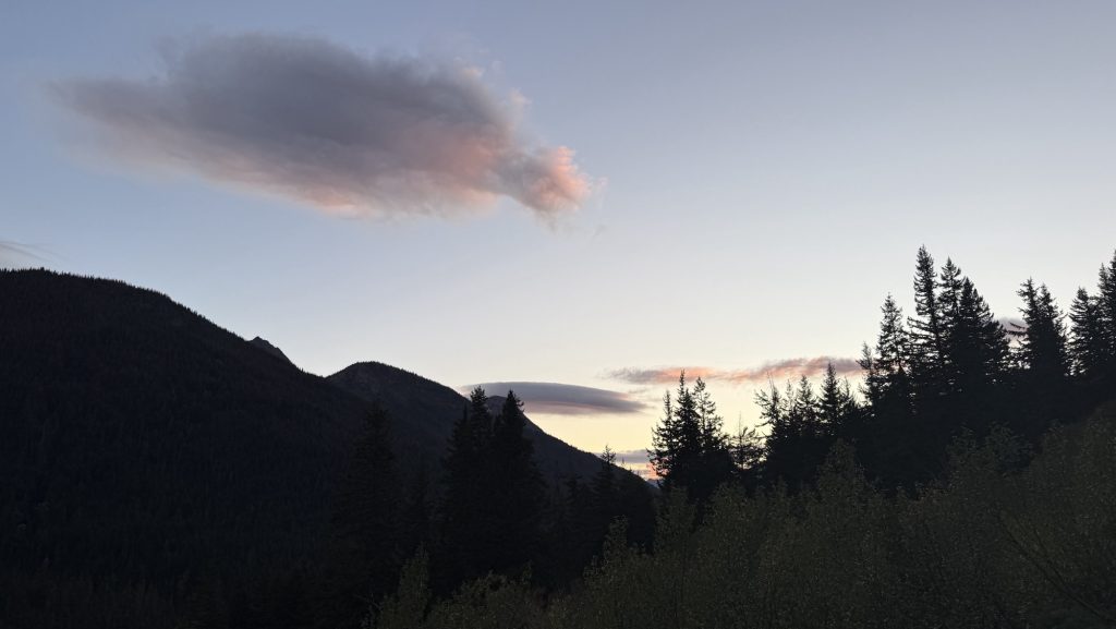
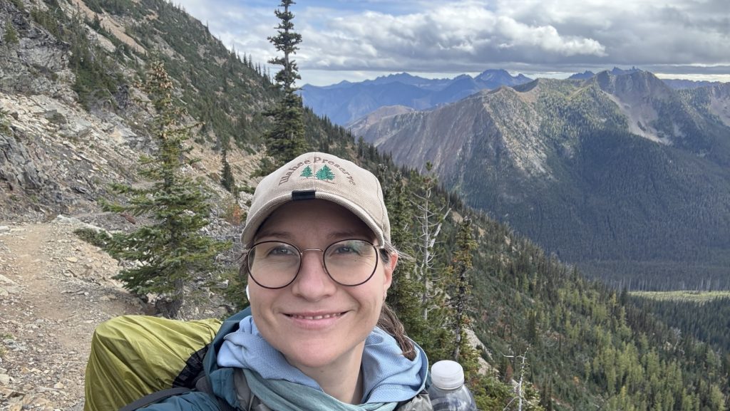
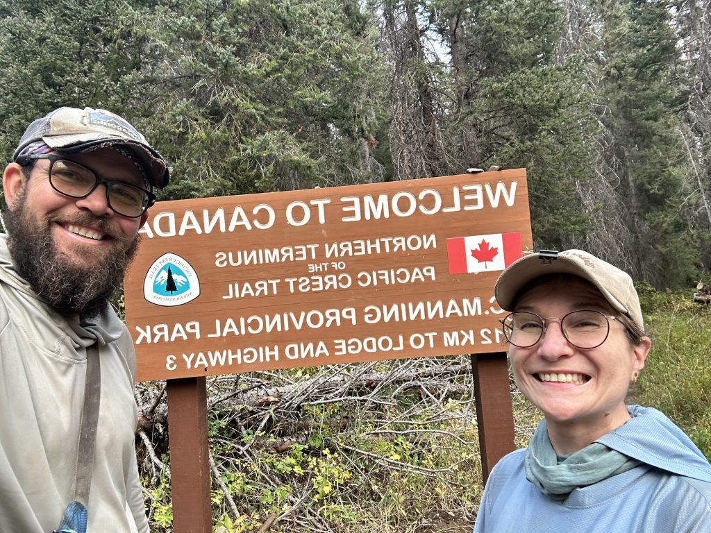
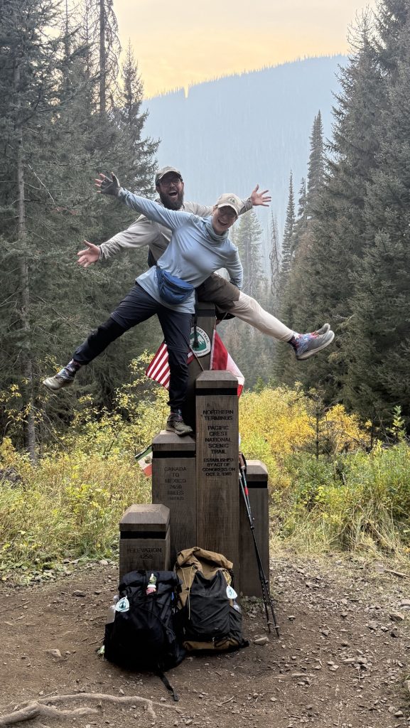
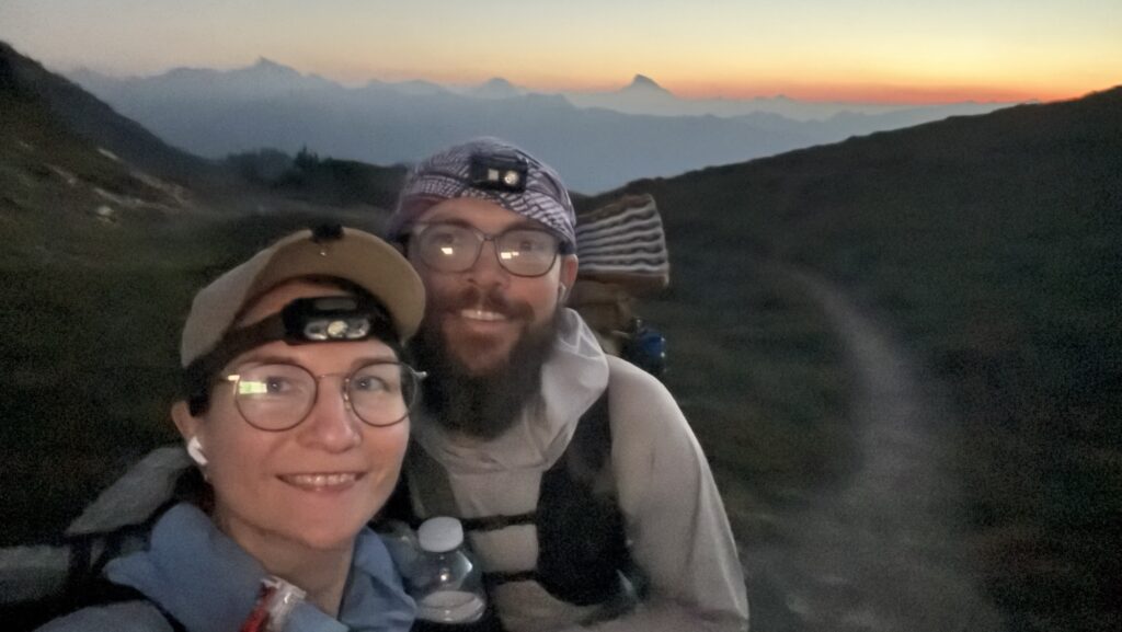
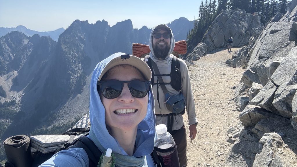
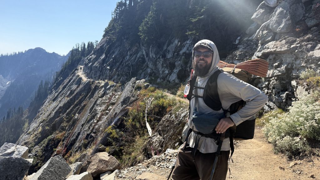
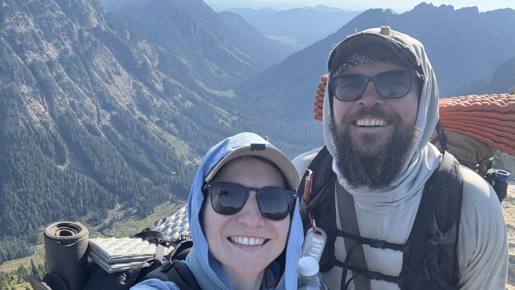
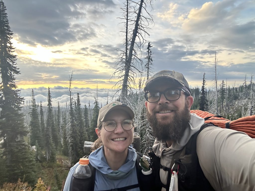
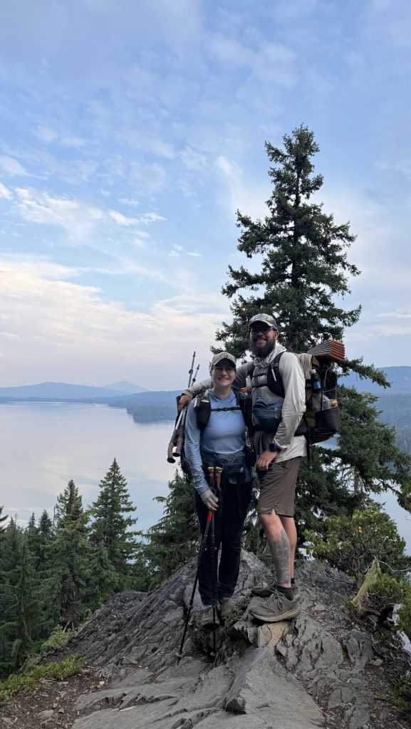
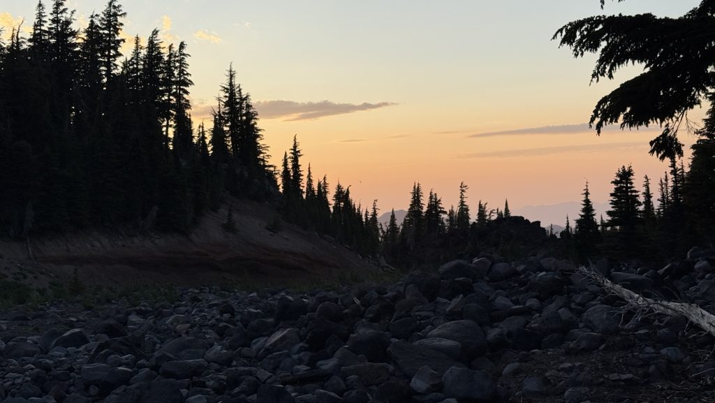
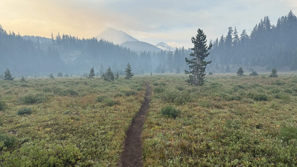
Day 141: PCT Mile 2647.9: Canada! And 8 Miles Back South
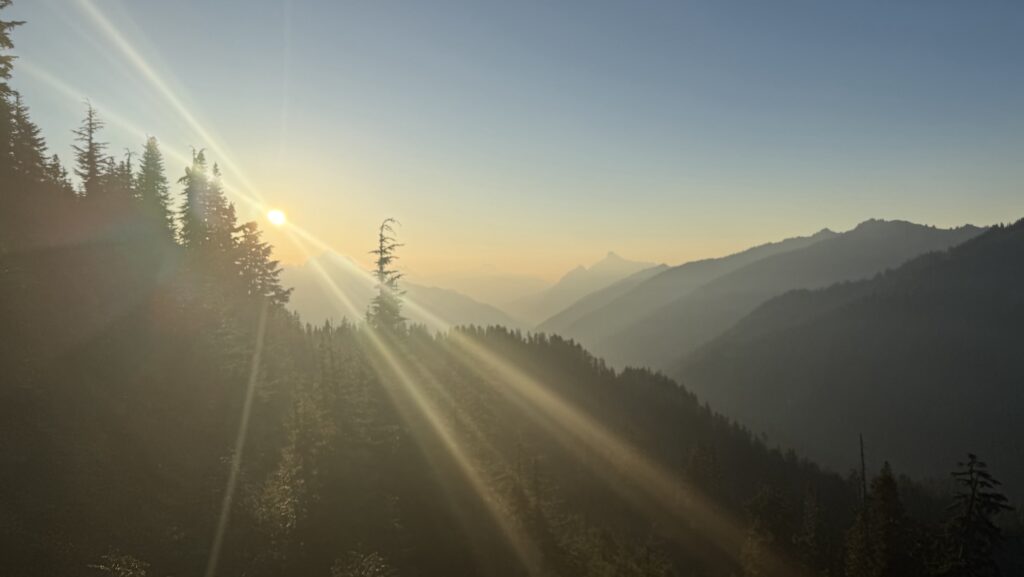
The alarm shrilled at 5:00 am. One last early start. One last day. We were out by 6:22 am, packs snug, shoes laced, determination buzzing in the morning stillness. This might be our longest day yet. Luckily the skies were kind—no rain, and the tent was blessedly dry. No frozen fingers today. We whispered a wish for sun, but waited for the horizon to catch its first light.
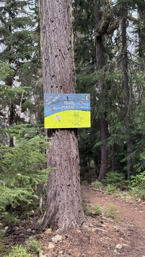
When it came, the day was flawless—bright blue skies, golden warmth spilling over the peaks. A day as perfect as the journey itself. The last trail magic wasn’t donuts, it was high-fives. We passed 37 hikers heading south from the Northern Terminus, each grinning, each congratulating us, and each reminder sending our excitement skyrocketing.
Still, reality kept us moving—today wasn’t just about reaching the border. We had to go big: big miles, big climbs. Tomorrow we need to make it back to Harts Pass to meet Iceman’s dad, so the two of them can fly halfway across the world to Everest Base Camp. The elevation gain was relentless. I wasn’t sure we had it in us… but the pull of the deadline is stronger than doubt.
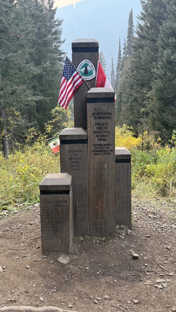
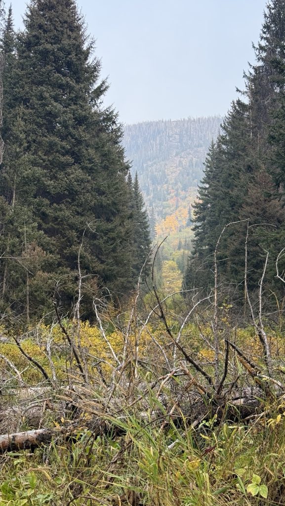
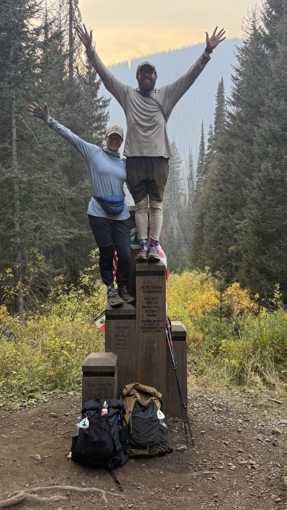
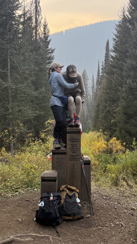
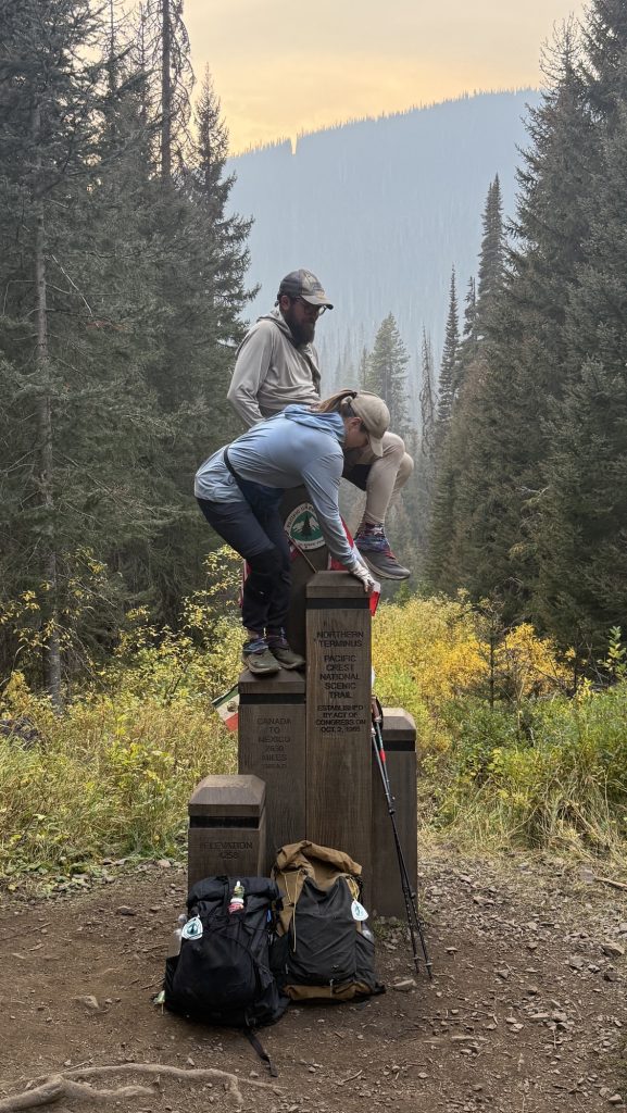
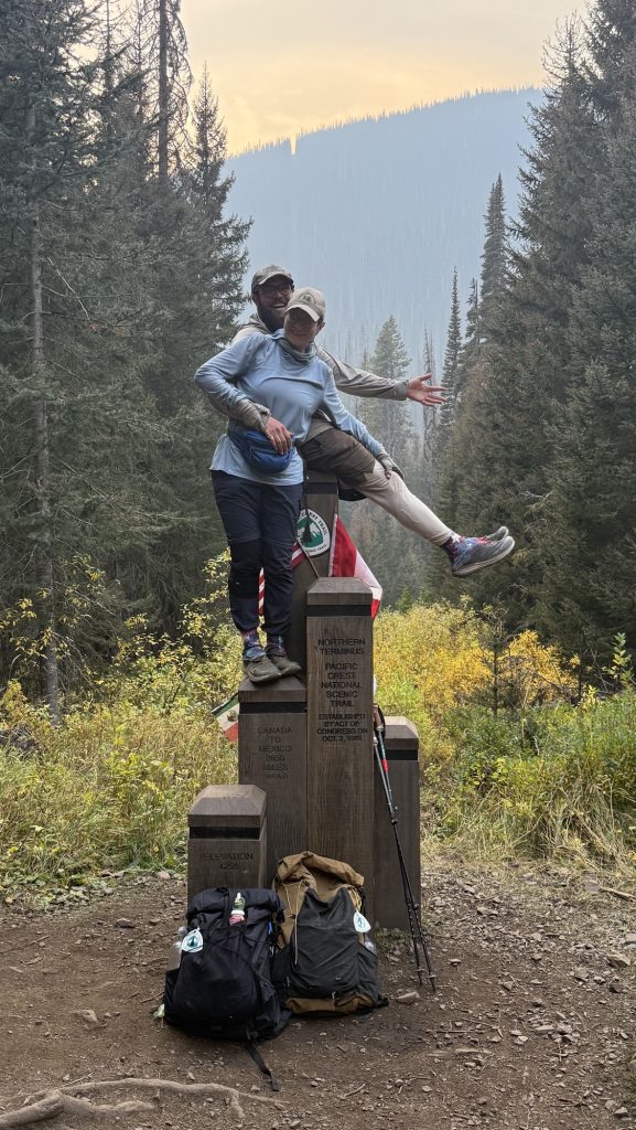
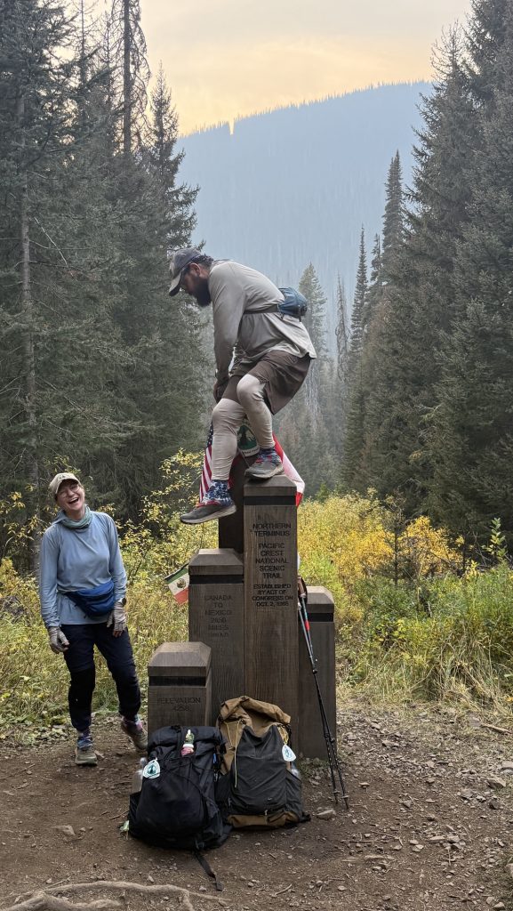
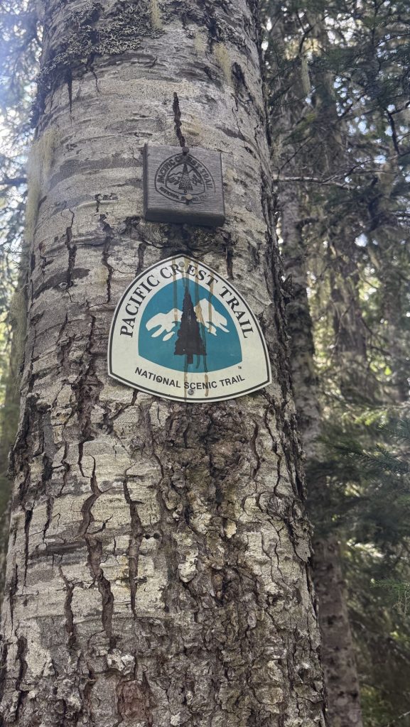
The last 8 miles northbound of the PCT are downhill—a gentle, beautiful roll into the border. The catch? We can’t cross. As of this year, hikers aren’t allowed to walk into Canada and simply exit to the nearest trailhead. Instead, the finish comes with a twist: you tag the monument, take it all in… and then you turn around. Thirty miles back south to Harts Pass is how the journey ends now.
When the wooden Monument finally came into view, the air caught in my throat. Canada was a whisper away. We hugged and danced. We drank wine and took pictures. We ate German chocolate. We touched the monument, leaned against it, climbed it and almost fell off, hugged friends, and laughed, and then the tears came—quiet, heavy, sharp with joy. Five and a half months, one month off trail, some 2000 miles of the PCT northbound. This was never the moment we’d been chasing – it was always about the journey, never about finishing or Canada. But this moment was incredible nonetheless because it meant ‘the end’, the end of my biggest adventure yet. It also meant the beginning of the rest of my life. I was as excited as I was sad. The whole thing was overwhelming.
And then… we turned around.
We hiked 8 miles back into the afternoon light, climbing the entire time, breathing hard, watching the shadows grow. By the time we stopped, it was dark, 10pm, cold and the numbers felt colossal:
Miles: 32.06 / 51km!!!!
Ascent: 6,472 ft
Descent: 5,680 ft
Steps: 72,846 – what?
My legs are destroyed. My heart is full. Tomorrow, we will walk back into Harts Pass and this chapter will close. The PCT is behind us.
It’s over. For now.
Day 142: In the end we’re all SOBOs / Victory Lap back to Harts Pass – The Last Steps of a long Adventure
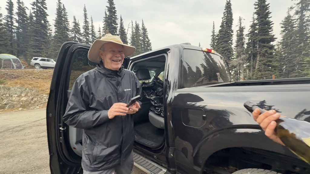
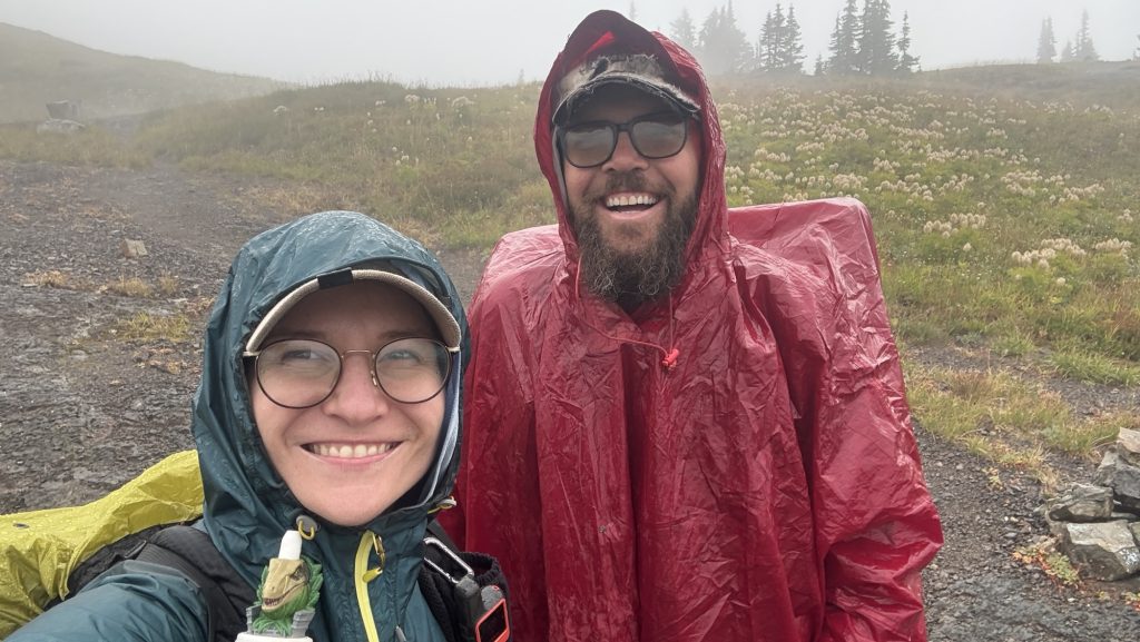
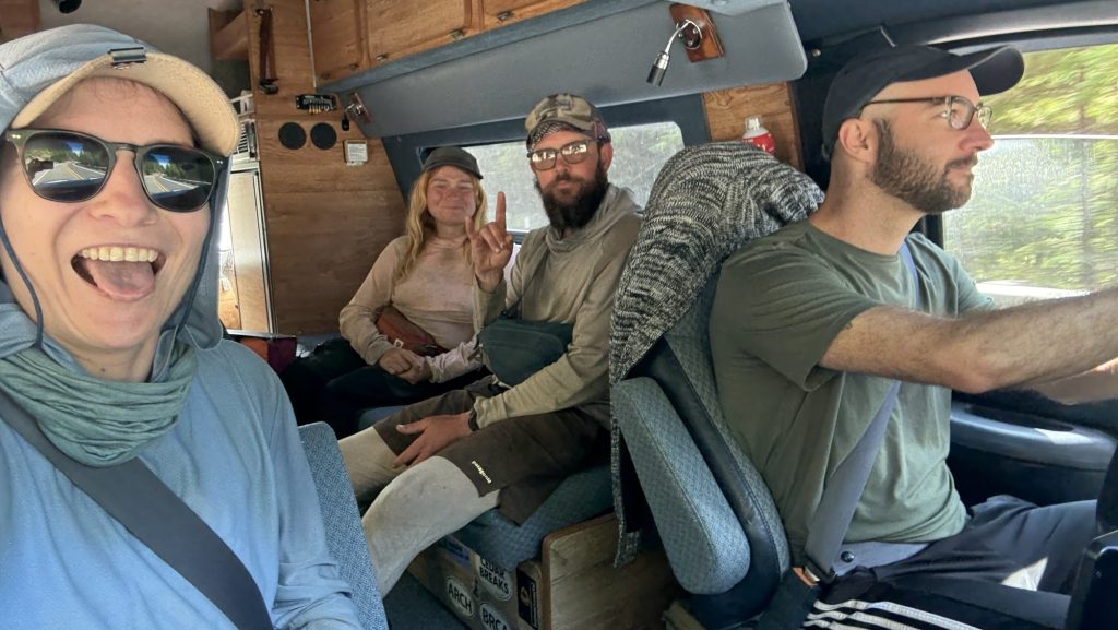
Our last morning on trail. It rained through the night, and when we crawled out of the tent, the sky was heavy and the air sharp. We knew Iceman’s dad would meet us between five and six at Harts Pass, so we planned to be there by four—no way were we going to make him wait. It felt fitting, really. Iceman got all his love for hiking from his dad—an Appalachian trail thru-hiker himself—so having him there at the very end of the PCT felt poetic. Iceman was sure his dad would want to hike the final few miles with us, to finish the journey side by side. I can’t imagine anyone better to meet us at Harts Pass. Exiting for me to finally meet the legend that is Icemana dad, having heard countless adventure stories over the last 5 months.
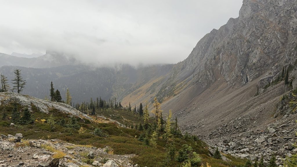

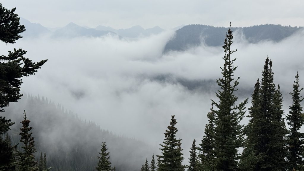
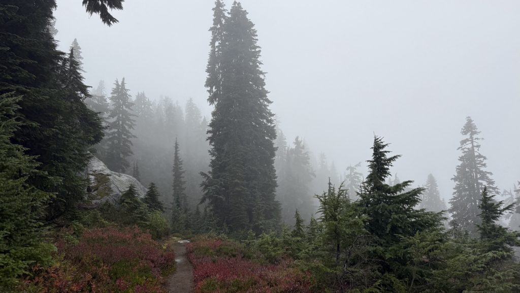
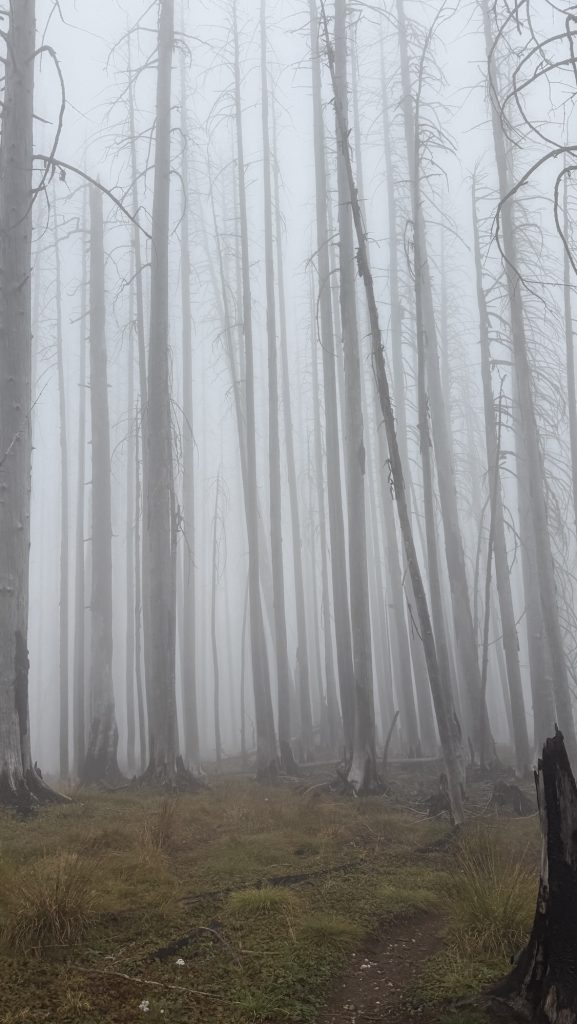
Twelve miles in, with about ten left to go, I started scanning the misty ridgelines for a tall man in a wide-brimmed hat and a blue rain jacket, just as Iceman had described his dad, trail name: Tin Man. But there was no sign of him. The world was gray and quiet, fog swallowing everything beyond a few meters. The rain came in sheets, cold and unforgiving. We were soaked but grateful—grateful for this incredible adventure, grateful we didn’t have to do this again tomorrow. It could have snowed any minute. We were exhausted but happy.
When we finally reached the trailhead and stumbled into a parking lot, relief washed over us—until we realized we were in the wrong place. Not Harts Pass. One wrong turn. My heart sank. I told Iceman we had to get back on the PCT quickly. His dad didn’t have a satellite phone, and there was zero reception out here. If we missed him, he could’ve hiked for hours looking for us, completely off-grid.
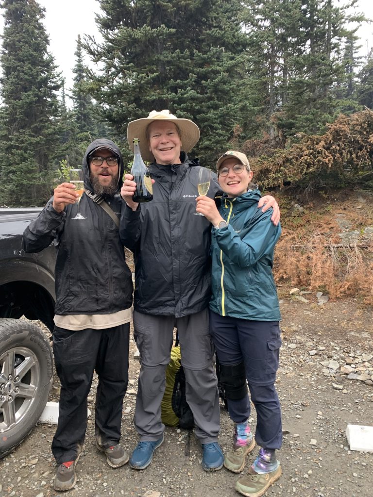
We pushed our way back through dripping trees and tangled brush, shouting his name into the fog. Then, through the rain, a figure appeared—a tall man, wide-brimmed hat, black jacket. We yelled again, louder this time. And then came a cheerful call back through the mist:
“I’ve got an Uber Eats delivery for Iceman and Disco!”
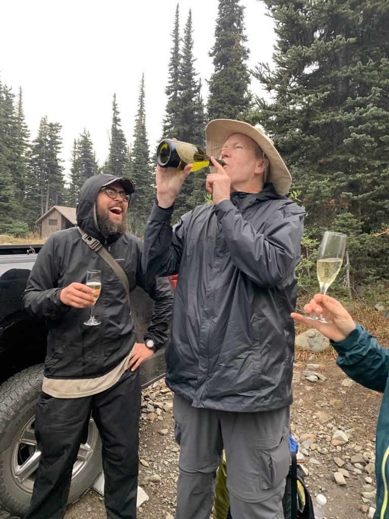
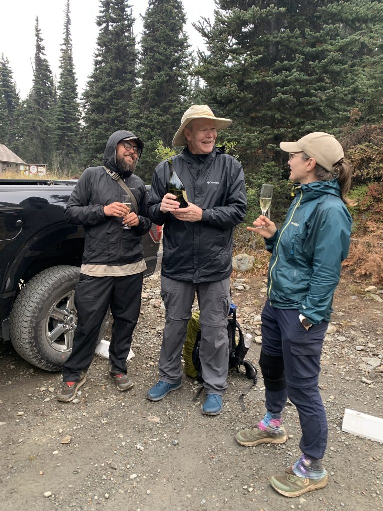
There he was. The legend himself—Iceman’s dad, Tin Man. We laughed, shouted, hugged, the tension melting away. For the last fifteen minutes of trail, we walked together through the rain toward Harts Pass. A proper ending.
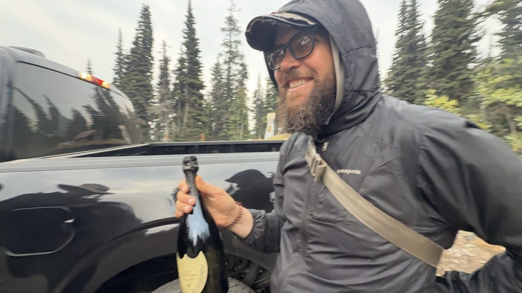
At the parking lot, Tin Man pulled out a white towel. Inside: a bag of ice and a bottle of 2015 Dom Pérignon Champagne. Two crystal glasses followed. He handed them over, grinning ear to ear. We popped the cork—loud and triumphant—and picked it up – leave no trace. Champagne foamed into the glasses, and we all took turns sipping, even pouring a taste for a nearby ranger who wandered over to check what the commotion was about. There we stood in the drizzle, drinking champagne at a remote trailhead, laughing, buzzing, completely alive. 🥰
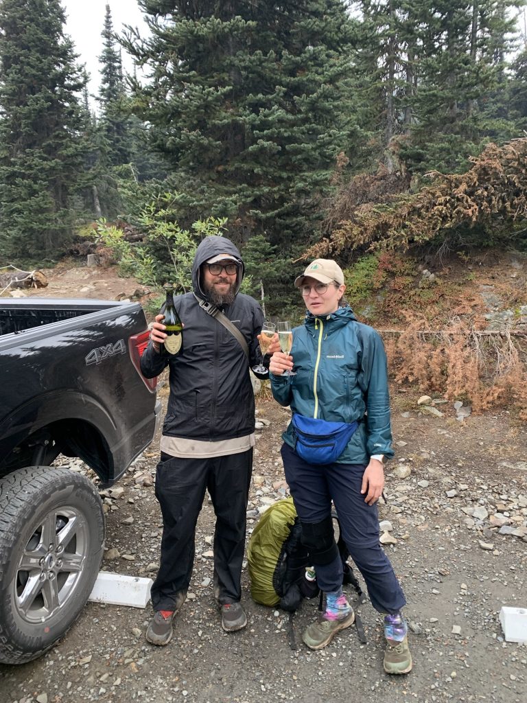
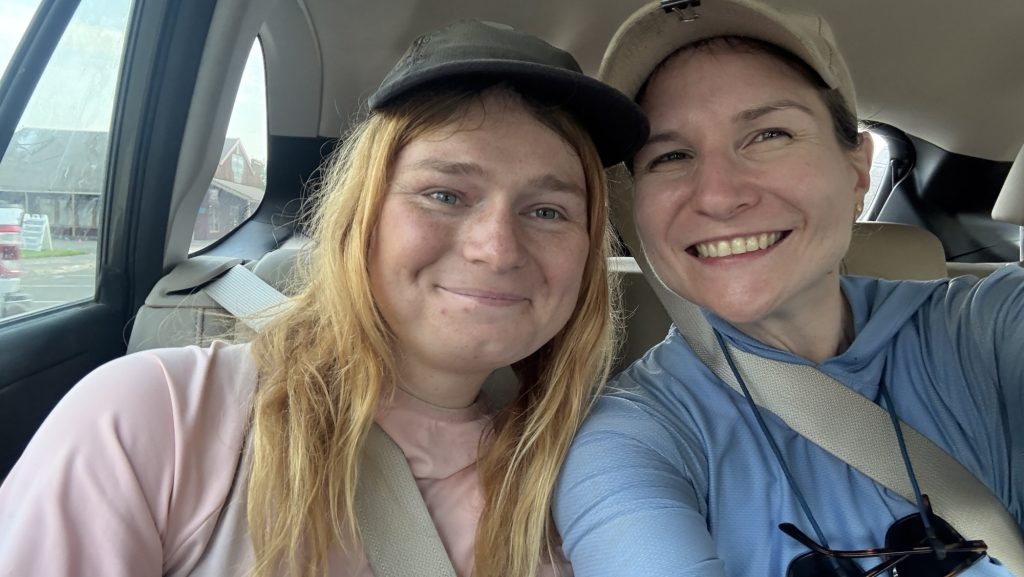
We stayed there for nearly an hour, time flying away in a trance, basking in the joy and disbelief of finishing the Pacific Crest Trail—five and a half months of mountains, deserts, snow, rain, and everything in between. Then we piled into the car and wound our way down the forest road toward Mazama, where our friend Kate waited for us at the bakery. One last reunion, one last round of hugs, one last familiar face from this strange and wonderful world.
The drive to Seattle took us through 5h of dark forest and quiet roads. We stopped for burgers on the way—nothing has ever tasted so good—and rolled into the city around 11 pm.
Kate wanted to catch an early flight back to the UK the next day. We said our goodbyes in the hotel lobby, sleepy but smiling. Then finally—soft beds, clean sheets, silence.
The PCT was over. And the rest of our life’s began. And Iceman and I had made a lot of plans in the last 5 months. 🤩
And for the first time in 142 days, we didn’t have to walk anywhere.
The End
After 2,198 miles / 3398 km and more blisters than I care to count, and plenty of trail dust in places it shouldn’t be, I’ve reached the end of the Pacific Crest Trail. It’s hard to put into words how it feels to be done, but here we are.
I want to thank everyone who made this journey so special — the hikers I met along the way, the incredible trail angels, the drivers who scooped up us dirty, tired wanderers, and every single person who supported us from near or far. Your kindness made the miles lighter and reminded me how much good there is in the world.
This isn’t goodbye for the blog. More adventures are on the horizon, and maybe a few reflections once my head and feet have caught up with the fact that we’re no longer walking.
Thank you, truly. It wouldn’t have been the same without you.
🫶🫶🫶
Disco
Statistics overall
Miles hiked:
• April: 177.4 (start April 17th and low mileage 1st 4 weeks)
• May: 458.9
• June: 345.2
• July: 66.8 (mostly in Germany not hiking)
• August: 503.8
• September: 646.7
Total: 2,198.8 mi
Ascent:
• April: 24,259
• May: 76,510
• June: 70,792
• July: 8,944
• August: 73,640
• September: 117,938
Total: 372,083 ft
Steps:
- April: 557,100 (start April 17th and low mileage 1st 4 weeks)
- May: 1,098,962
- June: 850,719 (Sierra Nevada, high elevation)
- July: 309,951 (mostly in Germany not hiking)
- August: 1,126,373
- September: 1,408,273 (killing it)
Total steps = 5,351,378 steps
Time (hh:mm:ss)
• April: 82:45:27
• May: 211:07:54
• June: 173:28:06
• July: 30:50:08
• August: 205:14:13
• September: 272:44:54
Total: 976:10:42
Calories
• April: 22,716
• May: 56,107
• June: 46,025
• July: 7,252
• August: 47,205
• September: 60,499
Total: 239,804 Cal
Numbers in perspective / Scope / for fun:
Here are some comparisons for those ridiculously large numbers:
Calories Burned: 239,804 Cal
- A 155-lb person burns roughly 300 calories in 30 minutes of brisk walking or 360–420 calories in 30 minutes of running at 6 mph (10-min mile).
- To burn 239,804 calories would take about 666–800 hours of brisk walking or 285–333 hours of running at 6 mph—this would require years of regular exercise for most people.
Hiking Distance: 2,198.8 miles
- Average hiking speed is 2–4 miles per hour.
- At 3 mph, it would take around 733 hours to hike this distance, or nearly 30 straight days of non-stop hiking.
- The distance is similar to hiking from New York City to Salt Lake City, Utah.
Total Ascent: 372,083 ft
- Mount Everest is 29,032 feet high.
- Your ascent is equivalent to climbing Mount Everest about 12.8 times (372,083 / 29,032 ≈ 12.8).
Total Time: 976 hours 10 minutes (976.18 hours)
- A standard full-time work year is 2,080 hours (40 hours per week × 52 weeks).
- 976 hours of hiking is equivalent to roughly 24.4 work weeks, or about 6 months of full-time work.
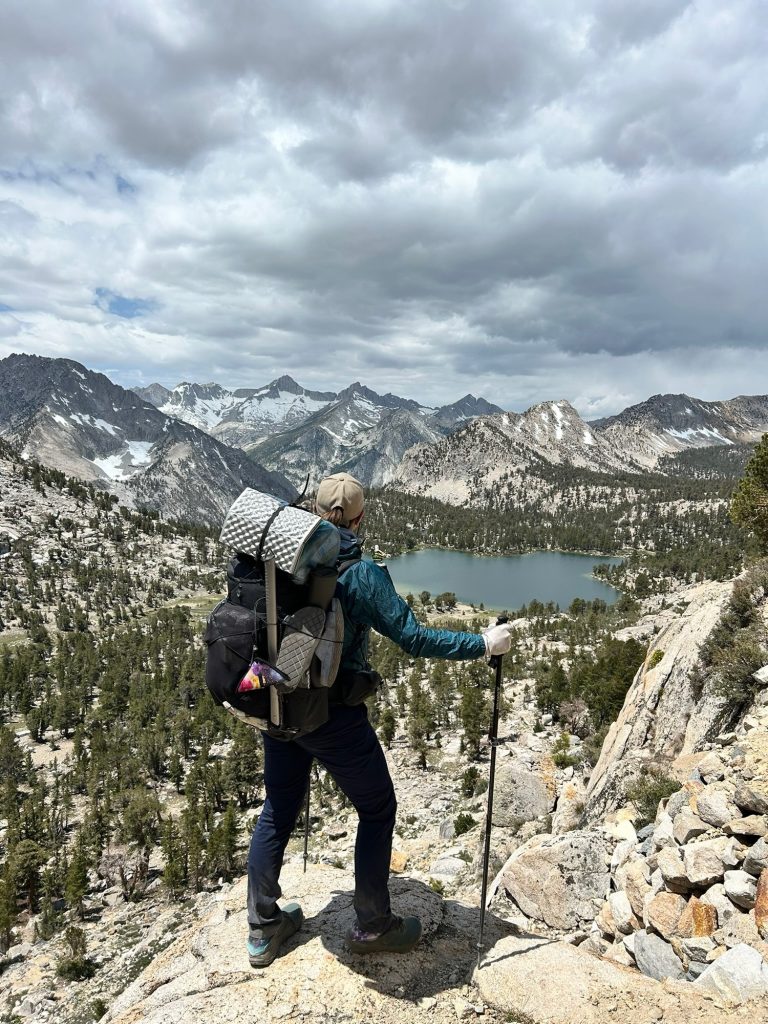
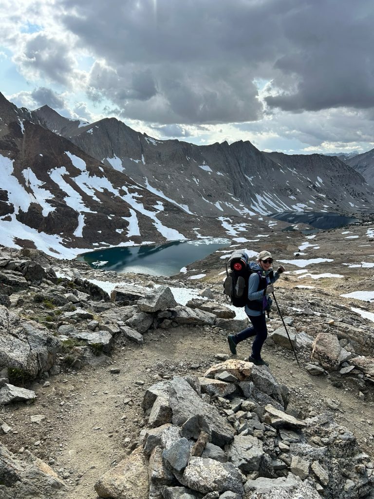
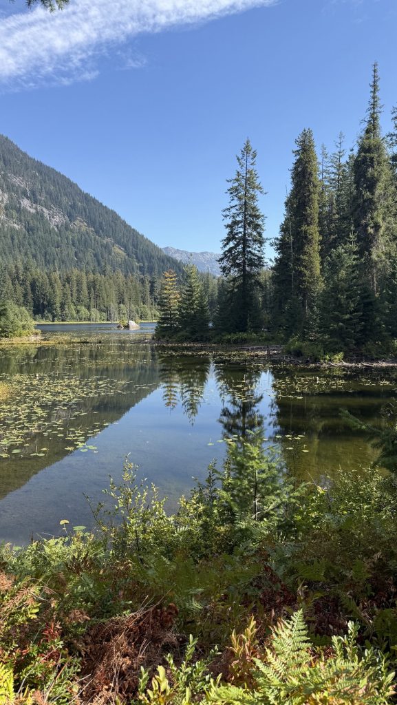
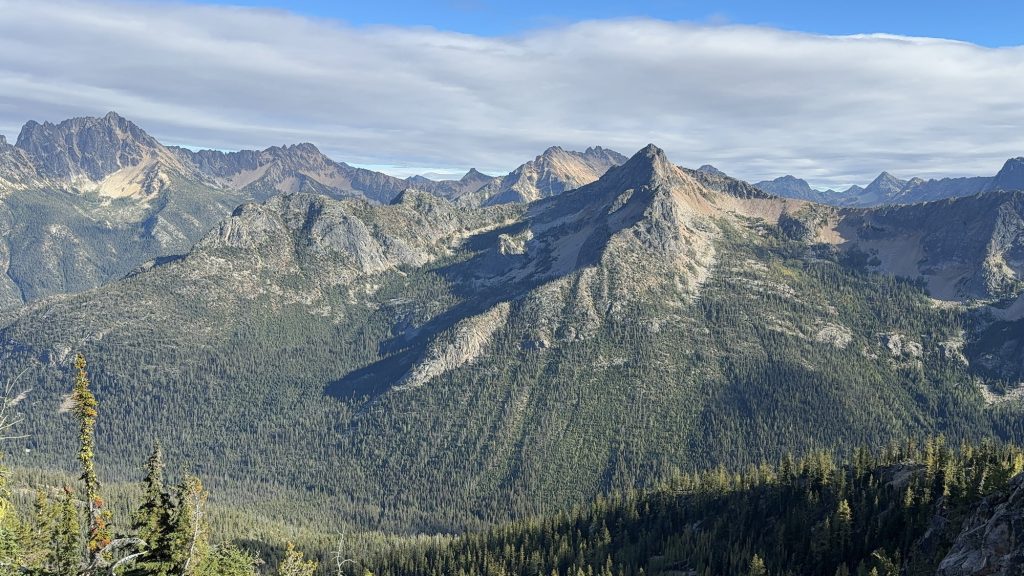
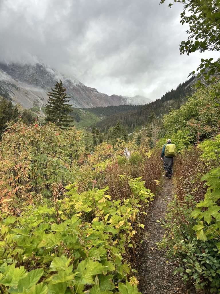
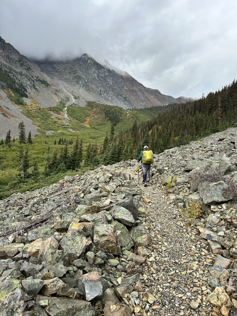
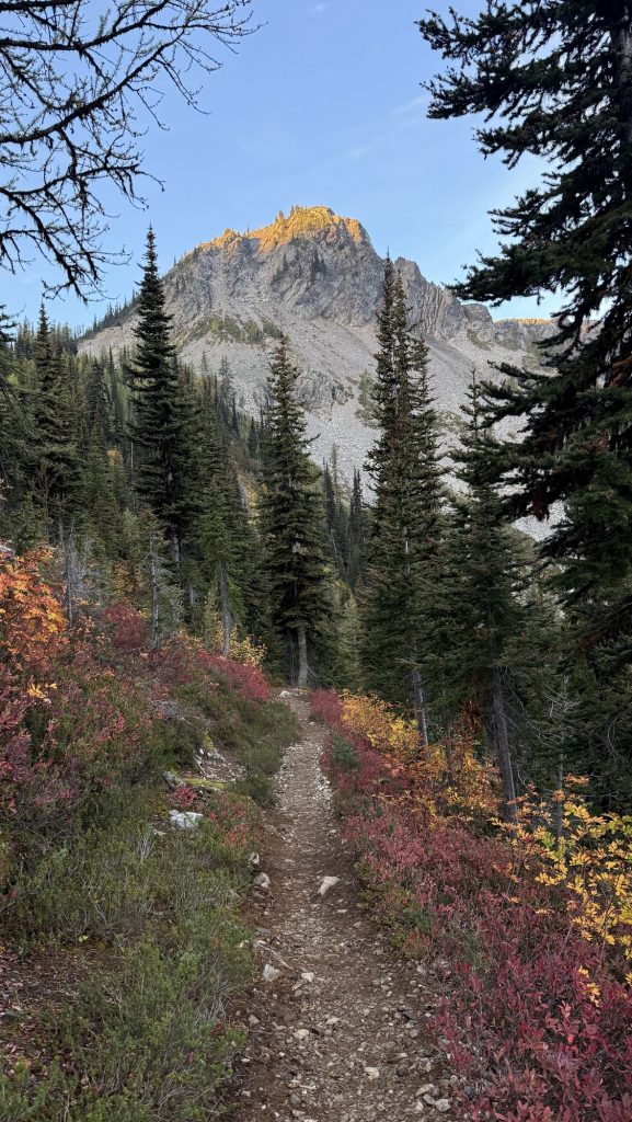
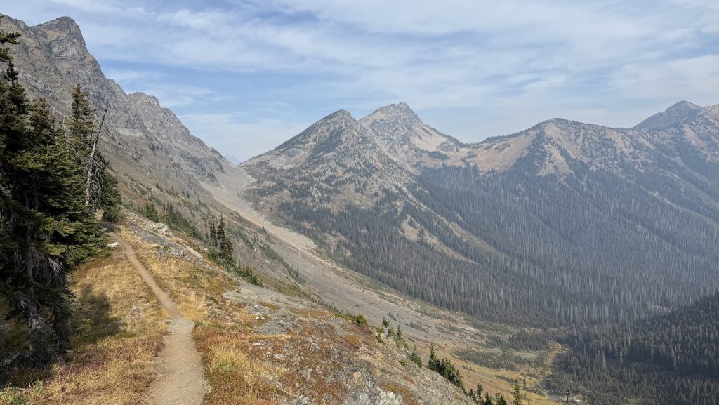
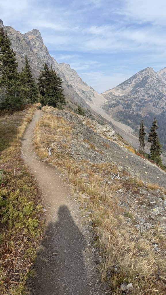
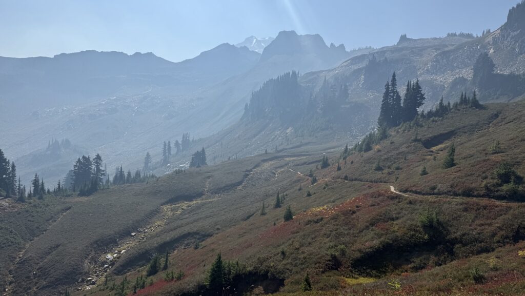
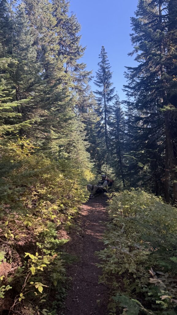
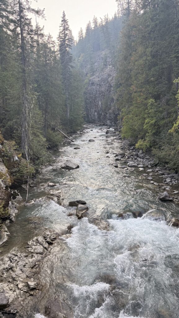
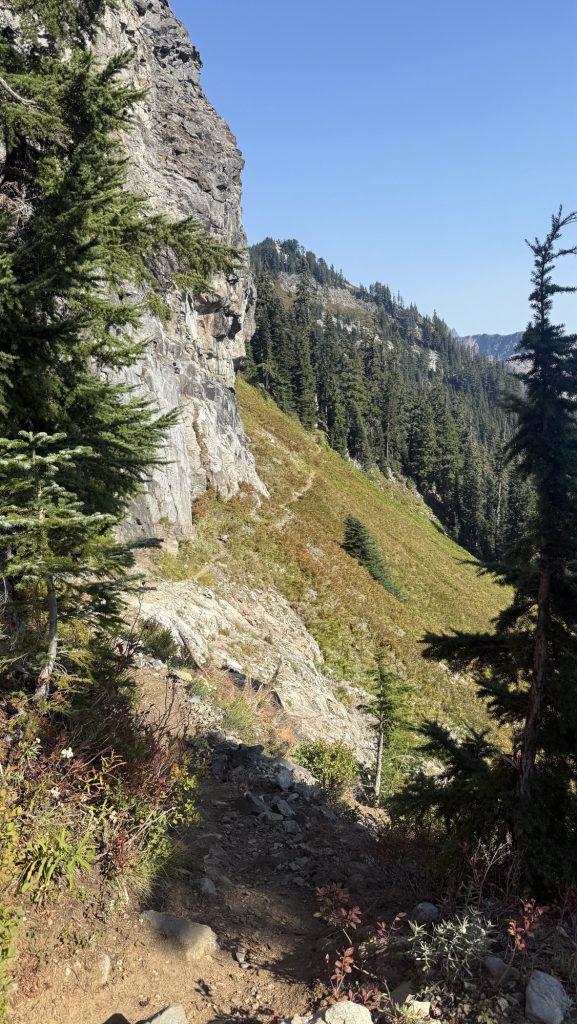
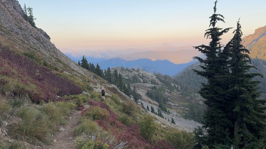
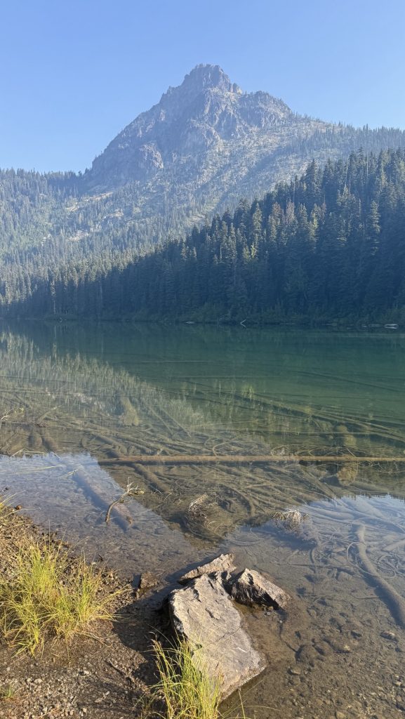
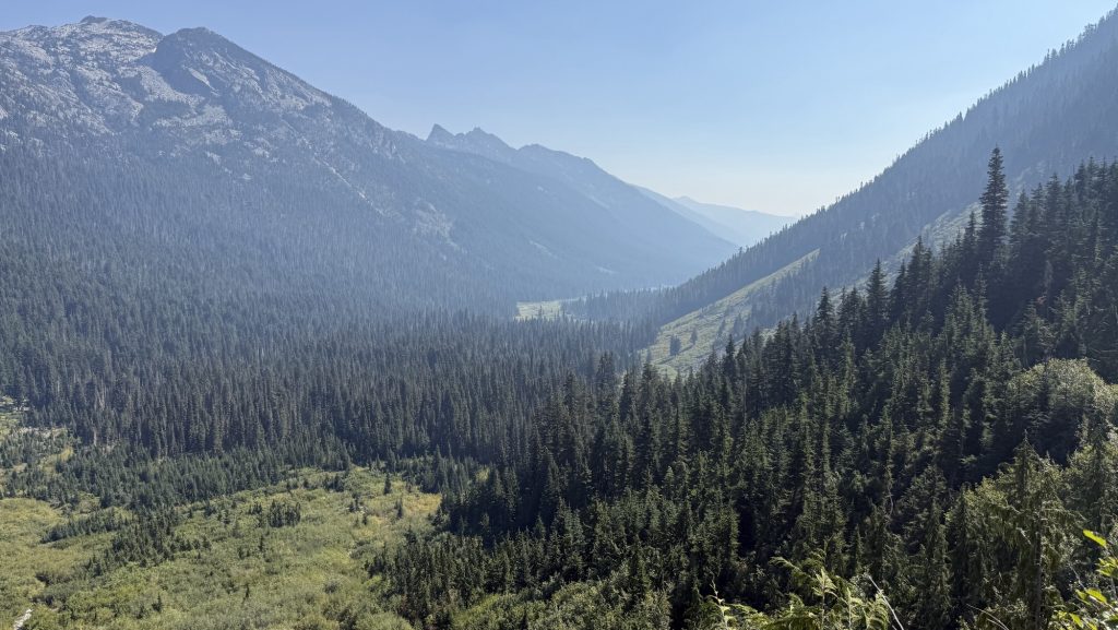
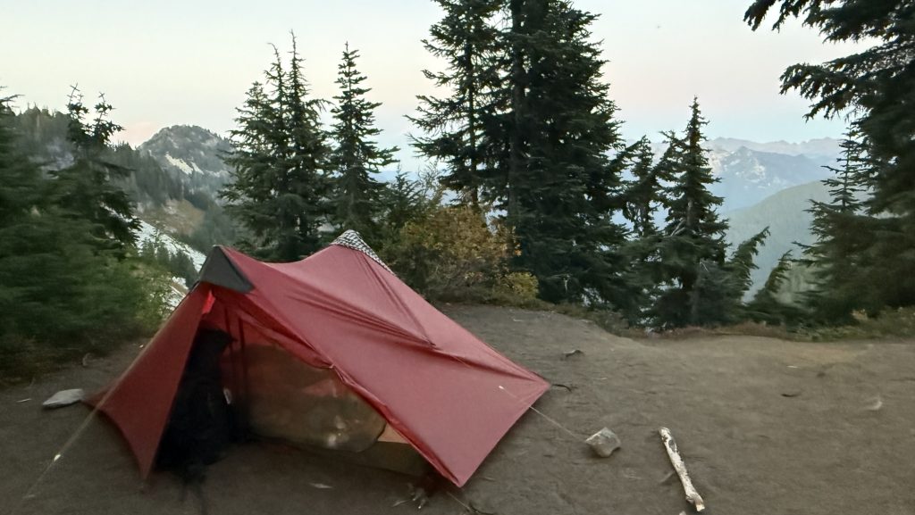
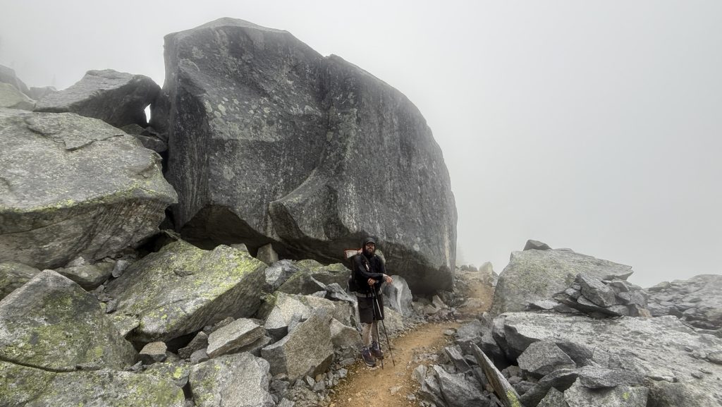
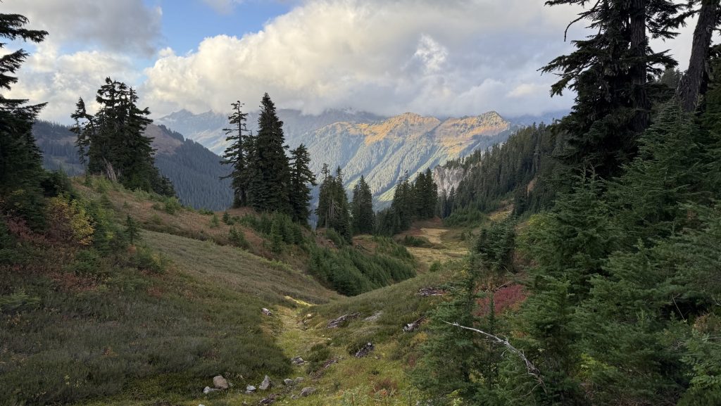
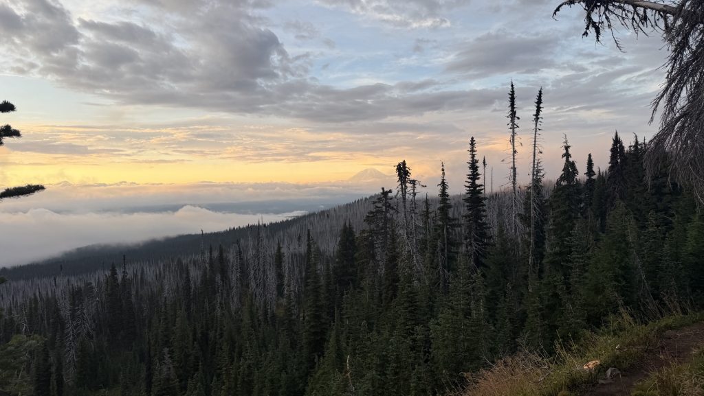
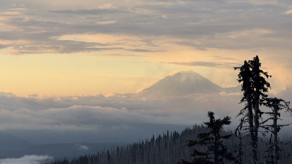
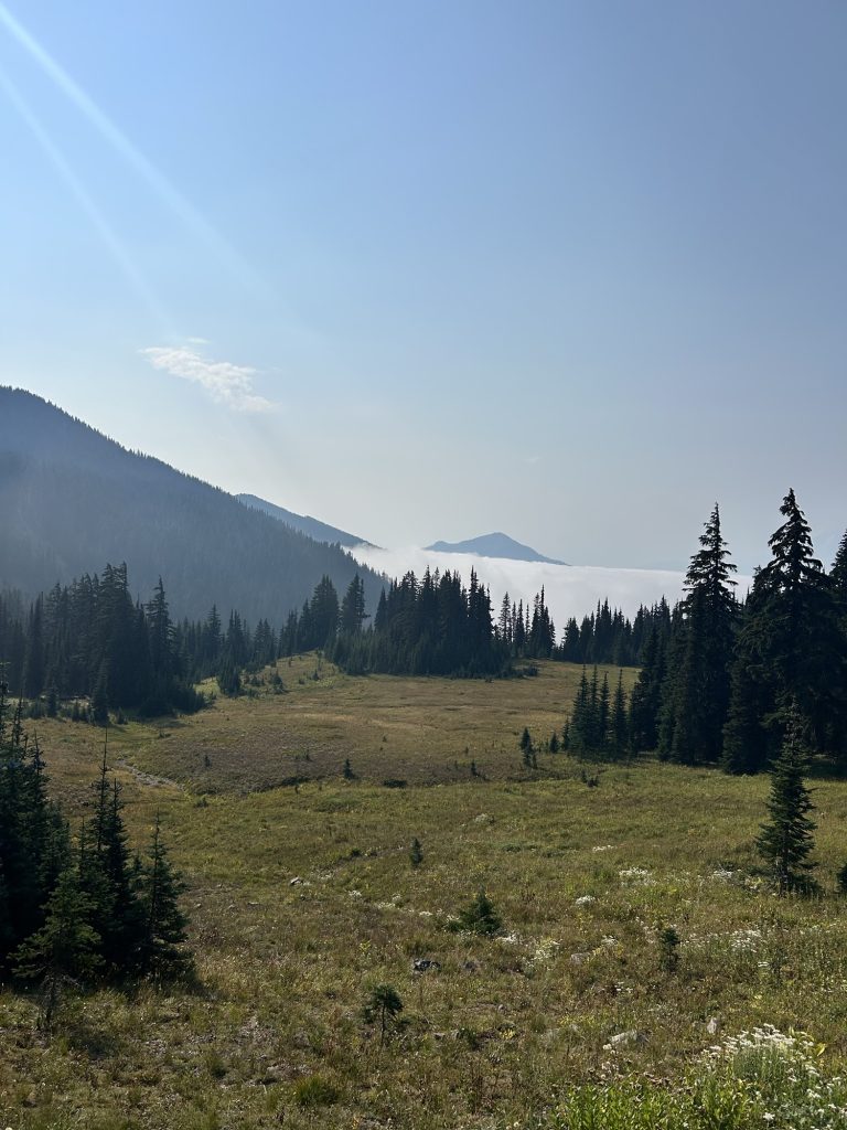
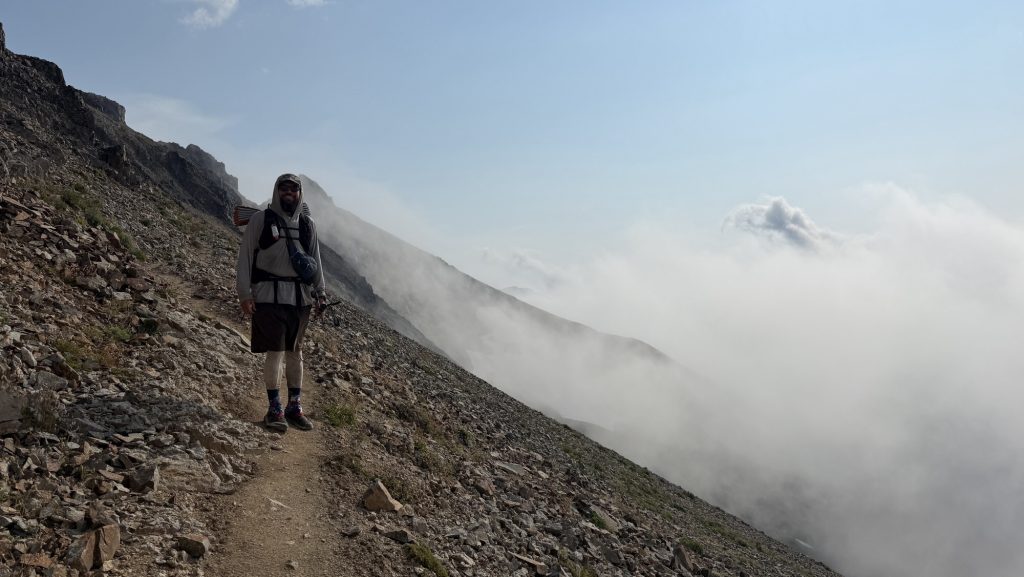
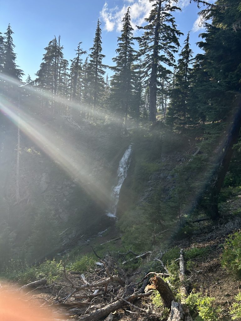
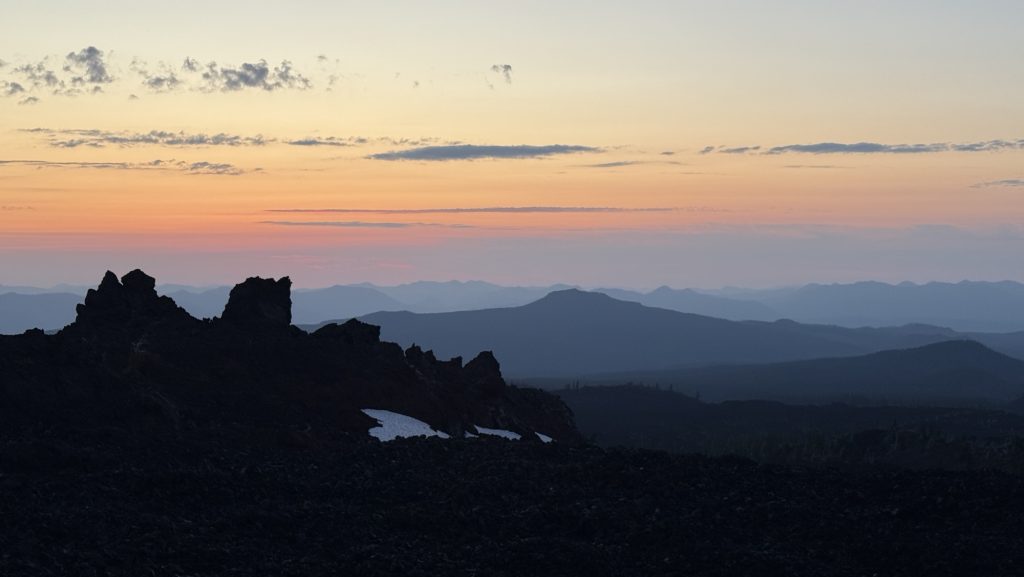
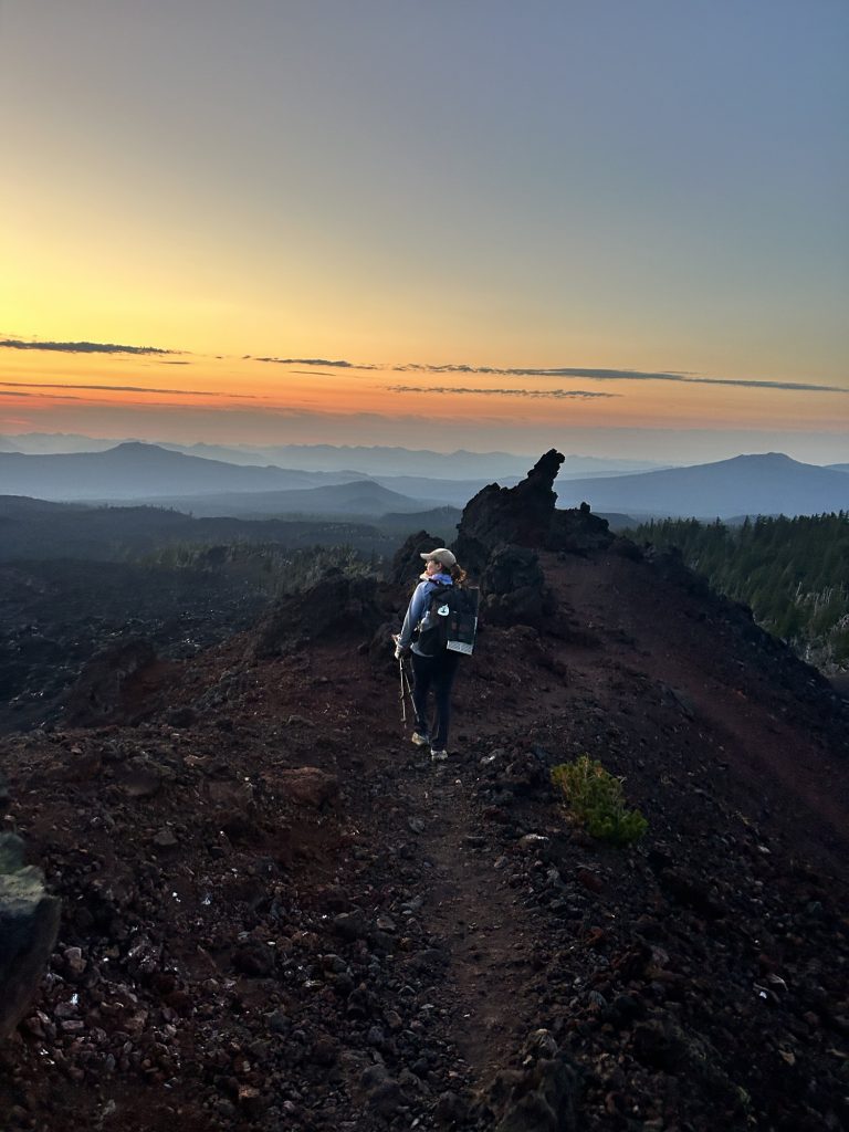
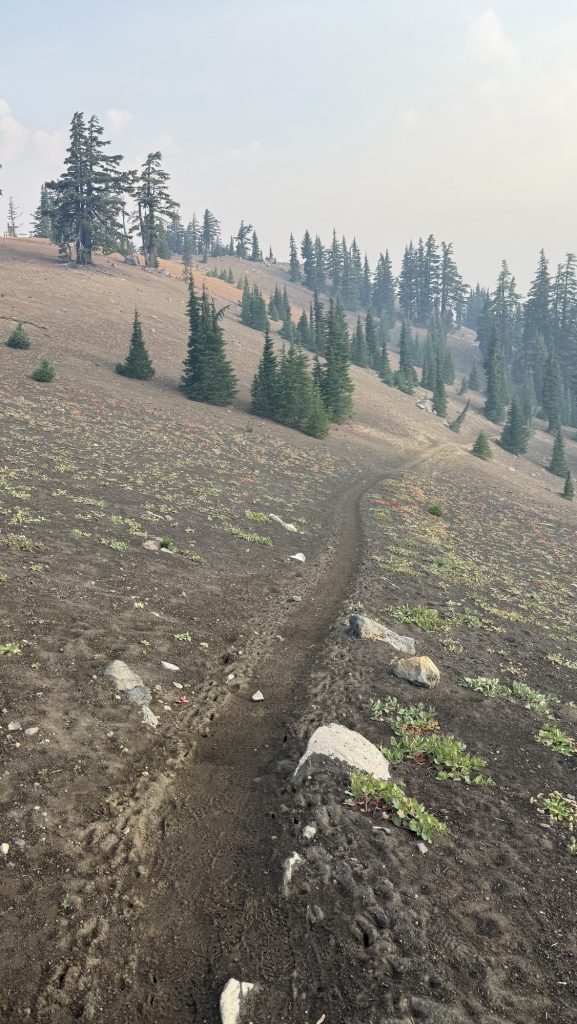
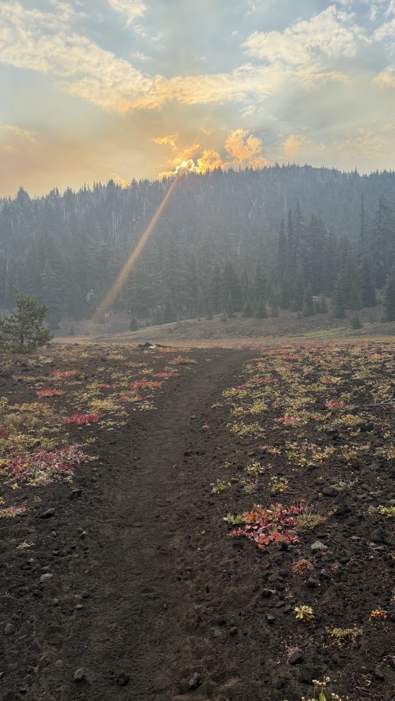
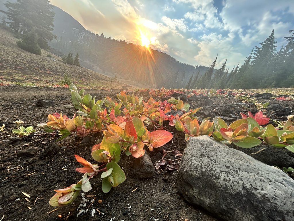
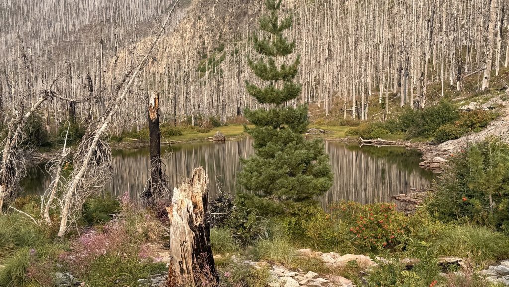
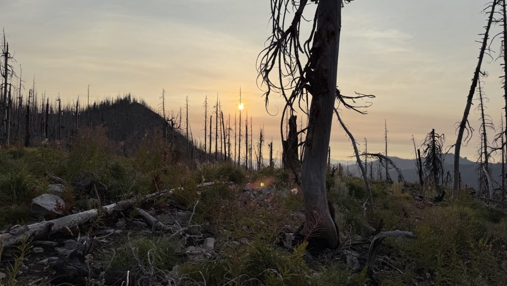
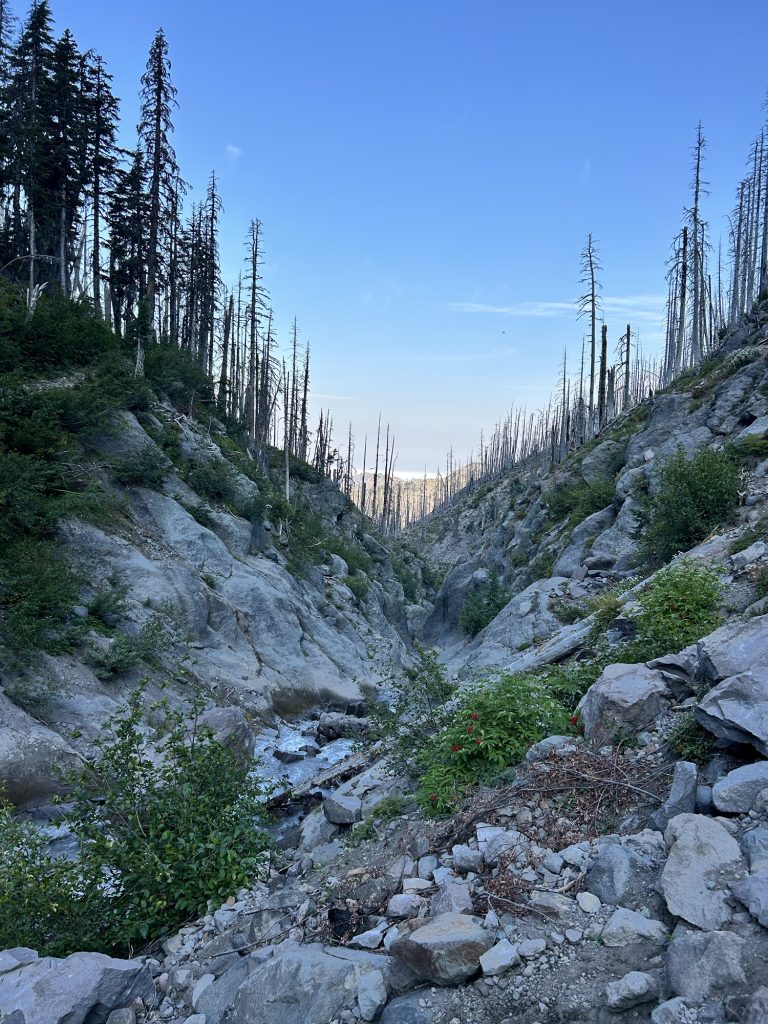
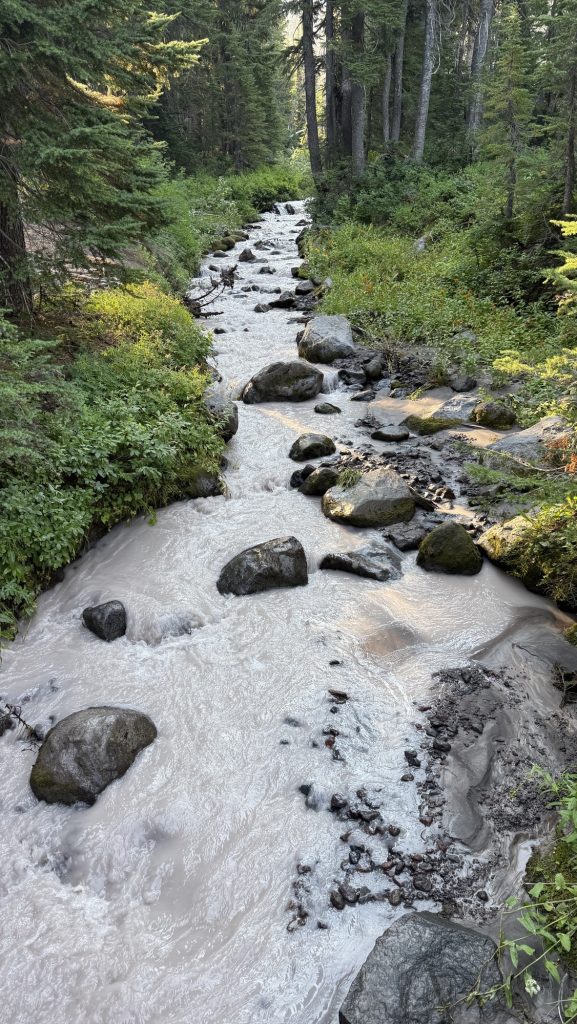
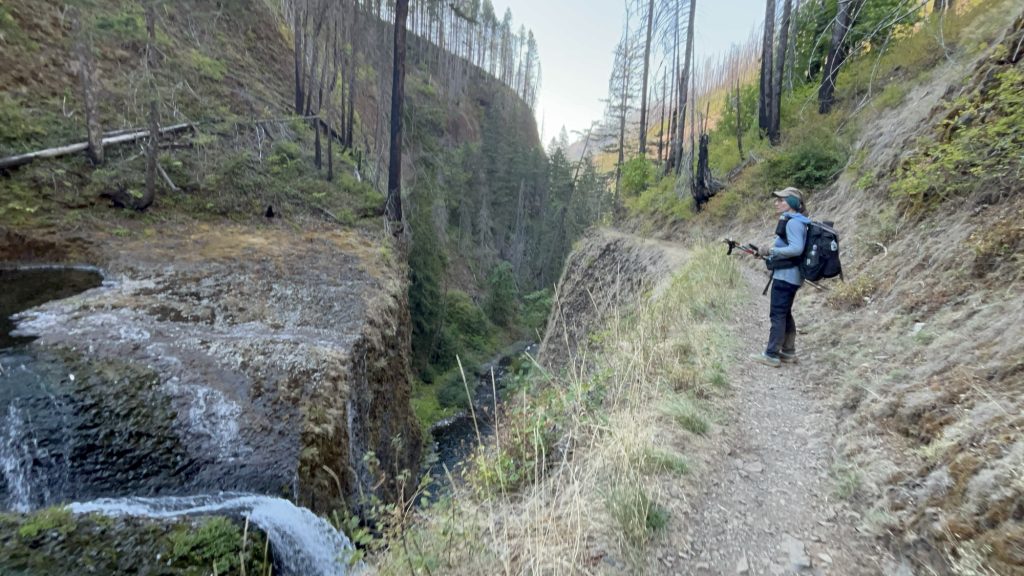
Days 135 – 137: PCT Miles 2500.73 – 2575.1
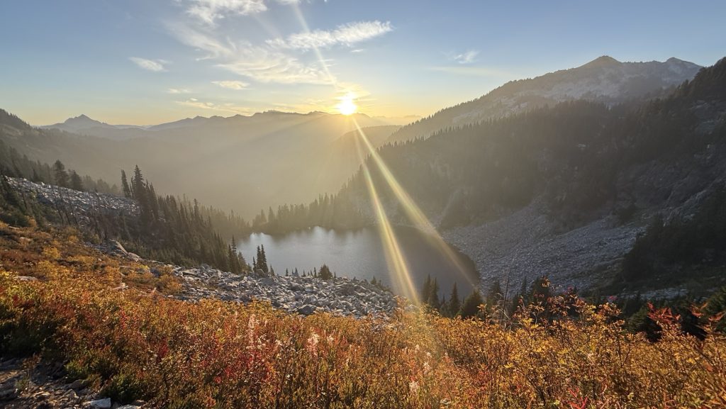
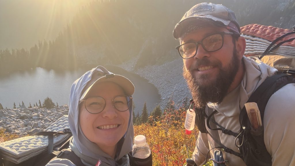
Day 135: Hiking into the night 2524.5 (23.77)
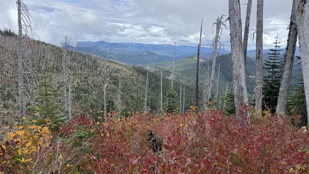
The morning was cold and we kept sleeping till 6am. It was below 10C. We left at 7.30am. We saw the sun come out. It was so great.
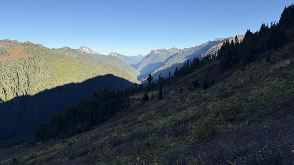

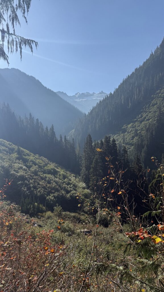
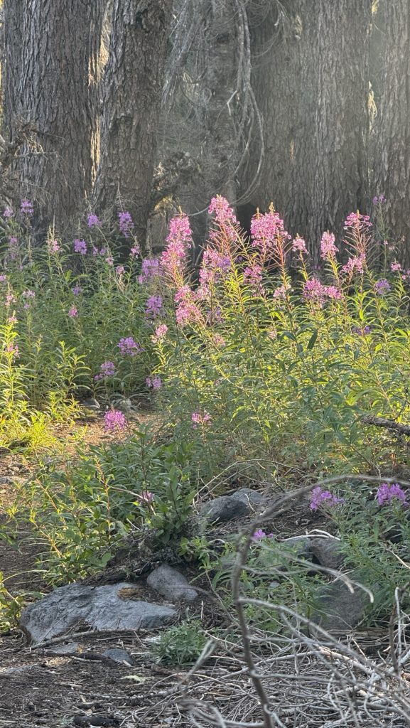
We warmed up and I solar charged my power bank. We climbed a lot and soon saw glacier covered peaks and red mountain tops. It was so beautiful. My left shin hurt a little but not to bad. We went over a saddle down into a deep valley and for the rest of the day stayed in a forest. We had lunch near a stream where the sun could dry our sleeping bags and tent.
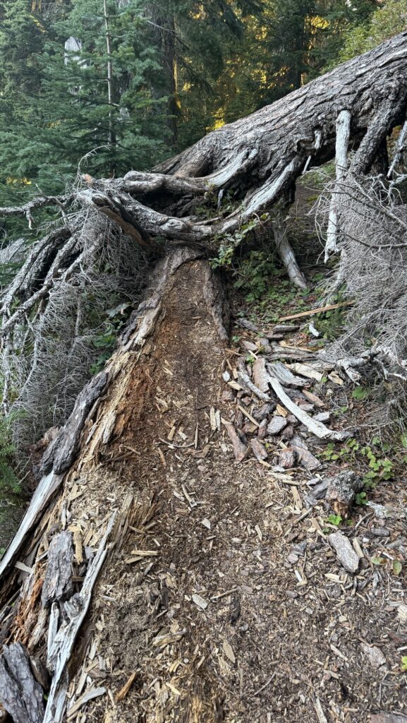
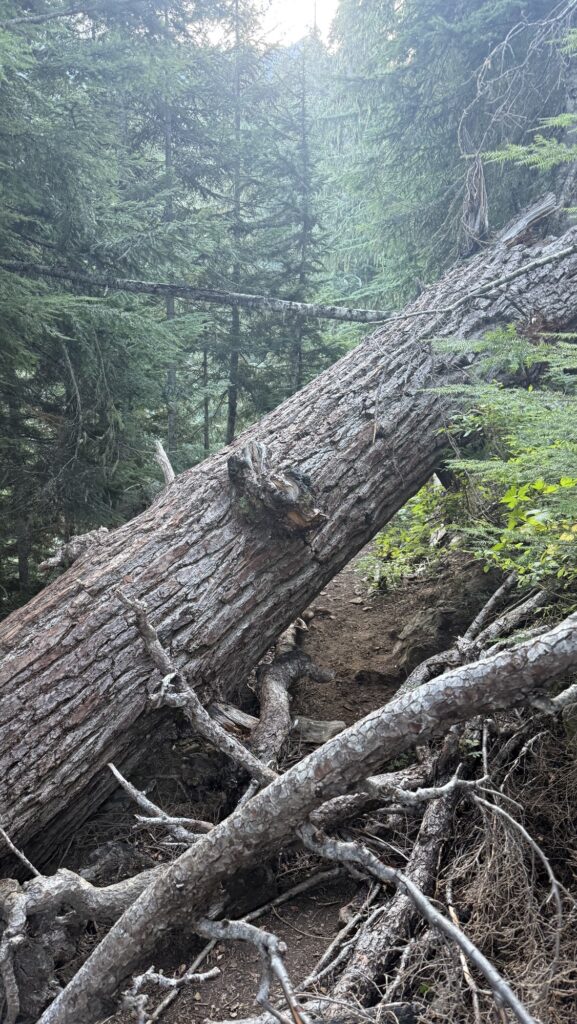
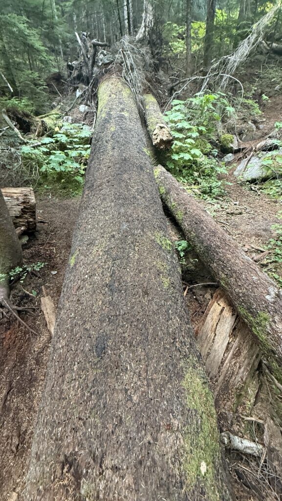
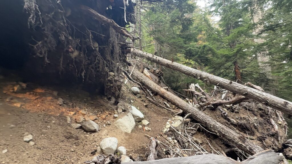
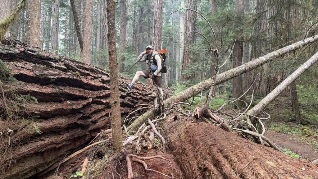
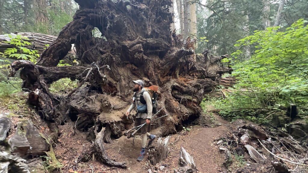
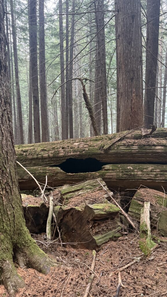
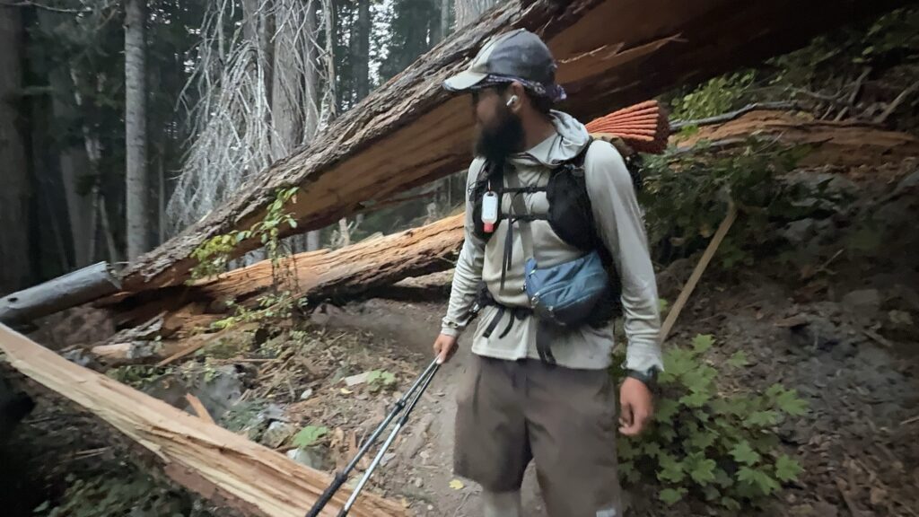
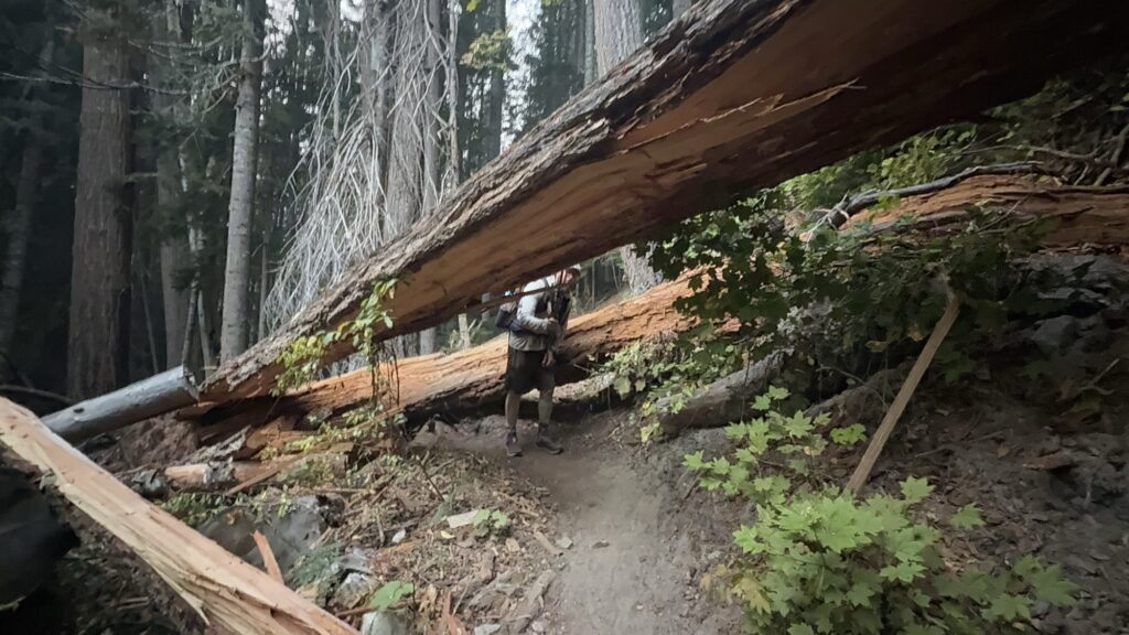
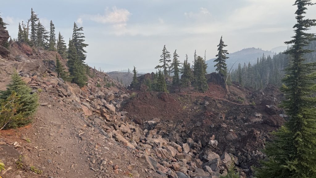
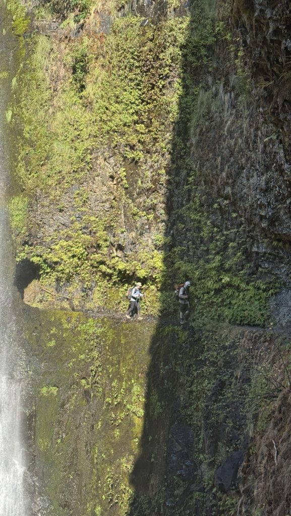
We had to climb countless fallen trees, sometimes several on top of each other and in many places there was no trail and we went straight up a slippery mud slide. At some point Iceman slipped into a tree and his hip belt buckle broke. Oh no! He could tie it together somehow but the hip buckle is essential, with no service the next few days, this is an issue. Section K is infamous for having over 30 massive fallen red wood trees on trail. Sometimes Iceman had to push me up one side of the tree.
We calculated in order to make the 6.15pm shuttle to Stehekin we should hike 25 miles today and tomorrow and 20 miles the third day. Weirdly, in the afternoon my left shin hurt so bad I had to take Ibuprofen and cool my foot in a glacial stream. It seemed to help.
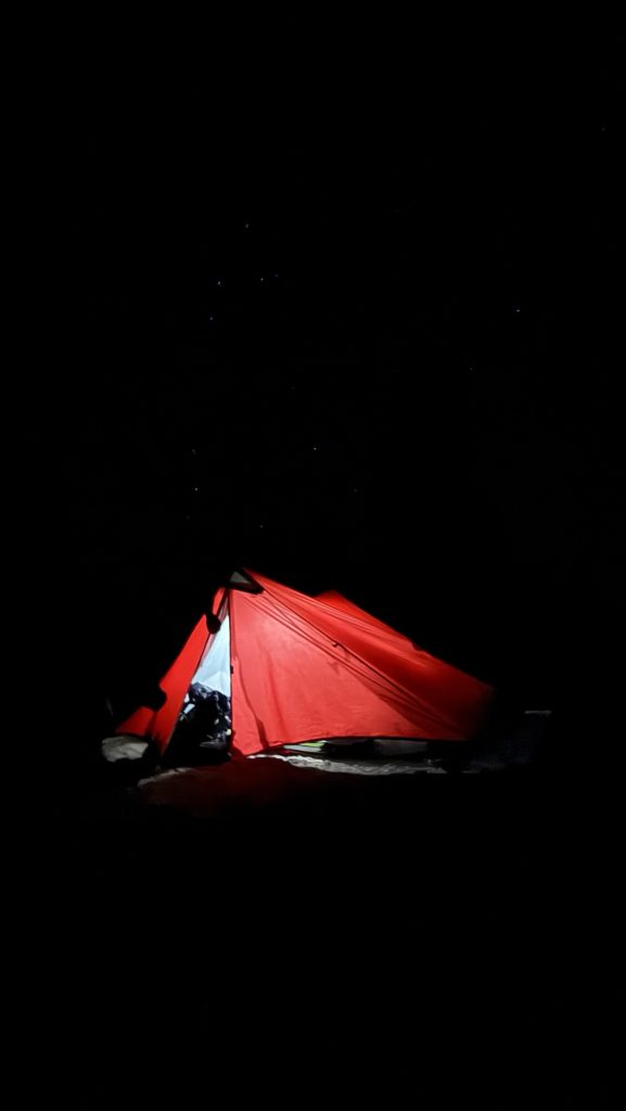
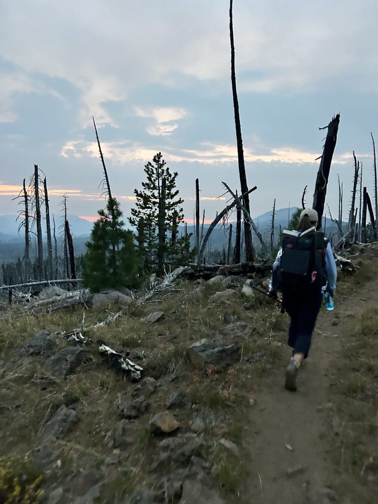
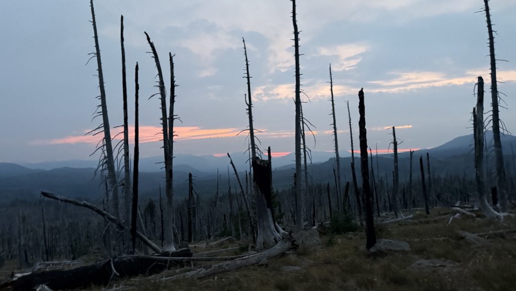
We hiked up some more and saw an incredible sunset over rugged mountains. With still at least 3 miles to go, we had to night hike. This is always spooky to me as you see only a little bulb in front of you. It’s scary. We climbed over a ridge line and down on the other side.
The lake we wanted to stay at has about 10 tents so we kept going. Another mile out so and we were almost alone, just one other tent. Much better. Amazing stars all around.
Miles hiked: 23.77
Ascent: 5799 ft
Descent: 5643 ft
Steps: 54.786
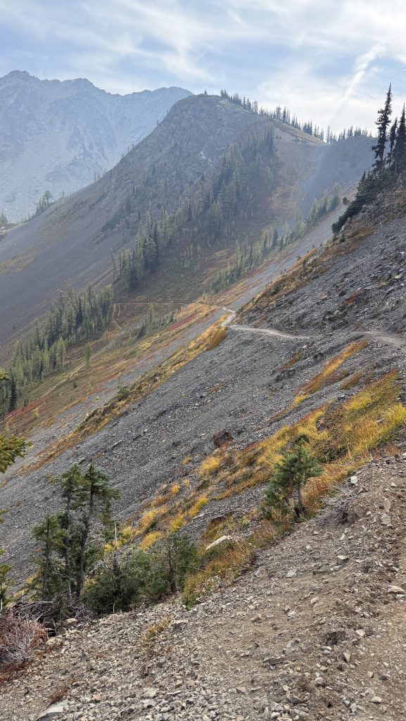
Day 136: Miner Creek 2552.3 (28.9)
The day began in the most responsible way possible — by turning off my 6 a.m. alarm and falling blissfully back asleep. When we finally stumbled out of our tent at 6:30, the world was already smoky, and we were already behind schedule. Things only went downhill from there — well, first they went uphill, eight miles and 2,500 feet of it.
I also made an unfortunate early-morning contribution to the PCT landscape. I thought I’d found a discreet side trail, but nope — turns out it was visible from the main path. Somewhere out there, a hiker is probably still wondering about my life choices. Sorry about that.
By lunchtime, things got real. We’d only covered 10 miles, it was already 1 p.m., and we realized that to catch the 6:15 p.m. shuttle to Stehekin tomorrow, we needed to crank out another 20 miles today. Nothing motivates quite like the threat of missing your ride to civilization (and real food).
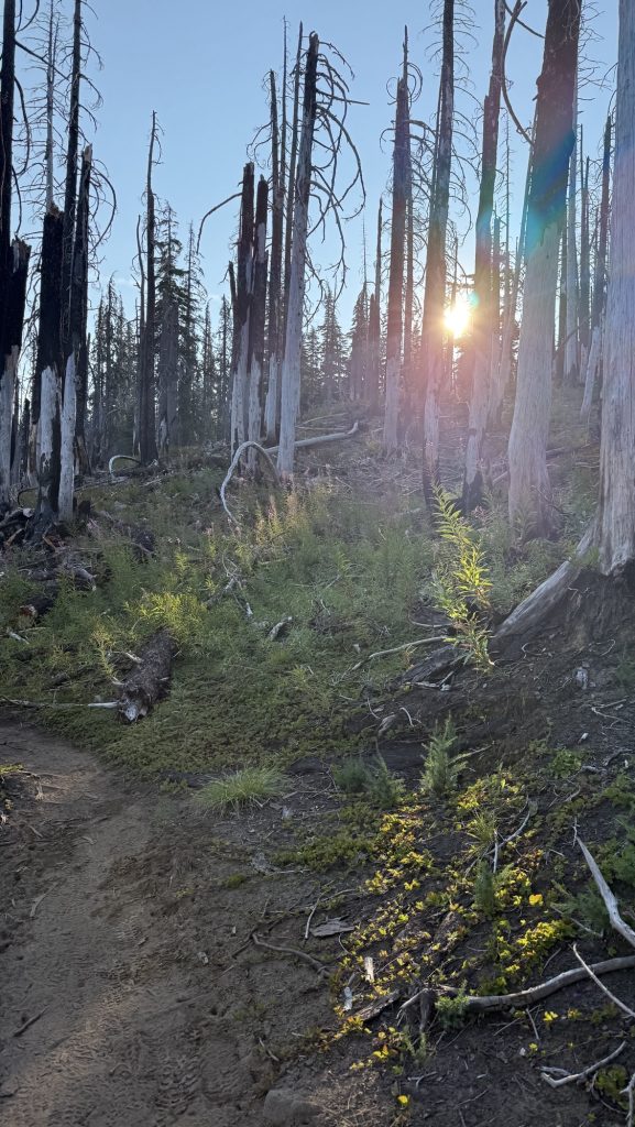
The trail responded like a cranky old gatekeeper. Blowdowns everywhere — tree trunks taller than us, forcing awkward climbs, yoga moves, and questionable language. Progress was slow and sweaty. Somewhere between fallen trees, we finished our audiobook ‘The Last Season’, a fascinating read about a backcountry ranger’s disappearance in Sequoia & Kings Canyon, my favorite section of the PCT. It made me grateful that, unlike him, I only have to worry about getting to Stehekin on time and not going missing entirely.
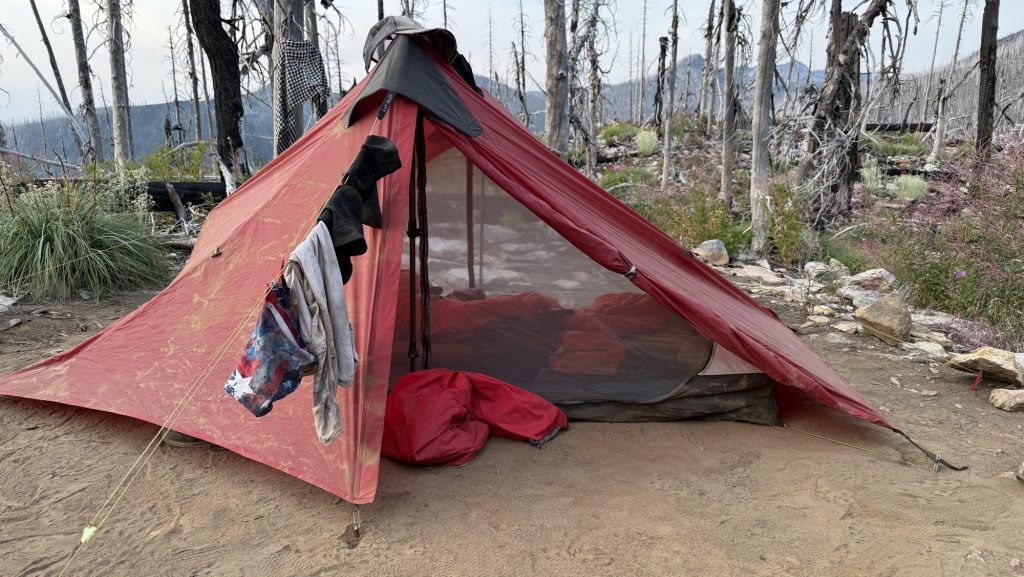
To keep the mental wheels turning, we switched to ‘21st Century UFOs’ on audiobook. Nothing adds atmosphere to a smoky mountain night like aliens. The haze stuck around all day, making our heads throb just enough to add an extra layer of misery. Meanwhile, Iceman managed to embody trail magic by gifting a lighter to a fellow hiker, and Arnoud worked some satellite-messaging magic to book us a cabin in Stehekin. Civilization was calling — faintly, through the smoke.

We kept hiking until 9 p.m., headlamps cutting through the gloom, stumbling over roots like zombies on a mission. Luckily, we found a flat camp spot with room to spare — and just one other hiker, no witnesses to our late arrival. My hip was complaining, but my left shin was quiet, and my right knee seems to have accepted its fate after weeks of stretching.
The stats say it all:
Miles hiked: 28.9 😝
Ascent: 5,668 ft
Descent: 2,650 ft
Steps: 66,178
A long day, a smoky sky, and a hard-earned camp. Tomorrow, Stehekin — assuming we can still stand up in the morning.
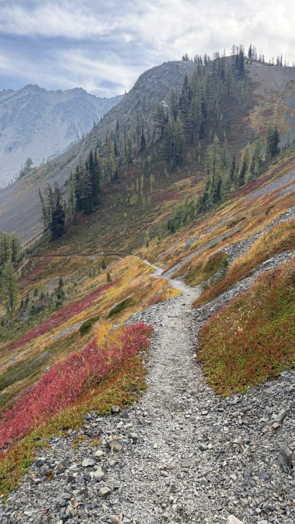
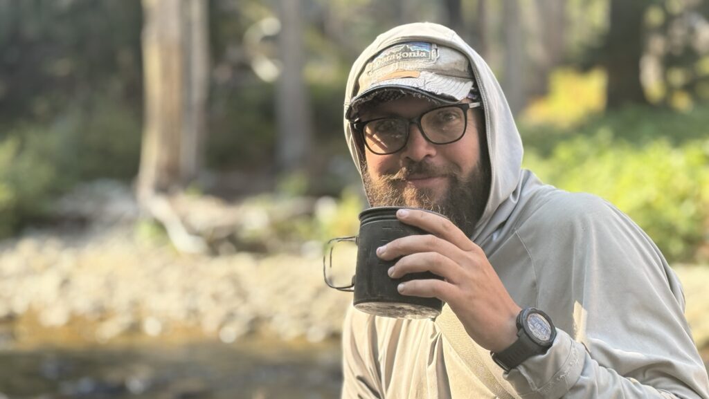
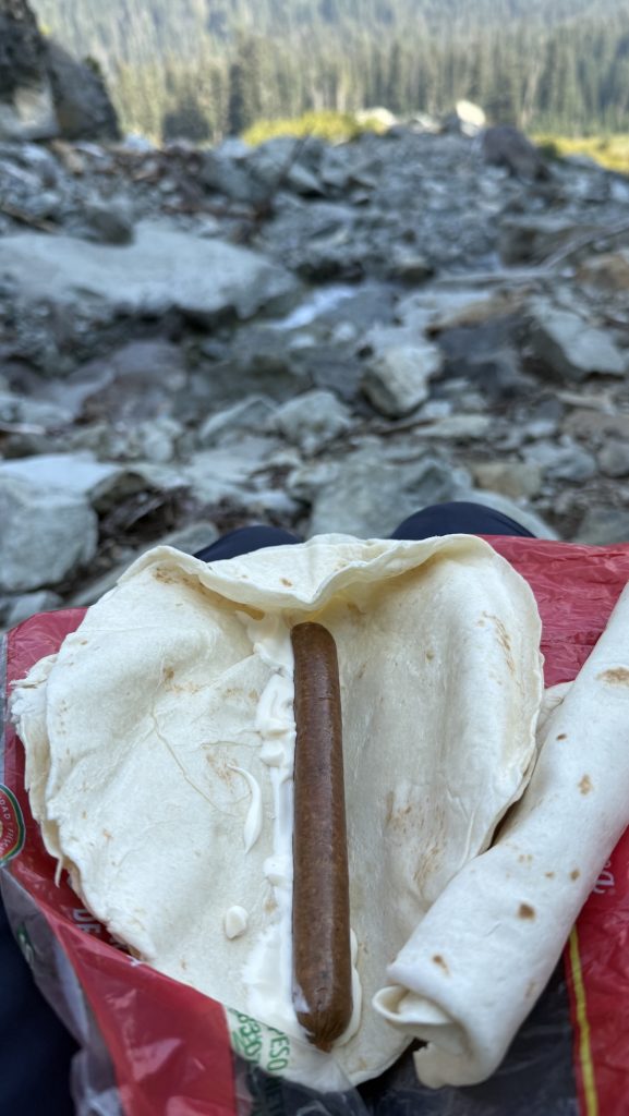
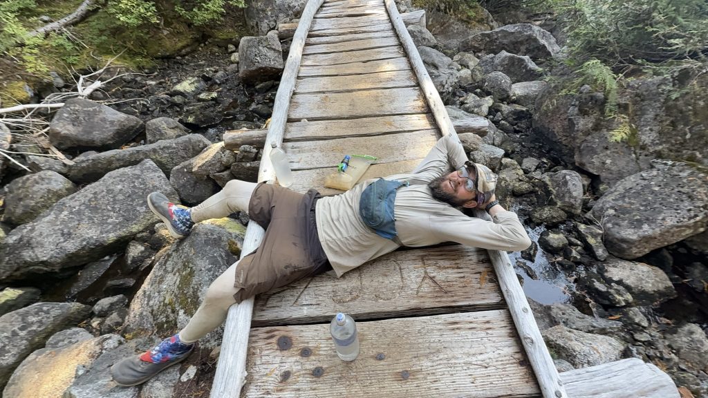
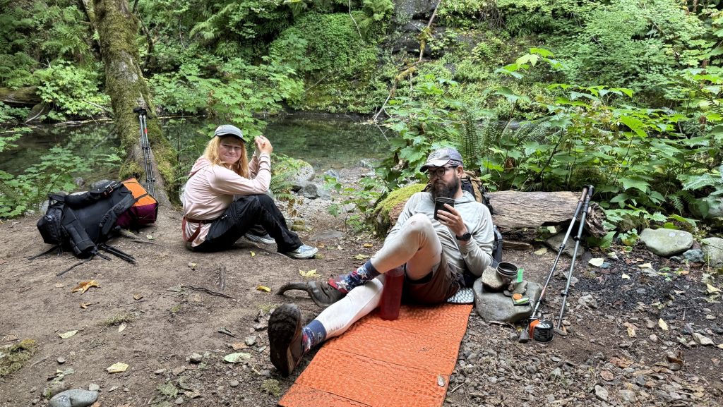
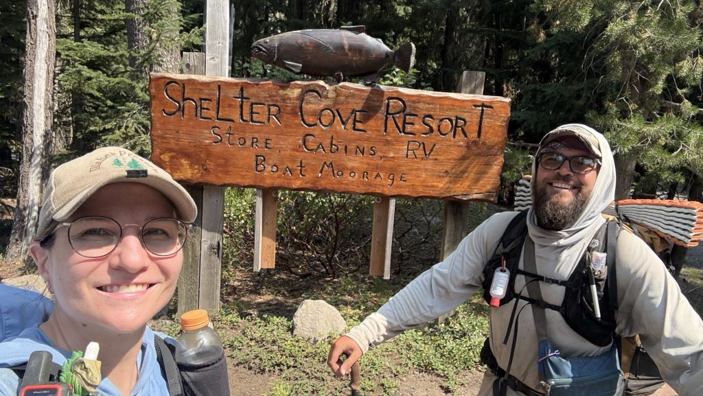
Day 137: The Day We Chased Stehekin (and Steak) 2575.1 (23.56)
Some mornings, adventure starts with a sunrise. Ours started with an alarm that laughed in our faces at 5:30 a.m. You know that blurry-eyed moment when you question every decision that led you to this exact point in the timeline? That was us while stuffing breakfast into our faces at dawn, convincing ourselves that the early bird gets… a shuttle seat, apparently.
By 7:00 a.m. on the dot, we stepped into the wilderness like punctual legends. If there’s a spiritual reward for hitting the trail before coffee fully hits your bloodstream, we earned it.
Around midday, we stopped at “the Creek”—which sounds poetic but is really just a gorgeous creek. There, we assembled what can only be described as a mourning burrito: tortillas, rice, beans, and the faint scent of regret that we didn’t pack cheese and salami. It was warm, which automatically made it the best lunch of the week.


With tortillas in hand and questionable enthusiasm in our legs, we pressed on.
After 10 hours of steady climbing, descending, and pretending to enjoy nature’s cruel beauty, we rolled into the High Bridge Ranger Cabin at a precise 5:50 p.m. (Is this what adulting looks like?)
We even had time to check out the salmon under the bridge—serene little zen masters of the current, gliding in circles while we contemplated our own mortal fragility and whether we smelled as bad as we thought. Spoiler: we did.


Then, at 6:15 p.m., the shuttle appeared like a chariot of glory. Destination: Stehekin Valley Ranch. Estimated mood upon arrival: feral delight.
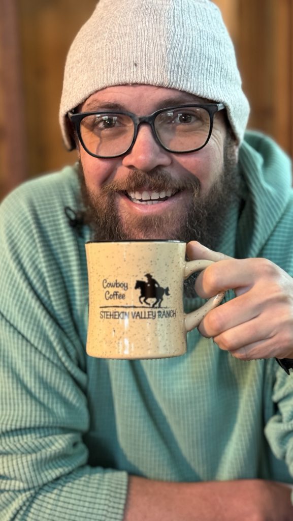
When we got there, we ditched our packs with the grace of collapsing storks and beelined to dinner in the “big kitchen cabin.” And oh, dear reader, let us tell you—this was no sad freeze-dried affair. This was the banquet of our wildest backpacker fantasies: a salad buffet starter, a 12-ounce steak flanked by potatoes and carrots, and a dessert buffet that almost made us cry.
Every bite whispered, “You did it. You’re not just hiking—you’re living.”
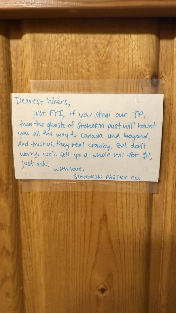
We checked into the trapper cabin, which had all the rustic charm you’d expect—wood walls, mountain silence, and precisely zero outlets. Charging our phones became a social ritual in the communal bathroom, where guests mingled in that half-desperate, half-zen camaraderie that only comes from trying to hold your toothbrush and your charging cable at the same time.
Stats That Don’t Lie
- Miles hiked: 23.56
- Ascent: 3160 ft
- Descent: 6181 ft
- Steps: 54,146
- Steak satisfaction level: 10/10, would hike again for dinner
In the end, the day wasn’t just about the distance. It was about how far you can push your body, your patience, and your love of tortillas before realizing that heaven might just look like a ranch kitchen filled with tired people and unlimited dessert.
Thanks for reading. Let me know if you have any questions or comments. I always love to hear from you.
🫶🫶🫶
Disco

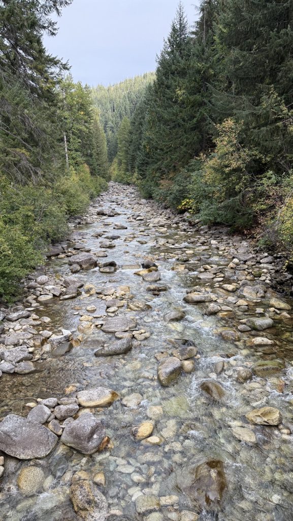
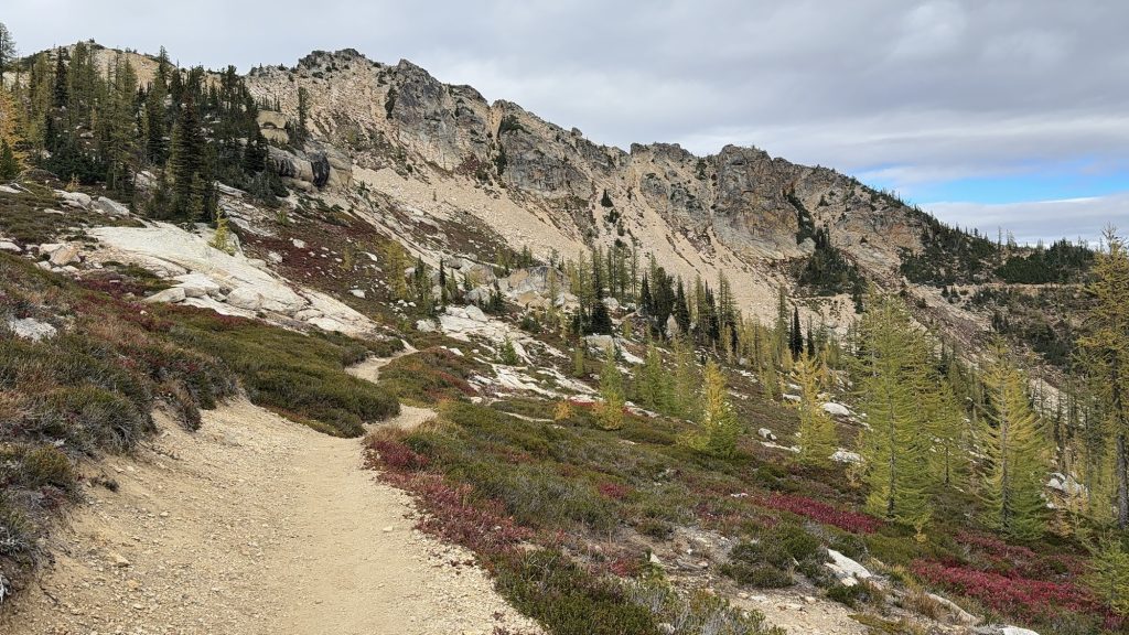
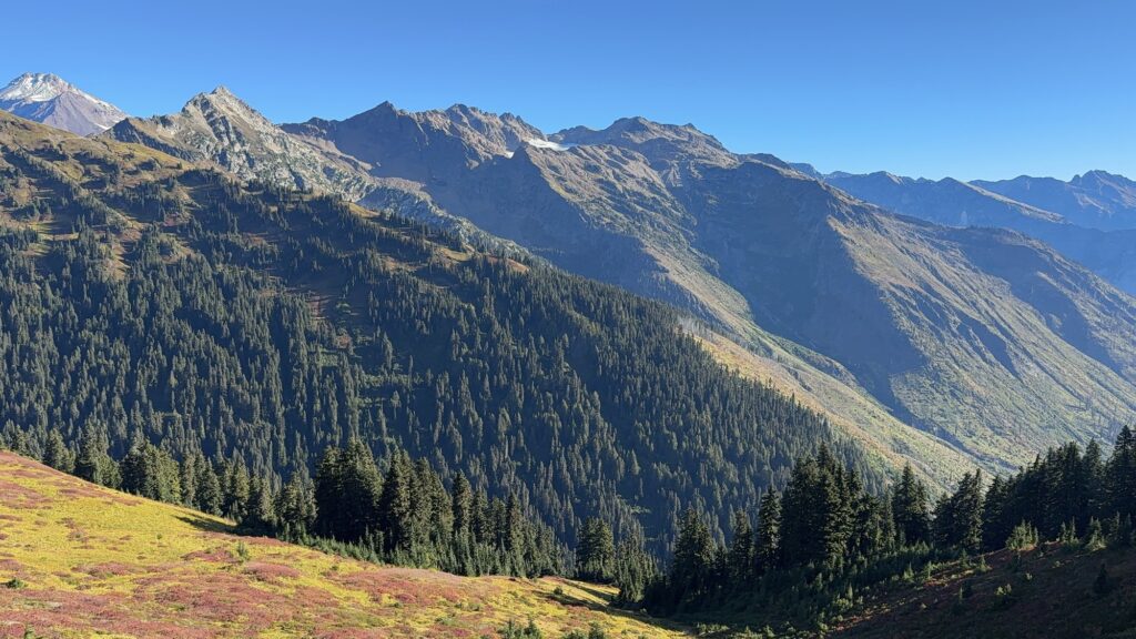
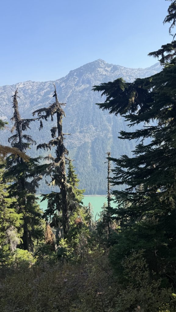
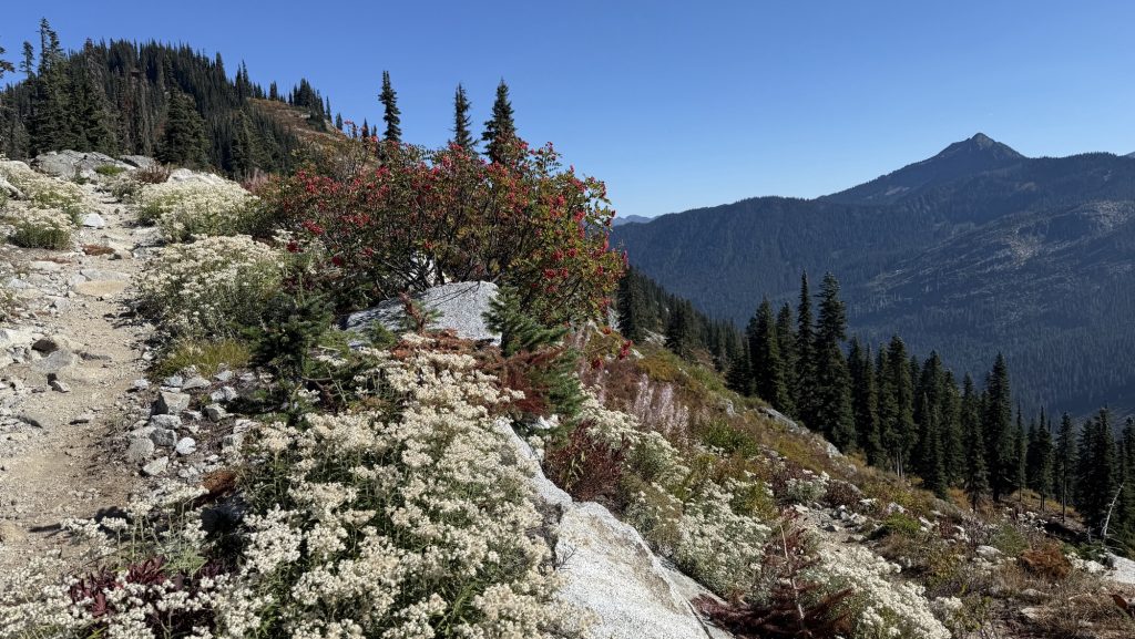
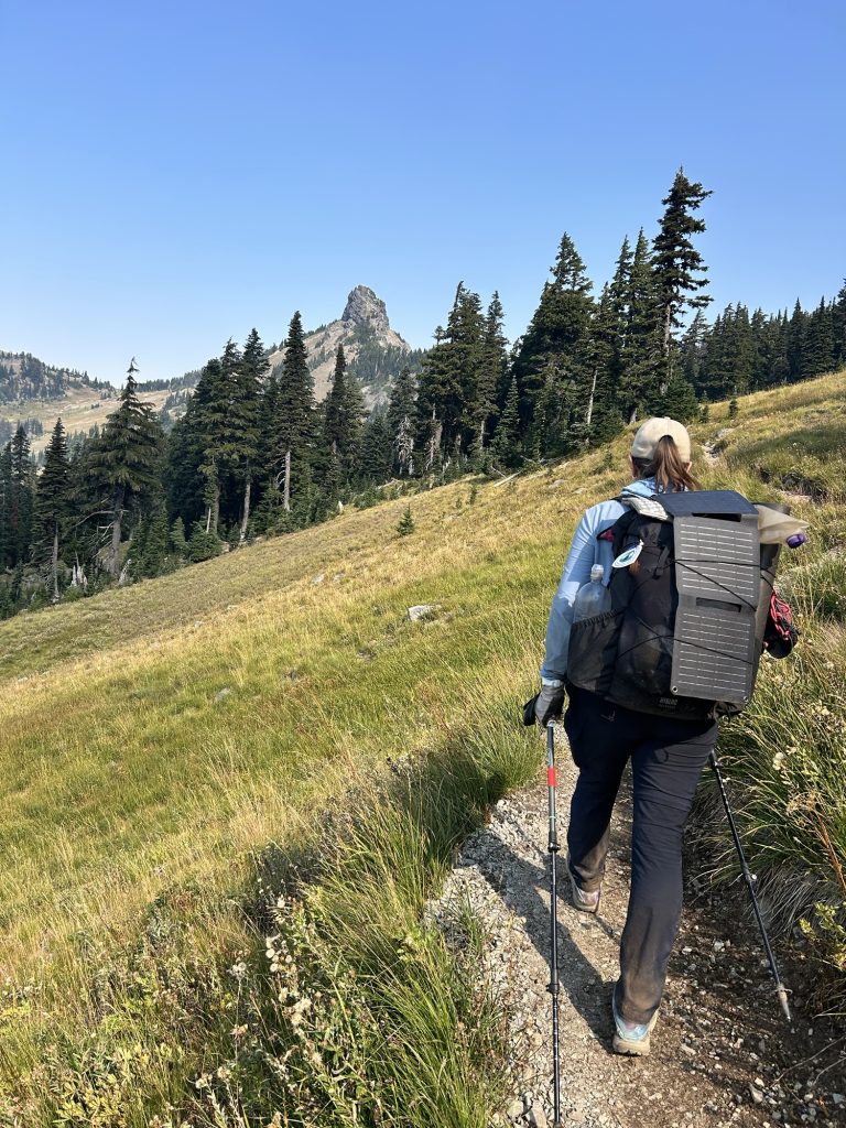
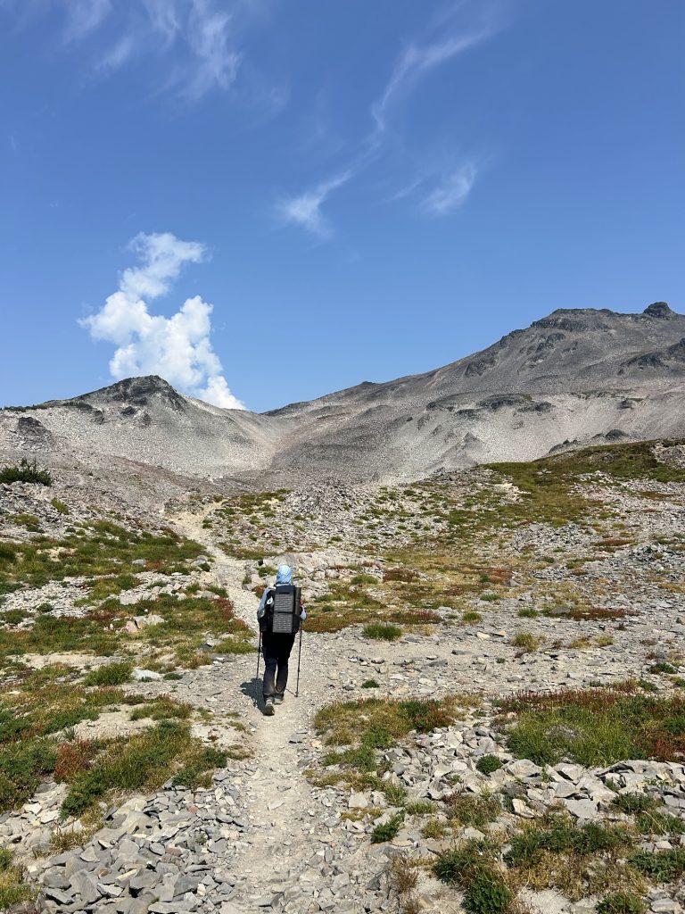
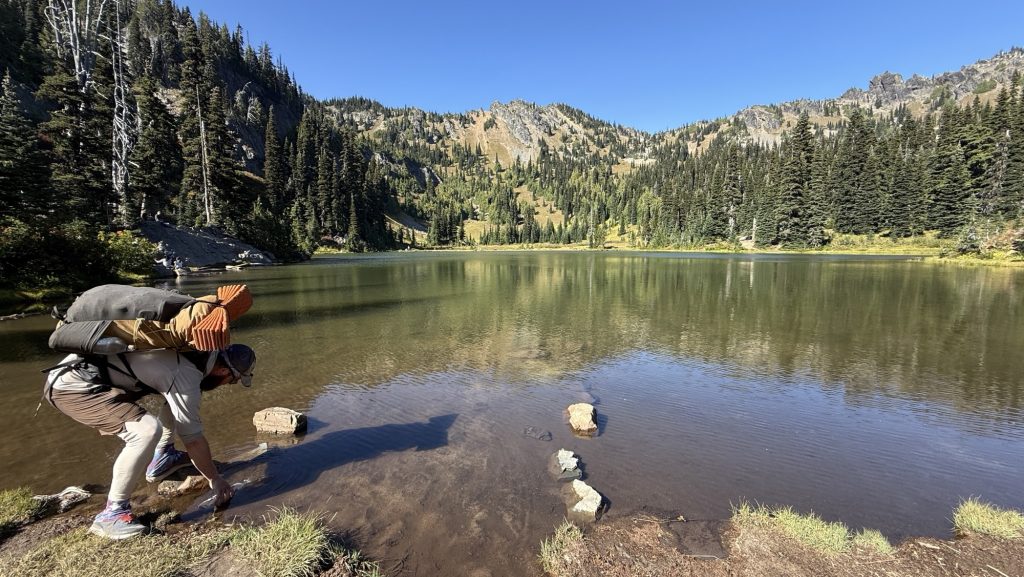
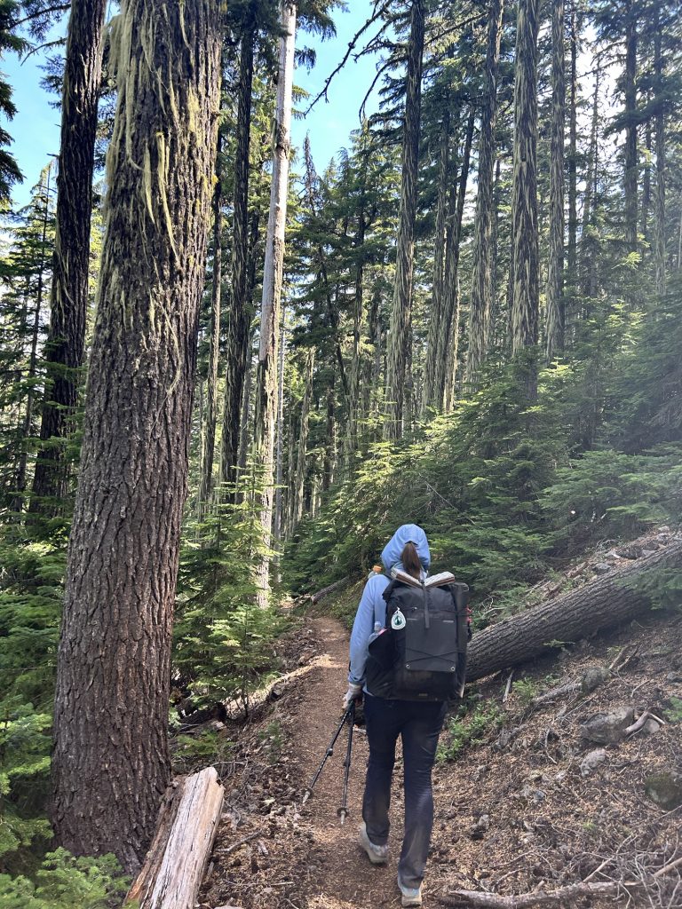
Days 130 – 134: Snoqualmie to mile 2501.3 (2396.3 – 2501.3)
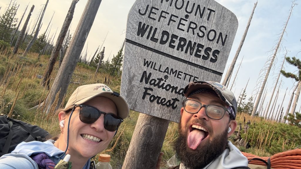
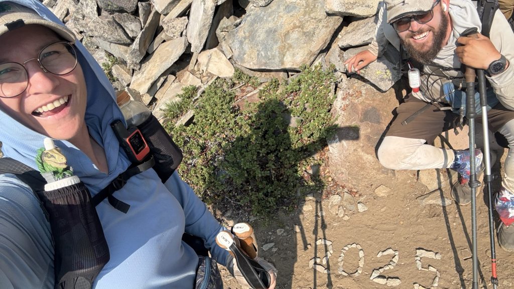
Day 130: Starting famous section J in Washington (15.96 Miles hiked) / Mile 2411.1
Section J in Washington is a 75 mile section from Snoqualmie to Steven’s Pass, and it is supposedly one of the most beautiful sections of the PCT, so we were stoked to check it out. We left at 10.30am and will try to do so last 17 miles.
We both feel better this morning. I had a great night of sleep, best one in weeks. Little hiking and no alcohol, 78 sleep score, body battery 63, more than 20 more than on trail.
We had a cappuccino at Laconia Market and Iceman talked to his parents, coordinating the pick up at Harts Pass in a few days.
We have an 8 mile 2500 ft climb ahead of us.
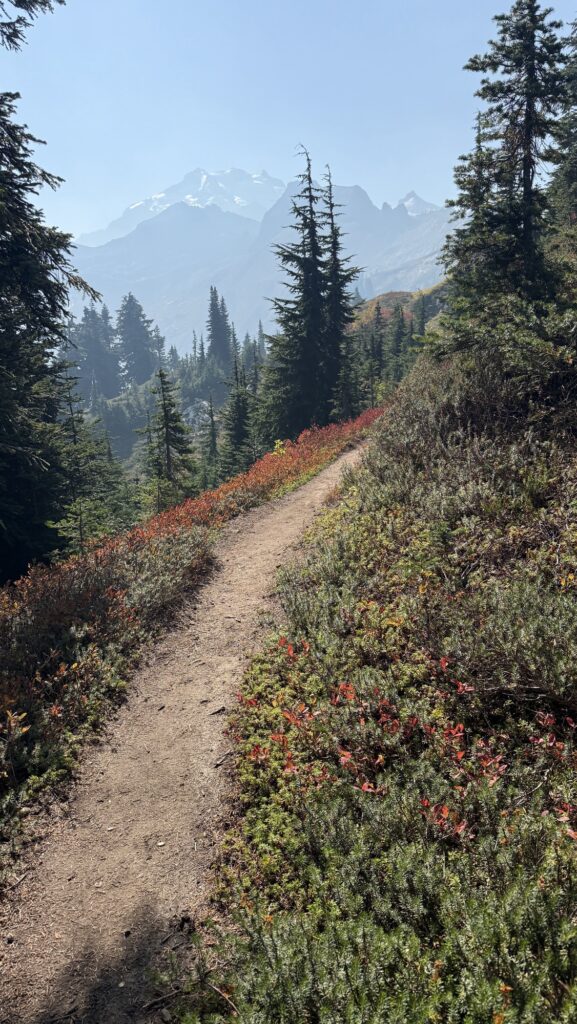
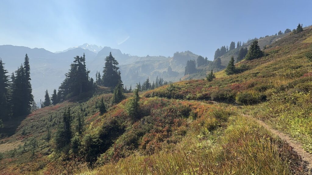
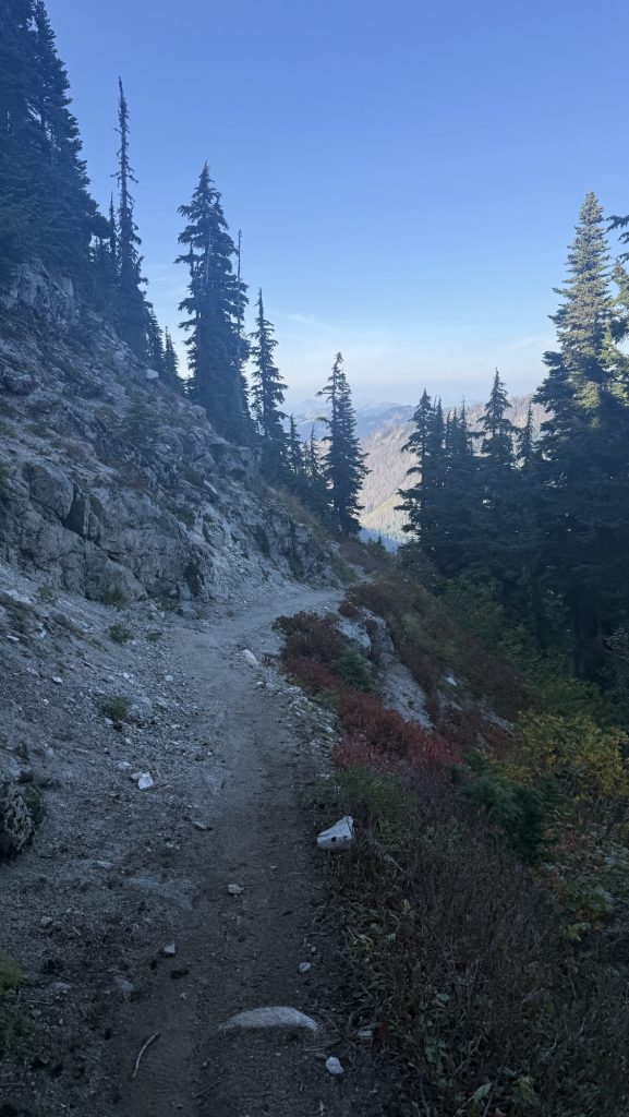
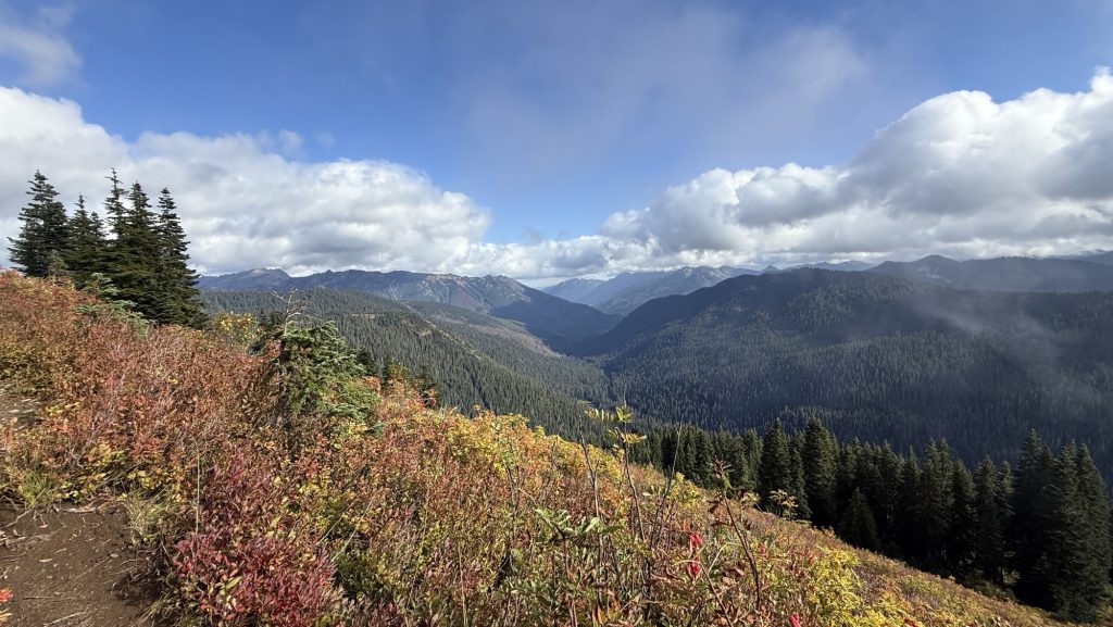
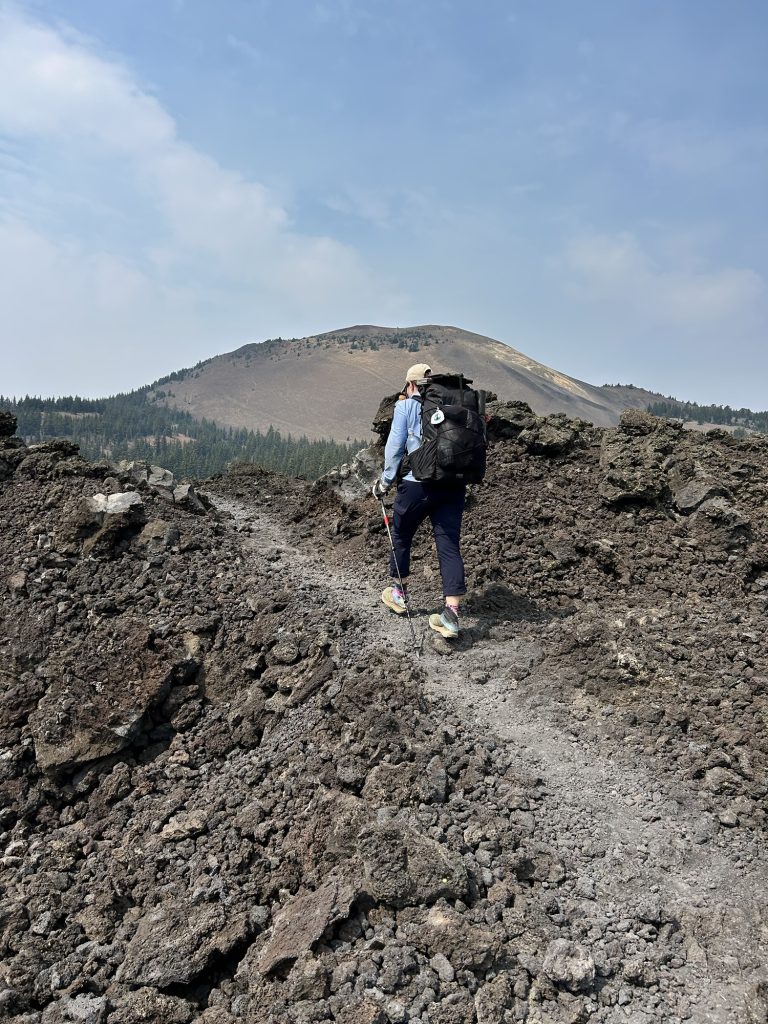
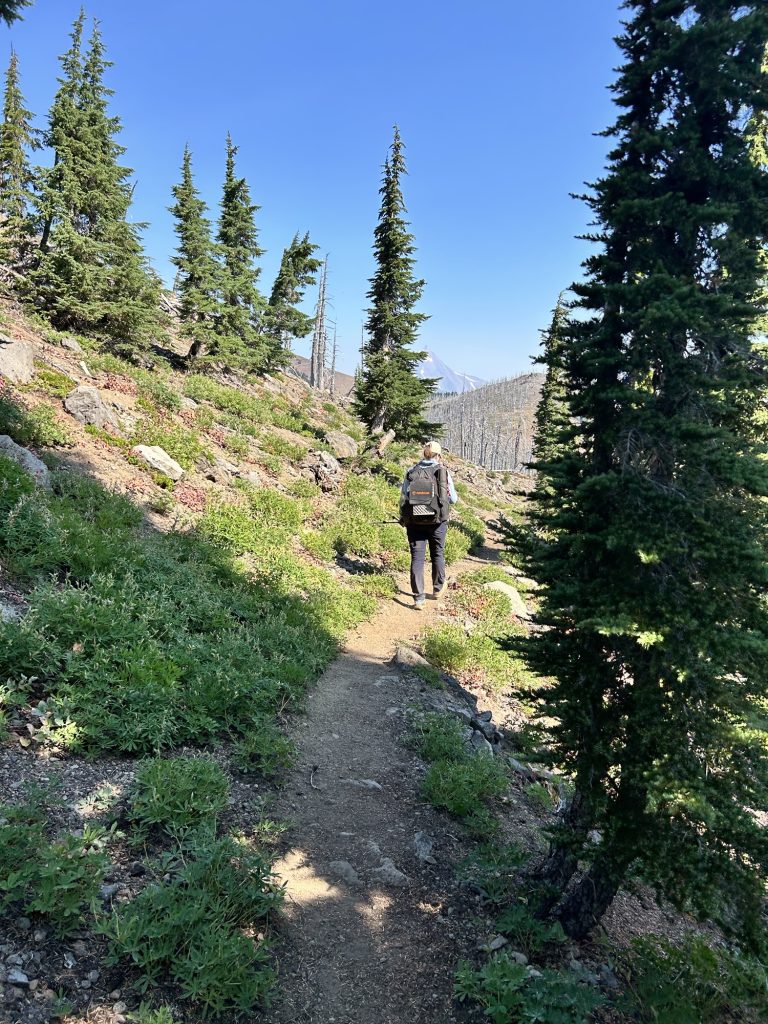
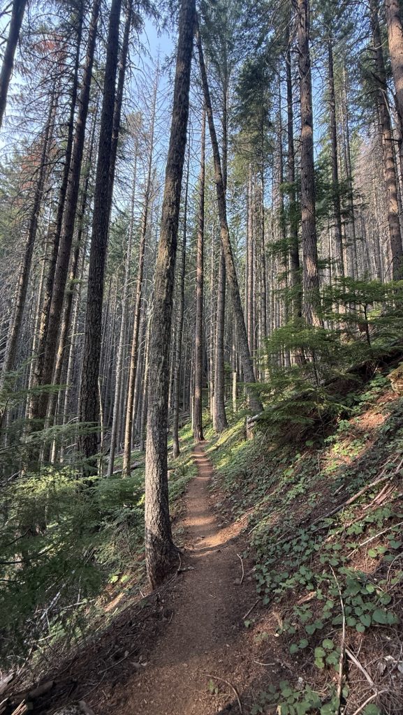
The climb was through forest, first with highway noises and many day hikers. But once we got to the top of the climb, we saw no more people and the views kept getting better and better. We kept climbing almost all day with little breaks and it was tough on the legs because the trail consisted of rocks and you have to pay attention in order not to trip or break an ankle.
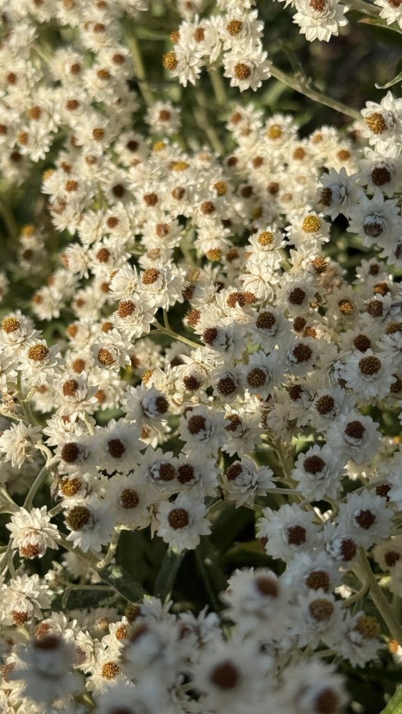
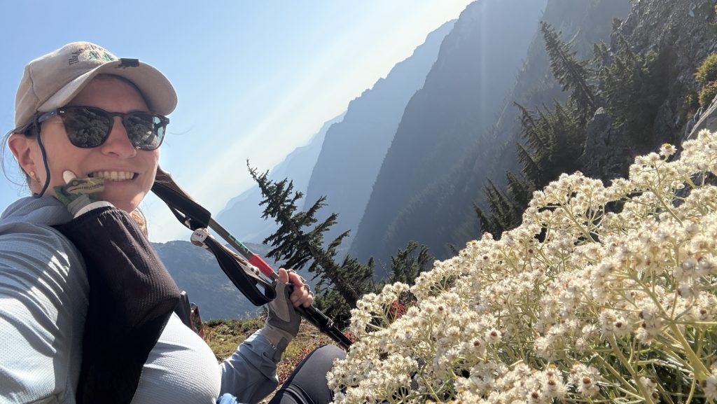
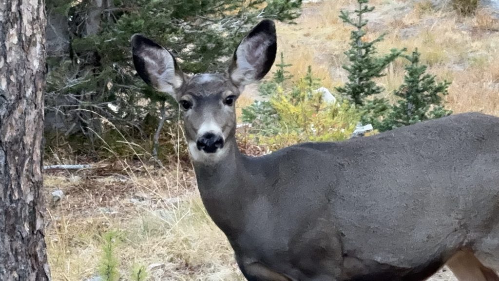
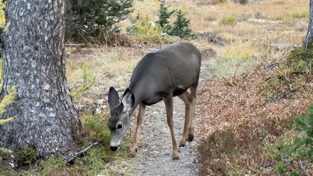
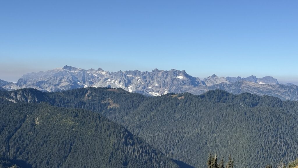
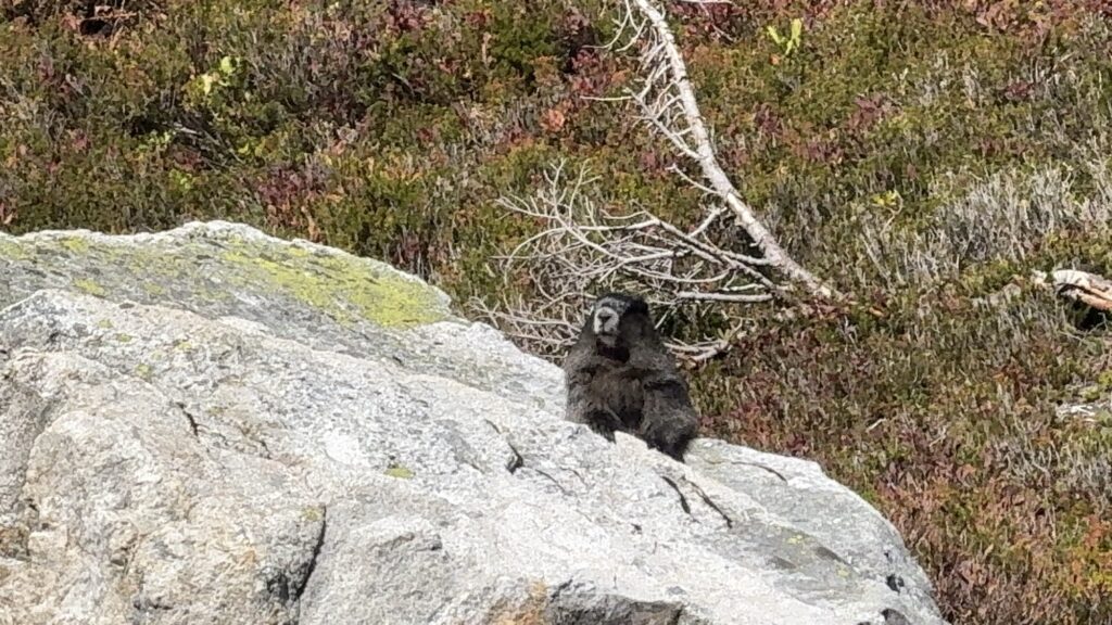
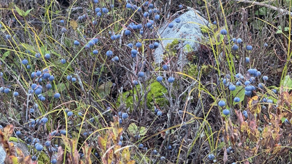
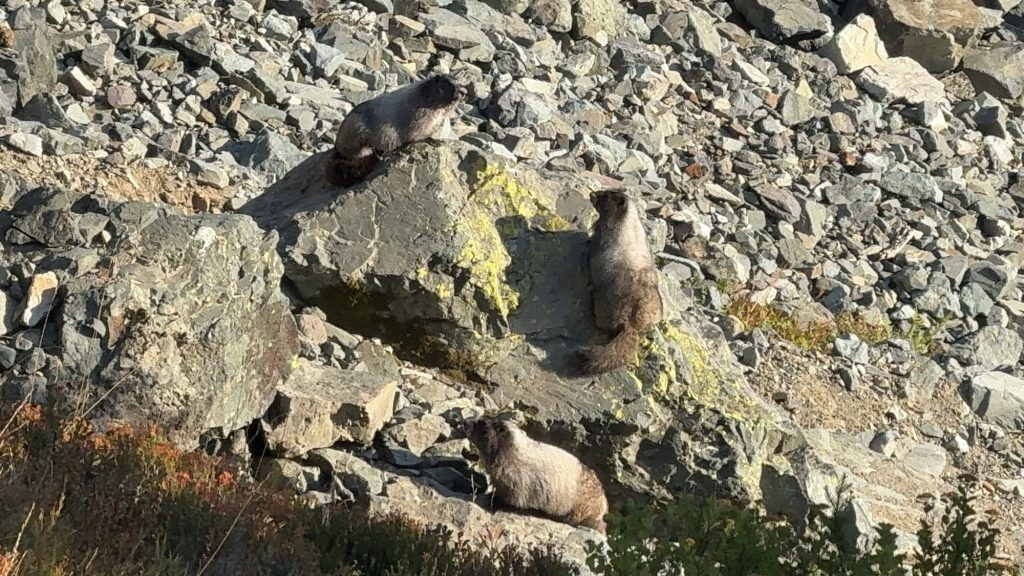
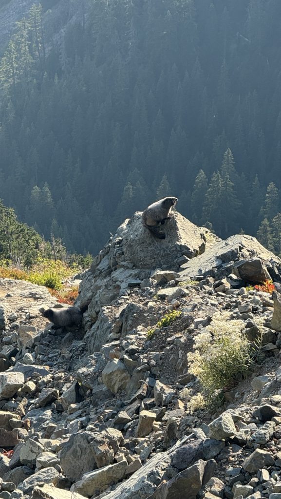
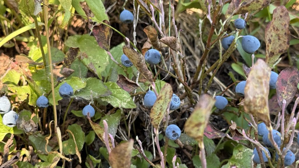
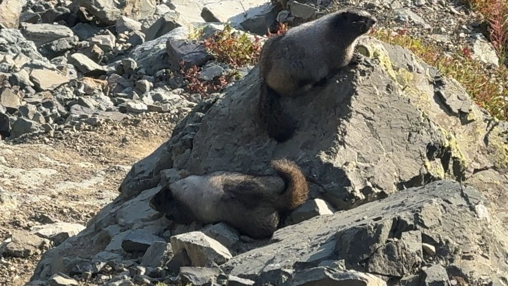
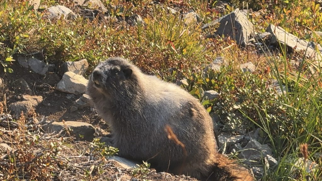
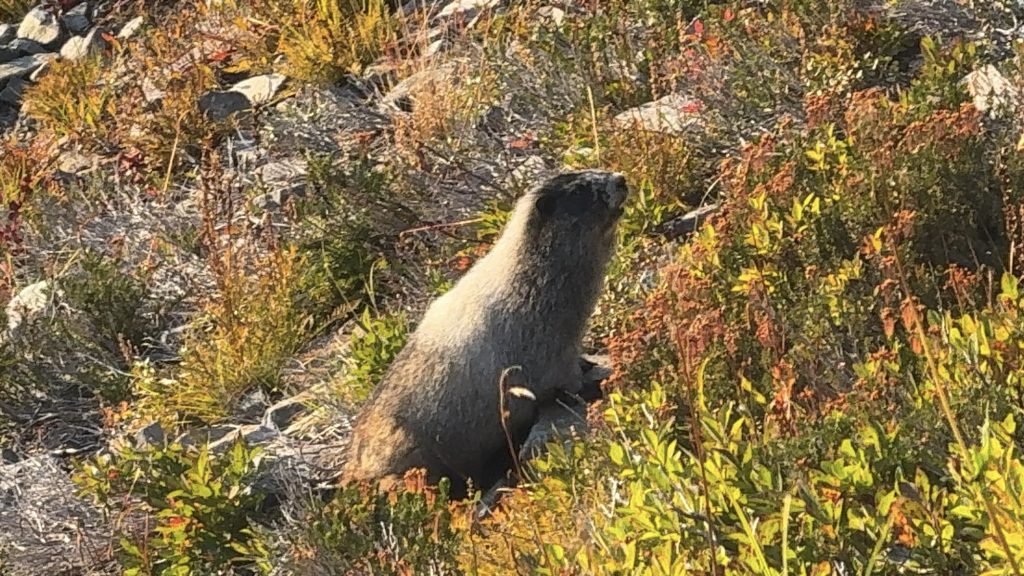
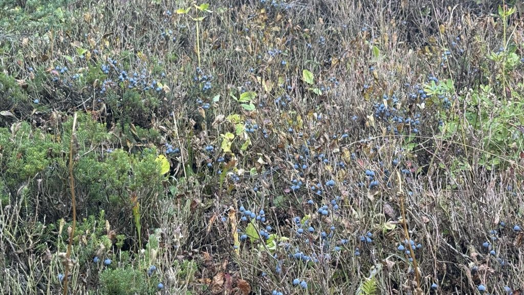
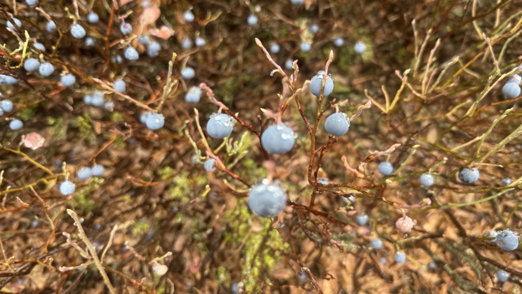
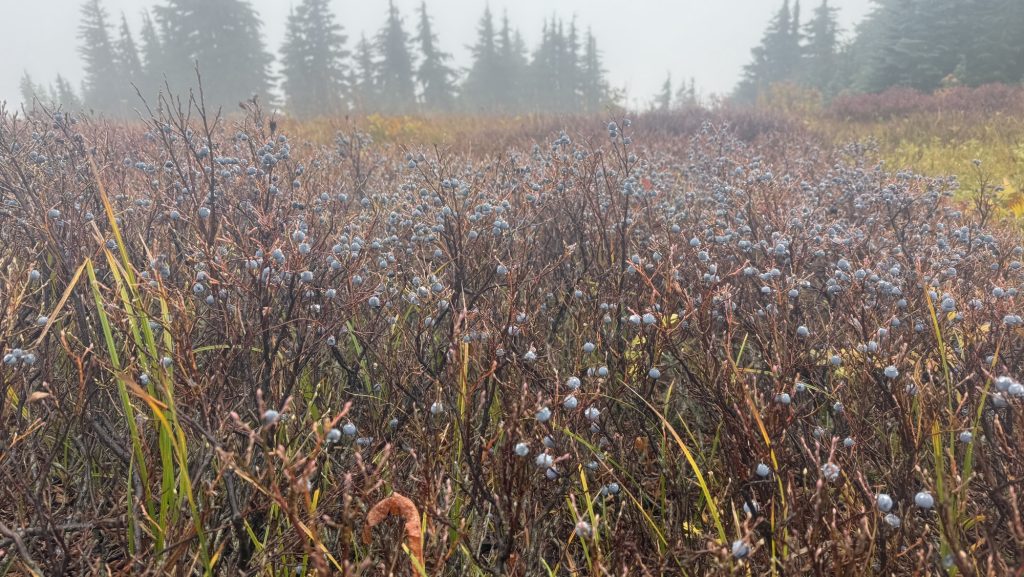
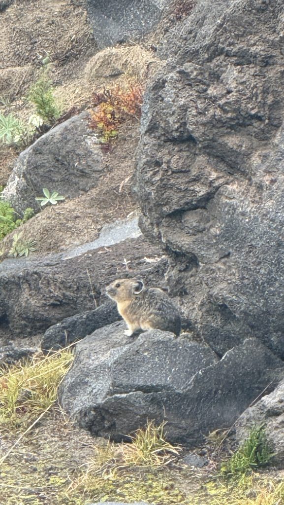
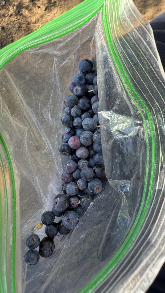
We enjoyed the sun and the views and later in the afternoon we saw marmots again – we haven’t seen those since the Sierra and they were really really cute and quite big – the size of cats. They conversed with each other over long distances with really high shrieks. They weren’t afraid of us as they’ve probably seen thousand of hikers walk by their „house“. I think they’re getting fat for hibernation – perfect as there were millions of huckleberries everywhere.
We were eating them too. After yet another climb, we didn’t make it to our desired campsite but one before it at a beautiful little pond, just before it got dark at 7.30pm. The views were so incredible at sunset, large rugged mountains all around us, beautiful green and red valleys, just wow!
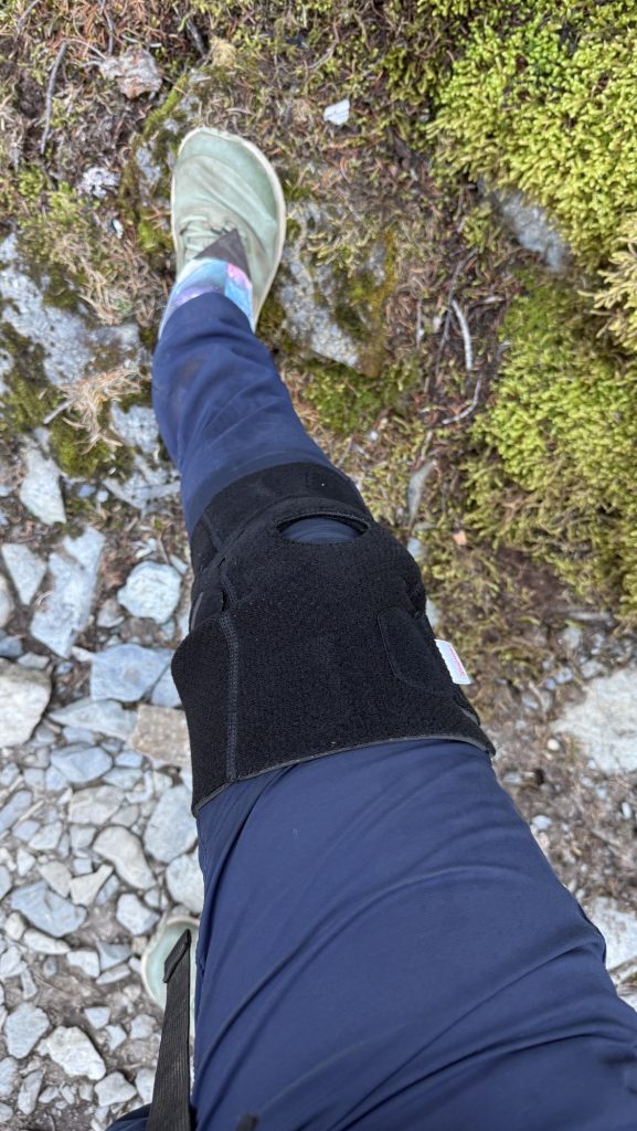
I iced my knee in town and did some research on taping it with k2 tape and knee stretches. Did those too, plus the arnica cbd rub several times a day. I also found a knee brace in the hiker box at our hotel and took that too, and it actually seemed to work – my knee didn’t hurt for the first 15 miles – the last mile wasn’t great. But I also started paying more attention to how I walk and tried to focus on my gluteus maximus, hips and hamstring more and knee less so let’s see if that does any good. At this point I gotta try everything in order to make it to the Canadian border.
Miles hiked: 15.96
Ascent: 4751 ft
Descent: 2916 ft
Steps: 32.025
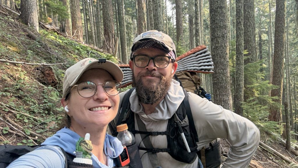
Day 131: 2433.2 (23.43)
We left at 7.24am, tent was wet, didn’t sleep well.
We had a gorgeous day: sunshine, beautiful glacier views, Spectacle lake, many more lakes, one huge lake, Waptus lake from high above in the afternoon and then hiked around it on the other side, climbs and descents. My feet hurt but it was great. We started listening to the book “Chaos” about the Manson murders. Wild! Very interesting.
Got to camp at 7.00pm right next to a water source.
Miles hiked: 23.43
Ascent: 3723 ft
Descent: 5367 ft
Steps: 46.163
Day 132: Deception Lake 2455.3 (24.2 Miles hiked) / 200 Miles to Canada
Alarm at 5.30am, we left at 6.47am – yay – we usually take 2 hours in the morning but we’ve been trying to shorten that to 1h – so we did better today.
We noticed to our shock that a mouse had chewed through our tent and my odor proof food bag to eat our granola breakfast. Because we camped next to a river, neither of us heard it.
We started with a long climb, and had phenomenal views all day. We stopped at Cascade creek for lunch which was beautiful. We had done 12 miles at noon.
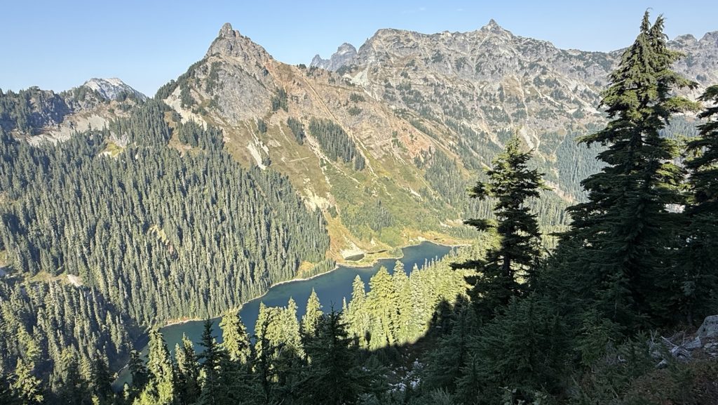
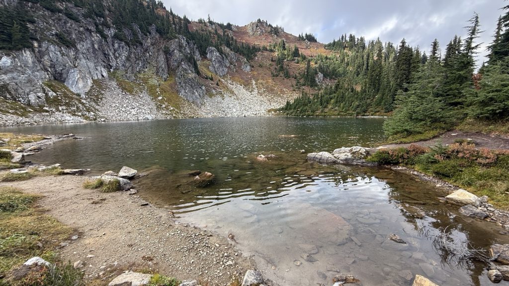
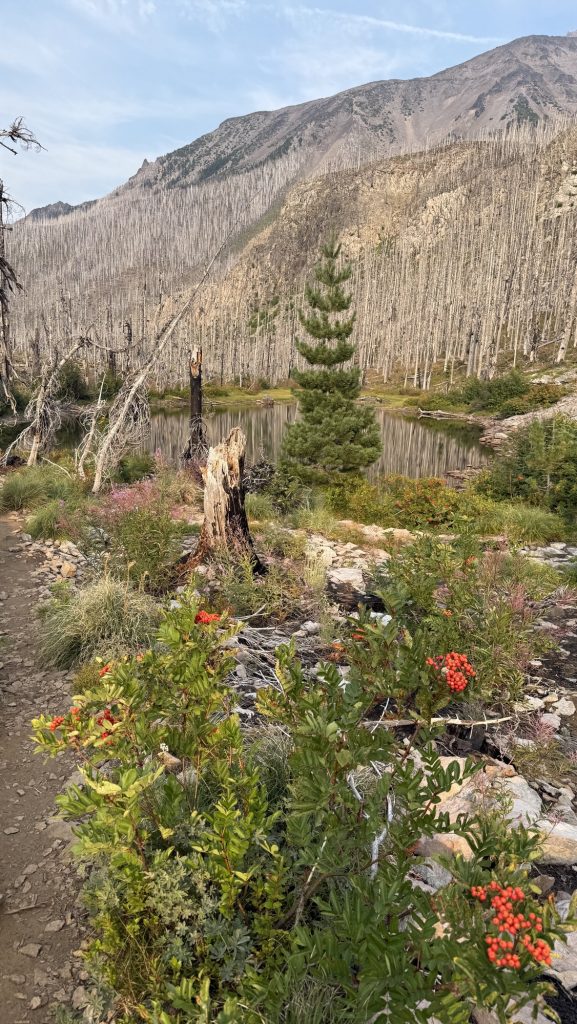
Then we climbed 2500 ft up again and around 4 we stopped at Deception Lake and jumped in – it was gorgeous and very cold. We cliff jumped and cannon balled into the cold water. It was wonderful.
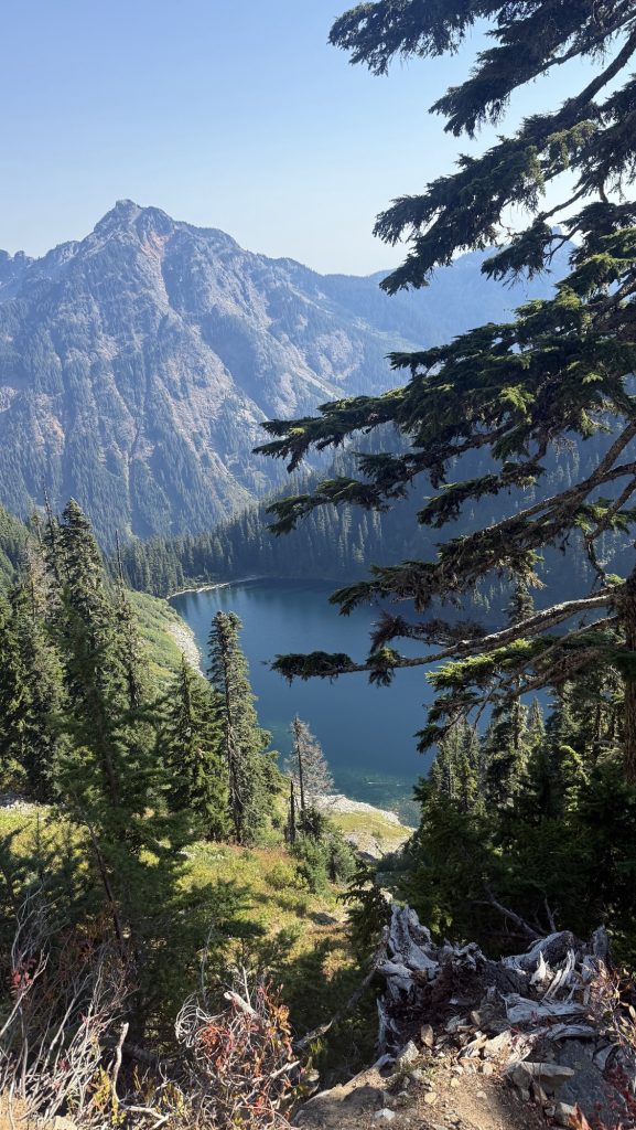
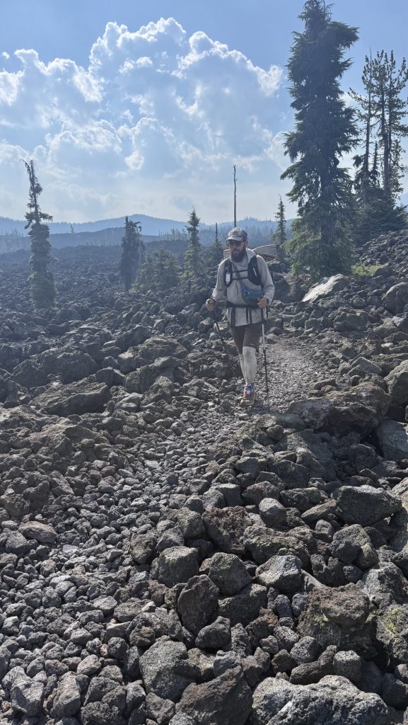
Then we started climbing again and got into a boulder wonderland with phenomenal views over Glacier Lake.
We camped at the most epic spot on top of a gnarly climb. Maybe the most elevation we have done in a day?
We are at mile 2455.3 which means we will reach the Canadian border in a mere 200 Miles. 😳😱
Miles hiked: 24.20
Ascent: 6201 ft
Descent: 3661 ft
Steps 48.029
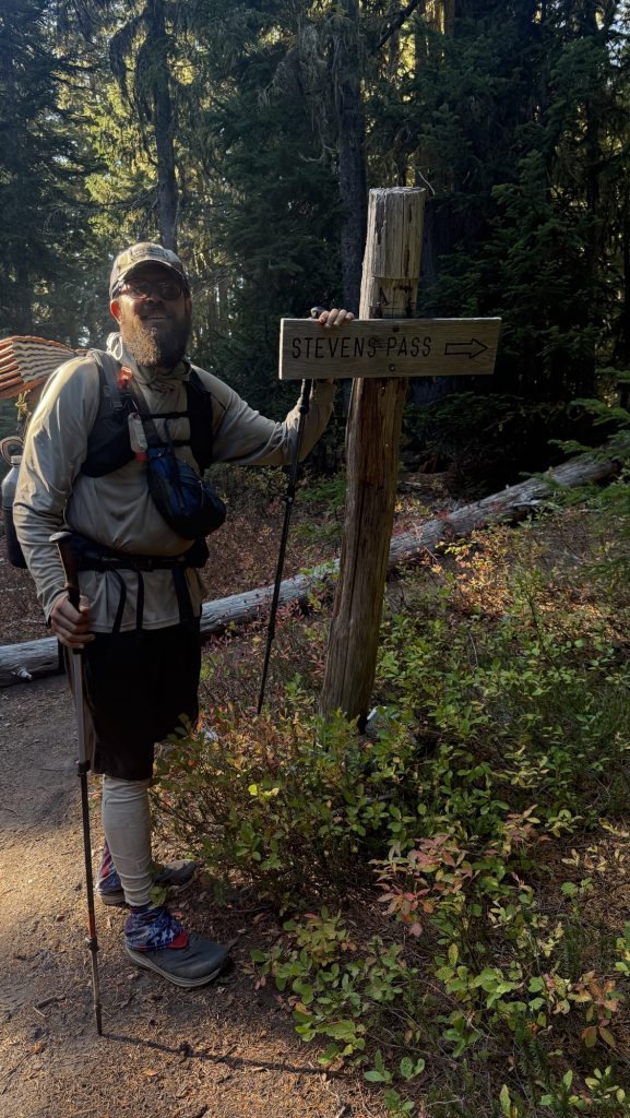
Day 133: Steven’s Pass / Mile 2478.4 (24.15 miles hiked)
We left at 7.10am and had sunshine and blue skies again. This section is gorgeous, many climbs and incredible views of mountain ranges.
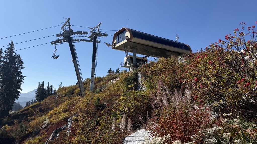
We got to the top of a ski lift and got close to civilization, seeing many day hikers hiking up the other direction on this sunny Saturday.
We got to Steven’s Pass shortly after noon and were delighted the restaurant serving burgers that according to Google was closed, was indeed open. We ordered two cheese burgers and Pepsi, hooked up our electronics to charge and got the resupply box we had sent ourselves.
Food for another 5 days. It is our second last resupply box. We will pick up the last box in Stehekin in 5 days. Crazy.
We had ice cream for dessert and left at 2.15pm to hike 12 more miles, entering Washington Section K, We got to camp just before it got dark, at the end of a 2 mile hill. Our packs were heavy with the 5 days of food and we were tired.
Miles hiked: 24.15
Ascent: 4.759 ft
Descent: 5.478 ft
Steps: 49.466
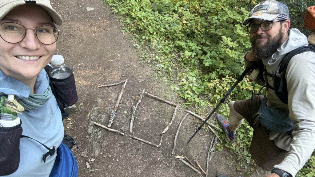
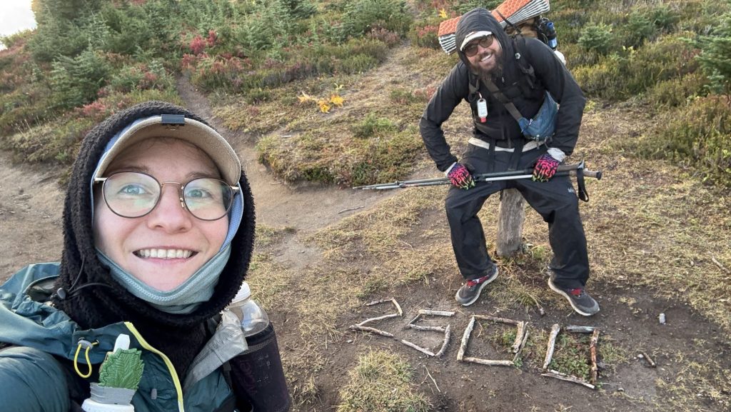
Day 134: 2501.3 (24.03 miles hiked) 2500 miles / 4000 km!!
When we woke up to our alarm at 5.30am, we could hear the rain so we slept a bit longer. We left at 7.40am and it was rainy and very cold for the first 5.5h. We tried not to stop much for water or to take pictures because we were completely wet, despite rain jackets, from climbing and sweating and wet bushes.
It was still raining when lunch time came but luckily we found space to sit between some boulders and threw Ice’s tarp over the top, fixing it with some rocks. We were still cold with our puffies so we kept hiking soon.
We started an audiobook to get us through the cold: about ranger Randy Morgenson in Sequoia & Kings Canyon National Park, called “the last Season”, which was super interesting. Highly recommend.
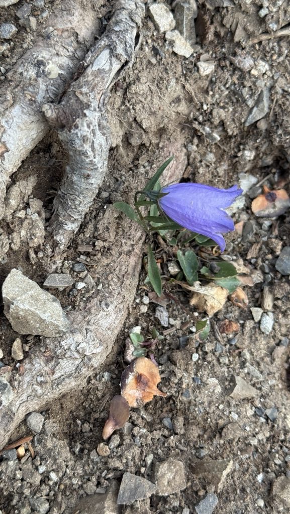
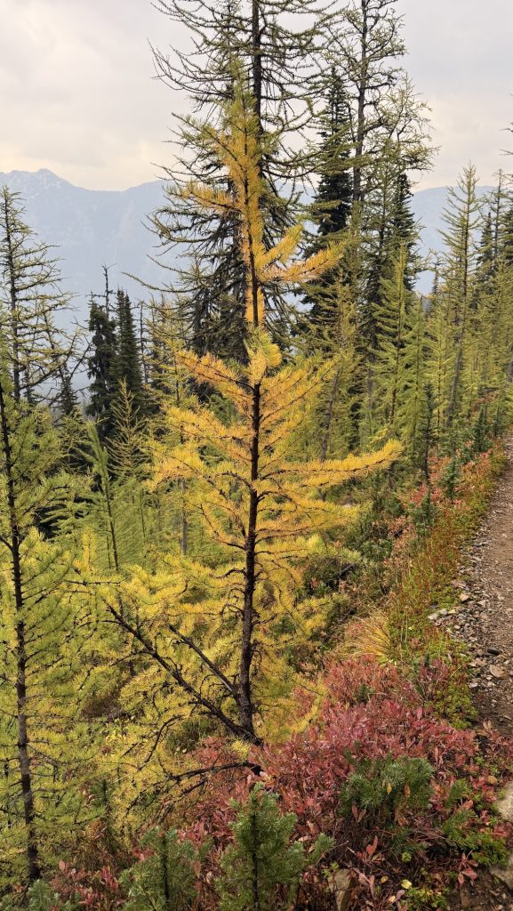
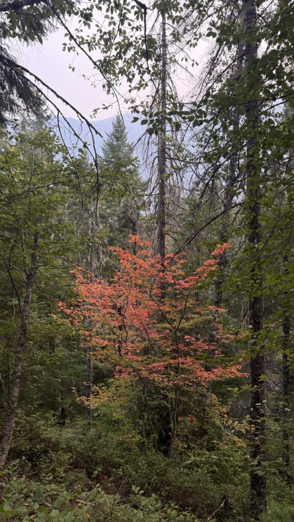
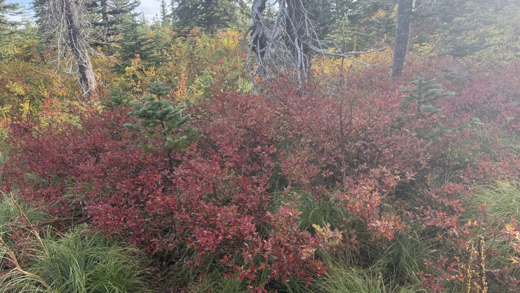
It stopped raining and the next climb warmed us up. The clouds lifted a bit and we could finally see the beautiful landscape with an abundance of red huckleberry bushes and some yellow bushes, rugged mountains and soft rolling green pine covered valleys.
We only saw a few people all day and a few times the sun broke through the mountains, feeling warm on our skin. We hiked till 7.00pm and did more than the 23 miles we have to do, as it took a mile to find a flat spot to camp.
We found a beautiful meadow to camp in. Two French PCT hikers we have been seeing for hundreds of miles came while we were eating and set up next to us.
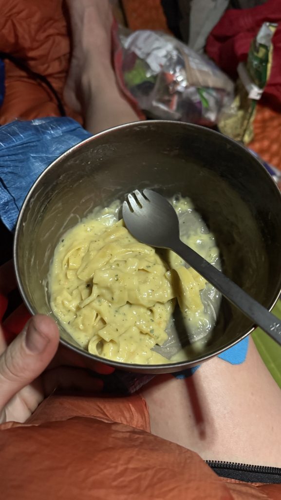
Today is our 3 month anniversary but with the rain this morning we both forgot. We celebrated in our little red home this evening with a simple but cozy dinner. Time flies!
The stars were clear and bright, the wind howling and rattling on our tent, we finally in dry clothes and our warm sleeping bags, slurping hot ramen soup with bear creek, passing out at 9pm. Another day done. Good. Not many left. Scary.
Miles hiked: 24.03
Ascent: 5393 ft
Descent: 5429 ft
Steps: 52.775 (usually what I do in 5-7 days)
Thanks for reading along! Only 155 miles to go – will we make it?
As always, let me know in the comments what you’d like to see and read about or if the post sparked any thoughts in you. I love hearing from you.
Happy trails,
Disco

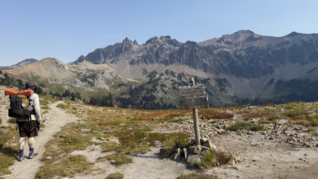
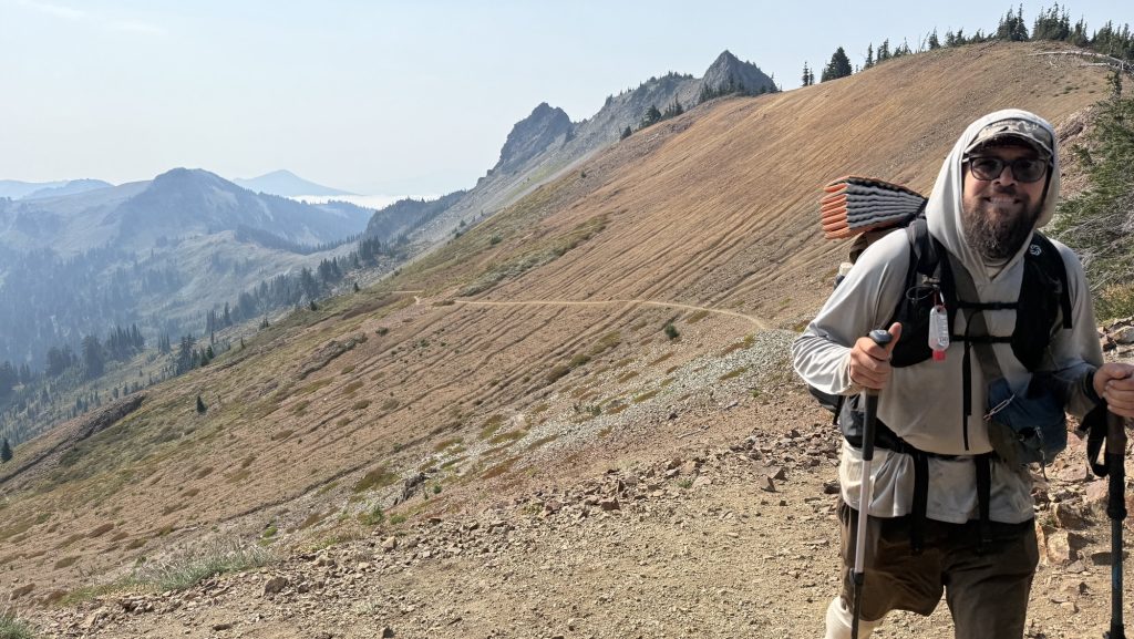
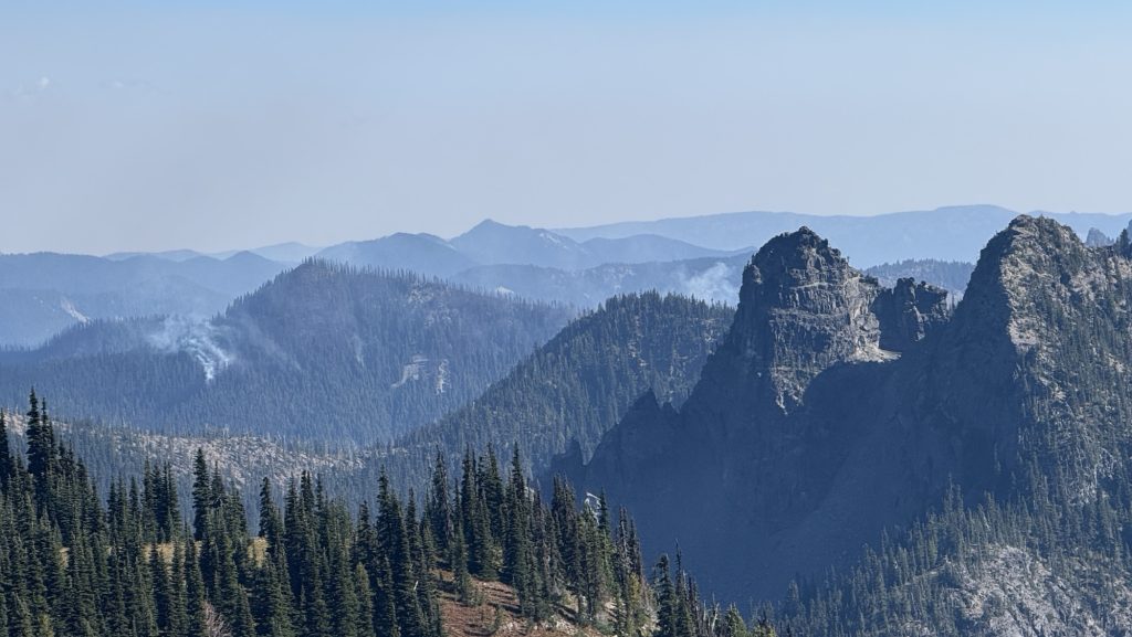
Days 119 – 129: Miles 2150.3 – 2396.3 / Cascade Locks to Snoqualmie Pass
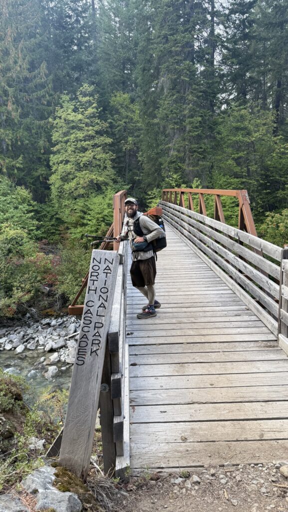
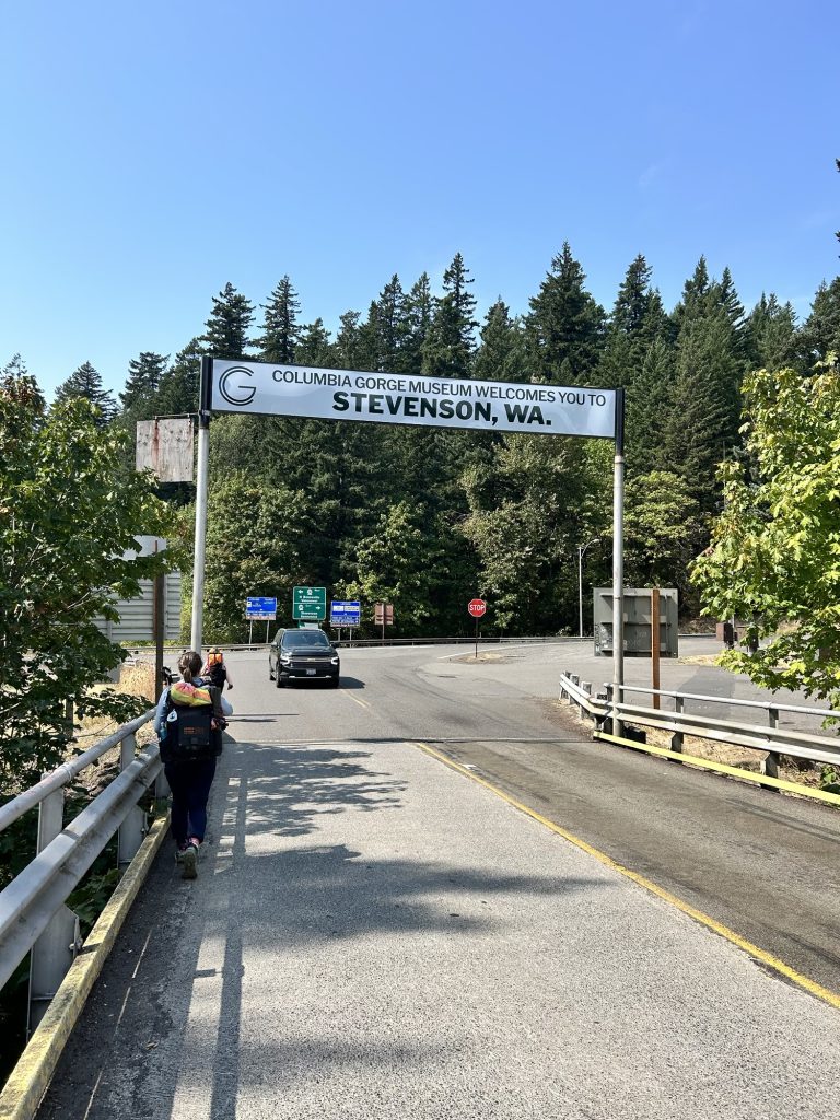
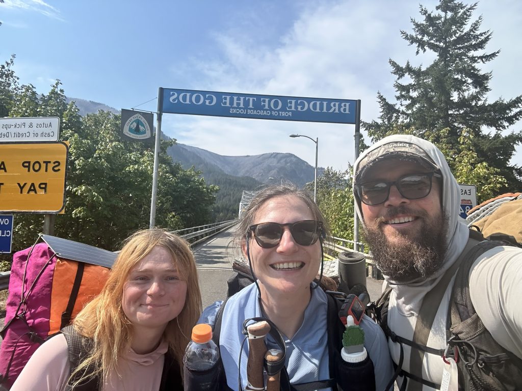
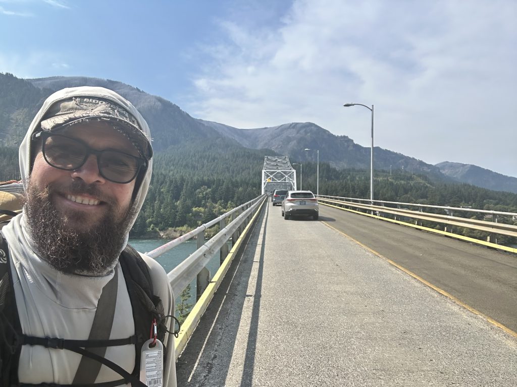
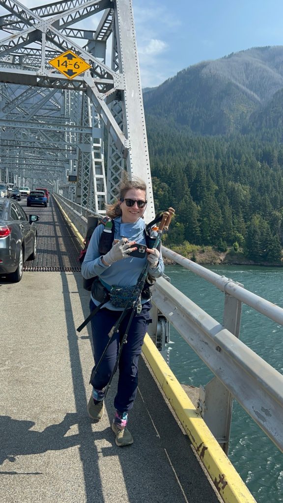
Day 119: 2164.3 (15.19) / Entering Washington State!!!
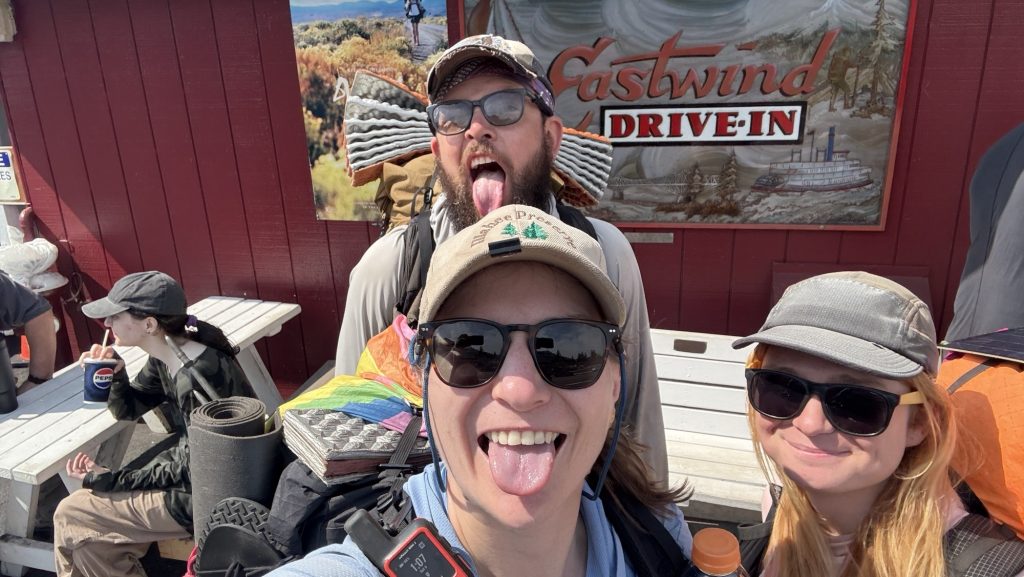
We slept till 9am, had left over pasta for breakfast and went grocery shopping for some last things. Checked out at 12.00 and met Kate for lunch across the street where we had burgers, like the day before. Had a great lunch and started hiking around 1.30pm.
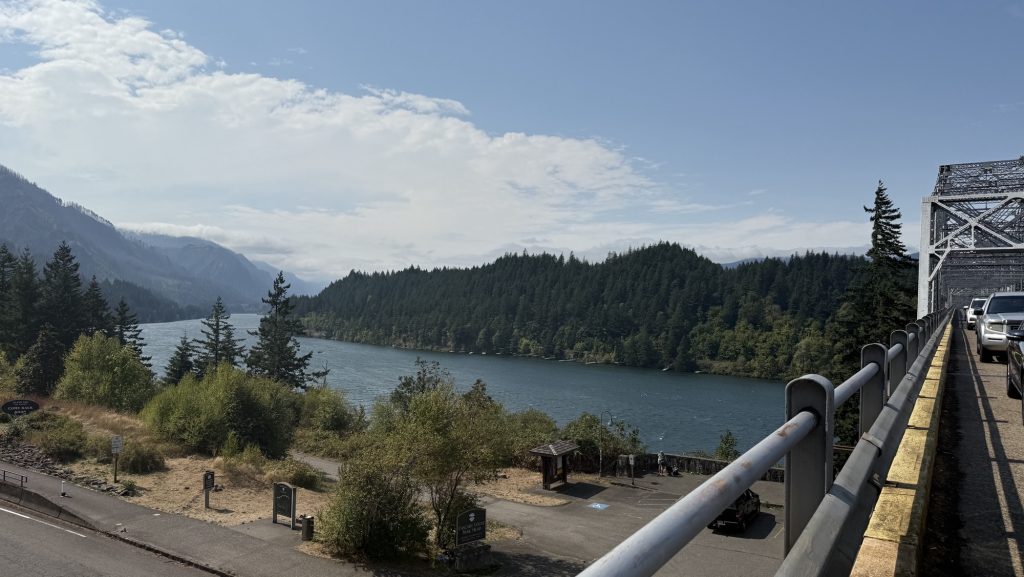
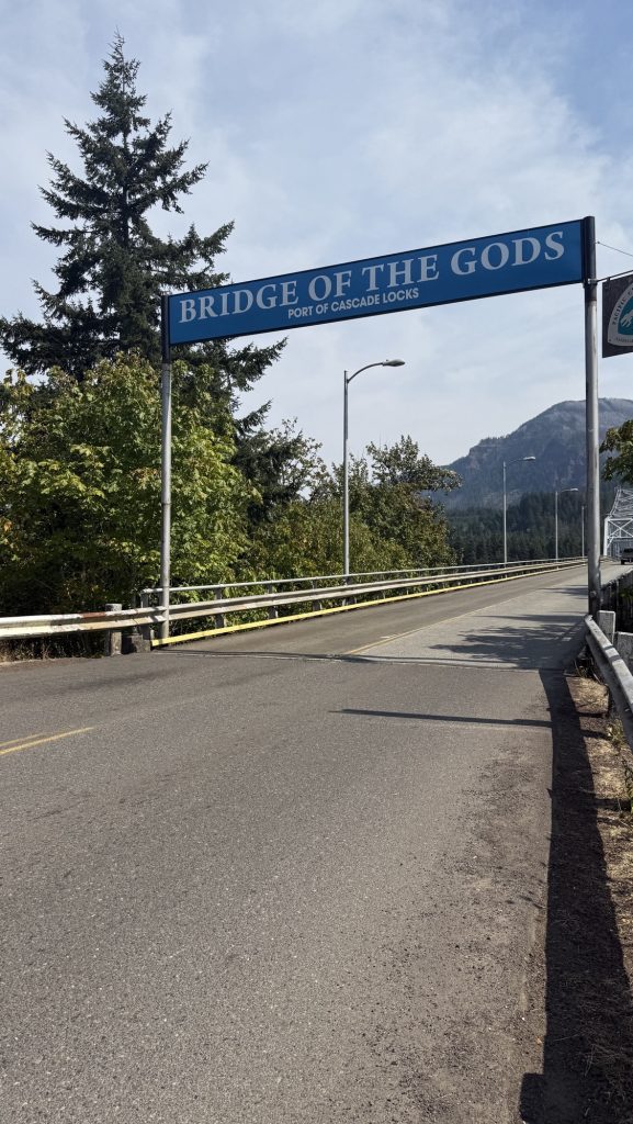
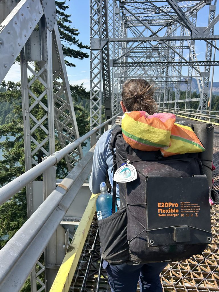
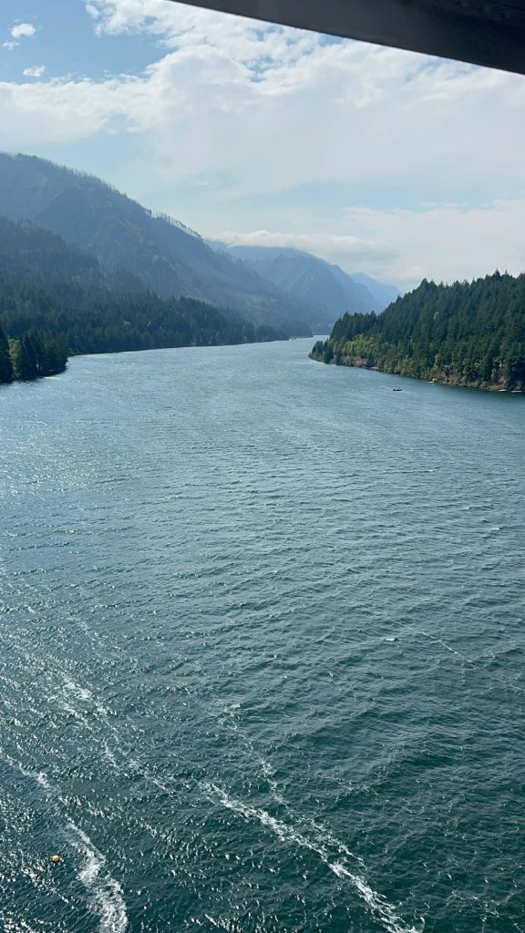
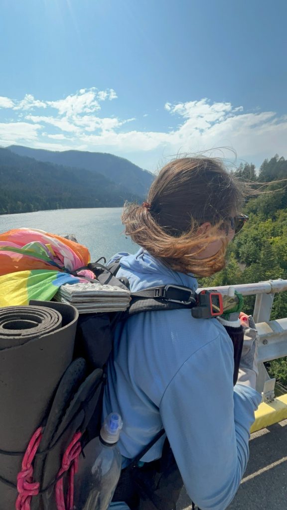
Walking across the bridge of the gods was emotional for me, and I cried. There was so much going on: cars, no sidewalk, crossing into my home state, being so close to the end, in the last of the three PCT states and the locals in their cars either congratulated us or welcomed us to Washington. It was a really special moment.
Then we hiked up 3500 feet and did about 15 miles to dry camp just as it was getting dark.
We camped 0.6 of Kate because we didn’t make it any further before dark.
Miles hiked: 15.19
Ascent: 4455 ft
Steps: 32.389
Day 120: 2190.2 Half way up first big climb in WA (26 miles)
Alarm rang at 5.15am as it had been the last few weeks. We were both tired. We made coffee in the tent as usual but also had breakfast in the tent because it was raining. We had blueberry donuts to get more calories and as we had dry camped, we didn’t have enough water for our usual breakfast – granola with nuts and dried fruit and peanut butter powder.
We started hiking at 6.50am. Our goal for today is to hike as much as possible but at least 24 miles. That’s the average we’ll have to hike for the next 22 days to make it to Canada in time of our deadline end of September. It will be tough because Washington has some of the toughest sections since the high sierra, like section K.
We passed Kate’s tent after 0.6 miles and tried not to wake her. We hiked 5 miles to the next water source.
The morning was gloomy and wet. At the first water source, we met our Japanese friend Bubbles again. We sat down to eat breakfast, make coffee and filter water. Shortly after, Kate showed up and sat down as well. It was a fun round. We hiked out with Kate but she was gone after less than a minute.
We hiked till two to reach the next water source as it was supposed to have a pic nic bench. When we got there, no bench was to be found and we sat on the ground again. Bubbles showed up and we had a nice lunch break together. We talked about Japan, our love for beer and food and the PCT. At this point, it had stopped drizzling and the sun came through the trees occasionally.

Around 5pm we made it to the last watersource for today and filtered another 6l, 3 per person. That’s as much as we can carry without the pack getting too heavy. The next water source is not for 11 miles and we’re camping half way before that. And 10 miles are uphill 1500 ft. Phew. Even just doing half at the ends of a 26 mile day is tough. But we made it. And we did even more than we had to. When we got to the place we wanted to camp at, there was a tent and we thought we might have to hike on. I recognized Kate’s tent and as she heard us, opened her fly and we joyfully greeted each other. She pointed us to another camp side close by and we pitched our tent and met her afterwards to have dinner together. And then Bubbles showed up and after a little introspection decided to stay and the third and last campsite and joined us as well. We hung out and ate and retreated to our tents around 8.30pm as it was getting quite cold. A super fun, but tough day filled with many laughs and joyful social interactions.
26 miles hiked
Ascent: 5312.3 ft
Descent: 5608.9 ft
Steps: 53307
Day 121: 2215.1 (24.8)
Alarm at 5.30am, Ice did not want to wake up. I could hear Bubbles pack up her tent. It was still dark. We made coffee and had pop tarts for breakfast, as we didn’t have enough water for granola again.
We left at 6.50am, Kate was still asleep but she’ll catch up with us in no time. We hiked up the remaining four miles and made it to the top at 8.45am. Beautiful view of Mt Adams, and sunny too, today, which means I might be able to charge my power bank during lunch break. I would need to on this long 7 day stretch without a resupply stop.
Only 1.5 miles downhill to water! We’re hiking through beautiful intact pine forest. The little brush is turning yellow and red. Fall is here! I noticed it last night in the tent as well, it’s getting colder.
My right knee feels ok this morning. I took an ibuprofen last night, for the third time on this trail, the last two times were within the last 7 days. I don’t like taking pain medication because I want to know what my body is trying to tell me. Taking ibuprofen at night is a trick Iceman told me about that his dad sometimes uses and which helps him, so I tried it out.
When we hiked 140 miles in 5 days (4×30+1×20 miles) to reach the Oregon/Washington border / Cascade locks, my knee really started to feel strange, stiff and sometimes painful. I’ve had issues with this right knee before but never this bad. I hyperextended it at the beginning of trail on Mt San Jacinto, maybe I sprained a ligament? Iceman got me a local CBD-arnica rub in Cascade Locks which seems to help.
I was joking last night during dinner I can’t get up from the ground or out of my tent anymore without using my hands to support my knees and that I’m probably just getting old, but my friends said it might be related to hiking 1635 miles / 2616km in the last few months. Maybe a combination of both? We had a good laugh as even Kate, the youngest among our lovely dinner group uses poles or hands to get up these days, she told us.
I just remembered I wanted to share a podcast we recently listened to. Most hikers I’ve seen on the pct listen to something, they wear earbuds of some kind. Some even listen to the radio on a speaker. I prefer not to, because I like to know what’s going on around me, hear birds, falling trees, other hikers or simply the wind. When you hike 12h+ a day, I try to be present and enjoy nature and let my mind wander, almost a walking meditation, taking everything in consciously and stopping to smell the roses. But when you start climbing with 30lbs at 6pm after hiking since 6.30/7am, mile 20, I will listen to a podcast or an audiobook to carry me the last few miles.
Climbing up out of Saeiad Valley, many hikers skipped the PCT and road walked to cut a few miles and lots of elevation at 100 degrees (can’t blame them!), so we had the whole trail to ourselves and it was really beautiful! On that stretch, we started philosophizing about thru-hiking and why it is such a wonderful experience and why so many people put themselves through this self inflicted torture. Our main conclusion was that walking all day, being outside, scarcity of food and water, feeling the elements, doing physically hard things and having no cellphone, social media or other constant consumables is how humans lived for a long time and so evolutionary, this is deeply engrained in our genes and collective history as a species. It was fun drawing parallels between hunter & gatherers and ourselves, e.g. camp fires giving us more than warmth and a hot meal. They also give you a calm and peacefulness, probably because subconsciously we know that fire keeps wild animals away.
Now coming to the podcast: a week after that conversation, we listened to my favorite podcaster, Andrew Huberman, the Huberman Lab, “How to grow from doing hard things”. Just what I needed to hear as things are getting harder and confirming some of our own amateur hypotheses why thru-hiking is a good thing despite being so close to torture. Have a listen, it’s super interesting (Just click on the link above). Let me know what you think in the comments or if you have recommendations for similar podcasts.
We got to camp at 7.10 as it was getting dark slowly,
Miles hiked: 24.8
Ascent: 4714.6 ft
Descent: 2627 ft
Steps: 54.321
So far, we are +3 miles ahead of schedule.
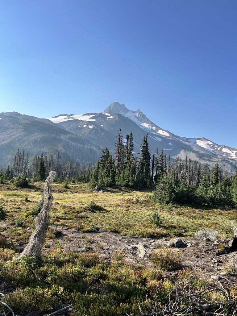
Day 122: 2242.2 Mt Adams Wilderness (27.2)
We left at 7.48am. Quite late. Mainly because I turned off my 5.30am alarm. It was quite cold, 9 degrees C. I started hiking with my rain jacket. My fingers were freezing. My warm gloves were at the bottom of my pack so my fingerless hiking gloves had to do.
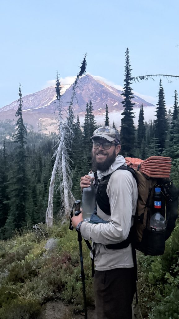
Had lunch at 12.52pm at Trout Lake Creek. Running low on pepperoni. So the second tortilla was cheese only. But I like this Monterrey Jack cheese. Even without pepper (the store didn’t sell it).
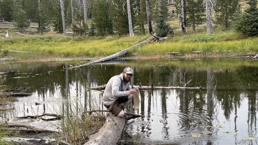
It’s been a beautiful 12 mile hike through the forest so far with lots of water, mostly downhill. We’ll be climbing the next 12 miles and dry camp. Again. We took way too much water last night, so ended up dumping some this morning which was painful when you carried it all the way up.
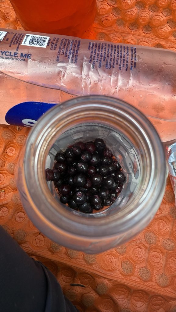
When we got to the last water source half way up the climb, it was dry. Oh no! We overlooked the comments. It dried a week ago. Damn. We had to hike 3 more miles to the next water source, a lake, so we could drink and eat dinner and breakfast. It would be dark by the time we got there. Night hiking isn’t our favorite. It’s dangerous as you might trip on rocky terrain and headlamps might die. It’s pitch black in wilderness with little light pollution. Great to look at the stars but not to hike. Before we hiked on, we collected huckle berries. They’re so delicious and everywhere!
We found a site and got water, filtered it, made dinner and by the time we were done with all chores it was 10pm and we quickly passed out.
Miles hiked: 27.2
Ascent: 4706 ft
Descent: 3827 ft
Steps: 54.758
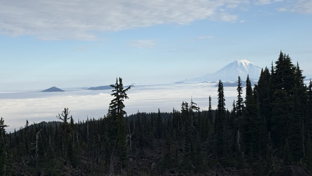
Day 123: 2263.9 (22.2) / Less than 400 miles to go
Today we left at 7am but I was tired and so was Ice, so we only did 22 miles. When we got to camp, I was super tired and cold. And then 3 kids showed up and set up all around us and yelled over our tent, didn’t say hi and even after we said “Good night”, kept yelling. Nothing a little angry german “Would you mind!? …” can’t fix. They were great after that.
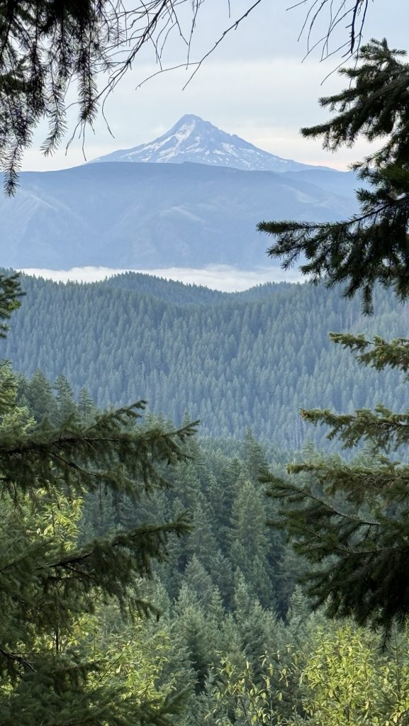
The good news is, Brett is picking us up Friday and giving us a ride around the Wildcat fire closure, which is 26 miles, which means we can do a zero or two neros at some point. Wohooo
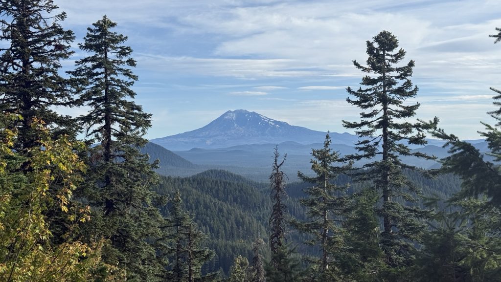
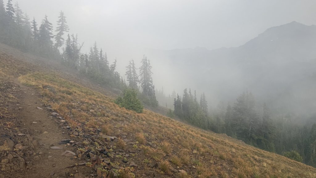
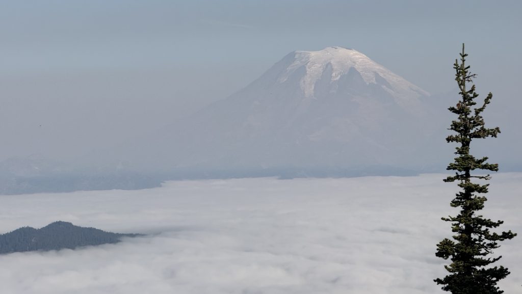
It was mostly forest, wet with occasionally exceptional views of Mt St Helen’s (We think) and the glacier at Mt Adams. We were above the clouds and only a few peaks broke through the clouds, it was wonderful.
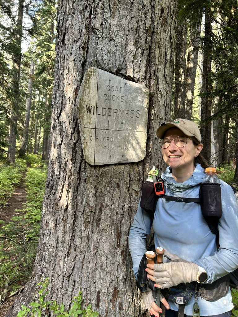
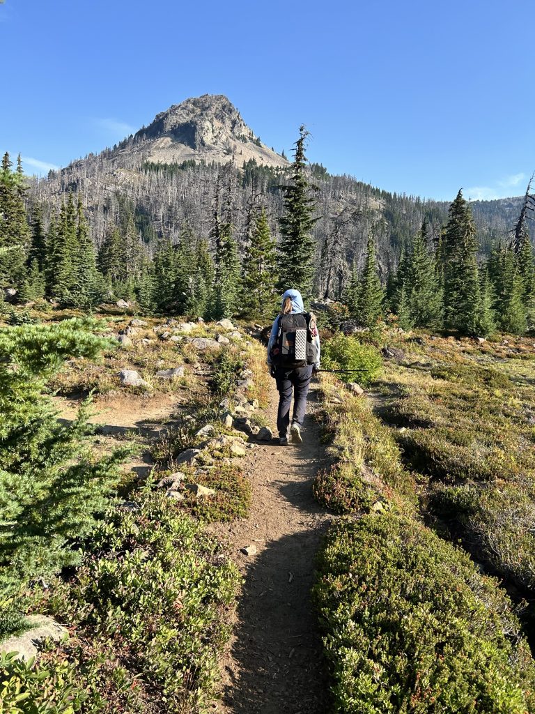
In the afternoon, we left Mt Adams Wilderness and entered Goat Rocks Wilderness. I’ve been looking forward to this for a long time, it’s dissed to be incredibly beautiful. And tomorrow, we’ll do knives edge, and 5500 ft of ascent. Phew.
Other than that, I had a mentally hard day today: I wasn’t enjoying the hiking anymore, it’s no fun I said, everything hurts, we’re on such a tight deadline and all we do is hike all day, little breaks, and at camp only chores. My Garmin watch doesn’t sync my activities, my Garmin Inreach doesn’t live track, all other devices are dead or almost as there hasn’t been enough sun in Washington to use my solar panel to charge all devices. And it’s true. It’s become a battle against time and it’s hard. But it’s not supposed to be easy. And hard days are part of it. I’m not going to quit. We have less than 400 miles to go! Many people are using the fire closure to skip up 100 miles to Snoqualmie. But we won’t. Only official closures can be skipped in our book. And for family emergency. hike your own hike, they say. One day at a time, one step at a time always north towards Canada. Tomorrow is a new day.
Miles hiked: 22.2
Ascent: 2668 ft
Descent: 3267 ft
Steps: 46.222
(To my Garmin watch, this is a “recovery” activity 🤣 and my V02 has been going down…)
Day 124: (24.23) Knife’s Edge
We left at 7am, I didn’t sleep too well, woke up a few times last night. Took a sleeping pill art 11pm to finally fall asleep.
Hiked through forest for 8 miles, then went up the first climb of 1000 feet and had incredible views all around. We got up to Cispus Pass and then climbed down and had lunch at a beautiful little waterfall, covered in moss on both sides.
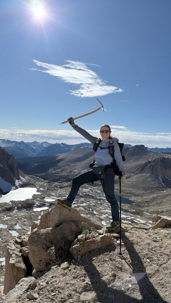
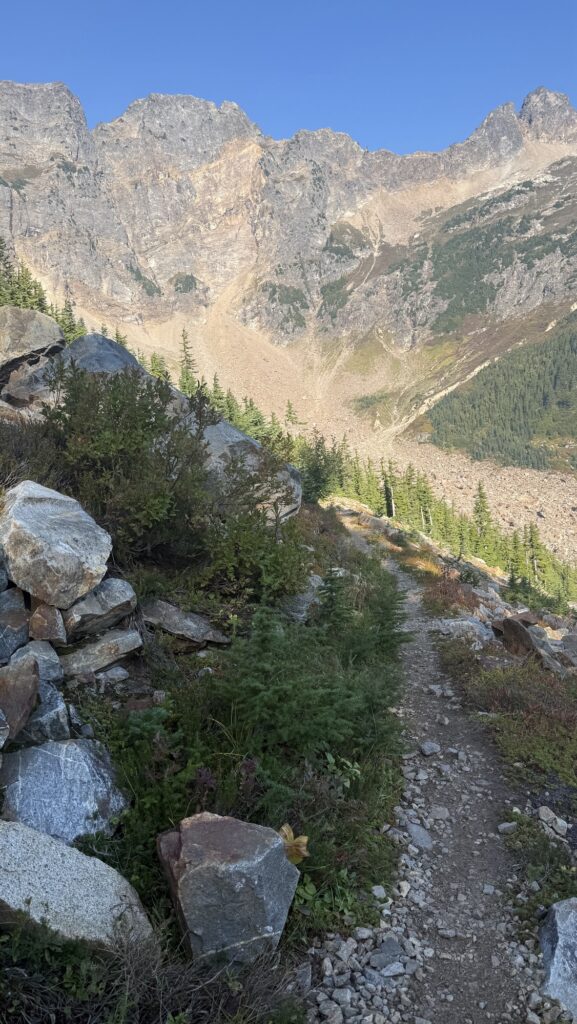
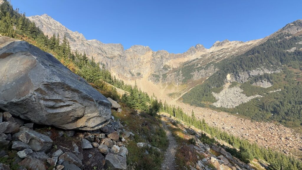
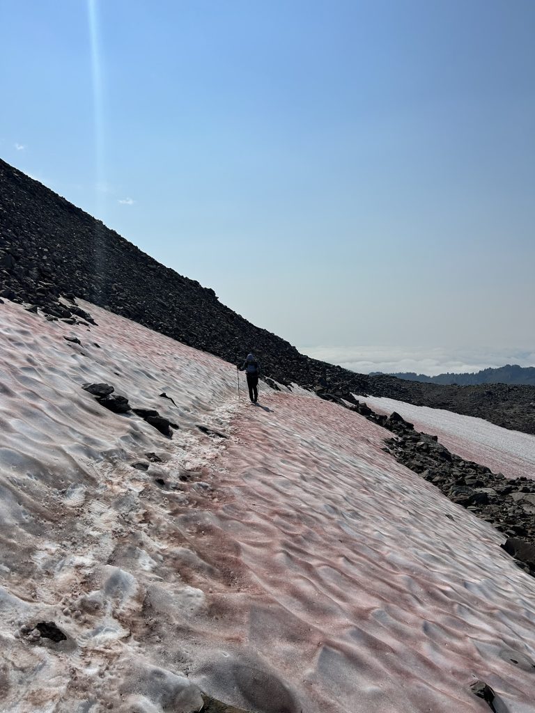
Then we went down some more and then climbed around the mountains and behind and up again. We were in a really beautiful rocky terrain. Then we had to traverse some snow – for the first time since the Sierra Nevada – and got up the third climb to Knife’s Edge. The ridge walk was incredible, clouds were moving over the ridge several times, it was really beautiful. Probably one of the prettiest days since the Sierra.
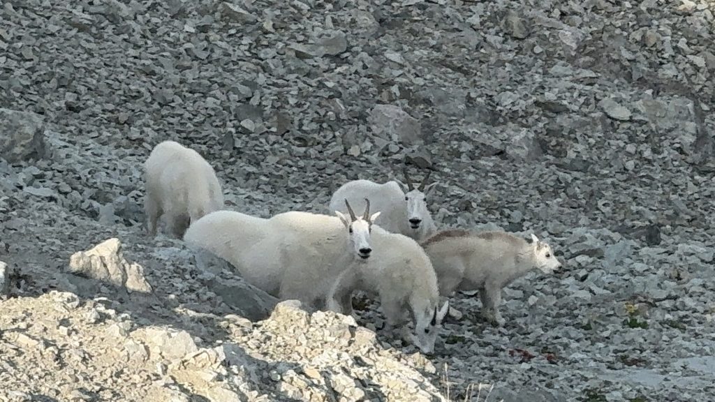
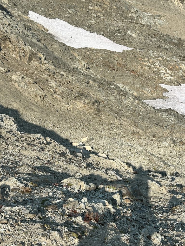
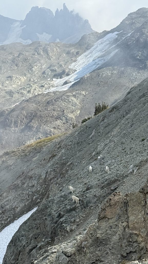
We sat down and had a pop tart. Then we saw the mountain goats climb up!! We’re in Goats Rock Wilderness so it checks out. When we continued hiking, they were right there on the other side of trail and we stopped and watched them for 15 minutes, it was a herd of 12, with two little ones and several big goat men with horns. They were so beautiful.
Then we hiked down and it started raining. We got really wet. We hiked till 7pm and set up in the forest next to a pond. It was wet and cool. Dry clothes, sleeping bag and warm food helps.
Tomorrow, we’re meeting Brett, and he picked up a few things like socks, power bank, fanny pack and fuel at REI in Olympia for us! We’re meeting him at Kracker Barrel. Super excited, and then driving 1.5h around the closure to chinook Pass. Today was awesome! Stoked for tomorrow.
Miles hiked: 24.23
Ascent: 4611 ft
Descent: 4872 ft
Steps: 50.743
Day 125: 2298.3 (10.77) Meeting Brett at white Pass Kracker Barrel
Hiked 10 miles and had some incredible views.
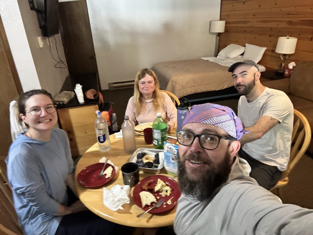
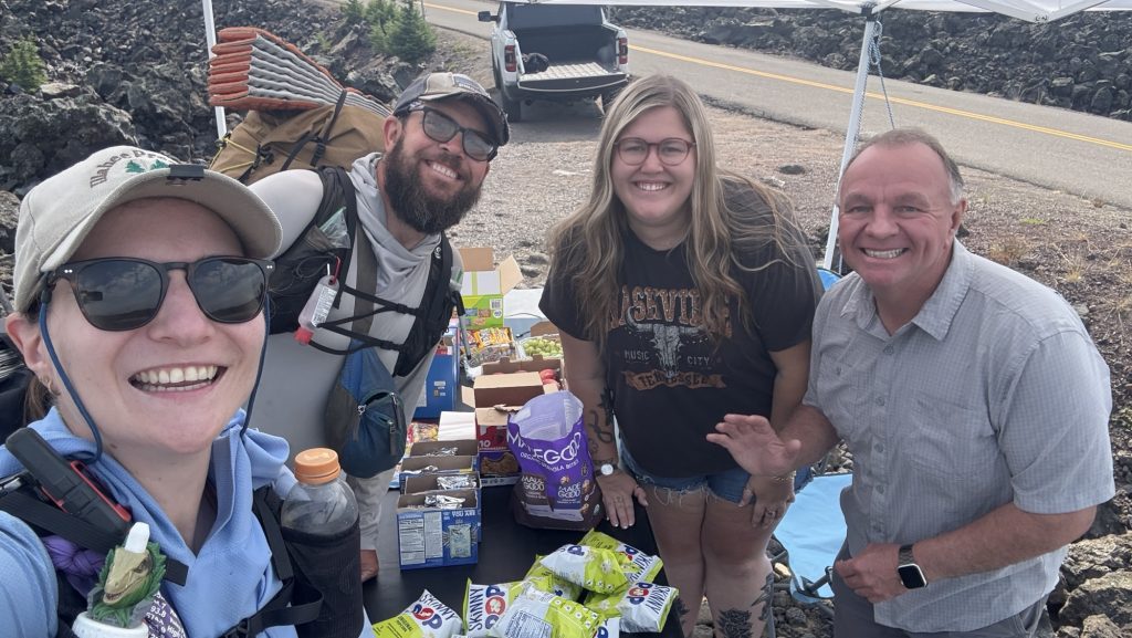
Around 11am, we met my friend Brett at Kracker Barrel. Wohooo, I had not seen him for a year. Also met Kate here again. We got a slice of pizza and our packages and went to Packwood. My friend Lisa sent a huge resupply package so we didn’t have to get any resupply. And ask the good stuff, too. Thank you so much, Lisa! 🙏
Originally we were going to drive around the fire closure today but spontaneously decided to stay the night in Packwood, 20 miles west of the PCT. We got a hotel room with full kitchen, went to a few breweries in town and later cooked dinner. Super fun!
Miles hiked: 10.77
Ascent: 1893 ft
Descent: 2326 ft
Steps: 28.595
126: Drive to Chinook Pass due to Wildcat fire closure (26 miles of PCT closed) 2337.3 (10.7)
We had bacon and egg breakfast and then drove over 2 ours to Chinook Pass to get around the closed section of the PCT.

We hiked almost 11 miles before it got to dark to hike.
Miles hiked: 10.7
Ascent: 2295 ft
Descent: 1531 ft
Steps: 22.882
Day 127: 2362.6 (26.33) /Pack Goats
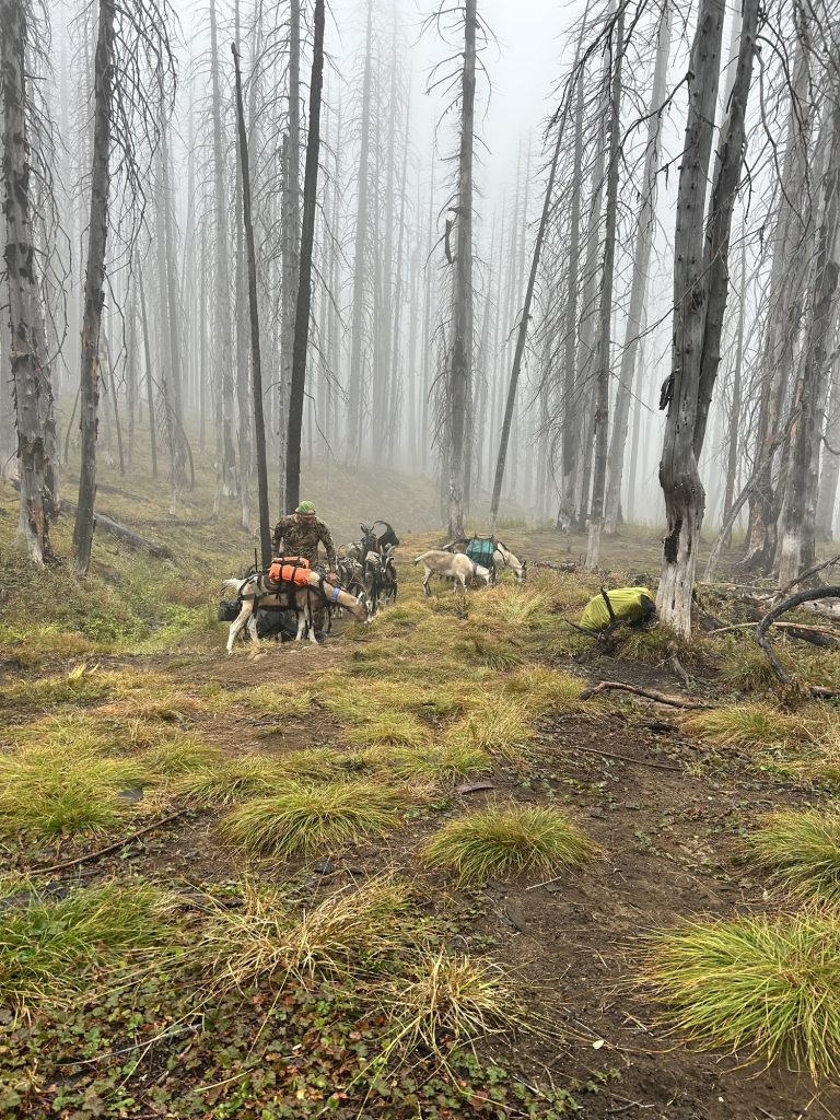
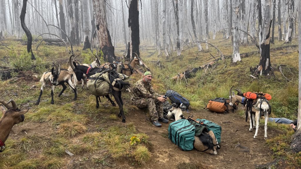
Left at 7.20am, it was rainy and cold and we were in the clouds. At 11.00am, we got to a water source were two hunters with their 9 pack goats showed up and we had a little chat.
5.5 miles further north is the Mike Zurich Cabin where we had lunch. A dry space, but with recent noro virus cases so we were careful not to touch anything.
Then we hiked on in the rain and later had some sun. We got to another burn zone and ate lots of huckleberries and took some to go.
We didn’t find a campsite till 8.00pm and when we finally got to a listed one, there was a person there and all fly spots were gone and later another guy showed up. It was really cold and the site was slanted. Maybe less huckleberry picking tomorrow.
Miles hiked: 26.33
Ascent: 3654 ft
Descent: 4957 ft
Steps: 54334
Day 128: 2387.5 (25.8) Mirror Lake
Left at 7.30am, before chatted with Sweeping Beauty, 66, and Data, whom we were camped next to. It was quite cold and wet but not rainy.
Stopped at water 4 miles from camp and had service first time in days so hung out 30 min. Got cold sitting too long.
Hiked 15 min and saw a car at a dirt road crossing and I jokingly said to Ice “trail magic” but then proceeded to say “good morning” to the gentleman who was just getting out of his car. And then I saw the tables and chairs and he said it – trail magic. Yes!!Matador, the gentleman and retired army officer we later learned, 72 years young, had hiked the PCT and AT after he turned 70. Now he does trail magic. He had the best filled donuts from a local bakery, Ice and I each had two and a coke and chatted wit Matador for half an hour, about how when he was in Berlin in the 80s he ran into Russian officers and many more stories. It was great meeting him and the sugar fueled the biggest climb of the day we were just about to start. I was flying up the hill!
On the way down, I had service and looked something up while walking and slipped. My left foot slipped forward, and my right leg collapsed onto my bad knee and I was stuck unable to move because of pain for a few seconds. It hurt but nothing worse happened. 🤞
We had lunch at a water source and the sun finally had come out so we could dry our tent.
We hiked till almost 8pm again because the Twilight Lake we were going to stay at was hard to get water from and had no good camp sites. We hiked 1 mile up the trail to Mirror Lake and found a flat site and there were no other people close by.
It is past 10pm which is late and I’m tired. But I’m also stoked because we’re less than 10 miles from Snoqualmie Pass tonite, which means town food tomorrow for an early lunch!
Miles hiked: 25.8
Ascent: 5286 ft
Descent: 6033 ft
Steps: 58723
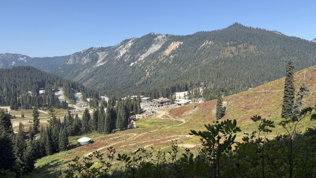
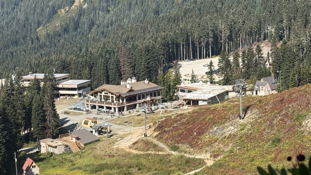
129: Snoqualmie Pass 2396.3 (9.07)
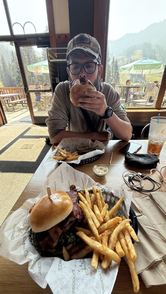
I turned off my alarm again and woke up at 6.20am. We hiked up a bit and then mostly down to Snoqualmie Pass. We got there around 12.00 and headed for the grocery store with Pizza bakery. We got a large Pizza (21”) and large Greek salad – half of the pizza to pack out for dinner. Both were really good – shout out to Pie for the People NW.
While eating lunch, Iceman complained about his big toe joint. My right knee has been hurting and so we spontaneously decided to stay for the night and not hike another 15 miles. This way, rest might cure our most likely overuse injuries and we calculated that we still can get to the border by September 29th is we do on average 23 miles. We’ve been doing a few more miles the last few days so the average went down despite taking a Nero today. Less than two weeks to go.
Miles hiked: 9.07
Ascent: 1164 ft
Descent: 2372 ft
Steps: 15.770
Thanks for reading! And please let me know in the comments what part of trail life you’re interested in or if you have any questions or feedback. I always love hearing from you.
Happy trails,
Disco
- How to physically and mentally prep for the PCT?
- 2.5-week Taiwan Itinerary – Whole Island
- Days 138 – 142: Canada!! (2575.1 – 2655.5 + 30)
- Days 135 – 137: PCT Miles 2500.73 – 2575.1
- Days 130 – 134: Snoqualmie to mile 2501.3 (2396.3 – 2501.3)
Days 105 – 118: 1912 – 2150 / End of Oregon
Day 105: Bingham Lakes (18.9 Miles)
We started hiking at 9.30am. We were tired. Haven’t done a zero since Ashland.
We took alternate route to cut 10 miles and some elevation to Shelter Cove. We will reach it tomorrow, 15 miles instead of 25.
I am very tired and will go to bed now (8:44pm)
Stats
Distance: 18.9 miles
Steps: 39.799
Ascent: 2124 ft
Descent: 2621 ft
Day 106: Shelter Cove & Lower Rosary Lake mile 1912.2 (21.94)
Breakfast at 7.30am by a beautiful lake. It’s completely quiet except for birds and the noises we make.
Granola and trail mix and coffee. 15 miles to Shelter Cove Resort where we can shower and eat a burger.
We haven’t had a day off in a while so we’re both feeling tired. Won’t have a bed for another 5 days till we reach the city of Bend.
We hiked through forest all day and it rained a little bit for the first time in a long time.
We made it by 2.30pm and had a burger – the burger was really good.

We took a shower and bought two dinners for trail and some snacks.
We ran into Fruit Loop and she told us Roadrash skipped to Washington. She also said Kate is ahead of us. We must catch her haha we thought she’s behind us!
We hiked out until it was almost dark and camped at Lower Rosary lake.
Miles hiked: 21.94
Steps: 49.985
Ascent: 2247 ft
Descent: 2020 ft
Day 107: 1912.2 Lower Rosary Lake to Jezebel Lake 1935.8 (longest day yet: 24.06 miles)
We left at 8.15am and hiked 7 miles to water. We continued hiking through beautiful forests.
We saw carpenter ants eating through a dead tree and throwing out sawdust (took a video) in a very efficient way. Nature is showing us fascinating things every single day!
Had lunch on some rocks – after finishing our “climb” for today. We have to ration lunch food a bit because we have a lot of snacks but only 6 tortillas and 5 chicken packets for 3 days – we would need 12 tortillas and 12 chicken packets. We have trail mix, and beef jerky to supplement with so it ll be fine.
Just as we were talking about rationing food, these beautiful colorful signs started showing up every 10 m. We thought we were hallucinating but it was real! trail Magic!!
Stats:
Miles hiked: 24.06
Ascent: 2929 ft
Descent: 2834 ft
Day 108: 1955.5 Elk Lake Resort (22.28 miles)
Alarm went off at 6am, we hiked out at 7.11am. I actually left without iceman for the first time because I was ready to go and the moskitos were so bad. We met at the next water.
It was hard today and we both felt sluggish. Time and miles weren’t passing. We talked a lot and eventually it started raining really hard and we got totally wet. But it was so much fun!! We jumped in the puddles and walked right through them, with water up to our ankles as the trail turned into a river. A kid again at last! We became a trail maintenance crew and wherever pine needles and other debris clogged up the flow of water we’d use both of our poles, dug them into the ground forcefully and destroyed the dams to build little canals for the water to flow off trail.
We did this as many times as necessary; until the water gained momentum and carried the remaining debris off trail. Sometimes raging rivers would form as the huge and deep puddles on trail were finally liberated to flow off trail down the hill. This activity slowed us down immensely but we didn’t care, it took a few hours, we were having the best time. Iceman was in front of me and kept looking back, shaking his head and laughing but eventually he joined in and we broke down dams together.
We got to Elk lake Resort around 5pm and everything hurt. We haven’t had a zero since Ashland- 10 days or so? We’re looking forward to reaching Bend in 1.5 days – 29 miles.
We had a good pizza there and some drinks and got back on trail – 1.8 miles back to the PCT.
We found camp just when the sun was setting at 7.57pm. Right next to the trail. But for free (not 20$/person like at Elk Lake Resort) and not 1.8 miles from trail but on trail! Yay!
21:15pm – exhausted but happy
Miles hiked: 22.25 miles
Steps: 46.523
Ascent: 2063 ft
Descent: 2683 ft
Day 109: Minnie Scott Spring 1977.7 (22.4 miles)
Left at 9.15am – took it slow. We hiked through beautiful forests and met “Grey Salamandar” – a section hiker – a few times who shared his snacks with us.
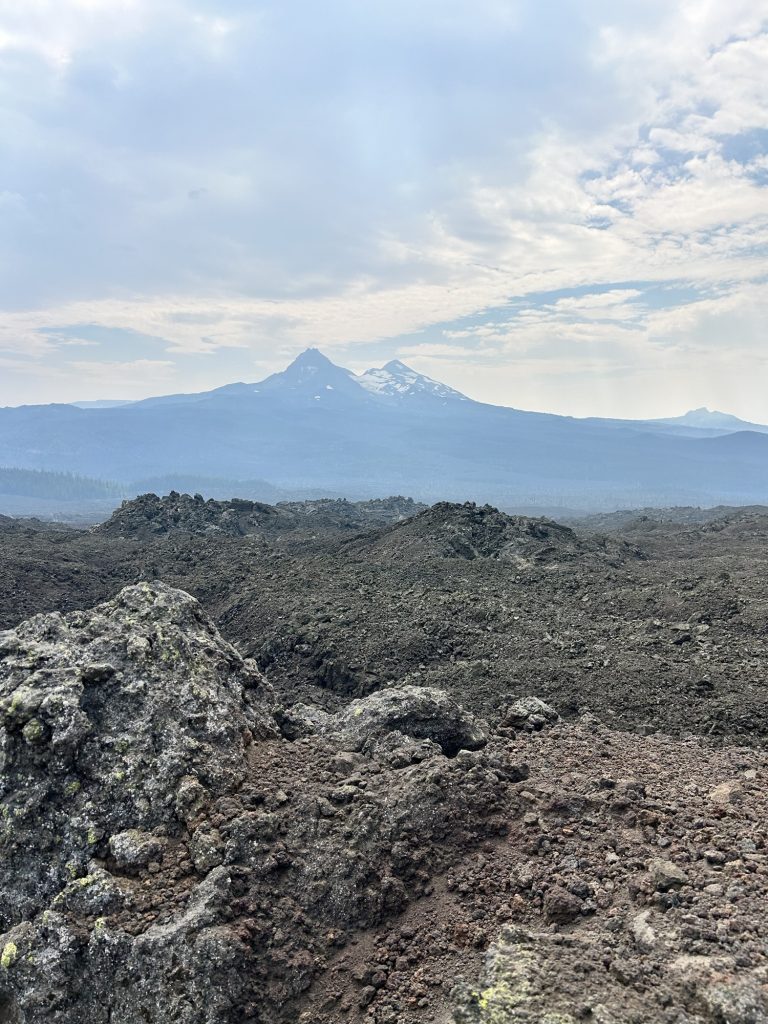
We had late lunch at 13.30 and after that hiked along the Three Sisters the rest of the day. It was rough on the feet – lots of volcanic rocks but really beautiful. We hiked into the evening and had the most amazing sunset.
Miles hiked: 22.4
Steps: 47.496
Ascent: 4014 ft
Descent: 2786 ft
Day 110: 1985.3 Bend! (7.5 miles)
Got up at 6am, left at 7am. It was really smoky. We hiked 7.5 miles through beautiful volcanic rocks and got to McKenzie Pass/Dee Wright Observatory at 11.00am.
A nice lady called Katie gave us a ride to Sisters and en route offered to bring us all the way to Bend.
We got to the hotel at 1pm. Iceman’s parents had booked a really nice hotel for us so we were in for a treat: right in downtown with a hot tub and pool
We took a shower and went to the post office and wallmart, to resupply for Washington, we bought 4 weeks of food so filled both our empty backpacks with food.
Day 111: Zero in Bend!
We sent our packages and then met Kate for lunch! it was so good catching up with her. We hadn’t seen her since Kennedy Meadows South as well, over 1200 miles ago but we kept in touch and almost saw each other almost, like in Ashland when she hitched a ride to the hotel with the lady that dropped us of at trail 5 min before.
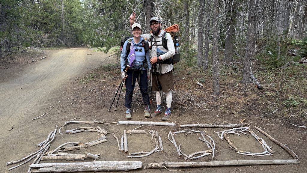
Day 112: 2012.5 27 Miles out of Bend & 2000 miles marker (longest day yet)
We got up at 7am, packed and had breakfast at the hotel. We arranged a ride to McKenzie pass with trail angels Angelique and Adrian at 10.15 from Thump coffee downtown Bend. Kate met us there. We dropped her at Sisters where she planned to hitch a ride to Santiam pass, 17 miles up trail.
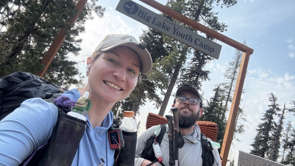
We got to the trailhead around 11.00 and there was trail Magic by Tracy and Caroline. We had a soda and a quick chat and hiked off, 11.30ish.
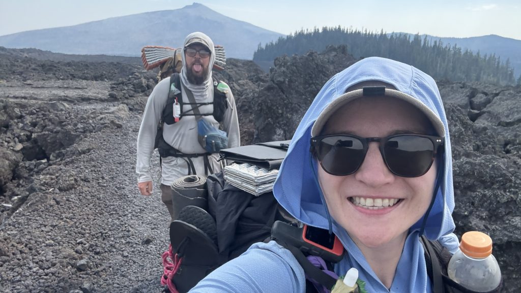
We hiked through burn areas and beautiful scenery and felt strong. Our goal was to hike 30 miles but with such a late start that meant hiking until 11.00pm. We had a warm lunch at the Big Lake Youth Camp, which has a great PCT building with an electric cattle, and I made 4 tortillas with cheese and pepperoni for dinner.
Shortly after leaving BLYC, we passed the 2000 mile marker. Wohoooo

We hiked till it was dark and some more. We ate the tortillas while hiking around 9.00pm and stopped hiking at a lake around 10.30pm at mile 2012.5.
Stats
Miles hiked: 27.01
Steps: 57.945 phew
Ascent: 3812 ft (lots of elevation for such a long day)
Descent: 3667 ft
Day 113: Mile 2031.7 (19.38)
We left at 8.15am and hiked through beautiful sceneries.
Got to Shae Lake at 14.45 with Great views of Mt Jefferson. It’s a beautiful pointy mountain, listening to Player of Games, a sci fi book.
We got to camp at 6.30pm, a bit early, as all campsites the next 10 miles are in dead fall zones, so we decided to camp here. Because we were also tired from the previous 27-mile day.
Stats
Miles hiked: 19.38
Steps: 40.333
Ascent: 2785 ft
Descent: 3369 ft
Day 114: 2061.4 First 30 mile day (29.81)
We hiked through Mt Jefferson Wilderness area which is really beautiful – I love it. Since it was a long weekend, there were many day hikers and even hunters here
Camped on top of hill, got there when it was dark.
Miles hiked: 29.81
Steps: 60.864
Ascent: 4468 ft
Descent: 4363 ft
Day 115: 2089.7 Frog Lake (29.65 miles)
Left at 6.42am. We hiked 15 miles before 1pm. Good to get half the days miles out of the way before lunch.
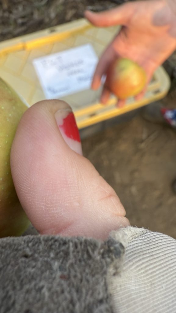
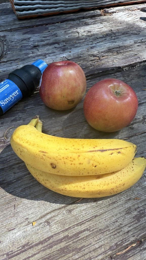
A lovely lady at the horse camp gave us 2 apples and three bananas – fresh fruit on trail is always a highlight since we’re eating only dehydrated or processed foods.
Second day doing 30 miles. Saw Mount Hood for the first time. Beautiful! Since we needed water, we had to camp at a campground. We got there in the dark. Price is 26$ per site. Wowsy! Some section hikers offered us to stay at their site for free which was really nice but we prefer to camp away from other hikers to get a good night of sleep. We didn’t pay.
Had dinner with “Meat Brick”, a nice guy from Olympia, WA we’ve been running into the last few days.
My feet really hurt today.
Excited for the iconic Timberline Lodge tomorrow.
29.65 Miles hiked
61.375 steps
Ascent 2845 ft
Day 116: 2117.3 Lolo pass (29 miles)
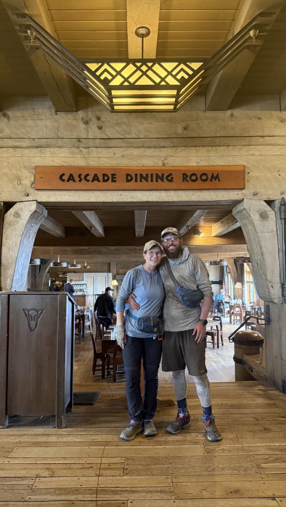
Left at 6.30am today. Got to Timberline Lodge at 10.45, just to learn the famous Buffett is closed from 11-12. We waited an hour to get the lunch buffet and it was well worth the wait.


Got to camp at 21.00, very tired. It was dark.
Did 28.97 miles
65242 steps
Ascent 5673 ft
Descent 6138 ft
Loooong steeeeeeep day. not sure how long I can keep this mileage up! But we have to get to Canada!! Ahh!!
Day 117: Tunnel Falls / Cascade Locks / End of Oregon 2150 (27.3 miles)
Alarm at 5, woke up very tired, didn’t sleep well. Since we dry camped, we packed up and left at 6.30am without breakfast. Hiked 0.4 miles to the next water, filtered 4l and had breakfast there.
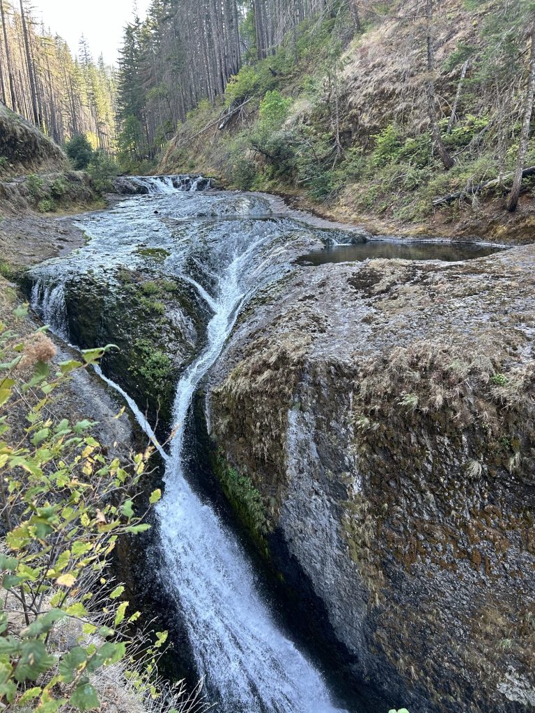
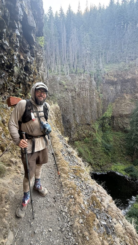
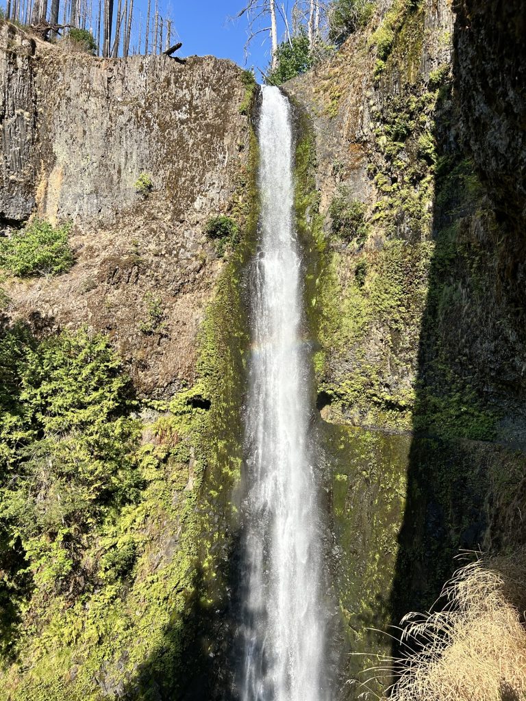
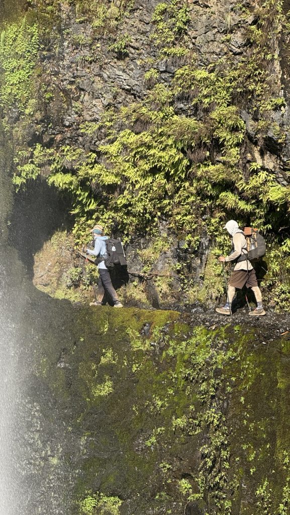
Took Eagle Creek alternate route to see Tunnel Falls. It was extremely steep at the top but it was worth it – we hiked behind a waterfall. Next to the trail a steep cliff – if you slip and fall it would surely be the end.
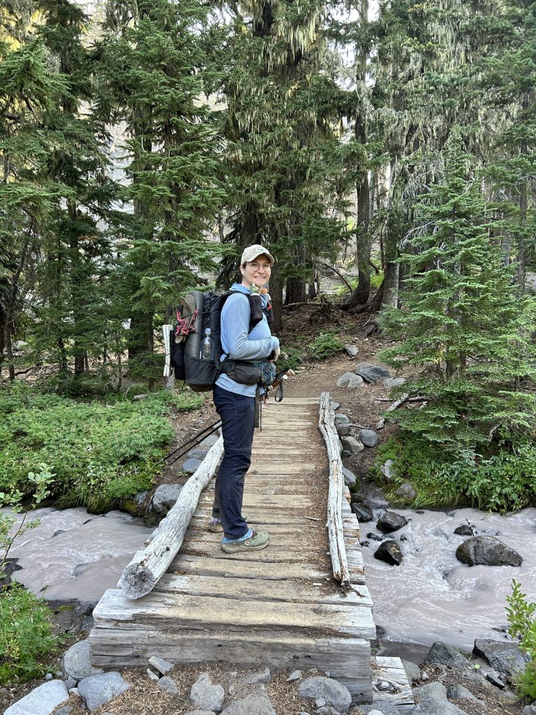
Made it to Cascade Locks around 6.30 and went straight to Whiskey Flats Tavern pub to get dinner, even though we usually like to shower and change first due to how filthy we are after 6h on trail. Kate had made it to Cascade Earlier that day and met us for dinner. Yay!!
Miles hiked: 26.44
Steps: 55001
Ascent: 2420 ft
Descent: 5716 ft (yup, we felt this)
Cascade Locks is the lowest point on the PCT with 120 ft of elevation. This also means we gotta climb back up after crossing the infamous Bridge of the Gods and crossing into Washington state.
Day 118: Zero in Cascade Locks
We slept in, which is 7am nowadays and met Kate for breakfast at the wonderful Bridgeside cafe, overlooking the iconic Bridge of the Gods, the border to Washington State. We were planning to hike it today but decided to take a zero as we felt so beat. Our bodies needed a rest after 5 dates of 30 miles a day.
After breakfast, we went to the room to relax and fix some gear. We got a burger and milk shake for lunch across the street at Eastwind Drive in
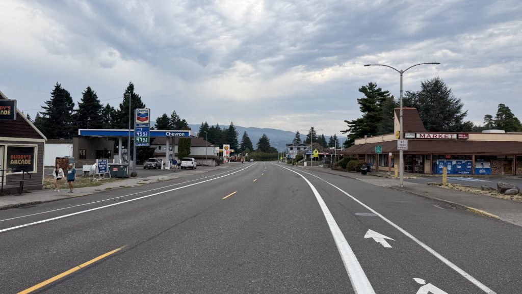
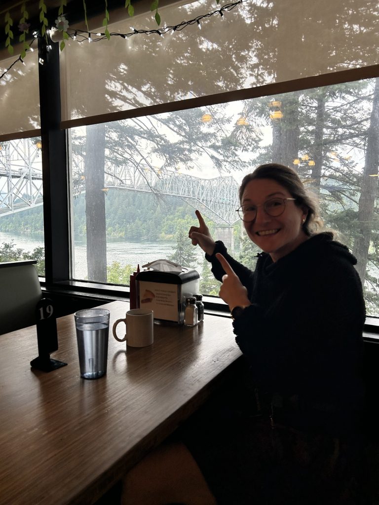
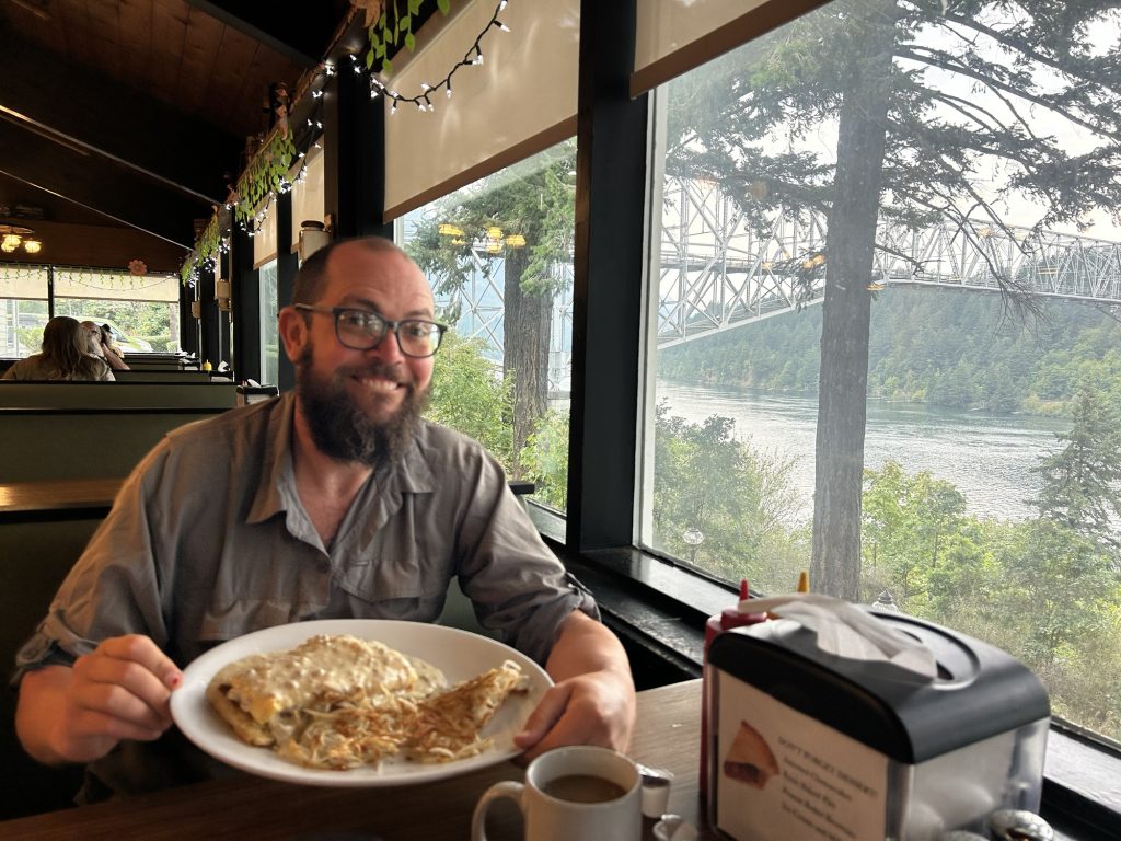
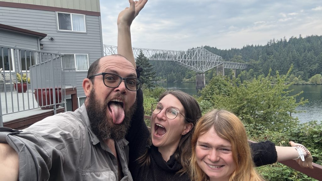
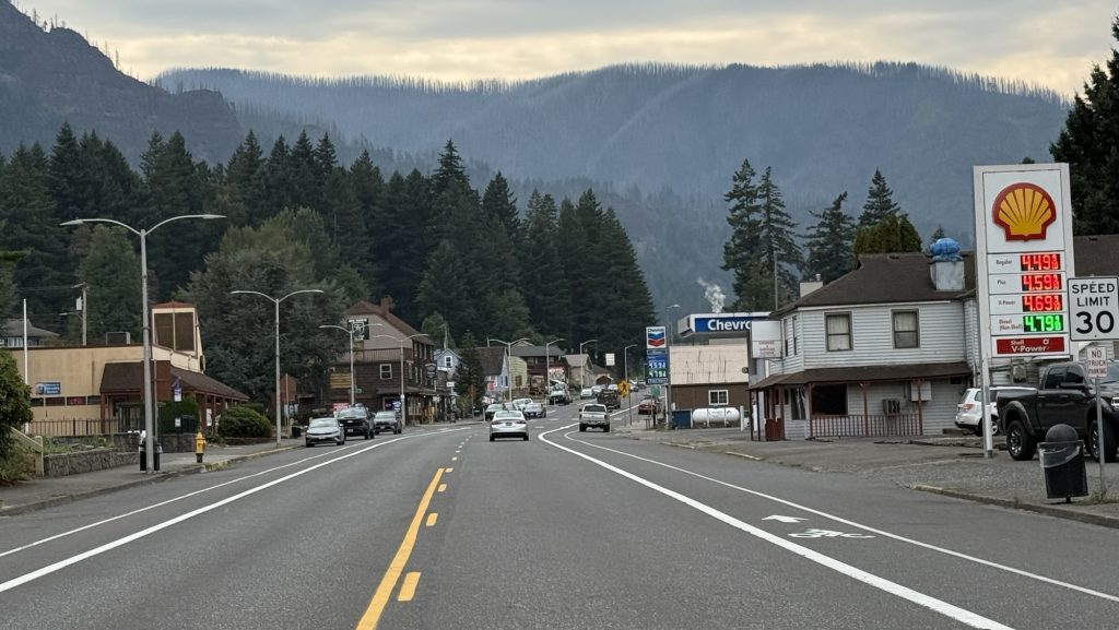
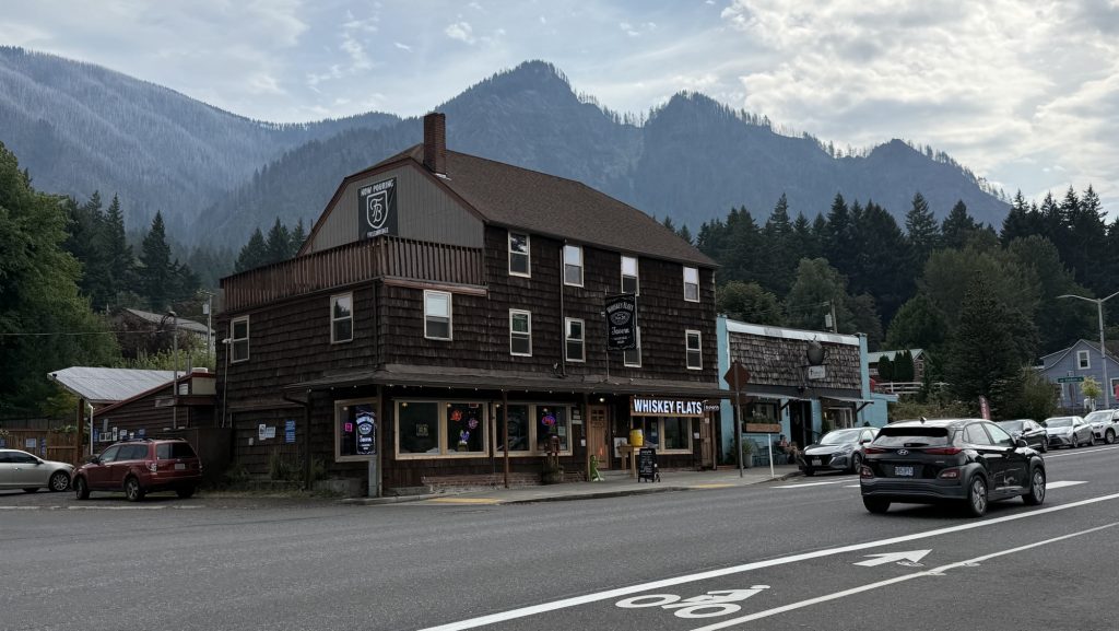
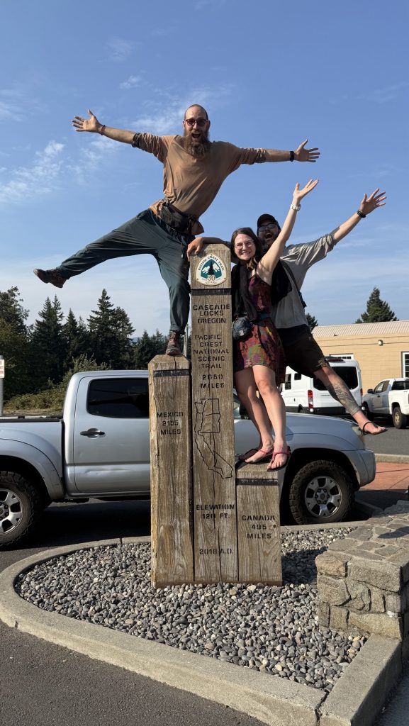
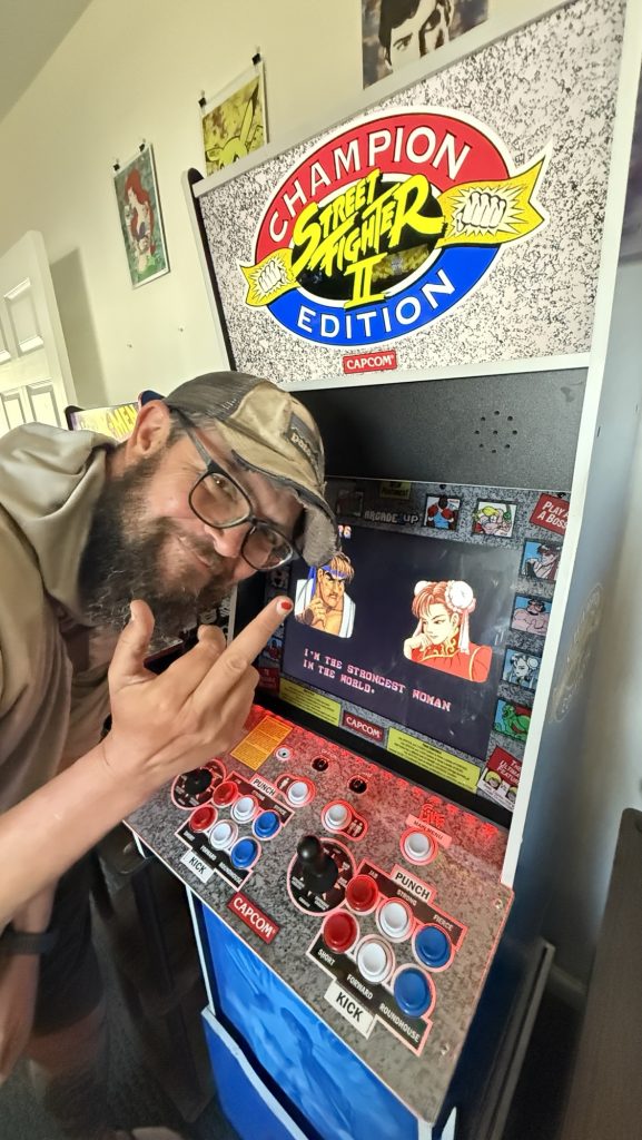
Thanks for stopping by and happy trails,
Disco
- How to physically and mentally prep for the PCT?
- 2.5-week Taiwan Itinerary – Whole Island
- Days 138 – 142: Canada!! (2575.1 – 2655.5 + 30)
- Days 135 – 137: PCT Miles 2500.73 – 2575.1
- Days 130 – 134: Snoqualmie to mile 2501.3 (2396.3 – 2501.3)
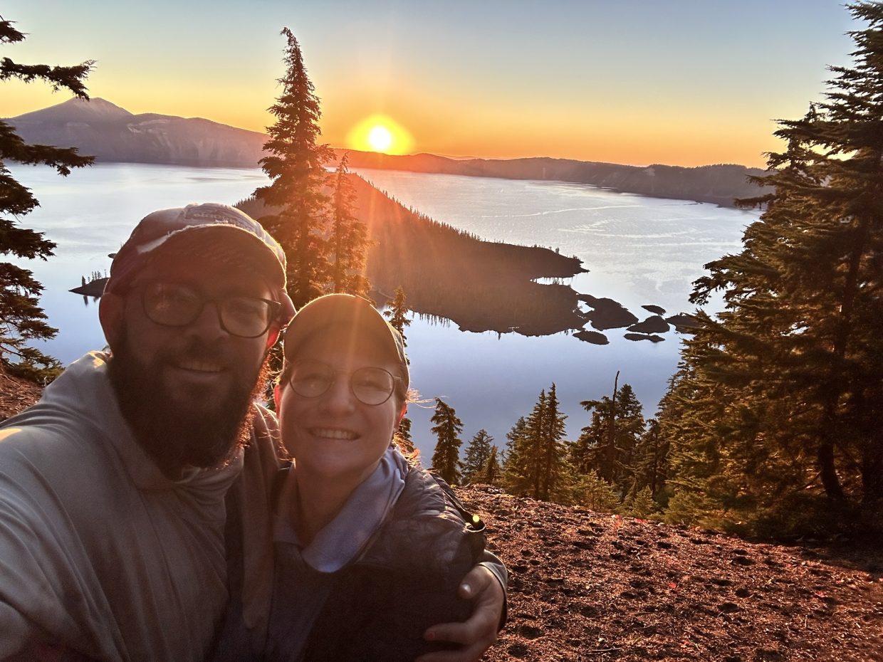
Days 103 & 104 (1849.3 – 1867.3)
Day 103: Crater Lake Sunrise Breakfast, 2 months anniversary & Diamond Lake Resort (1849.3)
We got up at 5:35 a.m. and packed up. At 6:05 a.m we set off for the Crater Lake Rim Trail to catch the sunrise. We made coffee and ate granola with dried fruit overlooking the sunrise over Crater Lake which was incredibly beautiful. We are celebrating our 2-months anniversary, what better way than a sunrise breakfast in nature and a hike? ☺️

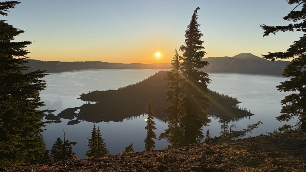
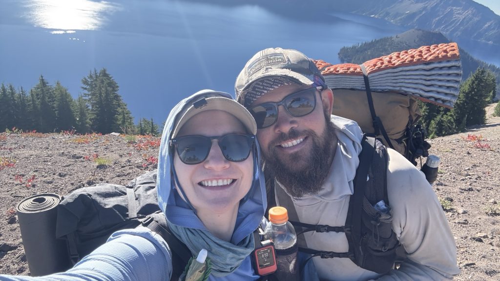
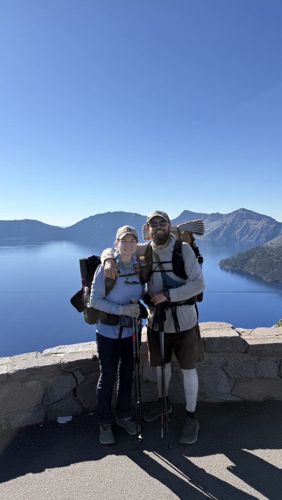
Afterwards, we hiked 8km along the Rim Trail, enjoying the views of Crater Lake. On the way, some lovely guys gifted us 2 cans of Coke and offered a yar of peanut Butter which we gratefully declined (way too heavy – we’re ultralight 🤣 (inside joke, we are not ultralight at all, we pack out beer and whiskey sometimes – many hikers take ultra light way too far and leave their tent or backpack at home, so we joke about it.)
Then we hiked another 8 km through a very flat forest, and reached Highway 138. From here we hitched 15 minutes to Diamond Lake Resort, which is a less common spot for PCT hikers to stop because there are no supply stores close by. We chose to stop here to celebrate our 2 months anniversary. A lovely couple in their awesome RV picked us up and gave us a ride even though they were going the other way. Turns out they were visiting Crater Lake to celebrate their 3 year anniversary. 🥰
We got to Diamond Lake and instantly loved the “rustic” vibe. It’s described as antique or something on FarOut, turns out it’s just a little run down and could use some love. But that didn’t smaller the awesome 70s vibe – the marina and lake access from the open air restaurant porch is one of a kind and we loved watching all the families relaxing and hanging out which looked like a scene from the 70s.
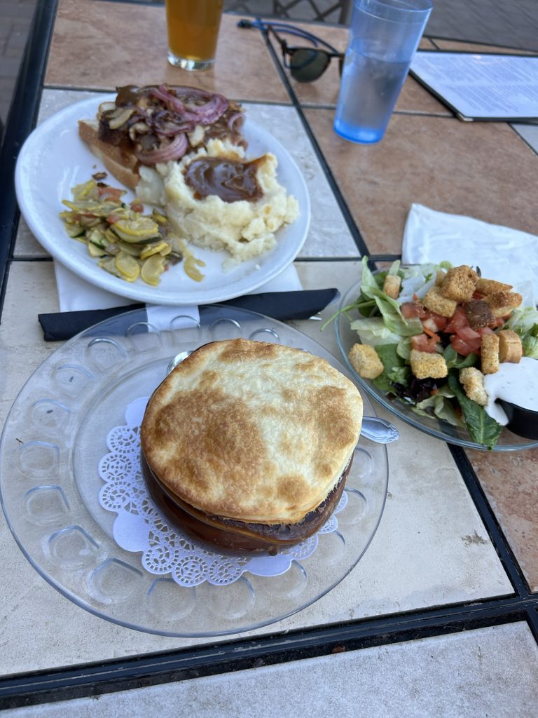
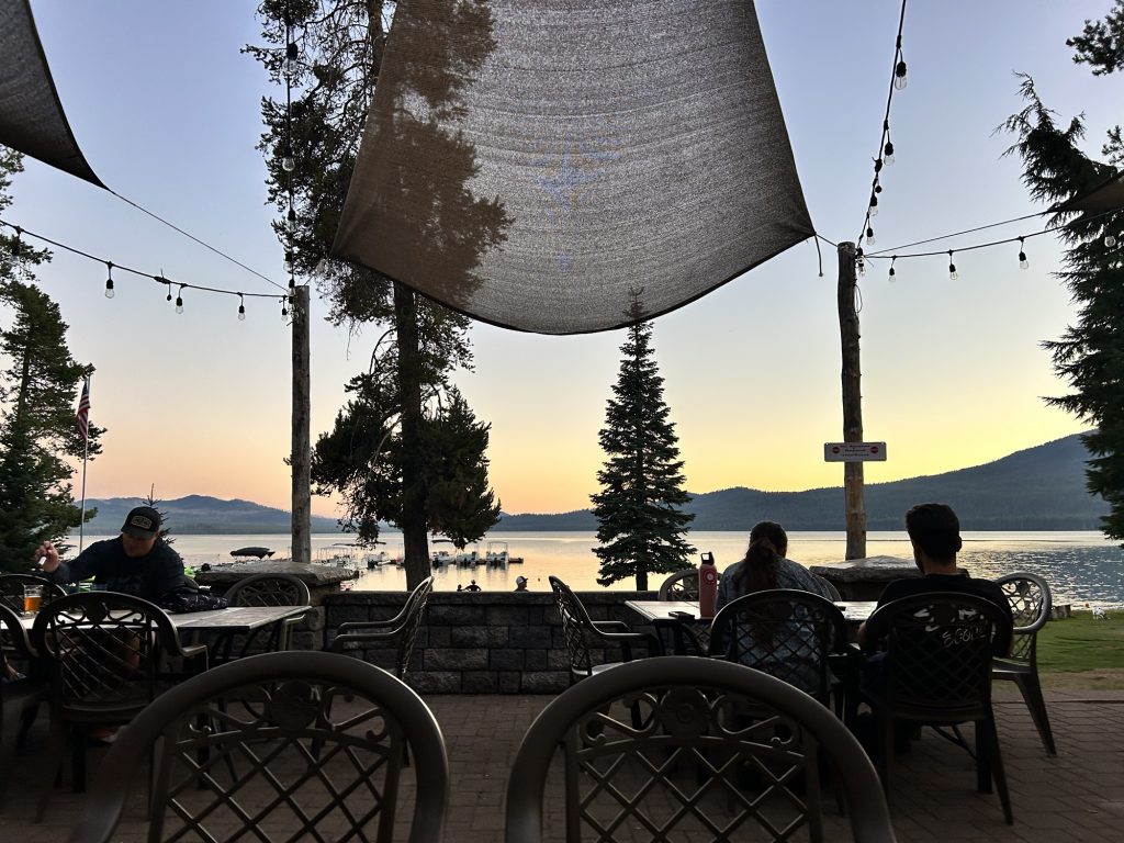
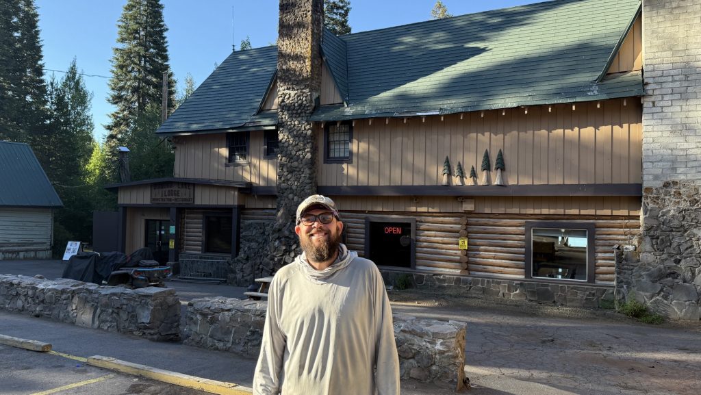
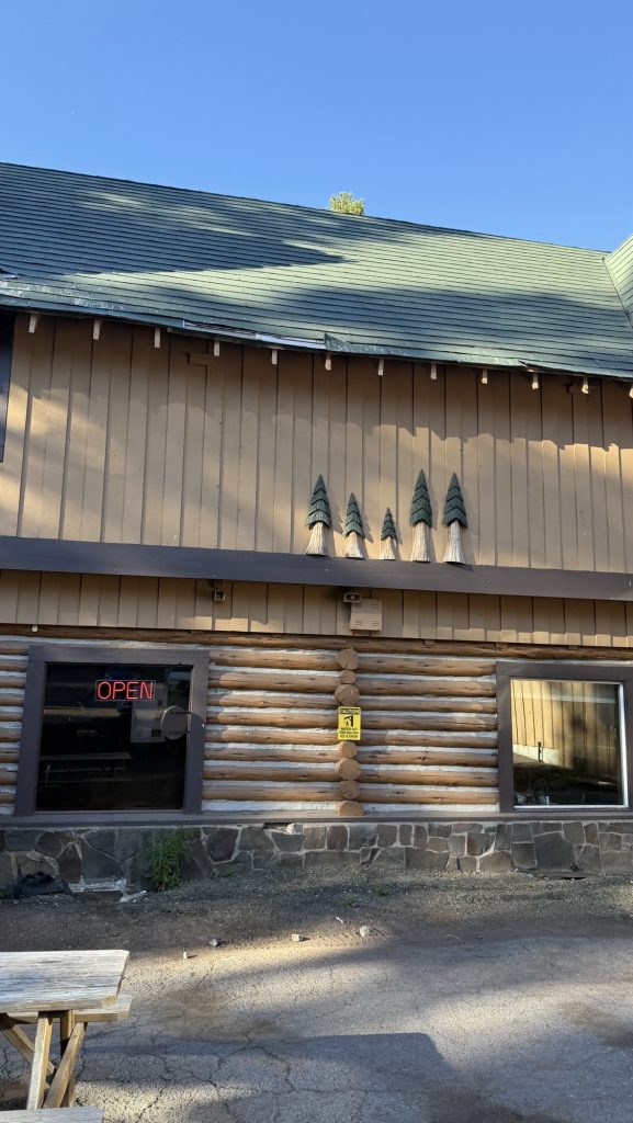
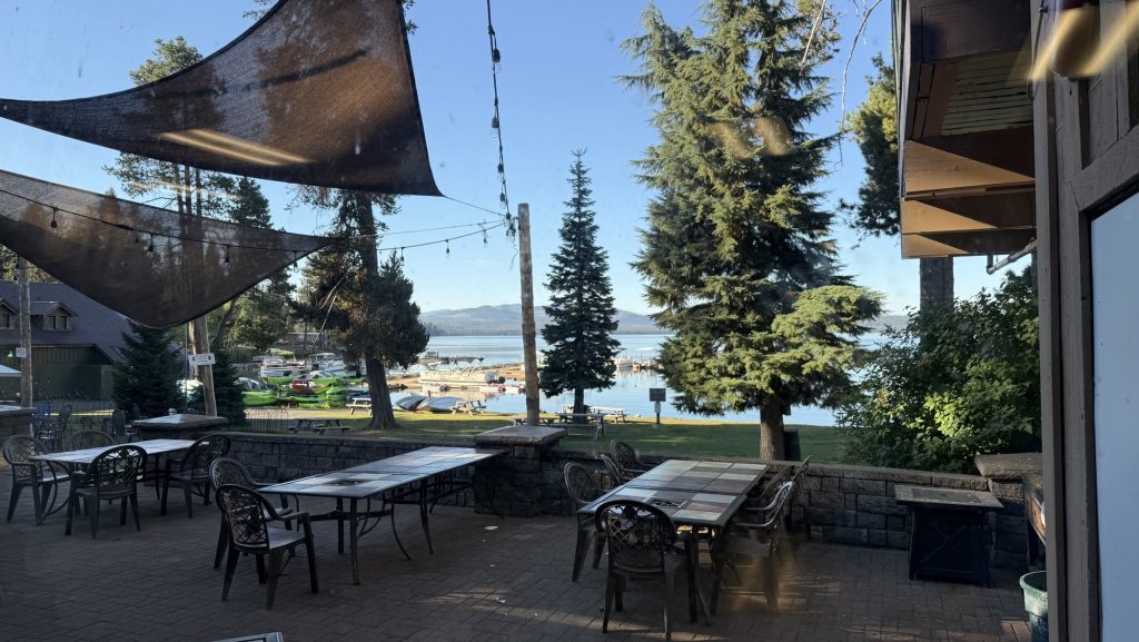

We had a wonderful dinner and enjoyed American classics – roast beef and chicken pot pie with salad.
Day 104: Maidu Lake 1867.5 3000km!! Marker
I woke up at 7ish and went to Diamond Lake to have a coffee and stretch. When I got back to the room, Iceman was up. I showered, we packed up and went to breakfast. I had scrambled eggs with toast and hashbrowns, nothing special but not bad.
After getting a ride at 9.45am with Elaine back to the trailhead, we hiked 0.57 Miles and got the most incredible trail magic. Barbara and Roy, with dog Clover, had brought a pickup truck with at least 6 ice chests full of cold drinks and food, a bbq, built a shower and bucket laundry and set up chairs in the middle of the forest. Everything a thru-hiker needs. Their son “Triple Thread” is hiking the PCT and told them the things most important: shower, laundry, food and his parents delivered. They are meeting him there on trail for a few days and bright large amounts of food for other hikers too. What a shame we ate. Roy made double cheeseburgers for everyone but I was too full to eat from breakfast. Meh! I had two sodas, a banana for potassium and grapes and plums from their garden.
The kindness of trail angels does not cease to amaze me. It’s not just the money, surely hundreds of dollars for food and drink but the energy, time and love that goes into preparing, building and hosting. Just incredible. These experiences not only make our day but also restore my faith in humanity. People are good, this trail has proven that over and over again.
We got vortexed into trail magic and didn’t really start our day till 11.20am or so. We had a cruisy 8mile hike to the next water, a beautiful creek where we had a late lunch, at 2.30pm.
Another 11 miles to the next water, cruisy again, mostly forest and some nice views around Mt Thiesen.
We passed the highest point on the PCT in Oregon and Washington – it’s downhill from here haha.
There are silver markers on the trees and people have been writing fun sayings on them – and Iceman marked a few of them with our names.
The next water is either 16 miles away which would’ve meant arriving in the dark after 9pm or taking 1mile off trail to Maidu lake so we did the latter. We still didn’t arrive until 7.30pm but managed to do 19 miles. And the lake is super beautiful! We got here just in time.
To get to Canada by the 25th of September we would have to do 23miles on average every single day the next 35 days. Today we did 19 Miles so we are currently 4 Miles short actually 5 Miles (because of 1 mile blue blaze).
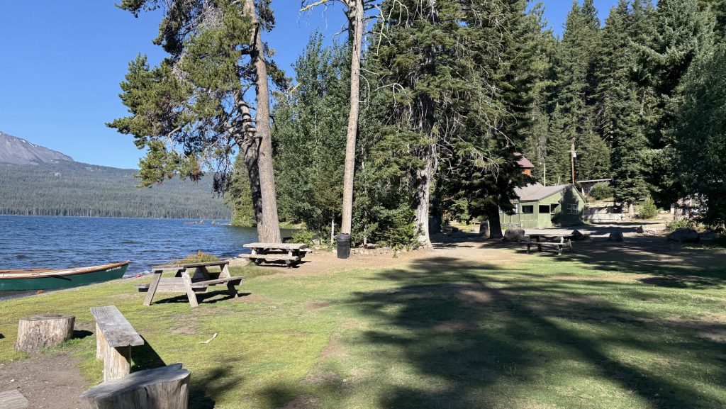
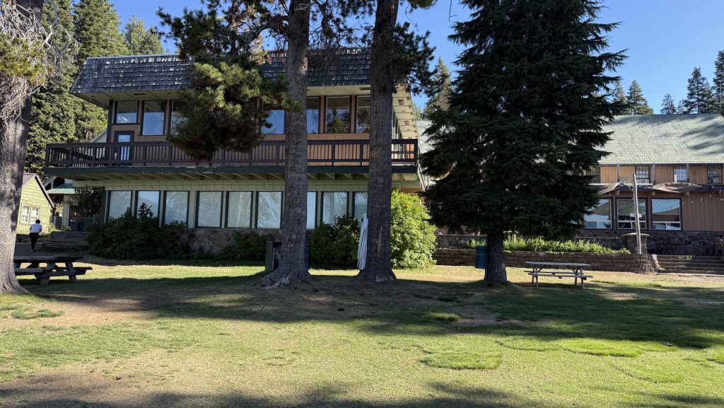
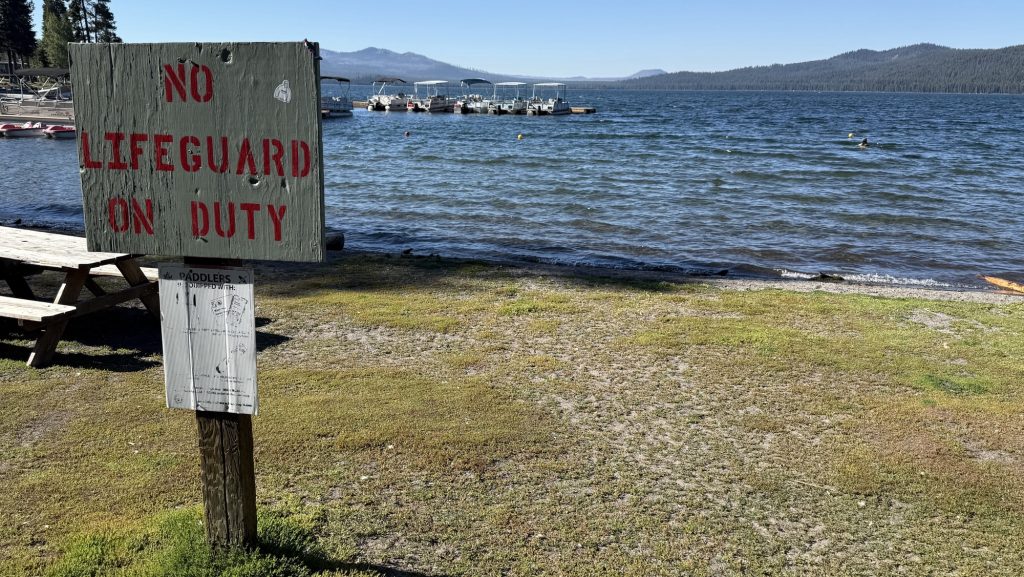
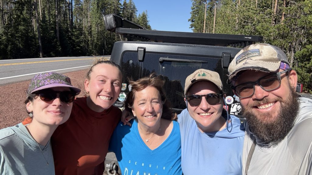
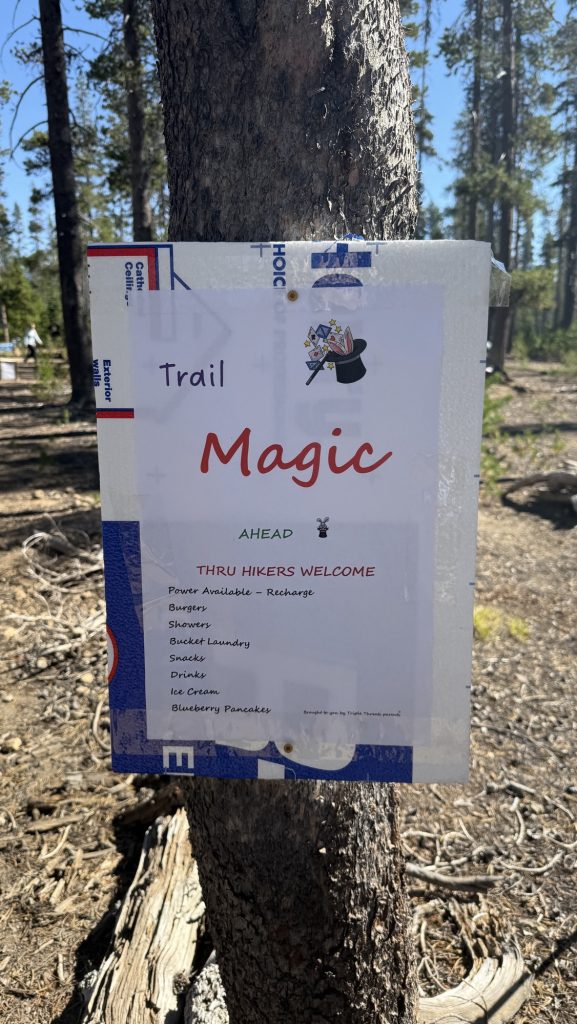
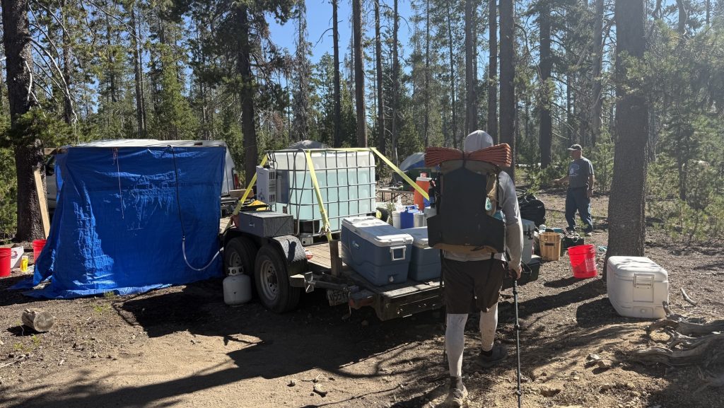
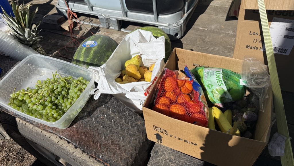
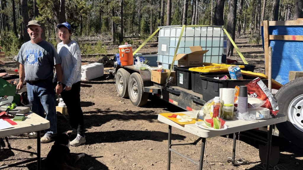
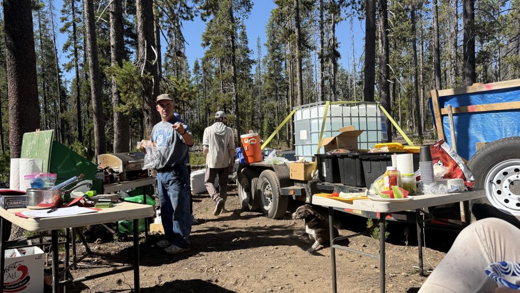
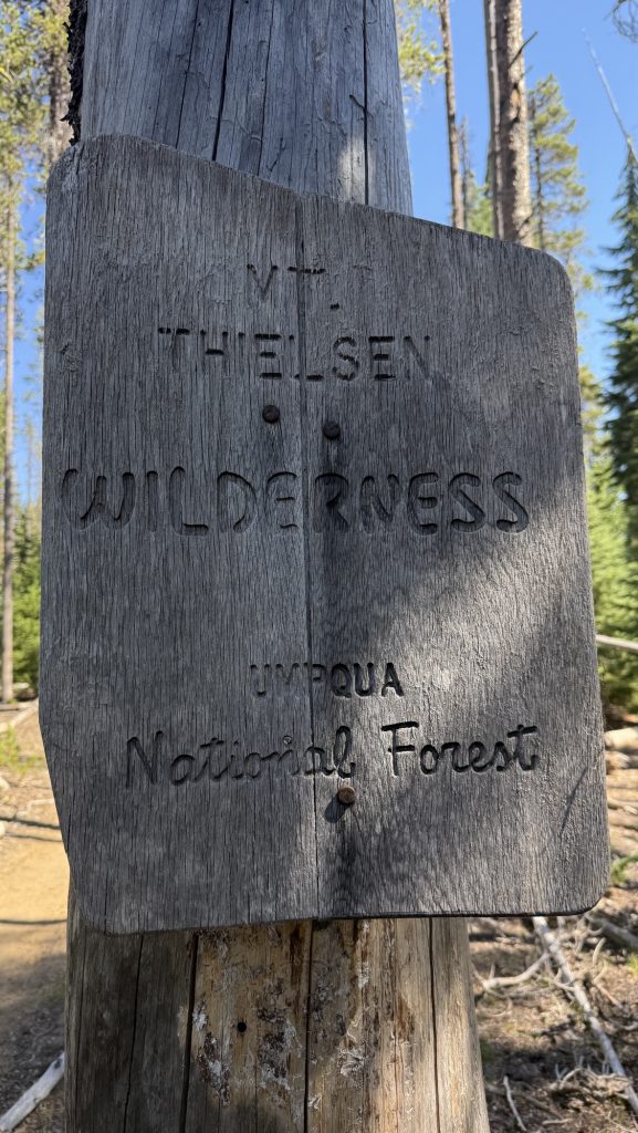
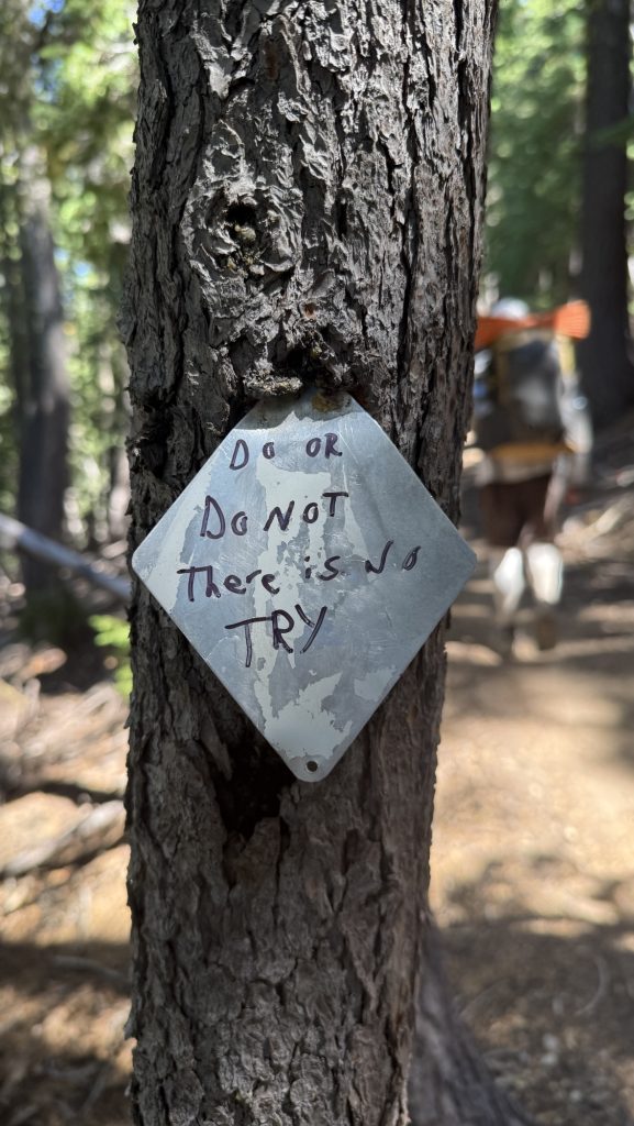
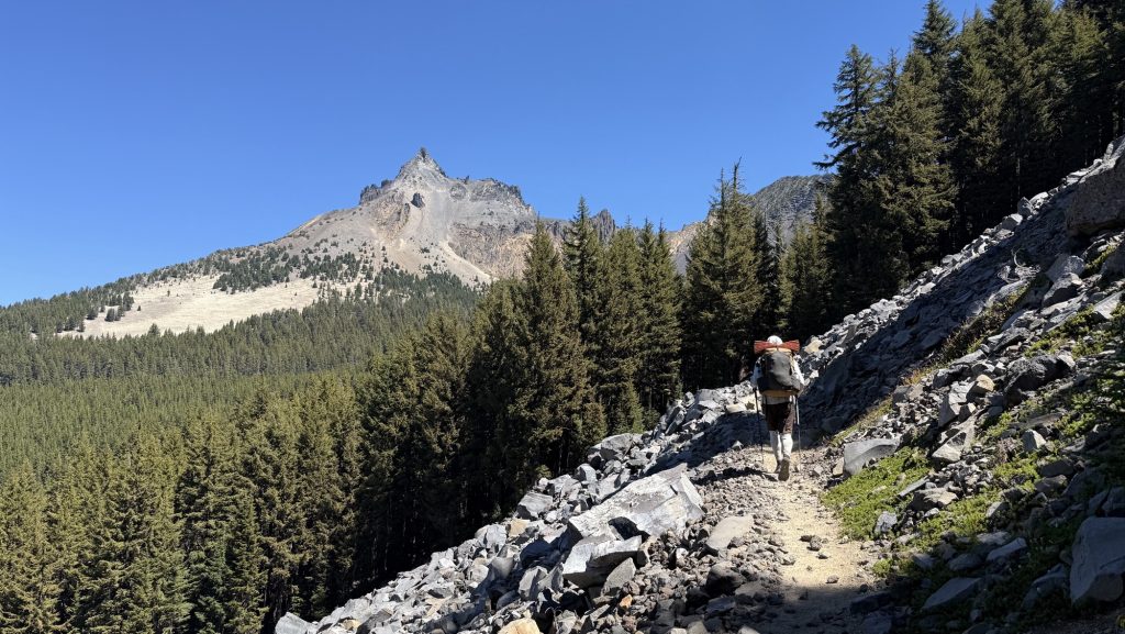
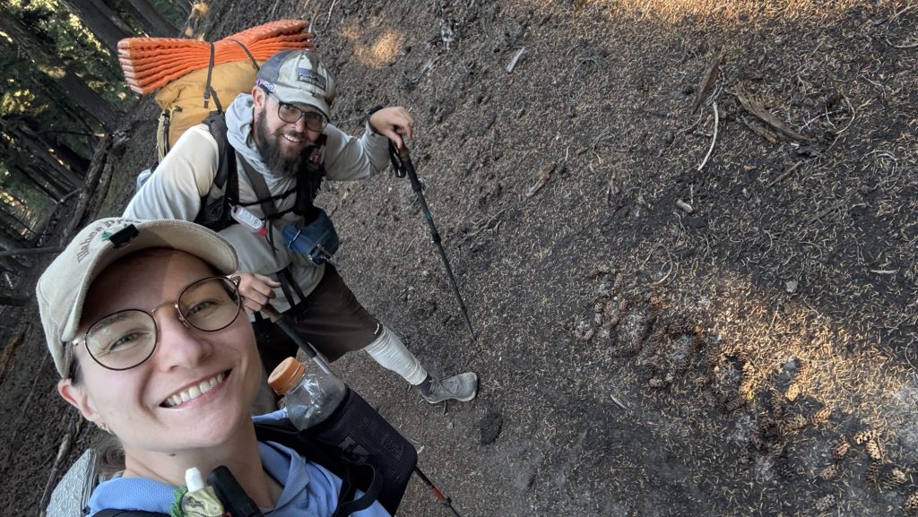

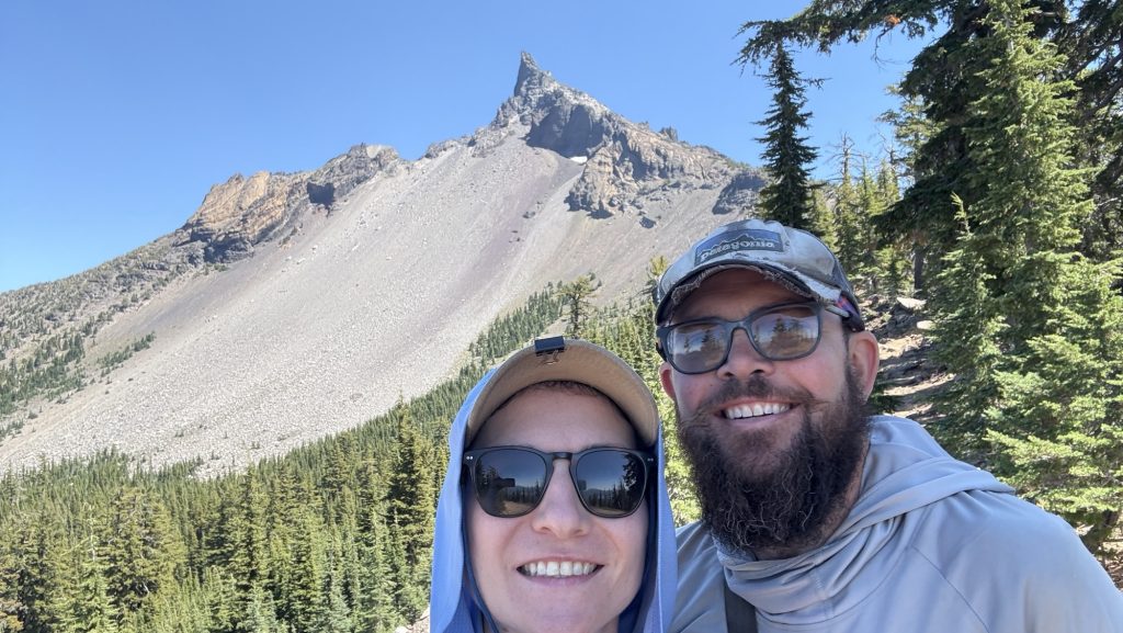
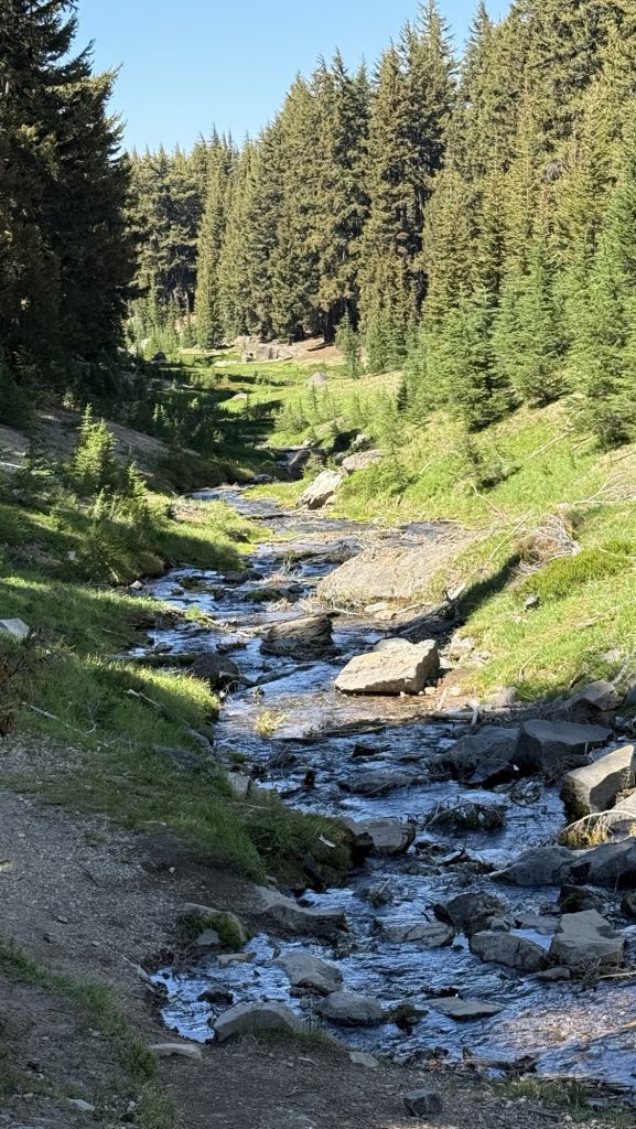

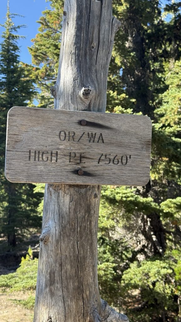
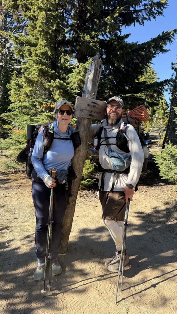
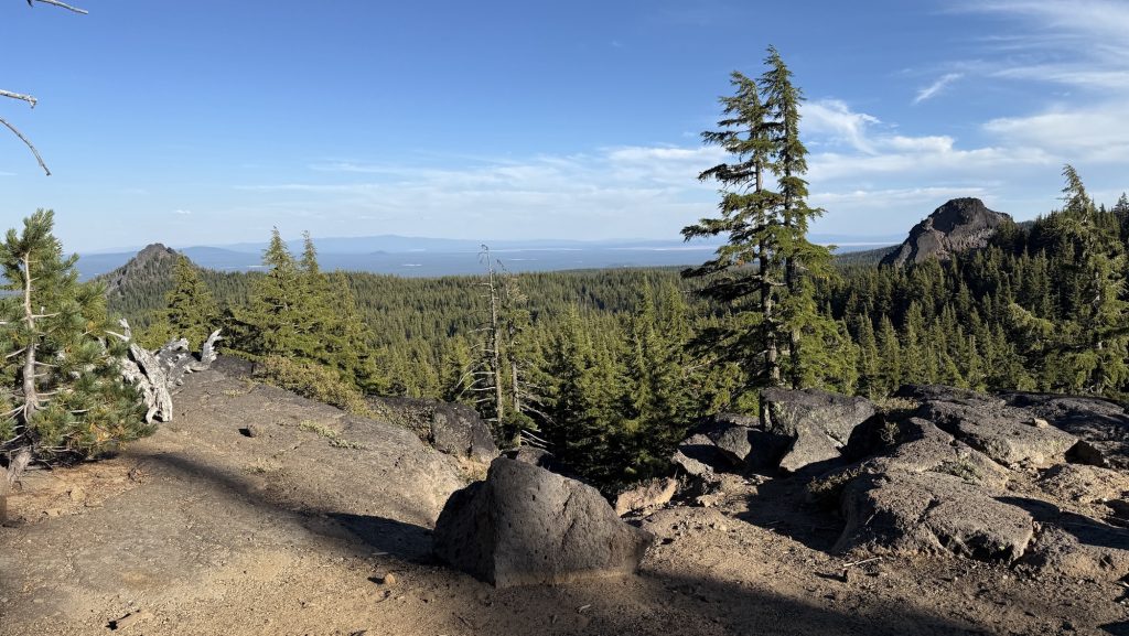
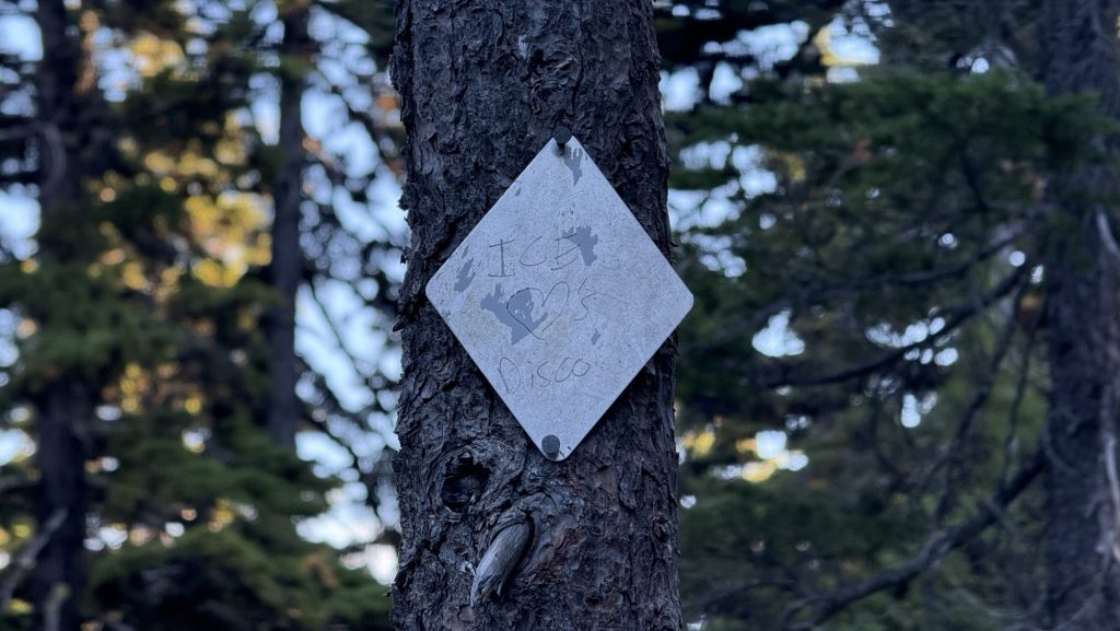
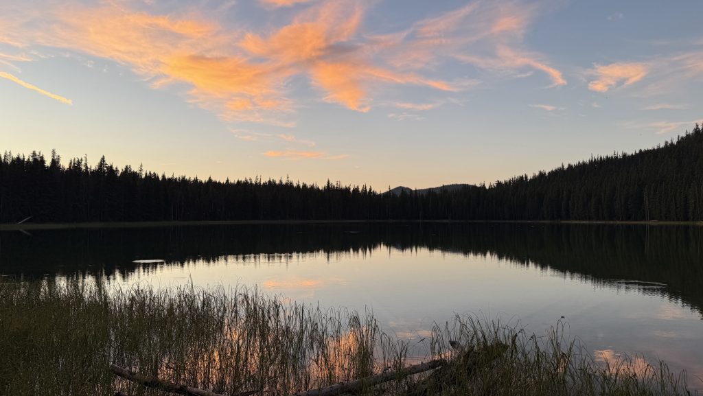
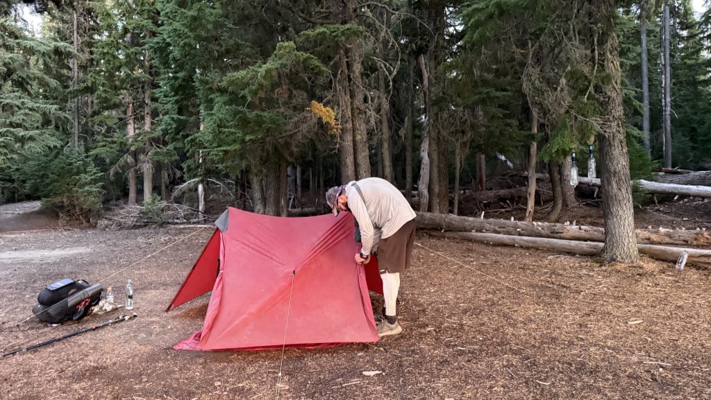
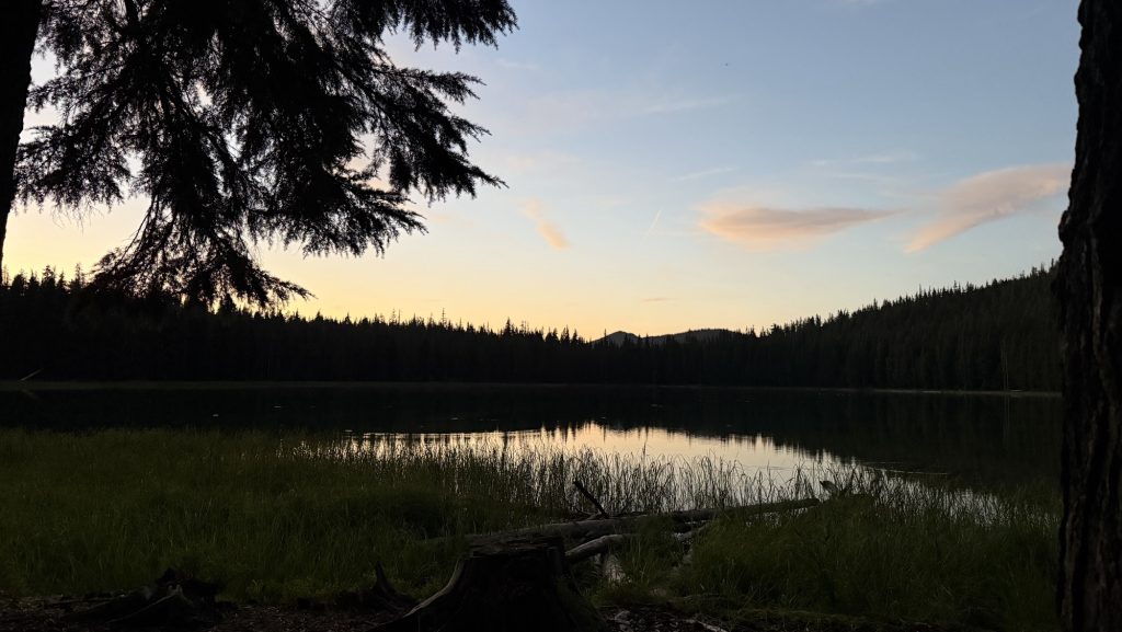
Stats:
Distance: 19.42 miles
Steps: 44.427
Ascent: 2370 ft
Descent: 2349 ft
Highlight: 3000km!! mark & highest point on PCT of OR & WA
Thanks for reading,
Happy trails!
Disco
- How to physically and mentally prep for the PCT?
- 2.5-week Taiwan Itinerary – Whole Island
- Days 138 – 142: Canada!! (2575.1 – 2655.5 + 30)
- Days 135 – 137: PCT Miles 2500.73 – 2575.1
- Days 130 – 134: Snoqualmie to mile 2501.3 (2396.3 – 2501.3)

Day 102: Crater Lake 1824.6 then Rim Trail
Woke up at 5.38am and started hiking at 7.15am.
Slept on my mattress all the way inflated and it was comfortable!! Maybe that’s why my back has been hurting? Cause I’ve been only inflating it half way?!
Heard elk roars all night which was cool but we didn’t see any.
We hitched into mazama village and got 3 boxes, one huge one from Iceman’s sister, Christina, and two I sent. Christina‘s box had so much good food in it! And the best part were drawings and letters Iceman’s nieces draw and wrote. 🥰 We unpacked it and packed it in our packs which got very heavy and then went inside Annie Creek Restaurant to eat a pizza and fish and chips. They brought chicken strips instead so we informed them about their mistake and then they brought fish and chips too so – we had lots of food and packed out 3 big slices of pizza. Hitched back to the PCT and now stoked to see Crater Lake in 1.5 miles!!
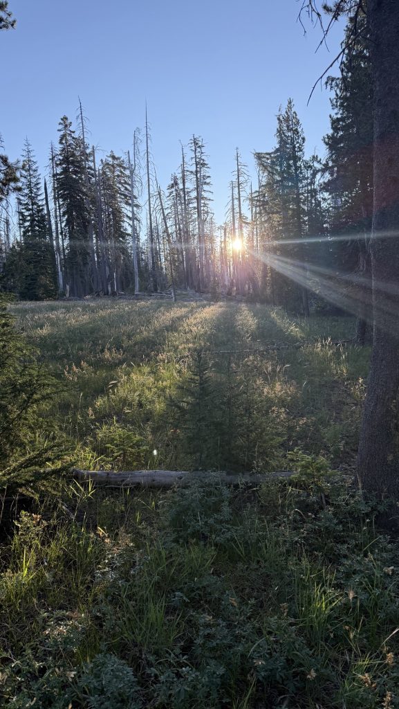
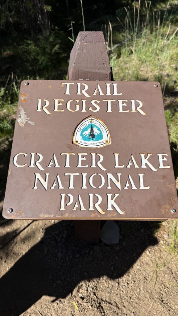
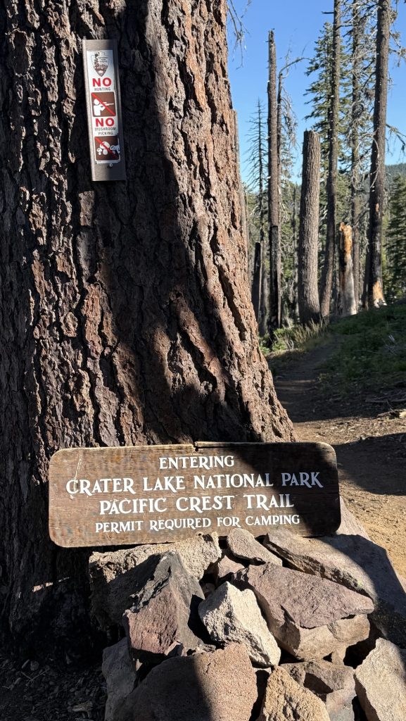
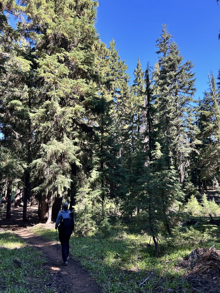
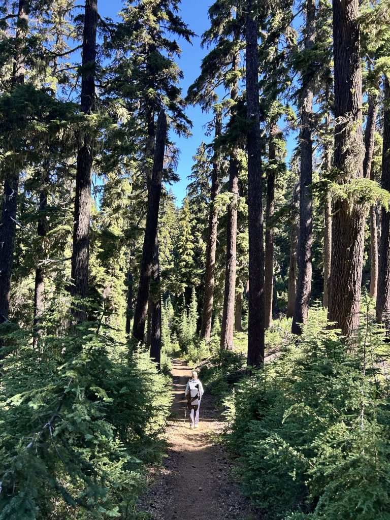
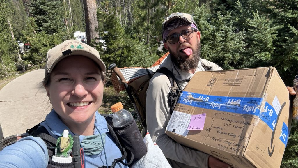
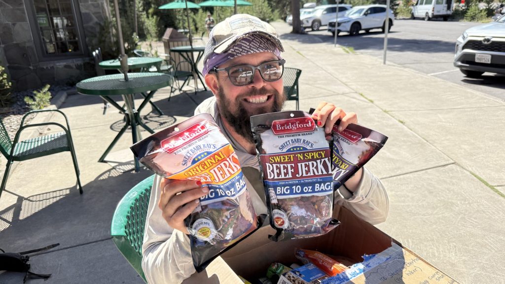
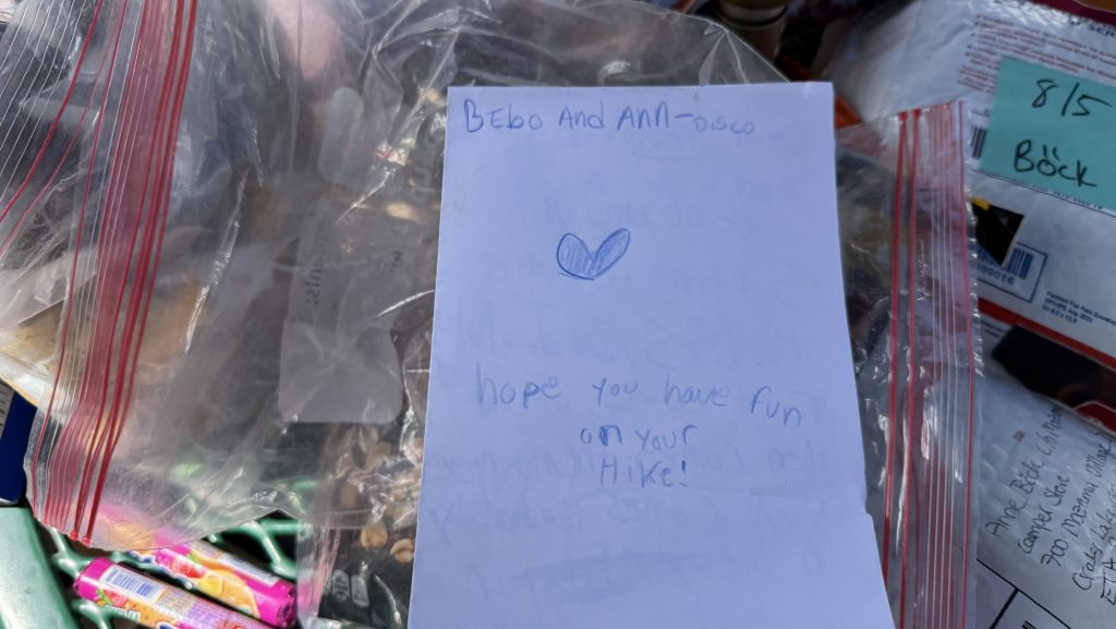
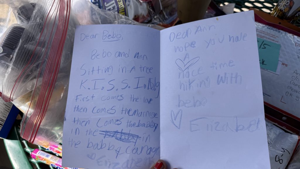
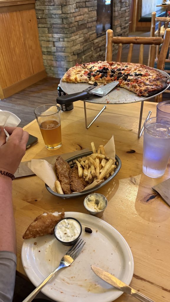
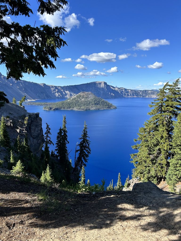
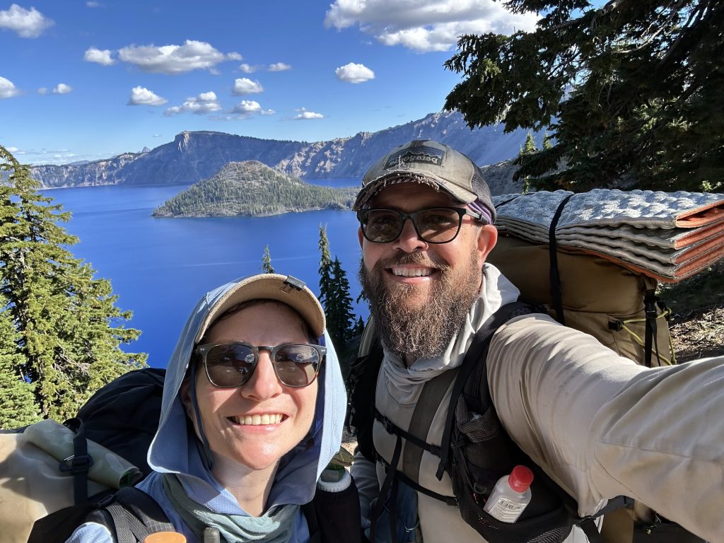
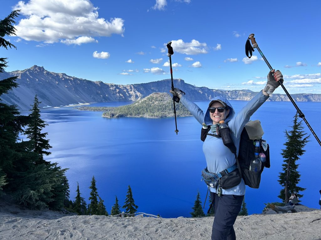
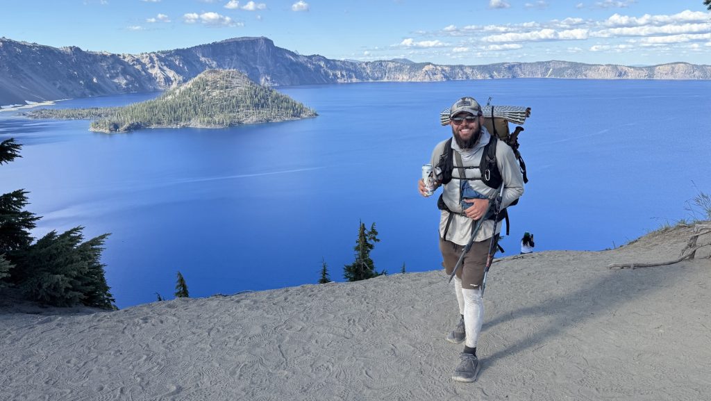
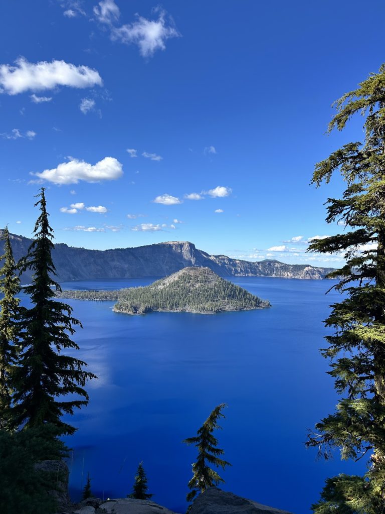
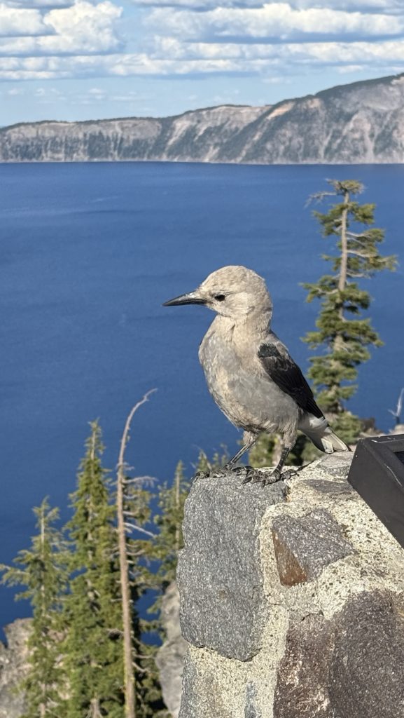
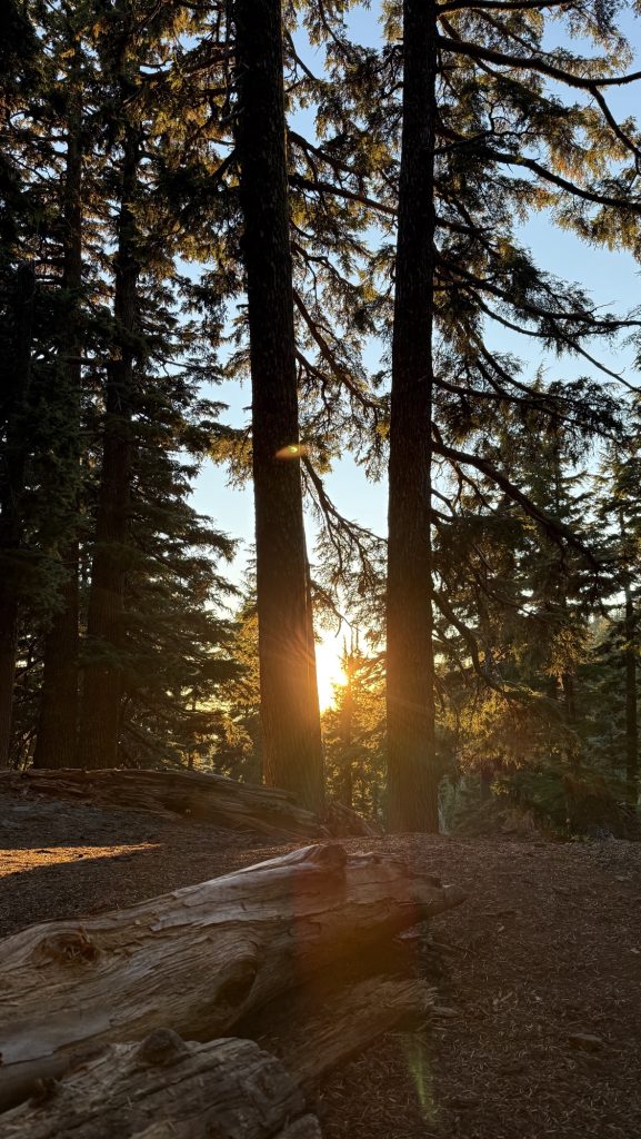
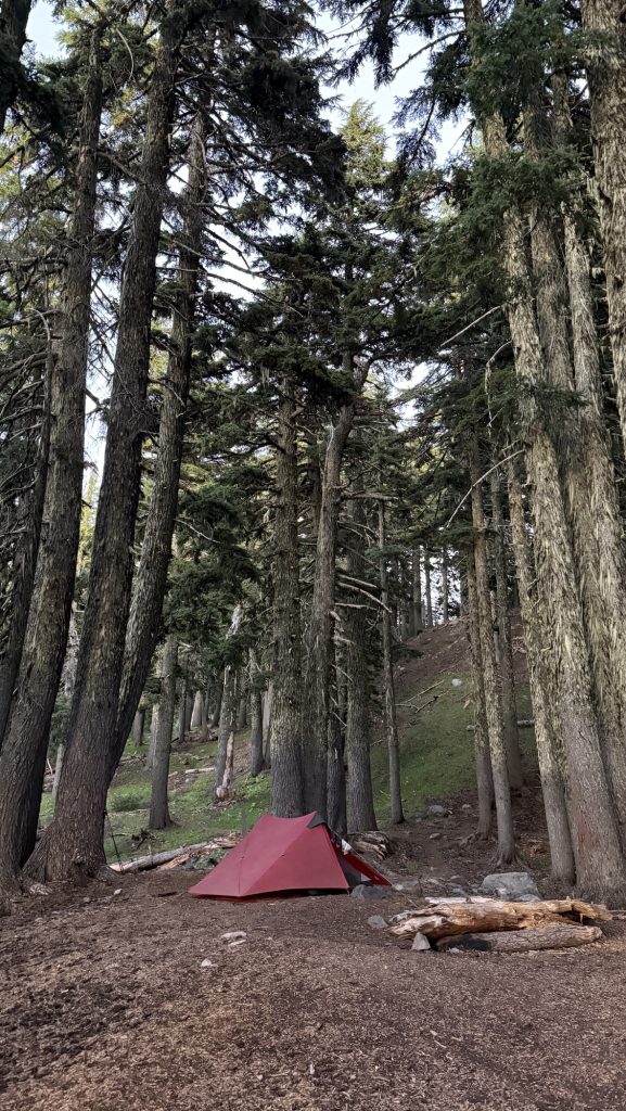
Steps: 42.869
Miles: 18.05
Ascent: 3211 ft
Descent: 2522 ft
Thanks for reading and happy trails,
Disco
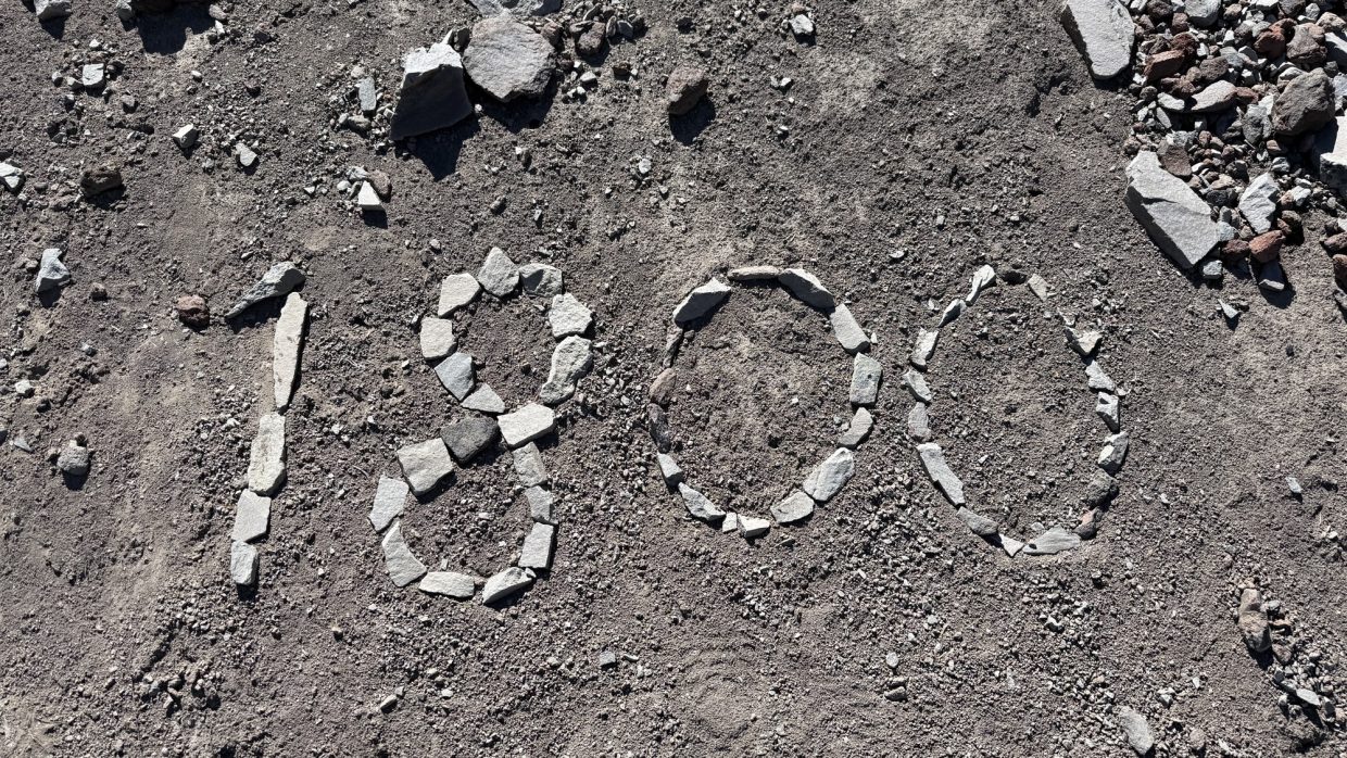
Day 101: Mile 1812.4 (21.66 miles)
Woke up at 6am and since I fell asleep at 8.30pm the night before, I felt well rested. Not really loving my air mattress. We had breakfast and two coffees in the tent and enjoyed the beautiful Deer Lake with the lake mist, and left at 8am.
It’s been a beautiful morning with nice views. I had service on top of a hill to call my mom. Good news from home, so I feel good. But generally just feel strong today, because we had 1.5 dinners last night. I think I haven’t been eating enough calories so we gotta change that.
Now at water and drying the tent, it’s been wet from condensation.
Also talked to Lisa, Theo, my brother and Tati. Feels good!
It’s sunny again and my solar panel is charging my watch and power bank. The watch charges so fast on the solar panel it’s crazy.
We hiked all day till around 7pm and then found a lovely campsite and had a nice sunset.
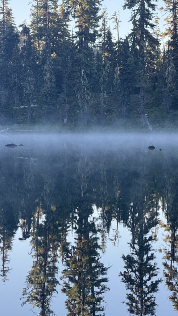
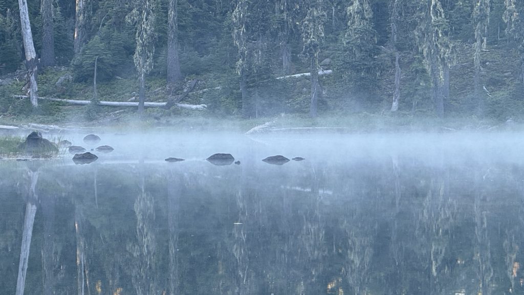
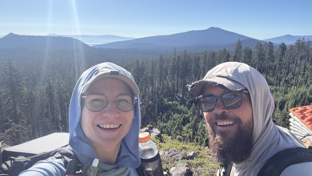
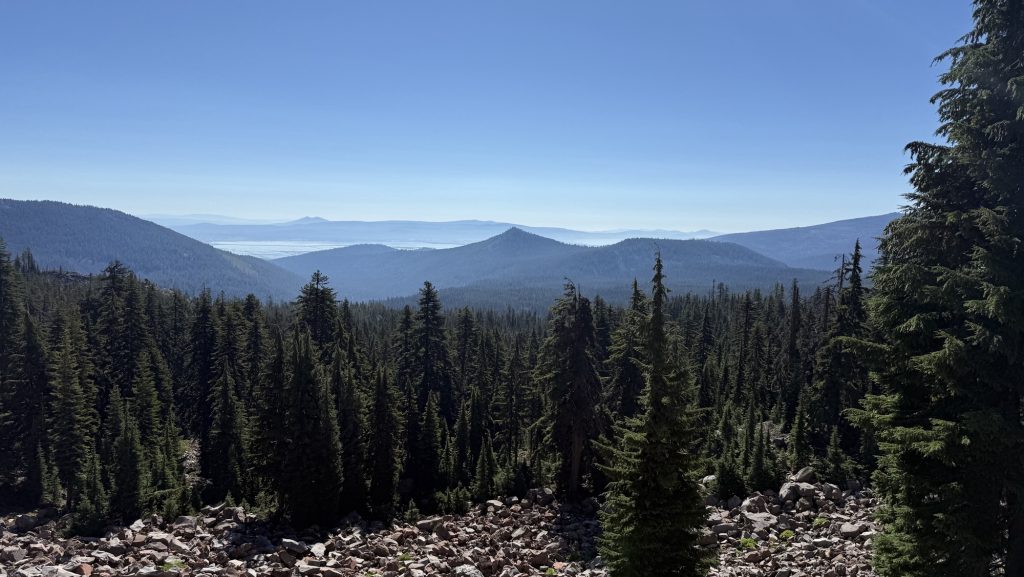
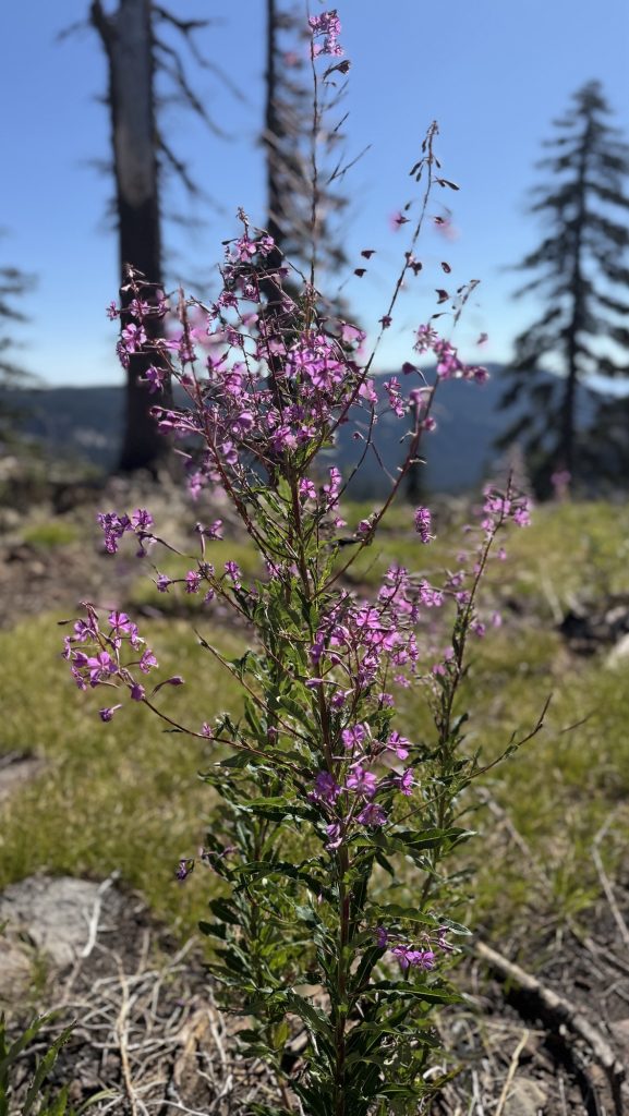
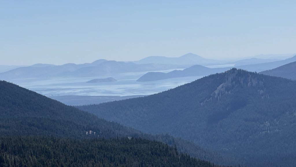
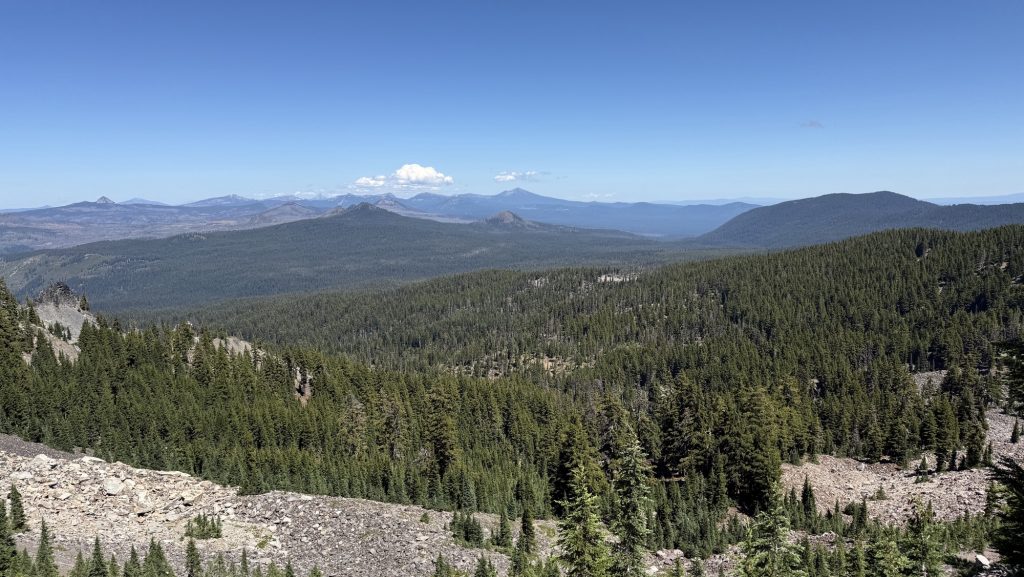
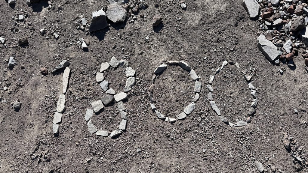
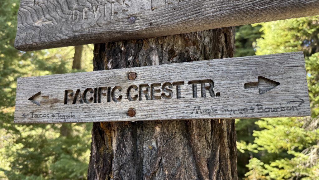

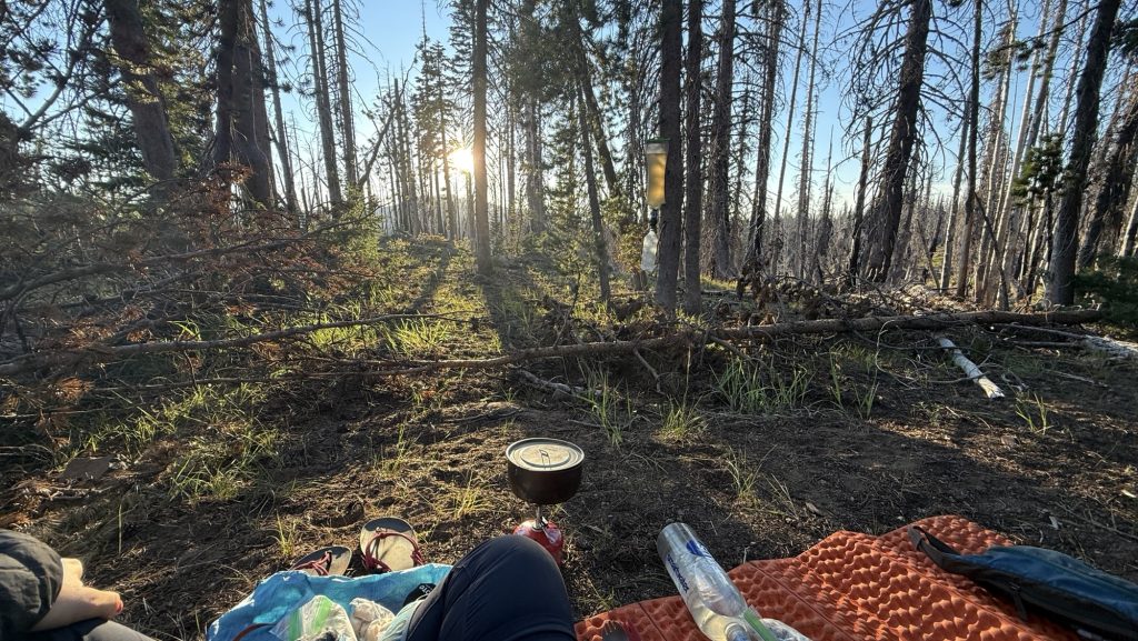
Thanks for reading and happy trails!
Disco